


Event diary, & station news..
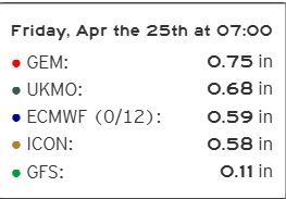
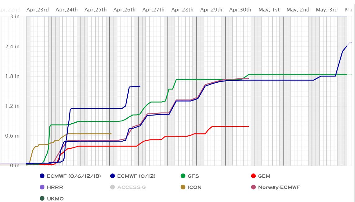
05/31/2025...17:10: The NWS issued a briefing statement about the upcoming Monday night storm potential. Looks like the more likely chances of 2" rainfall stay south of Valentine. Doesn't look like we'll reach the 80° mark today with the elevated breeze, haze, and high clouds; so far we have only managed 76°. Air quality peaked in the red earlier today at 134, now down to 80, so getting better.
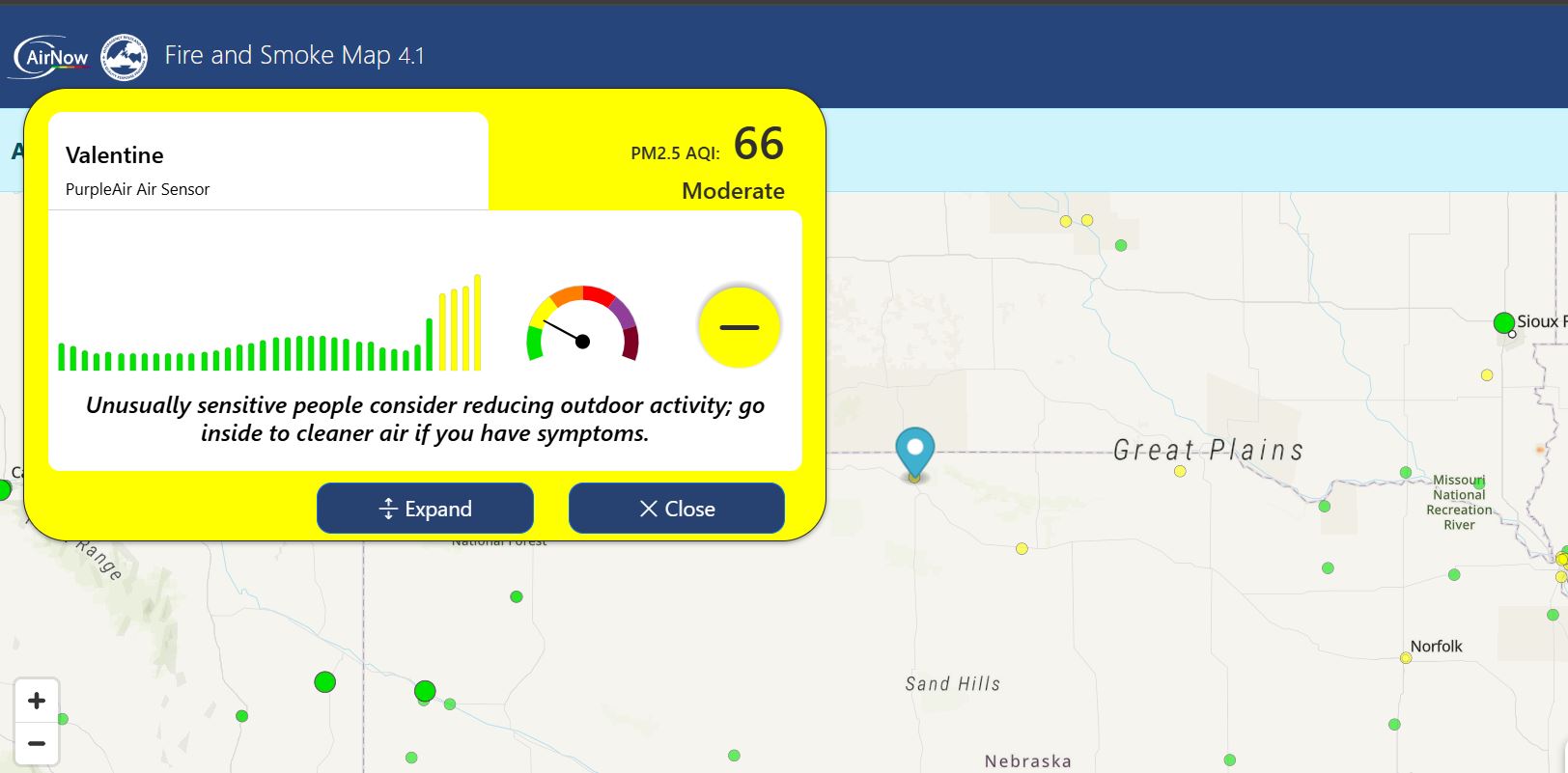
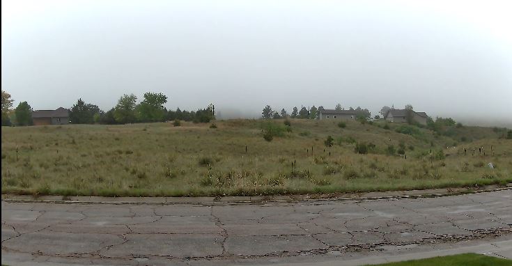
09:40: You can see the smoke haze this morning, open the camera to full size, lower right box. The satellite loop also shows it. Checking the AirNow link, Valentine is in the moderate yellow currently. The air quality sensor is located here at the NE Valentine location.
06:15: A little more wind this morning than was expecting. Been attempting to reduce wind noise on the streaming camera mic, and it is getting better; the birds can be heard now, and not an obnoxious noise all the time. The true test will come on a very windy day. Monday have a furry type material coming, so hoping the combo of dense foam and fur together will reduce wind noise even more. With the original unprotected mic, you couldn't even hear loud cracks of thunder over wind noise. Not much change in the forecast, near 80° today for a high temperature and a good chance, now at (80%) for thunderstorms and showers Monday night.
05/30/2025...05:10: Beautiful weekend coming up, including today with warm temperatures, sunshine and light wind. There is a good chance of high-level smoke from Canadian wildfires, but not expected to reach the surface, just some hazy sunshine. Monday night looks like all models are on the same page for showers and thunderstorms moving in. (Models).
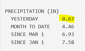
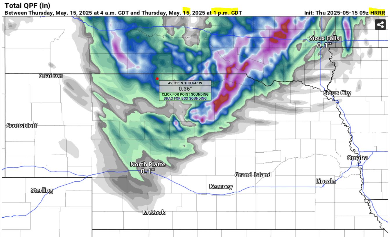
05/29/2025...05:20: We picked up an additional (0.06") after 10 pm last night, (0.66") 24-hour total. Miller Field reported (0.67"). The tipping bucket had a delayed tip after midnight, but all fell prior. What happens the water droplets that stay in the bucket slowly drain into the almost full (0.01") tipper, and eventually tips with a delay. Scattered pockets of fog have developed around the area this morning, at times dense. Today should be our last day of below normal high temperatures until next Tuesday when it becomes active again. High temperatures should reach into the 80s, Friday through Monday. The sunshine will be welcome and needed for plant growth. Have added the forecast back to the navigation menu but would prefer the red 7-Day Forecast link at the bottom of the page be used to ensure it's the latest. Both are time-stamped toward the top.
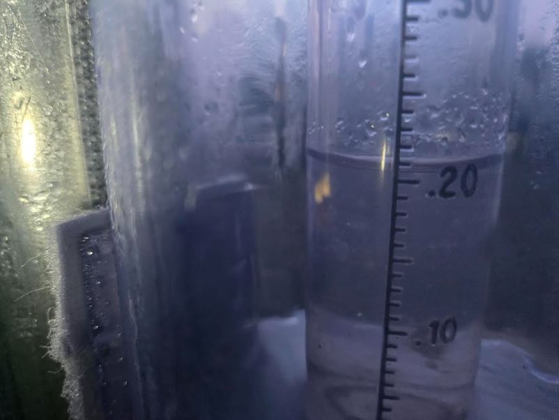
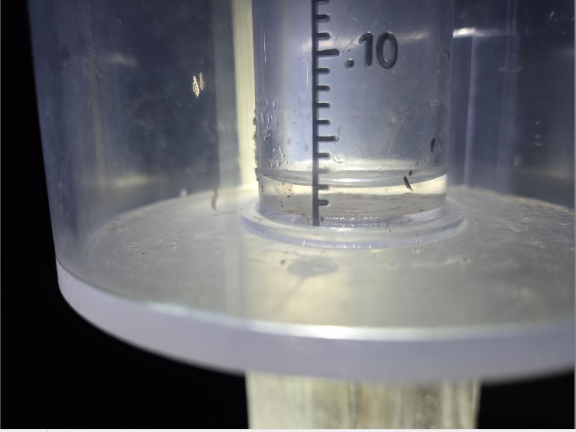
05/28/2025... 11:35: Just checked the manual rain gauge: (0.60") so far today, and still a very light rain/mist. (.10") fell before 6 am, and (.50") after. Yesterday picked up (.02") in the spotty showers. It looks like it's close to over on radar for Valentine.
07:10: You can see fog has developed on the hills, and getting rain again.
06:50: Starting to see some fog developing. The rain is down to a drizzle.
06:30: Currently, moderate rain (.28") so far this morning. Have the GRlevel3 radar on front page because it's more detailed, so have a 3-minute refresh for image updates. This Doppler radar feed is always available, link above images or Radar/Satellite tab. The default normally front page is the NWS looping radar.
05/27/2025...08:00: Picked up another (.02") this morning. Doesn't look like Miller Field received any, so scattered pockets.
The last 4-day rain total here was (0.48"), so a disappointment from what models early on advertised, some as much as 3". Even though this week underperformed expectations, the month of May has been good for moisture with (4.18") so far here. The forecast has a 50% chance of more on Wednesday to finish out the week before temperatures get into the 80s for highs starting Friday.
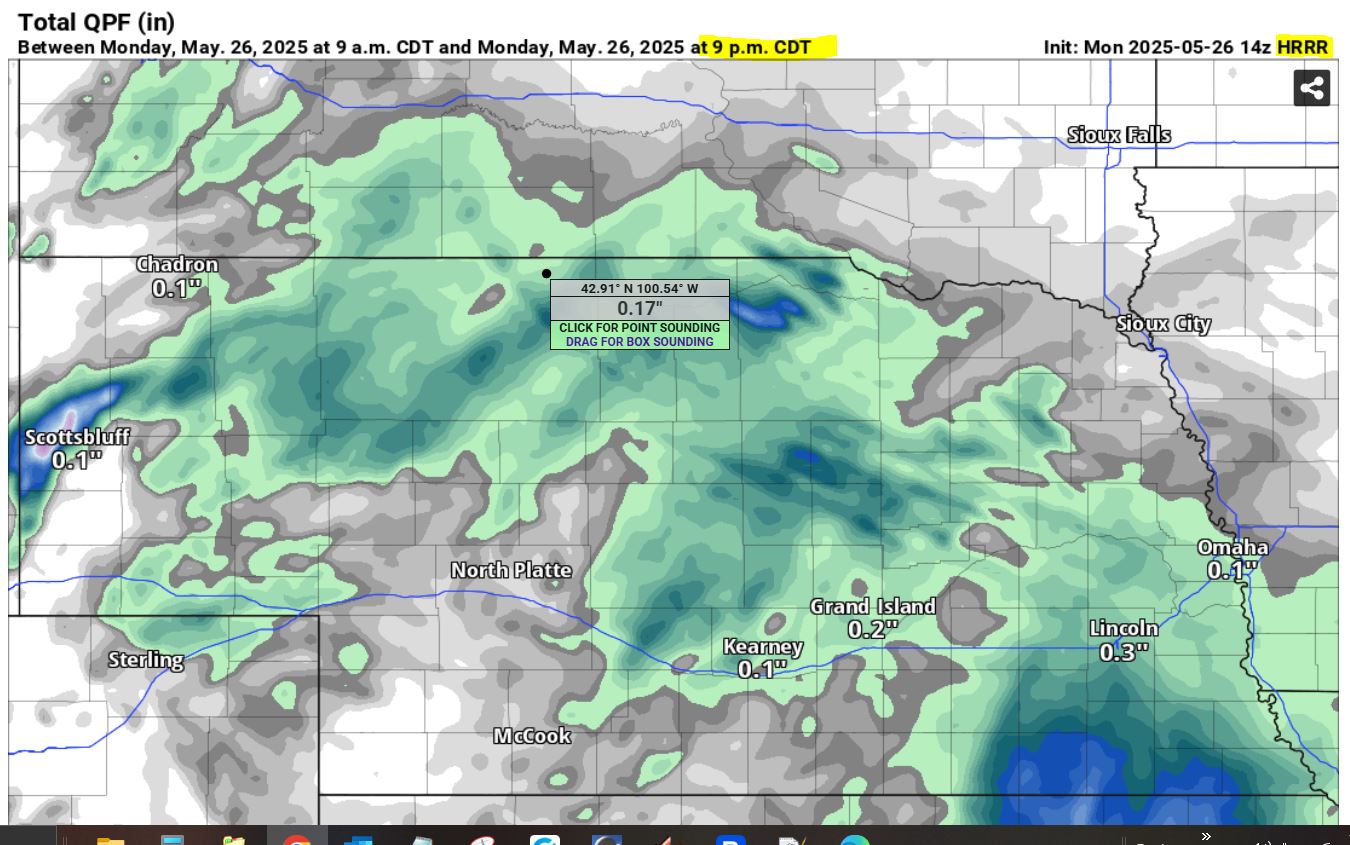
05/26/2025...10:18: Here is the HRRR for precipitation today. It's backed off on amounts from just an hour ago.
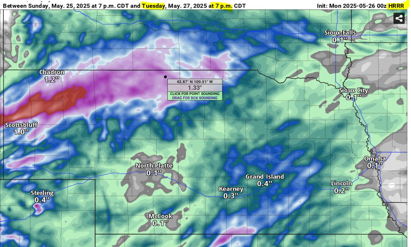
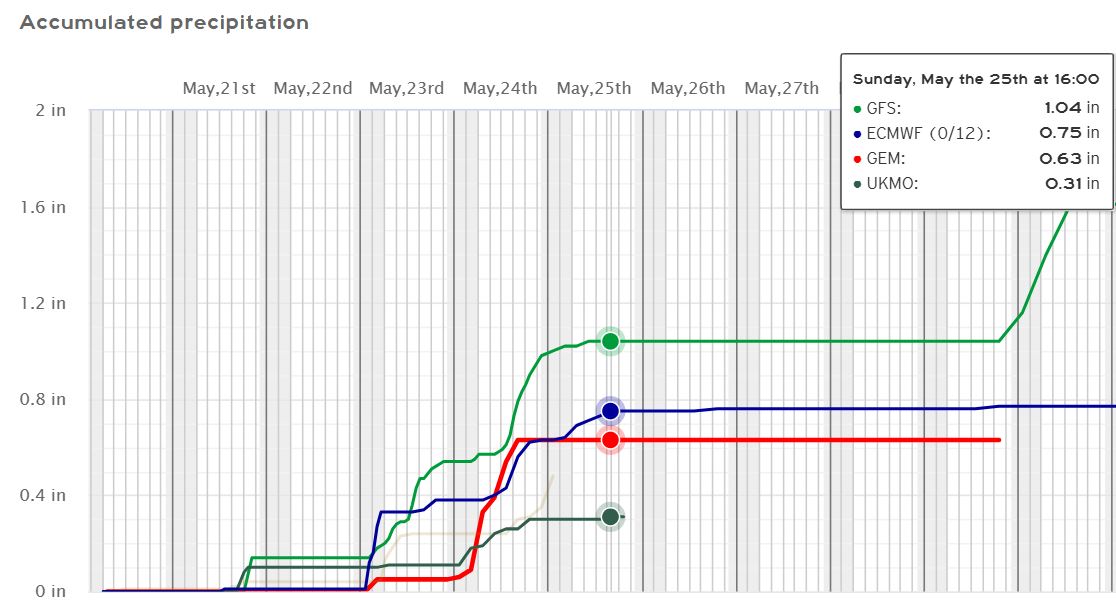
05/25/2025...21:10 Here is the latest HRRR 48 hour run. So wet again. Looks like some more light activity on the way now.
15:00: Thanks to some brilliant help from a weather Forum, was able to get the radar to refresh on its own, so a full page refresh isn't necessary. I may still have a page refresh every 8 minutes or so for forecast updates, but the stream won't be restarting every 3 minutes now. For uninterrupted stream use the Live Streaming link. We did pick up another (.01") so far today. The High School Rodeo is thankful for not having rain, I'm sure. Trailers and horses as far as you can see at the Fairgrounds.
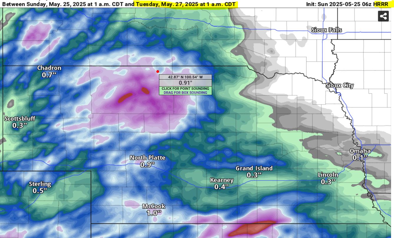
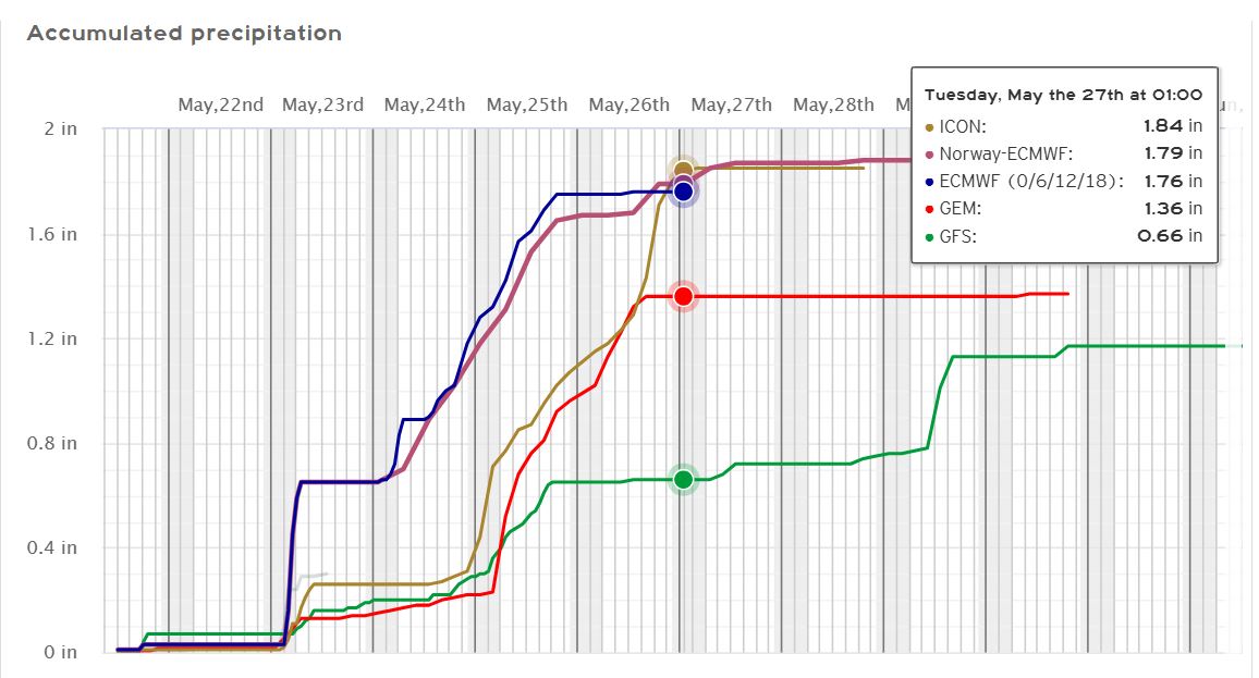
The rain gauge measured (.10") for yesterday and overnight. Most of the activity has stayed well south of Valentine. The HRRR is still saying we may end up with about an inch total, on the extended 48-hour run this morning. Really, it's the only model that's been close. Here is the GFS same time May 27th 1 am. Temperatures stay below normal until this coming Friday. We need some heat now to take advantage of all the moisture and promote grass growth. Kentucky Blue does well with cooler temperatures but most grasses need heat.
05/24/2025...12:05: Light rain so far today, with only (.01") here (.03") out at Miller Field. The website is now utilizing the streaming camera on the front page. The WSW to WNW image is available on Cameras link. The full screen, option (box) is located lower right corner.
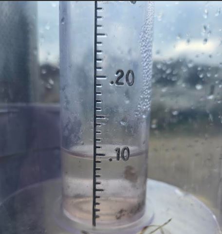
05/23/2025...11:40: Rain total so far is .09" on 8" standard, also with the Cocorahs. This includes what fell earlier today, the gauges haven't been emptied.
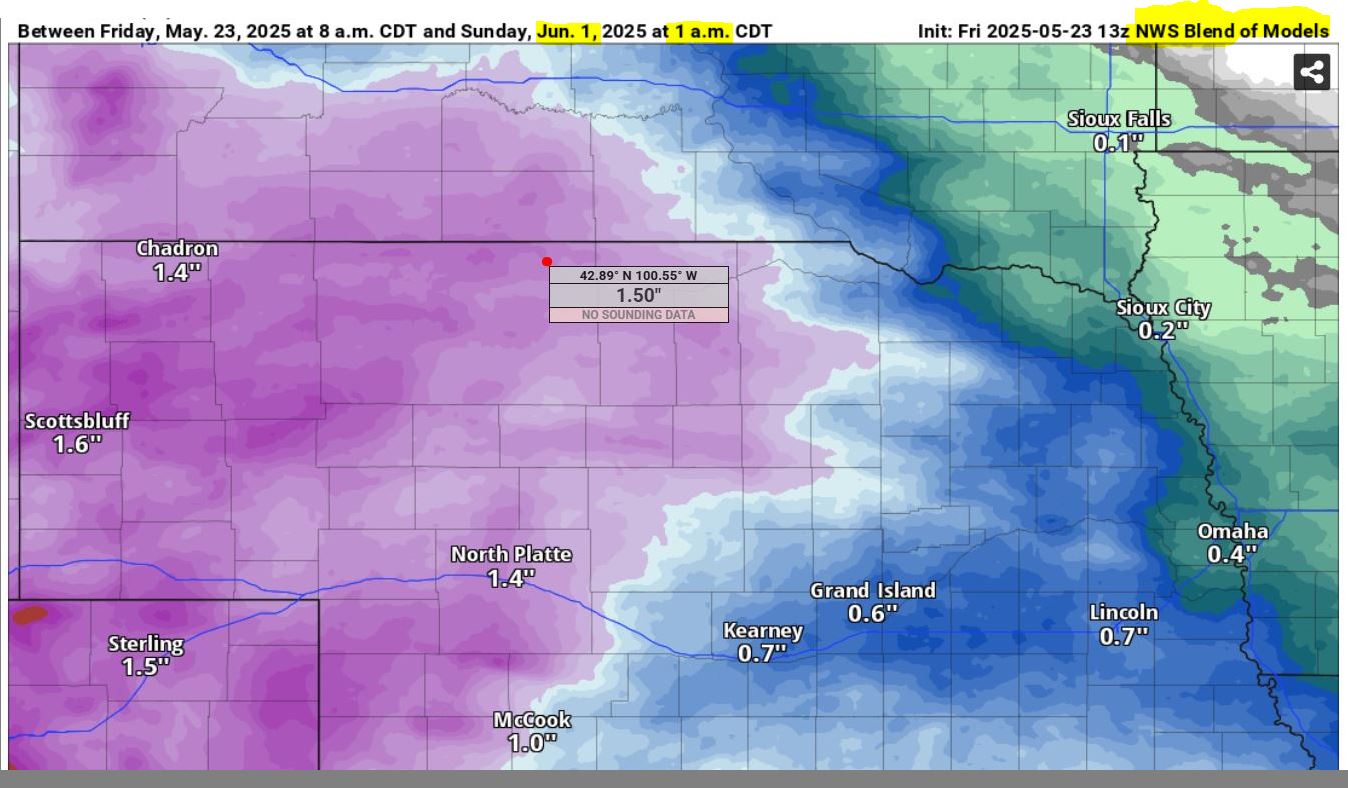
11:15: Getting some light shower activity again. This morning measured (.07"). Models have substantially backed off from red 2" plus, to the pink 1" plus for projected upcoming rainfall. It's not that unusual for models to back off, seems to happen a lot as the event approaches. Here is the latest NWS model blend for precipitation through 1 am June 1st.
05/22/2025...16:00: Here's the blend of NWS models, through Wednesday 7 am. Several models have much heavier amounts.
Only a 40% chance tonight in the updated forecast. The HRRR does have moisture moving in about 5 am tomorrow morning. Friday and Friday night only a 50% chance, so don't get into the likely 90% range until Saturday and again Saturday night.
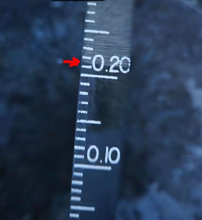
06:00: Dumped the rain gauges, (.21") on the 8" NWS, and same on the Cocorahs gauge. Miller Field reported (.18"). Currently 37° and light ground fog here at the NE location.
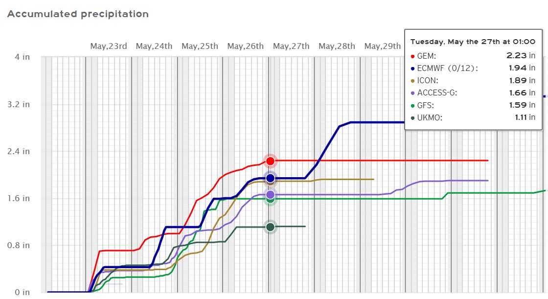
04:10: Scattered light-fog on and off. Miller Field so far reports a 10-mile visibility so not widespread. Looks like scattered frost is unlikely, with no mention in the undated forecast. Our temperatures are still hanging near 40°. Wet is the main focus ahead, with the overnight models through the Memorial Day weekend. The Low-end precipitation 1.11", and High-end 2.24" come Tuesday morning.
05/21/2025...20:30: Picked up (.21") out of T/S here at the NE location. Looking at radar, there is more activity in SD following the same path. Doesn't look as developed though, so might not reach us.
20:00: Thunderstorm, one of the models did see this coming, the HRRR.
This looks pretty wet coming up. (Models)
05/20/2025...Breezy with below normal temperatures all week, along with slight chances of showers (20-30%) today and Wednesday. Normal temperatures this time of year are (74-46f). Possible frost/freeze Thursday morning, then a better chance of precipitation Thursday night at 70%, and again Saturday likely showers and thunderstorms. Overnight, there was a 40 mph wind gust; today, gusts as high as 45 mph are possible. A look at models this morning on precipitation this week, HERE. Between 1/3 and 1" come Sunday.
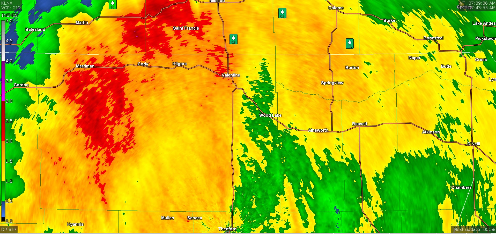
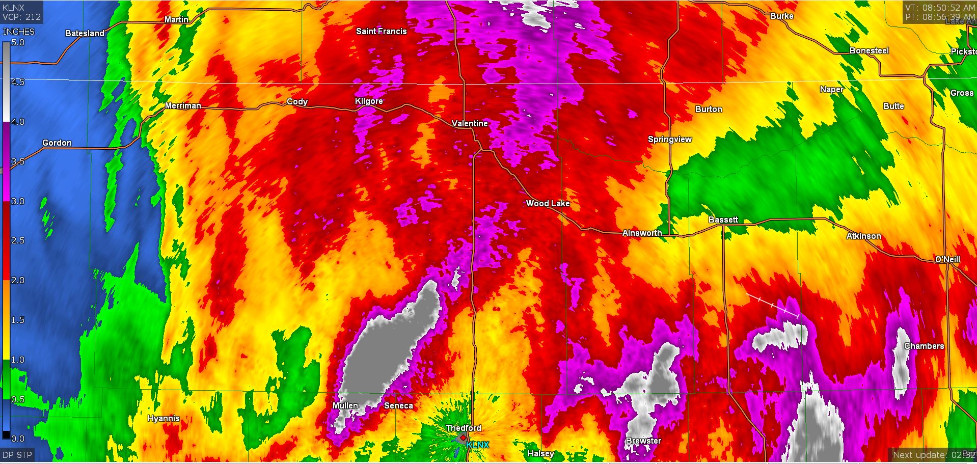
05/19/2025...Here is the Doppler rainfall estimate for the event.
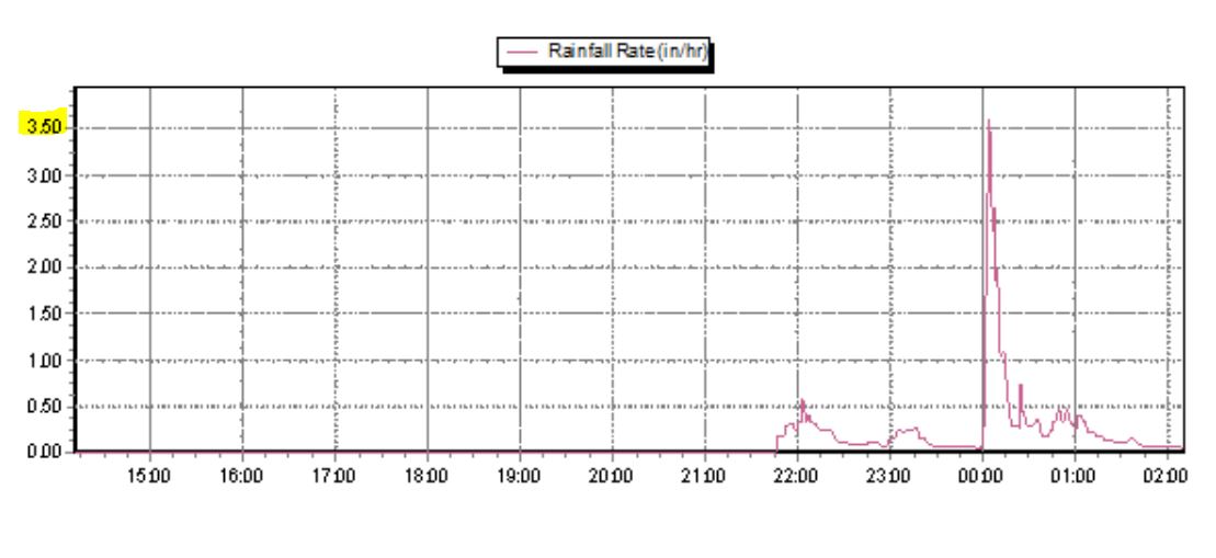
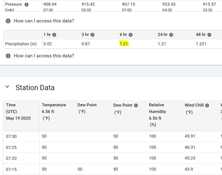
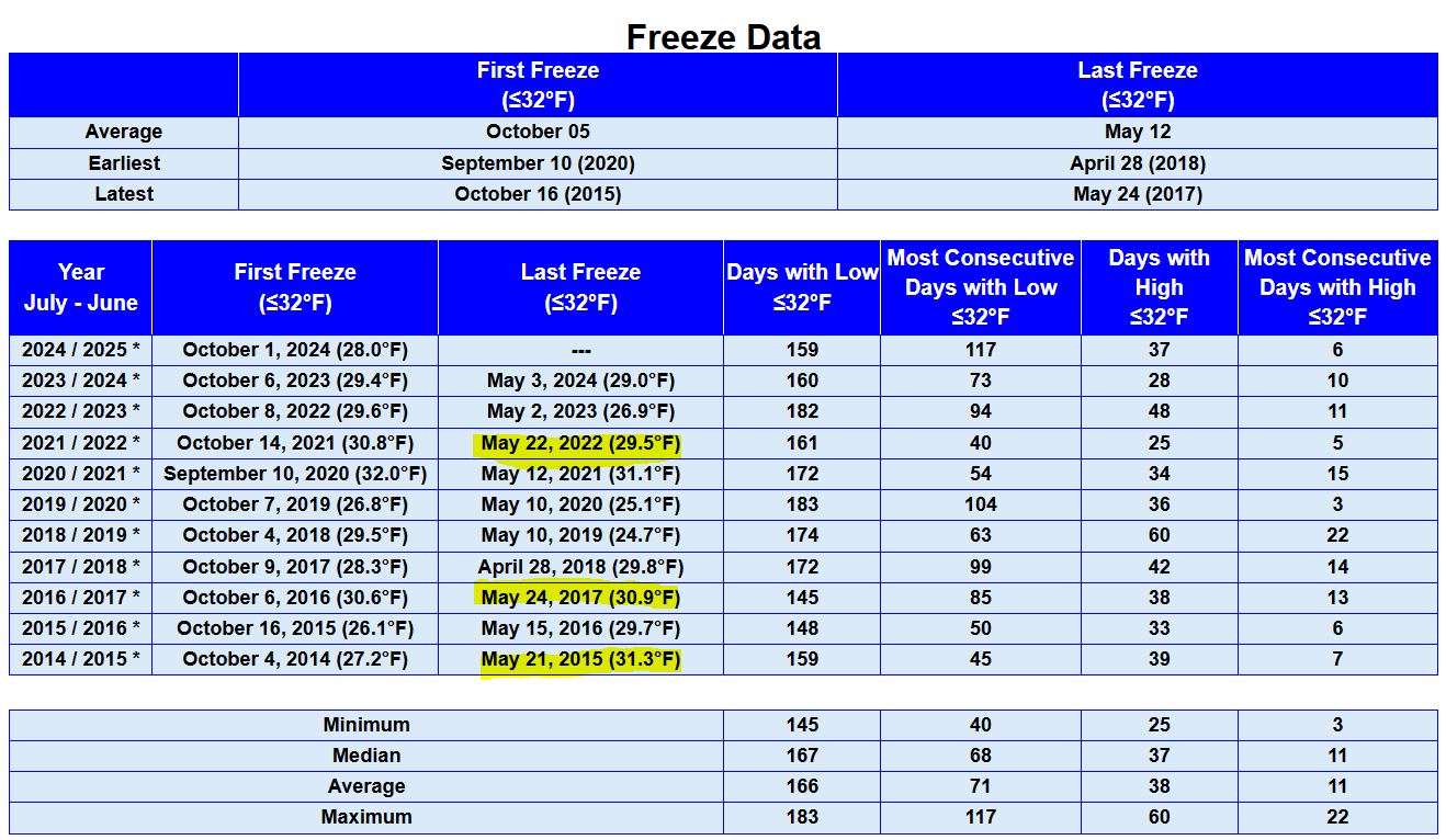
The rain has stopped, (1.17") here at the NE location. We did get some brief very heavy rain, peaking at 3.6" per/hr. KVSH downtown location reported (1.22"). Miller Field rainfall (1.21"). This should put the airport just a few hundredths shy of normal on the year. The month of May hasn't disappointed and still have 13 days left. We have a potential of more later today in the forecast. The forecast has a couple low temperatures of 35° coming up, so a threat of frost, especially Thursday morning with a clear sky. Should it freeze it's not all that unusual, we've had 3 different freeze occurrences beyond May 20th, since 2014.
05/17/2025...23:45: Picked up (.02") in a shower.
08:00: The low temperature this morning was 36° here and out at Miller Field.
05/16/2025...17:00: Miller Field just had a 63 mph wind gust. The SD Dot station 15 miles north of here is still the high wind winner today at 67 mph. It came in around the same time the 61 mph gust occurred here. Just checked the rain gauge here (0.15) and rain has stopped.
12:15: At noon, so far today (.07") in light rain, KVSH radio reports (.08") in their downtown (8" dia.) rain gauge. Miller Field looks like only (.03"). Still getting some light rain on the NE side.
10:05: Checked the official 8" gauge (.05"), and same on the Cocorahs. All fell as light rain. At this rate, we'll end up with around a tenth today. Plenty more on the way, especially Sunday night. It may even put us close to normal on the year.
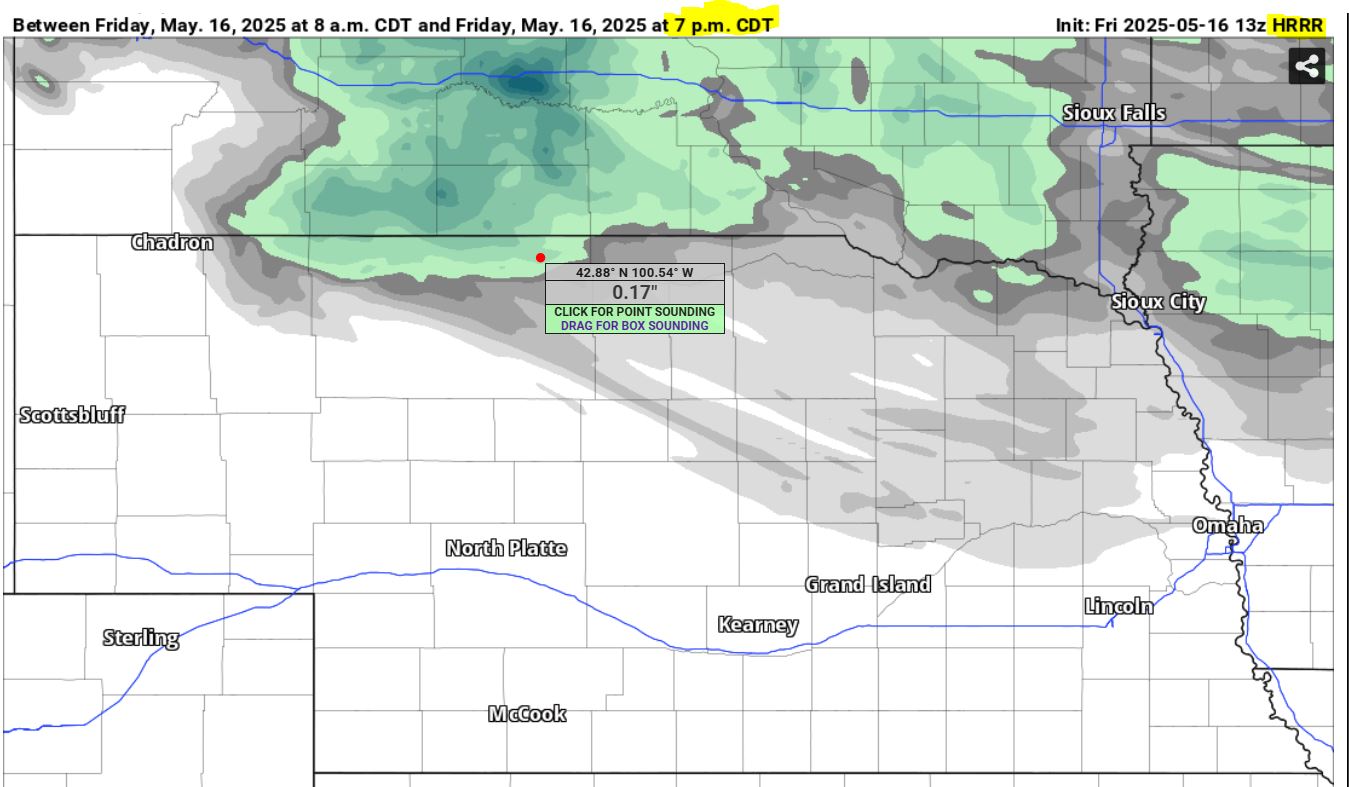
We have a "High Wind Warning" through 8 pm tonight. Also have a good chance of light rain today, with the HRRR saying around (.17"), for Valentine. Starting to get a wind-blown sprinkle now. Had a 50 mph wind gust here at the NE Valentine location.
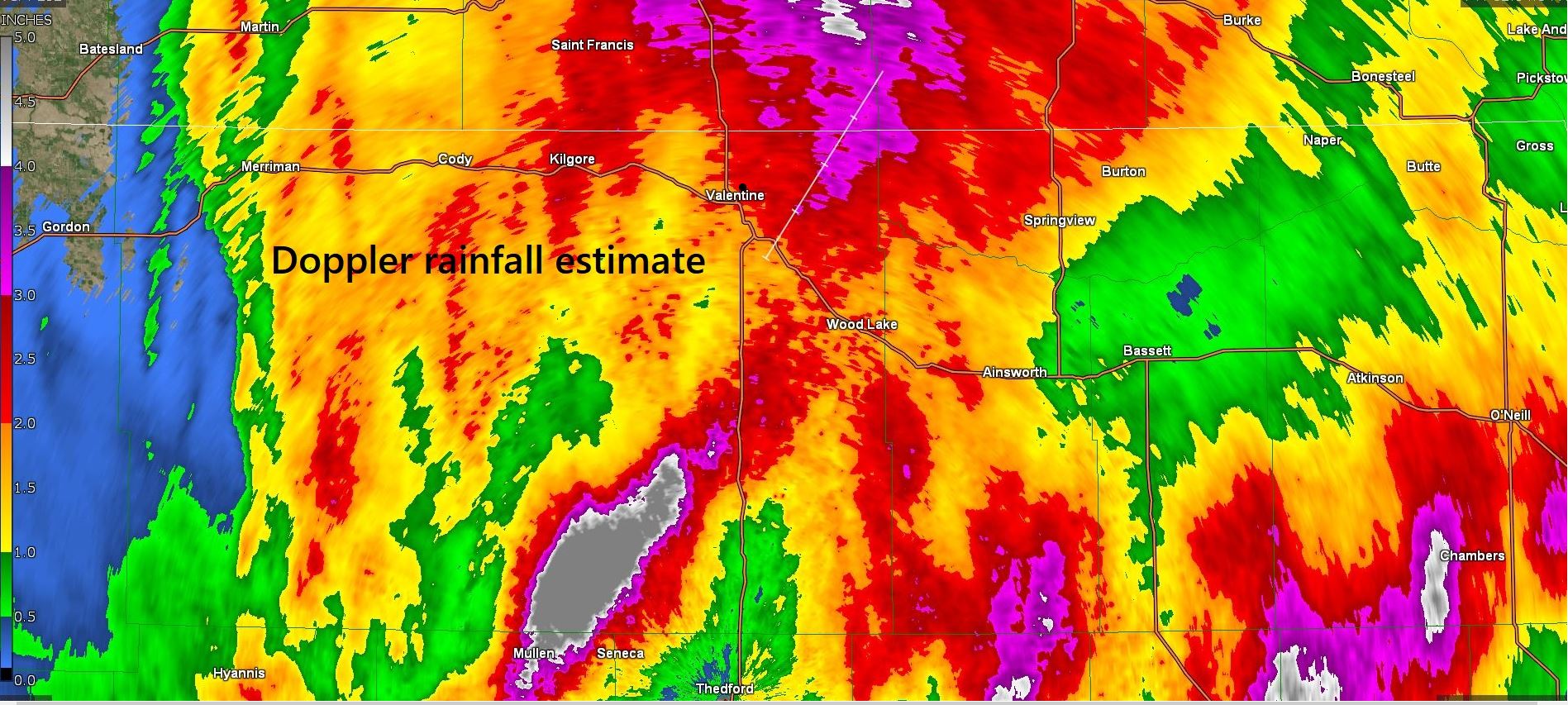
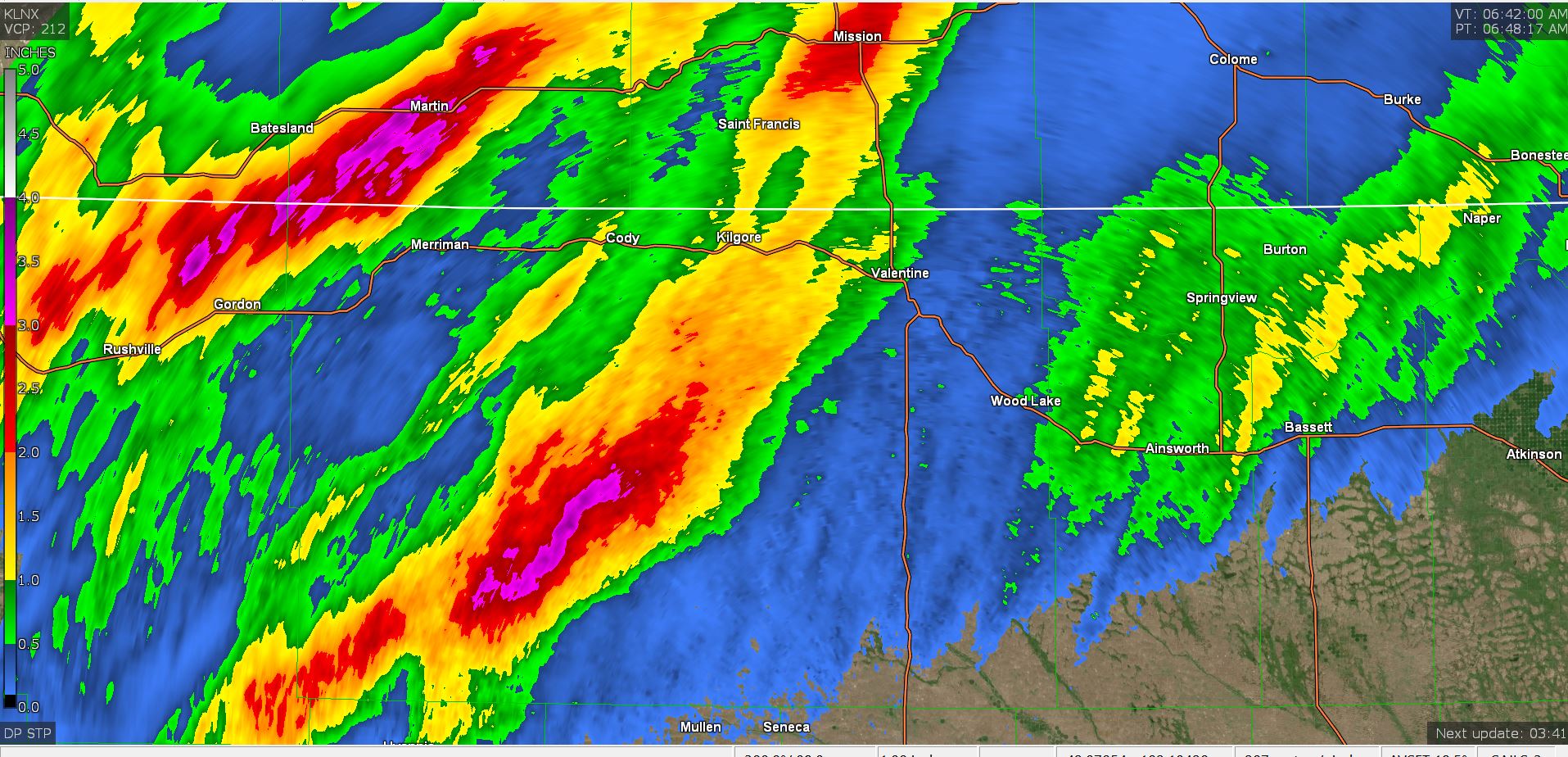
05/15/2025...11:20: Here is the storm event total, Doppler rainfall estimate. What actually fell could be less than the estimate, but this gives a good idea where the heaviest and lightest rain actually occurred. Just east of Valentine were some heavier areas and down by Mullen the real heavy stuff yesterday with the thunderstorms almost stalled over the area.
10:00: Had a 54 mph NW wind gust, also the South Tempest station recorded a 54 mph gust out of the NW.
08:00: Just reached the 2" mark on storm total.
For Miller Field rainfall, go under "External links" (Miller Field Synopticdata) and look under Summary Data for the "Precipitation (in)" column. (1.47") at last check.
5:40: Getting light rain again.
The HRRR model is saying it may not be over today, with another 1/3" potential. Wind gusts could be as high as 50 mph today.
Storm total (1.64") in 8" diameter gauge here at the NE Valentine location. On the Doppler radar estimate, put a dot top of the "t" in Valentine is about this location, so in the red. You can see on the south, airport side it's more in the red/yellow mix.
05/14/2025...19:15: Raining currently, (.59") is correct, just checked the manual gauge. The small hail we got didn't last long.
16:00: We are under a "Severe Thunderstorm Watch". The Miller Field station is broadcasting again. link External Links, (Miller Field Current) or (Area Observations) Synoptic Viewer. When you see a triangle with a number that's possible hail size.
08:50: The streaming camera audio control is back on for the upcoming rain event. It can always be muted by the user for excess wind noise. Or listen to the birds sing this morning.
It's looking good for moisture, starting later today. All but one model has over 1.5" of moisture falling by tomorrow. Even the HRRR is onboard with over 2". It's been a long time since Valentine has been in the Red on model moisture projection. Friday and Saturday look best during the day for lawn maintenance, then rain chances increase again Saturday night. Nice to have this problem of having to plan out a window to mow the grass.
05/13/2025...This looks GOOD, hopefully it pays off, we need several inches. No more nickle and dime stuff. This is the wettest time of year, so critical it starts paying off.
05/12/2025...The website hosting transfer is complete. It didn't go as smoothly as hoped. The website is complex, with multiple PHP scripts working together with the weather instruments. Apologize but it had to be done.
0550: Looks like the Miller Field ASOS stopped broadcasting at 1 am. Last time it took about a week to come back. It's some kind of communication issue.
Another "Red Flag Warning" day, starts at 11 am though 9 pm tonight. 88° was the high temperature here yesterday on the main aspirated sensor, the Coop Nimbus 87°. Miller Field came in at 90°. It's forecast to get warmer today (92°). The record high temperature at Miller Field for today is only (93°) in 1915, so could be in jeopardy. Miller Field had a wind gust of 53 mph out of the south yesterday. Only 42 mph here, but the south direction has the most obstructions (trees) at this location. The south side Tempest had a wind gust of 47 mph, yesterday. This station is linked on the navigation bar and worth watching, with a good open location.
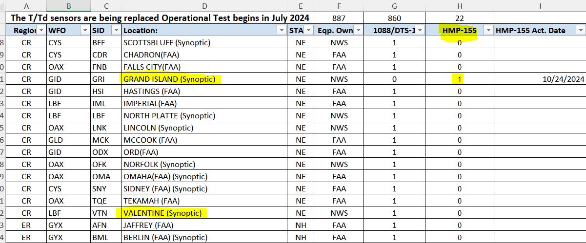
FYI there is a new ASOS Temperature/Dewpoint System slowly being brought out. This started back in 2023 and they've only done one, Grand Island in the State of Nebraska. I'm looking forward to it. More information, Here.
05/11/2025...Happy Mothers Day, all moms. Very warm air today and windy. Lawns will require extra water the next few days. Plus we aren't getting any supplemental rain which is unusual for May. Our ground soil is almost all sand, so have found watering daily works best here, unless several inches of topsoil got added when the lawn was planted. "Red Flag Warning" starts at 11 am central though 9 pm tonight.
05/10/2025..."Red Flag Warning" for gusty winds, low humidity, and above average temperatures, starts tomorrow, Sunday from 11 AM CDT /10 AM MDT/ to 9 PM CDT /8 PM MDT/.
05/09/2025...NWS key message: Dry conditions with temperatures well above normal for Friday through Tuesday. Next chance for precipitation will arrive Wednesday into Wednesday night with the greatest threat over northern Nebraska. The Miller Field weather summary is updating again, linked under "External links".
05/07/2025...The Miller Field Daily Summary Report updates is down for maintenance, should be back sometime Friday. You can still get the high and low temperature off the "Miller Field Current" link and scroll down to 0:52, & look on the 24 hour column. No rain in the forecast until Monday night with a slight chance of showers & TS. High temps will approach upper 80s toward the end of 7-day.
05/06/2025...Forecast precipitation chances have dwindled to a slight 20% chance for today and tomorrow with warming temperatures getting into the upper 80s Monday and possibly even warmer further out with a couple models mid 90s.
05/05/2025...Forecast has changed slightly and not for the better. No rain chances Monday night, with a slight chance starting Tuesday and the best chance of 40% on Wednesday, followed by no rain chances and 80s for high temps to finish out the week. Not what we need for our wettest month. Hopefully it gets better in the latter half.
05/03/2025...It Froze across Valentine this morning, (30°) here on the NE side, also (30°) at the South Tempest location, with Miller Field reporting (31°). There was no wind and a clear sky. Today may be our last freeze of the season unless another sneaks in later, which does happen occasionally. 3 freezes since 2014 have occurred after May 20th. High temps in the 70s forecast over the next 3 days with Monday night a 40% chance of moisture.
05/02/2025...1355: The Miller Field ASOS is broadcasting data again. Found under external links. The conditions icon is back on also. The website icon sometimes only updates hourly and can't see high clouds so may show clear on overcast days. Best to trust the cameras if not matching.
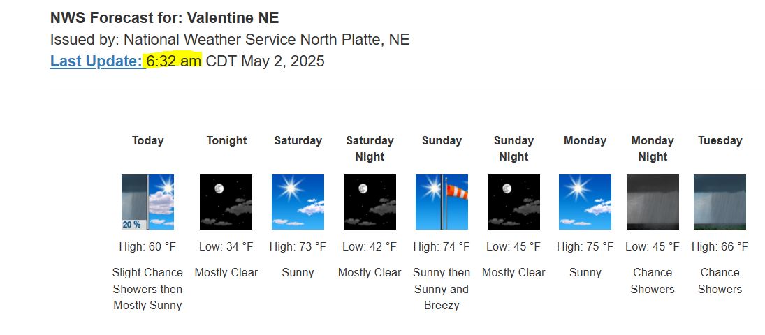
0640: We did pick up a couple more hundredths overnight. Tomorrow morning we might freeze. The forecast has the low reaching 34°. The Gem (Canadian) model has 33°. Our next best chance of moisture after today's 20% comes Monday night with highs reaching into the 70s, Saturday, Sunday and Monday. To get the latest forecast click the link at bottom of main page. For unknown reason the website forecast can lag behind on updates and can't figure out why. The Forecast can get updated at anytime with changing conditions, so it's the surefire way for latest. It even gives the time of update.
05/01/2025...1915: Just checked the 8" rain gauge (.07") of new light rain since last night, for a daily total (.11") so far. The automatic tipping bucket is right on with this light rainfall and heater off. Where automated tipping bucket accuracy suffer is with heavy downpours, they tend to under-count or light snow with heater on, through evaporation. The forecast has a 50% chance of more throughout tonight with a possible TS.
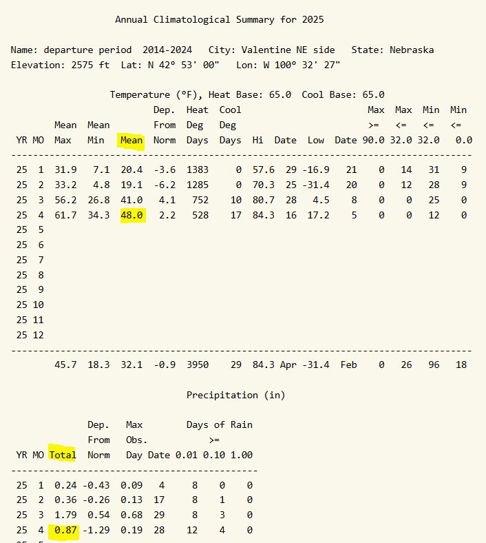
Looking at the April 2025 climate summary based on the departure period 2014 to 2024 of this station. Miller Field HERE. May is our wettest month historically, hopefully it doesn't disappoint.
Light rain overnight, measured (.04"). Looking back on radar images, it looks like mainly on this north side again.
04/30/2025...Drove south down Green Street, the road went dry in front of the High School football Field. (.03") was recorded here.
1540: Getting some rain on NE side, (.02") so far on the tipping bucket. Have a blue sky in the west looking cameras and rain.
1500: Several lightning strikes.
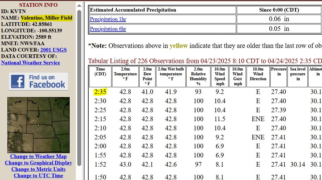
0650: The Miller Field KVTN ASOS has an unknown timeline for returning to broadcasting again. It's a communication issue and handled by the FAA, the last update was 6-days ago on the 24th at 2:35 am. The North Platte NWS office still has the ability to get weather data by directly dialing in. The Miller Field ASOS summary data is linked under "External Links".
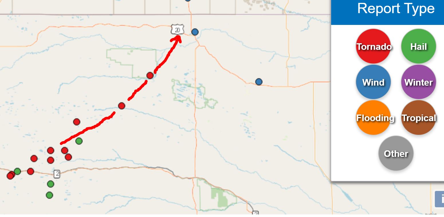
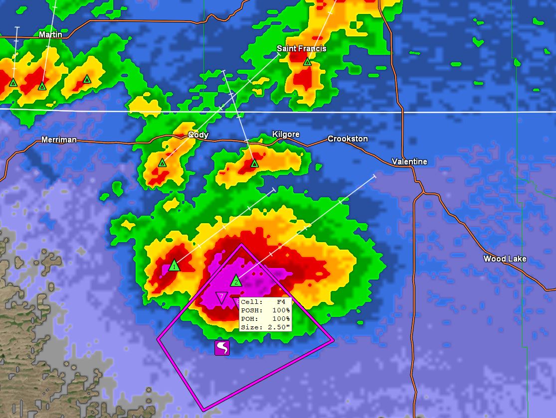
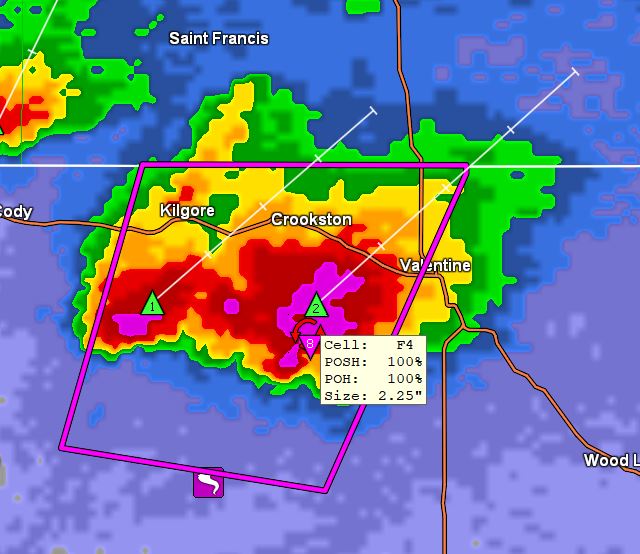
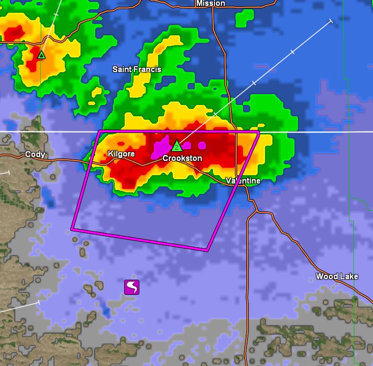
04/28/2025...Here was the track of the supercell. 11 tornadoes total, the last tornado radar image, 3 miles WSW of Merritt Reservoir, and before crossing between Crookston and Valentine.
Added the video of the massive wedge tornado yesterday, HERE.
The NWS Storm Report link is under the "External Links" menu, or HERE. Here is a look at Doppler estimated rainfall.
Updated: Last night a second round of thunderstorms came through about 1 am. After hearing hail report from someone else on north side of Valentine, may have had some small hail mixed in because it was pretty loud. Didn't last long, a couple of minutes at most. Recorded a 59 mph wind gust here. Total moisture prior and after midnight (.22"). The tornado watch for today was removed by the NWS. The forecast today has a 50% chance of showers and thunderstorms between 4pm and 5pm, increasing to a 70% chance of showers and thunderstorms tonight.
04/27/2025...23:40: The TS cell passed to our west and did weaken some, (image), but still have a line of TS off to the west that could come through later. The radar will stay up like it is. Goodnight all.
2322: Looks like Valentine may take a glancing blow.
2235: This supercell is staying together and aimed for a higher populated area (Valentine), unfortunately. Won't be able to see a tornado at night so if it doesn't weaken in the next 20 minutes or so, it's a good idea to prepare.
1945: That supercell entering southwestern Cherry County has spun off at least 2 tornadoes and a 3rd funnel cloud. One of the tornadoes was described as very large along with 3" dia. hail reported from the same cell. A second supercell looks to be developing just east of the first. The large tornado is still being reported traveling on the ground by the NWS Weather Radio which keeps going off.
1705: A "Tornado Watch " was just issued. Starts at 11 pm tonight through Monday noon.
1645: The afternoon NWS forecast has bumped the precip chance tonight to 70% between midnight and 4am. Here is the latest HRRR. Looking good for at least this area. Ready for some sunshine, we clouded up last Thursday afternoon and finally the sun is trying to peek through. If it does and we get heating, can increase odds of thunderstorms tonight.
04/26/2025...1545: The updated afternoon forecast has dropped odds of precipitation Sunday night down to 40%, still at 70% Monday night.
1015: We just had a light shower that measured (.01"). Sunday night is still the best chance of substantial moisture coming up, currently the forecast says 80%, then again on Monday night 70%. The GIF once again is not onboard but others are. Could have thunderstorm activity mixed in both nights.
04/25/2025...0740: The automatic rain gauge just tipped (.01") so checked the 8" official rain gauge and it's true, (.01") new precip from the heavy mist. The gauge was emptied a couple hours ago.
0630: 30 to 40% chances of precipitation through Sunday night when it jumps to 70%. Still a heavy mist this morning with a 99% RH. The current air temperature is 38°, yesterday's high at the NE location was 44°. The 3-day moisture total (.18") here, Miller Field (.19"). On the month (.59") here, (.62") Miller Field which is still (-1.28) behind average. As mentioned yesterday the website condition icon comes off the airport ASOS and still down this morning.
04/24/2025...2040: Precipitation so far today (.17") since midnight. Something you don't see often here is an all day mist. RH is currently 99%. Our high temperature today was only 44°. A rather miserable day, but needed for the big wildfire to our east.
1130: The forecast updated, now a 80% chance tonight for rainfall. Here is what the hourly HRRR looks like at 4 am. Sunday night "likely" wording is still on for the next best chance after tonight. Getting heavy mist currently.
0845: The Miller Field ASOS stopped broadcasting public data last night after 02:35 am report so removed website conditions icon, which comes off the ASOS. The ASOS is still working just not sending data to public.
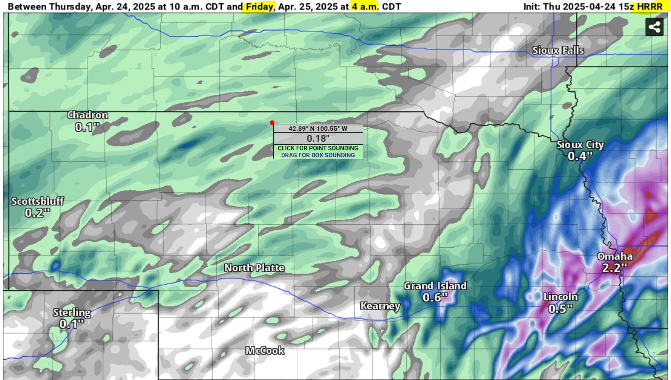
Only picked up (.04") here. We still have a 50% chance later today. The next likely chance comes Sunday night. Getting decent rain has been an issue starting last July, that's why we are in a drought. Miller Field is about -1.30" behind on the month now. We've had some very wet springs, here is the "Rainfall Summary" showing rainfall from this location dating back to June 2014. May, June and July have been the wettest months at 5.28", 4.29" and 3.34" averages. Looking at the graph you can see when the drought started back in July of 2024, a normally wet month but only (.46") fell last year.
04/23/2025...1540: The afternoon forecast backed off to 70% chance on Thursday.
0510: A look at models this morning going into Friday morning, with the GFS showing the least for Valentine, HERE. The forecast shows a very active pattern with chances daily throughout the 7-Day. Likely chances start tonight at 60% into Thursday at 80%, our best chance. Thursday night another likely at 60%. Then the next likely comes Sunday night. Miller Field picked up (.01") about 8:30 pm last night. Only a Trace here.
04/22/2025...1730: On radar currently, scattered showers in the area, much may not be reaching the ground. If any thunderstorms development they'll likely be high based again, not much moisture but a lot of wind.
0730: It's been below freezing for well over an hour now. Yesterday the airport only recorded a trace from the high base thunderstorm. We had (.01") here and about 1/2 another tipper. High base thunderstorms are known for producing high wind gusts, we did get a 48 mph gust but it came later after the thunderstorm. Did see several 60-65 mph gusts reported around the area. The forecast looks active but when you look at models , some like the GFS only show .29" and the ECM not much more through May 1st, so not that confident. Yesterday it looked more promising.
04/21/2025...1700: Picked up (.01") here from a light T-storm. Heard one rumble of thunder. The peak wind gust was 39 mph. There is a lightning started fire east of town. This TS kind of put a damper on the forecast high. We did reach 74° here prior.
15:50: Special Weather Statement for potential thunderstorm is out. We did pick up a quick shower earlier.
Here is a look at (Models) for this week ahead. At least it looks active, how much moisture actually falls is another story. Today the forecast high of 77° is well above the normal of 62° with a "Red Flag Warning" in place for parts of the area. Valentine is left out of the Warning however.
It's got down below freezing this morning (30°), so isolated the lawn sprinkler water again, just in case. Do have 1-sprinkler head above ground. At ground level it can get colder than at 6-foot where the air temperature is measured.
04/20/2025...19:50: Turned out to be a pretty decent Easter Sunday. Have two different aspirated thermometers, one recorded (64.5°) the other (64.8°) for a high temperature today. The new repositioned shield came in the warmer. It's now being used as the main sensor for the website. There is a "Red Flag Warning" tomorrow starting at 1 pm, but doesn't include Valentine.
04/18/2025...08:30: Picked up another (.01") since the 6 am measurement. Storm total so far (.08"), so another disappointing amount. Does look like on radar a little more is on the way, and aimed right at Valentine. Was looking at models and it looks like April will end up rather active to close out the month.
06:00: 3 tenths in snowfall so far. Just enough to cover the grass at one point. The ground is warm so most melted on contact and what does accumulate melts rapidly. Total moisture (.07") so far today. All but about (.01") fell as snow.
03:45: Getting light snow now. It's melting on contact currently, with a 34° air temperature.
04/17/2025...20:05: And just like that, the HRRR gets onboard with the ECM and ICON. Image It's saying around 1/4" for Valentine now. Saw some video of a tornado over by Omaha about an hour ago. Looked like an EF-2ish. It wasn't a big wedge tornado. (Update) the NWS says it was a EF-3 by looking at surveyed damage.
07:00: Yesterday's high temperature came in at 84° here, and 85° at the Miller Field ASOS.
04/16/2025...Enjoy one more nice day (near 81° today) with elevated fire weather conditions due to low RH in the 10 to 20% range, winds will be light however, only around 5 mph here in Valentine. Then it becomes active with rain and snow chances throughout the rest of 7-day. Forecast has bumped precipitation chances to 80% for Thursday night into Friday, with snow chance wording mixed in followed by more activity even a possible thunderstorm with Mother Nature fireworks come Monday night.
04/15/2025...21:00: Was a beautiful day, our high here reached 74° on both the Nimbus and website thermometer. Looks like Miller Field also came in at 74°. Saw several working on the lawns today. Tomorrow it's oil change time on the mower with the forecast high of 82°. The 70% chance of rain Thursday is still on in the forecast.
13:30: Since nothing is happening on radar will leave the Nimbus thermometer up today on front page for temperature comparison. Reminder image updates every 2 minutes so not real-time. The aspirated thermometer reacts more rapidly to change so can have higher peaks & dips in real-time. Looking at latest model runs, it's looking a little better but still not enough.
06:05: Not much happening today, sunny and above normal temperatures the next couple of days. 71° today, 79° tomorrow, then a 60% chance of showers Thursday night. Thankfully we get a break from the wind the next couple of days. Normal highs for this time of year are low 60s with our average low just above freezing. We did dip to 24° (4:49am) this morning before a WSW breeze picked up. It may get back down there before sunrise if the wind subsides.
04/14/2025...13:05: The "Red Flag Warning" started 1 pm and on cue just had a wind gust of 48 mph. Currently 50° with 24% RH.
Today another "Red Flag Warning" starting at 1 pm through 9 pm tonight. Yesterday the peak gust recorded at the NE location 46 mph. Miller Field 50 mph at 9:25 pm last night.
04/13/2025...We have a "Red Flag Warning" today starting at 1 pm through 10 pm tonight for the region. A northwest wind 25 to 30 mph with gusts to 45 mph, combined with low RH in the 15-20% range will make for rapid fire growth and spread should it occur.
04/11/2025...16:55: The high so far today 77° here, also out at Miller Field. RH is running pretty low 14-15% currently so fire danger is up. Our wind is 15-20 mph currently. Even though there isn't a Red Flag Warning, be careful. Sure does feel good outside, even in a T-shirt.
Below freezing this morning, (28°) currently with a great weather day ahead, with mid 70s for a high. Tomorrow near 80°. Wind won't be too bad and no Red Flag Warning scheduled for today. Some may have tree pollen issues, it's pretty high right now.
04/10/2025...Pointed the streaming camera looking toward the NW. The blue water tanks on top of hill are at compass heading 300°. This puts a large ponderous pine tree in view for a better perspective of wind and hard to see precipitation against the darker tree especially when everything is white with snow.
07:05: It's flat out windy on the NE side this morning. (gusts to 34 mph) If you go to the streaming camera you can see and hear it. Not near as much wind at Miller Field yet.
We are under another "Red Flag Warning" today.
04/09/2025...A few sprinkles around the area early this morning, nothing observed here on the NE side of Valentine. We have a "Red Flag Warning" today starting Noon CDT /11 AM MDT/ to 8 PM CDT /7 PM MDT/ this evening.
04/07/2025...13:00: Full sun & 44° now, we might make the 50s.
08:20: The fog has lifted. Got down to about 1/3 mile visibility.
07:25: Have a little fog developing on the hill tops right now, RH is up to 95% here. We have a backdoor cold front today. Valentine is on the dividing line between the cold air and warm air so temps could end up higher or lower than forecast depending on exactly how far east the cold air settles.
04/04/2025...12:40: The fog that was developing lifted off the hill tops. Getting a few snowflakes now. Very light so far with the current air temperature 33°. The radar is starting to fill in from earlier.
11:30: A rather disappointing rain event. Expectation was higher with the forecast of 90% chance last night and today. Oh well, the way it goes. (.05") here so far today. Don't really expect much more today. As you can see on radar not a lot going on. What is on radar is pretty light so maybe another .01" or so. Seeing a little fog development currently, we have a 98% RH, that's pretty high for the middle of the day.
04/03/2025...06:20: Looks like we are in for another round of moisture starting tonight and Friday with 90% chances.
04/02/2025...15:00: Getting a mix again. Looks like primarily this side of town. Nothing being reported at Miller Field.
14:00: Precipitation has ended currently, total amounts (.14") here at the NE location, KVSH Radio (.16"), Miller Field (.18"). Little heavier the further south. Still a chance of more with weak radar returns moving out of SD.
11:35: Getting some snowflakes again. Pretty big flakes this time. Can't do much about the wet snow sticking to camera lenses.
06:10: Light rain this morning, at 6 am (.12") overnight total. Today we have a continued 50% chance of rain with the possibility of light snow mixed in. Temperature is a little warm for that currently, 38°. We had some really heavy fog last night with well under 1/4 mile visibility. Couldn't see the light at (.14 mi) and barely see (.10 mi) light.
04/01/2025...17:00: Updated forecast has 50% chance of precip tonight, 60% tomorrow. It will be borderline snow tomorrow with the temperature in the 33-35° range before noon. The forecast has under 1/2" of snow possible.
15:30: Haven't got any new rain since last night. Gloomy day, might as well rain. Going to start putting an occasional time-lapse video at the top.
5:40 am: The rain overnight melted what snow was left. (.12") here, Miller Field (.14"). More is forecast later today.
For March we were +4° based on station data since 2014. It was nice and wet, over 1/2" above the average, thanks to the 5" wet snow. Here is Miller Field.
03/31/2025...16:20: We are down to a trace of snow on the ground. Only on grassy surfaces currently.
06:20: Looks like an active weather week ahead with primarily rain chances but snow gets mixed with less than 1/2" expected Tuesday night and Wednesday. We still have (2.8") on the ground this morning. Pretty sure the forecast (snowfall differences wording) got figured out, so removed the direct forecast link below the conditions box. New updates from the NWS are showing promptly too, yeah. Clicking on the red 7 Day Forecast link shows the update time.
04:50: Getting a few flakes visible with the streaming camera. Probably too light for the ASOS to see it. Update: it did see it. ASOS, Miller Field
03/30/2025...07:30: No new snow overnight, still have 4" on the ground this morning. The clouds and low to mid 30s today will prolong the complete melt off at least today. We could get patchy fog with slight snow shower chances through tonight. Monday night it looks wet again with a 90% chance of showers. Tuesday 70% and Wednesday 60% with rain/snow. Then again on Friday and Saturday chances of precipitation in the forecast so a rather active period ahead.
03/29/2025...19:30: New snow today is 4.7" and wet, total precipitation (.68"). It did start out with freezing rain, maybe as much as .07" before it went all snow. The (1.8") so far in March is a good recovery start for our drought.
15:40: Heavy wet snow, just what the doctor ordered for our drought. Below the 10:1 ratio for sure, so may not get that deep, but very beneficial. Right now visibility is low, under 1/4 mile. Reminder the streaming camera works great for visitors.
03/28/2025...16:20: Forecasters still have uncertainty on snowfall amounts. A big wildfire is reported 39 miles south of Valentine with multiple agencies involved. Anyone with firefighting equipment is welcome to help out.
A warm day ahead (79°) with a (Red Flag Warning) before an extended active period of rain and snow starting Friday night. It's starting to look like up to were just born and
03/24/2025...13:00: Getting some light wind blown rain now. Very light so far, no more than a sprinkle.
12:35: Another windy day. What you see on radar right now is mainly virga, (evaporating before reaching ground) but there might be a sprinkle mixed in. Early this morning it looked like rain on radar but got nothing. We do have a 20% chance per the NWS forecast.
03/23/2025...05:15: Picked up (.03") in a mix of rain and snow. All precipitation has ended.
04:20: Starting to see some big snowflakes, 34° currently. It started out as light rain. The streaming camera has a spotlight that picks up any precipitation best at night. The auto rain gauge (tipping bucket) has picked up (.02") so far.
03/20/2025...08:10: Miller Field dipped to 16° this morning, 18.5° was the low here on the aspirated main station, and 18.4° on the Nimbus Coop thermometer. We have a "Red Flag Warning" today starting at noon through 9 pm for much of the area including Valentine for low afternoon humidity and wind gusts to 40 mph.
03/19/2025...02:40: Snow has stopped, radar looks like it's over for us. (0.2") of new. Not much liquid in the snow (.01") melt, 20:1 ratio.
01:40: Light snow, 2 tenths of new snow measured, enough to completely cover the lawn. Roads are too warm to stick. Panned the streaming camera back so grass shows in foreground.
03/18/2025...14:50: Here is the latest high res HRRR run on moisture potential for this upcoming event. HRRR Looks like a major blizzard for SE Nebraska, if that's all snow. For here it looks like snow showers in the latest update for Valentine, with less than 1" potential. Click on the red direct forecast link located below conditions, for the latest, before website reflects changes. That's why the link was added, the website can be slow (30 min or so) at picking up changes in the forecast when made so added the direct link. Unlike some sources that use the same morning forecast all day long, this website tries to use the most recent. New updated forecast can come out several times a day. We started 1-3" potential and now less than 1". Many who use other sources will be wondering what happened to the snow tomorrow.
Update: The Valentine stream is back online. The ISP changed the IP address last night, this was a first.
13:00: The camera stream went off line last night. Just sent an email to server support.
03/17/2025...06:30: A "Red Flag Warning" today, we are starting out with a 24° dew point temperature which will produce very low RH% later today, (10-15%), once the ambient temperature gets in the 70s.
03/15/2025...06:10: Moisture total for the storm here on the NE side of Valentine was (.05") mainly rain with only a trace of snowfall, all snow melted on contact.
03/14/2025...19:10: On schedule have a light sprinkle starting. Winds have calmed substantially, had a peak gust earlier of 60 mph and sustained wind of 40 mph. Currently 28-39 mph.
16:28: Looking at the afternoon 3 pm HRRR, its dried substantially from 7 am. Saying (.13") for Valentine but many areas getting nothing in moisture. Winds still strong with mid 50s for gusts. We just had a 52 and 53 mph gust here. Highest gusts expected to start around 8 pm. This latest run has moisture starting about 7 pm.
14:10: Today set a new station pressure, record low. (29.01") A good indicator of just how powerful this storm is. Feel lucky we are not in the active "tornatic zone". Got a bad feeling about this one.
03/13/2025...Today, we could come close to the record high of 81° set in 2012. We also have a "Red Flag Warning" that starts at noon and runs through 9 pm tonight. Tomorrow a "High Wind Warning" starts in the morning and runs through Saturday morning.
03/12/2025...09:30: Since the snow stake camera is off, have an extra camera, the Cooperative Nimbus thermometer is back online with 2 minute updates currently. You can find it on the camera's link page.
03/11/2025...09:20: Have Ice fog now. down to 25°. The cameras actually clear up the fog some. It's thicker than it looks. House on the right is (.14) mile, left (.10) of a mile.
0705: Low level clouds developed this morning. The ceiling is pretty low. It should burn off later. Sat loop Here.
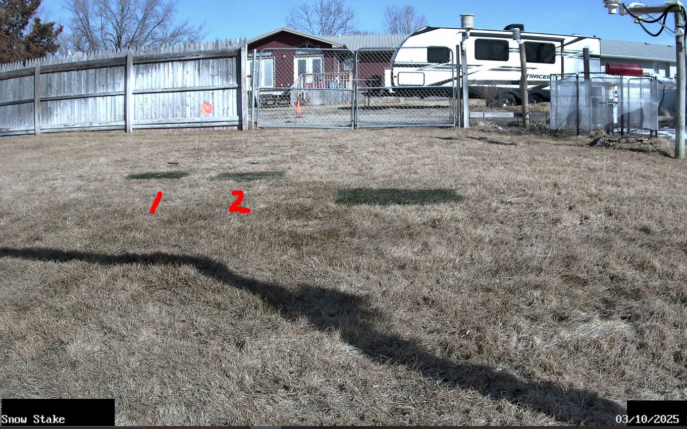
03/10/2025... Took the snow stake down for the season with the warm temperatures to allow the grass underneath to breath and get some sun. The snow measuring boards will go back down when needed. Today's record high is 83° in 1972. With the exception of 1-day all record highs reach into the 80s for the rest of the month. Most consecutive days with a Low 32° or below will end at (117) this 2024-2025 season. Little chance we freeze before midnight here tonight.
03/09/2025...17:35: Down to a trace of snow on the ground. We did hit 58° at this location. Going over to the 24 hr. time format including cameras.
7:20 am: We still have almost 3" of snow on the ground this morning. The forecast high of 58° may melt the rest. 3 inches is still a lot of snow to melt. We've been staying at or below freezing until about noon, today it should warm-up faster, it's already 28° here.
03/07/2025...7:10 am: A record for the date, (7.3") snowfall yesterday, since midnight another (0.6") making a storm total of (7.9"). Currently 7" on the ground and it's deep to walk through.
03/06/2025...Midnight: New snow 6.0" since 5:45 pm and the snow total today (7.3"). Currently still snowing, but it's let up a lot.
4:30 pm: Heavy snow, using visibility, the house on right image is (.14) mile, left image (.10) mile. So around 1/16 mile. The "Winter Storm Warning" doesn't activate until 6 pm. So it started a little early.
1:05 pm: Light snow has started and is picking up. Looking at the latest run of HRRR, it does support the higher end amount of 9". Not all models are in agreement however with the ECMWF European showing the least, with around 4" total for Valentine.
The NWS has issued a "Winter Storm Warning" for Eastern Cherry County. * WHAT...Heavy snow expected, with total snow accumulations between 6 and 10 inches. East-northeast Winds gusting as high as 30 mph.* Whatever falls won't stay around long with 65° expected next week. Put the snow stake on front page for visual aid only. The stake itself deflects snow and also collects snow above the base so not official. It can run a 1/2" or more short depending on how much snowfalls and how wet it is.
03/05/2025...3:40 pm: The NWS has an updated briefing package out concerning the upcoming Winter Storm event, linked. This one won't have the very high wind thankfully, only moderate wind but chances of getting significant snowfall look better. We need the moisture so it's welcome. Snow melts fast this time of year.
2:20 pm: Western Cherry county is now under a "Winter Storm Warning" and "Eastern Cherry, including Valentine a "Winter Storm Watch".
4:50 am: Blustery this morning with 18-30 mph wind, putting our WC down in the single digits. This NE location still has over an inch of snow on the ground early this morning. The NWS has issued a "Winter Storm Watch" for western Cherry county, WHEN...Thursday through Friday afternoon for 5-8 inches of snow. Valentine isn't included, but looking at models, all are in agreement we may still get some significant moisture. For snowfall, the low end amount is around 2" with 90% chance. Potential for around 5 inches.
03/04/2025...4:30 pm: All snowfall has stopped so did a liquid measurement from the other Novalynx 8" rain/snow gauge that was out. Total moisture (.35"). Only (.01") difference from the NWS 8" gauge. FYI, Miller Field only reported (.22") it looks like. Did notice this morning the ASOS kept saying light snow when it was pretty heavy here. Spoke with North Platte NWS about it. They said the snow band was rather narrow so a couple miles can make a difference.
11:50 am: Light snow continues, adjusted website to match snow melt. (2.2") of snowfall so far today. Warm roads have melted off, most of the snow fell before 8:30 am this morning. Cleared off the WNW camera lens.
8:30 am: Snowfall has let up some, visibility is about 1/2 mile now. Can just make out the blue water tanks on the hill (.66 mile) distance. Did a early measurement check, currently at 2.2" on the snow measuring boards. The snow stake is a little lower but not an official measurement, only visual aid. This wet snowfall will buildup and collect on the stake leaving measurement a little short. Add 1/2" puts it closer to actual. Reminder the moisture reported on website may not match the 8" NWS gauge, likely lower. Around noon will be doing a snow melt check and website adjustment to match. Miller Field a couple miles south is getting more wind, peak gusts 46 mph. 38 mph has been the peak here.
7:30 am: The airport ASOS says light snow, but it's heavy with visibility around 1/16 of a mile here at the NE location. This moisture is welcome, even if it is snow.
6:35 am: This wet snow is covering everything. Hard to read the snow stake. It does have the metal cutout numbers. Around noon will get a snow melt and snow board measurement. Meanwhile precip comes off the automated tipping bucket which may be behind slightly.
5:33 am: Rain has changed over to snow now, currently 33°. Moisture so far today (.16") fell as rain. For this event have 2-8" gauges out, one of them won't measure or dump until the event is over. Also have a 4" Cocorahs gauge along with the 8" automated website heated tipping bucket.
4:40 am: Checked the NWS standard 8" rain gauge (.13"), also the Cocorahs gauge. The website is a little behind -(.03"), now adjusted. The heated tipping bucket may need calibrated again. I know it can under count because of evaporation. The rain should change over to snow around 6 am.
03/03/2025...6:00 am: Blizzard Warning Tuesday and Wednesday. Starts 3 AM CST Tuesday through noon Wednesday. IMPACTS...Whiteout conditions are expected making travel treacherous and potentially life-threatening. Plan on slippery road conditions. Travel should be restricted to emergencies only during this period. The hazardous conditions could impact the Tuesday morning and evening commutes. Very strong winds could cause tree damage and power outages.
03/02/2025...3:30 pm: The NWS is concerned about this upcoming storm and blizzard conditions. Read about it in the "NWS Briefing package" linked.
Believe this is our first "Winter Storm Watch" this season. It's good we might get some beneficial moisture finally. Being it's early (Meteorological) spring now the snowfall won't stick around long with the longer days and higher sun angle, even if it's substantial.
03/01/2025...Meteorological spring starts today. We did slip below freezing before midnight, so the consecutive freeze streak continues. Even with this abnormally warm last week of February, it came in as our 6th coldest winter month in station history (Since 2014) with a sub 20° mean temperature of (19.1°). Average high was (33.2°), low (4.8°). Here is Miller Field February Summary: Sub 20s for the mean temperature is considered very cold. Yesterday's Red Flag the the peak wind gust recorded here was 38 mph with an average 12 mph speed. Miller Field peak gust was 39 mph with a 13 mph average speed.
02/28/2025...6:20 am: The "Red Flag Warning" starts at 10 am CST. It did freeze at Miller Field (32°), (33°) here this morning. Looks like it may freeze again tonight before midnight so the consecutive freeze streak would continue.
02/27/2025...2:00 pm: The "Fire Weather Watch" gets replaced by "Red Flag Warning" tomorrow, Friday at 10 am CST and runs through 8 pm CST.
The NWS has issued a "Fire Watch" for tomorrow, today the forecast has much lighter winds, only 10-15 mph. Wind is still a little elevated here on the NE side vs south airport side early this morning. Tomorrow morning it's not expected to freeze, breaking the consecutive stretch of freeze days at 107, dating back to Nov. 13, 2024. Enjoy today, it's going to be a good one. Looks much cooler and wetter next week, with rain/snow mix.
Even though this last week of February has been running 15-20° plus above normal, this February 2025 will still rank as the 5th or 6th coldest month recorded in station history (starting 2014). Had it not been so warm 60s-70s, say just 50s for highs this last week it would have ranked in the top 2 coldest months. Not many places where you experience 100 degree temperature swings in a few days. This happens to be one of them.
02/26/2025...7:10 am: It did freeze on this NE side (31.4°), but the wind never did lay down. Miller Field dipped to 28° with less wind. Wind gusts to 40 mph today in the forecast for Valentine. High winds aloft are mixing to the surface.
5:55 am: A cold front has moved through, still not very cold for February with temperatures expected in the 50s today, & low 60s tomorrow. This morning with the moderate wind 15-21 mph we still haven't froze on the NE side of town, (32.1°). Miller Field with less wind has dipped down to (30°). It will freeze here around sunrise when the wind calms more. Miller Field is under 2-miles away but there is micro-climate differences with this location closer to the river canyons. The streaming camera you can hear the wind. Only 5-7 mph at the South Tempest currently.
02/25/2025...1:25 pm: 70° and just had a 45 mph wind gust. Was outside messing with a camera when it occurred. 5 days ago it was 100° colder, so will gladly take it.
02/24/2025...4:55 pm: The Snow Stake camera is running again. Found under the Camera's tab.
3:15 pm: Got a wind driven sprinkle, 41 mph peak gust.
5:50 am: More April like temperatures, 60s today and tomorrow with 50s rest of the week. One model has a slight chance of rain tomorrow, (.01") but the rest are dry. We did tie the station record of 104 consecutive freeze days. It's currently (31°) outside.
02/23/2025...10 pm: The wind we are experiencing tonight on this north side is much more than the south side of Valentine. NW wind (18 to 28 mph) currently. You can hear it in the streaming camera too. You may of heard of canyon winds, think it's localized and sets up under certain conditions. Update the peak gust was 36 mph at 10:49 pm.
This is pretty amazing, a (97°) difference in just a few days. From -33° below to 64° above. If it freezes tonight it ties the station most consecutive freeze days of 104 set in 2019/2020 season.
Our forecast has 59° today and 67° Tuesday, the week ahead looks great and well deserved.
02/22/2025...6:15 am: Winter may be over, with only a week left of meteorological winter and looking at long range temperatures nothing is resembling what we went through. Sure we'll still get an occasional cold front, but nothing looks bitter cold or snowy right now. Still have an inch of snow on the ground this morning with interior streets snow covered. It'll be down to a trace or less this afternoon. The month of February is sitting at (-14°), below normal on temperature as of yesterday here at the NE location. The airport looks like (-16.4°) as of latest update on the 20th. So it's been very cold. -27° one day and -33° below the next isn't the normal. It does happen but rare. Did make up a below zero script found here for comparison to other years. Sitting at 18 days below zero currently, which is about the average of 17. What it doesn't show is half, (9) of them occurred in the month of February, the other (9) January which also ended below normal on temperatures.
02/21/2025...Yesterday, Miller Field the minimum of (-33°), crushed the old daily record of -22 in 1918. The South Valentine Tempest also recorded (-33°). It's only about a 1/2 mile from the airport ASOS. Yesterday it got down to (-31°) on both Nimbus and main station thermometers here at the NE station. Snow measurement this morning is down to 2".
02/19/2025...12: noon: Confirmed, Miller field did set a record low of (-27°) this morning. Dates back to 1936.
Final low here was (-27°) @7:47 am. And is a record low for the date, over the 11-year station history. Found on Daily Records link. Being only 11-years, get a lot of station daily records. The station all time low -32.2 (2021) occurred in February also. 3 of the coldest months have been February and La Nina years. Miller Field data goes back into the 1800s and may have set a record also. Still waiting for conformation.
The Coop Nimbus thermometer is (-26°), Miller Field low, looks like (-26°) so far. Not official yet, but looks like a new record low.
02/18/2025...11:55 pm: Updated the snow report page. Still getting light snow. Looking at radar, it may end here soon.
Moved the streaming camera direction and zoomed in a little, so the flakes show a little better against the pine trees. May leave it like this today during the snow. The large white foreground makes it hard see the smaller flakes during the daylight. With the west view camera covering W through NW direction may leave this camera pointing this general direction 220 degrees SSW so not redundant. Will decide later, want to see what this direction looks like at night with the floodlight being used.
Also took the snow stake camera offline. Kept having a rabbit visitor and this time sit on the snowboard in front of stake messing up level accuracy. I may put it back online later if I can figure out a way to deal with the rabbits. May be more than one, had 3 cottontail rabbits, 2 were babies under the deck last summer, and living here basically. The large grass yard and deck where they can get dry attracts them. I've held off on getting a dog for this very reason and the rabbit is doing it anyway.
4:55 am: It cleared off last night and dipped to (-19°) here. Miller Field (-22°). Today will be bitter cold with the high temperature near (-5°), with a wind chill that could dip to (-39°) early this morning. The Valentine public schools will be closed today due to the cold along with other closures announced yesterday. Chance of snow is 70% with 1-2" possible. We are starting to get some light snow again. The streaming camera picks up the light snow well at night. Much better than daytime when everything is white, so takes larger flakes to see.
02/17/2025...9:00 pm: The Snow Report page was updated. 3.1" of new snow, (0.13" moisture) 24:1 snow ratio makes for nice ski powder. 24" of powder to every 1" of moisture.
10:30 am: As of 11:45 am, we've picked up another 0.8" since 6 am. The snow report page was updated.
7:30 am: We've picked up more snow, haven't checked the measurement since before 6 am. Current air temperature is (-5°) and still light snow. Another inch is possible today, with a second round tomorrow, with the expected heavier amounts further south, but still another inch is possible. I'm on -30° below watch for Thursday morning. The Icon has us Yikes. This may be winters last hurrah. 50s possible next week and then we get into March. La Nina years, we could still have some winter visits in March, but nothing like this.
02/16/2025...11:00 pm: Light snow started around 9:20 pm says the airport ASOS. The GR-Level3 radar (radar Local) shows heavier bands a little clearer. Snowstorms with a near zero air temperature outside are rare. 3°f outside currently.
02/15/2025...3:00 pm: The NWS has issued a "Winter Weather Advisory" and a Cold Weather Advisory. The WWA starts at 6 pm Sunday and ends 6 pm Monday. The "Snowfall Forecast" map also has been updated. The wind speed has picked up a little, currently 15 to 25 mph. Giving a WC of -8°. Still have an occasional flurry, but not steady like this morning. Everything is white again with the cold air, nothing melts.
02/14/2025...3:45 pm: The NWS has updated the forecast. The high temperature Tuesday stays below zero. Back down in the -20s range Wednesday morning. The forecast high tomorrow for the Bull Bash is 10° with a 30% chance of snow showers. Wind chill values as low as -21. Monday and Tuesday snowfall potential is around 2". Check out the "Snowfall Forecast" link for the latest updates.
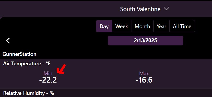
02/13/2025...8:30 am: Miller Field the low was (-22°) , Also South Tempest, located nearby. Here on the NE side (-21°) this morning.
05:30 am: Bitter cold morning, so far (-21°) here, (-22°) on the south side of town, Miller Field and South Tempest. That South Tempest is set up in a good location for both wind speed and air temperature. It's a good station to follow so linked on the main menu. The record low for the date isn't in danger, -30°F (1905).
02/12/2025...9:05 am: Looks like it may be over on radar and the snow has stopped. Since 6 am picked up another (0.2") for a storm total (1.6") with (.09") melt.
6:45 am: We picked up another 1/2" of snow since midnight. The snow water content has gone up from yesterday. (.04") in that half inch. At 6 am storm total is (1.4"). Pretty much what's on the ground too, not much settling yet. 3° this morning is +10° from yesterday at this time.
0:00 am: At midnight the daily snow total yesterday (0.7") with (0.9") on the ground, includes the (0.2") prior day. (0.04") was the daily snow melt. With the arctic air the snow is dry and powdery. Currently light snow is falling.
02/11/2025...5:10 am: Very cold this morning (-7°) with a wind chill (-18°) currently. A new NWS briefing package is out, check highlighted link. Light snow started about 4:30 am. Most of the snowfall today and night will stay south of Valentine, the Icon model does have as much as 2" (Kuchera scale which adjust for temperature) falling for Valentine.
02/10/2025...4:00 pm: Snowing now, with reduced visibility. (Image)
2:00 pm: The updated forecast has Tuesday night our best chance of accumulation, with a 60% chance. Today, we still have a 50% chance. Valentine is basically on the northern side as you can see with the storm total, Wednesday per HRRR.
5:40 am: We have an arctic air mass that moved in overnight. Light snow should develop later today, but once again not much moisture is available, so less than 1/2" expected. Chance of snow development is 60%. What does fall won't have much moisture, so not much help with our severe drought situation.
02/09/2025...6:00 am: With good radiational cooling conditions, it got down to 1° both prior and after midnight on the NE side of Valentine before the clouds moved in. Looking at the week ahead, there are light snow chances almost daily, with Monday night looking like the best chance at 60% with up to an inch. The cold pattern looks to continue through a good chunk of February, with a few more negative zero lows this coming week thanks to the arctic air.
02/08/2025...5:30 am: This morning the snow looks about over with flurries currently. The snow started around 10:40 pm last night, we picked up just under 1/2", (.4") with melt coming in at (0.02"). Image Cold today with our high near 24°, NW wind 5-20 with gusts to 35 mph. Current wind chill is (-8°).
02/07/2025...Yesterday warmed up rapidly from the cold start and turned very nice, reaching 45°. We do have a chance of light snow tonight as a cold front approaches. Saturday will be back down in the low to mid 20s for a high before warming Sunday into the 30s. Then the arctic air arrives next week with chances of light snow on and off. Enjoy today, even though it's going to be a little breezy, it'll be our last 40+ degree day for a while.
02/06/2025...Models have finally agreed on some moisture Friday night into Saturday. Today is starting out cold again with single digits but should warm near 40°. The Icon says 39°, with our forecast high today 43°. Here is the ECMWF European long term, it stays pretty cold.
02/05/2025...4:10 pm: That warmer 40°+ air still hasn't arrived and now we have clouds. 31° has been the high temperature so far. Today was uncertain with a couple models like the Icon topping us at 34° and the HRRR 37°. Tomorrow the Icon (my favorite for temperatures now) has us topping at 41° so fingers crossed.
02/04/2025...It was a cold one today, we only managed 14° for the high and had a below zero wind chill throughout.
02/03/2025...9:50 am: Snowing now, the visibility has dropped also. Street cracks are full. Still nothing showing on radar. 15° with the wind chill (-2°) currently.
8:58 am: Getting a light snow flurry. Nothing showing on radar. The wind chill (-2°) currently.
8:00 am: The feels like temperature is currently (1°) with the wind chill. Our daily high temperature has already occurred, (23°) at midnight.
02/02/2025...January summary, Miller Field mean temperature was (19°) which is (-5.5°) below norm. Here at the NE location the mean was (20°). The difference usually occurs on overnight lows when Miller Field will dip a little lower occasionally. This morning wasn't one of them, it came in (25°) here, with Miller Field (26°).
The Icon model was correct, we dipped below freezing (27°) before midnight, so now sitting at 82 consecutive freeze days during this season. Looking ahead, we may stay below normal on temperature through as far as models go out, even hinting at getting back below zero. Yesterday the anticipated 60° with the clouds and stiff breeze fell short, (57°) here, (56°) Miller Field.
02/01/2025...Looks like consecutive freeze days comes to an end today. Currently sitting at 80. There is one model showing it may freeze just before midnight, the Icon.
01/31/2025...Hope everyone is enjoying these mild temperatures. Tomorrow will be our warmest day of the week, with the forecast high near 60° before the big cool-down. The first week of February, possibly going into second week will be much colder with chances of snow mixed in. Currently, doesn't look like anything heavy. There are models that show more precip but what happens as we get closer they back off. Even with this last week of mild temperatures, this January will go down as one of the colder recorded in the last decade. Check out the Monthly Summary page and look at "mean" temperatures. As you can see the 3 coldest winter months have occurred in February with 2019 being the coldest, (12.5° mean).
01/26/2025...Final low was 2° here, this morning. Enjoy this upcoming week with the above normal temperatures. It has been a cold January so far, with the monthly averages, here: (H-28°, L-5°), Miller Field: (H-28°, L-4°). These numbers will modify with this upcoming week of above normal expected.
01/25/2025...Tomorrow morning we may flirt with a negative temperature again, with the forecast low for Valentine, 4°. Starting Monday, a big warm-up for the last week of January, with a couple 50°s for highs.
01/22/2025...11:50 am: Getting light snow again. The Streaming camera is picking it up. Light snow or flurries, with a 40% chance throughout the day, up to 4 am. Under 1/2" is possible.
7:45 am: Dusting of snow this morning. It started around 6:25 am and has ended currently.
01/21/2025...The overnight low was (-17°). Miller Field (-18°). No more negative temperatures in the near future on any of the medium range models.
01/20/2025...5:35 pm: The low wind chill was -37° today. Graph The peak wind gust was 50 mph. Graph The high temperature occurred at midnight (-4°). On the south side Miller Field had similar numbers. Today's Final lows likely come in closer to midnight tonight.
10:05 am: It's getting colder with the air temperature -7° and near gale, with a sustained wind of 34 mph, gusting to 50 mph. The WC is currently (-37°) below zero. Miller Field peak gust has been 50 mph also.
8:40 am: Updated: The wind chill is running (-30°) currently at this NE location again. Our High temperature is forecast to stay below zero today. The "Extreme Cold Warning" for the area is active through today at noon. At noon the "Cold Weather Advisory" takes over and goes through Tuesday at noon. Just had a 35 mph gust, WC is hanging (-30 to -32°) below with the air temp (-7°). Miller Field is the same. The wind is being caused from a reinforcement shot of Arctic air moving in. That's why the forecast is staying below zero for the high temperature today. Valentine Schools taking the day off, is a good idea. Tomorrow morning will be cold but hopefully not as windy.
01/19/2025...12:20 pm: Overnight lows this morning, Miller Field (-13°) and here (-12°). The low wind chill on this NE side reached -30°. Currently, we are above zero at a whopping (2°), with the WC (-14°).
The NWS has issued an "Extreme Cold Warning" for Monday through Tuesday morning. It's pretty cold now here at the NE Valentine location, the windchill has been down to (-30°). We get a local canyon wind on some mornings, not as much wind on the (airport) south side currently. Monday we stay below zero for the high temperature. Tuesday another cold morning but warms by afternoon.
01/18/2025...6:30 am: Still occasional flurries until 8 am this morning. Not much else has changed with our cold forecast ahead. Lows -10 to -13 below zero Sunday through Tuesday mornings with the WC approaching -30 possible. Snowfall overnight (0.1") with only a trace of moisture, under 0.01". This is typical with arctic air, snowfall is very dry a powdery.
2:00 am: Light snow has currently stopped, a little more than expected and do have some accumulation. Local roads have a dusting including intersection of HW20 and 83.
01/17/2025...7:20 pm: Getting some light snow. Nothing showing on radar. No accumulation expected just flurries.
8:00 am: The NWS added a 20% chance of a snow shower today. The 3 coldest days upcoming -10° to -13° for lows and wind chill could reach -29° Monday morning.
01/16/2025... Midday model runs on upcoming temperatures. The GEM has modified some but still, (-20°). The GFS runs warm on cold events, so wouldn't put much into it staying above zero Tuesday morning. Forecasters are currently thinking (-8 to -13°) for morning lows over the 3 coldest days.
01/15/2025...5:35 am: The light snow last night stopped about 9 pm with just a dusting. Good radiational cooling this morning with a clear sky and calm wind. Currently 9° here on both thermometers. Some question remains just how cold it gets with the upcoming arctic air arrival. The GEM doubled down and has Valentine dropping to -26° while other models not as cold. Thursday will be our best day this week for outdoor activities with the high reaching upper 40s.
01/14/2025...6:05 pm: Getting some light snow, visible on the streaming camera.
How cold will this upcoming arctic blast for Valentine be? The GEM Canadian says we will flirt with -20°f. Hopefully nothing will compare to last winter where it was well below zero for daytime highs and the windchill as low as ever experienced in Valentine.
4:45 am: Light snow is falling again this morning. The website conditions icon comes off the airport ASOS, and it hasn't been picking up on the light snowfall all night long. Was informed it was a known issue with light snowfall and ASOS stations. Radar is showing these small pockets of (more intense) snowfall moving this direction. Use the local radar link for latest still image. The live streaming camera shows the light snowfall the best.
01/13/2025...11:35 pm: The light snow stopped. As you can see in the cameras everything got a white dusting, the measurement was just shy of a tenth of new, with the melt under 0.01". So a (trace).
Looks like (-6°) was the low at Miller Field. Here at the NE Valentine location (-3°). The forecast gives us a 30% chance of snow today, 40% tonight with the HRRR saying (0.04") of moisture tonight on this early morning run. More adjustments during the day as it runs hourly. We do warm up this week, with 40s on Wed and Thursday, before an arctic blast moves in on the weekend.
01/12/2025...2 am: Picked up 0.4" of new snow. Most fell before midnight. Melt (0.03"). Currently light flurries.
01/11/2025...The relative warm air (38-39°) and wind is eating away at the snowpack. Down to a trace on the ground at 6 pm.
01/10/2025...Single digits this morning after the wind calmed. 9° here and 6° out at Miller Field. Still sitting at 2" of snow on the ground this morning. At least a dusting expected over the weekend. Possibly several inches to our west.
01/09/2025...9:30 am: updated- Light snow has currently stopped. Less than 1/2" is expected today. Just before noon will do a snowmelt check and measurement, also adjust website precip if needed.
01/08/2025...Below zero this morning, both here and Miller Field (-9°)
01/07/2025...10:35 am: Very cold with the windchill, our feels like is running around (-9°). Still have some light flurries occasionally. The temperature varies between 8 & 9° currently. The forecast 34° tomorrow will feel like the Bahamas.
6:10 am: Picked up a dusting of snow overnight, it was measurable 0.1". The airport ASOS also reported light snow during the night for several hours. Currently 12°, with the forecast high of 14° expect little to no warmup. Our daily high likely already occurred near midnight (15°). Our WC this morning is slightly below zero.
01/06/2025...7:20 pm: We have some very light snow falling as an arctic air mass approaches. Not expecting any accumulation tonight, and it's so light the airport ASOS likely won't pick it up. You can go to the stream and see the light flurries.
5:25 pm: Added a new camera, this replaces the dual lens (180°) camera. What's nice this is a movable lens camera so it can capture different views like the sunset tonight. More sky for thunderstorms, less & more foreground for snowfall etc. For the full lens size experience visit the Camera's link and click once to open and twice for full size, 3840x2160 (4K). The streaming camera stays the same. Not enough bandwidth to stream in 4K smoothly. When the streaming camera was originally set up, we tried a 4K stream and it wasn't smooth. But it does stream in full QHD(2560x1440).
6:50 am: Overcast this morning, we've warmed up from (-12°), currently (-4°). Much warmer today, with the forecast high of 21°. This morning the snowpack is 3" and still settling. Miller Field had a low of (-14°) just after midnight before the clouds moved in.
01/05/2025...9:40 pm: (-11°) currently. Right now it's clear with little to no wind. What happens toward morning, clouds or if the wind picks up will influence tomorrows low. Our snowpack has settled, now at 3" depth.
6:05 pm: Currently down to (1°) outside. Today will be our first negative below zero temperature this winter season. The only other year since the station started in 2014 when the first 0° occurred this late in the season was Jan. 12th, 2024. More information on below zero occurrences here.
9:00 am: As of 9 am, the storm total measured snowfall for Valentine has been 3.5". (+0.3" since 6am). Very cold outside with our low today 3° and currently sitting at 4°. The wind is light this morning, thankfully. There is a dry slot on radar by Winner SD working it's way this direction. So we may be nearing the end soon, the sun is even popping out.
01/04/2025...11:58 pm: Daily snow 1.6", storm total including yesterday, (1.7"). Light snow currently.
2:30 pm: The Cameras facing east, lenses are freezing over. The wind direction is out of the east, so it's freezing mist we are experiencing along with the snow. I'll clear it off with de-icer and see how long it takes to freeze back up.
6:25 am: We picked up (0.1") in new snowfall and (.01") moisture prior to midnight. Only a trace since. 3-4" storm total is expected. Very cold this morning, 11° with the windchill below zero. We are getting light flurries this morning you can see best on the streaming camera.
01/03/2025...6:10 pm: Getting a few flakes now. The streaming camera works best for viewing. Less than 1/2" is expected tonight should it continue. Tomorrow will be the same way, light accumulations until later in the evening when the majority will fall.
01/02/2025...9:00 am: The freezing fog has covered limbs with rime ice. It's the tree across the field.
Freezing fog started about midnight. It's starting to look like some real winter weather returning, most models are saying 2-5" of snow possible over the weekend with the coldest model (Icon), having Valentine dip into the (-20s°) Monday morning. -27° below to be exact. Other models aren't near that cold, so it could adjust. The station medium the last 11 years is 18-days below zero, and we haven't had 1-day below zero this winter yet. It's a strange winter, the same with snowfall, having so little this time of year. Normally we've had at least a foot by now. Parts of Nebraska (Lincoln) hasn't had any measurable snow since last January. Not complaining, it's nice not having to shovel, just pointing out how unusual it is. 2 winters ago we had 60+ inches and with the wind here, it gets rough.
01/01/2025...Final numbers for 2024 based on station history data, not Miller Field, HERE , overall the departure for 2024 was (+1.6°) on temperature and (-8.07") on moisture. Snowfall departures are not included because it's done seasonal 2024-2025 etc. For year-to-year station comparison, the Summary page is easiest and look at the means. The yearly summary average isn't correct because 2014 (54.0) was not a full year. The North Platte NWS put out "Top 10 Weather Events from Western and North Central Nebraska" Here.
12/31/2024...3:45 pm: Now, the GFS is the wetter model for the upcoming week. It also turned colder again. Last night the ECMWF was wetter. A lot of model movement with these cold air masses. Forecasters aren't confident either when the models move around this much. One thing for sure if we do get precip it will be snow. This cloud cover today never did breakup as expected, so only managed 26° so far and sunset is coming soon.
6:10 am: No new snowfall since midnight. Starting the day off with 0.6" on the ground. Looking at models, some discrepancy with the GFS and ECMWF (European) on what's ahead. Model runs later today may come together for the week ahead. Have a safe and happy New year.
12/30/2024...11:00 pm: The snow has stopped, only an occasional flake. Measured another 0.3" tenths since 6 pm for a 0.7" tenths storm total. Radar shows more possibly moving in later.
6:00 pm: New snow today so far 4 tenths. Total precip so far including the light rain (.08"). Not much showing on radar right now but light snow is still falling. The radar looks like it wants to fill back in. We've hovered just above freezing by a few tenths (32.2 to 32.6°) most of the afternoon with a steady light snow.
12:15 pm: Light snow started about noon. Not sticking yet at 34°.
11:25 am: The HRRR 10:am run has light precip starting between noon and 1 pm and ending about 10 pm. This is the hourly model that does pretty good short term. Up to a couple inches depending on changeover to snow. Because this model updates hourly it will likely adjust so nothing is final until it's over. Being Valentine is on the outer edge of the precip any wobble changes things. Getting light drizzle right now.
There is a good chance of rain and snow today, just how much snow depends on the temperature and changeover from rain to snow. Not expecting much locally but should it freeze earlier than expected it could accumulate 1-3". January 4-5th looks like another good chance with much colder temperatures on the way. Potentially staying well below freezing as far as the models go out.
12/25/2024...8:05 am: Merry Christmas to all, Another fall-type day with upper 40s. There is some good news for the ice fishermen: a shift to winter temperatures, maybe even snow, is on the way starting early January. A really warm morning with the low so far only 27°. It has been mainly below freezing since 7:30 pm yesterday, so it's making some ice slowly.
12/21/2024...1:25 pm: The morning low was 11°. With the warm air moving in, it's already 53°. Today's the winter solstice, with the least amount of sunlight.
12/20/2024...8:00 am: The low temperature was (2°) here on the NE side and (2°) Miller Field. The peak wind gust was 54 mph out at Miller Field and 59 mph here yesterday. Big warm-up starting tomorrow through about Dec. 30th.
12/19/2024...12:25 pm: update: The peak wind gust here has been 59 mph at 11 am. The cold air is starting to filter in, with the HW 83 station just north of the SD border, down to 30° right now. The wind has slowed here in NE Valentine since several 50+ mph gusts around 11 am. Not sure if it stays down or if this is just a lull; you can see how it crashed, with the temperature going down. Update: Just had another 50 mph gust, so maybe it's not over.
6:10 am: We have a "High Wind Warning" for today, starting at 9 am. and ending at 4 pm. The wind has stayed up overnight on the NE side of town, so it's running warmer vs. Miller Field, where it dipped to 34°. Only 38° for a morning low here. Our low temps for today will come this evening just before midnight as the cold air moves in and wind calms down. Tomorrow morning expect a single-digit low followed by a nice warmup Saturday with above-normal temperatures through Christmas. Beyond tomorrow, it'll be mild for this time of year, with no cold weather (compared to norms) until maybe Dec. 30th.
12/18/2024...9:40 am: Visibility got down to about 75 feet. Miller Field is still not socked in, so it's not widespread. The NWS has issued a "Special Weather Statement". It should lift out soon, starting to see a little blue sky.
9:05 am: The fog has arrived here on the NE side. Freezing fog so beware, down to around a tenth of a mile visibility.
8:35 am: Heavy frost this morning. You can even see a little fog developing up on the blue water tanks. See it best on the streaming camera. Miller Field at 8:30 am, was still 10-mile visibility so appears isolated.
8:10 am: Looks like the final low here at the NE location will be 10° where it currently sits. Miller Field the noon summary will have the final low. Light wind here this morning, so windchill was not an issue. A little more breeze out at the airport, however.
12/15/2024...4:15 pm: All the snow is gone, even in areas that catch some shade. Not looking great for a white Christmas unless models make a sudden change. For Valentine, at least an inch (0.5" or more) occurs approx. 37% of the time. Here was two years ago today, December 15, 2022, the snowdrift was about 4-feet deep against the house. What a winter it was. I remember it was the 3rd La Nina year in a row and it was a doozy.
.jpg)
12/14/2024...8:15 am: Near perfect radiational cooling conditions with a clear sky, calm wind and a little left over snow on the ground. Low temperatures so far observed, Here (7°) and (7°) out at Miller Field. 2 of the 4 area Tempest stations are reporting 6°. For the Tempest area map, External links, (Near Airport Tempest) and click on map.
12/12/2024...6:00 am: The snow stopped, picked up 1 tenth of new and (.01") on melt.
4:20 am: Getting some light snow. The streaming camera shows it best with the spotlight on. Going back and checking camera history this is the first time snow has reached the ground overnight and not expected to amount to much.
12/11/2024...9:30 am: We've picked up an additional (0.2") in snow today for a storm and monthly total of (0.7"). The cold air currently 13° is squeezing the flurries out. Haven't done a snowmelt for moisture yet, will do so just before noon, but the heated tipping bucket did tip (0.01"). Looks like some blue is peeking through the clouds so may be over. Light flurries continue even with the blue.
6:55 am: Turned on the (180 degree) and (Streaming camera) spot lights. Picks up the snowflakes better. We have continued snow flurries this morning.
There is some light snow falling (flurries) this morning. Roads in the area are mostly covered as seen on the 511 cameras from the state-line down to HW 83/20 Y. Under the links tab, the 511 roads and cameras.
12/10/2024...9:45 pm: We ended up with 1/2" (0.5") of snow today. About what forecasters had predicted this morning. Looks like it's over, stars are out.
7:15 pm: Snowing pretty heavy right now.
6:10 pm: Getting some light snow again. As usual the streaming camera picks it up the best. Temperature is lower 28° so sticking on the roads better, and turning white. We did pick up 3 tenths today. (.02") snow melt before 6 pm.
1:30 pm: The snow is melting, so not getting much build up. We are below freezing (31°) so might start sticking to the roads if it continues.
12:45 pm: Getting light snow again. This one may last a little longer, per the radar. Not expecting much, under 1/2" (.4) for the Valentine area. Removed the conditions icon, being it only updates hourly coming off the airport ASOS, so not to confuse anyone. The best way to view the falling snow is with the live stream. Linked above.
6:50 am: Getting light snow. Reminder the streaming camera works well.
12/09/2024...9:45 am: Getting light snow. It's filling the street cracks on the Live streaming camera. Radar looks like it's confined to the north side currently.
6:00 am: A cold front has moved through, our midnight temperature 39° will be today's high. Looking at different models it does look like potential of a few snowflakes with a couple models, maybe even a little accumulation, especially to our west by Wednesday. Here are the two more snowfall aggressive models HRRR model and the ECM model. Update: The Icon is about the same. Wednesday will be our coldest day this week, 20s for a high but another weekend warm-up ahead it looks like. The ECM backed off on the snowfall next week, but it is that time of year, so could change again.
The wind speed description is derived from the Beaufort scale. The Beaufort scale is 0-12. The index is based on sustained wind and not the gusts associated which can be a little deceiving. Examples: 0 Bft - Calm, 4 Bft - Moderate breeze, 5 Bft - Fresh breeze, 12 Bft - Hurricane Force. The reason for the scale, with no standard scale it could be very subjective one man's "stiff breeze" might be another's "soft breeze".
12/08/2024...Updated (12:40 pm) latest model runs: High temperatures yesterday reached the low 60s, so no record. For today and tomorrow the main weather concern is wind with gusts as high as 45 mph possible. Tomorrow colder air moves in with wintry like temperatures Wednesday, Models show 20s for highs, even teens (Icon) with a chance of light snow starting Tuesday into possibly Thursday with the Canadian model GEM. Looks like the ECM (European) want's to bring several inches (snow), starting the 16th, all subject to change as models update.
12/07/2024...6:15 am: We may approach a record high today, forecast is 66° for Valentine. The record is 69°, so enjoy, unless you are waiting for ice. Yesterday was a huge temperature spread, we started at 18° and reached 61°. Some may have notice the cameras have new software released and can fine tune the night color to where you can actually see a few stars now. Still playing around with the adjustments. Today, "December 7", is Pearl Harbor remembrance day, a day that will live in infamy.
12/04/2024...4:15 pm: Chance of sprinkles or flurries was removed from the afternoon NWS updated forecast, so took the radar off front page. Radar or satellite is always available under the Radar/Satellite tab if not displayed on the front page. 2 different satellite feeds and 2 different radars to choose from.
8:00 am: Out at Miller Field the wind has picked up, so temperatures have evened out across town. Both sides at 41° now. It is interesting, with only (1.79 mile) distance, how conditions can be so different (16°) on days like this.
7:30 am: Big temperature difference across Valentine, 41° here and only 25° at Miller Field. The wind is blowing (19-28 mph) on this north side of town, holding the temperature up, while the south-side only about 6 mph. This is the largest difference I've observed (16°).
12/02/2024...7:10 am: Coldest morning so far of the 2024-2025 meteorological winter, which started yesterday, Dec 1. Currently, 3° on the NE side of Valentine. Big warmup tomorrow near 50°. Should mention, with the last week of November being so cold, we ended up slightly below average, (-0.4°) over the past 11 years. Because there is enough station data now 11 years worth, no longer use the airport ASOS data to compare with. The ASOS at Miller Field was about 1/2 degree warmer, 36.5 vs 35.8°.
11/29/2024...6:05 am: Getting some light radar returns, but nothing is reaching the ground so far. It's warmed up from the overnight low of (6°) occurring just after midnight, currently (14°) with the cloud cover acting like a blanket. Yesterday was pretty cold with the 28° high. We do have a chance of light snow flurries tonight. Big warm-up Tuesday and Wednesday near 50°.
11/28/2024...8:35 am: Getting some big snowflakes, very light so far. Best seen on the streaming camera. Not expecting any accumulation but there was a mention of possible flurries northern Nebraska in the forecast discussion. Looking at the HRRR model this light snow was east and north of us and occurring later today.
6:10 am: Happy Thanksgiving. Clouding up this morning after a 10° morning low here on the NE side, 9° at Miller Field. Today's high expected near 30° with a 5-15 mph wind. Mentions of light snow chances have been removed for Friday night. Big warm-up, reaching above normal temperatures the first part of the upcoming week.
11/27/2024...12:20 pm: Already 34° with a NW wind 14-28 mph currently. Fast warmup once the breeze picked up bringing warmer air in. Unfortunately short lived. The forecast says back to 29° later this afternoon.
5:30 am: Currently, 12°. Yesterday was another sub-freezing day, with 28°, both here and out at Miller Field for a high temperature. Today looks like maybe mid 30s. I say maybe because the temperatures the last few days have fallen well short, with colder than expected air in the area. Still a chance of light snow Friday night, the GFS was the most aggressive yesterday but has backed off to around .05" in precip . on latest run. The European model (ECMWF) doesn't show anything for Valentine, so nothing is for sure yet.
11/26/2024...1:00 pm: With the clouds now, the temperature is struggling to get out of the upper 20s.
6:10 am: Trace of leftover snow still on the ground this morning. Low temps so far, 13° on the NE side, 12° at Miller Field. Forecast temperatures have moderated a little for the upcoming week but still cold with a chance of snow showers Friday evening. Next Monday is looking closer to normal with a forecast high of 40°.
11/25/2024...6:20 am: Still a 1/2" of snow on the ground this morning. Roads around town are partially covered, with the wind blowing much of the snow off. Looking at Thanksgiving, sunny with a high temperature near freezing. Turning colder Saturday and Sunday with highs in the mid 20s, but no snow in the forecast, so should be good travel conditions for those returning home.
11/24/2024...9:40 pm: Snowfall has stopped, we picked up just over half an inch (0.6")
5:45 pm: Getting some snow, it started about 20 minutes ago. It's picked up a little but still on the light side. FYI, did turn the automatic tipping bucket heater on. It can and does cause evaporation prior to filling tipping bucket, especially light precip including light snowfall so leave it off during the warmer months. It will turn on at 45° otherwise. If a first time or newer visitor, the streaming camera is also available for a better idea of snowfall rate. Linked under the Live Streaming tab. This will be the first winter with the camera stream. Mute the camera volume (lower left side) if too loud with the wind.
Updated 10:30 am: We have a cold front moving through with a 30% chance of light snow today and 40% chance tonight. The "updated" forecast has New snow accumulation of less than half an inch possible for Valentine. Better chances toward our west for accumulation. Have the snow measuring boards down since it looks like winter has arrived. Caught us all by surprise yesterday including models. Our high temperature yesterday in Valentine was only 32°.
11/23/2024...11:15 am: Started out with a little fog this morning and heavy frost. Only 28° currently so may not reach the forecast mid 40s with the heavy cloud cover. Doesn't look like any snow for Thanksgiving but it will be cold, current forecast high 31° and 10° for the low.
Celebrating a Life, Kathy Keller yesterday, today was the burial at the Purdum Cemetery. Kathy will be missed, she touched so many lives. This was Kathy and me, years ago. Kathy reported the rainfall amounts across from the Catholic Church when they were added here on the blog.
11/21/2024...5:50 am: Wind hasn't completely decoupled, still around 12-17 mph holding the temperature up a little. 21° currently, if it does calm before sunrise it will dip into the teens. Current windchill is 9° so bundle up. The forecast discussion mentions the possibility of a Thanksgiving impact storm.
11/20/2024...Peak wind gusts today Miller Field 56 mph, here at the NE location 57 mph. The HW 83 weather station just north of the SD state line below Olsonville reported a 66 mph gust. Very dry air, with the afternoon dew point temps running below zero.
8:45 am: The "High Wind Warning" is in place today, with 60 MPH gusts possible. Probably not a good day to travel highways, especially with high profile vehicles. Did see a few broken limbs from yesterday's 57 mph gust on this NE side of town. So far this morning, sustained wind around 20 with a peak gust of 36 mph @ 5:40 am. So not as much wind this morning as yesterday at the same time, but expected to change. It's a long John morning if working outside with our windchill at 19°.
11/19/2024...Had a localized 57 mph gust @ 12:03 pm, highest of the day and month. Didn't see the same gust at other stations, so it was localized. Noticed there was a pressure spike at the same time of gust. Not sure what phenomenon it would be called. Possibly the wind pressure against the building, and it was loud, caused the barometer located inside to spike.
5:45 am: Very breezy this morning with sustained wind in the 20-30 mph range this morning. Peak gusts so far 44 mph here and out at Miller Field. Wind is not expected to get much stronger today, but there is a "High Wind Watch" in place for tomorrow when gusts could approach 55-60 mph.
11/18/2024...Updated: The latest ECMWF keeps the moisture streaming into Nebraska east of our area. There is a sharp cut-off as seen on the ECM, leaving us dry. Wind tonight and tomorrow is our main weather feature, with gusts 40-50 mph. The zone forecast shows wind gusts to 55 mph Wednesday. Keep in mind the zone forecast covers a much larger area and Valentine gets it's own specific forecast you see here on the website. The low temperature this morning 23° at the NE Valentine location and update 23° also at Miller Field.
11/15/2024...12:00 pm: Here's the latest Icon run, and GFS for the big rain event next week. Doesn't look good, however the latest ECM just out hasn't changed so still a chance of moisture. The reason for all the moisture streaming up from the south is it taps into the active gulf moisture.
11/14/2024...With the upcoming forecast mention of snow showers later next week, went ahead and got the snow cam and stake ready for this winter. Found under Cameras link or Here.
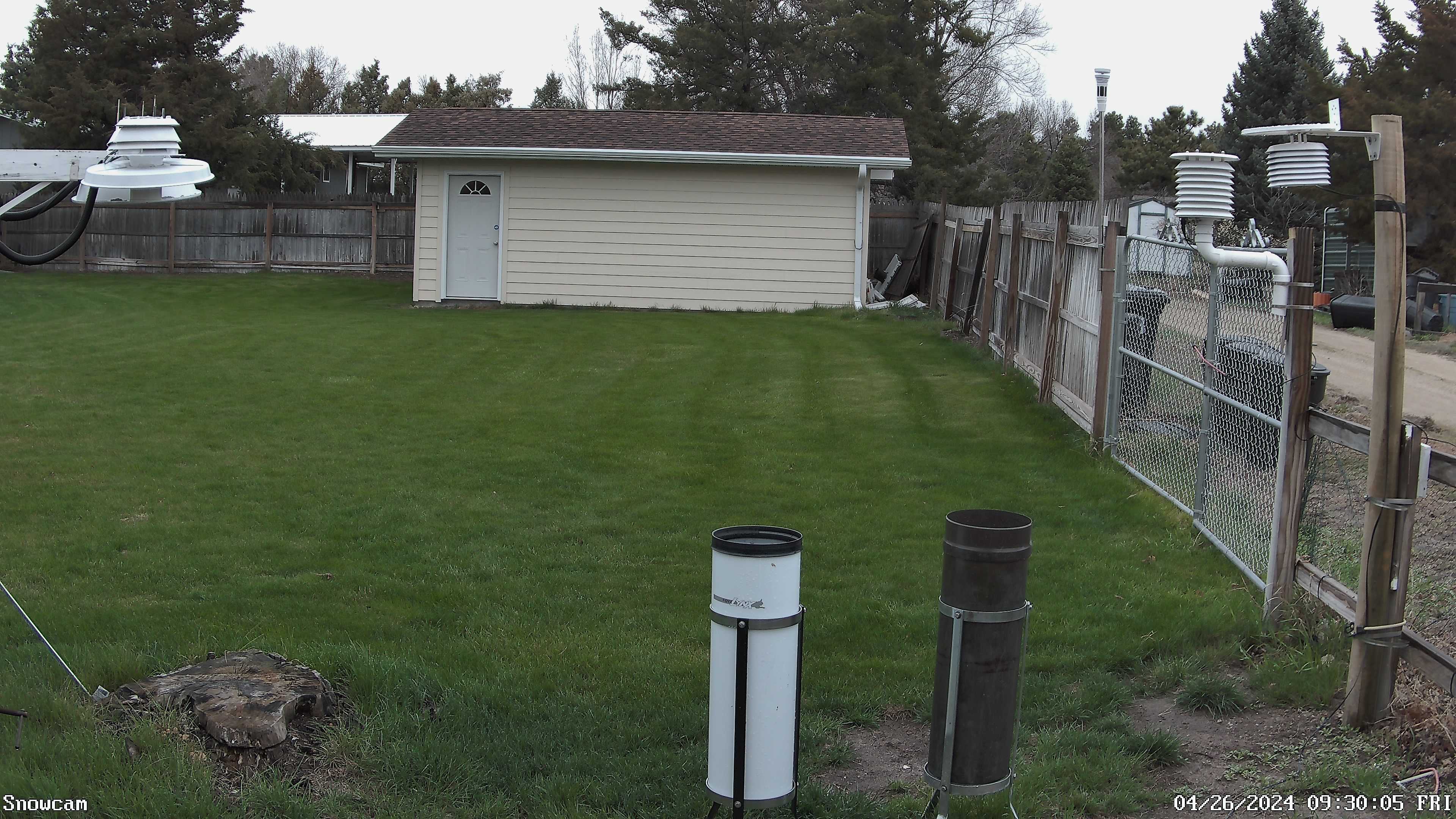
11/09/2024...5:15 pm: Light rain most of the day, if it wasn't raining heavy mist. As of this hour an additional (.18") on top of the (.65") measured at 6 am for a storm total of (.83"). Currently still raining.
5:55 am: Picked up (.65") overnight. Currently have mist.
11/08/2024...8:20 pm: Latest model runs and rainfall amounts locally. North Platte NWS Weather Story link shows (.50 to 1.00") for Valentine. Everything has moistened up. We've had some light rain but nothing measurable yet.
11/07/2024...6:35 am: Down to 19° out at Miller Field, it's only been down to 21° on the NE side so far. As far as precip (rain) late Friday and Saturday goes, models this morning are saying .4 to .5 for Valentine. The further south the more expected. This is a big system moving up out of the south with pretty much statewide rainfall.
11/05/2024...Our first teen temperature this fall. 19° here on the NE side. Looks like Miller Field also reported 19.4° multiple times. The thing about Miller Field and all these ASOS weather stations everything gets converted from C to F and those temps being reported are every 5 minutes so not exact. They do have an exact number every 6 hours, so the actual low at Miller Field will show just before noon.
11/04/2024...(.10") was also reported at the KVSH rain gauge yesterday. Picked up the Cocorahs gauge at Miller Field for this winter, it was also reporting .10" .
11/03/2024...Manual gauge measurement (.10"). Miller Field reports (.07"). Think the ASOS is running just not broadcasting normally. The conditions icon comes off the ASOS so will stay off until it gets back up.
6:30 am: Getting some light drizzle/heavy mist. Nothing measurable +(.01") yet and not showing on radar currently. Most models are saying we may end up with (.20-.30") today. Wettest model UK has (.77") while driest ICON (.04"). The hourly running HRRR around (.30-.50"). The airport ASOS is still not reporting this morning so have the conditions icon off.
11/02/2024...Miller Field ASOS isn't reporting conditions. So won't see sky conditions on the website. Just look at the cameras it's very overcast.
7:00 am: It's dipped to 22° at Miller Field. 23° here on the NE side so far. Our final low could come in around sunrise with the calm wind and clear sky.
6:00 am: The temperature has been down to 23° so far. Our Forecast has lowered chances of precip down to 40% Sunday night, but models are still together this morning. Pretty much all on the same page for Sunday, just not a lot of it, around (1/4" Models). All we can do is hope. Don't forget to fall back 1-hour tomorrow night.
11/01/2024...Correction on graph, my mind was on something else: If wondering just how dry it's been the last 2-Months . Last year at this time we were the wettest it's been since the station started back in 2014. Being we are entering a La Niña pattern for winter, it may not continue this dry. Winter may look closer to normal is the current NWS thinking. The lack of clouds and moisture continues to keep our temps above normal, too. Mother nature's way of equalizing out, I guess.
10/31/2024...We did pick up a little moisture overnight, (.05") total. Our next best chance is this weekend late Saturday into Sunday with all models on the same page which is a good sign.
10/30/2024...5:40 pm: Updated forecast has Valentine at 40%. What you see on the radar is it, and doesn't look to be building our direction. There are areas to the south getting some needed moisture with the slow movement.
10/27/2024...We froze over parts of Valentine, 29-32° on several different thermometers. Miller Field appears to be the warm spot above freezing (33°), possibly the wind stayed up. The south Tempest near MF also reached 32°. Here at the NE location, 31° was the low.
10/25/2024...Updated MF low: Chilly morning, (24.4°) here on the NE side. The NWS MMTS thermometer here came in at 24.5°, so (0.1°) above the FARS. Updated: Miller Field, 24° . This time of year the lows can come in later than the 7:24 AM report.
10/23/2024...5:40 am: We did pick up a shower overnight around 12:30 am, just enough to wet the ground, less than (.01") however so trace amount here on the NE side of Valentine. Nothing was reported at the airport ASOS. The south side Tempest did report a trace however. You know it's dry when a trace makes the event blog.
10/22/2024...4:25 pm: Fiber is back up, good response from Allo techs. They just pulled a new fiber line through the same conduit.
3:00 pm: Allo fiber is down, all cameras will be down until repair gets made. The Fiber Line got cut. On slow DSL backup currently. Weather conditions are still real-time.
10/21/2024...7:15 am: Only a 20% chance of a shower today and tonight. The Icon does bring in a better chance on the 23rd. Right now the only model onboard.
10/18/2024...6:00 pm: The latest GFS shows very little moisture for us. Almost a nothing burger.
3:15 pm: The latest NAM is looking good. This is tomorrow noon totals. . Also there may be some activity in Gordon tonight, here's 10pm. Still nothing for Valentine yet, it looks like 11 pm to midnight for the start here. So the NAM is moving the moisture further north and west vs some of the other models, bringing Valentine into the heavier amounts. The other models won't update until after 6 pm tonight.
10/17/2024...It really was bright last night with the supermoon. Here are a few images from the streaming west camera. 7:00am, 7:20am, , Forecaster confidence looks better for rain Friday evening into early Saturday with a 70% chance this morning. Very warm today, the forecast high is mid-80s with the "Red Flag Warning" continuing, wind gusts could get into the mid 40s. Miller Field had a gust of 50 mph yesterday. The south direction has obstructions (the City of Valentine) at this location. Once the leaves fall it gets better. 42 mph was recorded at the NE location.
10/15/2024...09:50 am: Another freeze this morning, 30° here on the NE side and also out at Miller Field.
10/14/2024...12:30 pm: Low temperatures this morning, 26° at Miller Field, also 26° here on the NE side of town.
Hard freeze <28° started at 2:30 am here at the NE Valentine location. So looking at 5-6 hours below 28° should accelerate tree leaf drop and kill most plants. We did dip below freezing, (31°) just before midnight, so the low yesterday will get recorded as a freeze at this location. This is our 4th freeze this fall season, which is ahead of last year's (2) at the same time. There is potential of moisture later this week, but all models are not on the same page, so not great confidence. What we have going on our side it's been dry for so long, eventually it's going to rain so maybe this will be it.
10/13/2024...Some isolated areas of freezing occurred on the far west side of Valentine this morning. The furthest west, Tempest station recorded 31°. Out at Miller Field 33° and 37° here on the NE side of Valentine. Widespread frost expected, with a "Freeze Warning" in place across the area starting tonight after 2 am.
10/12/2024...7:20 am: Red Flag Warning again today, mainly because everything is so dry with Land management officials reporting fuels being fully cured. Yesterday positioned the the Snow Camera and mounted the snow stake temporally for a visual check. Lawn sprinklers are still running being this warm and dry. It's been down to 35° here at the NE location this morning. We'll have freezes (Monday and Tuesday) mornings so if still watering may want to water during a warmer period of the day, sometime after 10 am.
10/11/2024...Looks like a widespread night and morning frost starting Sunday through Tuesday is still on. The forecast has moderated and not as cold as originally however. Near 80° next Wednesday and Thursday again. Our AQ looks good this morning.
10/04/2024...8:40 am: We did have a little frost this morning, nothing heavy. Some areas inside town may have not froze like Downtown. Here on the (NE side) the low reached 30°, hovering at or just below freezing for 4 hours total. Miller Field also 30°. The Miller Field conditions link is at top of "External Links" with 5-minute updates but may be 10-minutes behind actual time when the update appears. So not in real-time but better than waiting for the top of hour update. MesoWest updates courtesy of the University of Utah, Department of Atmospheric Sciences and the NWS.
Our second seasonal freeze started at 4:27 am here at the NE location. It's not as dry as the last freeze, so may see more frost forming later this morning. Our Dew Point is 29 vs 23° on the Tuesday freeze. We still have a "Red Flag Warning" and 'Fire Weather Watch". Yesterday a fire broke out and spread rapidly with homes getting evacuated just west of Valentine. Tune into the KVSH news, they should have more details.
10/02/2024...Got a freeze report on some plants and flowers around town yesterday. One report all plants died, another only had 1 plant die. So the freeze wasn't hard enough to kill everything.
10/01/2024...8:20 am: We may have had a killing freeze overnight. Reached freezing at 4:15 am, Miller Field, dipped to 27°, here 4:23 am the freeze started and dipped to 28°. So a solid 4 hours, and it's still below freezing at 31° currently. The only thing it didn't stay at or below 28° for extended time, don't know if any plants can survive that long below freezing. The Spring Creek Rd. Tempest reached 26° this morning. Did turn the lawn sprinklers off, anticipated it yesterday, not sure why the models didn't see it coming. The model closest yesterday was the Icon at 34°, several were keeping it in the 40s which made forecast uncertainty. Why the mention may freeze. Think the wind was anticipated to stay up and it didn't, which allowed the bottom to drop out. Almost dead calm here.
05:30 am: Calm wind and 31° currently. Our first freeze this fall. Miller Field has also been down to 30°. Doesn't look like a hard freeze, extended sub 28°, but with the Dew Point temp at 23° there is room to drop more by sunrise. Today will be another Red Flag day with the low humidity. This September was very dry and warm. In 11 years of station data the warmest and driest September by far. The station summary link is found here for comparing year to year.
09/30/2024...10:55 am: Power is back on, the website is back to normal. Transfer switch, installed.
6:35 am: Today the website will stop updating for a couple hours this morning, scheduled power outage for adding a transfer switch. Time-frame start is somewhere around 8:30 am for approximately 2-hours. All website links will still work, however real-time conditions and camera images will stop updating. Normal real-time updates are every 4 seconds on data, so if it increases updates are off. Early this morning a brisk SW wind is holding the air temperature up (67° currently) as a cold front approaches. The wind will turn NW as the cooler air arrives. Our potential first freeze looks possible tomorrow morning. Especially low lying areas where colder air will settle. IE along creeks, rivers bottoms etc. (8:00 am update) switched temperature sensor to the backup naturally aspirated radiation shield until outage is over.
09/29/2024...I would like to say this is likely our last day in the 90s but being so dry can't. Here is the morning precipitation outlook over the 10-day. "Models" This was not only the driest September for this station, it was also the driest on record at Miller Field dating back to the 1880s. Miller Field tied the record high yesterday of 95°. Here at the NE location, 93° was the high. The Tempest station just NE of town a few miles Spring Creek Rd. was also 95°. Need to drive out there and see what the station siting looks like. It gets very cool at that location at night, you can see the low was only 44°, while it was 47° here. Almost like it's down in a drainage area. Cooler air always settles at low spots on low wind nights.
09/22/2024...Today is the fall equinox (equal sun equator) occurring at 7:44 AM central. Looks like this September will go down as the driest September (station history) dating back to 2014, with only (.12") so far and no signs of precipitation over the next 7-days. The next driest September occurred 2020 with (.71") of moisture.
09/18/2024... A disappointing (.04") here overnight. Still a couple models GFS and ECMWF have rain on Sunday. We have a "Red Flag Warning" for parts of the area today, including Valentine.
09/17/2024...5:10 am: We may finally get some rain tonight, looks like around 1/4" potential with another chance coming Sunday with much more potential in the 1" range per a couple models, but as always this far out things can change and not all models are in agreement. What is more certain cooler air arrives Saturday with highs in the 70s and upper 40s for lows. Noticed Miller Field had an isolated shower yesterday (.01"). Nothing in the rain gauge fell here.
09/10/2024...Starting tomorrow, a "Fire Weather Watch" until Wednesday night, this will include Eastern Cherry unlike the Red Flag Warning the other day. Because Cherry is so big, click on the Watch/Warning banner to see what parts of the county are included.
6:20 am: Picked up a trace of precip overnight. A little disorganized cell rolled though right around midnight. Miller Field between 11:55 pm and 12:05 am shows light rain. Only a trace here, with less than (.01"). This cell did have some lightning in it. But only 6 strikes locally. Highs temps yesterday (94°) here inside town, (96°) out at Miller Field.
09/05/2024...8:25 am: The live streaming camera is working again, picks up the smoke haze. The blue water tanks are .67 of mile distance. Miller Field is down to 4 miles visibility. We are in the orange now with AQ at 105. Unhealthy for sensitive groups. (.09") recorded in the Cocorahs gauge by the Catholic church last night.
7:20 am: Plenty of haze and smoke this morning. The AQ is getting worse, 92 currently, so getting close to the unhealthy orange. You can check air quality under the AirNow EPA tab, the next one down and click on Valentine. The streaming camera won't stream this morning. Sent a message to BrownRice support.
09/04/2024...9:20 pm: (.08") fell at this location. Rain was disorganized on radar so likely varying amounts across town. Heavier on this side for sure.
8:50 pm: Getting some rain, also thunder.
11:25 am: Looks like CenturyLink is back up. Cameras working and the airport ASOS is showing new data. May have to (ctrl+F5) to clear image cache on some browsers.
5:50 am: CenturyLink DSL has an outage this morning locally, it's expected to be back up by (10:51 am), per message on the website. The snow camera is down because of it. Our threat of rain tonight has decreased some. Models started backing away from the idea yesterday, still a 30% chance.
09/01/2024...Meteorological Fall starts today (3-month blocks for seasons). Here is the NE location August 2024 averages and departures (+1.4°). With 10-years of collected data now, starting 2024 using this NE location instead of Miller Field for departures from average.
08/30/2024...6:25 am: Nice cool morning, it's been down to 50° here, currently 50° out at Miller Field. We may dip into the upper 40s by sunrise. Yesterday afternoon the dew point was down into the upper 30s but has risen to 46° this morning. The dew point is a good indicator of the morning low potential. One more almost hot day tomorrow at 95°. Meteorological fall starts Sunday.
08/29/2024...Updated: Rainfall amounts, here at the NE location (.26"), Miller Field (.28"), the Cocorahs gauge near the old NWS office (.29"), across from Catholic church (.27"). Update: KVSH also (.28") . The KVSH Tempest had (.35"), so have been putting request in with WeatherFlow (Manufacturer) for calibration and it's getting closer to actual. Probably won't be perfect but at least not 3x more than actual like haptic sensors are known for.
6:40 am: Rainfall amounts from T-storm activity, (.18") here at the NE location and KVSH studio. (.25") out at Miller Field. May not be over yet, still some activity on radar to the SW moving this direction. Final rainfall totals once it's over. Looking at models 2 had precip falling this morning the GFS and Canadian GDPS. All the rest zilch. Even the HRRR which runs hourly had nothing falling. Just shows T-storms are so unpredictable at times. The forecast had development more to our SE as the cold front pushed through Nebraska, but not much up here.
5:20 am: A cold front is pushing through with t-storm activity in the area this morning. Currently t-storms popping around Valentine.
08/28/2024...6:10 am: Low visibility with fog developing this morning. Down to 1-mile with the ceiling 200 feet at Miller Field. Red Flag Warning for western Cherry starting at 10 am through 8 pm. Must have some drier air moving in. Dew Point is at 66° this morning so not very dry yet. When the dew point temp and ambient temps come together it causes the mist and fog.
08/27/2024...8:40 am: A couple more rainfall amounts, (.68") in the Cocorahs gauge near the Catholic church and the Cocorahs gauge at Miller Field (.92"). Now this gauge is 1/4 mile away from the Official ASOS gauge. That was a good rain over on the south side.
05:55 am: Round 2, wasn't as organized. Since midnight (.22") for a total (.76"). At Miller Field (.88") and (.72") at the KVSH studio. Here is the Doppler radar estimate of storm totals.
08/26/2024...11:50 pm: (.54") fell here on the NE side on this first round, still have a light sprinkle. Miller Field looks like (.65"). Another line of thunderstorms well to the west. Finally got a decent amount, long time coming. Hopefully it opens the door for more. For those sleeping here was the thunderstorm as it approached Valentine. And here is what is developing to the west.
3:15 pm: An updated NWS Briefing Package is out concerning severe weather this evening. 2 links above. Valentine is included in the "Enhanced" #3 Region of severe storms now. 70% chance of precip tonight.
7:00 am: The highs yesterday came in at 100° here and at the KVSH studio downtown, South Tempest 101° and the warmest 103° out at Miller Field. Checkout the latest NWS briefing packet for possible severe storms. Valentine is on the edge of the bad stuff. BTW, I did a check on the Miller Field ASOS temperature the other day when it was above 100°, and it's accurate. It just gets hotter out there during summer conditions. Unless you live on the edge of town, it's not as hot. The temperature here at the NE Valentine location is more likely what you experience. Several factors play in as to why, such as watered green lawns and shade trees inside town having a cooling effect along with wind compressing or friction heating out at the airport with the wide-open location, possibly playing a role. I've seen it happen while driving, hit a wide open windy area the air temperature will rise a few degrees. Think that's what's going on out there. Regardless yesterday was hot wherever you live.
08/25/2024...The Heat Advisory starts at 1pm today.
08/24/2024...5:30 pm: Looks like our high on the NE side will come in at 98°, 101° at Miller Field. The Heat Advisory is still on for tomorrow, starting at 1 pm.
5:25 am: The NWS has issued a "Heat Advisory" with heat indices nearing 100° possible Sunday. ...HEAT ADVISORY IN EFFECT FROM 1 PM TO 8 PM CDT SUNDAY... Not sure why the popup on banner says expires Saturday 10:15 am, ignore that. Today may also be hot with a 68° dew point this morning, so if we reach the forecast 97° the feels like will be running a couple above actual. Overcast early this morning, combined with a south wind is keeping the morning low in the 70s so far. May clear off before sunrise and dip into the 60s. Highs yesterday 91° here and at both the KVSH and South Tempest. 93° reported at the Miller Field ASOS.
08/23/2024...4:10 pm: The NWS has issued an updated briefing package concerning the heat tomorrow. This evening is the last best chance to beat the heat over the weekend. Current forecast has Tomorrow (97°) and Sunday (99°) so a very hot weekend. Checkout that Thursday temperature next week 79°.
08/22/2024...6:20 am: Nothing fell overnight. Took the condition icon off, it comes off the airport METAR and still says clear but it's overcast. The camera is best for cloud cover with only slight chances of precip over the next few days will leave the icon off for awhile, maybe permanently, tired of babysitting it and with the camera and live stream you can see what's going on. The airport ASOS reported a high of 98° yesterday. 95° on the thermometer here and downtown Tempest. The south Tempest near the airport was warmer at 96°.
08/21/2024...9:00 pm: Don't know if we are getting anything tonight or not. Several models are saying yes, but the one model I trust the (HRW-WRF-ARF) says no. It doesn't run often however, only twice each day so may not have picked up on latest developments. If it says rain we almost always get it. Not sure why Miller Field says clear as you can see in the camera it's very overcast. Put the Radar-loop back up if you prefer the GRLevel3 it's found under the Radar/Satellite tab should we get any activity tonight.
Last year this was the hottest period with three 100+ days. Aug. 21 2023 it hit 103°.
08/20/2024...9:10 am: Smoke haze is worse today. Miller Field shows a 9-mile visibility this morning so under the 10+ mile standard. We are in the upper end of moderate range at (PM2.5 AQ of 85) currently. You can always check Valentine AQ under the AirNow EPA tab, Or here . and click on Valentine.
08/17/2024...7:15 am: For precip chances, Monday night and Tuesday look like the best chance at 40%. We do have a couple 30% chances mixed in including tonight. We still have the Air Quality alert through Sunday at 3 am. You can always check Valentine AQ under the AirNow EPA tab, Or here . and click on Valentine. Currently (61) PM2.5 air quality which is moderate in the yellow.
08/15/2024...6:45 pm: Here at the NE location picked up additional (.19") in a heavy rain shower. Daily total (.30"). This one almost missed the airport. Nothing was recorded on the South Tempest. By the Catholic Church another (.09"), downtown KVSH (.05").
(.11") also reported near the Catholic Church. (.13") downtown at KVSH. (.11") here and (.12") at the airport both rain gauges. Here was the Radar at one point.
7:45 am: Just had a 51 mph wind gust. The rain that started stopped.
7:29 am: Starting to get some rain. 6:34 am: Those thunderstorms in SD are heading this general direction. Maybe a little too far north, we'll see.
08/13/2024... KVSH reported (.06") in their rain gauge from this morning. Had a report from near the Catholic Church of (.10") but that included a few hundredths from the prior day.
6:40 am: (.07") fell at this location. Just shows how unpredictable it can be. More fell with a 20% chance than the 70% Sunday night. Still way behind normal and this one was spotty, some areas of town may of got nothing. Miller Field reports nothing which is a little surprising here was the radar at one point showing precip on the south side along with the south Tempest reporting rainfall. Looking at the 7-day forecast only slight (20%) chances almost daily with Wednesday night our best at (30%). So not real promising for catching up.
6:05 am: Getting a heavy rain shower currently.
08/09/2024...6:25 am: Picked up a trace yesterday, post 6 am measurement. The (.01") came before. Radar looked like more, but all that fell was just enough to get the sidewalk wet. High today near 70° with the best chances of rain starting Saturday night through Sunday. Yesterday we reached 73° here so a little cooler today being forecast. This morning it dipped down to 48° and it was dead calm, not even 1 mph.
08/08/2024...7:00 pm: Getting some light rain.
Overnight picked up (.01"). Today is our coolest day this week with a forecast high of 73°. For the Cherry County Fair and Rodeo goers, Saturday night into Sunday looks like our next best chance of moisture currently at 40-50%. Temps stay in the 70s for highs until Monday next week where the current forecast says 81°.
08/07/2024...Updated: Total rainfall (.19"). The Cocorahs gauge came in close. At least it was something, several models were onto it last night when I hit the sack. Looks like Miller Field was (.17") and (.18") reported at the KVSH studio downtown in their 8" diameter rain gauge. A couple other reports, near the Catholic Church (.18") and down by the Mill Pond, Lake Shore Dr. (.21").
6:35 am: Currently stopped just a sprinkle, (.11") is the correct amount so far. The tipping bucket (automatic gauge) is calibrated pretty good unless it gets real heavy, when it can get behind. Looks like (.11") at Miller Field too. The tipping bucket suffers most when the snowfall heater is plugged in, even with light rainfall. The heater kicks on around 45°. Always get a certain amount of evaporation going on. I've thought about not using it at all in the winter but probably will continue, just be aware adjustments need done, because it will be behind actual. Sometimes, as much as 50% with light snow or rainfall. IDK may still kick the idea around and just leave it off. If I do, would have to completely unplug the tipping bucket and enter everything manually. Too bad can't get a weighing type gauge to integrate with the weather station.
6:05 am: With the strong wind and rain the streaming camera has the clearest lens for viewing. Turned the IR off on the dual lens and it looks better. I've only got 5 minute updates on that camera right now. The streaming camera is always live. As always when it rains the manual gauge measurement comes after it stops and website adjustment if needed.
08/06/2024...3:00 pm: Updated NWS afternoon forecast has a 30% chance tonight.
7:55 am: Unfortunately, it doesn't look real promising for rainfall over the next few days. Only 20-40% chances, and models are only showing a few hundredths if it does rain. Let's hope they're wrong. This coming Saturday and Sunday looks a little better on chances. We've been abnormally dry since early July. The temperature across Valentine, from here on the NE side, downtown and Miller Field all show 60° with an overcast sky this morning.
08/05/2024...5:55 am: Currently getting a sprinkle. We have a front pushing through this morning is why it's so warm, upper 70s this time of day.
08/04/2024...7:55 pm: Only managed 91° today at the NE location. The same at the KVSH studio, South Tempest 92° and finally Miller Field reported 94° today. No complaints here it was nice, even a little coolish at noon with the overcast and still in the 60s. Our low temp this morning occurred late at 11:10am is why it was still cool at noon.
10:05 am: Overcast and mist this morning. The Miller Field ASOS was down to 1/2 mile visibility earlier. This is our last forecast hot day showing on the 7-day with 98°. The 102° recorded here yesterday was with the main FARS (fan aspirated radiation shield), the passive shield (Davis 7714) with added top shield recorded 103° with the light wind. Actually, for a passive shield that's good with such a light breeze yesterday, matching the Tempest shields which are also passive or (naturally aspirated). For the Nimbus Coop shield it came in a degree under the main FARS here at 101°. You can always check it out under the (cameras) link with 2 minute image updates. The 3 shields labeled here.
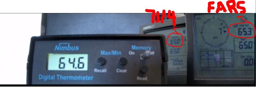
08/03/2024...7:30 pm: Final numbers around town, and it was toasty, here at the NE location (102°). Both the KVSH Tempest and south side Tempest 103°. Miller Field reported a record of 105°.
5:15 am: The heat is still on for the weekend, with highs near 100° both today and Sunday. There is a "Heat Advisory", out also. The dew point is starting out near 60° this morning, it's been more humid, with a 70° dew point on Wednesday morning. The forecast this morning says T-storms likely starting Tuesday night, with highs getting down in the low to mid 70s starting Thursday. Fall can't get here soon enough. Football and frost on the pumpkin, bring it.
08/02/2024...5:50 am: Near 100° again today and tomorrow, with 98° Sunday. Can see a light at the end of the tunnel with 80s starting Tuesday next week, even upper 70s Thursday with T-storm chances starting Tuesday night. It's about time, we haven't had a drop of moisture since around the 4th of July. As mentioned yesterday this was the driest July since the station was installed, 10+ years ago.
08/01/2024... As warm as it's been lately, here at the NE Valentine location, July still came in below the airport departure period NCDC 1991-2020. July Temperature, Precipitation was well below normal here. That BTW was the least July rainfall in 11 years. The next lowest was (.78") in 2017. Miller Field has been running 1-4° warmer on highs vs the rest of Valentine over this hot stretch. Looking at only this NE stations data over the last 11 years, July was only -(0.6°) cool. You can find this data on the Summary page, and compare the mean temperatures. Since there is 10+ years of station data now, this may be the better way of comparing because Miller Field does have a warm bias during the summer.
07/31/2024...6:30 am: Here are the Doppler radar rainfall estimates from yesterday. Where the tornado was spotted near Johnstown almost no rainfall. The reason Saint Francis got dumped on was the slow movement, it was almost stalled.
Yesterday the high temperature broke the century mark at 101° at this NE location, downtown KVSH and south Tempest 100° while Miller Field reported 104°. Our dew point temp is 70° again this morning, so lots of moisture in the air. The forecast high today is only 89° and below normal finally, with a 20% chance of a T-storm this evening. The high heat index yesterday reached 105° here, also was the highest on the year. It was more of a spike so it didn't just sit there, but 100-103° heat index yesterday was common during peak heating.
07/30/2024...9:35 pm: Tornado spotted on the ground 8 miles west of Ainsworth.
7:05 pm: Starting to look like another swing and miss. These storms are moving at a snails pace.
6:40 pm: Approaching T-Storm may clip this side of town. Current image
11:35 am: Our heat index is up there this morning with a Dew Point temp running around 70° currently. Hopefully it peels off as it heats up this afternoon. It's concerning when the dew point is near 70°, especially with the forecast saying 99° today. A dew point temperature above 61° is where the heat index starts going up. The mist in the air this morning was saying there was plenty of moisture. Be aware it could feel a lot hotter today than what the thermometer says.
6:55 am: A little fog developing this morning in some areas. Miller Field is down to 4-mile visibility. Our hot weather continues with 99° forecast today, maybe only 90° tomorrow. We had another thunderstorm track by early morning but nothing in the rain gauge.
07/29/2024...10:00 pm: Hail reports east of town 2" was the largest. High temps around town today 97° here on the NE side of town, also downtown at the KVSH Tempest. The South side Tempest 98° and the usual hot spot Miller Field ASOS came in at 100°. The 96° forecast today was only 1-degree off from being spot on for inside town. Fortunately it doesn't do this all year, just during our heat waves it seems like. Most other times Miller Field is the same as this NE location. Think it has something to do with what causes our heat waves in the first place, the wind compressing and heating, adiabatic warming in the open area. As it blows through town it has less effect because of obstructions breaking it up so runs a few degrees cooler.
7:40 pm: Winner SD is about to get nailed. That's a strong T-storm with up to 3" size hail. Already a 84 mph wind gust was recorded at Witten. Dime and nickle size hail 4 miles north of Sparks out of the cell that missed Valentine.
7:00 pm: Pretty good size T-Storm just missed Valentine. Developed too far north of town.
6:55 am: This morning our low so far has been 60° on the NE side. The AQ is good again in the green but on the rise currently at PM2.5 (37). Check the AirNow EPA link for trends. We do have a 30% chance of a T-storm tonight, and it could be severe should it happen. Check out the "NWS Briefing Package" linked 2 tabs above. The forecast high today is 96° with 100° tomorrow. Still no sign of cooling (exception maybe Wed 92°) with mid to upper 90s through the 7-Day. Last summer we didn't have an extended hot period like this, nothing over 3 days without a break. This July we've experienced 5 days straight now in the mid 90s plus with another potential 7 to go. It's been much drier also with under 1/2" of moisture. Despite this hot stretch July 2024 started so cool we are still running behind normal, at least here on the NE side of Valentine. The Coop thermometer is even cooler. BTW, the Coop thermometer is available to view under the Cameras tab. Have it set at 2-minute updates on the image.
07/28/2024...8:20 pm: AQ is back in the moderate range at PM2.5 (61). No storm activity tonight. There is a couple cells by Winner SD but nothing around here. Highs came in at 98° here on the NE side and Tempest stations KVSH and South side. Miller Field was +1° at 99°.
Good news, the AQ is in the green at PM2.5 (27) this morning. The forecast has a 30% chance of T-storm through tonight, 20% chance tomorrow with continued mid to upper 90s all week except Tuesday 102°. So continued hot and dry over the 7-day. Yesterday this NE side topped out at 95° with Miller Field coming in at 98°. Our dew point temp is down this morning at 58°. Yesterday we were 61° at this time, so it's only slightly drier this morning. Once it warms up and the dew point gets above 61°F, the feels like (heat index) rises. Instead of watching RH which varies by the temperature (Relative) and all over the place, the dew point is what to focus on in the summer. (Above 61° heat index goes up) I don't pay much attention to RH unless it's real high or very low. In the dry deserts of Arizona dew point was watched closely, the old technical definition of the monsoon arrival was when dew point in Phoenix averaged 55 degrees or higher for at least three days in a row. Now they've gone with a set date, which doesn't make much sense.
07/27/2024...2:45 pm: The HRRR and RAP models are showing precip tonight for Valentine. The NWS upped our chance to 40%.
We are down -3° at the noon hour over yesterday. Showing a higher dew point also 64-65° currently, making feels like slightly above ambient. Fingers crossed we can get some moisture over the next day or so.
6:00 am: Cloudy this morning, the ASOS says clear. Today another hot one around 97°. Tonight through Sunday night we have a 30% chance of a T-storm. Tuesday looks like another century mark day at 103°.
07/26/2024...7:15 pm: We topped out at 97° here on the NE side of town and 100° reported out at Miller Field. Other highs around Valentine, KVSH Studio downtown and the South Tempest. Tomorrow night the forecast has a 30% chance of a T-storm. Our AQ continues to get better.
11:55 am: Currently (90°) so running below yesterday by almost 5 degrees at this same time. Probably means we'll stay under 100° today. The 24-hour difference is located under the temperature. More wind today and our air is cleaning up, dropping below 100 PM2.5 puts us in the yellow. The live streaming camera gives a taste of the wind. Lower left to mute wind noise. Still see haze but it's better. If looking at the dual-lens camera the left side is closer to actual. That right lens cleans it up too much.
5:35 am: A SW wind this morning so good mixing, making area temperatures similar, currently low 70s across Valentine. Highs today near the century mark again. No real relief through the 7-day with mid 90s to near 100°. Slight chances of T-storms start Friday night through Sunday. Our air quality is still in the orange this morning at 108, but this is slightly better than the last couple of days. Linked under the (AirNow EPA) tab. Western Cherry County (Mountain Time zone) still has the "Red Flag" Warning today. This does not include Valentine on the eastern side.
07/25/2024...Updated: Here on the NE side including the 2-Tempest stations, one near the airport and downtown at the KVSH studio, recorded highs of (102°) today. Also the Fawn Lake.Rd. Tempest and east of town SpringCreek Rd. Tempest recorded 102°. FYI have a backup non-FARS Davis 7714 shield here should the FARS fan fail, the SHT-31 sensor recorded high was also 102°. Miller Field ASOS reported (104°).
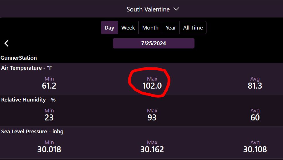
12:05 pm: Breaking the century-mark today is likely. We are running +3° (96°) vs yesterday at this time. The forecast was updated to 101° for Valentine.
Updated 8:55 am: A little ground fog was developing earlier, you could see on the "Live Streaming" camera. Now it's dissipated. Fire-weather concerns for Western Cherry today with a "Red Flag" Warning. Forecast high 99° today. Yesterday here at the NE location the Coop thermometer high was 96°, with the FARS (fan aspirated radiator shield) 97°. I do question the reported 100° coming off the ASOS, mainly because the nearby Tempest was only 98° and it was 96-97° here and also downtown. Generally these Tempest thermometers are pretty accurate as long as they're sited correctly. I had one located here and it followed the FARS surprisingly well. In the extended, it looks to continue hot with 100s now toward the end of the 7-day, Tuesday and Wednesday, of next week.
07/24/2024...6:55 pm: Our high today reached 97° here on the NE side, also downtown at the KVSH Radio station Tempest. The Tempest located near Miller Field came in at 98° and Miller Field reported (100°) ???
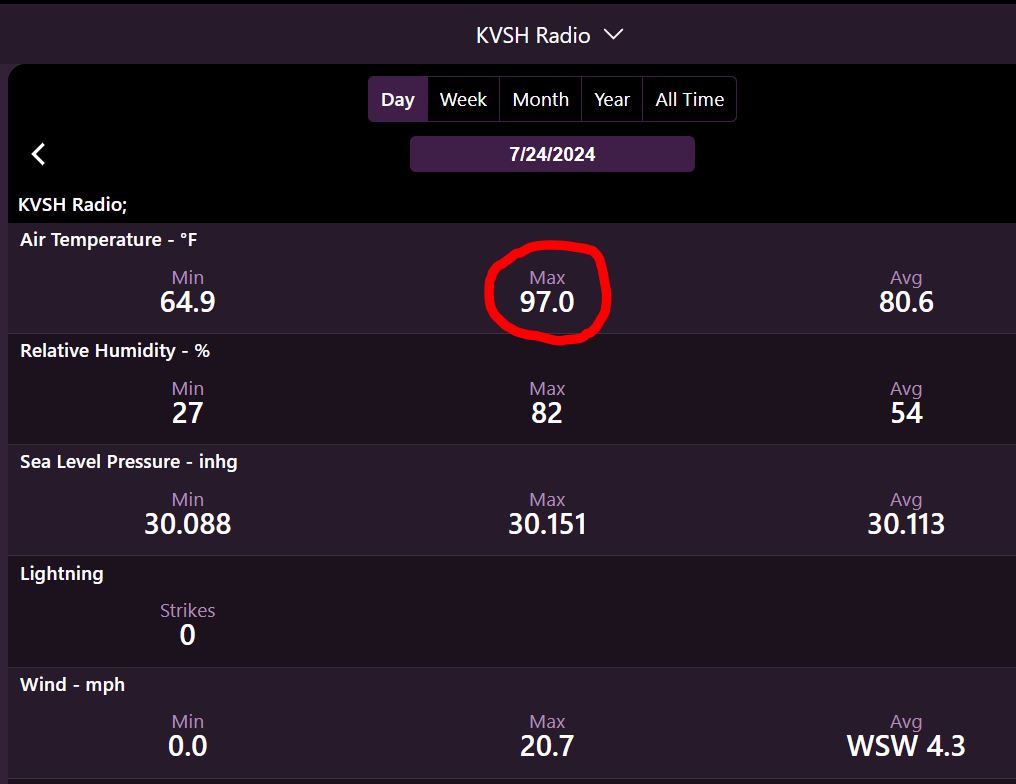
8:50 am: Another lazy, hazy summer day. Almost no wind this morning so seeing temperature differences across town as much as 5°. Warm areas stay warm and cooler areas stay cool without any mixing. As the sun gets higher mixing will occur and these areas will even out. Mid 90s expected today with upper 90s starting tomorrow through at least Tuesday next week.
07/23/2024...4:50 pm: The EPA AirNow adjusted air quality map is working again. So removed the Purple air map. Currently in the unhealthy range for sensitive groups @112. Airport visibility is 8 miles currently.
7:00 am: Updated the "Air Quality" link, now added to the main Navigation bar, it opens directly to the Valentine and surrounding region. Hazy this morning with a 5-mile visibility at Miller Field, we are in the moderate range at (95 PM2.5) . That's almost in the unhealthy range for sensitive groups, which starts above (100 PM2.5). It gets hot later this week, even a 100° forecast Friday at this time. This morning starting out at 56° here on the NE side, 58° out at Miller Field.
07/22/2024...1:27 pm: The haze in the cameras today is smoke, our AQI is 92 which is in the moderate range. This morning it was mixed with fog around the immediate area.
7:00 am: Miller Field has heavy fog this morning. Negative visibility is zero. Some areas just have mist while others fog. Went ahead and put the Miller Field Field conditions icon back on the website. The reason it was removed the ceiling instrument wasn't seeing clouds and saying clear when it was cloudy. High clouds it can't see but these weren't high. We did dip to 54° this morning.
6:00 am: A little mist, light fog this morning. You can see it best in the streaming camera. Another cool morning at 55°. Very warm later this week with mid to upper 90s Friday through Sunday and no mention of precip until Sunday. Some areas did receive rainfall yesterday mainly south of Valentine.
07/21/2024...A cool morning, the low here was 55°, 56° out at Miller Field. Today we do have a 30% chance of precip. Unfortunately, it's our best chance over the 7-day, and we are running well behind now for July. Speaking of behind, our temperatures have also been below normal, currently around -4° on the month. So that does help being so dry, but it heats up very soon with little moisture in sight. Some may have noticed areas of lawn are getting stressed without mother nature helping out. Had to increase sprinkler timers a few minutes here.
07/20/2024...Added adjacent Nebraska counties Keya Paha and Brown to the Warning and Advisories script for website. This is a test period if having adjacent counties having Warnings and it gets confusing may remove it. That's why you saw the dense fog advisory this morning. We are closer to those communities than far Western Cherry County, Ainsworth is 46 miles, Merriman 58 miles. Also added the Ainsworth airport, only (33 miles ESE) latest conditions under "External Links" 4th tab down. As I type at (8:55 am) they were cloudy with a 300 foot ceiling this morning. The weather station at Ainsworth doesn't update as often as the Miller Field ASOS so labeled as Latest conditions.
07/19/2024...9:45 am: Went ahead and took the conditions icon off the website. It's comes off the airport ASOS METAR. It's saying mostly clear again and it looks like THIS. Lately it's not working right, think I'll just leave it off until it gets fixed. We picked up (.02") in a light rain so far today.
8:45 am: Getting light rain now.
7:40 am: The NWS updated briefing packet is Here. The only thing different from the direct link is probable timing for storms today, now 1 PM to 9 PM CDT. The Briefing link still hasn't updated. There are multiple outages nationwide this morning, including internet. No issues here on Allo fiber. I'm thinking of removing the ASOS conditions icon. We are fully cloudy this morning and it says clear. These aren't high clouds either. It's just not working right.
07/17/2024...Something I've never heard of, a man gets struck by lightning near Rushville while sitting in his vehicle. Story here: I've always thought being on 4 rubber tires you would be safe, apparently not.
07/16/2024...Forgot to bring the level when the Tempest weather station was mounted at the KVSH radio station last Friday. This morning got it leveled and perfectly plum. Hopefully the Wi-Fi issue of shutting down overnight can get fixed so it stays online all the time. Linked under "External Links" toward the bottom or HERE. Just a reminder, these types of stations that use hepatic sensors to measure rain almost always over shoot actual. Sometimes 2 to 3x actual. A manual rain gauge is the only way to go if you want accuracy. The Stratus clear plastic 4" rain gauge is as close as you can get matching the Official 8" NWS gauges. Other than the questionable rainfall these Tempest stations are pretty accurate. Location, location is everything. Downtown it's mounted pretty high to try and avoid all the concrete and block building heat and to help get a more accurate wind speed. Wind won't be as accurate as this NE location however due to all the buildings. It seems to be working well as mounted in the above image.
5:20 am: Picked up (.01") overnight on this side of town.
07/15/2024...For those interested in such things, the airport ASOS (Weather Stations) are replacing some of the Vaisala instruments like dew point and Temperature sensor, now out of production with readily available commercial instruments in production. They had a delay with the project but have started again and currently in testing at certain stations. Here is a link for more:
5:25 am: Just heard some thunder so was going to look at how close the lightning was and found the KVSH radio Tempest weather station went offline around midnight. The WI-FI at the studio goes off-line for some reason. I'll try and speak with KVSH about keeping the WI-FI running so the hub can continue to report conditions overnight. If not it may be shutting down at midnight and won't be available again until around 6 am.
07/14/2024...It's down to 91° here, 89° on the Nimbus. I don't know why the big difference across town. Miller Field is reporting 98° right now. Sunny with a 8-14 mph ENE wind currently. Oh I see now...Miller Field has a south wind is why. 2 different air masses across town. The dew point is high here 70° and only 55° at Miller Field so much drier. This is kind of nuts really to have this big of a difference across a 2-mile area. Our heat index with the high dew point feels the same at 97°. The moist air is also at KVSH radio downtown. Also 91° currently.
2:00 pm: Someone asked me if the wind blew last night because they had broken tree limbs in their yard. It did blow, I totally slept through it. 50 mph wind gust here and 58 mph gust at Miller field. The KVSH Tempest downtown recorded 39 mph. We have a high thin cloud cover and 93° currently.
8:00 am: There is a new NWS briefing package out. The heat advisory for our area ends this evening. Expect the heat index to reach around (100°) again this afternoon. 98° was the high heat index at this location yesterday. Maybe being in Phoenix at 118° last week climatized me to the heat. It didn't seem that bad, but wasn't doing anything but sitting in the shade.
07/13/2024...The high today reached 97° here with the heat index high of 98°. The Tempest at KVSH studio recorded only 95° for a high. 95° was also the recorded high on the Nimbus thermometer here. Miller Field reported 98° for the high.
9:55 am: It's been mostly cloudy all morning. The ceilometer at the airport doesn't see the clouds for some reason. It doesn't pick up the highest clouds so maybe that's why. It should clear off this afternoon and get hot, approaching 100° again. The Heat Index will also be near 100° so we are still under a "Heat Advisory".
07/12/2024...The KVSH radio station has a Tempest Weather Station at their downtown studio location installed now. Linked under "External Links" toward the bottom or HERE.
7:00 am: Areas of T-storms just east of Valentine this morning. The ICON model was right yesterday morning, just had the location of development off 30 miles. Hot today through the weekend, with upper 90s to around 100°. The Heat Index will also be near that century mark with humidity. Yesterday it reached 89° here and 90° out at Miller Field. Surprisingly, that was the first normal temperature all month. That changes today through at least Monday with above normal temps, cooling below normal again with low 80s starting Tuesday. It's been a very nice summer so far for us here in North Central Nebraska. Running a little behind on precip for July, but it will come, hopefully.
07/11/2024...6:55 am: Low temperatures this morning look like 55° at Miller Field and 54° here on the NE side of Valentine. Normal low for this time of year is 60°. Our AQI is moderate at 69 PM2.5 this morning, so wildfire smoke is still in the area. You can also see the haze now that the sun is up. The cameras clean it up slightly. Yesterday's high was 83° here and 84° at Miller Field. Also below the normal of 90°. If watching the live-streaming camera, a couple of whitetail deer just walked by.
5:15 am: Almost completely calm again this morning (0-4 mph). The dew point and temperature are almost together so have a 97-99% RH currently. The NWS has put out an updated "Briefing Package" concerning the upcoming heat. We've been running behind averages on temps this month, but over the next few days it will change. There is one model bringing a threat of T-storms tonight for Valentine, the Icon. We have a 20% chance in the forecast with other models not agreeing.
07/10/2024...3:40 pm: The wildfire smoke has arrived, we are currently at (80)PM2.5 which is moderate on the AQI at this NE Valentine sensor location. Linked under external links. This smoke haze may keep our high today from reaching the forecasted 89°. So far we've reached 83°.
07/09/2024...7:30 am: Our lows this morning with no wind dipped to 52° here and 54° out at Miller Field. A little taste of summer heat is still on for the weekend, with highs near 100°.
07/07/2024...9:10 pm: The Weather station is back online. The computer didn't go down so was always running but lost internet connection completely, something never experienced before and of course it happened while out of town. Rebooting, fixed the connection issue and back online. FYI had the ability to remotely get into the computer but with no internet connection, that ability got taken away. So required a manual reboot.
07/01/2024...June 2024, here at this NE Valentine location ended up (-0.4°f) below average for the (NCDC 1991-2020) period on temperature and with (5.77") of moisture, plus (1.81") above average on precipitation. The station climate summary is here. Valentine's warmest month is typically July followed closely by August. This summary page is easiest to compare all years, dating back to June 2014. No rain since the 27th with our best chance coming Wednesday night this week, currently at 70%.
06/27/2024...4:00 pm: The NWS has issued a Severe Thunderstorm watch for Cherry including Todd and Tripp counties in SD.
1:20 pm: The GRL3 radar feed is back to normal. Our dew point has been on the rise, now up to 70°. Ripe for storms.
8:35 am: Some rainfall totals since midnight: KVSH radio (.14"), NE Valentine (.14"), Miller Field ASOS (.10"), Miller Field Cocorahs gauge picked up another (.08") for a (.12") total today. Cocorahs gauge across from Catholic Church (.15"). If travailing this evening, storms could be severe with big hail and high winds. Beware and check out the NWS briefing package. You don't see us in the enhanced area that often. What it means is big growth on thunderheads where the hail can get big. Only a 40-50% chance, but if it does happen could be bad. Getting caught in a hailstorm isn't fun. As a kid living in Odessa, Texas at the time, one of the worst experiences I've had was a hailstorm. Grapefruit and baseball size hailstones broke ever window out, including windshields on vehicles. It was so loud you couldn't hear yourself scream. I remember thinking we were going to die. Hailstones were shooting across the living room floor, while we were huddled in the hallway. Think that experience hooked me on becoming a weather enthusiast.
6:55 am: We're getting a good shower on the NE side currently. Here's the Cocorahs gauge prior to morning shower, hanging on a fence post at the airport. (.04"). It was emptied yesterday also. The ASOS measured (.02").
5:05 am: We have a "Enhanced chance" of severe weather today, read the NWS briefing packet. 75 mph winds 45-59% chance and up to baseball size hail with T-storms 15-29% chance. Overnight picked up (.05"). How we are looking on precip this year going back to the station start in June of 2014: Precipitation Summary In June 2014 was located at the far West side of Valentine location. Moved to this NE location in June 2019.
06/26/2024...10:05 am: Two tornadoes last night. Here's the Whitman Tornado. The other one was near Mullen also confirmed. Image: Courtesy of Grant County Sheriff.
06/25/2024...10:35 pm: We picked up (.02") in precip.
6:50 pm: The GRLevel3 radar has caught up. Big cell in SD kind of heading this direction. Loaded with hail, so stay away.
More info on the outage, the Fiber went down at all the NWS offices and they were on backup (Satellite internet). That's why the GRlevel3 radar went down also. Statement from AllisonHouse group.
11:20 am: Everything appears working again, even the Grlevel3 radar has updated. Weird how everything stopped working last night. Some kind of outage but looks back to normal. Conditions icon which comes off the airport ASOS METAR is working, and the GRLevel 3 radar is updating again.
7:40 am: Today will setup a dusk to dawn light for the streaming camera. Was looking at visitors to see how much it was getting used: "Visitors" Looks like it's getting used with (130) individual viewers (708) visits. Sure it depends on weather conditions. Have a total of 1000 gigs (1Tb) available each month and only used 54 gigs so far, so feel free to visit. Not coming even close to available bandwidth.
5:50 am: Only a trace of rain overnight. Our next best chance of precip comes Wednesday night. We have a 40% chance tonight.
06/24/2024...10:00 pm: Getting a light rain you can see in the streaming camera.
9:20 pm: Decaying T-storms and our dew point crash. Still hearing some thunder though but not much on radar.
6:50 pm: The dew point temp you see at 70° is correct, actually it's 71°. I hand checked it with a sling psychrometer. Our high Heat Index today was 103.8 °F at 5:52pm at this location. The Heat Index temps show on the trends page. FYI removed the ASOS conditions icon. None of the WX stations are updating normally, it may be the entire country, every station checked was the same way, no updates. Just the top of the hour. (strange) Lot's of things broke or not working right today is the trend. It's a Monday.
6:00 pm: The GRLevel3 radar isn't receiving data today, so only have the NWS loop. Also have this radar loop. Enable mouse wheel if you want to zoom.
6:40 am: MesoWest is down for maintenance again if looking for Miller Field conditions, so added a different link for Miller Field, top of "External Links".
Hot one today, with the high reaching around 97° and our heat index near 100°. It's short-lived with the rest of the 7-day near or below normal, even mid 70s on Saturday. Wednesday night looks like the best chance of a t-storm, currently at 50%. If it felt warm yesterday, we peaked at 95° here and 96° at Miller Field.
06/22/2024...Here is the final Doppler radar estimates on rainfall. Have the ability to zoom down to the street level so here are the numbers, (1.84 to 2.12") across Valentine, St.Frances (2.12 to 2.28"). That storm late yesterday put St.Frances over the 2 inch mark.
06/21/2024...5:00 pm: The Miller Field Cocorahs gauge picked up another (.23") making a (1.71") total vs (1.56") from the ASOS. There is a .23-mile distance between the gauges, but a 9% difference?
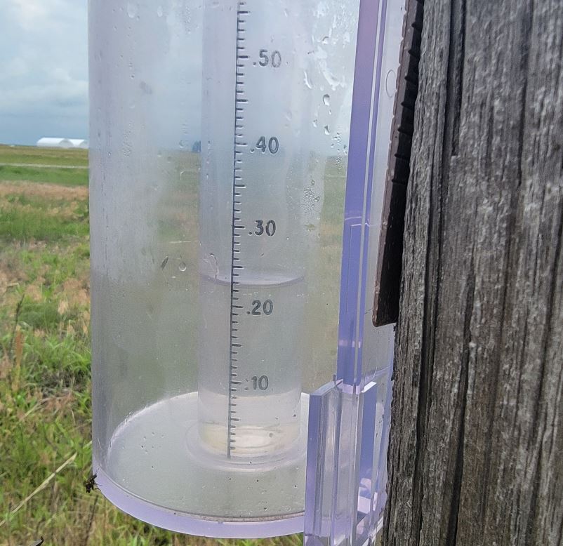
11:45 am: Here on the NE side, picked up another (.18") from the 6 am total. We started out at (.11") since midnight now (.29").
10:15 am: Rain is falling, not heavy (.15" per hr.) and starting to hear thunder, lightning detected 14-16 miles out.
The Cocorahs gauge at Miller Field recorded (1.48"), these gauges hold 1" in the inner cylinder and overflow into the outer.
6:55 am: (1.63") was storm total here at the NE location. At the NW location storm total was (1.44"). Miller Field (1.43"). Since yesterday morning KVSH radio gauge (1.52"), not sure what the empty yesterday morning was for a storm total however. Here's the Doppler Radar storm total estimate. It usually overdoes rainfall. The lightest rainfall area was the St. Frances, Gordon, Merriman areas with an inch or less. Ainsworth, Bassett were the heaviest with 3-4"+. Flooding and road washouts were being reported.
06/20/2024...6:00 pm: Confirmed tornado on the ground south of Ainsworth/Bassett.
5:40 am: Picked up (.08") at the NE location so far. Models have been pretty consistent, bringing another round of heavy rainfall for the area. Icon-3", GFS-2", and the ECM with the most, over 4" for Valentine. The NWS has issued an updated briefing package concerning excessive rainfall potential for the area. The ground was saturated from the last 3" rainfall only 3 days ago, so we could see more flooding this time, provided the heavy rain does play out as models suggest.
06/19/2024...5:00 pm: Updated NWS briefing packet is available. Just dumped the Cocorahs gauge at the airport from the June 16-17 rain. (3.11") is what it recorded. Over 2" in the overflow and another inch in the center tube. The ASOS reported (3.00") but is about 1/4 mile further south.
06/18/2024...5:45 pm: Adjusted the streaming camera for a closer view and less sky. This may solve the nighttime issue and lack of visual during storms. At least now the ground will be visible. The mic is muted now also. The almost constant wind noise along with privacy concerns played into the decision.
5:12 am: Temperatures are upside down, with the high yesterday reaching 80° at 11 pm. The high today has occurred already coming in at 80° at the midnight hour. It's 76°, currently with a south wind. A cold front is currently pushing through so the wind will switch to the NW soon. Very muggy this morning with a 68° dew point in front of the cold front. There was a sprinkle this morning, wasn't showing on radar.
06/17/2024...5:45 pm: We picked up another (.09") since the 6 am measurement for a storm total of (3.20") here. We did make it to 73° so far today. Was beginning to wonder. Last nights event was sudden, at 9 pm there was no activity and at 10 pm thunderstorms all around.
Updated 6:05 am: At measurement time (3.11") with an additional (.02") for a storm total (3.13") and still getting an occasional burst of rain. We have a flood advisory in place locally. This rain started about 10 pm last night so 8 hours of rainfall, much from training thunderstorms. It looks like it's about over for us currently, however there is a potential for additional storms over the next few days. Here is the Doppler estimated rainfalls. You can see this north side of Valentine was heavier than the south side but not by much. (2.94") at the airport. Near the Catholic Church (2.98") and may have spilled a little. You need to subtract about an inch from the Doppler estimate, (white is 4" but closer to 3" actual ) but still useful showing the heaviest to lightest areas.
06/16/2024...0:28 am: Rain rate reached 3.5" inch per hour. (1.6") so far and climbing. Doesn't look near over either. Looking at what models were saying yesterday afternoon, the Icon was close saying about 2.75" of rain. We may exceed it at this rate.
11:39 pm: Power went out, took a while for cameras to get going again. Pouring right now and lots of close lightning strikes. These thunderstorms are lined up in a train.
10:38 pm: Picked up (.41") with this first thunderstorm, which has now moved east. More potential coming up on radar. The hail never got any bigger than pea size here.
10:13 pm: Getting pea size hail hail right now.
5:55 am: We could see severe weather tonight and Monday per the briefing package, starting after sunset, even a brief tornado near and north of HW 20. Happy Fathers Day to all you dads.
06/15/2024...5:15 pm: You can feel that 60°+ dew point outside.
Updated: Picked up (.19") here on the NE side, also includes what fell yesterday. The NW location near Catholic Church reported (.26"). Looks like Miller Field (.18"), it's a weighing gauge so just shy of .19". You could see T-storms fall apart a couple miles out as they approached yesterday evening. Not sure what's causing it this year, but it's been happening a lot. Another good chance Sunday night, including throughout the 7-day where we have chances of moisture every day. Moved the cameras and streaming camera link toward the top of the navigation bar, just under the 7-day forecast tab.
06/14/2024...7:47 pm: Getting some lightning and thunder. 9-12 miles distance. The baseball game may get rain delayed. (.09") is correct on rainfall so far.
02:20 pm: Our light rainfall total so far (.03") on the NE side of Valentine, had a light sprinkle while the manual gauge was being checked. Tonight, rain may arrive a little later than normal, between the 11pm and midnight hour per several models. We could use a good soaking, looking at models a couple show good amounts, while the HRRR keeps going back and forth on how much. It will be a June surprise, unfortunately tendency this year has been on the lighter side, that's why we are running so far behind. A big difference from last year, when it seemed like everything was nailing us. Only (.43") in the middle of June. That would be great for the Southern Arizona deserts but dry for us. June 10th of last year (2023), we had a thunderstorm stall right over us, dumping 4" here on the NE side and flooded areas of town. Image-1, Image-2
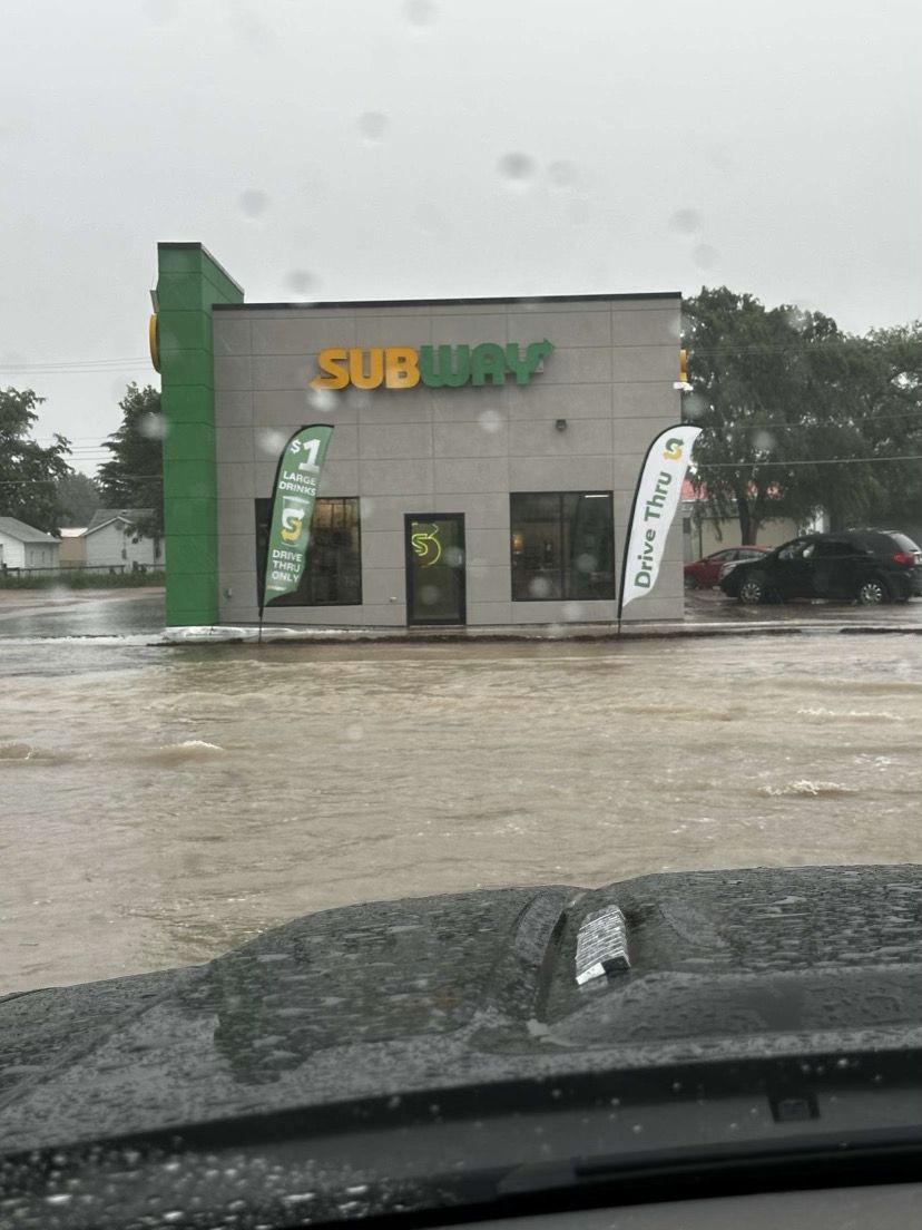
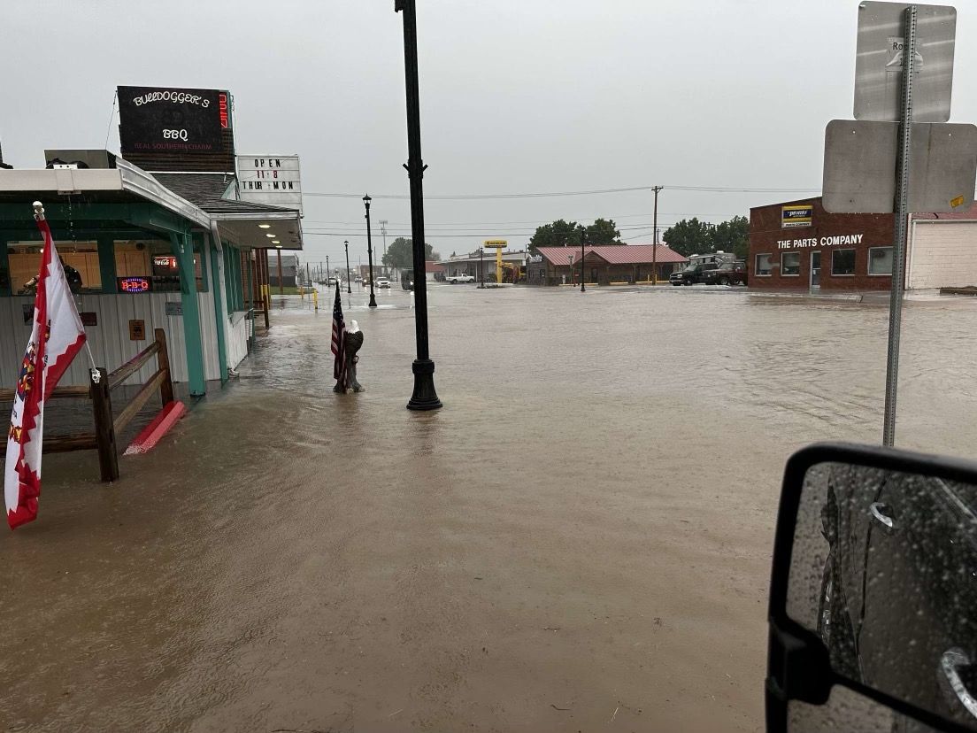
06/13/2024...Added a makeshift windscreen on the streaming camera mic using a couple kitchen sponges. Should help some when the wind blows. You can also mute the volume or turn it down, controls lower left.
06/12/2024...The high today came in at 90°, also on the Nimbus. Miller Field was 92°. The naturally aspirated 7714 shield recorded 91°.
12:45 pm: About the streaming camera, Tech support from BrownRice hosting got the audio working by changing to RTMP stream, also now able to stream at the highest camera supported bitrate (4096 Kbps). If you want audio, mouse over to the lower left to turn on.
Updated 11:20 am: We had some thunderstorms in the area early this morning. Our low was only 64°. It's going to be hot today, reaching the mid 90s. Last night ran a Cat-6 cable to the streaming camera, so it should work much better now, instead of using WiFi. Tried to get the mic working, but it keeps crashing the feed, so no sound yet. Clicking the link will now open in a new tab, so a convenient way of viewing the stream on the side. As far as I know, this is the only streaming camera in the area, so wanted to get a camera streaming for some time.
06/11/2024...6:40 am: Another rainfall amount from yesterday (.29) at the KVSH radio station.
06/10/2024...9:30 pm: The rain stopped (.29") fell here on the NE side. (.33") in the Cocorahs gauge near Catholic Church and looks like (.22") at Miller Field.
5:55 am: A good chance of a thunderstorm tonight. Timing looks like after 7 pm with the 8-9 pm hour looking most likely on the Rap and HRRR models. The RAP has around 3/4" for Valentine, but thunderstorms are very unpredictable where they dump. We've been dry so far this June only (.11").
06/09/2024...4:50 am: With the internet connection working normally, have 3-cameras uploading again. The Nimbus (Coop temperature) is on the Cameras tab and set to upload and refresh every 3 minutes. May need to Ctrl+F5 to refresh cache first time if all 3 don't show. The Nimbus radiation shield is the larger shield on the right, showing on the snowcam image. The smaller shield is the Davis 7714 and backup for the website should the FARS fan (main website temperature) ever fail. The reason for keeping IR lights off on cameras at night, is because spiders within minutes will build webs across the lens. Spotlights will still turn on with movement. Looking at models and the forecast we have a good chance of rain Monday night around midnight, is the current timing of frontal passage.
06/08/2024...4:30 pm: Getting a sprinkle. Looks like Miller Field picked up (.02").
3:00 pm: Everything started working again. Have the VPN off and packets are going through with no drops, looks like normal again. Fingers crossed it continues. Unless someone calls and says they found something, and it should be fixed, the plan is still to keep the DSL CenturyLink for backup, at least until reliability is proven. Today, backed up the website, was getting ready to move to a new host. Hopefully that won't be necessary now.
6:15 am: Still have the internet issue between GoDaddy servers and Allo. Cameras likely won't upload consistently, if at all. Occasionally a few packets make it though, and an image will upload, found on the Cameras link. Hopefully this gets solved Monday with a CenturyLink connection. This started 10 days ago. The weather conditions data works because it's behind the VPN connection. Not one packet is getting through without using the VPN this morning. Unfortunately haven't figured out how to get the cameras behind the VPN. The ALLO router is restrictive. The only solution is changing route or path to the website servers (GoDaddy), this is what the VPN servers do, so will try CenturyLink Monday. Allo replaced the router and modem but that didn't help. GoDaddy keeps saying it's the routing to their servers Allo uses, is where the problem is. That actually appears to have some truth because the VPN does just that, changes the path to the servers. However, what's strange others using Allo don't seem to have any issues reaching the website and not dropping any packets. Twilight zone stuff, nothing makes sense.
05/26/2024...7:15 pm: The Miller Field Coco gauge (.14"). The ASOS also recorded (.14"). NW Valentine near Catholic Church came in at (.15").
6:25 pm: Once again (.16") on all gauges, including the Coco gauge just put out. This was a nice slow rain, lasted almost a full hour. I'll check the airport Stratus gauge is a few and update.
5:20 pm: Rain is just starting, here is what radar looks like.
8:00 am: Took down the Cocorahs rain gauge at the AP last week, but today put it back up after the (.09") reported off the ASOS yesterday. Reason being the Doppler estimate was twice as much (.18"), along with all other gauges including the NW Valentine 4" gauge (.18"), coming in near the Doppler estimate of (.16" to .18") around Valentine. The (.09") was half; it may be right but worth a double check. Judging by the puddles at the airport. We'll see what happens today, looks like another good chance tonight.
05/25/2024...Updated: Here on the NE side (.16"), both rain gauges agreed with the automated tipping bucket. Not a gully washer but did have a 47 mph wind gust here. NW Valentine across from Catholic Church (.18"), South side Miller Field reported (.09"). The Doppler estimate was twice as much at (.18") and (.16") here on this NE side.
7:00 pm: Thunderstorm is getting close. Hearing thunder and seeing lightning.
The NWS has issued an updated briefing packet. Dated May 25th 3:08 pm. Click the link above.
05/24/2024...8:25 pm: Added a Flight Tracker script. You can click on each flight for details. The larger airports are interesting to watch the traffic. Today we went from 50 mph wind gust down to 3 mph currently. The weather here really isn't boring.
8:55 am: We had a 50 mph wind gust around 8 am. Hopefully we'll break out of the clouds later.
5:30 am: We have a stiff breeze this morning, currently west at 24 mph and a cool 45°. (.28") was measured overnight at this location. It looks like the Miller Field ASOS is down this morning so no sky conditions icon. Use the webcam. (.30") was reported prior at the airport. The (.01") reported here today actually fell before midnight, it's something that can't be reversed so has to go down today. Would rather have the total amount correct than leave it off.
05/23/2024...8:45 pm: Just a light sprinkle currently. (.27") so far, NW Valentine (.29"), and Miller Field looks like (.30").
5:30 am: A new updated NWS packet is out. Click the link above, hold Ctrl plus F5 to refresh cache. Later today could become active with thunderstorms, especially late afternoon into early evening for our area. We have a cold front that will push though with potential supercell development. Quote from discussion: "Moderate instability will also develop across north central and into central Nebraska by the late afternoon. Ample instability will exist across the region to support the development of supercells initially across portions of north central Nebraska. As these storms track eastward, storms will become more of a convective line, possibly even take on QLCS characteristics."
05/22/2024...6:30 am: Rainfall totals Monday/Tuesday; NE Valentine (.96"), Miller Field (.98"), NW Valentine (.98") recorded in the Cocorahs gauge across from the Catholic Church. We are running behind normal for our wettest month but still have over a week left.
05/21/2024...7:40 am: Update NW Valentine near Catholic Church. (.94") also in Cocorahs 4" diameter gauge. Goose Creek road area reported (1.3"), not sure about the rain gauge type used. The rain has currently stopped. (.94") total here in NE Valentine, Miller Field (.96"). What fell prior to midnight is the difference (.07") here and (.09") Miller Field.
6:15 am: At 6 am (.91" ) measured with the manual rain gauge, this includes the (.07") before midnight. Looking at radar the main portion may be over in about an hour. We could still get areas of redevelopment and scattered showers through midday however. The website is correct on rainfall currently.
5:15 am: The NWS has issued an updated briefing packet. Click the link above. Rainfall is in progress; currently, there is a large area of rain across the area. This rain is slowly moving east and is expected to subside later this morning. At 4:35 am did a manual rain gauge check; (.76") is the total amount. Includes the (.07") that fell prior to midnight. The website is correct on rainfall at this hour and should stay within (.01") of actual throughout. As always a final manual rainfall measurement and website adjustment if needed once the rainfall stops.
05/20/2024...6:40 pm: The NWS has issued an updated briefing packet. Click the link above.
05/18/2024...2:40 pm: The afternoon model update is looking pretty wet on Tuesday. 2" plus, with the GFS projecting the least at 1". It's only Saturday but being May it won't surprise at all, it's that time of year.
05/15/2024...2:20 pm: Getting a rain shower now, on the NE side of Valentine.
6:55 am: Looks like another chance of thunderstorms this afternoon at 60%. Our AQI is in the yellow, 77 this morning. So we still have some smoke. Dodged the bullet yesterday with some golf-ball size hail potential in one of the storms. Look at the 5 pm entry yesterday.
05/14/2024...6:30 pm: Looks like we have one more chance at some rain. May have to run the sprinklers again with the 80s today and this wind if it doesn't happen.
5:00 pm: Now the TS south of Merriman is the strongest with 3.25" hail and dark pink which is almost 70,000 feet tall. The number 3 on the cell...3" diameter hail.
6:20 am: The air quality is better in the yellow today at 81 AQI so the smoke from Canada has concentrated more to our east and should exit as a frontal (trough) moves through this afternoon. With this system moving through we have a 60% chance of rain with models putting the arrival around the 4-5 pm hour. Some areas could get heavy downpours.
05/13/2024...10:15 am: You may have noticed the haze today, our air quality is at the unhealthy level currently for sensitive groups and being caused from smoke. Believe it is Canada again starting wildfires. Last year it was sickos that wanted to blame climate change so drove around starting wildfires. Wouldn't surprise me if it wasn't happening again. We have 2 air quality sensors (Purple Air) here in Valentine one of them is located here, both can be found under external links or here. Click on the individual monitor for details.
05/12/2024...5:45 pm: Getting some rain here, looks like it will be short lived. Might get another later.
4:50 pm: South side of Valentine picked up a few hundredths only a trace on this NE side. Miller Field looks like (.08").
05/11/2024...8:35 am: Took the Davis 7714 down and replaced with the Barani Design shield previously located at Adams place 3/4 mile east of here. The shield temperature can now be viewed in the Cameras tab with 1-minute updates. The Barani is the far right shield next to the Nimbus. The FARS (fan aspirated shield ) is located on left side of the snowcam image. The FARS is the main thermometer for this website. The Barani is a backup to the FARS should there be a fan failure. The Nimbus thermometer/shield is for the Valentine Cooperative (COOP) temperature.
05/10/2024...5:35 am: A little windy this morning on the NE side of Valentine, 18-26 mph currently with a peak gust of 29 mph. It may settle down some after sunrise. South side Miller Field, has about half as much at 10 mph. No rain in the forecast until Sunday and then only a 30% chance.
05/09/2024...1:15 pm: Update: Rainfall on the NE side, .05" all gauges, here's the other 8" Novalynx. KVSH radio reported (.06") in their 8" rain gauge.
12:20 pm: Getting light rain. As always the website will get adjusted if needed to the manual NWS rain gauge once it stops. It's the right side gauge under the cameras tab. The left rain gauge is made by Novalynx a weather instrument company.
12:10: Radar does show we may get a shower in the next 10-15 minutes. The only yellow on the radar is near Valentine.
05/08/2024...5:00 pm: Light sprinkle currently.
11:20 am: Much nicer today than the last few; 10-20 mph wind is nothing compared to yesterday and the day before. We may pick up a little moisture tonight, with a 40% chance. The Icon model shows around a tenth possible.
05/07/2024...3:40 pm: So far today, the peak gusts, here on the NE side 58 mph, Miller Field 62 mph. The haze is from the sand being picked up in the open area of Miller Field. Not really sure why no (wind advisory) was issued. It doesn't get much windier than what it was today. I did notice the Nebraska hourly Roundup wasn't working today and includes Valentine, so maybe nobody noticed. While talking with KVSH radio about the high wind today, was told their rain gauge recorded (.49") yesterday, so W 3rd St. and Main was similar to this NE side.
12:10 pm: Just had a 55-mph wind gust. Miller Field reported a 56-mph gust out of the west. FYI, a gale force wind can vary, but frequent gusts to 54 mph are considered a gale force. Between 51 and 55 mph now, so near gale is being indicated. Depending on where you are located, today may seem more windy than yesterday, like here in NE Valentine with an unobstructed west direction. These storm systems this spring have had deep low pressure associated, thus the wind. It's still low (29.35") at this hour.
5:45 am: There is a new NWS briefing packet out. Linked above. You may have to clear cache, Ctrl plus F5 a couple times. The peak wind gust at Miller Field was 59 mph yesterday or 57 mph reported on the climate report. Today getting more wind on the NE side of town with the westerly direction vs SE and town obstructed. Today's peak gust so far has been 48 mph here. Still roaring outside with the wind but expected to calm some later. Noticed the barometer is still very low (29.26") currently.
05/06/2024...4:50 pm: Updated: Officially (.54") recorded in the NWS Cooperative rain gauge. The Novalynx 8" (.55"). This is what radar looked like at one point, Image. Cell Q2 and we did see some 1/2" hail. Other rainfall amounts around town, Miller Field (.23"). The 4" Cocorahs gauge at the old NWS office located 2 tenths of mile further NE of the ASOS (.25") and finally NW Valentine near Catholic Church (.28") . Late report need to add KVSH radio downtown, (.49")
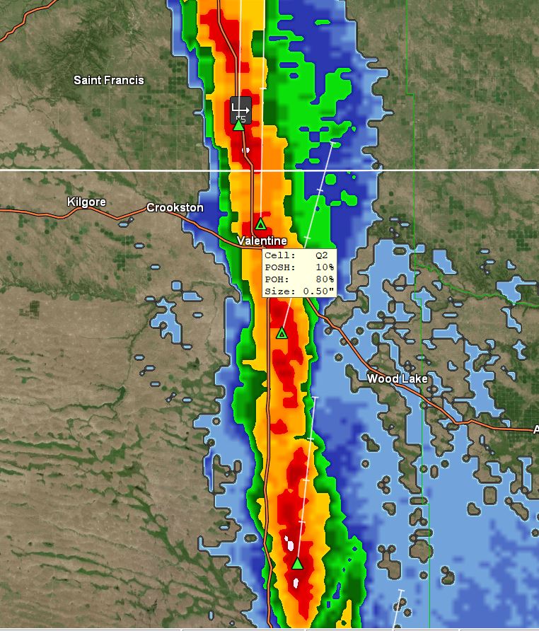
3:22 pm: Hail here and very heavy rain the hail is marble and pea size.
3:10 pm: Just started raining (Heavy). A line of thunderstorms pushing up from the south currently. Have the west camera recording.
1:55 pm: Miller Field has had a 55 mph wind gust today. Too much obstruction at this location from the SSE direction so only 42 mph here. Miller Field airport updates is first link under external links. Updates can sometimes get 15 minutes behind.
Tornado watch was issued by the NWS, includes Valentine. Make sure your phone weather alerts are turned on and safe space doors unlocked and ready, including have helmet or pillows for head protection. If you don't have a basement under a stairwell if possible.
6:05 am: The latest NWS briefing packet concerning severe thunderstorm threats is out, click the link above. Looks like most of the threat will be east of HW 83.
05/05/2024...5:30 pm: The NWS put out a briefing packet concerning severe thunderstorm threats upcoming. Click the link above for details. Tornado, wind and hail threats are low for Valentine Monday into Tuesday. Higher toward Ainsworth. I know everyone has tornadoes on their mind, at least I do after what happened last week. Those tornadoes didn't have a whole lot of rain with them either. The one I saw here in Valentine when I was between 6-7 years old, living behind where Scotties is now, and looking NW from Cherry Street didn't have much rain associated either because I was playing outside at the time. It was maybe an FF-1 or 2, small but distinct funnel reaching the ground, so ran inside the house and told my grandparents who also saw it. Vaguely remember hearing of some damage reported.
It looks like a decent day temperature wise (71°) but the wind could gust to 40 mph. Tomorrow, there is a 60% chance of rain. With the SE wind direction this location won't see wind speeds as high as the wide-open airport. It'll still get into the 30 mph range with gusts. The only wide open unobstructed direction here is from the west and NW as you can see on the camera.
05/04/2024...6:35 am: 33° temperature currently. You can see frost on the roof of the shed, those are normally brown shingles. The wind has calmed some 7-13 mph.
5:00 am: Before midnight (.43"), fell here on the NE side yesterday. A rather stiff wind currently 1114 mph out of the W with a 34° temperature currently. How low our temp gets this morning will depend on the wind, if it calms some the temperature will fall off. Did notice the back deck is frost-covered. Today should be rather nice with a high forecast near 61°. Looks like MF picked up (.41") yesterday. All the rain gauges here were the same at (.43"). The NWS gauge on the right is the Official Cooperative gauge under the cameras tab. The left gauge is the Novalynx 8" diameter.
05/03/2024...6:35 pm: Still light rain, dipped both rain gauges (.21") so far as is the tipping bucket. It's already down to 36° outside. Expect another freeze in the morning especially if we clear off toward sunrise. Got the sprinklers off.
4:00 pm: Finally getting some sprinkles, the HS may have gotten the full track meet in. It didn't look good this morning, but the rain has held off. It was a very cool track meet with temps in the 40s and 50s with a 1020 mph wind.
7:25 am: Here are what models are saying for precip today. And they are all on the same page, you don't see that often so anywhere between noon and looks like about 3 pm it starts.
5:40 am: A freeze this morning, was a little unexpected. So far 29° on this NE side, 31° at MF, we do have some high clouds starting to filter over and may raise or get us back above freezing by sunrise. Saturday morning we may have another. This isn't unusual, the 10-year average last freeze is May 12th for this station. So we may get another down the road.
05/02/2024...6:36 am: We picked up (.15") yesterday before midnight. Looks like the same at the Miller Field rain gauge. Beware of the wind today with potential 40 mph gusts this afternoon. There is a really deep low developing to our NW.
05/01/2024...6:50 pm: (.07") at this location so far.
04/30/2024...3:18 pm: Getting a little shower, don't know if it will be more than a trace. Got the ground wet but didn't tip the (.01) bucket. I'll check the manual rain gauge dip stick later.
8:50 am: Put the Grlevel3 radar up. There may be a few sprinkles reaching the ground. Most of it is virga however, meaning evaporating before reaching the ground. We only have a 20% chance of precip today, increasing to 80% Wednesday night.
04/29/2024...6:40 am: We ended up with (.89") going back to Thursday morning in the 8" NWS manual gauge, (.88") in the tipping bucket. The KVSH radio station downtown reported (.90") in their rain gauge. The low this morning so far 36° here on the NE side. The west wind 10-16 mph will likely prevent a freeze.
04/28/2024...6:00 am: Light rain currently, so far (.45") of new rain today, plus (.01") before midnight.
04/27/2024...9:20 pm: Light rain isn't showing on radar.
The afternoon NWS briefing packet concerning severe weather; click the link above.
04/26/2024...53 separate sightings multiple states as of 7pm: Tornado videos Eastern Nebraska today: Twister1; Twister2 ; Twister3; Twister4. Fox Weather has video of some huge wedge tornadoes also.
4:00 pm: The sudden downpour an hour ago dumped (.10") here at the NE location of Valentine. Parts of Valentine may have received nothing. The website is correct for daily rainfall since midnight at 4 pm.
4:55 am:(.11") in rain here on the NE side of Valentine so far; (.07") fell today.
04/25/2024...4:40 pm: Added the east looking 180° camera on the camera link page. After event is over the camera will be removed but during periods of thunderstorm may add it again.
Here is a look at what models are advertising this morning for precipitation this week.
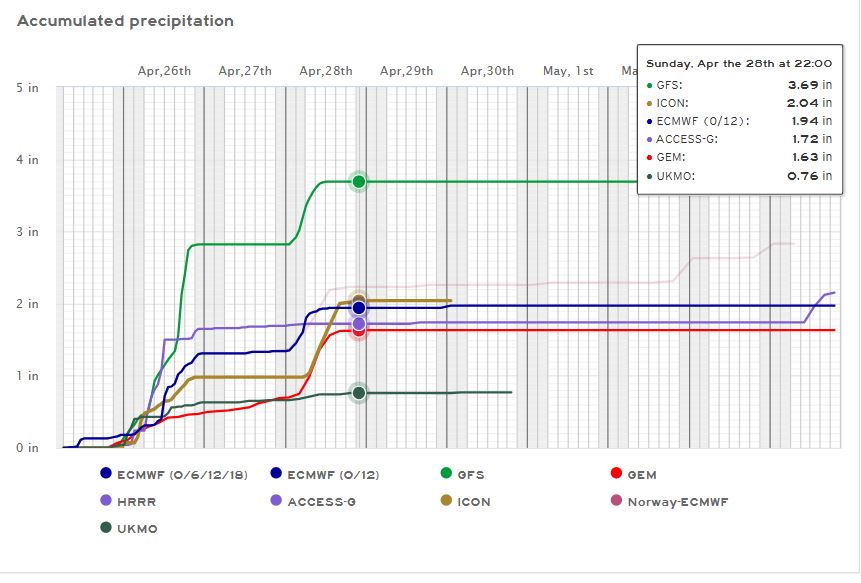
04/23/2024...Per the afternoon forecast discussion: Active weather will arrive on Wednesday night bringing significant rain chances to the region through Sunday as well as potential severe storms on Thursday night and into Friday.
04/21/2024...6:00 am: It's been down to 22° this morning so far. Today's our last freeze forecast in the 10-day. The average last freeze has been May 12 since (2014) so expect at least one more mixed in somewhere beyond the 10-day. The freeze data can be found: HERE
04/18/2024...7:00 am: (.26") here in NE Valentine for rainfall. Miller Field reported (.23"). The radio station KVSH reports (.25") in their 8" rain gauge. The 4" gauge located at the old NWS office says .24". The ASOS is .21 miles further south.
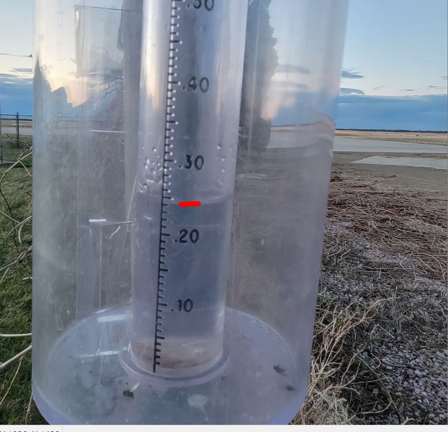
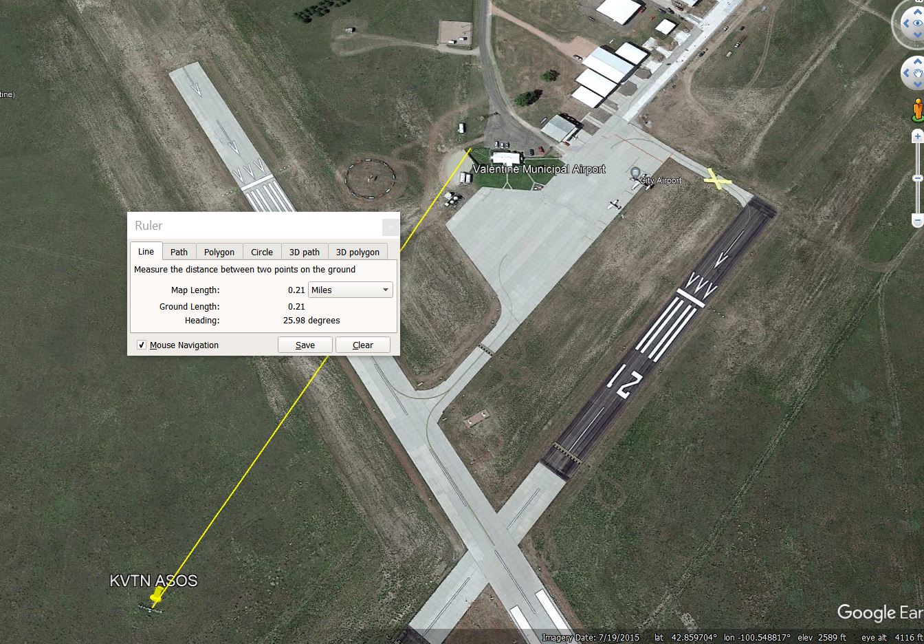
04/16/2024...8:30 pm: The rain has stopped, just checked the manual rain gauge (.20") here on the NE side of Valentine today. Looks like tomorrow night another round. Wind speeds are down currently, 18 to 28 mph.
4:40 pm: The latest updated NWS briefing packet is out. Click link above. The wind has calmed some from earlier today. (.12") in the manual rain gauge so far today. The website was adjusted to match.
2:15 pm: We have a near gale wind NW 34 gusts to 52 mph.
6:15 am: No rain yet. Thunderstorms split around Valentine yesterday on both east and west sides leaving us dry. Today the rain has stayed to the east. Thankfully the wind has calmed down from the relentless high gusts yesterday that caused some roof damage here. Did get a report of fires south of us late yesterday.
04/15/2024...5:10 pm: Center ridge cap sections of the roof blew off. Image Ugh! And it's heavy weighs about 50 lbs. Allen Daugherty to the rescue before the rain hits. That was part of the loud noises kept hearing.
4:50 pm: So far today, (52 mph) which just occurred has been the peak wind gust, Miller Field also has had a 52 mph gust. Just noticed the dew point is pretty high at 57°.
4:15 pm: The latest NWS briefing packet concerning the strong upcoming spring storm is out. We have a risk of Large to very large hail, damaging winds, and isolated tornadoes possible; click the link above for details. Springtime storms can be very strong with the combo of warm and cold air masses clashing. This wind is something else this afternoon, the house doesn't like the SE direction, it's not used to it, so making strange noises. Think most of it is the exhaust fan dampers clanking. Definitely can't get a quick nap in with all the noise. Here is the latest NAM just as wet as the GFS.
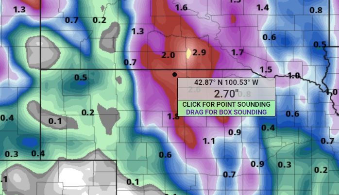
04/14/2024...4:35 pm: A peek at what models this afternoon say about moisture. Always subject to change.
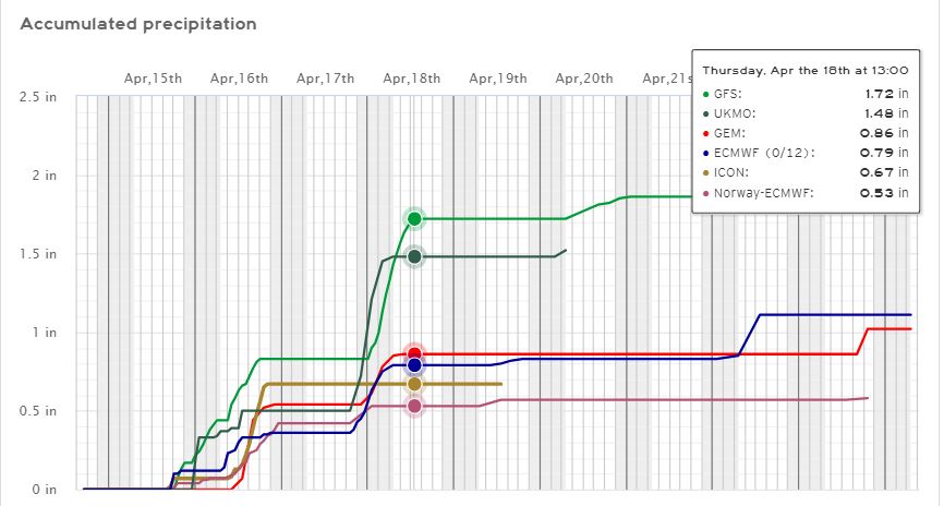
Have the 3-different solar radiational shields together for comparison, found under the cameras tab. For reference the FARS is on the right with the Davis 7714 naturally aspirated shield in the middle and the Coop Nimbus left. Image All 3 shields can be seen on the Snowcam image. The FARS shield is the main thermometer used for this site in real-time. The 7714 being naturally aspirated is backup should we have an extended power outage. Both the 7714 and FARS use the Sensirion SHT31 sensor with a (+/-) (.36f) accuracy.
5:10 am: The latest NWS briefing packet is out concerning Fire Weather concerns with high winds followed by the development of thunderstorms, some severe, late Monday afternoon and overnight. Click the link above for details. Yesterday, the high of (91°) was a record for the date. We have only had 2 days reach into the 70s this coolish spring and then set a record high. Mid-80s forecast today, so a little cooler.
04/13/2024...5:35 pm: A NWS briefing packet concerning the above normal temperatures and Fire Weather concerns is out, click the link above for details. The RH has been down to 9% this afternoon. We did reach (91°) for a high temp here and also out at Miller Field where it was a record.
3:50 pm: Not just the first 80° plus of the year but first 90° day recorded here in NE Valentine. (90.2° at 3:45 pm) so far. We just skipped over the 80s. Have only had 2-days in the 70s this spring. Kind of a shock to go right into the 90s.
04/12/2024...Hard freeze for Valentine this morning. We dropped below 28° at 2:30 am and will be there through sunrise (5 hrs). With tomorrow reaching upper 80s, probably get the lawn sprinklers going today, especially with 3 days in a row forecast in the 80s. The next freeze upcoming is Wednesday night, 29° with a chance of snow showers mentioned, so not a hard freeze. Since this station started 2014 the last freeze date average is May 12. The station freeze data can be found Here. Reminder was relocated in June 2019 from west Valentine to the NE side, and do think this NE side tends to run a little colder in the mornings because of lack of trees near the instruments which can act as a blanket. The west location was surrounded by trees. This NE location tends to be more like Miller Field where it's wide open.
04/11/2024...NWS briefing packet concerning the "Red Flag Warning" was updated click the link above for details. Today peak wind gusts reached 40 and 41 mph out of the NW. The low RH was 21%.
6:25 am: Already windy (20 to 30 mph) on this NE side of town, not as windy if you live on the south side of Valentine. (10-15 mph) Yesterday Miller Field only reported a trace while (.02") fell on this NE side. It was a small cell, short lived about 2 minutes of intense rain, even had someone on this side of Valentine report hail.
04/10/2024...The airport ASOS had a 51 mph gust, here on the NE side 45 mph today.
4:25 pm: Picked up (.02") here on the NE side. The radio reported hail on the east side. Didn't see any here just rain. The GR level 3 radar showed a yellow cell above, but by the time the radar was setup to publish it was over. It did come down pretty good for about 2 minutes. There is a new NWS briefing packet about the "Red Flag Warning" click the link above.
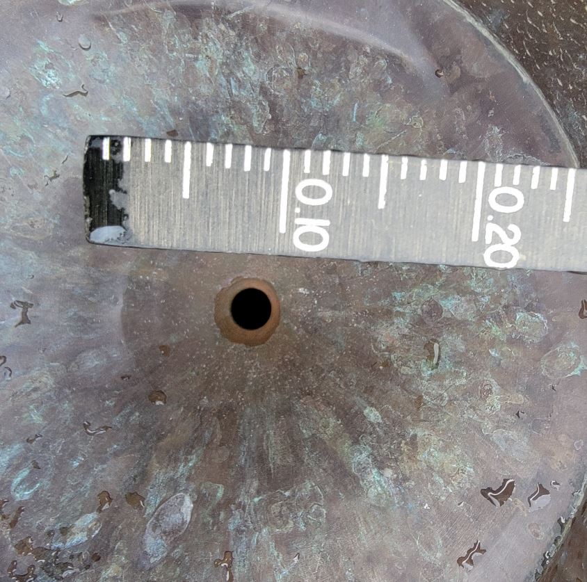
04/08/2024...6:30 am: The Saturday and Sunday storm total was (.66") here on the NE side, (.67") out at Miller Field. Glad to see Miller Field getting similar amounts. The Climate Reports is easiest way to see individual days here. Climate reports end and start at midnight automatically so looks a little different from the coop observations manually inserted daily at 6am.
04/07/2024...5:50 am: Low pressure is centered over us, you can tell by the radar circulation. The altimeter pressure reached 29.19 inHg on the barometer. Bands of rain are wrapped in the circulation, 70% chance of additional rainfall today.
04/06/2024...7:35 pm: (.37") here, Miller Field received (.41"). More expected later tonight and tomorrow. Barometer keeps on dropping, it's low 29.32 inHg, currently.
The updated NWS Briefing packet is out. Click the link above. Dated April 6, 402:pm
Several models have scaled back on precipitation as the event approaches, now in the (.60" to .80") range for Valentine. The ECMWF (European) however is still saying over an inch. A chance of a thunderstorm for today and night is also in the forecast. Yesterday afternoon the high wind watch expired with wind gusts not expected to exceed 45 mph for the Valentine area. The new (Snowfall Forecast) tab, 4th down from the top is also available. Temperatures have been trending cooler, so possibly areas in the panhandle could get more snow. Valentine still looks like all rain.
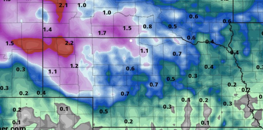
04/05/2024...Added a couple scripts, thanks to SE Lincoln Weather. The snowfall script should make next winter easier to relay potential snowfall, instead of adding links or publishing images. The briefing packets can be a pain because of browser cache issues. With the roundup script can easily check what's going on at the old stomping grounds even if in another State.
7:15 am: The NWS has issued a High Wind Watch. Little change on the ECM (European) overnight, still looks wet in the 1" plus area for most of Cherry County starting Saturday. Here is the morning ( GFS run ) No mention of rain to snow change over for Valentine, but further west in the panhandle this could occur with little accumulations expected. There is also a severe thunderstorm potential with this strong system.
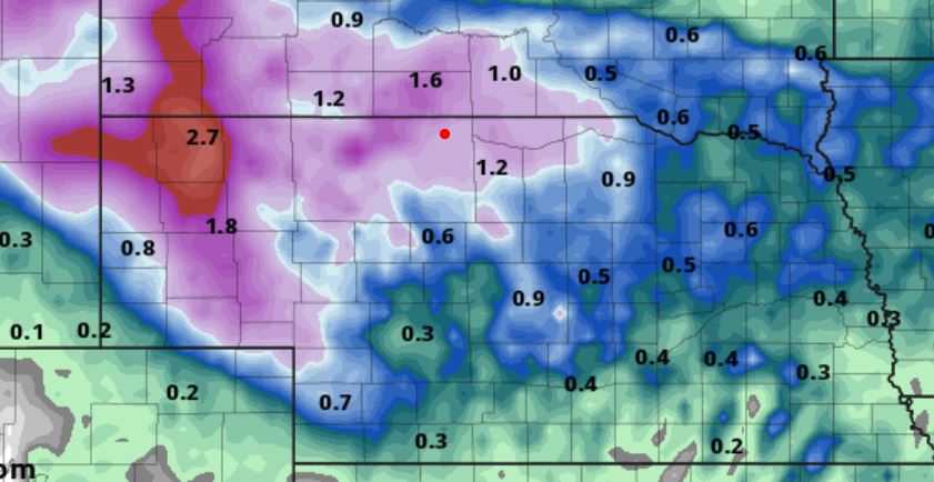
04/03/2024...3:25 pm: We are at a trace of snow with under 50% ground coverage.
7:30 am: The snowpack is down to 2 inches this morning. Looks like another wet weekend ahead, starting with rain and possibly a little snow. Still too early on how much and exact placement but does look unsettled. This is how much less snow fell just 5 miles south at the Y, showing only a trace this morning. Here in Valentine a solid 2" is still on the ground. It will likely be gone by the end of the day with the expected high near 50°.
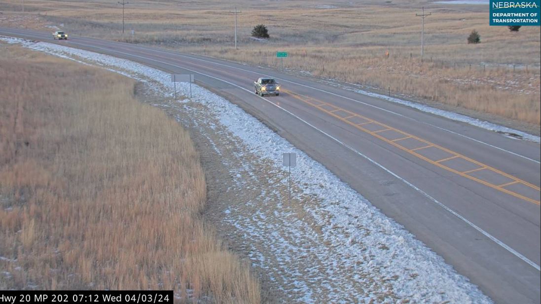
04/02/2024...5:40 am: 24° currently with a brisk 15-21 mph wind. The wind chill is 11°. The snowpack has settled to 5.7" this morning. Yesterday set records for both precipitation and snowfall for April 1st. You sure didn't have to travel far to run out of snow both south and east. Even the highway cameras 5 miles south at the Y (HW 20/83) looked like it received substantially less than Valentine. Now going west was a different story with Kilgore receiving at least 8".
04/01/2024...4:55 pm: Snow has stopped the storm total (7.7") with (1.15") of liquid precipitation recorded. (1.17") at Miller Field. This included the heavy sleet early this morning and possible rainfall (ASOS reported), it looked like all sleet here. (6.4") on the ground currently. It's a heavy wet snow with high water content, measured 1" of moisture in a core sample at noon. Yesterday's rain and today's snow totals 1.70" in moisture and very welcome.
6:00 am: At 5:45 (2.1") of new snow it may be another 1/2 inch by now, it's snowing that heavy with large flakes. Website was adjusted on precip.
4:10 am: There is a new NWS briefing packet out, click the link above and refresh cache if needed. Currently a heavy sleet with the temperature right at the freezing mark. Expected to change over to all snow soon as the temperature drops. Miller Field ASOS (33.8°) is +2° warmer and reporting rain which is strange. The Tempest south side reports 32.4° similar to here.
Didn't get a chance to put out the March 2024 summary, so here it is: March 2024 Thanks to the rainfall yesterday we ended slightly above normal and our temperatures were slightly below normal at the NE Valentine location. For a full look including wind data visit HERE. As far as snowfall (3.9"). March historically is around (7.4") and our snowiest month, this year however it will be April.
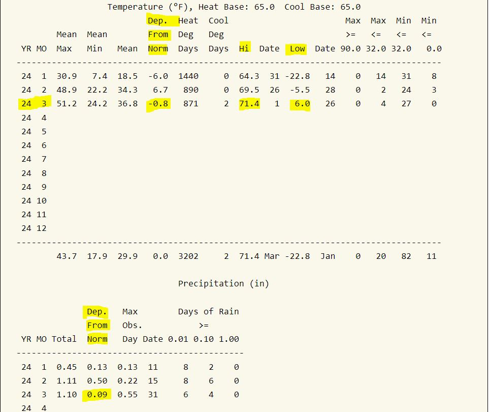
03/31/2024...9:50 am: No rainfall currently, so checked the manual rain gauge, we picked up another .21" since 5:50 am for a daily total of (.55").
5:50 am: Rainfall total is (.34"), coming down pretty good right now. The tipping bucket matches the manual very close so no adjustment. It's almost turning to snow. (34°)
5:50 am: Happy Easter, for the latest NWS briefing Packet on the current event, click the link above. A couple inches of snowfall is possible. Overnight we've had rainfall, will do a manual measurement just before 6 am and adjust website total if needed to match.
03/30/2024...1:15 pm: For moisture coming over the next few days, models ECMWF, Icon, have around 1/4" on the low end and 3 models (Gem, GFS, NAM) models showing around an inch. Lately we've been around the low end of models, but that could change. Have the snow measuring boards back down because we may see some snow mixed in, especially Monday, all snow. Not going to put the snow stake back out, the camera has been moved. It's back on the camera page link at the new location.
03/29/2024...7:30 am: The low this morning was 28° before the wind picked up. Currently 38° with a NW wind 15-27 mph. Looking wet starting Saturday night through Monday with a wintry mix of rain and snow. Here is what models say this morning for moisture amounts.
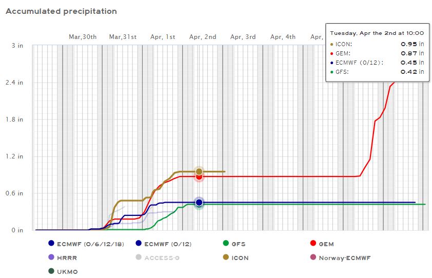
03/27/2024...7:10 am: Our low so far 9° here on the NE side, 10° at Miller Field, the clouds rolling in may have prevented it from dipping lower. Today we should get some good snow melting.
03/26/2024...1:25 pm: The quicker the snow melts the warmer we'll get, but it's struggling mightily today, 21° currently. We might make the forecast high temp (30°) because of the late March sun angle, something we wouldn't see in January. Getting some melting now even though it's well below freezing.
6:40 am: The wind has picked up over on the NE side of town, moderate breeze 16, gusting to 23 mph making for a (-11°) wind chill. It's not as windy on the south side of town, looking at the south Tempest station around 7-9 mph. One of those localized events that happens occasionally. BTW official wind chill is calculated off the the sustained wind speed and not gusts.
5:30 am: Very cold morning for late March, single digit 8° currently with the wind chill at -7°. We could drop a few more by sunrise. Heavy jacket weather today with wind gusts near 30 mph. This morning we still have around 1.5" of snow on the ground, but it should melt down a little with the March sun, even if we don't get out of the 20s. Yesterday we only reached 24° and that occurred around midnight so a very cold day in the teens with the wind and snow. It may warm to 60° on Thursday, but looks like another wet weekend coming up.
03/25/2024...4:45 pm: The latest NWS briefing packet is out, click the link above for details. Storm total for Valentine (1.6"), this includes what fell yesterday.
At noon, for snowfall we picked up another .6" (.06") melt since 6 am for a (.14") daily total since midnight. Still wind driven snow but has lightened from this mornings 1/4 mile visibility.
8:20 am: Down around 1/4 mile visibility currently. This is the hardest it's snowed. Reminder the website automatic tipping bucket can get behind when the heater is running like it is today. Evaporation becomes an issue, so every 6 hrs while it's snowing do manual measurements and adjust website to match. Example overnight the tipping bucket gauge only measured (.03"), but actual was (.08") caught in the 8" NWS gauge.
6:10 am: Manual measurement (.08") in snowmelt .8" total new, with 1" of snow on the ground. Click link above for the latest NWS briefing.
03/24/2024...10:35 pm: The forecast update for Valentine has a 70% chance of snow tonight 1-3" is possible mainly after midnight. Tomorrow another 1" with 70% chance. We do have some very light snow currently and radar is starting to fill in around the area.
8:30: Light freezing rain/mist.
5:25 pm: The latest NWS briefing packet for the upcoming strong winter-like storm is out, click the link above. What has changed, a shift south and east. Valentine has a 51% chance of 6" or more. Since this morning, models have been pretty consistent moving the high impact areas east and more south. Time will tell, we are still under a Blizzard Warning. Our high today was only 30° so below what was expected.
7:00 am: 2 tenths of an inch accumulation of snow and ice. (.22") collected in the 8" NWS rain gauge. Hmm, looking at several of the models this morning there is a shift east, we've already exceeded or near their current moisture prediction for Valentine before the main event has even started tonight. Complex storm, models may not have a great handle. We still do have a "Blizzard Warning" for Valentine tonight and tomorrow with between 5-13" snowfall potential. You can always check for the latest briefing update on the link above. If today's file (6:27 am) doesn't load, try holding Ctrl plus F5 and don't release until a new file loads. If Chrome refuses to show the latest PDF file, try a different browser.
4:55 am: Light sleet currently (28°). Cleared the ice from the snow stake camera lens. Very slippery outside with a layer of ice. Avoid using exposed stairs (steps) if possible. Going outside through the garage here.
3:57 am: Sleet, freezing rain mix now. 27° current temperature.
3:10 am: 27°, Snow started, huge flakes.
03/23/2024...4:15 pm: The latest NWS briefing packet for the upcoming strong winter-like storm is out, click the link above.
1:40 pm: At the noon hour we were down to a trace of snow on the ground.
6:00 am: 22° and light snow currently. 1/2" so far, overnight. It's the dry fluffy variety 20:1 ratio plus so piles up. Have the heater plugged back in on the tipping bucket rain gauge which can cause evaporation so website adjustments for snowfall are needed. Same with light rain the heater comes on around 40° and can cause substantial under count.
03/22/2024...4:05 pm: The latest NWS briefing packet for the upcoming strong winter-like storm is out, click the link above. Uncertainty still remains in regard to timing and track of the system, which will affect the transition period from rain to snow, precipitation types and amounts. The NWS Therefore, strongly encourage you to monitor the forecast as the storm evolves over the next 24 to 48 hours!
We picked up (.01") in rain before midnight. Models shifted back west overnight. Here is the latest ECMWF, 9". The latest NWS briefing packet for the upcoming strong spring storm is out, click the link above. If it's not dated March 22nd, 5:34 am try ctrl plus F5. Chrome is bad about not clearing the old cache. It took several tries here. Found this about Chrome always loading PDF from cache: Solution. Basically says use a different browser.
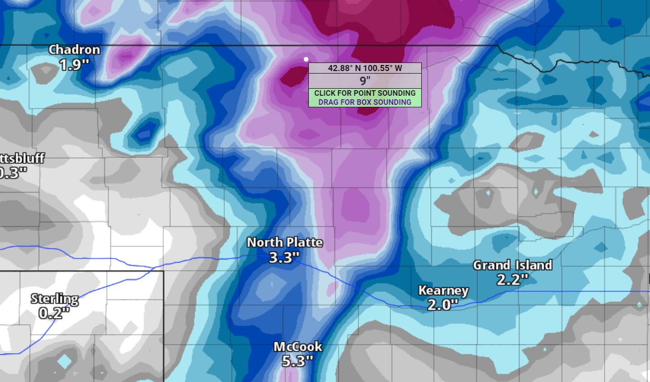
03/21/2024...5:50 pm: The latest NWS briefing packet for the upcoming spring storm is out, click the link above. The afternoon models shifted the heavier precip 1" plus of moisture further east. Valentine is still in the 1/2" range. Odds of getting 6" plus of snow did drop, now at 37%.
12:55: The snow stake camera is back up. (Cameras tab) A little different location, mounted on existing swing post.
6:00 am: The latest NWS briefing packet for the upcoming strong spring storm is out, click the link above. For Valentine, we have a 45% chance of 6" or more of snow as of this morning. The track of the storm can still change, this is what models are showing currently. How much snow also depends on temperatures, with rain change over to snow. Sunday night into Monday afternoon looks like the main snow impact period. There is some late season arctic air getting pulled down with this system, so it could be winter-like for a few days.
03/20/2024...4:40 pm: The latest NWS briefing packet has been updated, click the link above. Confidence is increasing in seeing wintry weather impacts early next week for much of central and western Nebraska.
When you hear or read the nation's low temperature at Peter Sinks, Utah. It's a sinkhole in the Utah mountains at (8,100 feet) elevation, with a weather station setup to record the extreme temperatures. The cold air gets trapped in the sinkhole, no one actually lives there or even close by. They also have a weather station setup on the rim where the trees are so they can compare. Be nice if NOAA would also include populated areas for national high and low temperatures. The current sinkhole temperature and more info is found under the links tab.
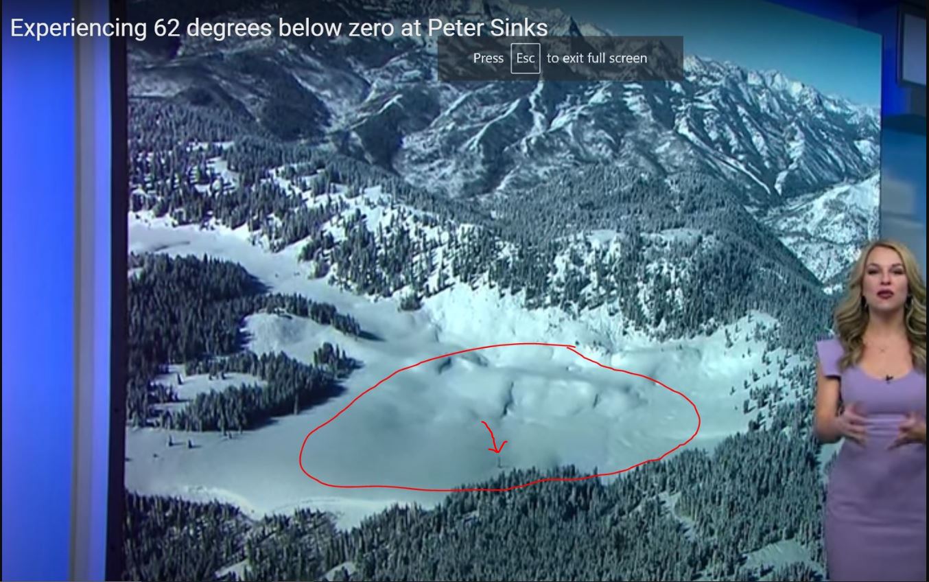
A potential for a strong springtime storm is increasing. Exactly where is still unclear. As far as temperatures go, it looks well below normal next week, even one model has Valentine getting below zero with highs in the teens, Monday through Thursday. So winter weather next week is looking possible. What temps actually occur depends on whether or not there is snow on the ground.
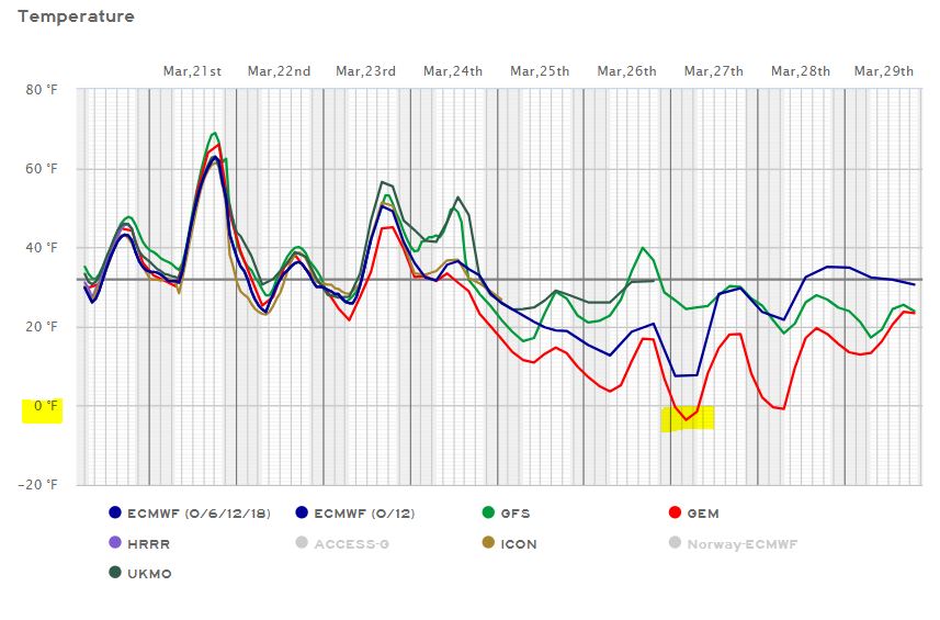
03/19/2024...Miller Field had a 55° swing yesterday from 5° to 60°. Climate report linked under "External links".
03/18/2024...5:40 pm: We had a 53° swing in temperature today from the low to high. (7° to 60°)
8:05 am: Final lows Miller Field (5°), South Valentine nearby (6°) and the warm spot here in NE Valentine (7°).
Cold this morning, with good radiational cooling on going, it's been down to 9° so far. A nice rebound is expected today, with upper 50s this afternoon. Starting Thursday night, moisture chances increase with snow possible over the upcoming weekend. Will update the final low temperature if it drops further before sunrise.
03/17/2024...8:00 am: Chilly morning 21° with a feels-like at 10°. Still no mention of moisture until Thursday night, so fire weather concerns have increased.
03/15/2024...7:20 am: We've dipped to 23° here and 21° out at Miller Field this morning so far. Clear sky and calm winds. No moisture chances until about this time next week. Starting off pretty dry this spring.
03/14/2024...We had such a mild winter 2023-24 in comparison to last winter. Here is a little reminder what it was like. This was just the start in (mid-December). There was around 4-feet of snow drifted against the house. The yard is on the same level with the plowed street.
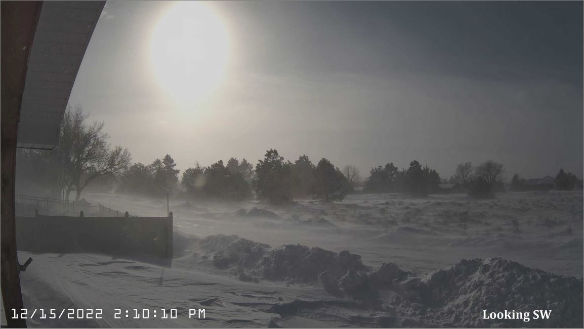
03/13/2024...The afternoon forecast from the NWS has been updated 30% chance of showers today and 20% tonight.
7:00 am: The latest briefing packet from the NWS on this upcoming spring storm is out. Click the link above. Dated March 13th at (4:16 am). Less impactful with no snow expected for the Valentine area. Looking at models this morning around a tenth here in Valentine with some models showing only a couple hundredths. Here is the latest European. If it pushes a little further northeast we could get a 1/4" at best. Big differences between the ECM and NAM, which is real wet across central Nebraska. The ICON (German) is more in line with the ECM (European) with the GFS being the driest.
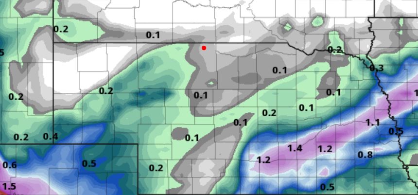
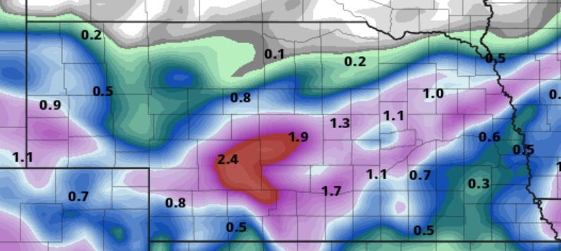
03/12/2024...4:00 pm: The latest briefing packet from the NWS on this upcoming spring storm is out. Click the link above. Dated March 12th at (3:22 pm) This afternoon it doesn't look like a lot of moisture for Valentine, but models can always adjust overnight.
6:30 am: For the upcoming spring storm and snow chances click on the briefing packet link above. Its updated to March 12th, 4:17 am. Try refreshing cache F5 if not the latest. Going to leave a permanent link for the briefing packets above but will still put out an alert when the NWS issues any new updates.
03/11/2024...Fire Weather concerns with a Red Flag Warning today. Looks like a good chance of rain later this week, starting Wednesday with a (1/2 inch) plus showing on several models this morning.
03/10/2024...Fire Weather concerns have increased. The NWS briefing packet is HERE. Ended up switching cameras around after having a failure on the snow stake cam, so trying out the dual lens camera again looking west. So far it hasn't acted up with a software update. No zoom ability on the dual lens camera but it does give a full 180° field of view.
03/08/2024...12:00 pm: At noon with the March sun and warm ground we are below 1/2" average snow depth, so a trace.
08:00 am: Was just told by the mail carrier delivering a package, the mail truck that comes up from North Platte did not make it today. North Platte set an all-time daily snowfall record yesterday, over 17". FYI I80 was closed in both directions this morning.
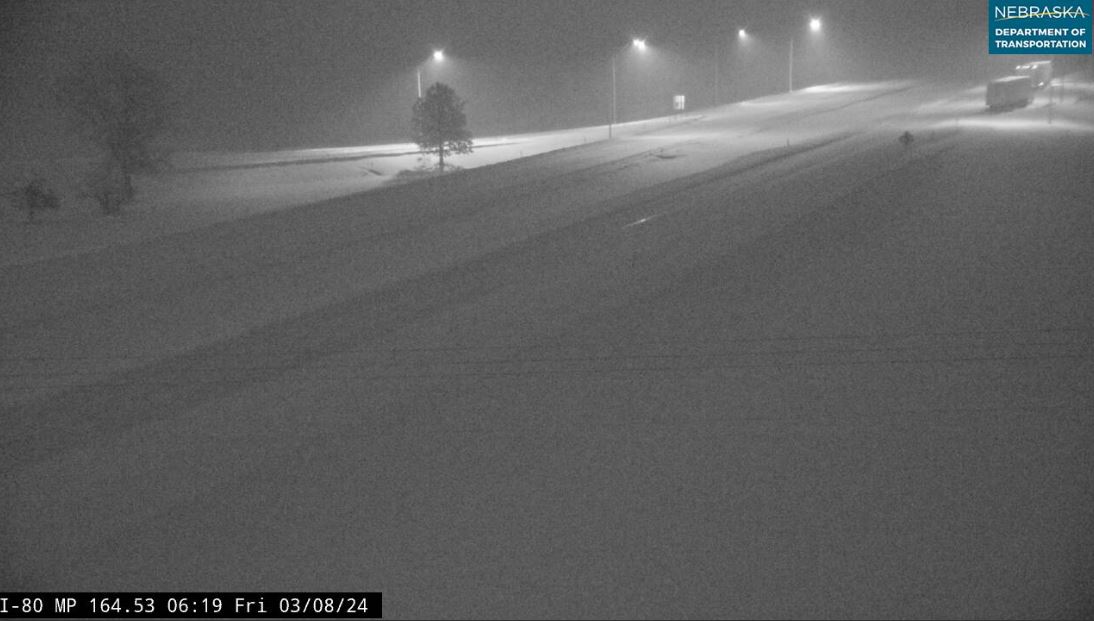
03/07/2024...11:20 pm: Snowfall has stopped we picked up another 3-tenths (.03") melt. Since midnight snowfall total (1.8") with (.16") in moisture content. Currently (1.2") on the ground. Miller Field reports (.19") in moisture content today. Not bad for a 30% chance, the moisture is needed.
6:10 pm: We picked up 1.0" of new snow making the daily total 1.5", (.13") was the melt here. It's not over, still light snow but small flakes.
5:45 pm: An accident on the HW camera near the Brownlee turn.
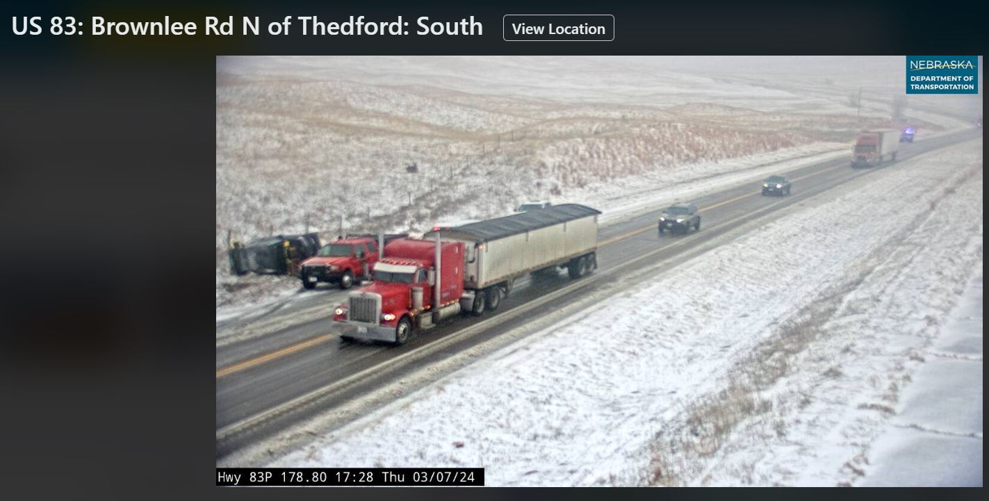
2:55 pm: This is HW 83 going south by Brownlee. Watching the radar there is some slight movement north also which may bring some heavier snow our direction eventually.
1:55 pm: We've been getting some light snow again, the 1/2" overnight has melted. Dew point is 22° so the lower atmosphere is getting a little wetter.
1/2" of new snow overnight, snowmelt (.04"). Still getting a few flakes occasionally. Western Cherry County is under a "Winter Weather Advisory" through tomorrow morning 6 am. Most of the heavy snow will stay down in the Ogallala, North Platte area. Here in Valentine snow chances are only 30%. Follow the NWS briefing packet linked for details. The latest NWS briefing packet is HERE. F5 will refresh browser cache for latest available.
03/06/2024...5:15 pm: Finally got some light rain. (Trace)
2:15 pm: Put the snow stake back down in the event we get some snow. Found under the cameras tab.
03/03/2024...A "Red Flag Warning" is still in effect for the area until 6 pm central. The peak wind gusts occurred earlier, wind has calmed somewhat this afternoon but still see gusts into the upper 30s. Today, gusts reached (47 mph) here and (49 mph) at Miller Field. The RH is low around 10% with the dew point near or slightly below zero. There is a slight chance of flurries or a sprinkle tonight (10%).
03/02/2024...With the rather light wind today the 3-shield comparison. From right to left the main FARS (fan aspirated shield) (H-65.4°), the Davis 7114-(65.4°), and Coop MMTS-(64.4°) so a full degree cooler. The first two shields use the same Sensirion SHT-31 sensor. The Miller Field ASOS reported (66.0°). The real test for passive shields comes later with strong summer solar and light wind in the sub 5 mph range.
4:50 pm: The NWS updated briefing packet is HERE. We didn't reach the forecast high today so the RH didn't drop as low as expected and winds have stayed rather light here in Valentine. A cold front arrives tomorrow bringing gusty winds of 45 mph.
Fire Weather concerns continue, with a "Red Flag Warning" once again today. The forecast high of 75° is close to the record of 76° back in 1974.
03/01/2024...4:00 pm: The latest NWS briefing packet is HERE, use F5 to refresh cache if not dated March 1st, 3:22 pm. The NWS issued a "Red Flag Warning" for today. Critical fire danger is possible so be careful, no open burning or running equipment that could cause a spark. The fire down south was caused by mowing equipment. The record high of 74° is safe today, 71° was the high today.
At 5 am (42°) with wind speeds already SW at 10-23 mph here in NE Valentine where it's much warmer than the airport (34°) with an almost calm wind.
For NE Valentine February, we came in (+6.7°) warmer than normal and + (.50") on precipitation. The summary is HERE
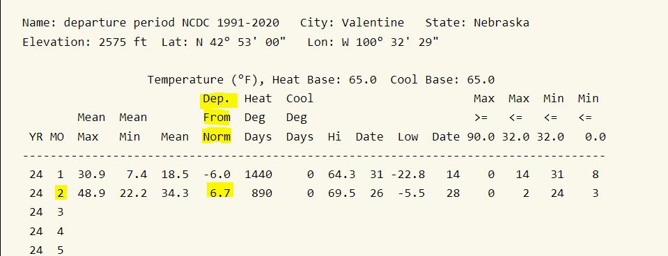
Leap day ...The latest NWS briefing packet is HERE. Covers fire weather concerns. This morning snow coverage is a trace around Valentine.
02/28/2024...5:15 pm: 11:45 am: 27° and just shy of an inch before noon. It should melt down this afternoon to a trace with mid 40s forecast. We still have partially snow covered roads around Valentine.
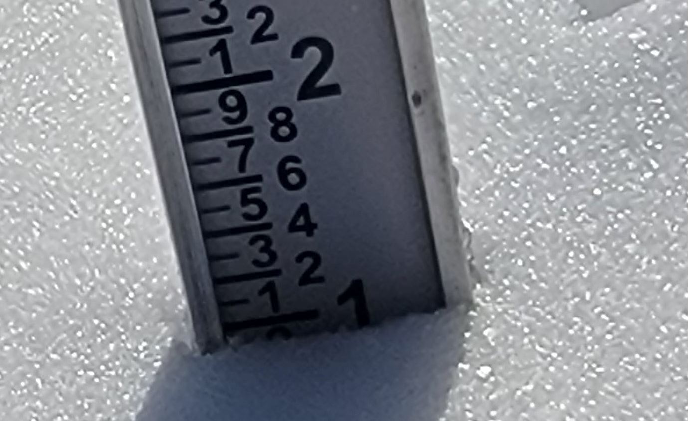
Below zero this morning with Miller Field down to (-7°) and here on the NE side (-6°). Locally here in Valentine around an inch of fresh powder breathing cold air remains from yesterday's snowfall and probably why we are below zero this morning. Expect a rapid warm up into the 40s today and maybe 70° by Friday. The old record is 74° on March 1st. Another slight cool down starting Sunday but doesn't look very cold. FYI today was our 11th below zero day for the season. For previous years starting in 2014 the comparison can be found HERE. The final lows at Miller Field and here will get updated should they drop further.
02/27/2024...5:50 pm: Just before 6 pm, 1.3" on the ground. Looking at the extended near 70° again Friday. What a roller coaster ride.
11:55 am: The snow stopped, measured (1.8") of new snowfall, snowmelt (.10") 18:1 ratio. The snow stake is low, noticed the powdered snow was blowing off the plywood for at least the first hour. Currently 11° with a -7° wind chill.
A Snow Squall Warning went out at 9:40 am for those heading south on HW83.
9:20 am: Still moderate to heavy snow. (1.1") of new snow (.05") melt so 21:1 ratio, very dry ski-powder (Alta Utah) snow. It's also only 12° outside, WC -4° currently. The next measurement and melt will be at noon using the 8" NWS gauge. Or before if it stops.
8:20 am: Heavy snow currently. Models didn't have a good handle on this storm. Really undercut the precip for us. That's why I mentioned the barometer yesterday. Usually when it gets that low something big will happen. I don't know how much will stay on the snow stake snowboard with the wind. You can look at the snow stake under the cameras tab. The precip for snowfall isn't real-time as soon as it lets up will do a snowmelt and adjust website.
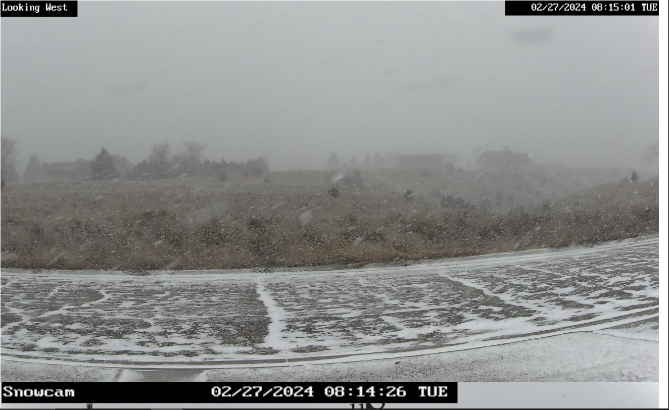
7:35 am: Getting light snow, the Valentine forecast updated, bumped the chance to 60% with a half inch or less possible before 10 am.
5:50 am: Put the snow stake back down, found under the camera's tab. Not expecting much if we do get any.
A taste of winter again today after the record high of 70° yesterday. The wind got high overnight with a 50 mph gust at 1:34 am. We have a 40% chance of snow for Valentine mainly before 2 pm. A cold day with the afternoon high around 26° and falling to single digits by morning. The latest NWS briefing packet is HERE.
02/26/2024...4:55 pm: The latest NWS briefing packet is HERE. Try F5 if not the (3:50 pm) packet to refresh browser cache.
Some may remember using the barometer to determine how strong a storm would be. Today it's low, currently 29.34" and still dropping.
2:05 pm: The snow chances tomorrow are down to 30%. A couple models are showing nothing for Valentine now. Had to reset the Nimbus thermometer, static electricity had knocked the calibration off. Some electronics are sensitive to getting shocked. Always try to discharge before touching. It's even knocked the portable AM radio out. FM still works, though.
We've had a couple grass fires, according to KVSH radio. The latest call out is just north of the SD border. At noon 66°, the RH is currently 20% reporting 19% at the airport ASOS. 20-38 mph NW wind speed. Update: the fire is under control.
5:30 am: We have a "Red Flag Warning" for the area today. The NWS briefing package is HERE. Only expecting a skiff of snow, with under 1/2" on Tuesday. Today a new record high for the date is likely, the old record is 68° with the forecast for Valentine 72°.
02/25/2024...4:05 pm: NWS briefing packet this afternoon HERE. This covers fire watch concerns and the snow potential starting Tuesday. Monday record highs likely to fall. Models have backed off a little on Tuesday snowfall amounts, but could change again overnight.
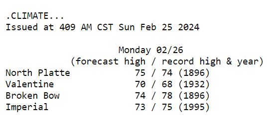
02/24/2024...6:00 am: Today the wind will pick up again after sunrise, but not as strong as yesterday, with gusts to 35 mph. Still looks like a potential record high temperature Monday here in Valentine.
02/23/2024...7:00 pm: Some areas will be under a "Fire Weather Watch" starting at noon Saturday. The NWS briefing packet is HERE. Windy today, the peak wind gust was 46 mph. Looks like Miller Field was the same. Doesn't look as windy tomorrow with gusts near 30 mph but warmer, getting into the 60s. We'll likely set a record high for the date on Monday.
5:20 am: Well above normal temperatures but windy, gusts could reach 40 mph today so difficult to enjoy the high temp mid to upper 50s today. Monday we could flirt with the record high of (68°). Light snow and much colder Tuesday, with Wednesday morning down in the single digits. It may not freeze this morning here on the NE side of Valentine with the wind already 13-20 mph. Miller Field has less wind, so has dipped to 27°.
02/21/2024...1:05 pm: Just noticed the snow mention in the forecast for Monday night. A little blip in our early spring. The snow stake will get put back down prior.
02/20/2024...With the spring-like weather even mid-60s next week took the snow stake down temporarily. The grass underneath the snowboard needs some air and sun.
02/19/2024...5:30 am: One of those mornings the wind is blowing harder on the NE side of town. Currently WNW 17-24 mph. We still have snow on the ground with under an inch average depth so a trace amount. Tomorrow and Wednesday with the forecast high of 58° should melt what's left except maybe those shaded areas. FYI the Miller Field ASOS visibility sensor will be OOS for a few days, needs a replacement.
02/18/2024...8:05 am: Updated lows this morning 7° here and 3° out at Miller Field, it came around 7:25 am. Still have a couple of inches of snow on the ground this morning, today's high temperature is expected to reach the upper 40's.
02/17/2024... Below zero this morning. (-4°) on the NE side, (-9°) at Miller Field. South Tempest near Miller Field (-7°). Got a report from the NW Valentine location near Catholic Church (-5°). We still have 3" of snow on the ground at 6 am. Expect a major warmup approaching 60° next week on Tuesday and Wednesday.
02/16/2024...1:00 pm: Still only 12° outside, with the wind chill at zero. Doesn't look like 21° will come close. It was 19° for our high, but that was at midnight.
11:45 am: The sun peeks through at times while it's snowing. Since 6 am we picked up another 1/2". (.02") melt. Very cold only 12° as we approach the noon hour with snow flurries.
6:00 am: 0.1" of new snow since midnight, .01 melt. Updated both snowfall report and website. (3.0") storm total. (.23") snow melt. A couple models were right on. Had a feeling the way this winter has went 4-5" was pushing it. So different from last winter. Nobody wanted a repeat. Killed some areas of lawn grass last year with the heavy snow drifts that didn't want to melt. We were 50+ inches this time last year. Only 18.4" this year. Day and night difference with El Nino and the strong southern jet stream. Last year with La Nina we stayed wet, 35" total rainfall here on the NE side while areas of the State suffered drought. Will be interesting how this year goes.
At midnight today snowfall today is 2.9". Melt (.22").
02/15/2024...6:00 pm: Manual snowmelt and measurement (.11") so far today. (1.5"), currently 1.4" on the ground. There will be a midnight measurement today with the ongoing snowfall. Adjusted website. FYI the tipping bucket and heater are off due to excessive evaporation, so decided to manually insert snowfall melt since I was doing it anyway.
3:50 pm: The afternoon NWS briefing packet is HERE. If not dated Feb.15, 2:37 PM try refresh F5.
12:00 pm: At the noon hour measured (.6") of new snow. Snow melt (.04"). Currently, snowfall is light. Adjusted website to correct snow melt. Melt ratio was a little drier than was anticipating. Snowfall melt is being inserted manually.
10:15 am: Snow, can still see water tank hill (.64 mile) barely. The ASOS says freezing fog but it's more like heavier snow, don't see any fog. Will be doing a snowmelt and measurement just before noon and adjust website precip. This got going a little earlier than expected. Right now the heavier snow is centered around Valentine per the radar.
8:25 am: Getting some light snow.
The morning NWS briefing packet is HERE. If not dated Feb.15 try refresh F5. Models have trended south similar to what the German Icon was showing yesterday. Here is what the ICON is showing this morning for Valentine (4"). Looks similiar to the NAM which has 3" for Valentine. Didn't include the ICON yesterday because it was the odd model out but looks like others are following today.
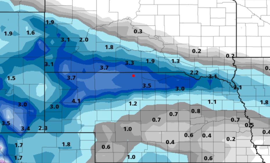
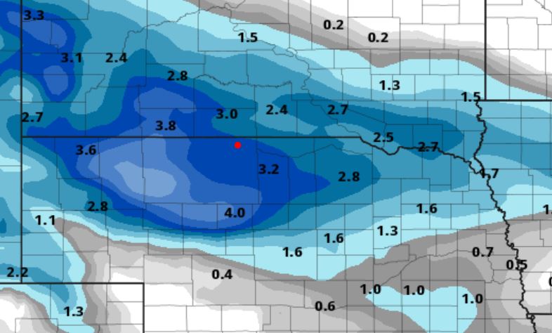
02/14/2024...The afternoon NWS briefing packet is HERE. Uncertainty still remains on snowfall amounts being on the southern edge. A track further north less snowfall, tracking further south more snowfall.
1:35 pm: Chilly outside currently 29° with a NNE wind 11-20 mph. We made 36° before the cold front pushed through. Looking to the west looks like fog is starting to develop here also. Water tank hill (.64 mile) disappeared.
7:50 am: Updated latest (European ECM) and added the HRRR. With this upcoming system, the NAM overnight has slid the snow accumulation area south. Looking at models 3-5" using the 10:1 ratio. A look at models individually ECM, GFS, NAM, GEM. and the HRRR.
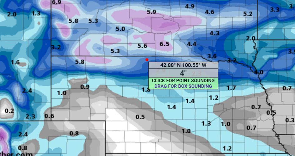
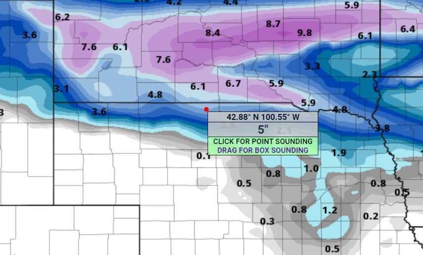
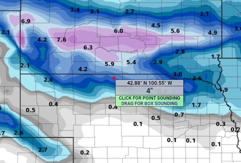
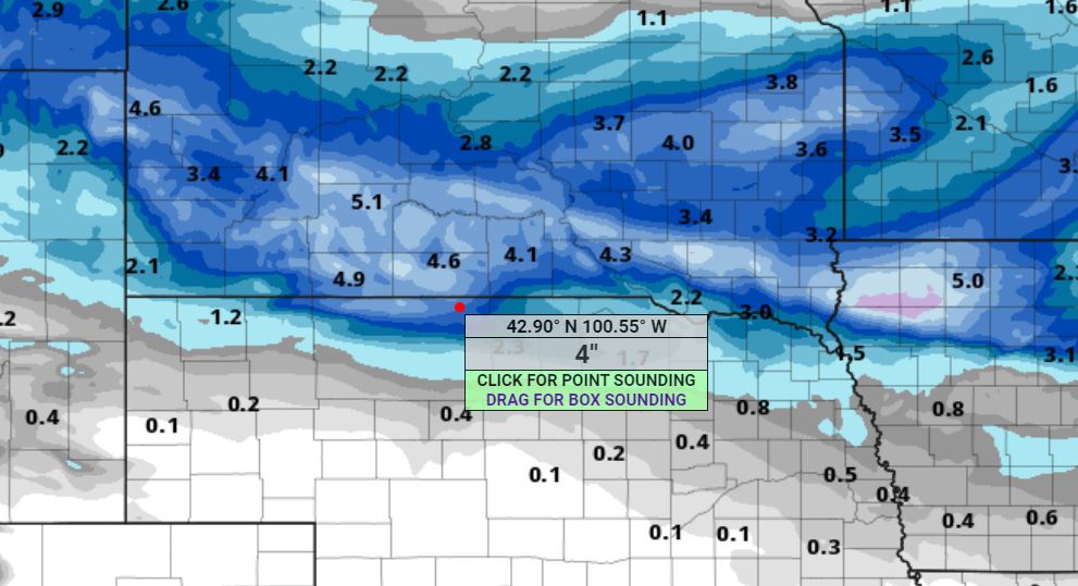
02/13/2024...4:00 pm: The NWS afternoon briefing is out. Still some uncertainty about snowfall for the northern areas. Not every model is on the same page, several have 3" with a couple including GFS around 5". One model however the NAM keeps most of the snow in South Dakota. Maybe more agreement by morning. A few sprinkles around the area currently.
Looks like models are coming together on how much moisture this system could bring for Valentine, using the 10:1 ratio it translates to around 3" of snowfall on the European and as much as 7" of snowfall on the midnight run of the GFS which could be overdone. 3-4" is the more likely amount. The heaviest snowfall stays in South Dakota with lesser amounts as you travel south.
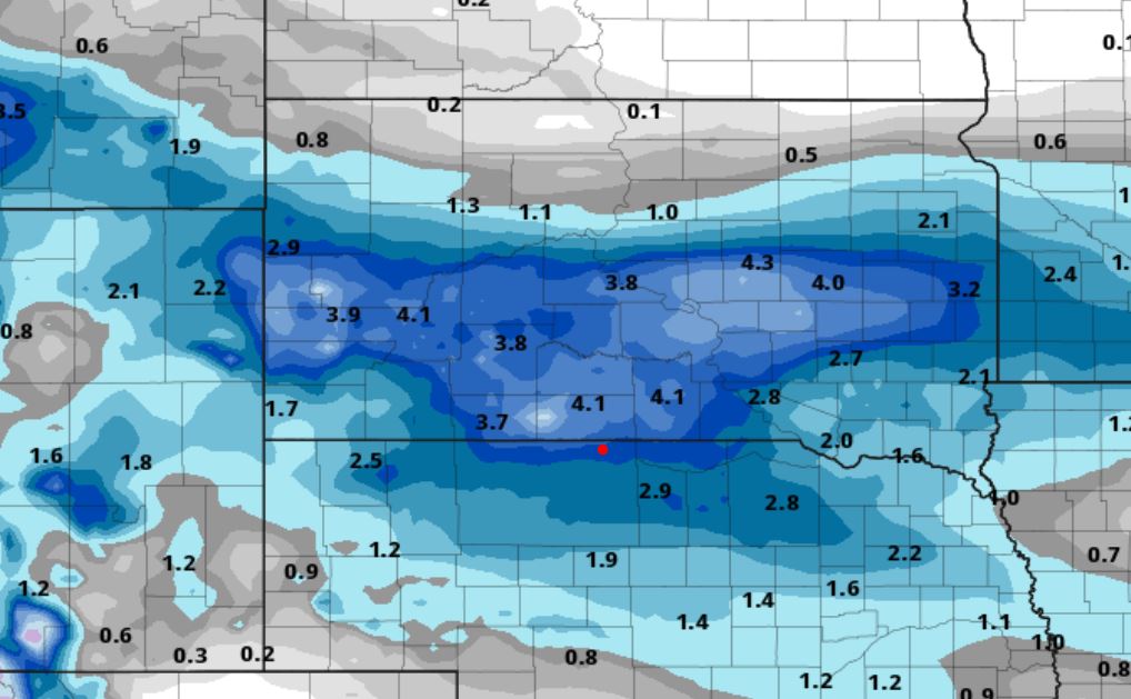
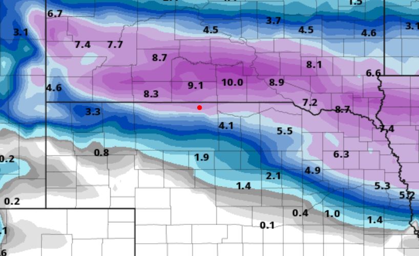
02/11/2024...7:20 am: Winter-like temps return later this week with snow chances starting on Wednesday. Models are not all in agreement on how long it lasts. The European keeps freezing temps through the 10-day starting Thursday, while the GFS and GEM warm right back up. (Models) It looks like a potential of several inches of snowfall is also possible. Still early on so this could change. We still have just over 1/2" of snow on the ground this morning but should melt down rapidly with the forecast high of 46°.
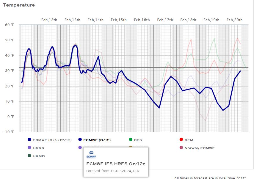
02/10/2024...6:10 pm: (.7") of new snow, .07" in melt. We may have a few light flurries for awhile.
4:30 pm: The afternoon NWS briefing packet HERE. Still have some very light snow falling but it looks about over.
Reminder snowfall will not be in real-time. Manual snowmelt measurements will be done and inserted for website precip. The tipping bucket heater just doesn't work correctly. It evaporates about 50% of what falls, especially if snowfall is light. The heater also evaporates light rain when the temperature is below 45°. Heavy snow does better but decided to just do it all manually so the tipping rain/snow gauge is disabled for snowfall. Have two different 8" gauges. One will be used for the website the other is the official 6-hour measurement can.
02/09/2024...5:20 am: We had a light dusting of snow early yesterday evening. Only a trace amount. The wind was strong yesterday with a peak gust NW at 41 mph. Gusts hit 40 mph several times in the afternoon. Here is the WU graph. Also found in real-time under "External Links", Weather Underground Dashboard. Data on the dashboard is the same as the website in real-time. Any corrections like precip after manual measurements may not show on WU, however.
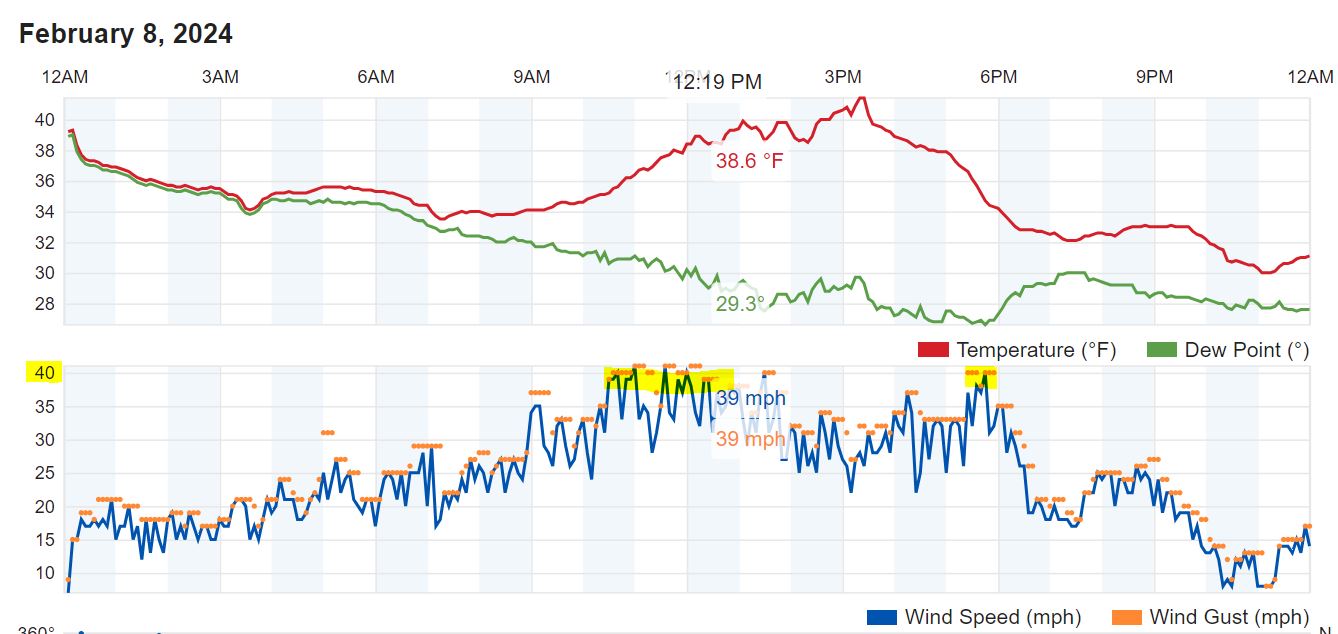
02/08/2024...7:00 pm: Getting some light snow.
6:55 am: Getting light snow currently. (34°) Picked up another (.01") in moisture (mainly rain) since 6 am.
6:00 am: Currently, the rain has stopped, radar still shows echoes in the area. Precip total overnight sits at (.30"). We did have some large flakes of snow mixed in. The HRRR was the winner among models predicting (.31").
Once again less reported at the airport ASOS (.22"). Something is off, these 8" rain gauges here are not wrong. Last year this side of town ended up with almost 5" more rainfall vs the airport ASOS. Some events were explainable with thunderstorms but being consistently higher isn't. Think I'll get permission to set up a 4" gauge at the airport. At least do a few comparisons once we get in the rainy season. I'd feel better knowing the ASOS gauge was right. I've heard how accurate those weighing gauges are but would still like to see a comparison check done because of the large difference that occurred last year. And we seem to be going in the same direction again this year.
02/07/2024...4:20 pm: Looks like we may get rain tonight. Here are the models. The 18z NAM not included on graph says (.22"). It's a rather narrow area where rain is expected to fall so only a 60% chance should it wander a little off course. Today was another well-above-normal day, the high came in at 62° here on the NE side.
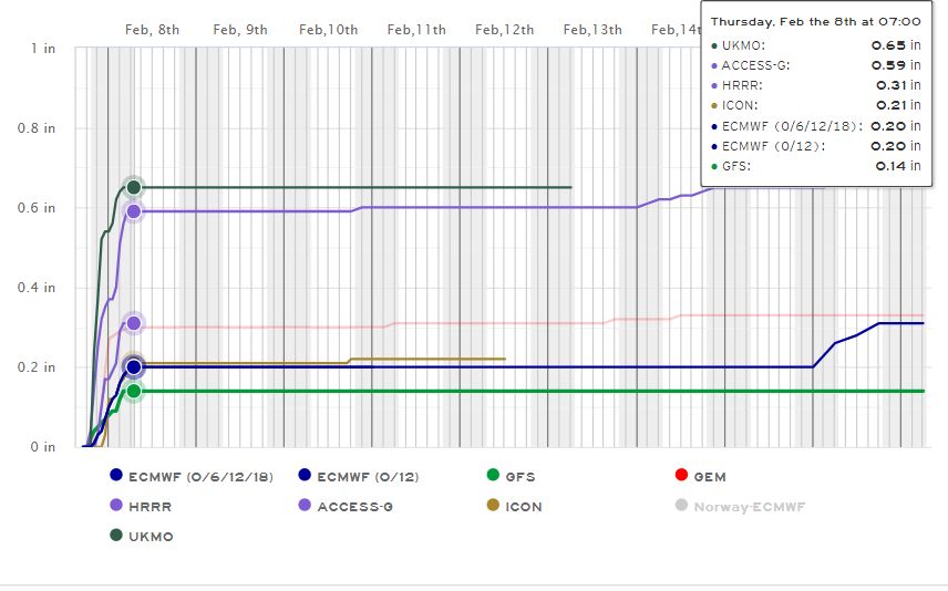
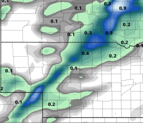
6:00 am: Very warm for a February morning (41°) with patchy fog this morning. There is a "Dense fog advisory" for this morning, it expires at 10 am.
02/06/2024...We made 62° today for a high. This weather is just too nice for this time of year, keep thinking we'll have to pay the piper eventually. But still, nothing looking that bad in the 10-day. The upper 30s our coolest day is just normal.
02/05/2024...8:25 am: The fog is clearing off. Watch your step it's icy.
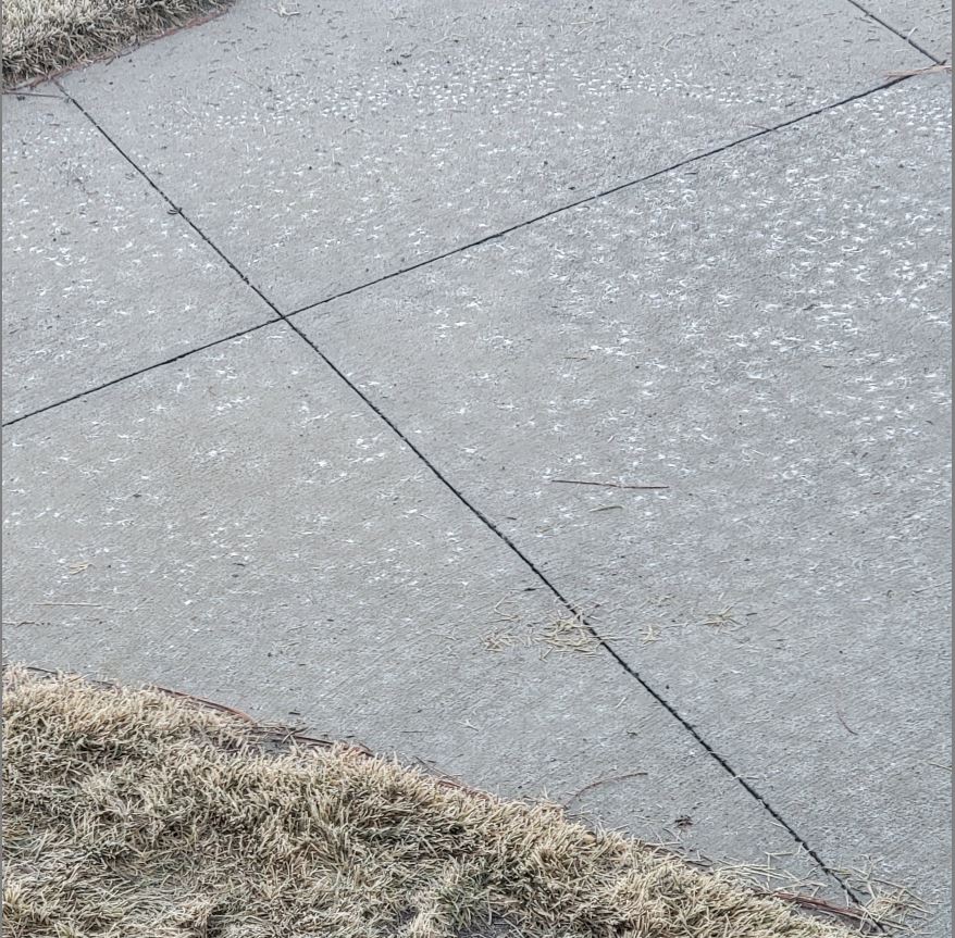
02/04/2024...11:45 am: We did pickup (.05") since 6 am for a storm total of (.37") here at the NE Valentine location. Unusual to get rain this time of year but it does happen occasionally. Now the relentless fog was the first I've experienced, we get fog occasionally, maybe for a few hours in the morning but not for 24 hours plus.
6:00 am: (.32") is the total rainfall on the NE side so far. Both the 8" rain gauges recorded the same amount. Miller Field reports (.29") in the same 24 hours.
02/03/2024...6:00 pm: Currently (.15") on rainfall today.
2:00: pm: Light rain, we have (.03") in both 8" diameter rain gauges, much fell as heavy mist with the fog. Adjusted website to match.
8:30 am: Dense fog continues overnight into the morning with near zero visibility currently. We've had a little drizzle too. Currently 33.3° same on the Nimbus. I've had some concerns running the main station FARS (Fan Aspirated Radiation Shield) and all the moisture so emailed someone who has a lot of experience along the Gulf with 100% RH and water, he said the sensors would survive the moisture just takes a while to dry out.
02/02/2024...Updated: 2:35 pm: Still very foggy, Not zero visibility but very low, under 1/4 mile. The latest European model run is HERE. The 18z HRRR (.25") It'll change for sure, this model runs hourly. Here is the 18z NAM(.17") .
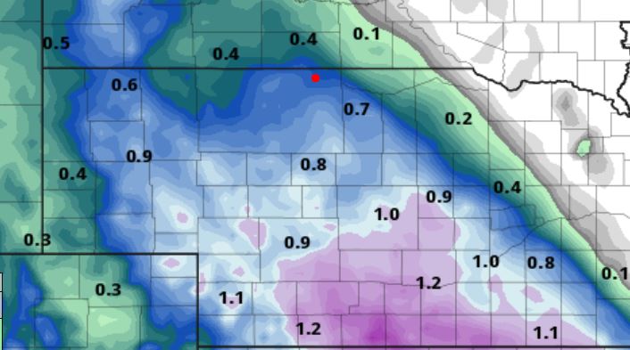
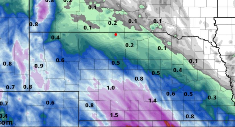
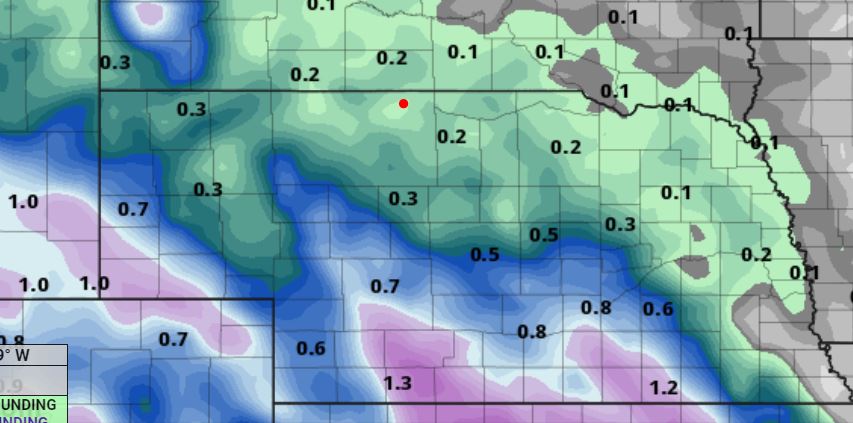
The morning NWS briefing packet is HERE.
5:00 am: Currently dense fog, visibility at Miller Field reported zero at times. The good thing is it's not freezing, thermometers aren't iced over either so reading correctly. Models are still jocking around moving back west again, for Valentine saying 1/4" to 1/2" of rainfall is possible this morning.
02/01/2024...7:00 pm: The fog developed around 7:pm.
Here are the final numbers for January. For this upcoming wet period the model range 1/4" to just over 3/4" with the wetter GFS for Valentine. Still a little early 2-days out, models may continue to adjust as it nears. Even then they are not always right but it does look wet helping melt the remaining snow. Models am Feb. 1st The NAM this morning around 1/2".
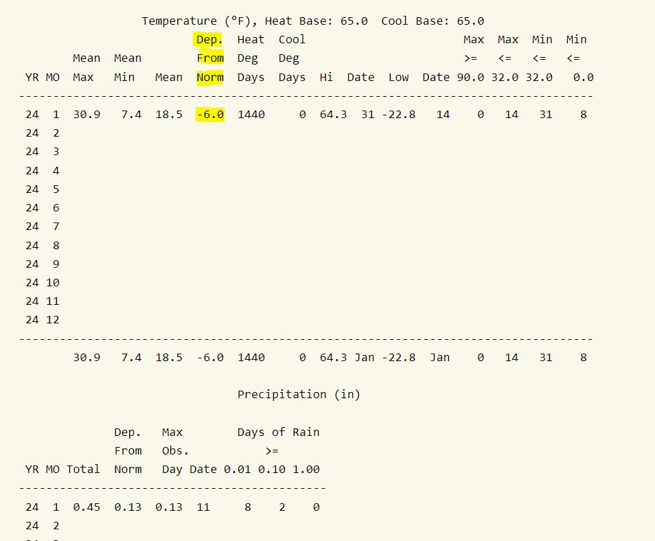
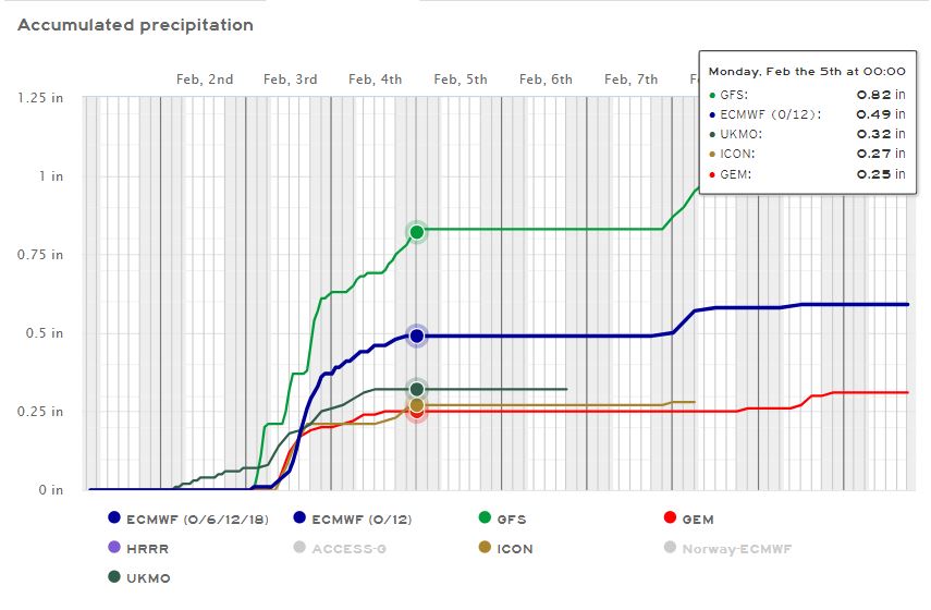
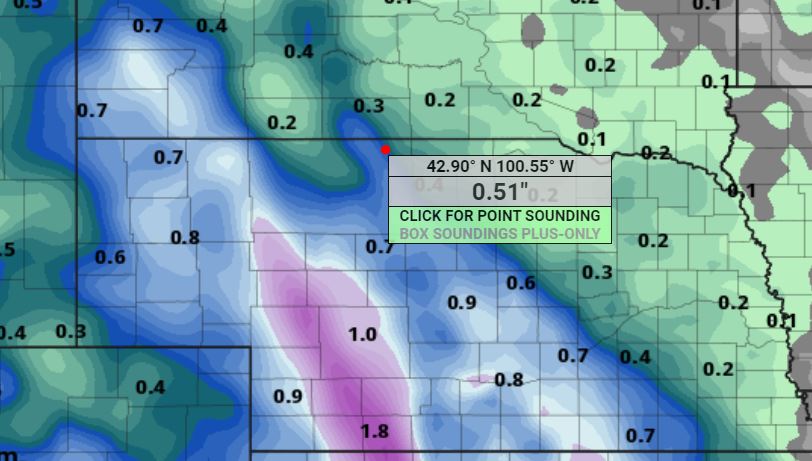
01/31/2024...4:30 pm: Several are curious and watching the Nimbus using the gill shield which is non-aspirated, on how it compares to the aspirated shield. Today it recorded H-65, L-26°. The aspirated shield thermometer recorded H-64°, L-26°. We did have a light SW wind today running 4-7 mph currently. Not sure how it will compare once the sun angle gets higher. Most days they match especially if it's breezy. Occasionally the aspirated shield will dip a degree lower on still mornings likely due to faster response times.
01/30/2024...5:00 pm: With the warm temperatures checked the frost depth using a wire marking flag, the average depth unfrozen turf is 4" here this afternoon. A few areas checked are still frozen to the surface but they are the exception. We may be okay with the upcoming rain plus one more very warm day tomorrow (mid 60s) in front of the wet weekend ahead. Fully exposed areas, like the field across the street all the snow has melted. Only areas that catch some shade during the day or drifted areas like around the snow stake still have snow on the ground.
5:15 am: It was a couple of degrees warmer at Miller Field yesterday both on the high and low temperatures. (H-54°,L-28°) on both Nimbus and main station thermometer here. Probably a little less snow on the ground at the airport. Well above normal temperatures with continued snow melt through Wednesday. Noticed yesterday water was pooling and taking some time to soak into the frozen ground around the snow stake. The forecast starting Friday night is for mostly rain chances with exact amounts still unclear but a 1/4" plus looks likely using last night's model runs. Whatever rain falls will have issues soaking into the ground. Normally we don't get large amounts of rain with frozen ground so not an issue.
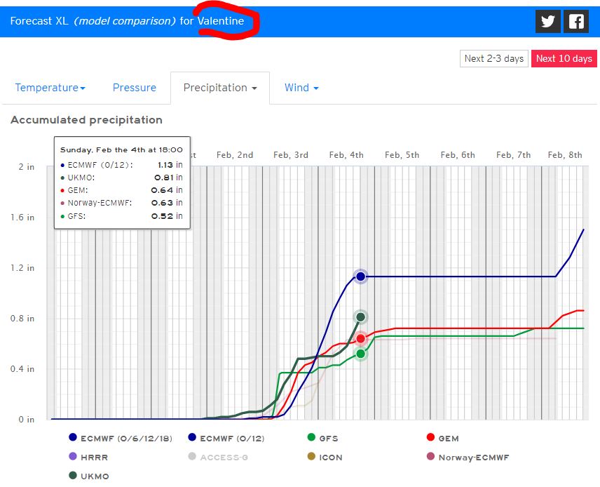
01/29/2024...Not much to mention except the ongoing January thaw. We are melting snow daily and should pick up more melting with a forecast, low 60s Wednesday. Starting Friday night chances of rain showers leading into the weekend, possibly mixed with snow showers later depending on temperatures.
01/26/2024...5:45 pm: The snowpack is under 50% coverage now but still deep in areas. The deepest drifts at this location are 40"+, 23" and 19". With under 50% ground coverage, it's measured as a trace, doesn't matter how deep the drifts are.
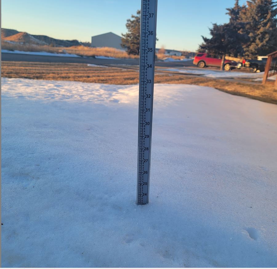
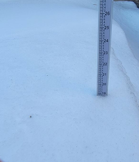
A peek down the road, models are starting to get on the same page. Here is moisture with the European the most and here are temperatures. Still beyond the 7-day so nothing definite this far out. Looks like a Pacific system on the southern jet looking at temperatures.
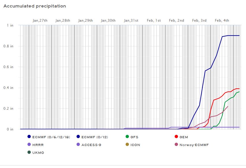
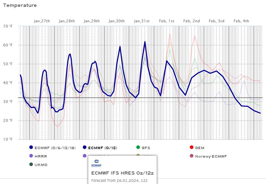
5:35 am: The fog advisory was lifted for Eastern Cherry County. There is a hint of moisture around the 2nd of February.
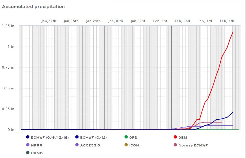
01/25/2024...6:05 pm: On level unshaded ground, the snow depth is about 2" on average this evening in the undisturbed areas. FYI the snow stake is about the same for reference. We topped out at 48° here on the NE side and at Miller Field today. Fog is the question for tonight. Does it develop and if so how thick? Some areas to our east have fog already.
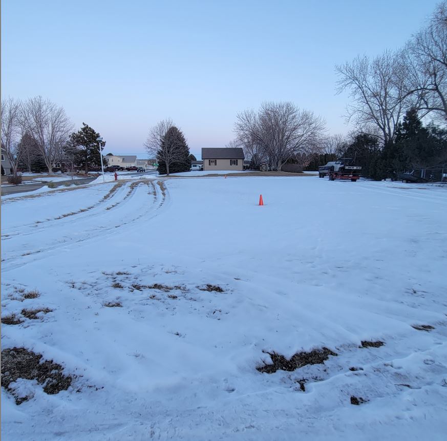
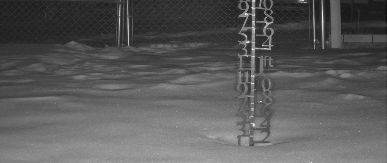
2:00 pm: Pushing 50 today. 48° here and only 2 pm so just maybe.
Starting out pretty warm this morning for January. The snow on the ground is still tempering our daytime potentials due to slow melting with the low sun angle and short days. Noticed yesterday while driving around, some areas of town still have snow-covered streets.
01/24/2024...No issues last night with freezing fog and thermometers around town. There were some areas that had fog, noticed water tank hill disappeared for awhile but it wasn't continuious like the previous night and nothing got coated in ice so the RH's also looked normal even at 100% out at Miller Field. The RH probe here at the NE location takes some time to fully saturate so only topped at 96%. The Nimbus wasn't running 1-2° below the aspirated main sensor at this location either. Another sign nothing froze up last night. Heavy freezing fog with "Hoar frost" really does mess with the instruments.
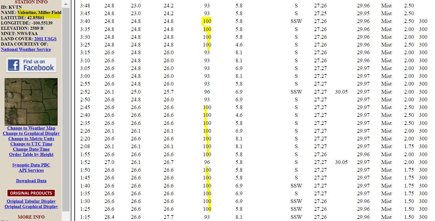
01/23/2024...6:00 am: Currently freezing fog with exposed areas all coated with ice, the fog at times gets down to near zero visibility, and the RH is only 89% which is too low, best guess is the sensor got iced over. The aspirated temperature sensor is also running +(1°) above the MMTS gill shield. Probably has something to do with icing also. The older CRS (Cotton Region Shelters) AKA Stevenson Screens probably work best in freezing fog. They still use the CRS on Mount Washington and in Canada for good reason. These aspirated shields pull high volumes of air across the sensor, this will always cause issues once the sensor freezes over with ice fog. This is what's going on at Miller Field ASOS, the ice buildup on the sensor acts like a blanket and has caused the aspirated temperature sensor to warm. You don't have 79-85% RH with freezing fog. We don't get that much ice fog here but now it's occurred twice this winter. Both times the same symptoms occurred with warming air sensors once iced over which lowers the RH. The dewpoint temperature sensor is non aspirated and separate on the ASOS reading (12°) which is also the actual air temperature with thick under 1/4 mile ice fog.
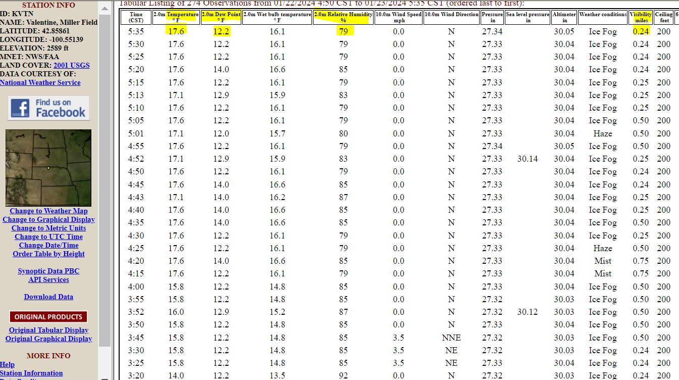
01/21/2024...Updated: Today will be the first time above freezing since January 10th at 5:20 pm. The freeze data page is HERE. (22) consecutive days is the most back in 2017/2018. Update: Added a zero data page HERE.. Found under Reports/Daily also. Only 8 so far this season with fall and December being so warm. This year 2024 Jan 12th has been the latest date to reach zero.
01/20/2024...We bottomed out at (-18°) this morning, same out at Miller Field.
4:40 am: Calm wind this morning, currently (-18°). Don't think the record low of (-24°) is in danger. It's been hanging in the (-17 to -18°) range for a couple hours and not rapidly dropping. It may dip into the -19 to -20 range by sunrise if the south wind doesn't pick up.
01/18/2024...5:45 pm: Updated: Snow melt is (.11"). The snow stake measured closer to 2" of new snow. Both the two 8" diameter gauges collected (.11") in moisture. The snowfall today (1.6").
3:38 pm: Getting snow again, not just blowing snow. Doesn't look like it will last long, because radar is not picking it up at all. You can see water tank hill (.64 mile) is disappearing.
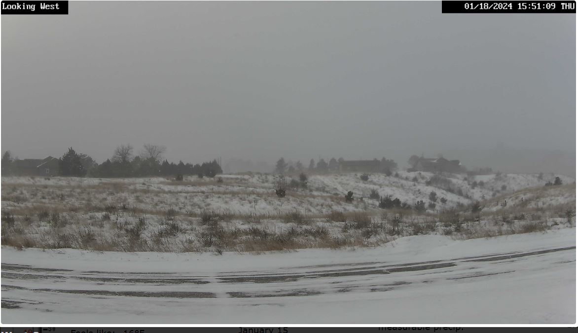
9:20 am: Under a tenth of a mile visibility with very heavy snow currently. Notice the temperature crashed, now at 9°. The morning forecast from the NWS has changed now says snow before 1 pm, instead of best chance between 1 and 3 pm.
8:47 am: This snow the air temperature is warmer (16°) vs the last arctic air blast so flakes are larger. The house on the right is (.14 mile), left side (.10 mile) so we are around 1/4 mile visibility currently. I'll say it's heavy snow vs fog currently. As you can see on radar it zeroed in on Valentine. About the time it was looking like maybe just a dusting per several models, heavy snow. Mother Nature saying, Not so fast.
8:14 am: Light snow started.
Another shot of arctic air arrives bringing a 60% chance of new snow, locally up to 1" is possible. The timing for best snow chances looks like today noon to 3 pm per the morning forecast. Wintery weather with wind and blowing snow is possible through Saturday with the wind chill dipping into the -20s. Starting Sunday upper 30s with low 40s for highs next week.
01/17/2024...5:00 pm: Light snow, looks short lived on radar.
The afternoon NWS briefing packet regarding the upcoming wind and snow event is HERE. Models this afternoon have trended snowfall east, still 1 to 2" possible for Valentine but only a 21% chance of 2" plus.
The snow stake this morning 1.5" , it was cleared last week so add a couple inches for total snowpack. We've had so much wind it's not exact, between 3.5 and 4". Potentially 1-3" of new snow coming Thursday.
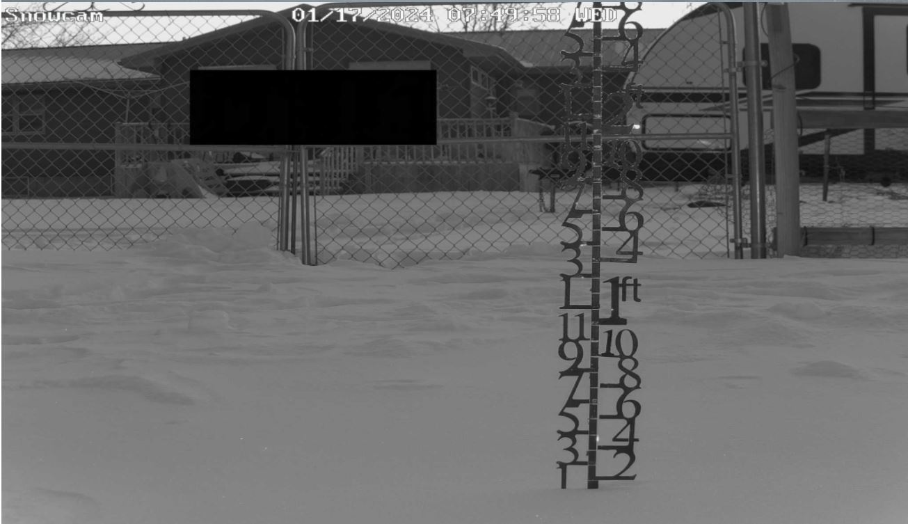
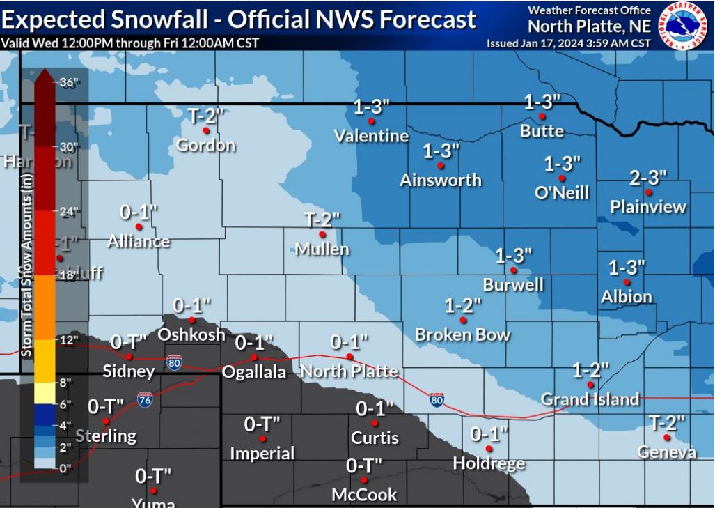
FYI this NE station is linked on Weather Underground also. Frederick Peak Golf Club also has a thermometer online, it was 3° this morning. It's not in real time however. For the WU link go HERE. Not a bad idea to bookmark as a backup should the website go down.
01/16/2024...We got above zero (0°) for the first time in 103 hours and 29 minutes at 10:33 am today. (4.3) days
9:15 am: The final low this morning at Miller Field was (-17°) and here on the NE side (-16°). Yesterday however Miller Field reached (-3°) for a high temp but the NE side with the extra wind only reached (-4°). So it evens out.
6:00 am: We finally pull above zero today and tomorrow with the high temperatures. Starting tomorrow night snow chances increase with Thursday snowfall in the 1-3" range expected currently. This brings in another shot of arctic air but not as cold. Our temperatures return to normal upper 30s on Sunday. Yeah!
It went below zero on Jan 12 at 3:04 am, today makes 4 full days at the same time we've stayed below zero. More on this later. More wind on the north side of town vs south especially yesterday, when 40 mph gusts occurred on the north side. It's starting to slow which will cause the thermometer to drop as it does this morning. (-16.6) at Miller Field, (-15°) here currently.
01/15/2024...11:00 am: Looks like the Niobrara River near Sparks has an Ice Jam. A warning just went out. The wind has calmed down some on the NE side. 23 mph gusting to 35 mph. Don't know if we'll make that -2° today. So far not a lot of movement, -10° currently which is 1-degree less than at 6 am. The wind gust of 44 mph today is the highest of the month. The Highway weather station just north of the border recorded a 47.4 mph gust about the same time. Not sure why Miller Field isn't having the same gusts. The quality control is red on the HW station because the road temperature sensors are disconnected or bad. They've been like that for months but the main instruments are working fine.
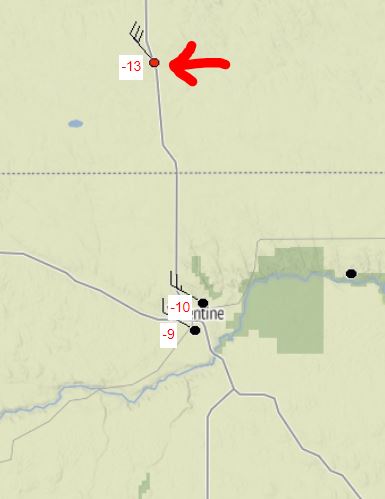
6:05 am: Currently (-9°) with cloud cover acting like a blanket. Still very cold with the wind Chill at (-33°). Today will likely be our last sub-zero high temperature for a while. We may get close to zero with the HRRR saying (-1°), and forecast (-2°). Another reinforcing shot of arctic air arrives midweek but not as cold with more chances of snow. Eventually, we come out of the deep freeze. On Sunday the forecast high is in the upper 30s which is normal for January.
The morning NWS briefing packet is HERE. Click F5 to refresh cache if not dated Jan 15th.
01/14/2024...The morning NWS briefing packet HERE. Click F5 to refresh cache if not dated Jan 14th. A little more wind on the NE side of Valentine currently vs the airport side. Still have a wind chill of -48° with a WNW wind of 15 to 21 mph. Should the wind subside around sunrise as it's done before the thermometer will drop. Currently -22° at 4:40 am.
01/13/2024...Today, the record low high temperature was crushed, whether you use the midnight -9° or daytime -15°. The old record low high was -5°. The forecast low is (-28°) which will tie the old record also -28°F in (1979). There is a slight chance the wind will decouple a little more, if that happens the record low could be broken also tomorrow morning.
Updated: At 12:50 pm it's still (-17°) below zero with a (-48°) wind chill.
8:30 am: Currently (-20°) with a 29 mph sustained wind (-53°) Windchill. When it gets this cold I give the heat pump somewhat of a break with supplemental sealed oil bath heaters. They are the most efficient design with the oil inside so run 3 of those units along with the heat pump so it's not running constantly.
The morning NWS briefing packet HERE. Click F5 to refresh if it's not dated 1-13.
8:15 am: Currently (-20°) below zero with the wind chill at (-53°) here at the NE Valentine location. The Nimbus follows the main station (Sensirion) sensor well. Image
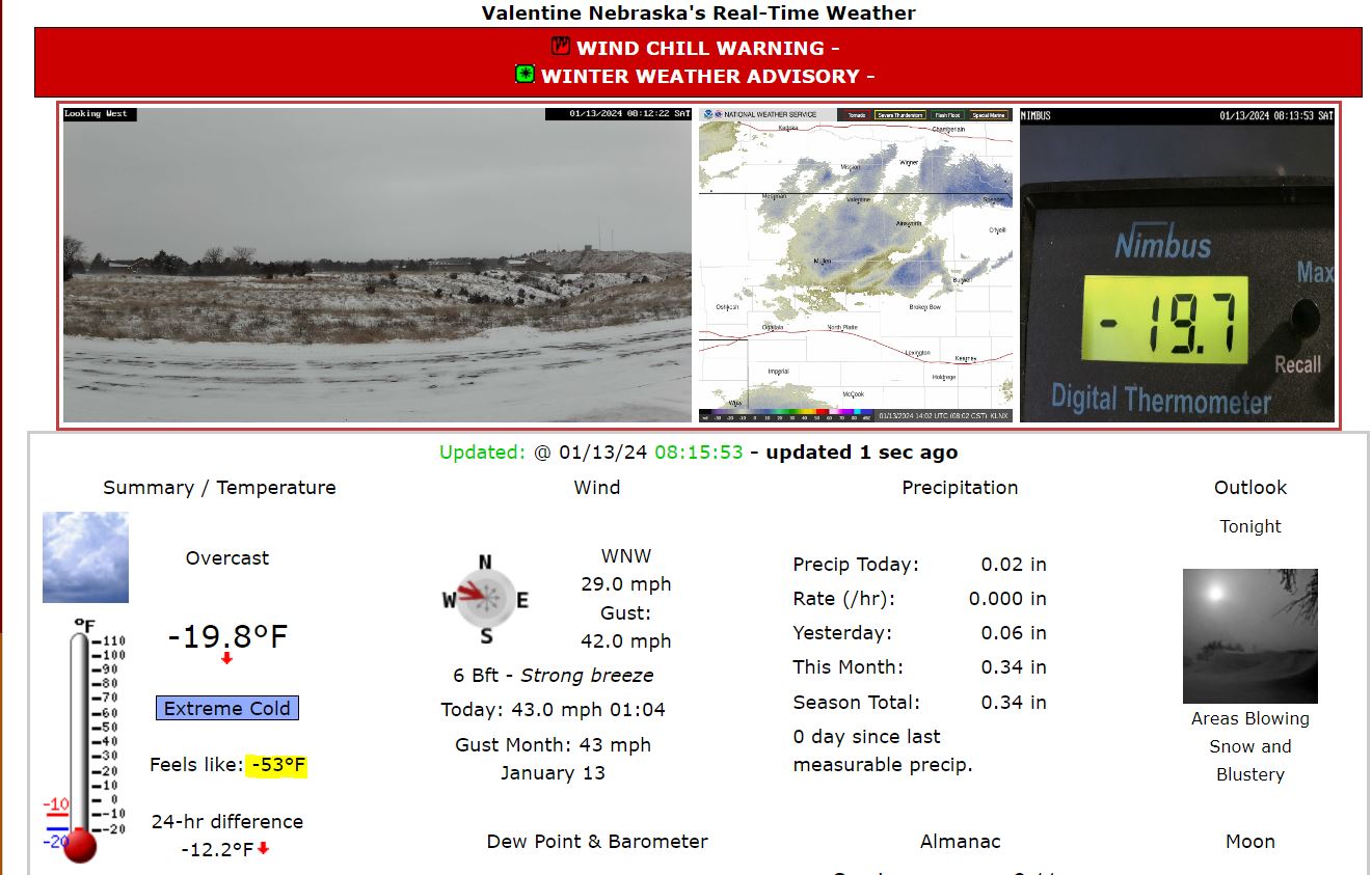
6:20 am: It's currently (-18°) with the wind chill in the (-47 to -48) area. Very dangerous to be outside. We did pick up snow overnight .6" total since 6 pm yesterday.
01/12/2024...3:40 pm: The afternoon NWS briefing packet HERE.
9:45 am: The airport ASOS is reporting overcast and haze. The sensor likely has something covering it so a technician is heading up from North Platte. We do have a little haze and had a sun-dog but not overcast. Went to the airport and measured about the same new snow as here on the north side around 2.5" of fresh snow.
Here is a frostbite calculator FROSTBITE
6:40: Measured .4" since midnight (2.2") storm total and it's about to end. The snow stake started at 1". and now just over 3" so following closely. The snow stake was cleared so add another +2" for total ground depth. Can't stress enough Saturday will be dangerous to go outside, even for a few minutes on exposed skin so plan ahead.
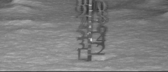
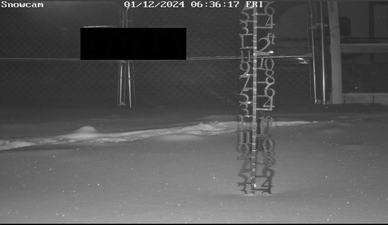
The morning briefing packet from the NWS is HERE. If not dated Jan 12th, (click F5) to refresh cache.
01/11/2024...11:55 pm: Measured another (.6") of new snow for (1.8") for the day. This arctic air is snowing itself out with little movement. It started about 7:45 am so 16 hours ago.
6:00 pm: At 6 pm we have had (1.2") of new snow measured here today. Light snow continues. We did reach the 1-3" in the forecast but took a long time with the tiny flakes of snow that tend to compress, unlike the big airy flakes. Currently, it's (2-3°) and this is as warm as it will get through the weekend ahead. Saturday will be dangerous to go outside, even for a few minutes on exposed skin so plan ahead. Probably too late to find a ski mask and goggles if you don't already have them.
The NWS afternoon briefing packet is HERE. If it's not dated Jan 11th 2:57 pm, (click F5) to refresh cache.
12:05 pm: The new snow measurement at noon (.5") (.04") melt. The snowfall is the very fine small flake variety with the 3° air temperature. It's so cold the 8" dia. heated tipping bucket gauge isn't melting all the snow. Have icing inside the funnel. The next manual measurement around 6 pm and website adjustment on precip. If looking for the radar loop it's under the Radar/Satellite tab.
5:20 am: The NWS issued a "Wind Chill Advisory" today through tomorrow night (Friday) when a "Wind Chill Warning" starts at 6 pm. Today we also have a "Winter Weather Advisory for Snowfall. Looking at models the HRRR is saying around 10 am when the snow gets started in Valentine. The water ratio with the cold air is likely very dry so wouldn't be surprised to see several inches of fluff buildup. The snow stake found under the "Cameras" tab is starting out with slightly under 1". The heated tipping bucket becomes more inaccurate the drier the snow. The heater evaporates moisture before it can tip. Manual measurements and snowmelt will be around noon and after the event.
01/10/2024...8:42 am: Light snow started again, so far measured (.8") of new snow. We did have some heavier snow earlier. Couldn't see the water tanks at (.64 mi).
5:35 am: Light snow currently.....Multiple advisory and watches go into effect either Thursday or Friday.
The morning briefing packet from the NWS, "Here" The new update is Jan 10th at 5:02 am, (click F5) to refresh cache if different.
FYI for those that may watch the snow stake, due to the snow stake getting cleared add +2" for total snow depth. Currently just under 2.5" at 2.3".
01/09/2024...4:55 pm: Just a heads up what's on the way. From the afternoon forecaster discussion.
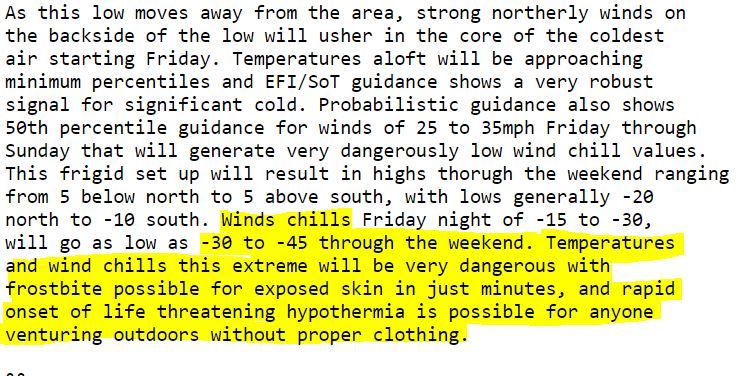
The afternoon briefing packet from the NWS is HERE. If it's not dated Jan 9th 4:27 pm, (click F5) to refresh cache.
8:15 am: The low temperature this morning (2°) here on the NE side of Valentine. Miller Field (0°), also at the south Tempest station near Miller Field (0°). The south side Tempest is linked toward bottom of "External Links" and click on History for the low.
Tonight into Wednesday we have a 50% chance of snow. The main story will be the prolonged cold through this coming weekend with high temperatures near zero or even below over the weekend with -35° to -40°f windchills. A very cold week indeed with chances of snow mixed in. Not sure where this week will land historically for cold weather but it has to be up there.
01/08/2024...8:35 pm: We haven't picked up any measurable snow since last night, just light flurries with lots of wind and cold. It's warmed up to 16°, from what it was running at 14°, most of the day. Looking at the temperature profile very cold over the next week with Jan 14th looking like the coldest day with highs below zero on several models.
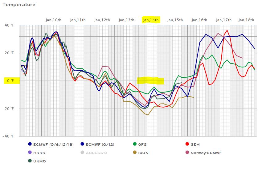
11:40 am: Getting some light snow again. Our first snow since last night. Quite nippy outside, the windchill is 0°.
5:40 am: Measured (.2") since midnight. (.01") in melt so a storm total of (.5") new snow so far. The heavy snow cutoff line is east of Valentine it looks like. The NWS morning briefing packet HERE. If it's not dated Jan 8th, (click F5) to refresh cache.
12:00 am: Light snow measured .3" (.02") melt, of new snow.
01/07/2024...The afternoon briefing packet from the NWS is HERE. If it's not dated Jan 7th, 4:06 pm (click F5) to refresh cache.
Updated noon: The NWS issued a "Winter Weather Advisory" for Eastern Cherry, for (2 to 4") snowfall potential with high wind gusts to 50 mph. Starts at midnight tonight through 6 am Tuesday. The low temps got down there this morning. Here on the NE side (2.1°) on both the MMTS (Nimbus Coop thermometer) and Davis Instruments Sensirion SHT-31 (main website thermometer), and out at Miller Field, (1.0°) occurred after 6 am.
6:00 am: So far this morning under a clear sky and calm wind, (dead still) currently. It's been down to 3° here on the NE side of Valentine. Around an inch of new snow is expected for Valentine tonight and Monday. We do have a 57% chance of 2" according to the briefing package. To our east is a different story.
Several people have notified me they are interested in how the MMTS works in comparison to the aspirated Sensirion SHT-31 temperature. So far with the winter low sun angle seeing very little difference. Occasionally a few tenths between the two temperature setups on recorded high and lows. The quicker response times of the aspirated sensor is likely the main differences right now.
01/06/2024...4:05 pm: The afternoon briefing packet from the NWS is HERE. If it's not dated Jan 6th, 3:39 pm (click F5) to refresh cache.
3:50 pm: The first sunshine and clear sky in days. It's cold but nice to see. Looking at the models this afternoon the NAM is saying Valentine could end up with 2-3" of new snow this Sunday night and Monday. Most of the other models have less snow for Valentine. The big snows develop later to the east.
Today is one of those times the high temperature occurred at midnight, colder air has moved in with a strong NW wind. Forecasters do the high for the expected daytime high temperature.
6:15 am: We picked up 1/2" of snow yesterday evening, only a trace amount since midnight. Another round Sunday night into Monday. Doesn't look that heavy for Valentine (.5-1") GFS and ECMWF with the NAM the heaviest (1-2") right now. Models could adjust the system further west later which would bring more for the area. The active winter pattern continues next week, with potential -20 below or colder temperatures later in the week.
01/05/2024...9:35 pm: Still very light snow. Looking at models this evening they're about as cold as you'll see them get around the 14th with the high temp below zero and lows around (-20f). Arctic Cold Outlook.
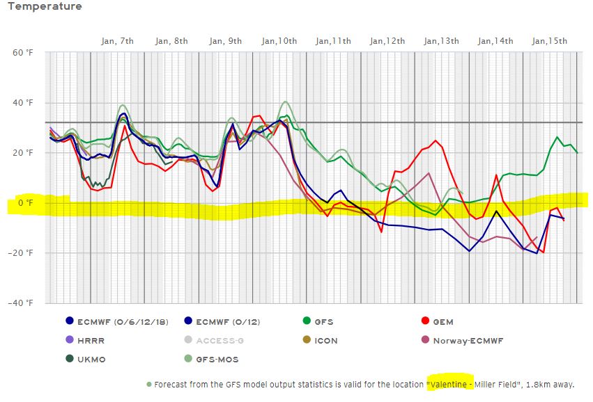
6:45 pm: Getting light snow. The snow stake was cleared prior, so showing new snowfall only. A manual snowmelt and measurement before midnight. The heated tipping bucket isn't always accurate with snowfall making a website adjustment later possible.
5:40 am: Not much temperature change today with the high forecast at 35°, currently 34°. Precip looks light Monday for Valentine, maybe an inch of snow... Models, but next week on the European 1.2" in moisture and with the forecast arctic air. Likely over done but something to watch, what it's saying is it may get really active going forward. Looks like January is going to make up for an abnormally warm and mostly quiet December.
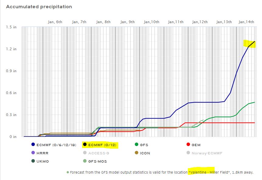
The morning briefing packet from the NWS is HERE. If it's not dated Jan 5th, (click F5) to refresh cache.
01/04/2024...The afternoon briefing packet from the NWS is HERE. If it's not dated Jan 4th, 2:39 pm (click F5) to refresh cache.
Just watched a segment on F&F First on Mt. Washington. Very cool they still use the old-time instruments. This is the Cotton Region shelter (CRS) with the alcohol Minimum (top) and mercury Maximum thermometers. Cotton Region shelter Used to have this same setup. They've gone away from this starting back in the mid-1980s now using the MMTS setup, with the Nimbus thermometer found on the Cameras link. Not looking like much snow for our area over the next week, maybe an inch or two at the most. It does look like an arctic air invasion around the 11th. Here's the temperature trends. Cold air is easy to shovel. The NWS morning Briefing packet is HERE. If it's not dated Jan 4th, (click F5) to refresh cache.
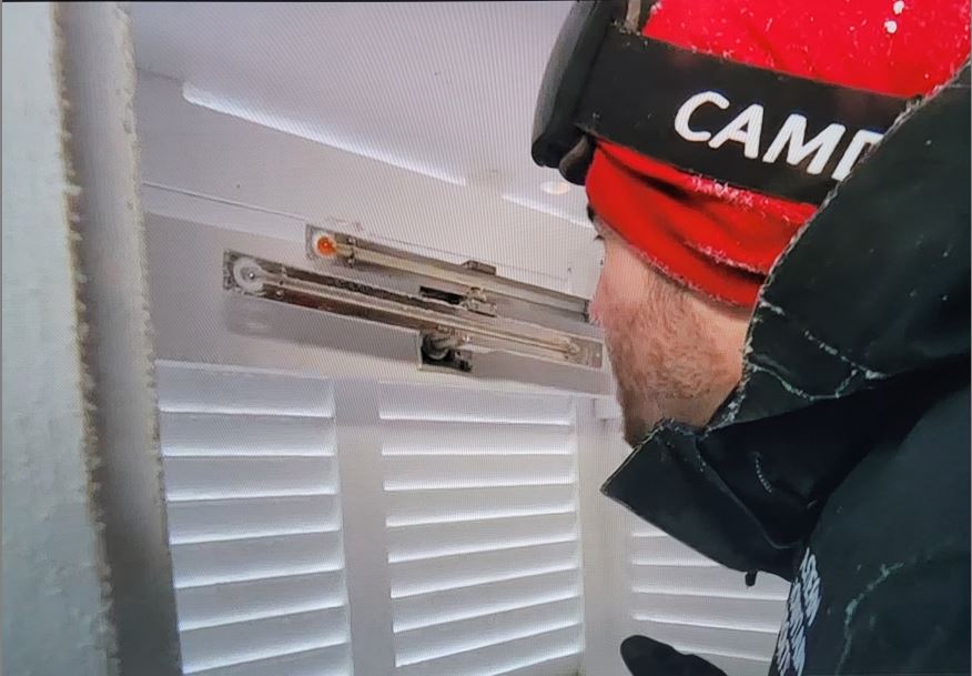
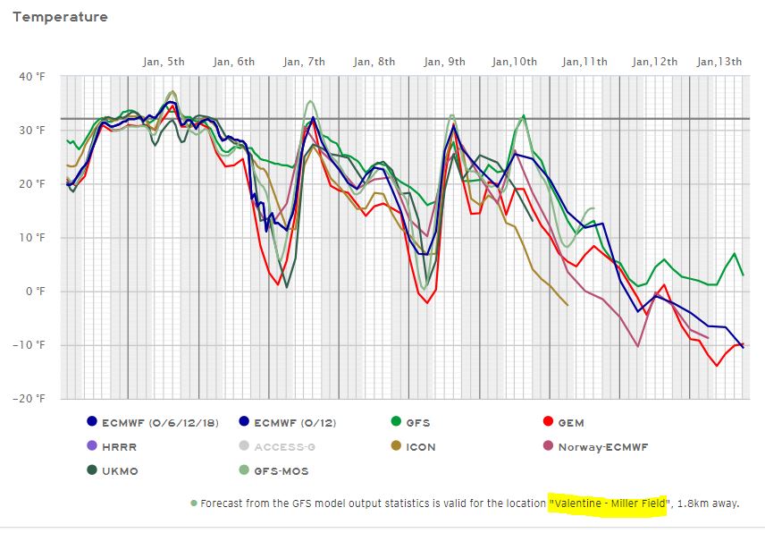
01/03/2024...10:15 am: Can see the fog starting to roll in. Water tank hill is almost gone. (.64 Mile)
Updated: Cold today with a forecast high of 28° as a Canadian cold front moves through. Slight chances of snow showers Thursday and Friday. The NWS briefing packet can be found HERE. The 8th still looks like our best chance of accumulating snow but low confidence on how much, models have been trending it south and east. Last year at this time we were buried with 14" on Jan 2 and 3 on top of the already substantial snowpack from the pre-Christmas blizzard. Temperature trends over the next 10 days look below normal with the Canadian GEM looking the coldest. So far the morning low has been (12°) at the NE Valentine location with an almost calm wind when it occurred.
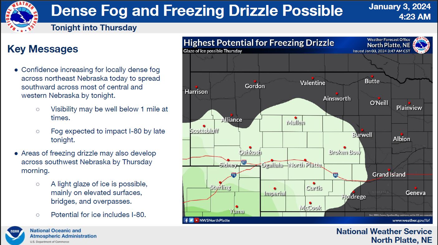
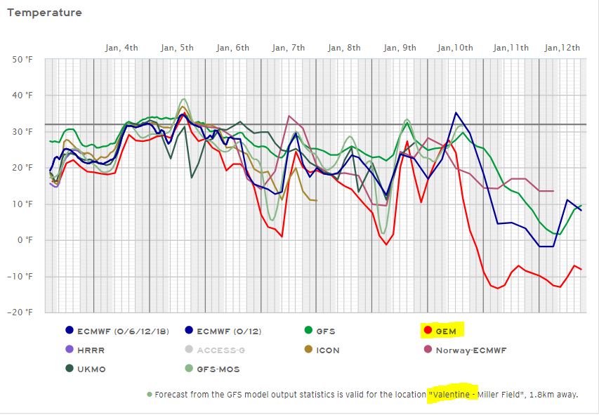
01/01/2024...Spoke with NP Forecast Office about the ASOS irregularity this morning of reading (4-5°) degrees warm. Possible the ice fog had something to do with it but not certain. The fan sucks a lot of air and with everything exposed being covered in ice this morning, the fog was very dense for several hours even under 1/4 mile so wouldn't be surprised if the sensor wasn't completely covered in ice, which would act as an ice blanket. The way the temperature stayed steady with little movement was another sign it was possibly covered with ice. Not 100% confident this happened but it does seem possible with the conditions. Anyway, fingers crossed it doesn't happen again. They said to report it should it continue. Afternoon temps looked normal.
Found a good open place to measure snow. A large flat corner lot, here's the image. Got permission to place a snowboard. Yeah! This will be the post storm measuring area for even melting. Catches plenty of sun too. Belongs to a neighbor so walking distance.
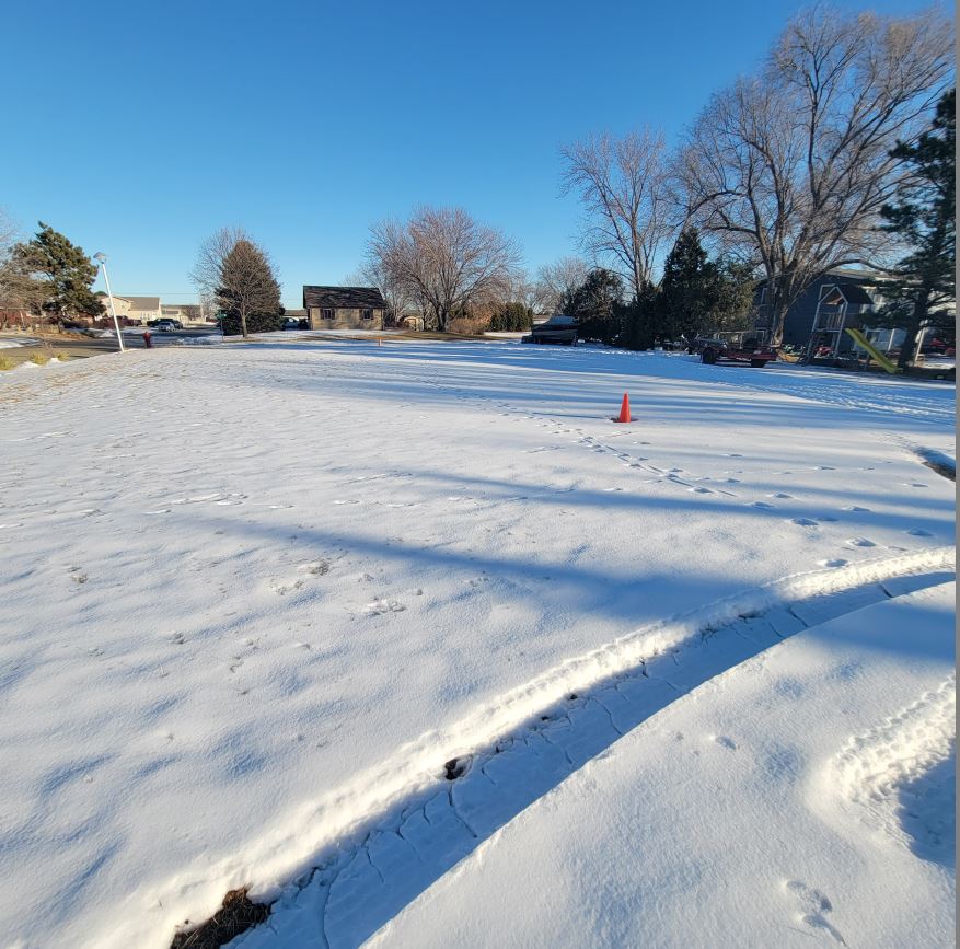
3:00 pm: Getting some good melting today with temps into the 40s. The metal snowstake had melted around down to the board so went ahead and cleared.
Update: Our lows around town 6° here on the NE side, 5° south airport side. Miller Field was only (9°).
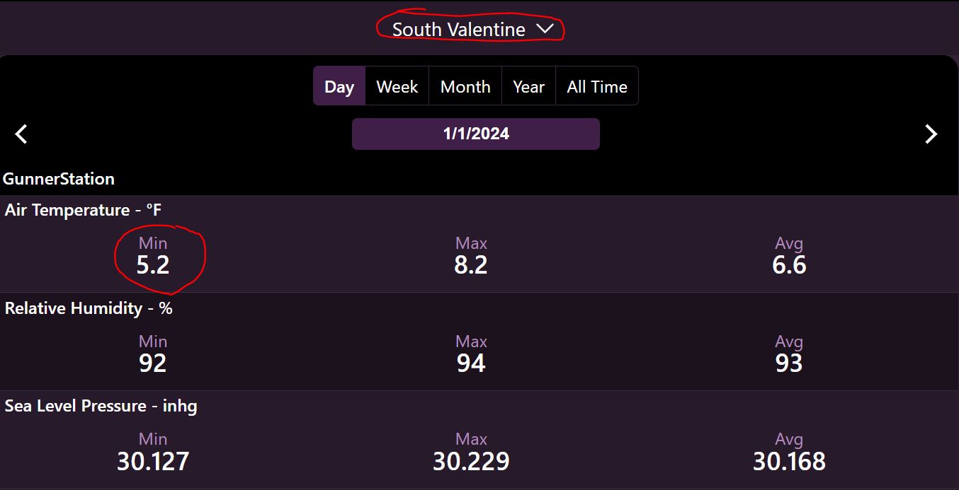
6:50 am: The ice fog has cleared off so we have good radiational cooling with very light wind and snow on the ground. Miller Field is running warmer at (10°) this morning on Jan 1. While everywhere else is (5-6°) including the south Tempest right next to Miller Field. Even the radio station with all the concrete and block buildings downtown is reporting 7°. .
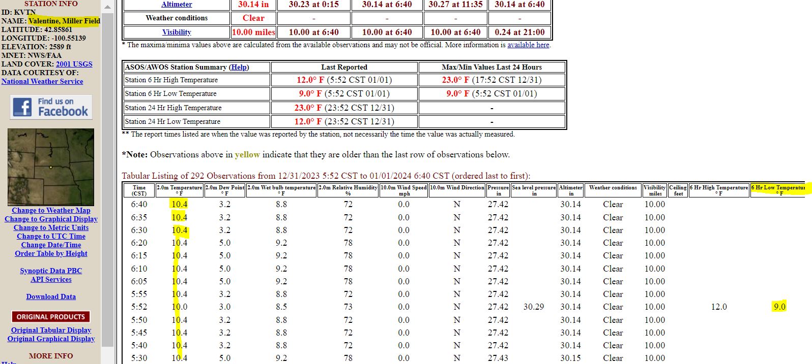
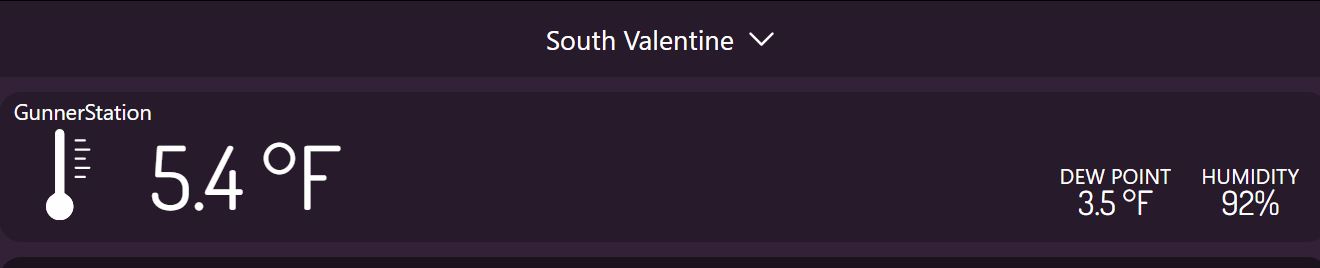
Happy New Year's: The climate summary for 2023 can be found HERE. It was wet with (35.65") in precip at this location the most since station startup in 2014 with the temperature departure on the year (-0.6°) based on the period NCDC 1991-2020. So really close to normal, thanks to El Nino and the warmest December (+5.5°) since the station started, otherwise we would be running several degrees below normal for the year. Here is another place to look at monthly comparisons between each year, temperature summaries and precipitation summaries.
12/31/2023...5:35 pm: Ice Fog has redeveloped.
8:50 am: Areas of fog, looking at West camera the City blue water tanks (hill) are covered in fog, it's (.64 mi.) distance, the house on the right is (.14 mi.), left side (.10 mi.)
6:00 am: Cloudy this morning, currently 19° with a feels like of 7°. We have a chance of patchy freezing fog through New Year's. Our next significant chance of precip looks like somewhere around Jan 8th. Temperatures look near to below normal over the next week. Here's a look at models this morning with the temperature outlook. The Canadian as you can see gets really cold with a high near 10° on the 7th and going well below zero on the 9th. My Anchorage daughter sent a text it was (-8°) and that's a coastal city so cold air is available should it move south. They're buried in snow, this was Christmas Eve, trying to prevent the roof from caving in on her van. Here's another from Anchorage.
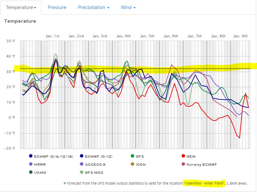
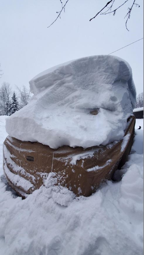
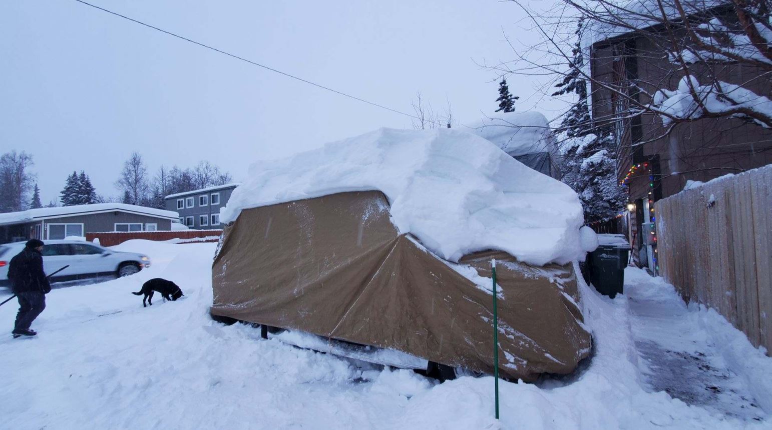
12/30/2023...3:50 pm: Our high today (39°) came in early, around noon. The cooler air has started filtering in, currently 36° with a NW wind 15-21 mph. Gonna be cold tomorrow with mid-20s. Here in Valentine not that much melting today. Areas to the south more melting with temps in the 40s. Never did clear the snow stake but will have to before the next snowfall. That metal stake will melt a hole right down the center.
5:35 am: A dry cold front moves through this afternoon pushing temperatures into the teens overnight. Tomorrow only mid-20s for highs. A mention of patchy freezing fog is also in the forecast tonight. The next precip potential is late next week. This morning we are right at the 3" mark for snow depth. May clear the snow stake later today it's melting with the sun heating the metal down to the board. Plus it's catching too much shade, so not a true indicator of snow depth after a few days. It's best used while snow is falling and soon after.
12/29/2023...3:45 pm: 42° and the breeze has reduced the snowpack. (3.25") at 3:45 pm. The snow stake is a little high, it catches more shade.
5:40 am: Not much going on with seasonal temps near 40° today for a high temp. A short-lived cold snap New Year's Eve with 20s, but on New Year's Day upper 30s for the high temperature. This morning a mix of temperatures around town depending on location, Miller Field has been down to 9°, 13° here at the NE location. Final morning lows may not come in until around sunrise. This morning we have 4" of snow on the ground. With the short days and low sun angle, it'll hang around for awhile.
12/28/2023...11:10 am: Still Dense Fog 1/4 mile and under on the NE side of Valentine. The house (west camera) on the right side is (.14 mi), the left side House is (.10 mi.) The blue water tanks you can't currently see on the hill are (.64 mi). This is an old Google Pro image the left side house has been rebuilt after a fire and the trees removed at the NE weather station location. Not that I don't like trees just not around the house, especially with the weather station so that was the first thing done in 2019. A lot less maintenance having them gone, too.
7:40 am: We did pick up a trace of snow overnight. Fog this morning.
12/27/2023...1:20 pm: Looks like the snow shower activity keeps redeveloping just north of Valentine. The Website gets adjusted if needed from the manual snowmelt, the next one is around 6 pm.
12:05 pm: At noon we picked up another (.3"), (.02") melt. Still 5 inches on the ground. Ground depth settles with time. Currently snowing just short of heavy. Radar shows it will end soon, however.
7:45 am: The 29.5" snowdrift in front of the garage door. The Ariens snowblower made short work of it. And fired up on the first pull which always makes you happy with last years gas. This is on the west side, facing the same direction as the West Camera.
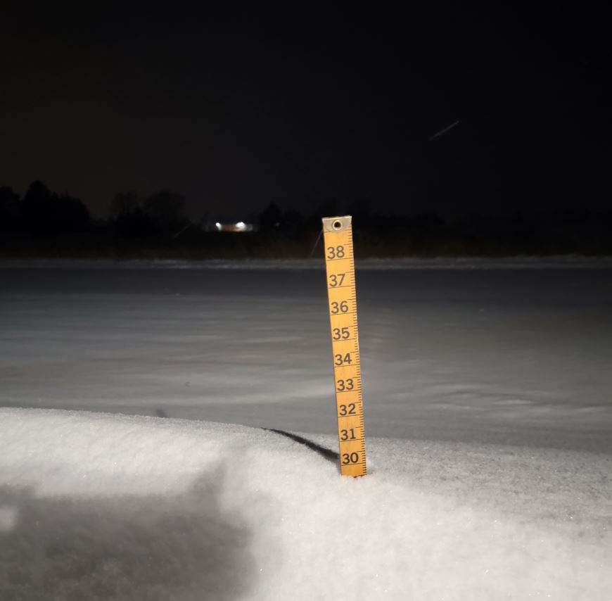
The NWS morning Briefing packet is HERE. (Trace to 1") is possible for Valentine. Looking at the medium range models, not seeing much precip beyond Thursday. Temperatures near to slightly below normal over the 10-day with New Year's Eve looking cold. No below zero temperatures but a couple dips into the single digits with the Canadian model. The overnight snow measurement (.2") , (.01") melt. 4.8" snow depth on the ground.
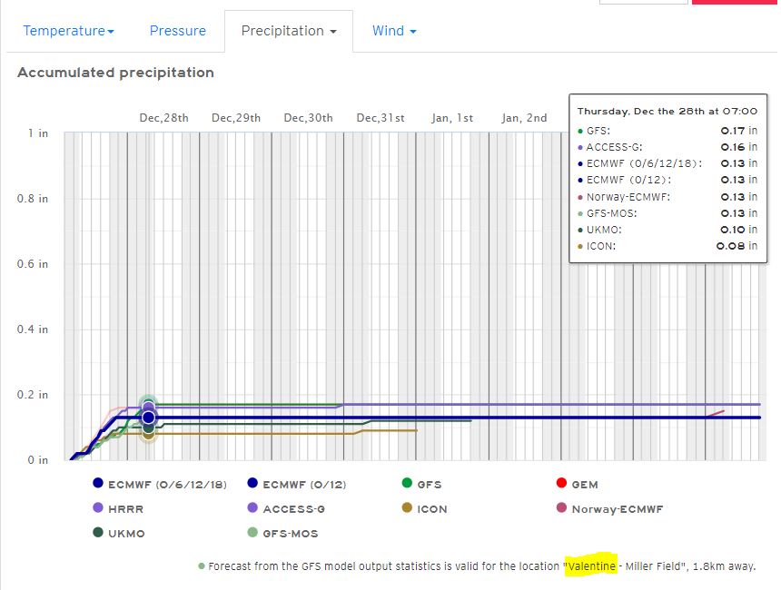
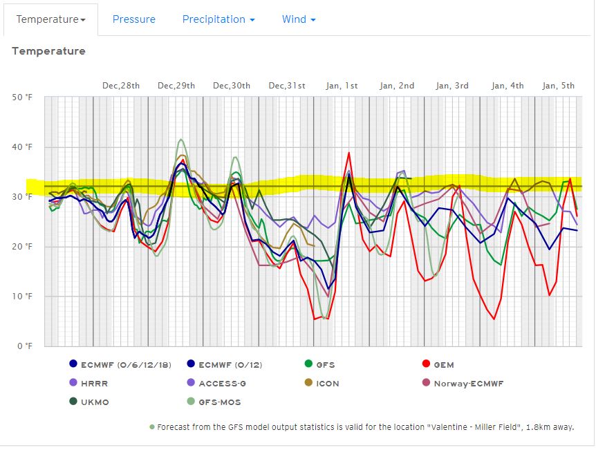
12/26/2023...The updated NWS Weather Briefing packet is HERE. Still a 1 to 2" potential through Wednesday for Valentine. We picked up another tenth since noon, (.01") melt. Still at 4" on the ground. Winds are substantially lighter now, currently 14-21 mph so the Blizzard Warning expires at 6 pm. The seasonal Snow Report has been updated. (5.4") for this storm so far.
12:15 pm: At noon measured an additional (.3") since 6 am, (.03") melt with the manual gauge. Total ground depth is still around that (4.3") range likely due to settling and the wind. Snowing currently with the first large flakes we've had. The snow growth area must be warming up, getting back into that 10:1 ratio. Maybe the tipping bucket will start working better. With dry snow much of it evaporates due to the heater before it can actually record. A nice wet snow will melt fast and act similar to rainfall.
6:10 am: The latest NWS Briefing Packet. Changes are the "Blizzard Warning" expires at 6 pm tonight for Eastern Cherry and turns into a "Winter Weather Advisory". The Blizzard Warning is being dropped Eastern Cherry because of reduced wind speeds. Blizzard Warning (red) for whiteout conditions due to significant snow and high winds reducing visibility below 1/4 of a mile for a minimum of three hours, making travel treacherous if not impossible. Additional snowfall for Valentine through Wednesday (2-4") total.
12:05 am: New snowfall measured last 6 hours (2.0") (.10") melt, making 20:1 ratio, very dry. Christmas day total (3.2"), storm total (5.0"), current ground total (4.3"). Drifts are knee deep in some areas with the wind. Peak wind gust was 52 mph here on the NE side of Valentine yesterday.
12/25/2023...6:00 pm: New snowfall measured today 1.2", .07" melt. We are around 2.5" on the ground currently.
4:15 pm: The updated NWS Weather Briefing packet is HERE. The expected snowfall by Wednesday has backed off some for Valentine, now 6-8". FYI the snowstake was at 1" before the snow started today. The actual snow depth was 1.5" before this round started.
1:47 pm: Snow has started to fall sideways. NW wind at 22 gusting to 39 mph.
5:20 am: Merry Christmas...BLIZZARD WARNING REMAINS IN EFFECT UNTIL 6 AM CST WEDNESDAY....The morning NWS Weather Briefing packet is HERE. Snowfall here in Valentine will start early afternoon with the light and fluffy variety in the 15-17:1 range on moisture. Yesterday's snowfall was 10:1, 10" of snowfall for every 1-inch of water. Our radar is still showing precip and nothing falling this early morning. Here in Valentine we are starting off with around 1.5" of snow on the ground, the snow stake is slightly less. Measuring snowfall with blizzard conditions isn't exactly scientific. FYI the snow gauge catch yesterday here was (.19"), Miller Field reported (.21") with the automated ASOS. At 5:20 am, its 22° with a NW wind at 22 mph with gusts to 34 mph.
12/24/2023...6:30 pm: Just an occasional flake currently, even though the radar shows snow. We picked up another (1/2") since noon. Total snowfall today 1.8". FYI the snow stake is slightly low from what fell today due to settling and the wind. Adjusted the website to match the manual gauge, (0.19"). The latest NWS Christmas Blizzard briefing packet is out. For Valentine an additional 6-13" on top of the 2" today is possible through Wednesday. Most of the models have the snow starting early afternoon tomorrow, with tomorrow night being the heaviest period. So Santa should have no problems tonight.
6:15 am: Today a "Winter Weather Advisory" for 1-3" of snow here in Valentine. Tonight starting at midnight Christmas Day a "Blizzard Warning" through 6 am Wednesday. Total snow accumulations for Valentine 8-15". Think this includes what falls today. The full "NWS Weather Briefing Packet" can be found HERE. With the high winds, travel especially on highways isn't advised during the Blizzard Warning period. Won't be surprised to see some roads shutdown with the expected snowfall. It's dangerous even for rescue crews.
1:10 am: (0.17") in rainfall here on the NE side of Valentine. The next moisture will likely be in the form of snowfall as temps are falling. Models have finally got on the same page, just with varying amounts of precip. Using the 10:1 melt ratio the low end (8") of snow for Valentine, high end (20") with the Canadian GEM which has been the most consistent throughout. The NAM not shown is (11") along with the ECMWF so may be the sweet spot on what occurs here. Normally we don't get this much moisture feeding in out of the south for a December winter storm. At midnight here are the Models.
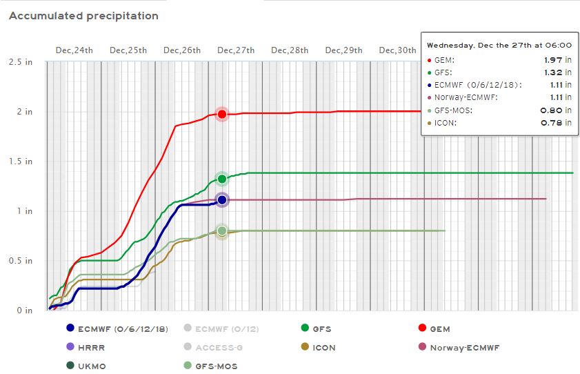
12/23/2023...6:00 pm: The NWS Weather Briefing packet is HERE. There is a major update. The most consistent model has been the Canadian GDPS. Snowfall amounts were so outrageous early on, 2 days ago actually it was hard for me to take it seriously. Rainfall so far today (.13").
5:am: The upcoming forecast this morning resembles the time of year it is, "In the dead of winter". Yesterday temps were in the 40s on the extended now in the 20s. Not even going to try and dissect what's going to happen after yesterday. This unusual and complicated pattern has played havoc with forecast models. If traveling for the holidays be prepared and check the forecast. This storm could last into mid next week.
12/22/2023...Some website News: There is a API gridpoint outage announced by the NWS so only the zone forecast was showing. The fix was an older page scraper script now in use. Our zone forecast covers such a large area would rather not use it, especially during inclement weather. Can have heavy snow on one side and hardly nothing on the other.
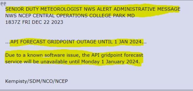
5:50 pm: Still uncertainty about the upcoming winter storm. Looking at the models everything is trending east this late afternoon.
12/21/2023...Here is the NWS update this morning. UPDATE. The full PDF file is HERE. The current forecast is leaning on the American models with snowfall potential starting on Christmas Eve. There is an interesting scenario setting up however with slower wetter models (European, Canadian, German, and British) showing a high probability of significant snowfall for the area similar to a spring-type storm with plenty of moisture feeding in. The GFS models have much less snow and a faster-moving system. So here in Valentine we could have a rain change to snow with a possible inch or two of wet snow using the GFS models or using the majority of models a faster turnover to snow with a significant snow. Something to consider if planning to travel. Hopefully, models come together later today for clarity. Today is the first day of Winter with the shortest daylight hours. Daylight Hours: 9 hours, 1 minute (-3s)
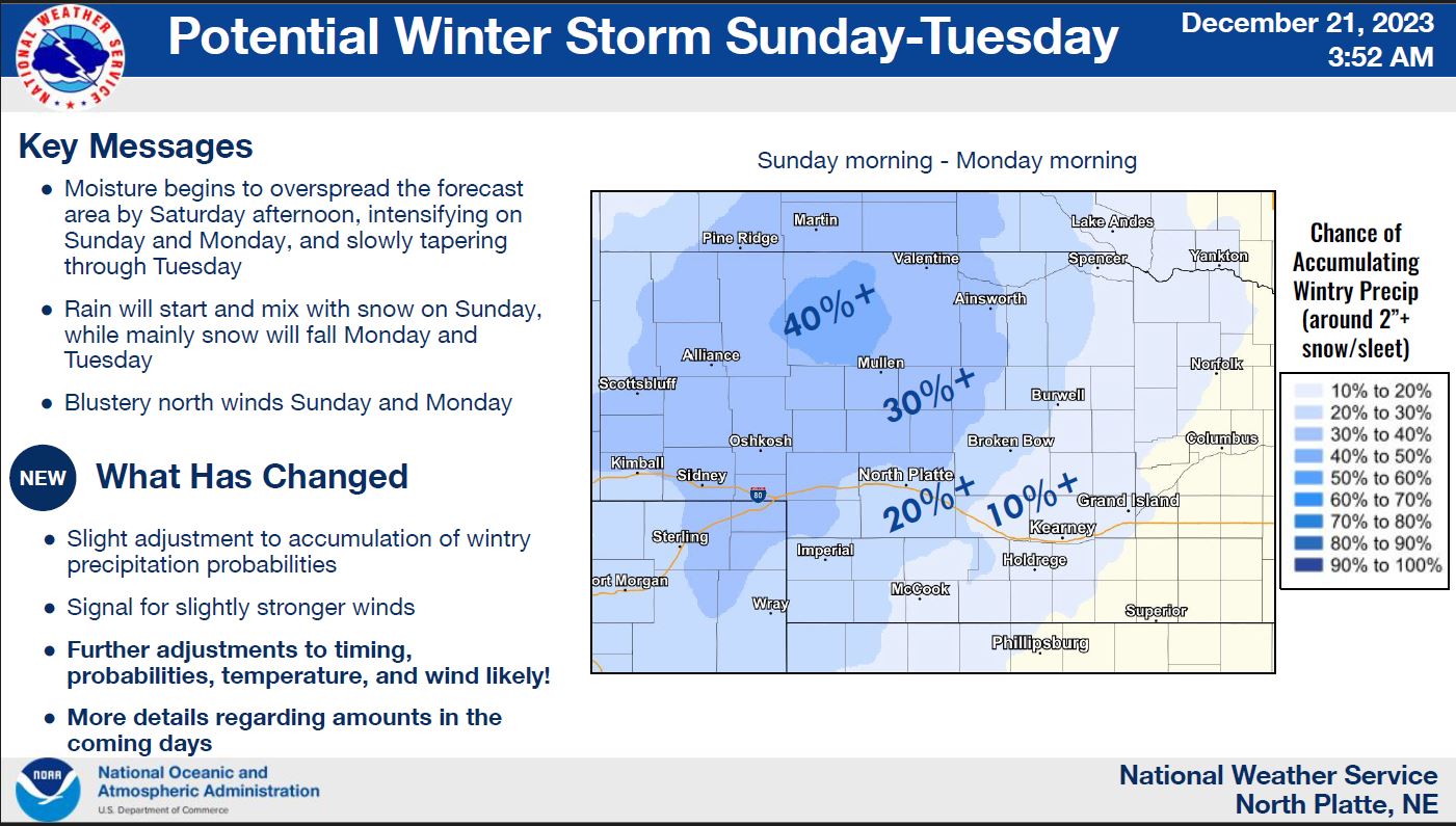
12/20/2023...Confidence with forecasters has increased for a White Christmas here in Valentine. A better chance as you head west. Looking at models the American GFS and European ECMWF have 2-3" while the Canadian has less than an inch keeping most of the snow in NW South Dakota. Temps are above the normal (12°) this morning at 19-21° across Valentine with a calm wind. It may dip more just before sunrise with the calm wind before warming to around 51° this afternoon. Thursday, and Friday even nicer with mid-50s and light wind.
12/19/2023...Beautiful weather through Saturday with 50s for high temps, that is if you enjoy the warmth. Record highs for this time of year are in the 60s for Valentine. Still watching Snow Chances for Christmas. It looks like rain likely Sunday and then the question mark whether it gets cold enough to snow late Sunday into Christmas. The track of the storm is still uncertain, with a more southerly track increasing the chance of pulling cooler air down on the back side for snow chances in the area.
Big difference from last December, at this time around 20" had already fallen with multiple days of blizzard conditions. Several long-timers said it was the worst December for Valentine in 25+ years. One even thought it was the worst ever. Went back and read the event diary for December 2022, I'd forgotten just how bad it was. Last year was a La Nina pattern this year El Nino very wet spring and summer. 2019 was Neutral (no El Nino or La Nina) followed by 3 La Nina years with the 3rd being a dozy with it comes to cold and snow for Valentine.
12/18/2023...Looks like the Miller Field low was 9°, 12° here on the NE side of Valentine. The south Tempest near Miller Field low was (10°). Turns out an add blocker (unBlock Origin) was preventing the south Tempest from showing on the Chrome browser. (unBlock Origin) prevents the YouTube nag screens. A chance of a White Christmas has increased to around 50%.
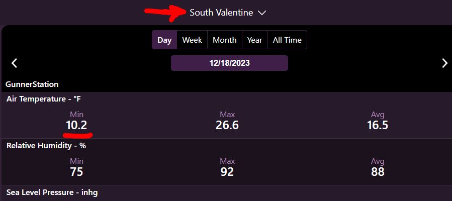
For anyone interested the airport ASOS stations around the country are scheduled to start being upgraded with commercial instruments as-needed across the ASOS network. Don't see the Valentine airport on the list yet. They are changing the Solar Radiation Shields to RM Young using a Vaisala HMP-155E dual probe Temperature and Relative Humidity sensor with warmed RH probe to prevent condensation. The Electronics enclosure and mounting hardware will be Campbell Scientific. More HERE. Apparently spare parts have become difficult to find so they are going with high end commercial instruments as needed.
12/16/2023...6:10 am: 25° currently, we may have some patchy fog around the area this morning. Miller Field visibility is at 3 miles this morning. There is a blip showing on 1-model Christmas Eve. So a White Christmas isn't totally out of the question.
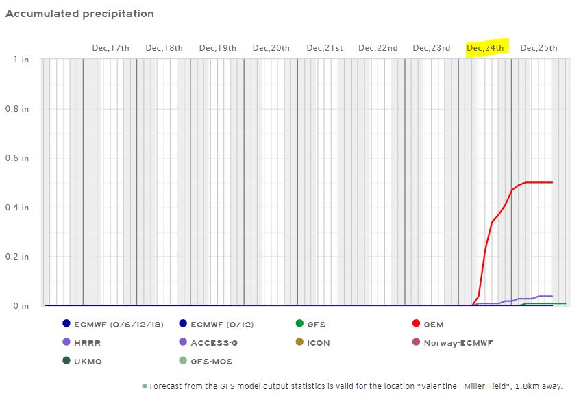
12/15/2023...6:20 am: A balmy morning for mid-December. 34° here on the NE side, 32° at the airport with a little less breeze. This NE side has wind gusts to 19 mph currently. Not a lot of warmup today with 43° forecast for the high.
12/13/2023...6:00 am: A trace of snow still on the ground. Doesn't look great for a White Christmas but a couple of models do show a blip on Dec. 21st so not totally out of the question. It's been down to 14° so far this morning, Miller Field looks like 13°.
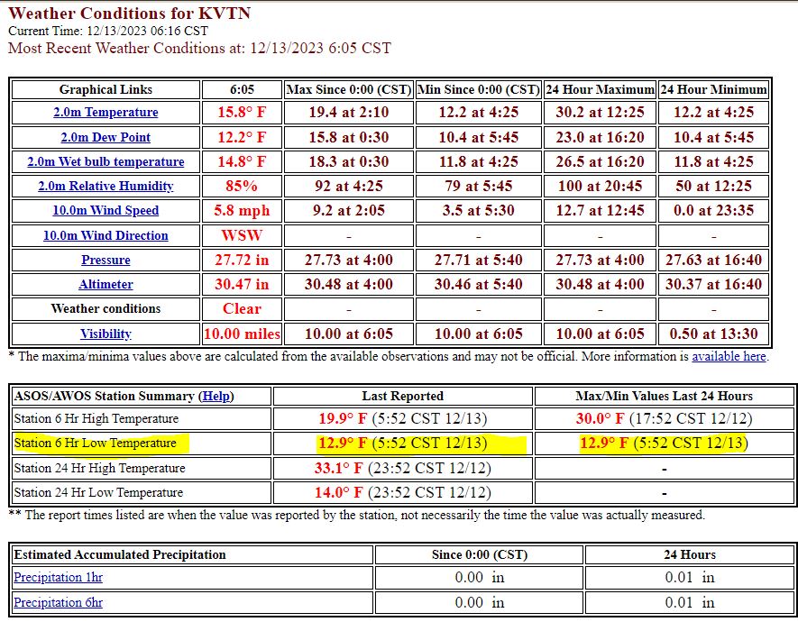
12/12/2023...3:10 pm: The snow stopped, melt is just under (.01") so very dry with 2-tenths measured on the snowboard. The tipping bucket didn't tip either but is recorded to the nearest (.01"). FYI the snow stake is separate from the snow measuring board, and today is pretty representative of what fell with the light wind.
2:15 pm: A couple tenths of light fluffy snow. Will do a snowmelt later (stops) with the manual gauge and adjust website if needed. The heated tipping bucket is getting close to recording (.01") in moisture. Snowfall is very light currently.
1:pm: Light snow, only a trace amount so far. The interior roads are turning white.
6:35 am: A chance of snow flurries after 11 am. For the rest of the week, back into the 40s, even 50s later in the 7-day for high temps and still no threat of winter like weather in the medium range. Radar shows some scattered flurries south of Valentine currently. Looks very light if it is snowing. If traveling south check the (511 NE) road cameras linked toward bottom of "External Links".
12/11/2023...Still not seeing any really cold air or snow over the 10-day forecast. We do have a slight chance of snow, 20% tomorrow. Big difference this year vs last year as the holiday's approach. Looks like good travel weather at least over the next week.
12/09/2023...3:00 am: We picked up a dusting of snow overnight so far, only a trace in melt. Not snowing currently. Had a 48 mph wind gust around midnight on this side of Valentine. I should add with this much wind catching snowfall in the 8" diameter rain gauge is an issue.
12/08/2023...8:25 am: It did reach freezing out at Miller Field and here on the NE side. The breeze is still a little higher on this side of town with gusts to 16 mph.
7:05 am: Not sure we'll reach freezing this morning with the 10-15 mph breeze and mild air for December. A better chance before midnight tonight. Normal temps for this time of year are (H-41, L-14°) so it would be unusual not to at least freeze this time of year. Ice Fisherman can't be happy with this mild start to winter. We're getting into the shortest days of the year right now, and it's looking like about mid December before it starts looking like winter.
12/07/2023...7:00 pm: Today a record high temperature was set with 69° at Miller Field, and 68° here on the NE side of Valentine. It was breezy with a 40 mph peak gust at Miller Field, 36 mph here.
7:30 am: Fire Weather concerns today Here
5:45 am: "A Day Which Will Live in Infamy". Today has a good chance of setting a record high temperature. Strong winds out of the SW in front of a cold front moving through in the forecast. This NE location is blocked somewhat from the town with this wind direction, so may not see as strong of wind as the airport location, which could reach 45 mph. Calm this morning and 24° on the NE side. The airport is starting the same with a low of 24° so far.
12/06/2023...70° was today's high temperature and not a record, better chance tomorrow of breaking the record.
Very warm today with a forecast high of 66°, according to Record Temps the record high for Dec. 6th is 73°F (1939). Tomorrow the record high is 66°F (2003) and (1889) so could be broken with the forecast at 67°. Lighter wind today, but tomorrow gusts near 40 mph, so do any outdoor grilling today. Fire danger gets elevated tomorrow with the wind and 20-30% RH.
12/04/2023...11:30 am: Getting a very light sprinkle, most of the precip on radar is just west of Valentine and moving SSE. Currently, 46° with a NW wind 25 and gusts to 42 mph.
12/03/2023...8:00 am: Mid-40s today with no precip mention, the nice warm-up is still on schedule for Wednesday and Thursday with mid 60s. Friday, Saturday precip chances has trended back on models, still a slight chance mention in the forecast. It got down to 16° (2:29 am) this morning before the clouds and wind picked up.
12/02/2023...Update 8:15 am: Mid 40s for a high temperature today. A slight chance of snow showers tomorrow has sneaked into the forecast. This coming Wednesday has a current forecast high in the low to mid 60s. Looks like starting Friday night into Saturday this next week, a better chance of moisture and return to more normal temperatures. This morning our low temperature has been (16°) here in NE Valentine. A little warmer at Miller Field (18°) with a slight breeze, the wind is calm here. Any kind of mixing can hold the air temperature up a little. Update: Miller Field has also slipped to (16°) with a calm wind.
12/01/2023...7:40 am: With the high clouds that moved in it's looking like the final low at Miller Field will be (11°). Also here in NE Valentine.
5:00 am: We have a good radiational cooling morning with a calm wind and clear sky. Lows so far 11° at Miller Field and 11° here on the NE side of Valentine. Starting to see a few high clouds on the west camera that may disrupt further cooling. November ended above normal on temperature (+2.4°) . Climate summary for NE Valentine HERE.
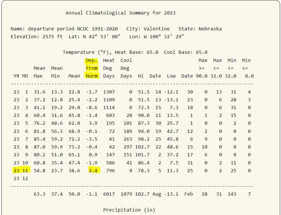
11/29/2023...6:30 am: Above normal temps today 56°, followed by upper 30s tomorrow and Friday warming into the 40s over the weekend. Still no mention of precip in the 7-day. Was looking at long range it may be the second week of December before this pattern changes. Probably not many complaining especially after last winter and the relentless snow that got old.
11/28/2023...6:20 am: Upper 40s today and near 50° tomorrow for highs and nothing in the 7-day for precip. November will end several degrees warmer than normal, currently sitting +3° on temperature. Still have a trace of snow on the ground this morning.
11/27/2023...9:15 am: Getting very light snow. No accumulation is expected. Currently 28°, wind is 10-20 mph out of the NNE. The forecast high today is 40°, if the sun comes out we may melt off what's still on the ground. Thinking about going back to the snow stake it may not buildup as much around it as the measuring stick did.
11/26/2023...12:00 pm: At noon the snowpack is under 1/2" (0.4") so a trace. Even with the temperature running just under freezing the sun has melted over 1/2" today.
6:05 am: Windy this morning 22 mph with gusts to 35 mph. We did have a light dusting of snow overnight not measurable. The snowpack is (1"). It may not get any warmer today the high temp is forecast at 32° our current temperature.
11/25/2023...7:45 am: FYI the airport ASOS isn't transmitting so the conditions icon for website will be missing until it starts transmitting again. Going to the bottom of "External links" is Area Observations . Once the AP ASOS starts reporting again two observations from Valentine will appear. The current station reporting EW5938 is this NE Valentine location. The snow has stopped and it's clearing off with the temperature drop, currently 12°. We only picked up a trace of new snow since the 6 am measurement.
6:10 am: Additional 0.9" of snowfall since midnight. (2.1") measured on the ground this morning. Light snow continues. This snow is very dry so not much moisture content, only (.11"). Plows are out
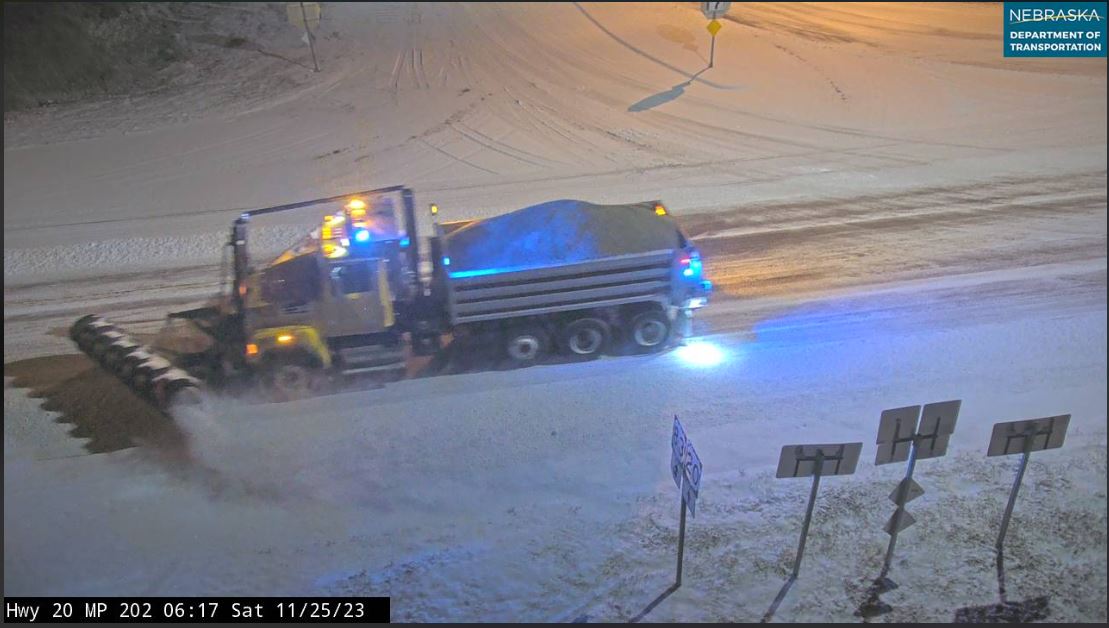
12:05:am: Snow measurement .5" since 6:pm, 1.3" ground total. Light snow still falling.
11/24/2023...6:pm: The current Snowboard measurement (.8"). Light snow is still falling.
12:10 pm: Light snow started on the NE side.
6:50 am: Updated Forecast for Valentine, 40-50% chance of snow today, still less than 1/2" expected, tonight drops to 40-30% chance.
Have a spare camera so added the Nimbus thermometer to the cameras page. Image updates every 2-minutes.
6:am: Just a few small flakes for Valentine. Cold today with the forecast high near 21°. The winter Storm is still going mainly to our south now as shown on radar. The 511 cameras show where it's snowing. Linked under External links.
11/23/2023...7:am: A "Winter Storm Warning" for Western Cherry County. Click on the "Winter Storm Warning" banner for details. For Valentine however only a 20% chance of snow with a possible 1/2" tonight and another 1/2" tomorrow. Our 24-hour high temperature already occurred at midnight 35°. This afternoon's high temp will be around 31°.
11/22/2023...2:45 pm: A "Winter Storm Watch" has been issued for Western Cherry by the NWS. The latest HRRR shows how Valentine is just on the outside edge of the 1" plus of snowfall. The latest ECM European is in agreement. Not much wiggle room should the track be slightly off.
Mid 60s today. Just a slight chance of snow Thursday night and Friday in the forecast 20-30% range. The forecast leans on the GFS and NAM. Here are what models say starting with American models NAM and GFS . Models that show a little more snow for Valentine the European and Canadian . Recent storms have under performed for Valentine so won't be surprised with no more than a skiff. An inch is possible however. If traveling south or west will have more snow.
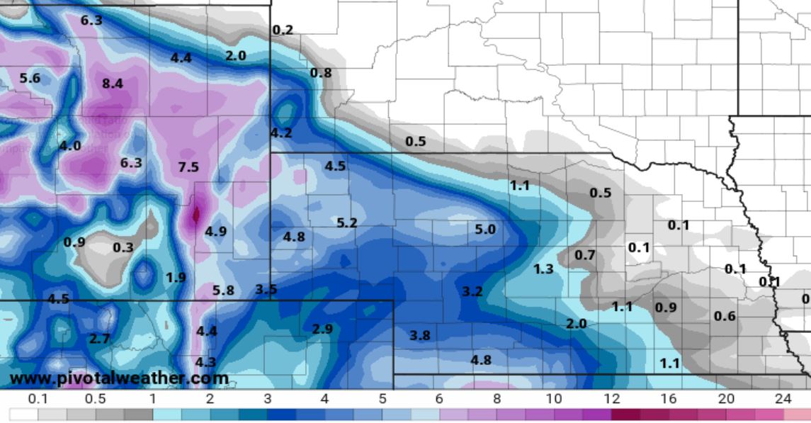
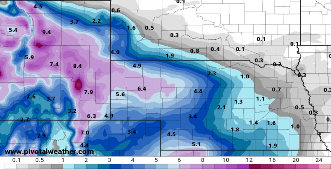
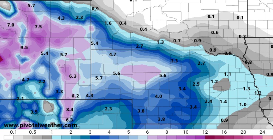
11/21/2023...Tomorrow's (65°) may be our last warm day for quite some time in front of an arctic cold front arriving Thanksgiving. Thursday evening into Friday light snow with less than an inch expected, high temperatures will stay cold (20s) Friday and Saturday followed by a slow warmup into the upper 30s through the 7-day.
Congrats to Sandhills/Thedford Knights, State champions in D2 football. For the record the game wasn't close (50-12). Some of the players travel an hour one way to and from school, that's dedication.
11/20/2023...There were reports of over an inch of rainfall to our east. Check out the Cocorahs reports today, select date 11/20 HERE. The Cocorahs link is under "External Links".
We've had light rain and mist/drizzle since yesterday afternoon. The radar doesn't pick up on it well, in fact at times not at all. As of 6:25 am (.13) . The forecast has showers continuing today then a 1-day warmup Wednesday at 63° before the Thanksgiving cooldown. Doesn't look as cold as first thought and not near as cold as the October arctic chill with highs staying above freezing. Forecast snow chances are saying just a slight chance now. The ECM model is still projecting a couple of inches, so be aware if planning a trip the forecast could change later.
11/19/2023...Our long dry spell is about to end, rain of all things for mid to late November. More winter-like weather with arctic air arrival later this coming week with snow chances Thanksgiving evening into Friday. Doesn't look like much snow at this time, from a few tenths to 2" (ECM) possible depending on the model. Enough however with the arctic air in place could make holiday travel hazardous. Yesterday's high was a balmy 68° here, 69° at Miller Field. Not even close to the record 82°F in (2020) but tied our warmest November day this year.
11/18/2023...7 pm: Added a new west view camera. It picks up the stars well on clear nights, for the full-size image visit the Cameras link.
Not much change in the forecast with the best precip chance Sunday into Monday all rain with a post-Thanksgiving snow chance. How much is still unclear with model differences. Looking at projected model snowfall this morning, between 3" GFS, and ECM 2" down to nothing on the GEM so nothing major for Valentine.
11/17/2023...3:20 pm: Starting to look a little wetter for Sunday into early Monday all rain. Looking at post-Thanksgiving after the cold air arrives both the GFS and ECM have a bump in precip meaning snow chances on potential holiday travel days. We reached 58° for a high today after a morning low of 18°. The Miller Field low was 17°.
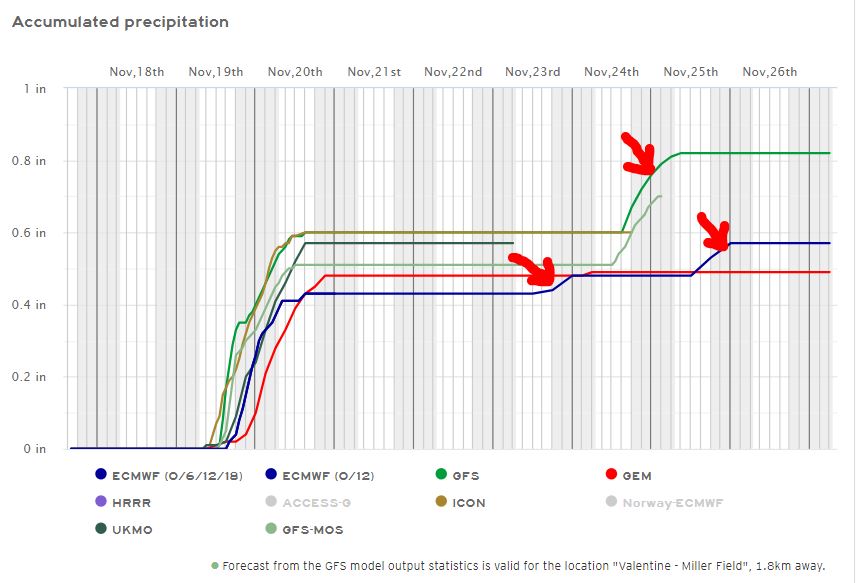
11/16/2023...4:35 pm: Our high today came in at 64°, it didn't feel that warm with the clouds and wind plus it occurred early around 11 am. The peak wind gust was 41 mph before the afternoon cool down, currently down to 40°. The extended forecast is now showing a big cool down just before Thanksgiving, with no snow mentions as of yet.
Another warm day, well above the (normal 51°) with the forecast high at 62° and wind gusts near 40 mph. The temperature will drop into the 40s this afternoon. A slight chance of showers starting Sunday night into Monday. The main models overnight are showing some sign of winter in the extended with below freezing temperatures starting on the 22nd the day before Thanksgiving. The Canadian (Gem) even drags arctic air down with high temps in the teens and below zero on the 25th. This is still early (7-days) out so could change and adjust on upcoming model runs.
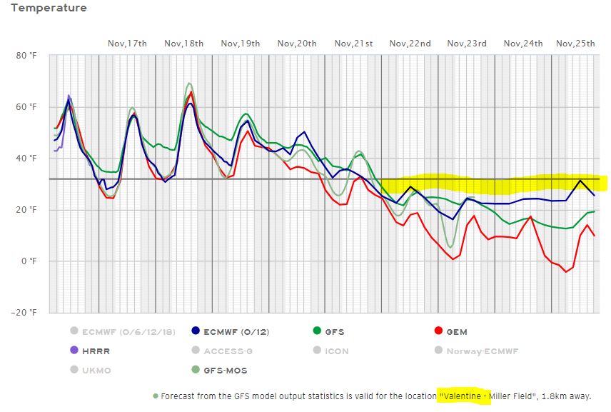
11/15/2023...7 am: Good radiational cooling this morning with a clear sky and light wind. Lows so far 21° out at Miller Field, and 22° here on the NE side of Valentine. Another warm one 72° is the forecast high. We came up a little short of 70 yesterday, 65° and 64° on the Nimbus. Tomorrow will be windy with gusts to 45 mph and low 60s for a high temp.
11/14/2023...Josh Adams of US Weather Action has released their winter 2023 2024 snowfall forecast. For the Valentine area 40-50" so about 15-25" less than last winter but still substantial. If having issues watching videos on YouTube "UBlock" gets rid of the nag screen. Just add the extension to browser. Here is the YouTube Snow Forecast LINK. Very warm today with a high near 70°, enjoy. It looks like toward Thanksgiving a cool down, models still have differences on types of precip and how cool.
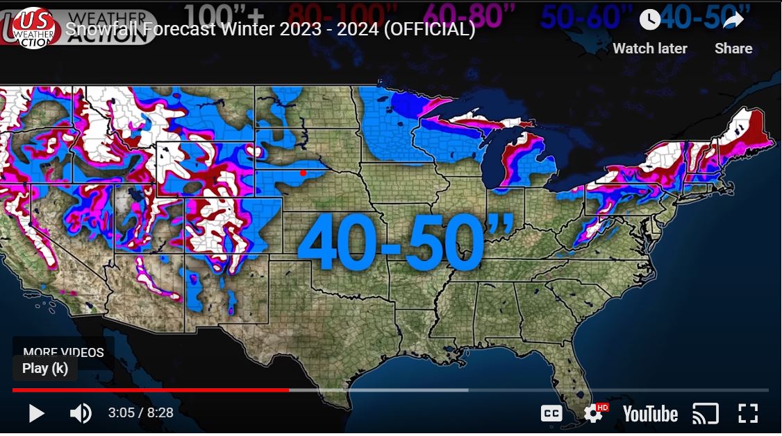
11/13/2023...Here is the latest 10-day on the European Model. Temperatures and Precip. Today warm and windy with gusts near 40 mph forecast, the GFS has gusts reaching 49 mph around 10 pm tonight. The forecast high temperature is 67° today.
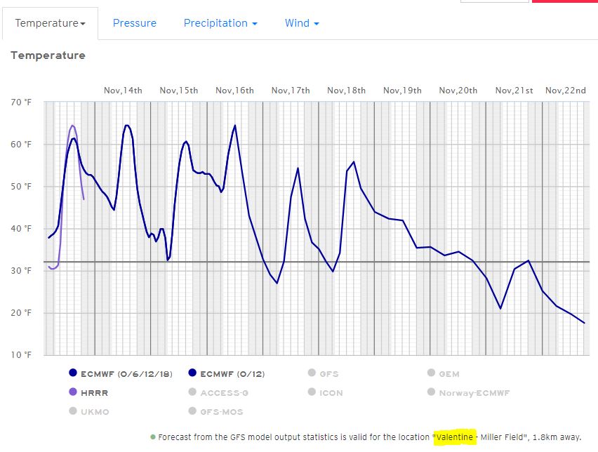
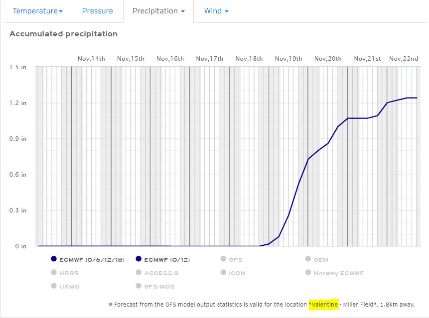
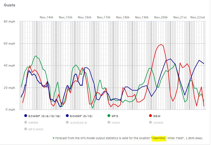
11/12/2023...4:50 pm: Updated the snow stake to a measuring stick for more precision. I'll test it for readability tonight. Found under the "Cameras" tab for full size.
Yesterday had a camera issue with the west-looking dual-lens camera so replaced it with a single-lens camera. The dual lens has a reliability issue, this was the 2nd unit to act up so will be sticking with single-lens cameras. Today the west view camera may go offline while locating for a permanent mount. For this upcoming week, forecasters say: Key Messages: - Windy conditions are likely Monday. - Well above average temperatures are likely through Thursday. - Rain is possible next Saturday.
11/10/2023...Updated: Final lows 15° here, Miller Field 14°. High temps 54° here, Miller Field 55°. Over the last few days, the Nimbus follows the aspirated main station sensor very well never straying more than a few tenths during the fall sun angle during the sunlight hours. It will be interesting how it does with sunny and less windy days especially once we get back into high solar sun angles next summer. The MMT shield and Nimbus setup was the replacement to the louvered cotton region shelters with mercury and alcohol thermometers. So far been quite impressed. If they continue to agree shows the climate data recorded at this station going back to the beginning in 2014 is very accurate. Never thought it wasn't but always good to have confirmation.
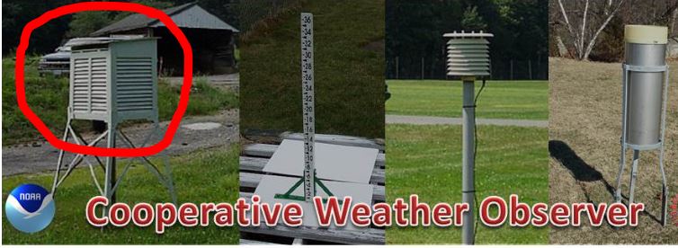
6:15 am: Chilly morning with calm wind and a clear sky, down to 16° here on the NE side of Valentine. Miller Field was at 16° also but currently 18°. The 7-day forecast has no moisture mention and upper 60s next week, enjoy.
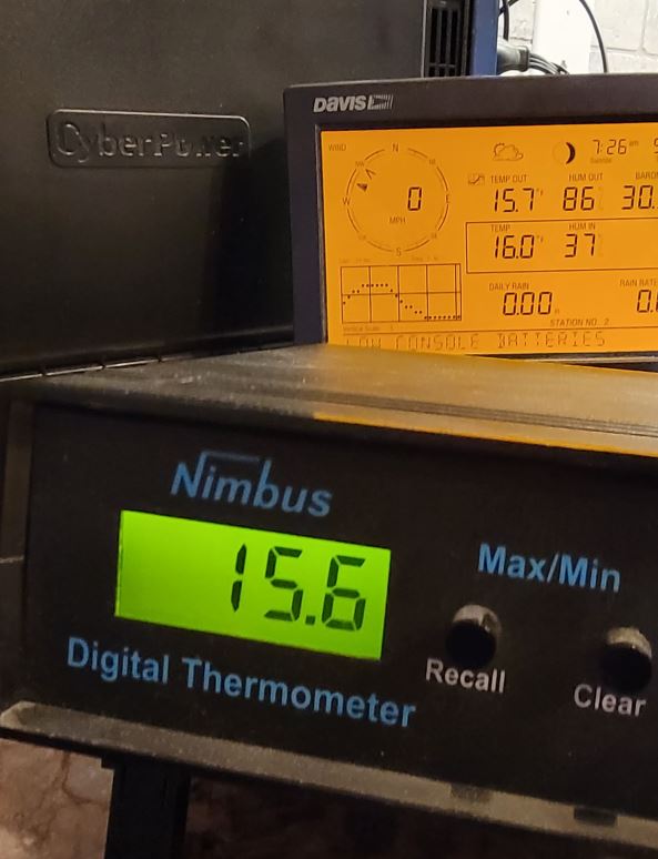
11/09/2023...5:50 am: This morning we have a big temperature split across town. Only 23° at Miller Field and 30° here on the NE side where there is a little more mixing going on ( Wind at 8 with gusts to 14 mph at times). It may even out around sunrise. The south side Tempest station low is in agreement with Miller Field at (24°).
11/08/2023...8:20 pm: Once the wind went completely calm the temperature went below freezing. All the models are too warm tonight. The GFS has the overnight low at 39°, just a slight miss. Miller Field is down to 27°.
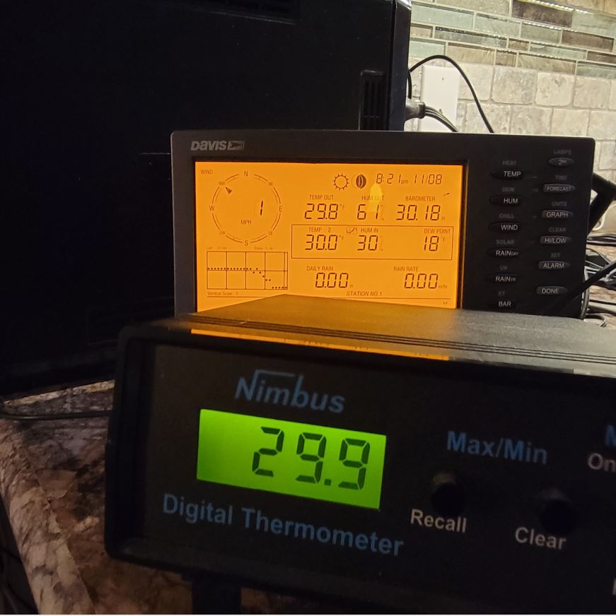
11/05/2023...7:00 pm: We just had a 49 mph NW wind gust on the NE side of town. Looking at the Tempest station on the south side 48 mph.
11/04/2023...5:45 am: We do have a few scattered showers showing on radar this morning. It's below freezing so this may be snow showers. Above-normal temperatures over the weekend into early next week and rather tranquil weather. The forecast high tomorrow, Sunday is currently 75° and still below the record of 83°F (2001). This is that time of year record differences between highs and lows can exceed 80°, from warm 80s to single-digit lows.
11/01/2023...We ended up below normal for October temperatures due to the month-ending cold snap. (-1.9°) . The month will go down as one of the wetter Octobers on record (+2.34") so was anything but boring. Here in NE Valentine it's running (14.58") above normal on precip this year using the departure period NCDC 1991-2020.
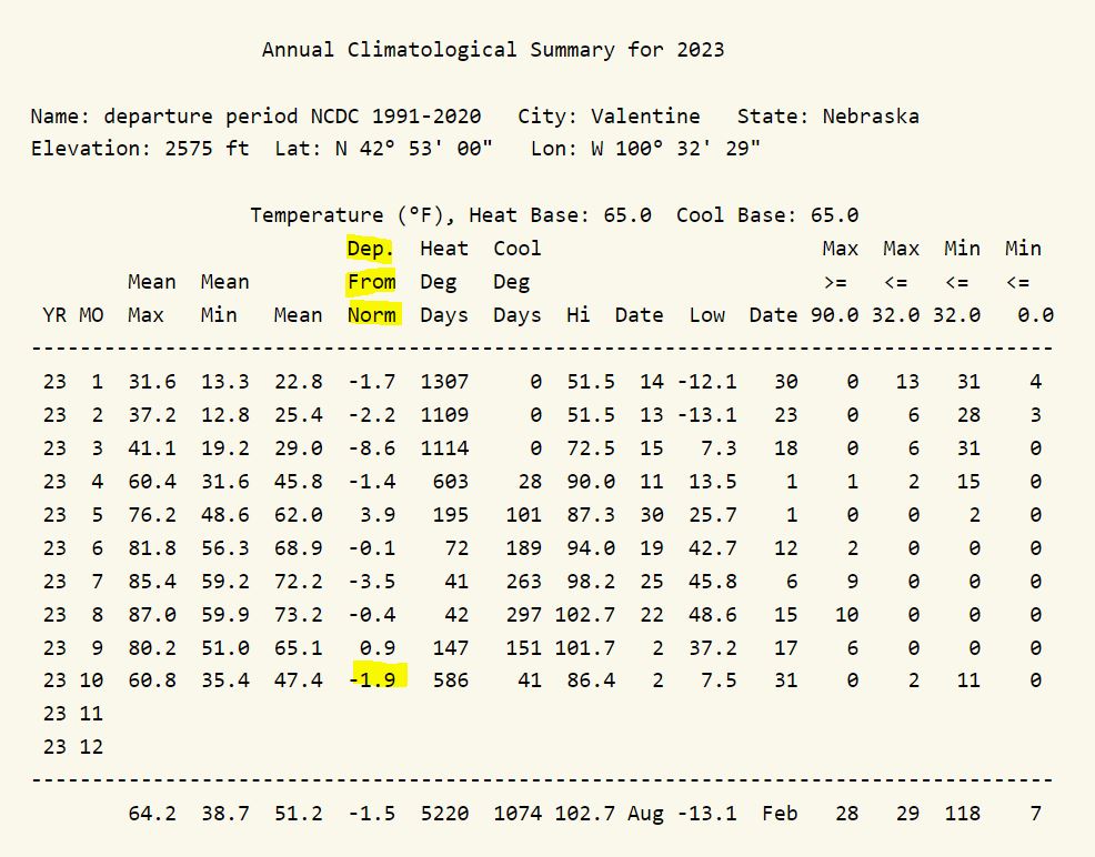
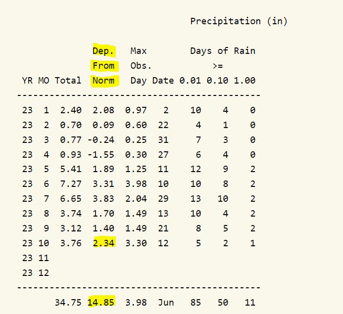
10/31/2023...Low temps this morning Miller Field (6°), South Tempest (6°), and the warm spot here on the NE side (7.5°).
5:30 am: A Cold morning, currently 12° with a feels like running around (-0°) f. It may drop another degree or two around sunrise. Looks like it might get above freezing, 34° late afternoon. With the windchill it won't feel that warm so bundle up those trick-or-treaters.
10/29/2023...1:20 pm: Another cold day for October, currently 30° with a 19 mph NW wind. Starting to get some light snow flurries.
10/28/2023...4:45 pm: Manual Snowmelt was just over .01" so no website adjustment necessary. 1-tenth of an inch measured.
2:05 pm: Getting some moderate snow now. The auto rain gauge tipping bucket tipped which means the heater is still working.
Light snow started about noon.
10:50 am: Another cold day in store with the high temp staying below freezing. The snow looks like it's staying mainly south of the immediate Valentine area. The Forecast still has an inch possible.
10/27/2023...1:30 pm: It was very Icy this morning on raised surfaces, porches, decks etc. Had to hold onto something or walk like a penguin. Heard about somebody falling and breaking a femur. The "Winter weather advisory" is still on for tomorrow. Low 30s expected today for our high, (27°) currently. Our low this morning reached 15° at Miller Field, also at the NE and NW Valentine thermometers. The WC was near zero early on. Here is what "Models" are saying mid-day for moisture tomorrow. The forecast has 1-3" of snowfall. A little further south the more likely heavier amounts could occur on latest runs.
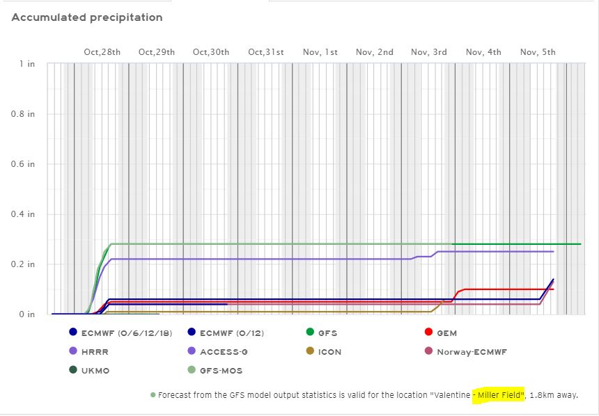
10/25/2023...3:30 pm: The Snow Stake is setup, found under Cameras tab. The high today so far with a heavy cloud deck and mist has been 52°.
8:00 am: Fog this morning once again with around 1/4 mile visibility here on the NE side, (Camera cleans the fog up). Today the expected high is upper 50s. Turning much colder tomorrow (42°) for the high and 30s Friday through the weekend. The chance of snow looks like 50% with only light accumulations being forecast. 1/2 inch or less each day, Thursday night through Saturday. The high temp Saturday forecast below freezing. Later today will get the snow stake setup.
10/23/2023...5:40 am: Currently 36° here, the NE Tempest at it's new location also shows 36°. Miller Field is currently 37°. Another mild day with mid-70s for a high-temperature today. Major changes start Thursday with the high temp dropping to mid-40s and a chance of rain/snow showers in the evening then colder still Friday through the weekend with daytime highs in the 30s and chances of snow over the weekend. How much snowfall is still unknown at this time. What is known for sure is it's turning much colder with near-freezing high temperatures come Sunday. I'll get the snow-stake setup for the camera this week.
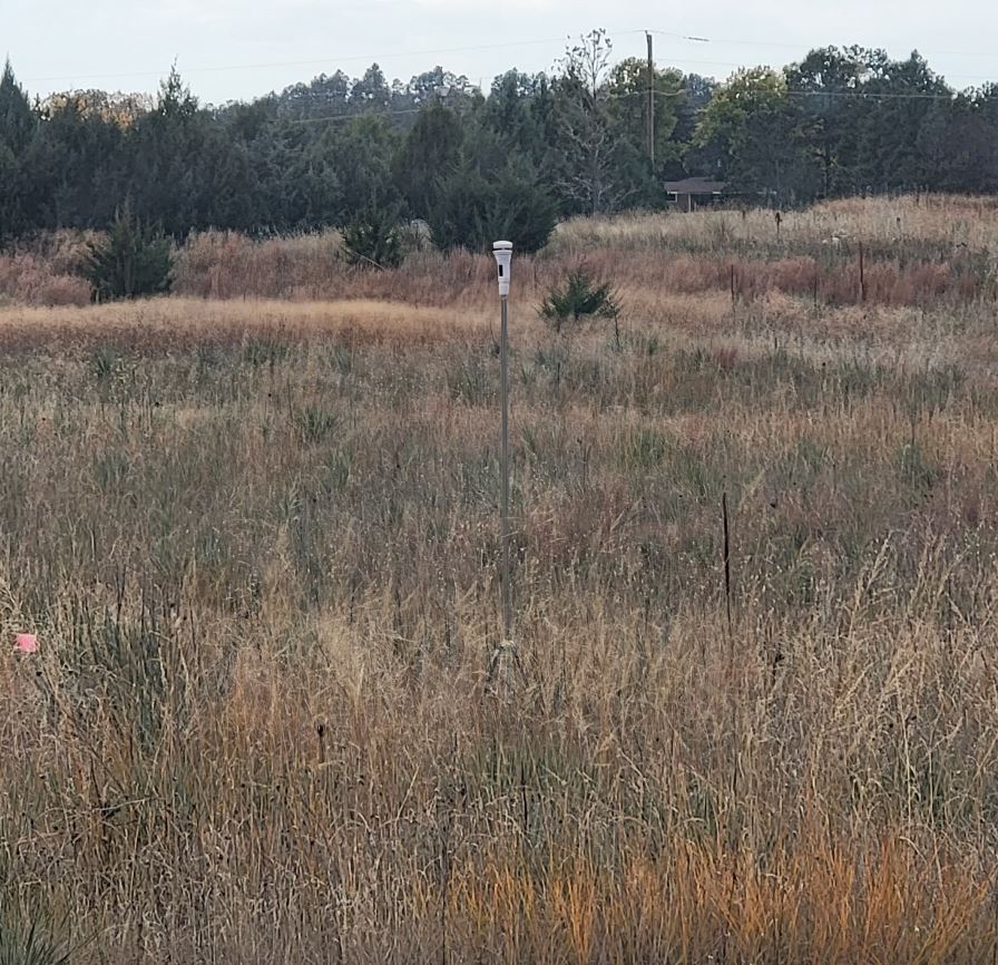
10/22/2023...We have a slight chance of a shower before 1 pm. Looking ahead models are starting to agree on a taste of winter starting toward the end of next week with the weekend high temps staying below freezing on 3 different models. "Models" Something to watch and how much " precip" will be involved. Forecasters still have some uncertainty this far out but with this many models agreeing, what is certain much colder temperatures.
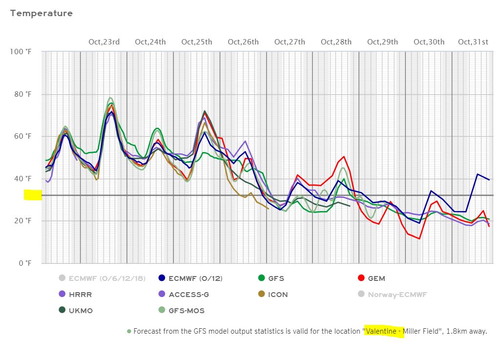
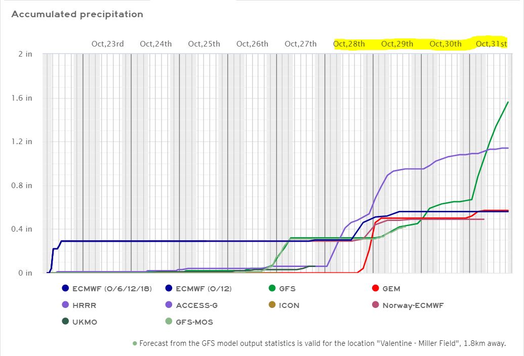
10/21/2023...Came up short of 80° yesterday but just barely (79.4°). Miller Field reported (81°) while the nearby Tempest thermometer reported (80°). Probably the end of the 80s for the season. Next week highs drop into the 50s on Tuesday with a mention of snow showers Thursday night.
10/19/2023...A breezy day but it sure felt good outside reaching 76°. The forecast has low 80s tomorrow for another great fall day.
10/18/2023...10:35 am: Just had a 49 mph wind gust. We did get a shower last night as the cold front moved through but only a trace fell. Near 60° today is expected for a high temperature. Looking at the 10-day as expected for this time of year turning much colder toward the end possibly below freezing for highs on a couple models.
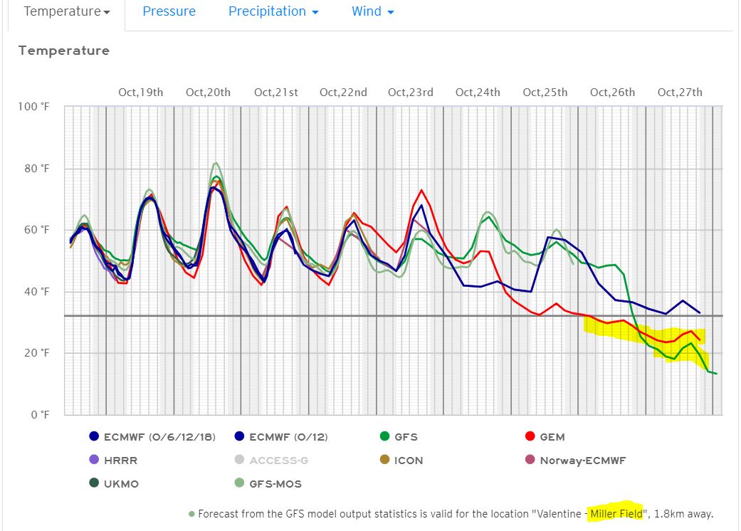
10/17/2023...Dead calm this morning on the NE side of Valentine so running a couple degrees below the airport where there is a 5-6 mph breeze keeping the air mixed. Upper 70's today with a slight chance of a shower tonight. Tomorrow looks a little windy with gusts to 45 mph and much cooler (59°).
10/16/2023...A frosty morning as you can see in the cameras. The low got down to 27° here and out at Miller Field. Looks like a good weather week ahead with only a slight chance of precip Tuesday night into Wednesday. The high upper 70s Tuesday will be our warmest day dropping back to near 70 or 60s for the rest of the week and no precip mention.
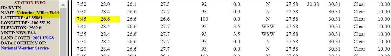
10/15/2023...Cloudy again this morning, should it clear off before sunrise the temperature will drop, currently sitting at 42°. Have some doubt it'll clear before sunrise looking at the Loop. With winter approaching took the plastic Cocorahs gauge down at the airport this morning. It collected another (.22") + (3.12") for a 3-day storm total of (3.34"). Here on the NE side of Valentine, the total was (3.70"). The Cocorahs gauge 3/4 mile east (Adams) collected (3.95") storm total.
10/14/2023...10:30 am: Update on forecast high today. The high temp today upper 40s with a 50% chance of showers. Tomorrow still cool 51° but turning mostly sunny. Tuesday a nice warmup, mid-70s before a cool down and another chance of showers mainly Wednesday night. The extended through Oct. 23rd looks pretty nice with 60s for highs but you just never know this time of year most models were oblivious to this record breaking storm 5-6 days out.
10/13/2023...7:40 am update: Currently 39° with a heavy mist/light rain this morning. Peak gust so far on the NE side 44 mph. The rainfall storm total on the NE side of Valentine so far (3.54") measured with the 8" SRG. Of that 3.30" fell yesterday. The Cocorahs gauge near the airport old NWS office recorded (3.12"). More totals as they come in including NW Valentine (3.15"), KVSH radio downtown (2.97"). Finally Adams place (3.63") 3/4 mile east of this location & just south of the City Golf Course. All totals may not be exact due to light rain again, picked up another (.02") here. As expected Adams place would come in close to the NE Valentine amount and even exceeded..
On the way to the airport noticed the sale barn area corrals were flooded more than usual. The (3.30") yesterday crushes the one-day rainfall total for October at this station. The old record was (.91) in 2015. The yearly rainfall total (34.52") is a station record going back to 2014. The old record was (34.40") in 2019.
10/12/2023...7:50 pm: The daily rainfall amount is now at (2.58") here in NE Valentine. You can see the pivot point (center) on the circulation near Ainsworth. The wraparound will continue here in Valentine until it decides to move or weaken. Update it is slowing moving WNW. 20 minutes ago it was just south of Ainsworth.
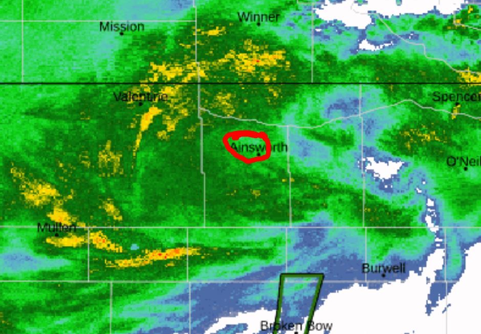
12:45 pm: Since it stopped raining for a bit checked the CoCo gauge near the airport (1.39"). Looks like the airport ASOS reports (1.30") which is about 1/4 mile south of the CoCo gauge location. CoCo rain gauge NW side of town near Catholic church (1.45"). Here on the NE side (1.59"). The KVSH radio station is reporting (1.52") in their 8" gauge downtown. It's not over, more is expected later today and tonight.
10:55 am: Made a website rainfall correction (1.47") to match the manual SRG. The tipping bucket got (.05") behind with the heavy downpour.
6:30 am: (.41") in the rain gauge here overnight. Much more to come before it's over. The NWS issued a "High Wind Warning" for gusts 50-60 mph starting at 7 pm tonight through 7 pm Friday. FYI the automatic gauge you see in real-time on the website is within (.01") of actual unless the rainfall rate gets really high. Rainfall amounts if off always get corrected to the manual 8" SRG.
(.42") reported at Adams place 3/4 mile east of here. Miller Field (.39"). The NW Valentine rain gauge will get a total once it's over. Same with the Cocorahs gauge set-up near the airport.
10/11/2023...This upcoming weather event is something unusual and likely impactful. The forecast discussion pretty much sums it up: "- An anomalous storm system impacts the area beginning tonight and continuing through Friday. Strong to locally damaging winds, very heavy rainfall, strong to severe storms, and wintry precipitation are the primary hazards." Here is what models are saying for precip here in the Valentine area this morning. (Models) Something else you never see, every model agrees. Don't expect much snow for Valentine but will set up the snow stake today due to the unusual strength, it can be found under the "cameras" tab later on.
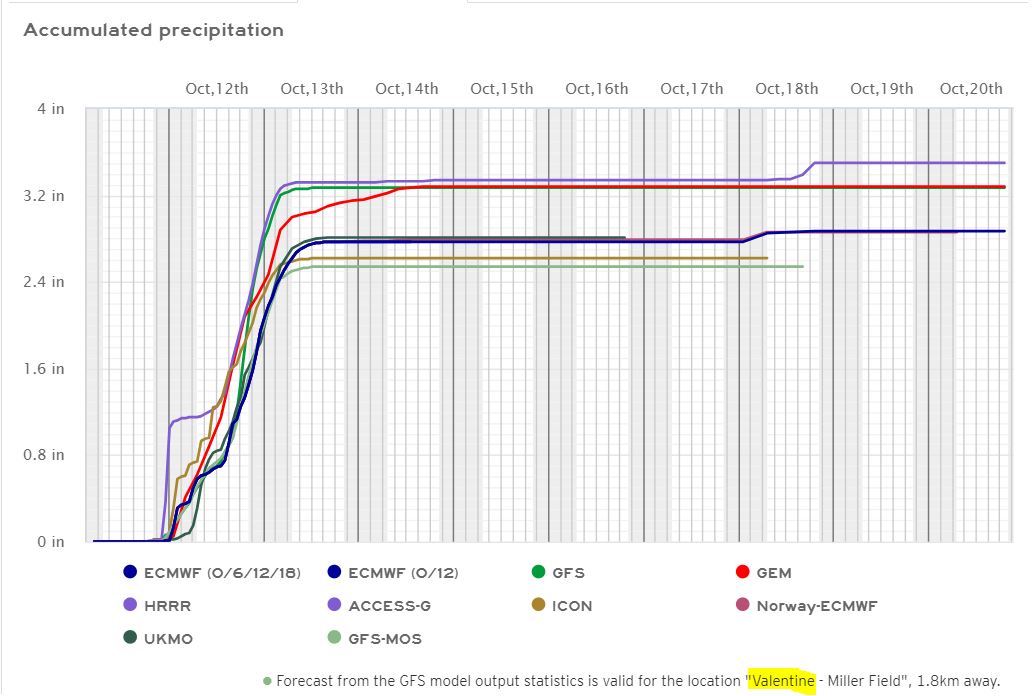
10/10/2023...6:35 am: Not much change in the forecast, still a major rainmaker with 2-4" possible. We've had 2" rainfalls but don't recall this much rainfall potential in the forecast so an unusually wet storm. Can't rule out some of the precip falling as snow also. May get the snow stake setup just in case. Temperatures this morning are around (37°) both here and over on the south side, Miller Field. It may dip a degree or two more around sunrise.
10/09/2023...7:35 am: Lows so far this morning (30°) at the Miller Field ASOS, (31°) here in NE Valentine. Both the Tempest thermometers also (31°). There is some frost on exposed surfaces this morning.
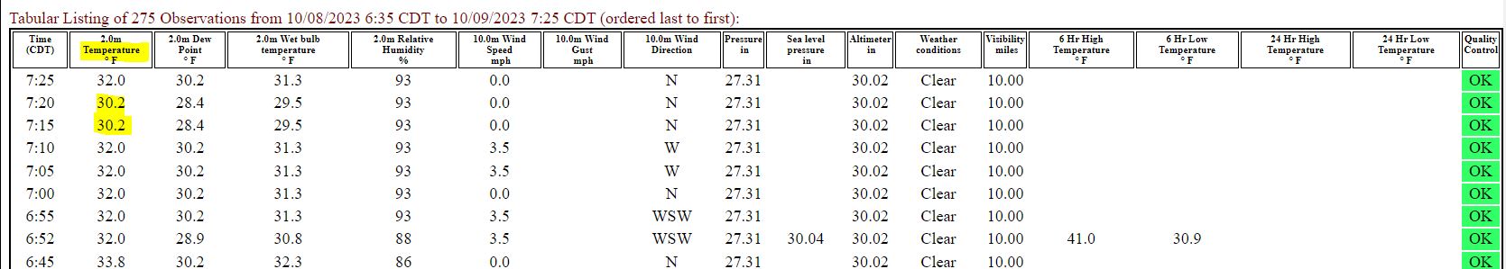
5:30 am: Scattered frost this morning. Looking at Miller Field the temp has been down to freezing (32°) also here in NE Valentine. We have a couple of nice days before a very stormy period starts later this week with high winds and rain potential in the (1-3"+) range (Models) so keep a watch if doing outdoor activities later this week. Even the S-word gets mixed in but confidence at this time is low.
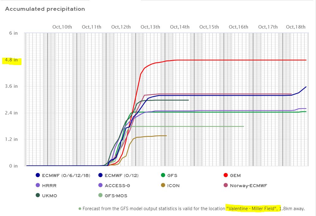
10/07/2023...9:50 am: Updated south Tempest. Final low temps around Valentine, (24°) here at the NE Valentine location, (25°) at Miller Field. The 2-Tempest thermometers (24°) here on the NE side, (24°) on the south side of town.
6:30 am: A hard freeze (below 28 degrees for two or more hours) is ongoing this morning, (24°) has been the low so far. 24° at the Tempest station here also. It dropped below freezing before midnight last night making the 6th our actual first freeze date this season. Not a lot of frost this morning, frost is an indicator of how much moisture is in the air, not how cold it is. The snow stake cam is best for looking at ground frost. Found under cameras link. Looks like perfect weather for the next few days with 60s for highs. Our next chance of precip starts this coming Wednesday night.
10/06/2023...The first seasonal freeze this fall occurred at 10:50 pm on October 6th. Happens to be the station's average first freeze date dating back to 2014.
5:40 am: Freeze Warning for tonight. It looks like we could slip below freezing early on so it could become an extended freeze until a couple hours after sunrise, the (Official) forecast this morning has the low at (24°) for Valentine Saturday morning so take necessary precautions. Luckily the sprinkler system here just needs drained and not blown out. Too early to completely shut down for the season. The air temperature is measured at around 5', at ground level it can be several degrees colder in calm conditions. Just a reminder there are a couple more thermometers you can reference around Valentine with near real-time (one-minute average cycle) linked under External Links Weather Flow Tempest stations.
10/05/2023...We have a slight chance of a shower tonight in the forecast. The NWS has issued a widespread "Freeze Watch" not Warning that starts at 12 am Saturday. If concerned about how cold it could get, keep an eye on the dew point temperature, the lower it drops the lower the potential air temperature. What actually happens always depends on wind speed (does it go calm) and are there any clouds acting like a blanket. Looking at the week ahead the GFS (American model) still looks too warm reaching into the 80s on the 10th while other models stay in the 60s so almost a 20° difference.
10/04/2023...5:50 am: Our next chance of precip comes Thursday night into Friday. The upcoming first freeze is still on track with the forecast high Friday only 50° and falling to around 27° by Saturday morning. The Low temp so far this morning 45°, also the same out at Miller Field. Mentioned next week it may get well above normal again, but several models have started to back off on that thinking with the exception GFS still showing mid 80s. The latest Models are taking this upcoming cool down all the way to the Gulf of Mexico something they didn't see a few days ago so right now struggling with the transition over to fall.
10/03/2023...6:30 am: No rain so far, was afraid of that, most models had really backed off yesterday afternoon (ECM showed nothing) keeping the storms well west of the immediate area. Still a slight chance this morning looking at the radar. A killing frost is possible looking at the forecast low Saturday morning (28°). Our high temperature for today may have already occurred at 1 am, 75°.
10/02/2023...Here is something of interest about Valentine's average first and last freeze dates since it's approaching, this goes back to 1889 when it froze on Oct. 17th that year. Image. Scroll to the bottom. Mean first freeze 9-28, last freeze 5-10. Since 2014 this station HERE.
5:45 am: One more well-above-normal temperature day. (Normal 72°) Tonight precip chances look good at 70% in the forecast but models aren't advertising much, around a tenth but subject to change. Our first possible frost is still on for late Friday night and Saturday morning. At 5:30 am here in NE Valentine the south wind has switched to the NNW while Miller Field still has a south wind. Yesterday it reached 85° here on the NE side of town and 87° was reported at the airport ASOS. The south side Tempest reported 86°. This coming cool down doesn't look like it will last, in the extended another strong ridge builds.
10/01/2023...September came in slightly above normal on temperature (+0.9°) here on the NE edge of Valentine. Precip another wet month +(1.42"). Even wetter out at Miller Field, at (+2.36") above normal for September. Monday night into Tuesday still looking like thunderstorms and showers likely. Some models have backed off on amounts. Well above normal today and tomorrow on temperatures before a cool down. Looks like the morning of Oct. 7th will be our first chance of frost this season.
09/30/2023...10:00 am: Dense fog this morning, the visibility got down to 1/4 mile at Miller Field. Monday night into Tuesday night a decent chance of precip (60% currently) with the forecast. We have our potential first freeze around October 6th-7th which is on target with the station average since 2014.
09/28/2023...A heat wave for much of Nebraska ahead especially to the south and east. Valentine is expected to reach around 80° today then cooling into the mid 70s tomorrow followed by 80s again. Starting around October 5th a big cool down per several models with highs in the 50s.
09/27/2023...A bi-monthly newsletter called "The CoCoRaHS Catch" came out and noticed an increase of observers here in Nebraska. Quote: " An increase in 1,000 stations came in large part from Minnesota (214), Kansas (161), Texas (107), Louisiana (89), Nebraska (79), Wyoming (78), Tennessee (70), South Carolina (44), Wisconsin (40), Kentucky (36), and an honorable mention to the growth that has taken place in Puerto Rico (21)." Anyone can join using one of the 3-types of rain gauges tested and approved for accuracy. There are also several training slide shows and videos. Don't worry if you can't report daily or forget you can always submit reports later. Skipping winter snowfall measurements (inches on the ground) is an option also. Many just don't have the area needed tree free for an accurate measurement. Even here without a single tree it becomes difficult during blizzard drifting conditions and gauge catch is all that can be used.
09/26/2023...6:40 am: Patchy fog is possible this morning, especially toward sunrise. Miller Field ASOS has been reaching 100% RH a few times, unlimited ceiling, visibility is still 10+ miles so no fog yet!
09/25/2023...A rather benign weather week ahead with the next best chance of precip coming Saturday night. Temperatures start off near normal then edge above as a strong ridge develops midweek. No sign of our first freeze yet. Freeze data for this station is HERE. We are getting close to the October 6th date.
09/23/2023...Final rainfall reports Miller Field (.11"), NW Valentine (.11"), NE Valentine (.15"), and 3/4 mi east of here Adams place (.21").
6:50 am: Doppler rainfall estimates overnight Rainfall . Under an inch of rainfall most areas with a couple of yellow 1" areas by Olsonville and near Crookston. My experience with Doppler rainfall, it overestimates but does give an idea of where the heavier rain occurred.
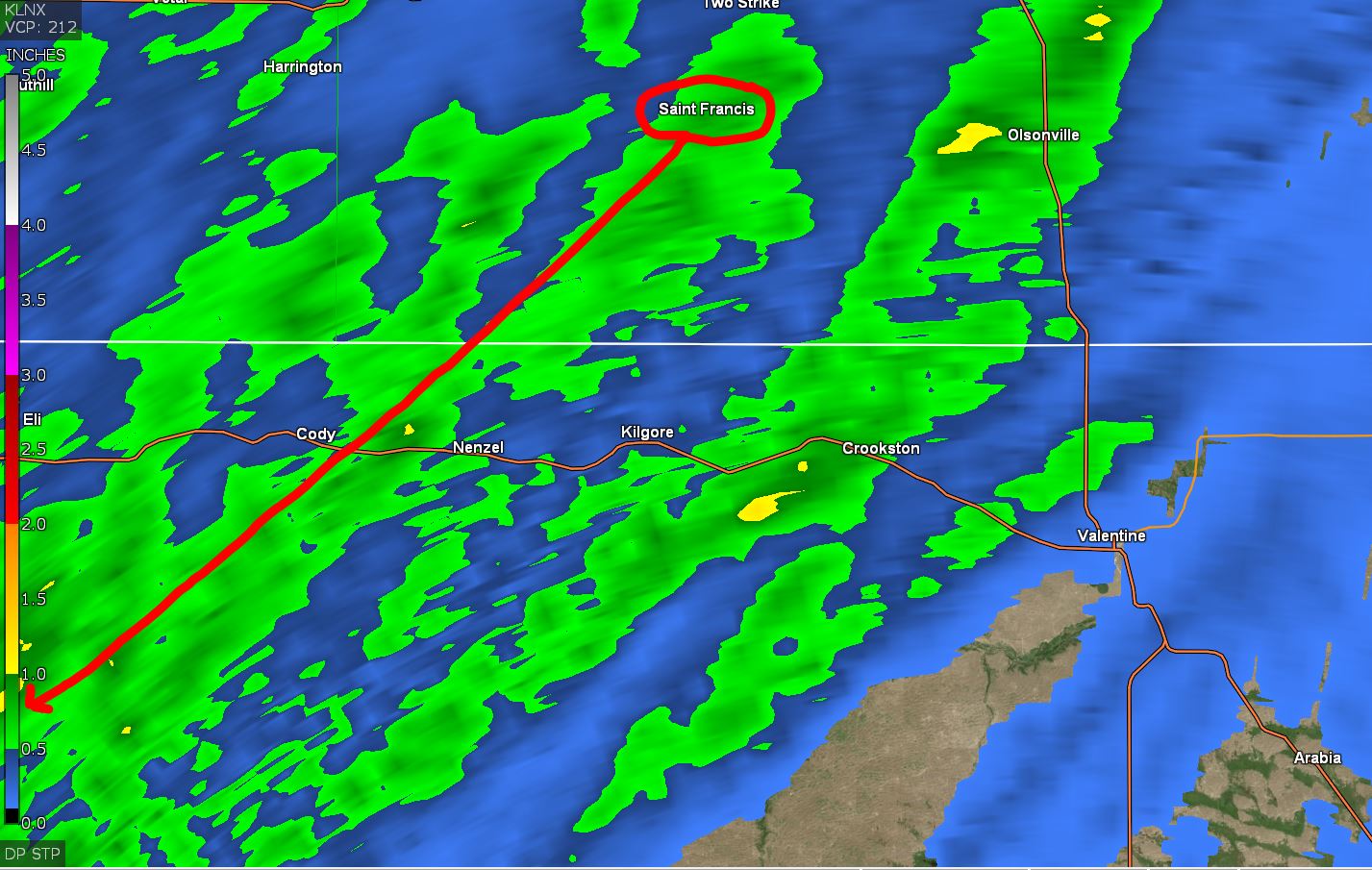
5:30 am: The Fall Equinox started last night at 1:50 AM. Some tree leaves have already started changing. Overnight so far we received (.08") here on the NE side of Valentine. Our next chance of moisture after today comes toward the end of this upcoming week. For the year now sitting at (30.92") at the NE Valentine location so not that far off from 2019 which ended with (34.40"). Need to include 2019 was the year this station was relocated from west Valentine to this northeast side in June so 2 locations were involved.
09/22/2023...7:28 am: We have fog around the area this morning. Reporting 3/4 mi visibility at the airport. About a 1/4 mi here in NE Valentine.
Miller Field set a daily rainfall record yesterday of (1.68"). Later tonight another round is possible. Update: On the lion KVSH confirmed that the animal was euthanized in accordance with Game and Parks policy to protect public safety.
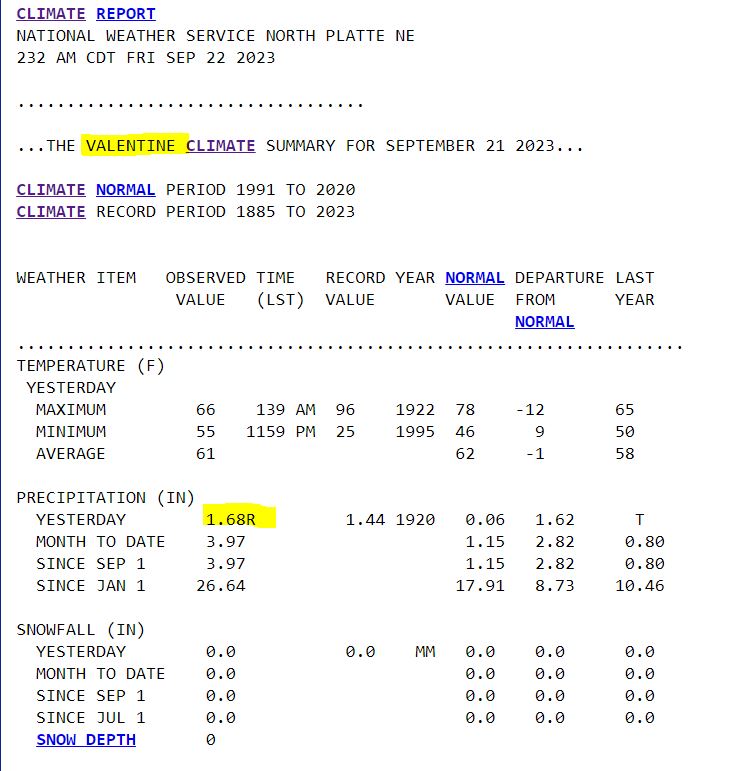
The mountain lion being seen inside Valentine was captured and relocated last night says KVSH radio this morning. There could be more than one lion with the multiple sightings.
09/21/2023...Updated totals: Since this morning: The KVSH radio station (Updated) reporting (1.60") here in NE Valentine (1.48"). Coco rain gauge NW Valentine near the Catholic Church (1.87"). Miller Field ASOS (1.61"). The Cocorahs gauge near airport office 1/4 mile from ASOS recorded (1.58") was dumped this morning about 11 am had (.10") from yesterday. (1.13") 3/4 mile east of here and finally Coco gauge far west Valentine near Thatcher St. and end of 3rd St. (2.33"). The old Station location. Here is the Doppler rainfall estimates. The color scale is on the left side of image. Showing about +1/2" more than what this NE location received.
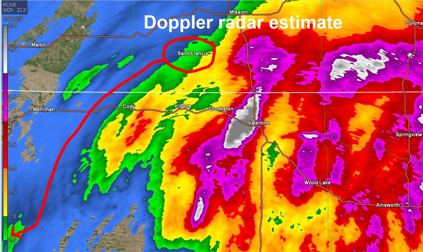
2:37: Very heavy rain over 8" per hr. rate and Low visibility.
2:18 pm: This thunderstorm has a TVS so radar indicates the likely presence of a strong mesocyclone that is in some stage of tornadogenesis.
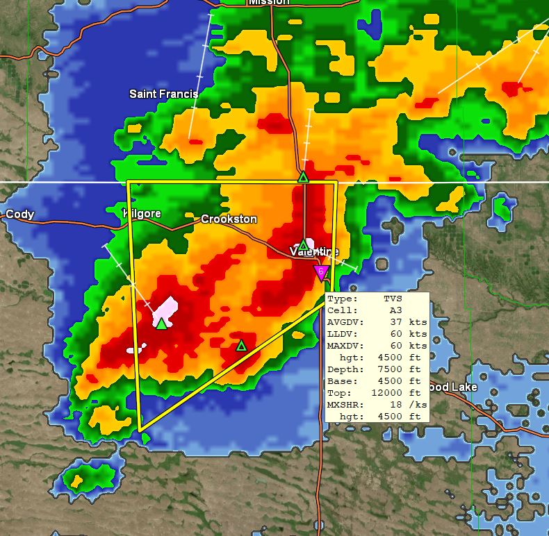
Looking at Prep game delays Thursday and Friday. Starting this afternoon is the wettest period according to the HRRR model locally. Has as much as 8" falling just north of Valentine. Not much happening Friday night according to this model. So may get lucky for Friday games if it all falls tonight. This model updates and runs hourly HERE. Also linked under External links "HRRR total Precip." Adams 3/4 mile east of here reported (.10") in the Cocorahs gauge this morning, (.03") in the NW Valentine COCO gauge.
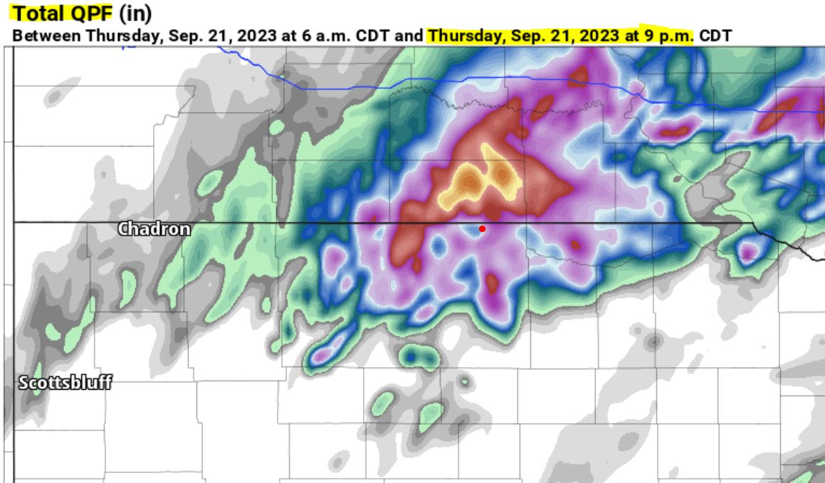
6:00 am: Scattered areas of showers and thunderstorms overnight. Only (.03") fell here so far, out at Miller Field (.11"). The atmosphere has moistened up with the dew point temp this morning around 60°. Now with thunderstorms, more rain will reach the surface. Pretty much on schedule for a chance of substantial rainfall over the next couple days with a couple of heavier amounts (HRRR and ECM) showing 2" plus for Valentine. All models are not in agreement some take the heavier rain just east along the SD border.
09/20/2023...5:13 pm: Hearing thunder. Current RADAR.
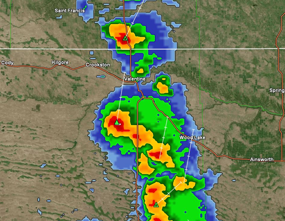
5:35 am: An active weather pattern starts Thursday night. Forecasters are pretty confident with 80% chances Thursday night through Friday night for Valentine. A look at Models this morning. We did reach (90°) yesterday here on the NE side of Valentine. (91°) at the airport. Today upper 80s before cooling below normal over the upcoming wet period. Normal now is (79°).
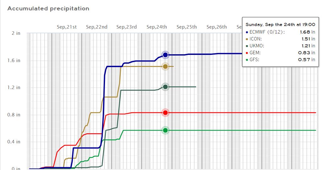
09/19/2023...6:50 pm: Had a brief heavy downpour with (.03") measured. That was a little unexpected. This side of town missed out on the (.03") a couple days ago so catch up. The Cocorahs rain gauge NW Valentine reported nothing today.
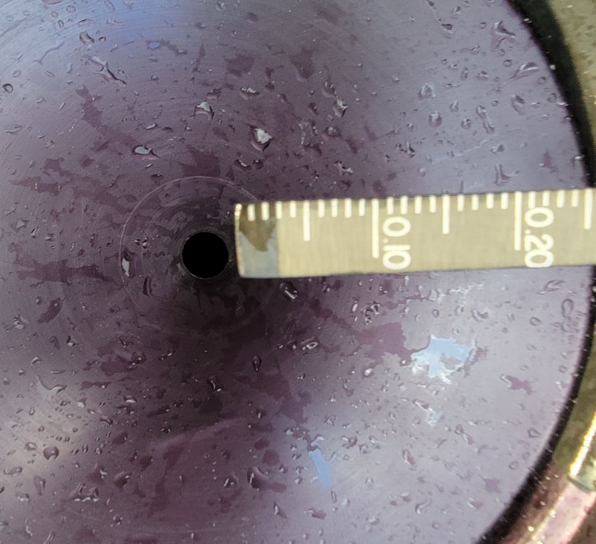
6:24 pm: Getting some rumbles, a small isolated cell popped up just to the west. It may clip this north side of town as many do following the river valley. The atmosphere is really dry only 21% RH currently so more lightning than rainfall.
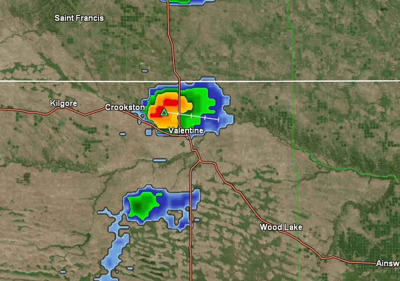
5:00 am: Not much has changed from yesterday, still looks like starting Thursday it turns wet. Once again the high today is expected near 90°. Won't be shocked if it stays a little below here on the NE side. At this hour it's running about 6° cooler (47°) than at the same time yesterday.
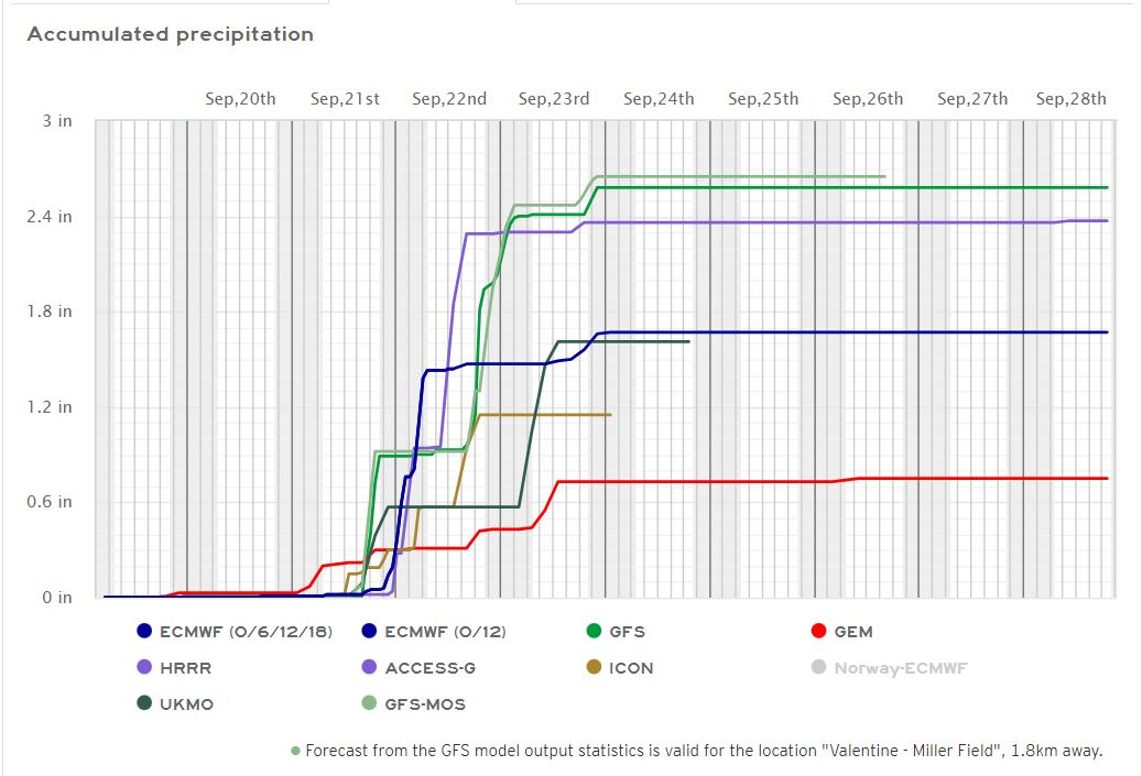
09/18/2023...5:20 pm: Our High today came in at 88° here in NE Valentine.
Above normal high temps Monday, Tuesday near (90°) cooling slightly Wednesday (85°). Our normal is around (80°), then turning wet starting Thursday night through the weekend. Looking at models we could end up with an inch or two of moisture before it's over. It's sure been a good year for moisture. Sitting at (29.30") here on the northeast side. The south side of Valentine has been receiving more recently and starting to catch up but it's still about 4" behind at (24.86"). It's likely due to the Northeast side closeness to the hills and river valley where the ponderous pines grow naturally, during the early wet period (May, June) thunderstorms followed the river valley and higher elevation on the north side sometimes missing or barely clipping the airport side.
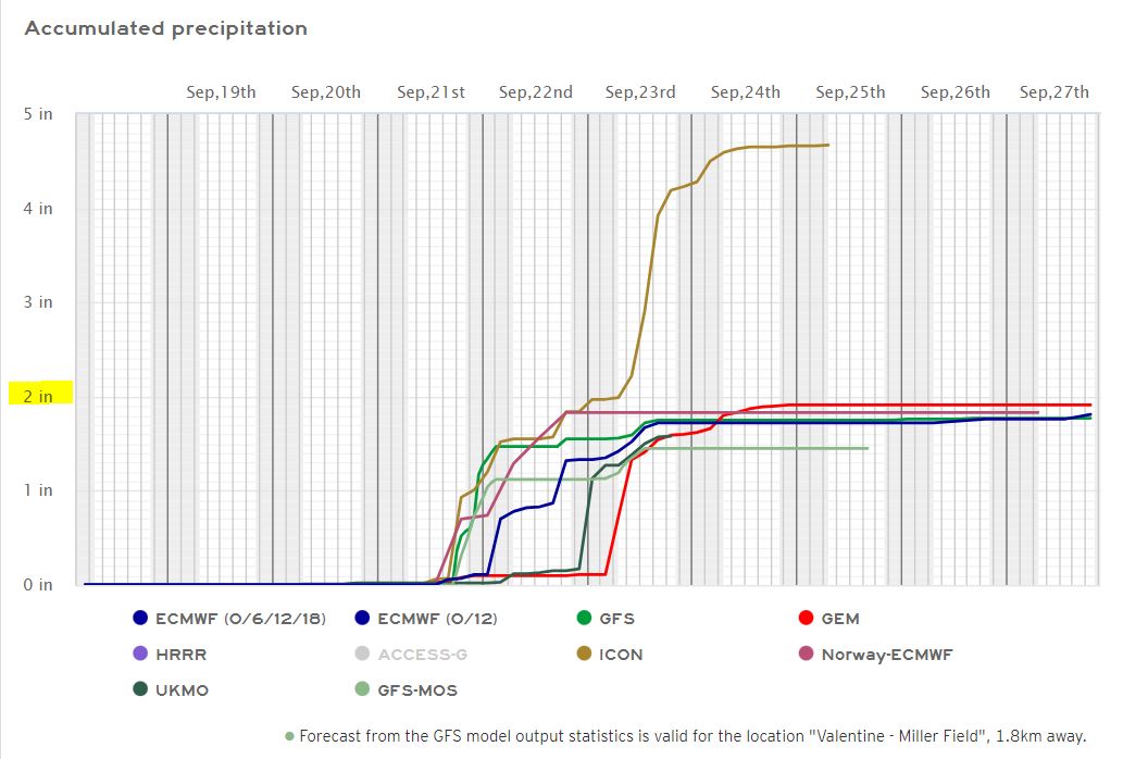
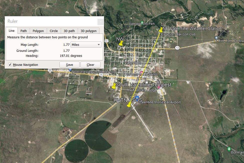
09/16/2023...Chilly this morning, as I work on the opinion blog it's down to 67° inside and 45° outside. Should be a perfect day mid-70s with light wind. A chance of smoke any time the wind direction is out of the north. Yesterday it happened but was short-lived.
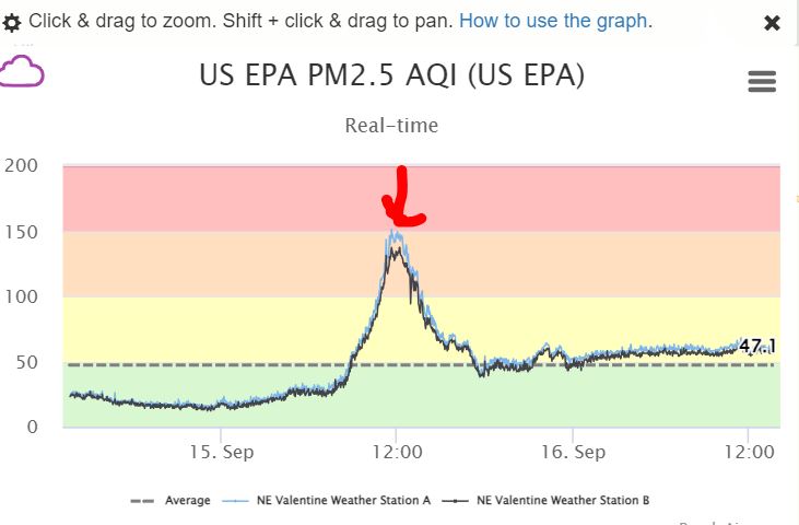
12:20 am: Smoke is rolling in, you can see and smell. Took the widget off again it doesn't match the Purple Air map. Linked under "External Links".
We had a trace of precip overnight here in NE Valentine. Miller Field looks like (0.03"). NW Valentine (0.03") also. Our next chance of moisture is Wednesday night.
09/14/2023...The PA widget is working again so put back on the front page for now. Scroll to bottom.
You may have noticed the Purple Air AQ was removed from the front page. The reason was the widget stopped working correctly and didn't match the actual. This morning the widget was in the 70s while the actual was 40, the links under "External links" are working along with the (New) EPA corrected formula matching the AirNow instruments. (article) The forecast for Valentine has a (30%) chance of moisture tonight as a cold front passes though.
09/13/2023...Under "External Links" Added the EPA adjusted Air Quality link (AirNow) map. Updates come about 13 min after top of each hour. The refresh doesn't work. For Realtime use the Purple Air link. If you scroll out on the AirNow map you can see the 6-Nebraska Government sensors (round) the (square) sensors are Purple Air.
For more info about the the EPA corrected equation, Quote: The correction equation developed by EPA scientists allows us to show the sensor data on the map, in a format that you can compare to information from regulatory monitors operated by experts, Go HERE for full article.
09/12/2023...5:15 am: Clouds this morning holding our temps into the 50s but should clear off by sunrise dropping us into the upper 40s. Next best chance of precip comes Thursday night at 50%.
09/10/2023...The (1.54") recorded at Miller Field was a daily rainfall record.
Updated 10:20 am: A couple more rainfall amounts came in after going back to bed, NW Valentine near Catholic Church (1.28") and Adams place 3/4 mle east of here (1.17").
The tipping bucket auto rain gauge was right on with the manual measurement (.99"). KVSH radio rain gauge recorded 1.37" and the Cocorahs gauge at the airport old NWS office area a whopping (1.59"). Both of those gauges were emptied yesterday after the rain. This NE side once again received the lighter amount. Mother Nature's way of catching up on the south side these last couple of months. Looks like the Miller Field ASOS total since midnight is (1.53"). It's another .23 mi south of the Cocorahs gauge location.
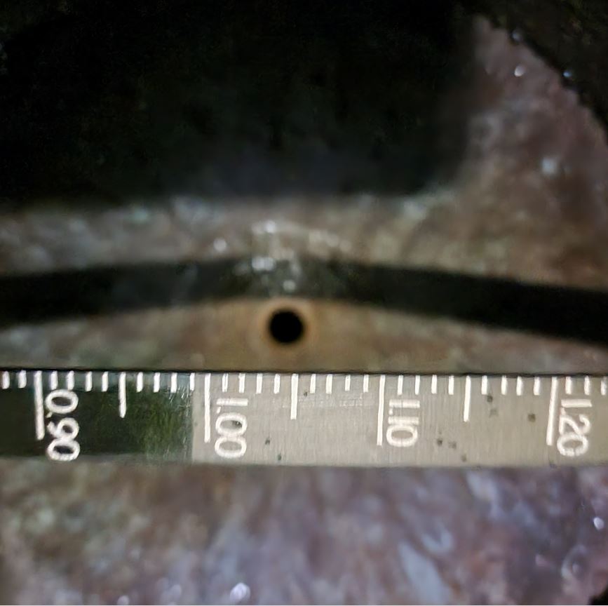
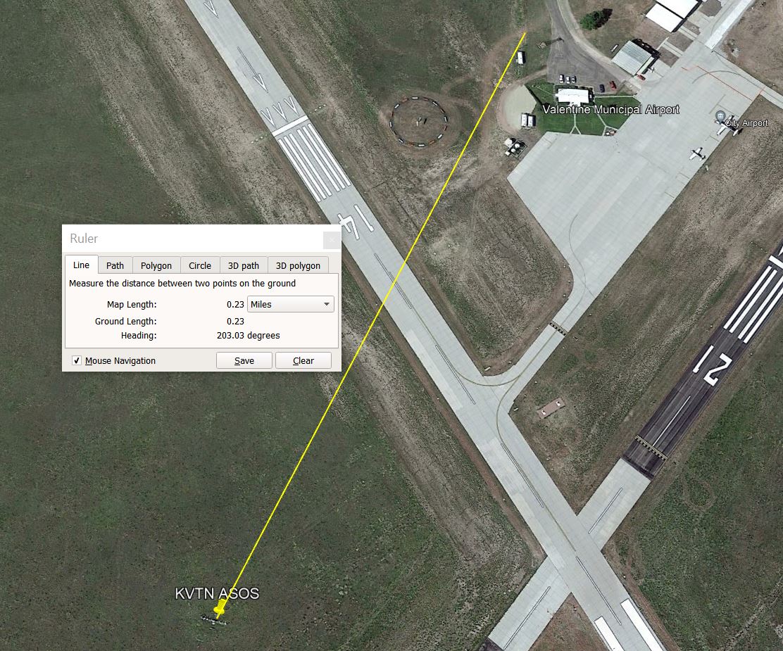
4:10 am: Heavy rain and T-storm. Didn't see any hail on this side of town, south of here (dot the T in Valentine for this location) likely did have some looking at the white radar return. Will get a manual measurement once it stops completely. The tipping bucket may be behind slightly with the rainfall rate reaching 3" per hour at least once. Looking at Miller Field (1.10") at 3:52 am so heavier on the south side again. Radar image during the storm. This one was elongated and lined up on Valentine moving west to east. Looking at radar, rain will continue lighter until about 5am.
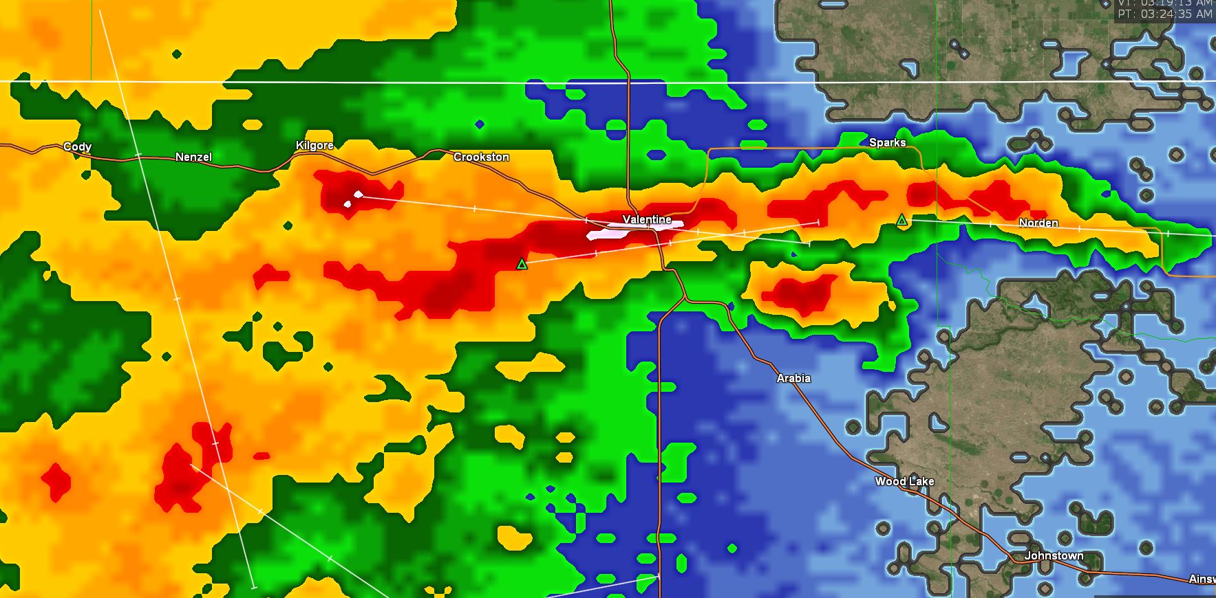
09/09/2023...10:10 am: Received brief heavy rain (0.05") and pea-sized hail. The T-storm is east of Valentine moving toward the SE. Radar
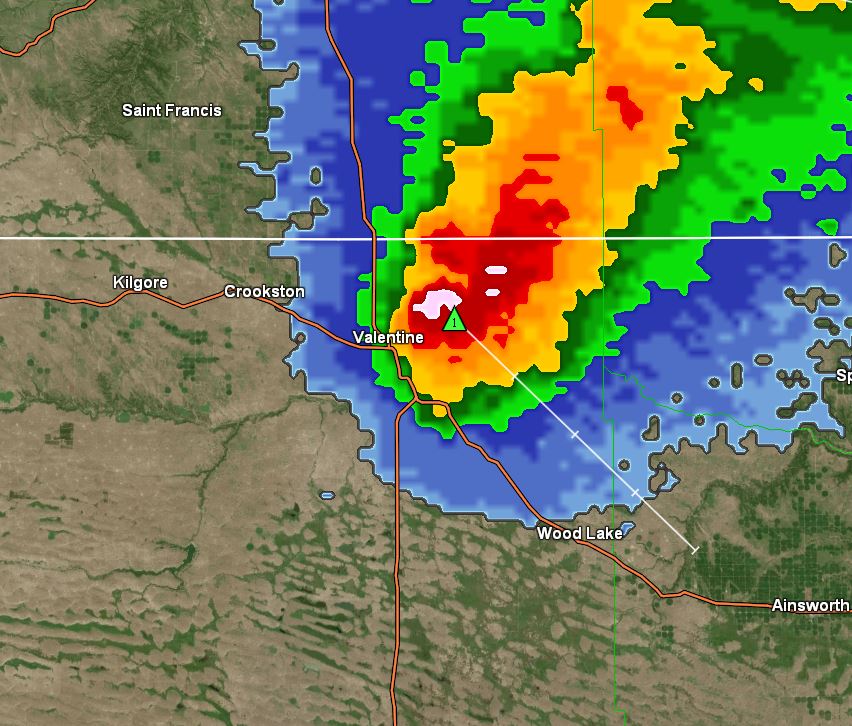
7:30 am updated: Early this morning had a thunderstorm and rain, (Radar) We did have a nearby lightning strike you may have heard. Total rainfall (.17") here on the NE side. Looks like the south side of Valentine received twice as much, around (.42") at the airport. The Cocorahs gauge near the AP old NWS office (.62") but that includes the rainfall on the 4th-5th that didn't get dumped. (.20") fell here on those days. The Miller Field ASOS is showing (.42"), also downtown at KVSH radio (.42"), 3/4 mi east (.25") at Adams place. For the rest of the day, the forecast has a 20% chance with the best chance returning Sunday at 50%.
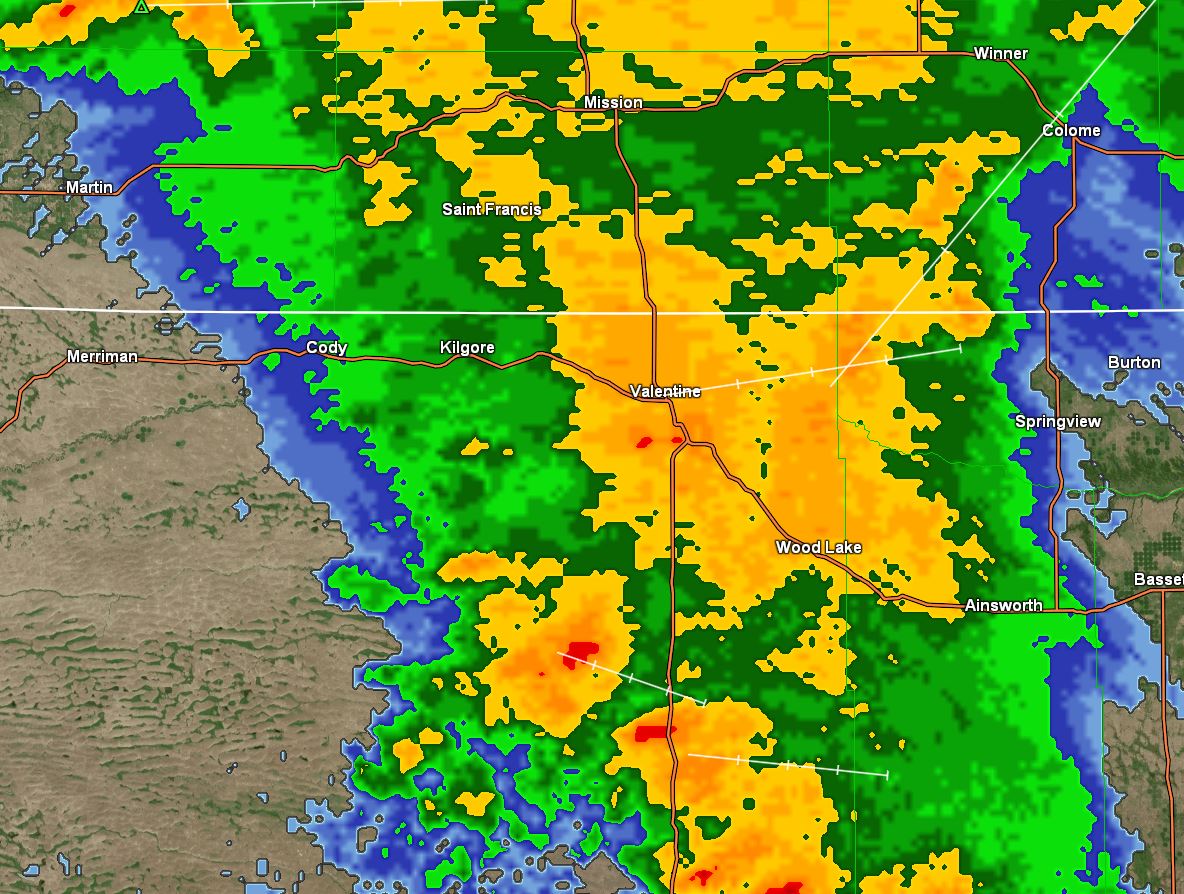
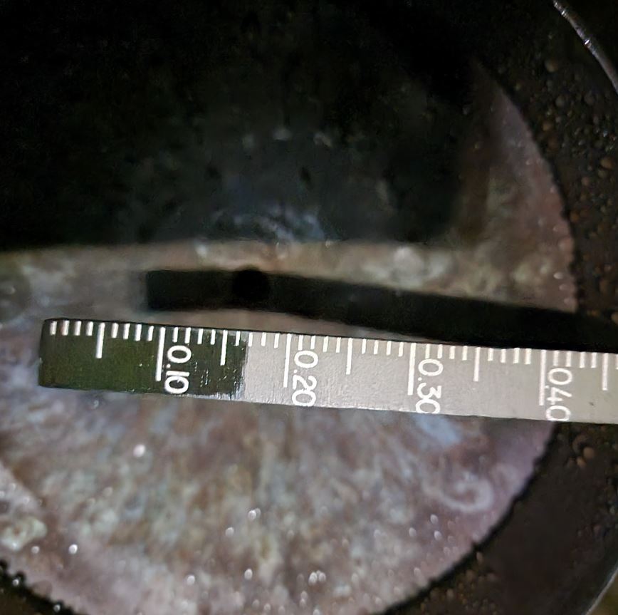
09/08/2023...Strong thunderstorms passed just south of Valentine yesterday evening. We did reach 91° yesterday, Miller Field reported 93°. What's been going on the Miller Field ASOS has been spiking up a couple degrees over a period is why the +2° daily differences. The south Tempest near Miller Field reported 92° yesterday vs 91° at the NE Tempest on this side so (apples to apples) it was +1° warmer. We just aren't seeing these same spikes in Northeast Valentine. Only a 40% chance of precip in the forecast for tonight and tomorrow. The smoke cleared out yesterday for a short period and got down into the Yellow but this morning we are back into the Red at 164, at least it's not purple again. Airport visibility is (3.5 to 4 mi) this morning.
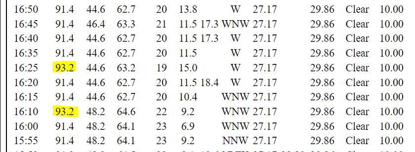
09/07/2023...The forecast has us topping at around 90° today. Maybe some of the smoke will get out of here with the south wind and warmer air. The latest ECM run thinks something may slip in tonight (0.07") in moisture, nothing in the morning forecast package, however. Starting Friday night will be our best chances of moisture.
09/06/2023...12:00pm: At top of noon hour 63-64° here in NE Valentine and at the airport. AQ is still 210+ (purple) with a 2 mile visibility reported at the airport.
The low temperature so far this morning has been down to (41°) both here and out at Miller Field. We may have a little ground fog mixed in with the smoke haze this morning. Got down to (1.0 mi) visibility at the airport. It sure is ugly outside. The webcams clean it up because the lens isn't as accurate as our eyes.
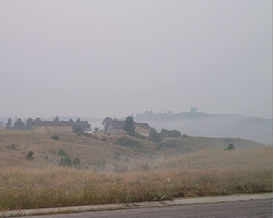
Very cool this morning with low to mid 40s. The airport visibility has been down to (1.75 mi) with the AQ in the 220+ purple range. 201-300: Health alert: "Everyone may experience more serious health effects if they are exposed for 24 hours." Tried to open the bedroom window but the Conway air purifier sensor kept saying dirty air and kicking on high which makes a lot of noise so gave up and closed it. Really like the Conway if you have hay fever or allergies it helps. For this Saturday and the Chaduza cook-off at the City Park, it's looking wet, here is what models are saying this morning. (Models) The GFS models are the exception.
09/05/2023...8:45 pm: Current AQ map. We are beyond red in the purple.
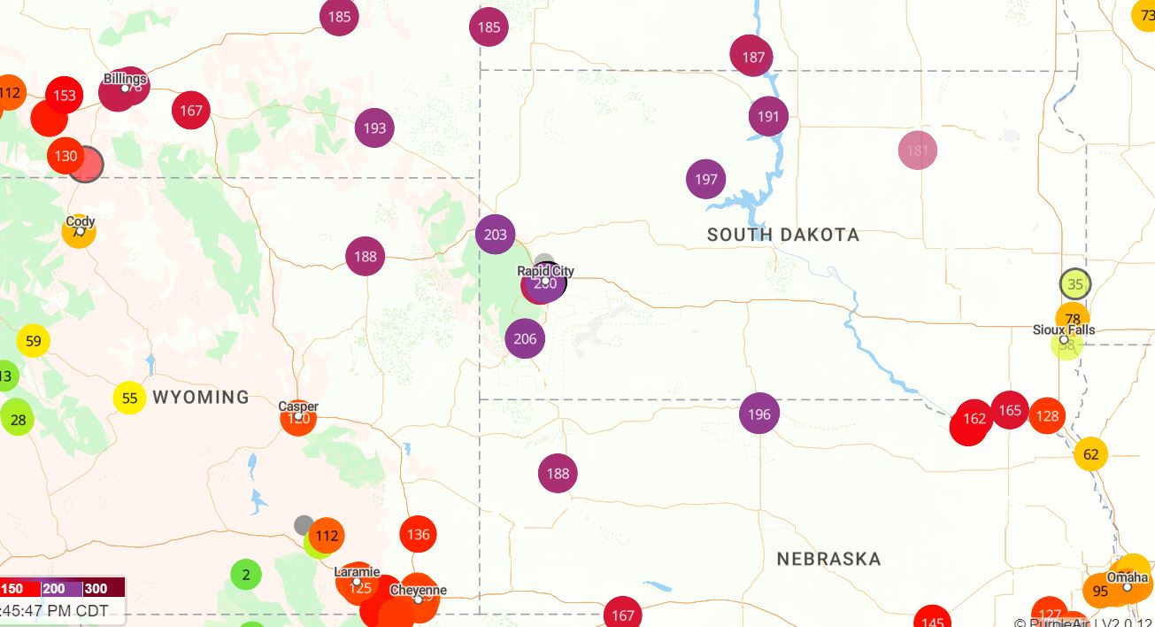
Here was the sun just before setting, no filters with the heavy smoke Image. If wondering about this thick smoke tonight whether it may affect the temperature by acting like a blanket the answer is no. It will keep daytime temps lower but doesn't act like a blanket at night.
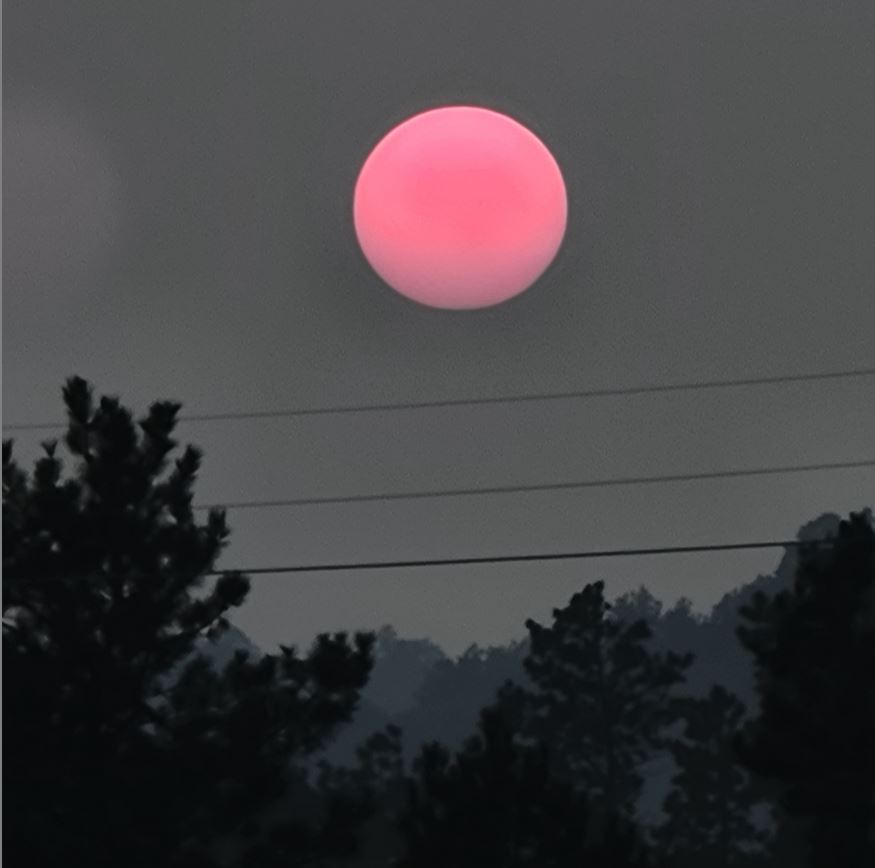
4:10 pm: Put the Air Quality back on the front page. It's really yucky outside today with the smoke. Currently a solid Red at (181). Miller Field is at 3 miles visibility. Almost too cool to run AC, they recommend not to below 60° it can stress the unit and cause damage over time and the air quality is bad enough opening windows isn't a good idea either. Between 151-200: Everyone may begin to experience health effects if they are exposed for 24 hours; members of sensitive groups may experience more serious health effects.
12:18 pm: We are getting some light rain and mist not sure why it doesn't show on radar. The temperature is down to (57°) at the noon hour. The wind NW at 25 with gusts to 36 mph. What a difference a day makes.
Moved the Air Quality off the front page, it was hanging up yesterday it's back on the sidebar under "external links".
Finally got a little moisture from thunderstorm activity overnight as a cold front moved through. (.20") Here in northeast Valentine. The high temp will reach only into the mid-60s today. A brief warmup on Thursday and Friday then below normal temps and chances of showers and T-storms. For Saturday it looks wet toward mid-day, forecast says evening however, this is what current models say.
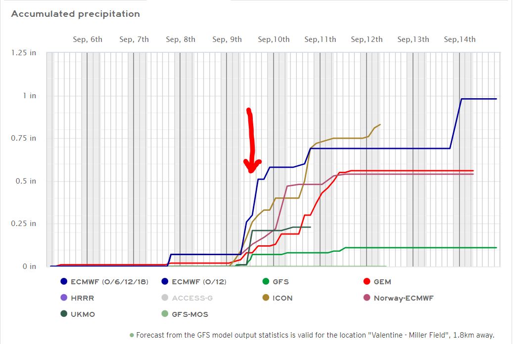
It was brought to my attention that the Chaduza cook-off in the City Park starts at the same time as the Huskers kickoff in Boulder at 11 am. Lots of interest in that game outside of Nebraska and Colorado with talk on the sports shows mainly about how Prime Time rebuilt the Buffs. Hopefully, the Huskers will bring them back down to earth. My suggestion is take the team to Colorado early and acclimate to the higher elevation it generally takes 1-3 days.
09/04/2023...8:31 pm: Thunderstorms are developing right over us. Getting big rain drops currently. We had a 60 mph wind gust.
One last hot day, then a chance of a thunderstorm tonight. Models aren't saying much rain but anytime there is a T-storm you never know. Miller Field tied the record high yesterday at 102°. Here in NE Valentine (100.4°) on the primary thermometer and a couple of others reached (100.5°). As mentioned before here in NE Valentine there are 2-aspirated shields each radiation shield has 2 Sensirion temperature sensors.
09/03/2023...6:00 am: A couple more hot days with a 60% chance of a thunderstorm Monday night. Yesterday was another record high at Miller Field (104°), 102° here. The south Tempest near the airport also reached 104°.
09/02/2023...2:20 pm: It's already reached 100° today, we're almost +7° vs the same time yesterday. Ouch!
6:00 am: Another hot one today with the NWS issuing a "Heat Advisory" through tomorrow. Our forecast says 101° for Valentine. The HRRR model usually does a good job on high temperatures experienced here on the NE side of town has us topping at around 101.5°. The Fire danger is getting up there without any significant rain for a couple of weeks so we do have a (Burn Ban) in place currently, no open fires allowed.
09/01/2023...9:45 pm: The airport reported a record high of (103°) and was all alone. Only (100°) here in NE Valentine on all (5 total, 2x in each aspirated shield) thermometers including the NE Tempest station (100.4°). The south side Tempest recorded (101°) and KVSH radio downtown reported (101°). It felt a little warmer the high heat index was 102° here on the NE side today. Sounded like the Badgers had a better game tonight even after a freshmen QB had to come in, temperature at kickoff here in NE Valentine was 97° and 84° at the end of game tonight. The airport reported 98.6° at 7:pm and 84° at 9:35 pm when the game ended. The HS football field is 1/2 mile from here and 1.25 miles from the airport ASOS.
Tonight will be one of the warmer prep football game kickoffs in years here in Valentine, kickoff temperature will be near 97° dropping to around 84° by 10 pm.
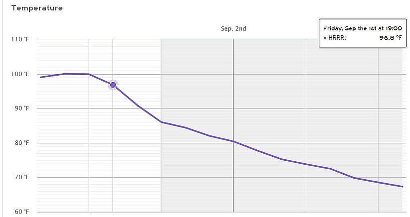
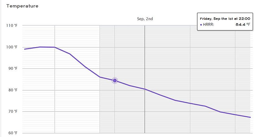
A Hot September start with the forecast high near 100° today and over the weekend. Here in NE Valentine, we ended August with near normal temperatures Summary. Rainfall was +1.7" for the month.
08/31/2023...Blue moon this morning. Turned off the west camera IR for a better view. Still a little smoke haze too. (118) on the AQ this morning.
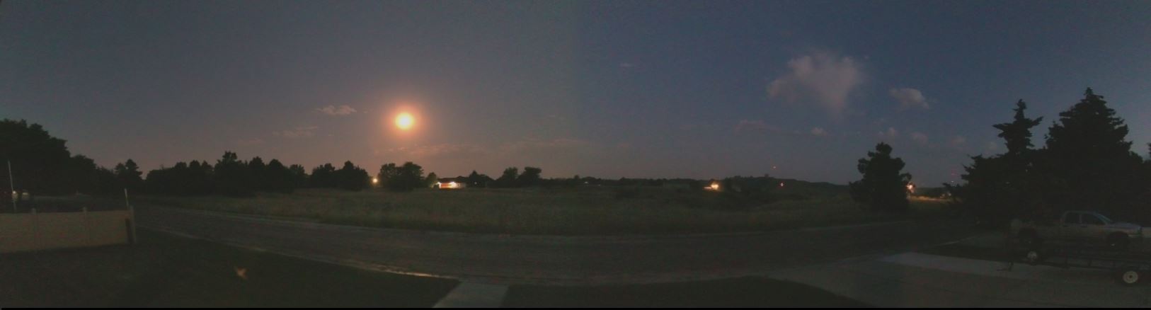
The forecast has us looking at the century mark Friday, Sat., and Sunday. This is some of that hot air from the SW. Phoenix was 117° the other day at the heat island Sky Harbor airport. You may have heard some thunder early this morning but no precip here.
08/30/2023...12:10 pm: Our air quality is still not great at noon (136) EPA PM2.5. The alert did expire however.
Air Quality is poor this morning around (144) EPA PM2.5 Members of sensitive groups may experience health effects. It should clear out starting about 10 am today as a south wind kicks in. The forecast gets hot approaching the century mark Friday, Saturday and Sunday.
08/29/2023...Smoke haze is the main concern, our Air Quality could get in the red (Unhealthy) category after 5 pm today. We are in the Yellow this morning at (81) EPA PM2. This AQ alert expires tomorrow at noon. For new visitors the Air Quality sensor is located here in Northeast Valentine. There are 2-different sensors and it calculates the average.
08/28/2023...Here is something of interest since many of the southern states have been so hot and still setting daily records of (100°+) temperatures how did Valentine Nebraska compare to other summers? HERE. Compared to Houston Texas HERE.
Weather records for Valentine go back to the 1880s the stats above was after they moved the thermometer from downtown on top of a building out to Miller Field. North Platte was the same way for a time, here is an IMAGE. I believe there may be a photo of the Valentine station on top of the building at the museum.
08/25/2023...Updated: (.08") in rainfall overnight. (.09') reported at KVSH radio, (.08") at Adams place 3/4 mi east, (.08") near the Catholic Church in NW Valentine and the Miller Field ASOS reports (.09").
08/24/2023...8:50 pm: Thunder and lightning close.
7:55 pm: That's a strong T-storm when you see the white hail reflection turn to pink. Radar
Forecasters think we are gonna get rain tonight, pretty confident at 70% chance, Fingers crossed...Forecast 94° today for the high temperature. Yesterday's final highs 100° here and 101° at Miller Field.
08/23/2023...Today was our 3rd consecutive day of reaching 100°.
5:45 am: One more hot one today (101°), then some relief tomorrow at 94° before a 60% chance of T-storms Thursday night and much cooler into the extended. So if this ends the heat wave we'll end up with 4-100° plus days all coming in August.
08/22/2023...6:30 pm: The high temp here in NE Valentine was (102.7°) but the heat index reached a couple degrees higher at (105°). Miller Field was also 103° today.
4:50 pm: The MesoWest website is down it takes area observations and Miller Field down so added a different link for Miller Miller under External Links. This one loads a little slower because of the graph but has much of the same information. Utah MesoWest Weather Data from the University of Utah and the National Weather Service Forecast Office in Salt Lake City.
5:am: The Heat Advisory is still in effect through Wednesday. The high temperatures around Valentine yesterday were (103°) here and (104°) at Miller Field which broke the old record 103°. Both the Tempest stations 103.5°, Got a report from NW Valentine observer near the Catholic church 103° also. The thermometer setup is a passive shield with a Sensirion sensor (+/-) .5°f accuracy. There was enough wind yesterday the passive shields worked well. Yesterday also had our warmest low for the date 71°, the old warmest low was 67°F (1986). Today the same thing the old warmest low 64°F (1966) and we will stay well above currently 77°. Don't think warmest lows are labeled as records.
08/21/2023...5:00 pm: Our high temp so far has been (102.6°) will update later if it changes. It's dry enough the heat index has been only slightly higher (103.4°).
A muggy morning with the dew point temperature in the low 70s holding the air temperature up also. The air temperature can't go below the dew point. Our high-temperature today is expected around 102° for Valentine. Think some of this high humidity will move out as it heats up today and a warm front pushes through. If not the heat indices will get high if the dew point stays in the 70s. Dry air heats up quicker than humid air so it's a catch-22. So watch for that dew point temperature to drop into the 60s later today, hopefully. Today is another good example of why it's about dew point temp and not RH. It can hit 100% RH with a 40° air temp and it's very comfortable with a light jacket and not muggy. Just went out on the back deck and everything is wet even the wood this morning. Windows are fogged up too.
Some station news, just finished swapping the aspiration fan out on the south side sensor with a higher airflow unit matching the north shield, while doing so updated the radiation shield. Image1 , Image2 , Image3. This DIY shield works as good or better than the RM Young. What's nice about it with the 4" dia. sensor chamber, there's room for multiple sensors inside unlike the RM Young which is now getting installed at airport ASOS stations around the country. Believe I read by the end of 2024 all ASOS would have the RM Young shield. Have a correspondence friend in South Texas with both these shields in service.
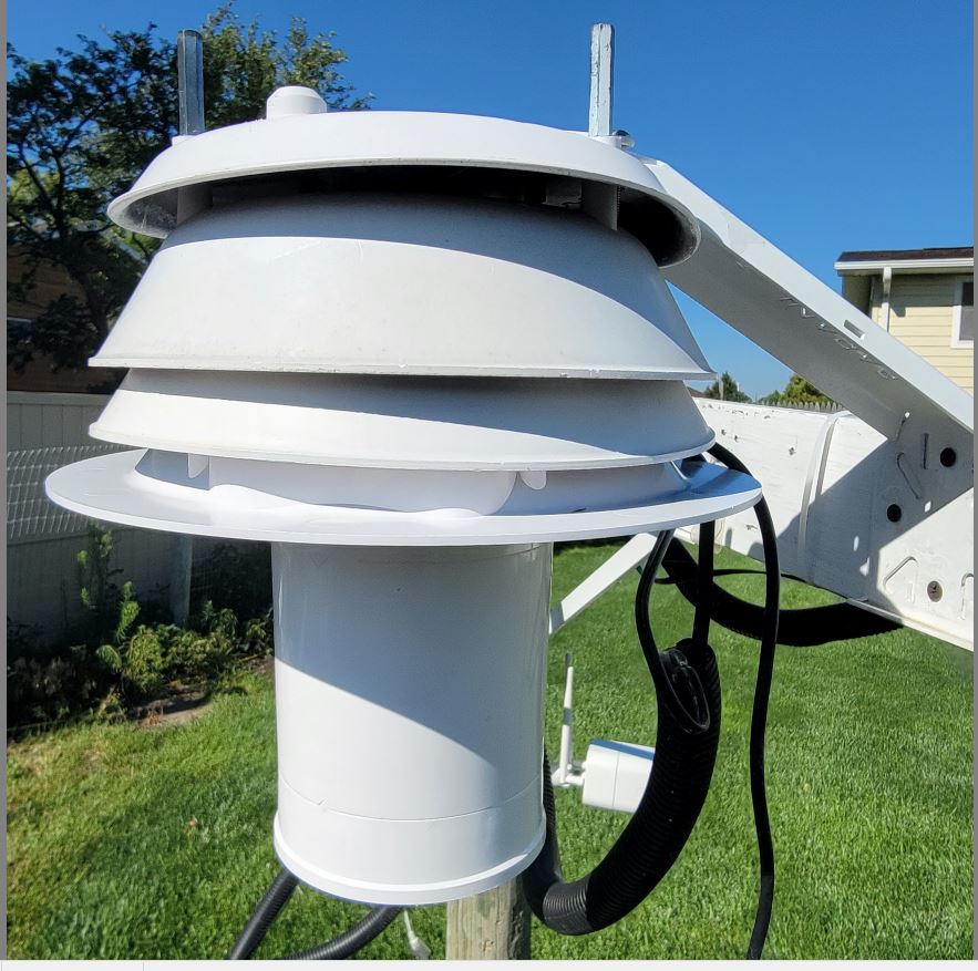
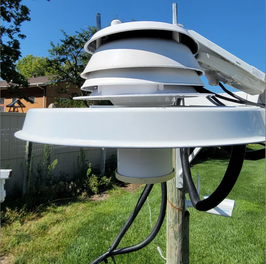
08/20/2023...6:26 pm: A nice below-normal day with the high coming in at 79°. Hot tomorrow with Heat Advisories up for dangerous heat indices possible. Thursday we should cool into the mid-90s with thunderstorm chances.
08/19/2023...Our high today 91° here in NE Valentine after a very warm 72° morning low temperature. Only mid-80s forecast for tomorrow so should be a great day to get those outdoor chores done before 3 days of 100° heat expected.
5:35 am: We have our warmest morning of the summer ongoing with the current temperature only 76° with a light west breeze expected to switch to the NW with gusts to 30 mph during the daytime. Our high today is forecast to reach the mid 90s. A couple models have a thunderstorm rolling through Sunday but not all in agreement so only a slight 20% chance in the forecast. Above 100° once again Monday through Wednesday before it cools down with Thursday night into Friday morning looking like our best chance of Thunderstorms.
08/18/2023...The high today did reach the century mark (100.5°) at 5:12 pm. We had a peak wind gust of 40 mph here on the NE side of Valentine. Out at Miller Field also 100° was reached with a peak wind gust of 42 mph.
This would be nice, the Local 4 TV meteorologist this morning has moisture Sunday over Valentine. He must be looking at the German Icon the only model showing moisture Sunday. Would be perfect timing to help deflect those 100° temps next week.
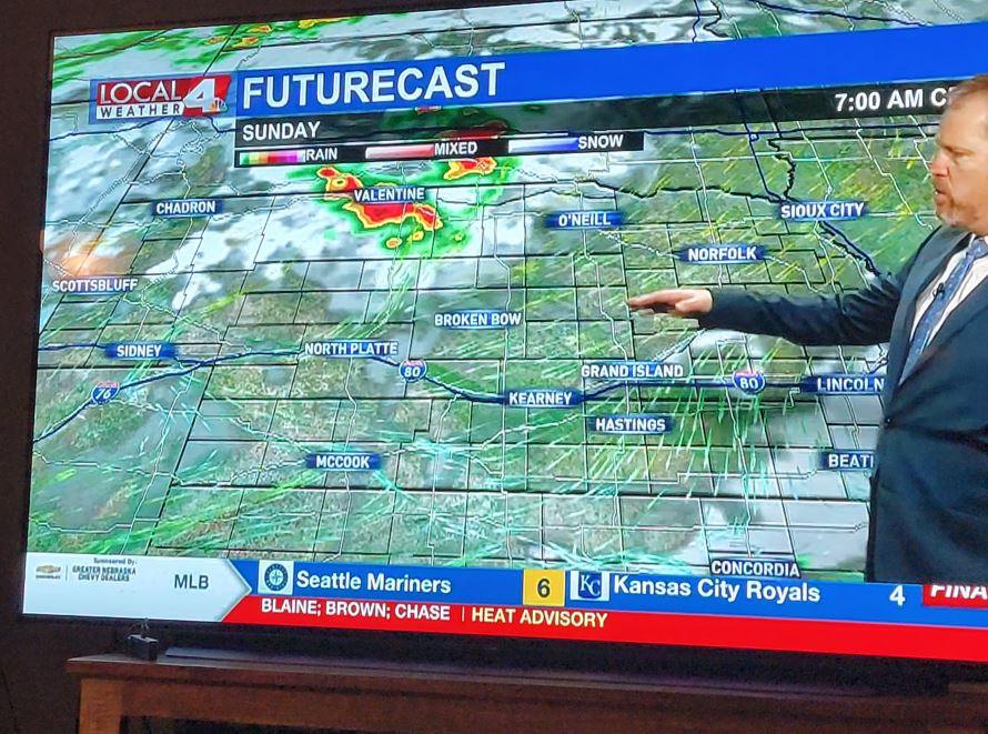
Hot and windy today with the highs expected 100-103° (103°) for Valentine itself. The SW wind has already picked up and is expected to gust into the 30s. This will be our first-century mark of the year and hopefully last. The forecast isn't as optimistic with low 100s on Monday through Wednesday next week also. What happens today may give an indication, does it struggle to reach 100° or shoot right up? Still think the moist ground and plant growth will temper the high temps somewhat.
08/17/2023...Heat advisory starting at 1 pm tomorrow. Includes Eastern Cherry and Valentine.
A good example of why not to stand under a TREE during a thunderstorm.
08/16/2023...5:00 pm: The high temperature in NE Valentine reached 98° today. We have a dry cool front pushing through currently with a 15 to 25 mph NW wind so down to 92°. Tomorrow back into the 80s and then the heat turns back up with the upper 90s to 100° for the rest of the week going into next week Tuesday at least. Not seeing any rain chances as of yet.
08/14/2023...12:30 pm: The GFS has Valentine having (6) 100° plus days coming up, hope this is way overdone. Regardless it looks hot.
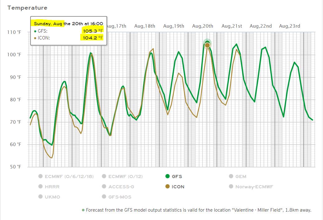
5:30 am: Upper 70s today then the forecast has a couple of days near 100° this week both on Wednesday and again Friday. One of the benefits besides plant growth of our wet pattern is keeping the ground moisture high. The moist ground can help moderate air temperature by using energy to evaporate water so hopefully this helps keep us under the century mark as it did back in July. Once the ground dries out the higher temperatures become more likely and it doesn't look like any new chances of moisture until Saturday night. During the week long heat wave back in July we had a big rain dump right in the middle helping prevent reaching 100°, just barely (99°).
08/13/2023...2:20 pm: We picked up another (0.03") since the 7 am measurement. So storm total (1.92") here on the NE side. NW Valentine reported +(0.03") also. Very cool with the temperature in the mid-60s and a 23 mph sustained NW wind gusting to the upper 30s near 40 mph occasionally. Almost too cool, stopped in at the Cherry County Fair for some food and those without jackets looked cold. The parking lot was near full last night so turnout looked good for the rodeo. One of the food vendors said this was their biggest Fair sale this year.
Updated: Rainfall totals as of 7:35 am NE Valentine (1.89"), Miller Field ASOS (2.44"), the Cocorahs gauge nearby, 1/4 mi. (2.51"), 3/4 mi. East at Adams (1.90") and finally NW Valentine near Catholic church (1.80"). The south side of Valentine finally got a bigger share. For the archives here was the radar at 1:15 am, Radar image
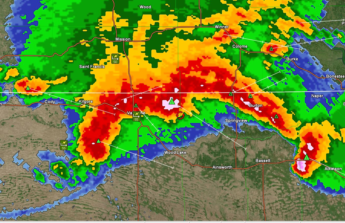
6:00am: Big rain overnight with multiple T-storms, so far here in NE Valentine (1.86"). Still raining currently but may end soon according to radar. Will do a final manual rain gauge check with the 8" SRG once it stops. Very cool today with the high temp expected lower 70s. Next week a big change with the upper 90s starting Wednesday. Did notice on the models the ECM (european) is advertising rain again starting next Saturday so something to watch if others start agreeing. It also turns much cooler again. Actually the Canadian Gem also shows some precip next weekend. The model I usually don't give a second thought to, Access-G out of Australia had Valentine receiving 2" in this storm.
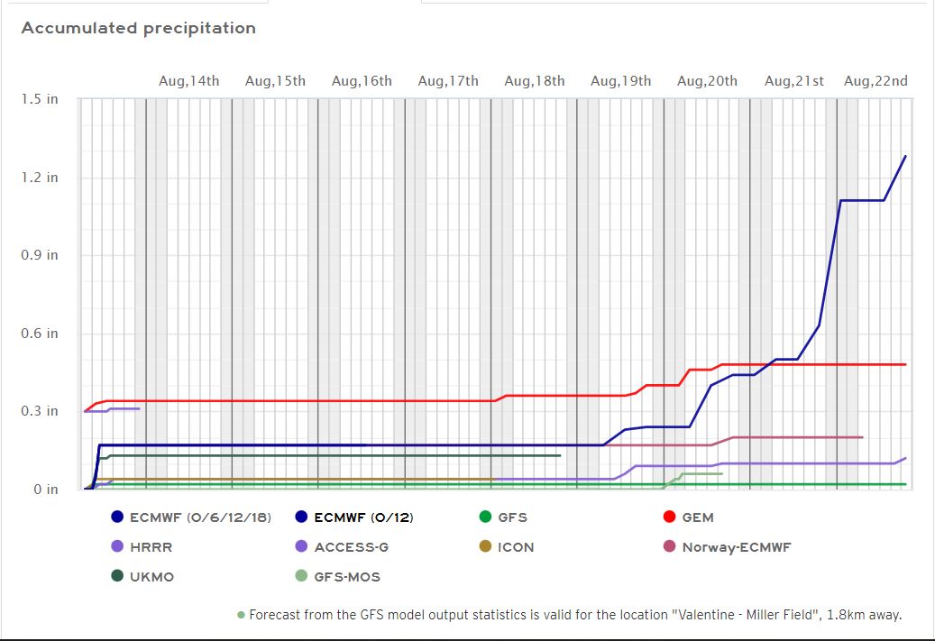
4:00 am: (1.54") so far in NE Valentine, Miller Field is (2.03"), it's not over yet. Current Radar.
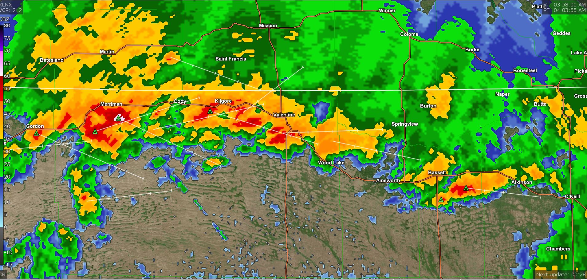
1:45 am: The first round of thunderstorms hit at around 11 pm yesterday with the second at about 1 am. Will get manual rain gauge reading once it stops and adjust the website if needed.
08/12/2023...6:00 am: Thunderstorm chances are good tonight as a strong cold front pushes through. Temps get very cool on Sunday low 70s. Then the heat starts building again mid-week into the mid-90s starting Wednesday with above-normal temperatures. We do have a slight chance of a T-storm Wednesday night again.
08/11/2023...Updated: The Cherry County Fair and Rodeo kicked off yesterday with the parade downtown. The high yesterday was (86°), 88° out at Miller Field so very pleasant with the nice breeze. Looking at models think we have a decent chance of one more thunderstorm tomorrow afternoon or evening (Saturday) as a cold front pushes through. The current forecast has a 40% chance but that could change as we get closer. This may be our last precip chance for an extended period. Looks like the airport picked up (0.02") out of that little thunderstorm early this morning. The Cocorahs gauge at the airport also recorded (0.02"). The rain started just south of McDonalds according to the wet road. Didn't even get a sprinkle on the NE side.
3:50 am: Getting some thunder, current radar. South side of Valentine getting some rain, nothing on the NE side.
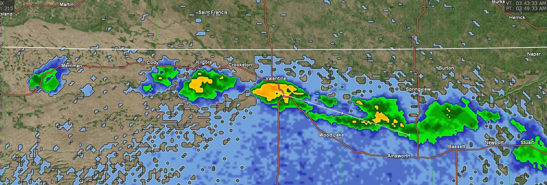
08/09/2023...Update: Rainfall last night (0.07"). The tipping bucket was a couple of drops shy of that amount so says (0.01") on the website today keeping rainfall total for website correct. Everything fell before midnight. Miller Field reported (0.02"), 3/4 mi. east, (0.07") and NW side (0.06").
08/08/2023...9:25 pm: Getting rain and thunder. Current Radar.
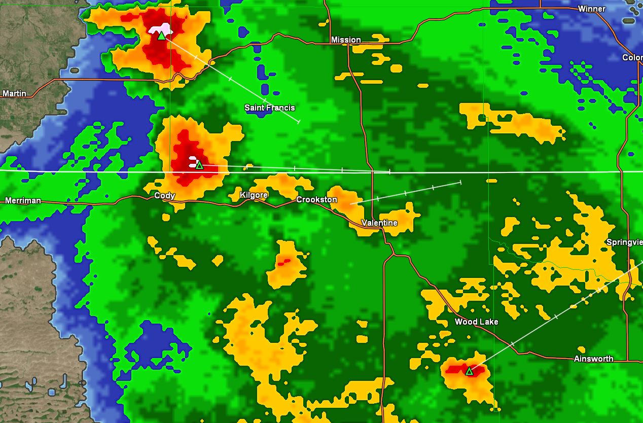
6:25 pm: The afternoon forecast package increased the thunderstorm chance tonight for Valentine to 60%. Busy radar to the SW currently.
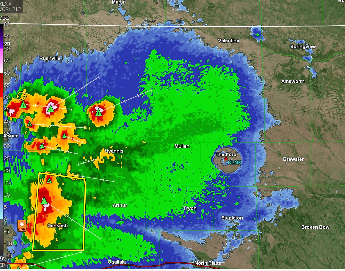
Our best chance of thunderstorms is tonight at 40%, and then a mini-dry period until the weekend. Our temperatures are getting back to normal on Thursday reaching around 90° then upper 80s to finish the work week out. The upcoming weekend will be the next best thunderstorm chances after tonight. Many of our bigger storms have occurred with less than a 50% chance. It's just the way Mother Nature works so it could get wet tonight.
08/07/2023...Updated am: Noticed the RH was running 100% at times, also out at Miller Field. See a little scattered ground fog this morning. The RH is high because of the cool temps near or at the dew point temperature.
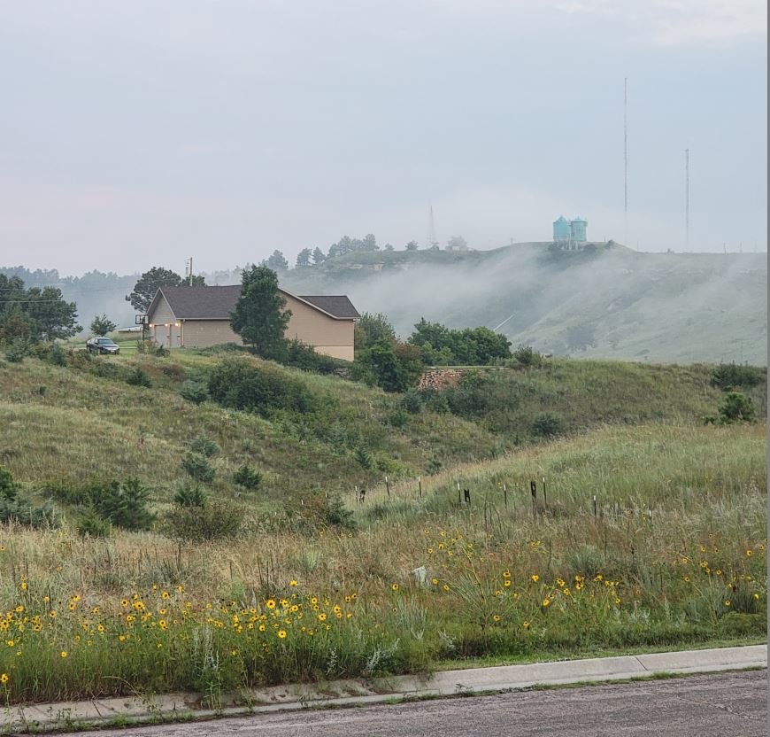
A slight chance of thunderstorms today at 30% with the best chance Tuesday night at 60%. Temperatures unlike what you may hear on the news continue below normal with Thursday our warmest day forecast at 87°. Normal for Valentine is 90° this time of year. The same weather pattern that's bringing the abnormally hot weather to southern areas is keeping us below normal, it doesn't fit the popular narrative so the news doesn't talk about it. I do feel for those in areas with relentless heat, have family in both Arizona and Houston area, they are sick of it. I've invited everyone to move to Valentine.
08/06/2023...3:50 pm: A ThunderStorm is just east of Valentine. Radar. The east camera has the best view. Cameras tab..
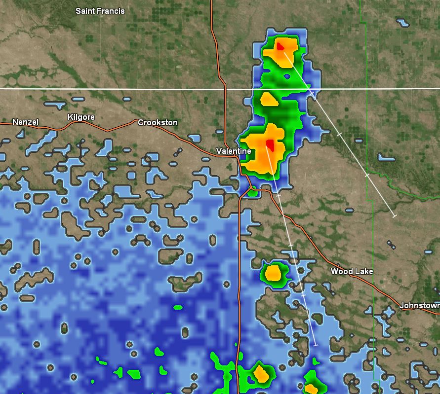
7:30 am: Just got a rainfall report from Adams place 3/4 mi east of here (0.36") in the Cocorahs gauge. So that thunderstorm yesterday dropped (.03") more out there. The NW Valentine COCO gauge reported (.16") including last night. It's still spitting rain and mist this morning. Not showing that well on radar.
5:30 am: Spitting light rain this morning. Looks like another (.09") overnight since the heavy shower (.24") yesterday afternoon. Haven't checked the manual gauge to confirm yet. Feels a little like fall with the strong NW wind (61°) currently. Not sure why the west camera FTP doesn't upload every time, been trying to figure out what's causing it. ALLO Fiber did change the router last week so may end up going back to my own again.
08/05/2023...4:05 pm: Manual rainfall measurement (0.24"). Didn't empty gauges we may get more later tonight. Miller Field picked up (0.01").
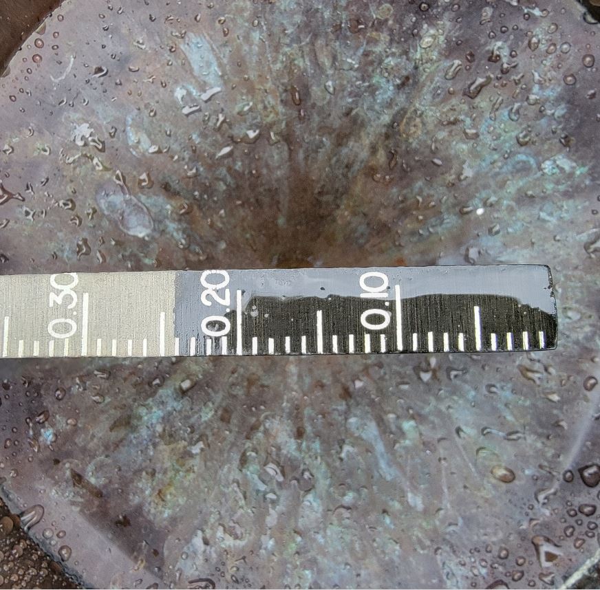
3:45 pm: Getting heavy rain over on the NE side of Valentine. See it on (0.16") radar and (0.24") here. looks like it didn't reach the south side again. Almost like two different climate zones when it comes to rainfall this year. It does it in the winter too with snowfall just not as obvious. Dot the "t" in Valentine that's where the NE station is located on radar.
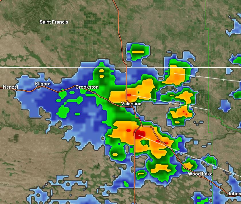
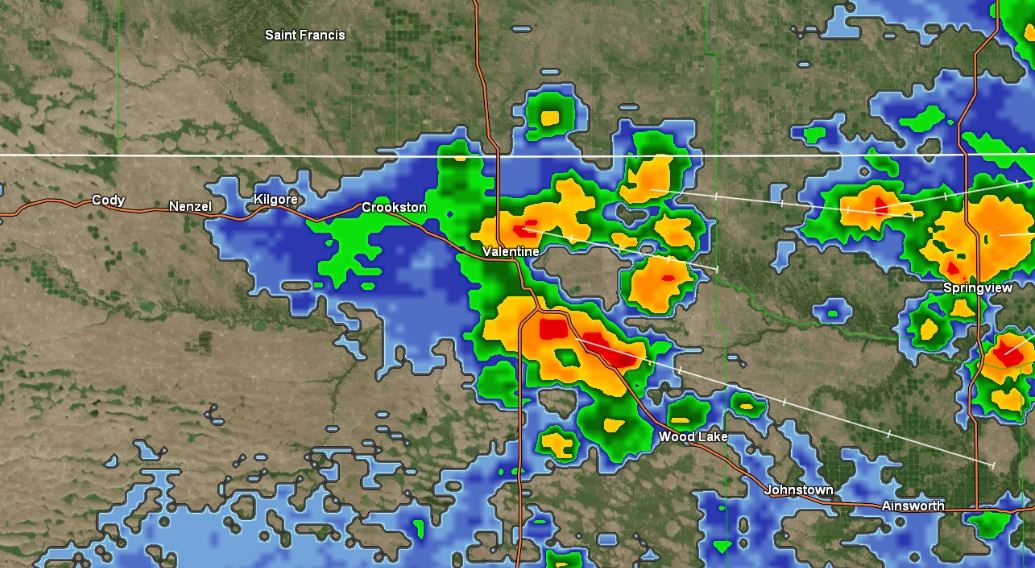
7:20 am: Yesterday evening's rainfall amounts around town: NE side (1.27"), near Catholic Church (.87"), downtown KVSH radio (.80"), Miller Field (.51"), Adams 3/4 mi east (1.02") and Lake Shore Dr. Mill Pond (1.20"). That location is HERE .
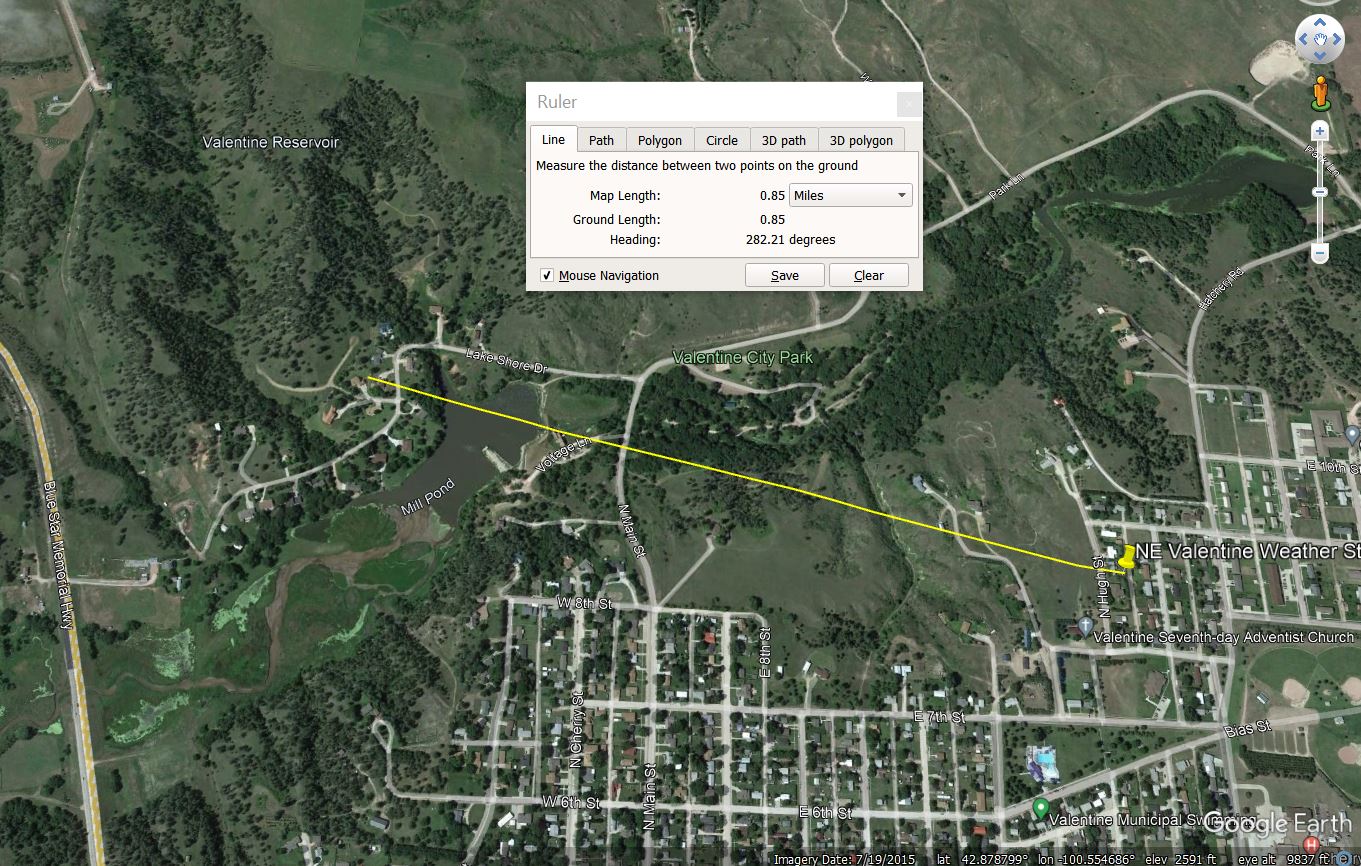
The Cocorahs gauge (Stratus) model recorded (1.25") so -2% low. The Tropo only 1.20" so -6% low and fails once again. There was little wind in this event with the peak gust only 18 mph at 26' height so no excuses. The Tropo was taken down and put back up yesterday to give it one more chance and it failed again. Gauges need to be within 4% of the NWS 8" SRG so how it passed testing to get approved, no idea.
08/04/2023...10:40 pm: Rainfall total here in NE Valentine was (1.27") . Won't be getting the Cocorahs gauge measurements tonight in the dark, will wait for light tomorrow. Miller Field looks like only (.51") in that gauge. Amazing how the storms continually dump more over on this side with just a few exceptions. You could see it on radar too, north of highway 20 was heaviest on Radar. The white dot above the T is this NE side location.
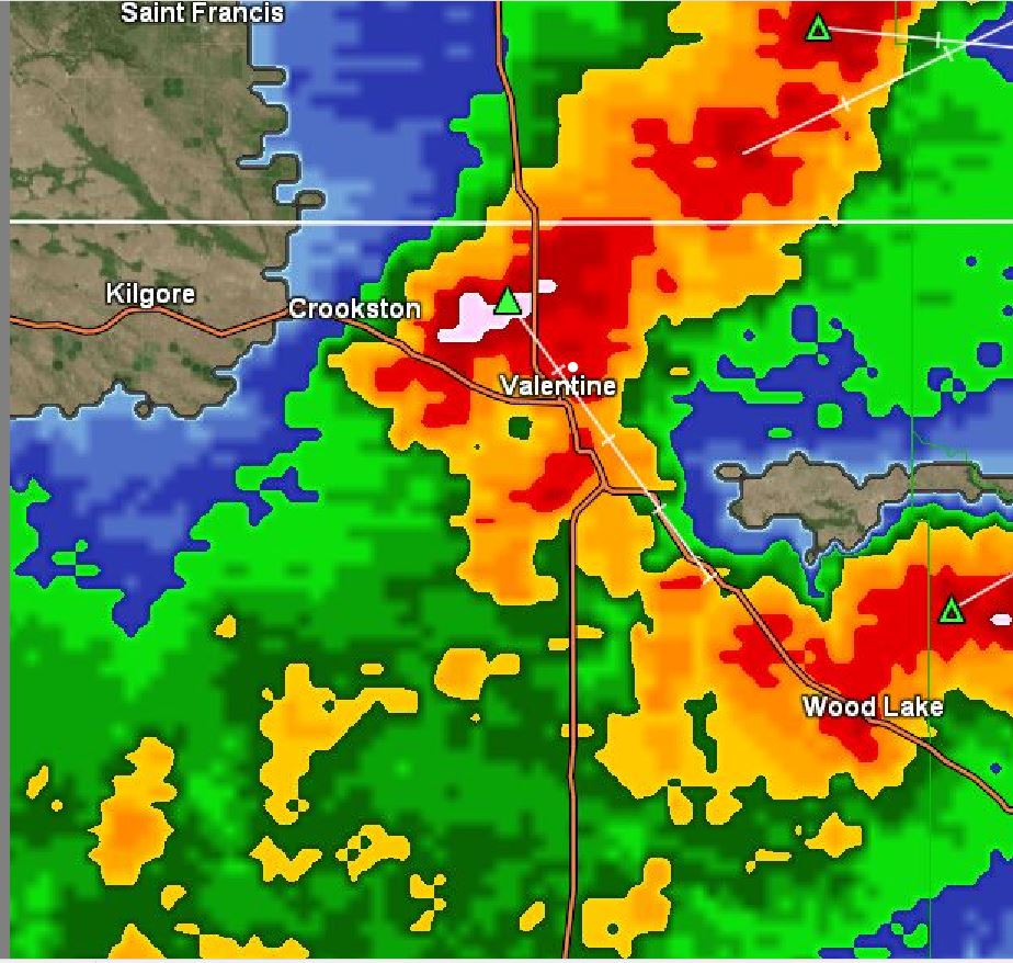
9:38 pm: Pouring again we had (.98") prior on 8" SRG so the tipping bucket was behind.
9:25 pm: Will be getting a manual rainfall measurement once it completely stops and make website adjustment if needed. Did see 6" per hr. rate.
8:55 pm : Rain just started, heavy. Radar image
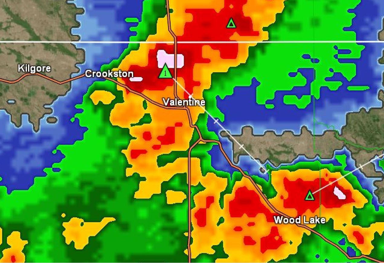
8:45 pm: A strong thunderstorm just NW of Valentine currently. Loaded with hailstones too. image.
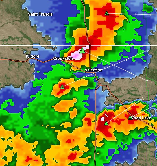
6:00 pm: The afternoon forecast package dropped thunderstorm chances from 60% down to 40% tonight so less than likely for Valentine. We do have thunderstorms to the east and a few to the west which are moving in our general direction.
5:30 am: Only picked up a trace last night which was surprising, expected more. The morning forecast has a 60% chance again tonight with the best chance at 70% tomorrow night. Highs in the 70s over the weekend are still in the forecast. Model rainfall totals have scaled way back on precip this week. A couple of models get over the 1" mark later in the week. Why the hesitancy yesterday to mention how much we could get out of this, not all models were in agreement and overnight they've mostly all backed off. The atmosphere did dry out just a little overnight with our dew point temp 60-61° this morning. With the next cold front passage the DP is expected to get even lower down into the low 50s.
Something to pass on to visitors, this website forecast comes directly from the NWS specifically for Valentine, and not a generic regional forecast many are so used of getting here. Yesterday was a good example, the updated afternoon forecast package downgraded rain chances substantially and it showed on the website forecast, while other sources were still stuck on the early morning forecast package. Weather situations can change often during the day. Forecast models run a minimum of 2 to 4 times daily so every afternoon the forecast can get adjusted by the NWS and sometimes does several times throughout the day with changing conditions. This website will automatically adjust to these NWS forecast changes. One size doesn't fit all when it comes to getting an accurate forecast, especially during weather events when things change rapidly.
08/03/2023...4:00 pm: The afternoon forecast package dropped our rainfall chance tonight down to 60% from the previous 80%. Still likely but less confidence. Models are still jocking around. A stronger cold front moves through tomorrow night so a better chance of significant rain.
The upcoming wet and cool period is still on track. There are some model differences as to where the heaviest rains will fall. Most keep it in South Dakota where Flood Advisories have already been issued including the counties just north of Cherry. Models will keep adjusting being the differences so at this juncture it's hard to nail down what Valentine could be looking at for rainfall amounts. Over the next few days starting tonight with an 80% chance we will have a general wet pattern with heavy rain chances.
Some station news a couple days ago installed a new temperature/humidity sensor. This one will reach 100% RH pretty easily. What happens due to the 24/7 aspiration they can dry out so need replaced every year or so. The temperature sensor doesn't go bad but the humidity side does eventually. Ideally, the humidity/dew point sensor shouldn't be aspirated for that reason but the Sensirion SHT-31 sensor come as an all-in-one unit. For accurate air temperature measurement aspiration is necessary.
08/02/2023...7:00 am: Rainfall today (0.07") image. Miller Field (0.07"), NW Valentine (0.08") and Adams homestead 3/4 mile east (0.09").
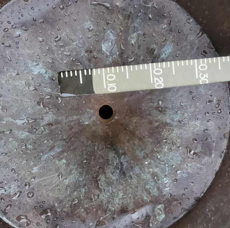
6:30 am: Light rain this morning...The forecast says we can expect continued chances of rain and thunderstorms over the next few days and turning much cooler as a cold front pushes through later this week with highs in the 70s. Some models show a couple inches of rain is possible during this wet period. The cold front arrival will bring drier air into the area dropping dew point temps down into the 50s with low temperatures forecast mid 50s by Saturday morning.
08/01/2023...Just how wet was this July compared to other years? The (6.65") here in NE Valentine set a station record for July dating back to 2014. As you can see May, June, and July have all been wet this year. Our temperatures have also been below normal for July (-3.5°) as shown HERE. 6 of the 7 months (2023) have run below normal on temperatures this year. March may have been the coolest in 50+ years. Hopefully, it's not too much of a good thing I know the insects like grasshoppers are all doing well this year too.
07/31/2023...Updated 8:15 am: Other rainfall amounts around town: KVSH radio downtown (0.40"), Adams 3/4 mile east (0.35"), NW side near Catholic Church (.038") and Miller Field (0.33").
Active evening with thunderstorms, slept through most of this one, our max wind gust was 32 mph here on the NE side of Valentine picking up (0.39") total image . (0.06") fell prior to midnight. This puts us at (6.65") for July and (24.13") on the year. Our air quality is as good as it gets down to (1) this early morning. We have a continued threat of thunderstorms throughout the 7-day forecast. Predicting these numerous thunderstorms can be a challenge so even slight chances can't be ignored, when some of our larger storms have occurred like on Saturday.
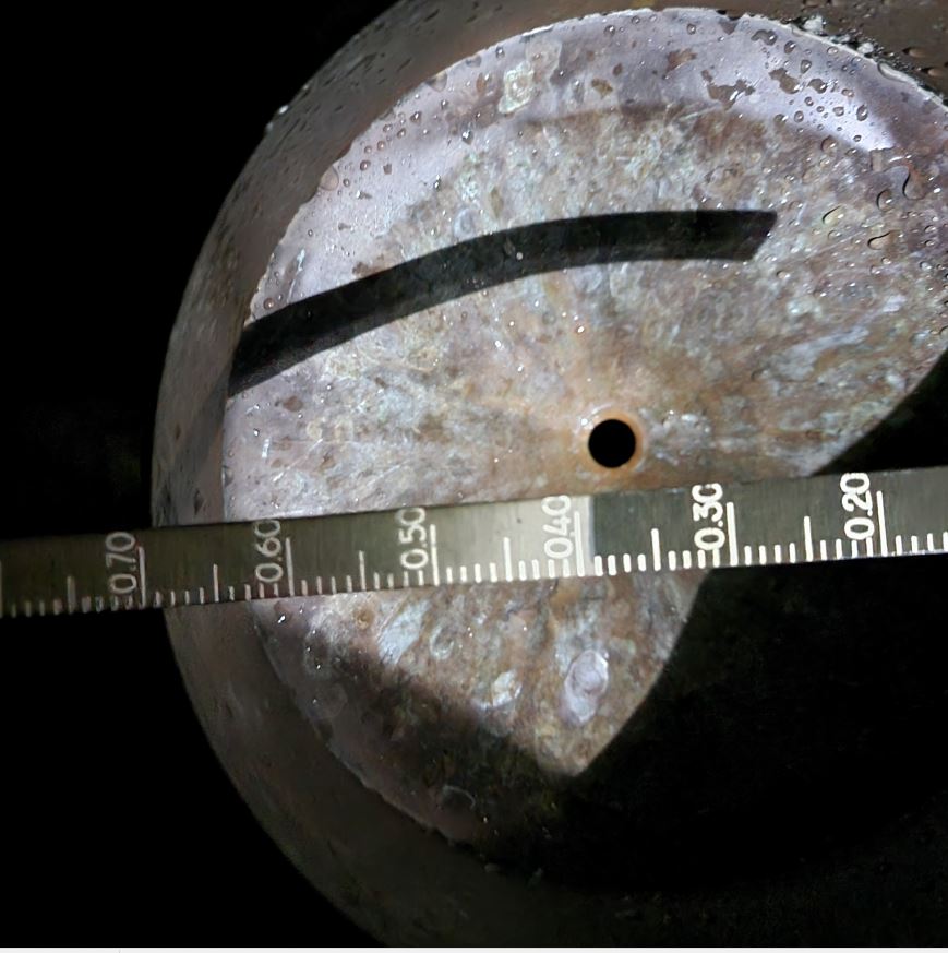
07/30/2023...5:00 pm: It's been a muggy Sunday with the dew point in the 70s making the feels-like (+9° to 10°). The chance of thunderstorms later tonight is 60% so will leave the second radar up overnight. Both radars are always available under the Sat/Radar tab.
07/29/2023...Updated: Final Rain amounts around town Saturday: Adams place 3/4 mile east of here- (2.05") in Cocorahs gauge. NE Valentine 8" SRG- (2.03") and the Cocorahs Stratus gauge same location 4 feet apart- (2.00"). KVSH radio downtown NWS 8" SRG- (1.98"). NW Valentine near Catholic church- ( 1.45"), and Miller Field- (1.33"). Lots of tree limbs down this side of town.
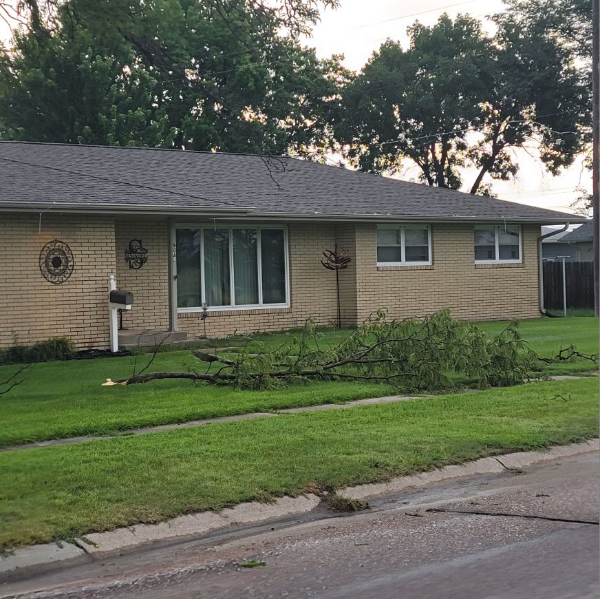
5:40 am: The manual measurement on the 8" SRG was (2.03" image) on the measuring stick. The 4" Cocorahs gauge did overflow, into the outer cylinder so will get that measurement once the sun comes up.
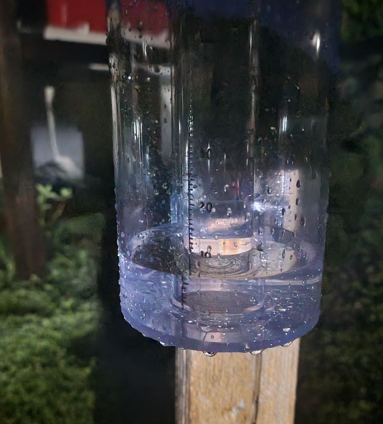
The NE Tempest weather station also located here recorded a 244 mph gust. It's not correct of course but it did reach 71 mph.
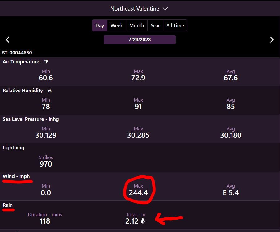
4:12 am: WOW, the wind is gusting to 71 mph, the noise is incredible with the heavy rain, saw it at 13" per. hr. rate.
4:00 am: Heavy rain 3.65" per hr. rate.
07/28/2023...6:10 am: 63° here in NE Valentine this morning also at Miller Field. Our high temperatures yesterday peaked at (98°) Miller Field and (97°) here at the NE location. As far as the heat wave goes it looks over after today and into the near future 10-day temps. (90-91° is Normal) Slightly cooler today with the forecast high of 94° then back into the 80s over the weekend as a cold front pushes through with decent moisture chances on Saturday and Sunday. Next week is looking like daily chances of Thunderstorms. Historically the last week of July is the hottest time of year across Nebraska and there were some 100° temps yesterday (16 total) including North Platte at 102°, Grand Island 103°, Thedford 100° and on the western side Alliance 100° and Chadron 101°.
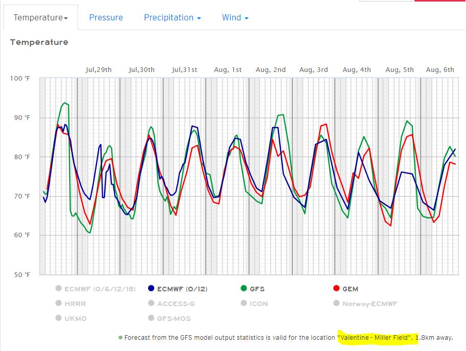
07/27/2023...8:50 pm: We had a wind gust of 53 mph, non thunderstorm. It was mentioned in the afternoon forecaster discussion that could occur and it did.
5:10 pm: A peek at what may be ahead next week. Right now it's looking active with one exception GEM. Even 4" on the ECM, that won't stand but does show the trend ahead. Models. You can see why it's a 50% chance Saturday night. So 1-week of hot weather and right back into a wet pattern. Really for Valentine, it hasn't been that bad temperature-wise, anytime we stay under 100° for July that's a plus. The ground being moist and very green may have played into keeping the temps under the century mark.
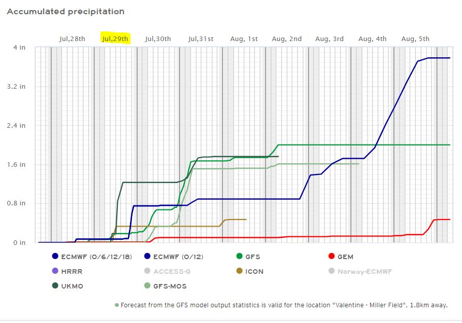
Today may be our first 100° day (forecast 101°) for Valentine, yesterday Miller Field reached 99° and 98° here on the NE side. It's not unusual during summer to run slightly cooler inside areas of town where shade trees and lawns help temper the high temps vs the more open airport. Even driving around yesterday while traveling north on Green Street the vehicle outside thermometer was saying 99 to 100° and would peel off to 98° as soon as the NE side of town was entered. We still have a slight chance of daily thunderstorms with Saturday night being the best chance at 40%. Our Air Quality is in the green (25) this morning and got down to (7) yesterday.
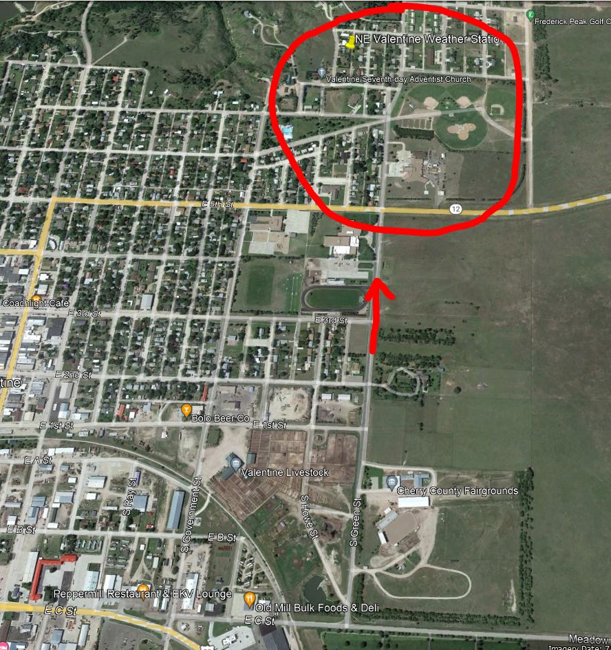
07/26/2023...6:05 pm: The dew point temp made a 10° drop in 10 minutes. So much drier air just moved in, you can see it on the radar sort of. Radar, dry boundary. A big thunderstorm on the south end also.
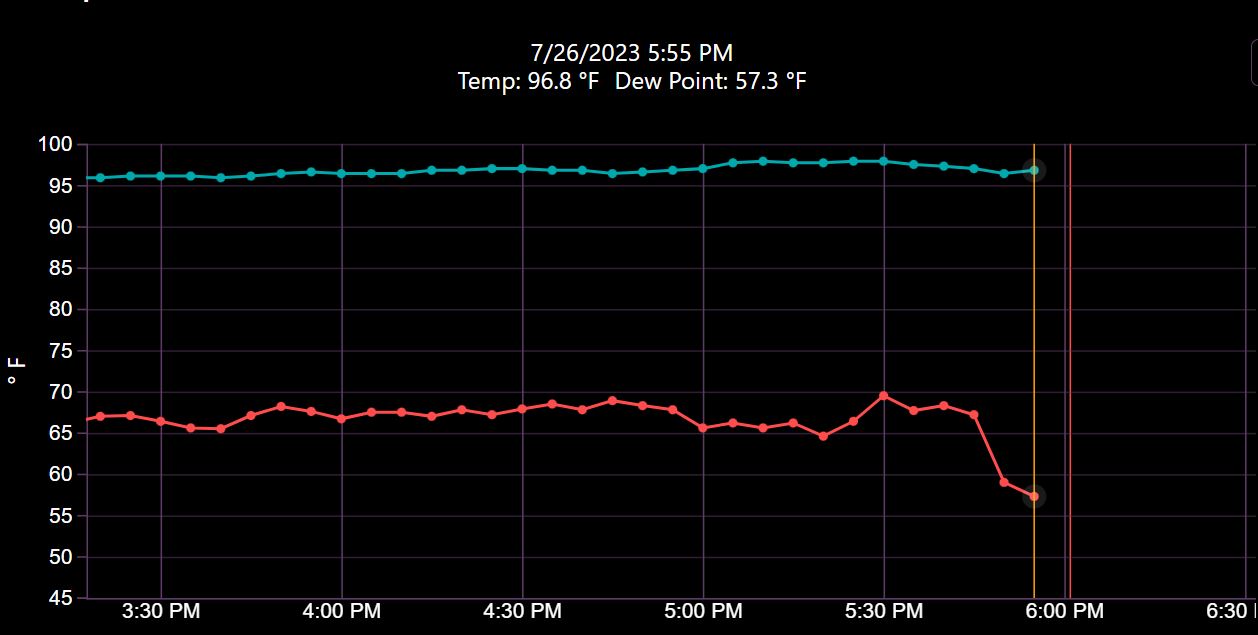
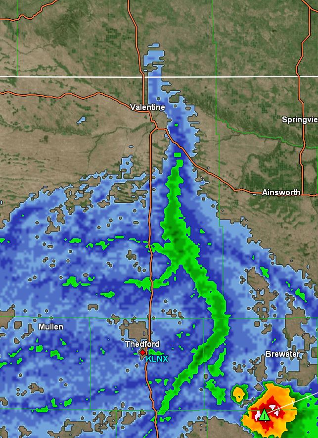
The heat continues with upper 90s to around 100 the next couple days with slightly drier air. If you looked to the ESE yesterday evening there was a large impressive-looking supercell thunderstorm that produced a tornado in Loup county. We have slight chances of thunderstorms daily 20% and a better chance Friday evening 30%. Our high yesterday here in Valentine reached 98°, wasn't sure it would get that hot with all the rain that fell, moist air and ground takes more energy to heat up but it did and felt very sticky.
07/25/2023...10:05 am: Updated Rain amounts last night: Adams place 3/4 miles east (.89"), KVSH radio downtown (.85"), NE Valentine (.83"), NW Valentine (.65"), and Miller Field ASOS (.46"). All measured with 4" Cocorahs (Stratus) or 8" SRG the exception Miller Field ASOS weighing gauge.
Updated am: The SRG measurement (.83) image, The 4" Stratus (.81") or (-.02%) low and within the +/-4% criteria Cocorahs allows for gauge error. And the new Tropo was way low again (.77"). or (-7%) low. There is an ongoing debate on whether the Tropo should have been allowed in as an Official gauge for Cocorahs is why I'm doing this gauge comparison. What counts is how a rain gauge performs under real conditions and it falls way short. Wherever they tested this gauge, I'm told (Colorado) apparently they had nice light rains but that's not real world conditions. The debate is over here the Tropo rain gauge is coming down, I've had several rains at 4% to 7% low and several smaller rains where it was the same but if it can't perform in real world conditions like thunderstorms no reason to keep testing especially since the Stratus at 1/2 the cost works better.
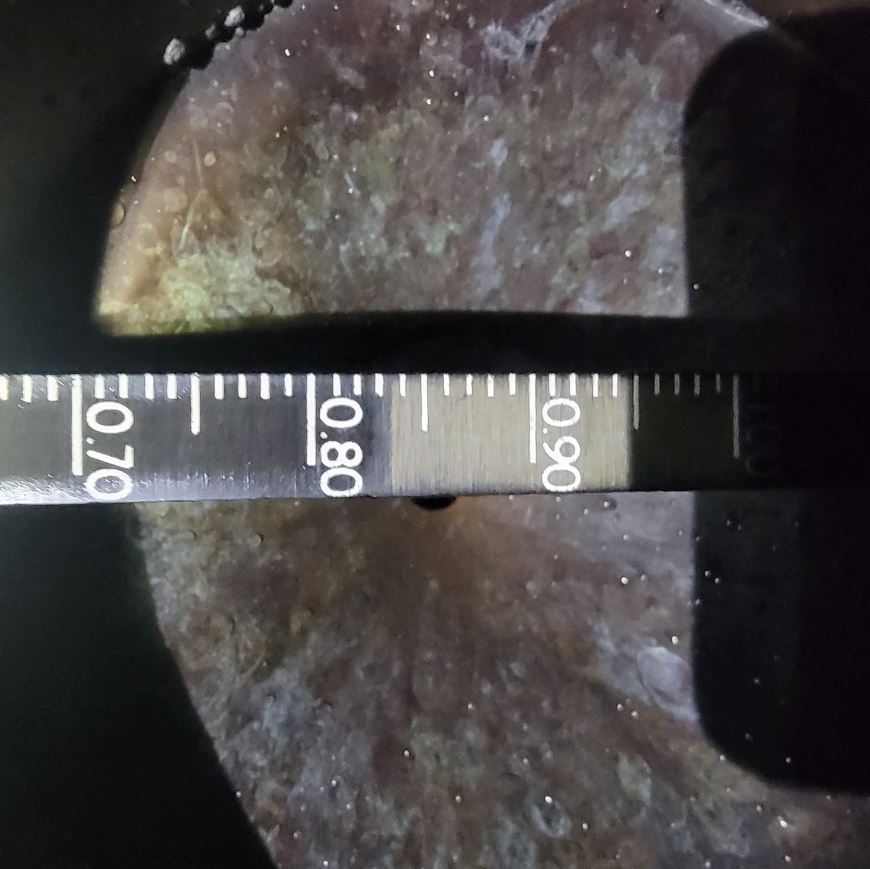
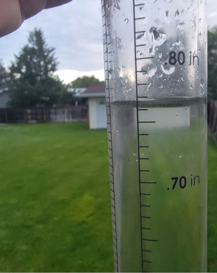
2:59 am: 3.7" per hr. rate. As always the 8" SRG will be measured after the event and website adjusted if needed to the official gauge. For those sound asleep this was the radar image at the height of the storm. The bulk of the storm was on the north side of town.
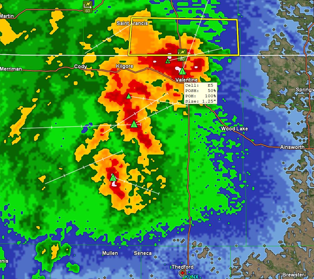
2:48 am: Heavy rain now. 2" per hr. plus rate.
2:27 am: Rain just started. 53 mph wind gust.
2:00 am: A large complex of thunderstorms heading our way. Radar image
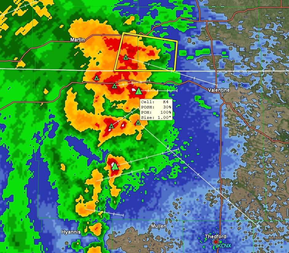
07/24/2023...4:20 pm: Cloud cover has slowed our heating process today with only (91°) so far but it's not over looking at the satellite loop it may clear off soon. This heat wave so far just hasn't cooperated which I'm more than okay with.
5:30 am: Cooler on the south side early this morning running 64° at Miller Field currently and 69° here on the NE side with a 11-14 mph WNW wind. High temps are expected to flirt with 100° over the next 4-days with heat indices exceeding the century mark. Slight chances of thunderstorms almost every day this week. Most of the thunderstorms have been avoiding direct hits on Valentine lately, mother natures way of saying you've already received 20" of moisture so spreading it around. Earlier in the year almost everything was hitting us like May 11th on this NE side Storm image . That was one crazy downpour.
Yesterday changed the snow stake camera to a newer model due to FTP issues. All 3 cameras can be seen on the "Cameras" tab. Also ordered a new SHT-31 temp/humidity sensor for a backup. These humidity sensors can go bad after a year or so of being aspirated 24/7. That's why yesterday was checking the dew point manually. It still looks good but eventually will need changed out so will have a spare unit ready to go.
07/23/2023...8:00 pm: The third manual dew point check 70°. The station sensor shows 70-71°.
6 pm: Did a second manual dew point check in the shade and came up with 68°. Pretty much what the main station sensor shows too. It does bounce around a little (+/- 2°) due to the aspiration. Some activity in SD so put the second radar up.
5:35 pm: Just did a manual dew point check in the shade with the Psychro-Dyne and came up with 67°. The high temperature peaked at 94.6° at this location.
2:40 pm: Doesn't look like 100° will be reached today currently (91°) but the feels-like just might, currently 96 to 97° with a dew point upper 60s and occasionally flirting with 70°. Ouch! The south breeze must be really moist we started out with a 54° dew point this morning.
Today may be our first 100° day says the HRRR model (99.5°) for Valentine and is the only model predicting the century mark but has a good track record with temperatures so won't be surprised. This same model has our low this morning at 57.2°. That thunderstorm complex yesterday just missed Valentine on the west side stayed together traveling south and strengthened hitting several areas with hail along the way including North Platte. Yesterday reached 92° here in Valentine before it clouded up.
07/22/2023...5:30 pm: Getting wind and sprinkles is all so far.
4:20 pm: Radar is showing some activity north of Valentine and heading south. Radar It did reach 92° before it clouded up.
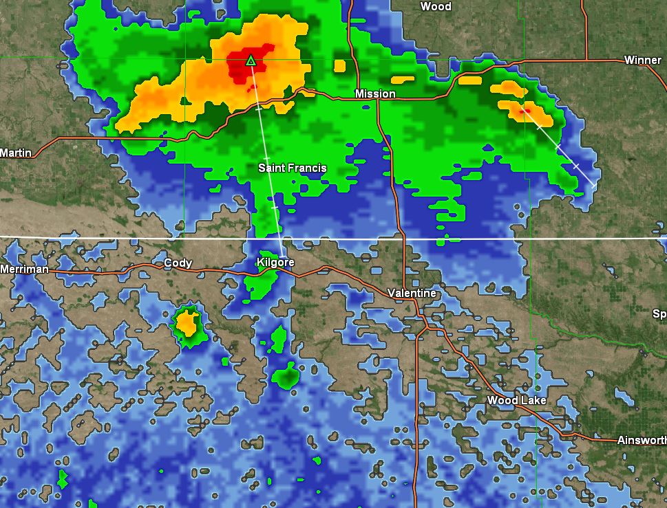
We may reach a normal high today (91°) which has been rare this summer with the forecast at 90°. As of July 21, we've only reached 90° 6 times this year and summer is winding down. High temps during this upcoming hot spell have trended back slightly so may not reach the century mark but the heat index could or even exceed. One of the models (European) is hinting at a thunderstorm on Tuesday with the morning run. Looking at the 10-day model trends after this next 5-6 day hot spell temperatures fall back into the normal range or below toward the end of the 10-day period. Yesterday was H-86°, L-53° at Miller Field. 85.4° and 53° here.
07/21/2023...7:10 pm: A strong thunderstorm passing east of Valentine currently. Traveling north to south.
The stargazers should of had a good night last night. (Satellite image) . Sure many have stayed up all night when it's like this. We have a 20% chance of a thunderstorm tonight, with high temperatures continuing below normal through Saturday. That all changes starting Sunday and throughout much of next week with highs approaching the century mark several times. Dew points are expected to be up some also, running in the mid 60s making the feels-like approach that century mark also.
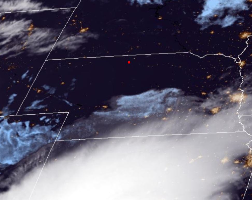
07/20/2023...We had isolated showers around the area even a few weak thunderstorms popped up yesterday but nothing here in Valentine. Our 65-70 degree dew point temps yesterday have dried out considerably overnight with mid-50s early this morning. The airport high reached 89° which was a couple of degrees higher than NE Valentine 87°. The scattered clouds played a role, normally the airport and NE Valentine temps end up the same give or take a degree but clouds can alter that. The heat is still on for next week starting Sunday with 90s plus and not seeing much moisture either so a pattern shift from the wet and cooler summer we've experienced so far. Hopefully, the pattern change is short-lived.
Our air quality is in the yellow low 60s this morning so it's getting better. Someone asked if it ever gets down to "0" here and yes it has. Both sensors have to agree for 10 minutes so doesn't stay there long. The Purple Air widget will remain on the front page below the forecast so it's easier to follow the air quality here in Valentine.
07/19/2023...Here was a funnel cloud south of Gordon yesterday Image This is even more amazing a hailstone at Pierre SD and almost volleyball size, have never seen one this big ever. Image .
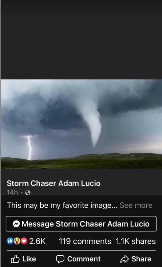
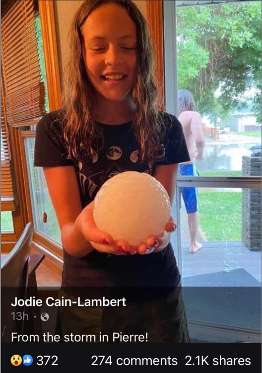
Looks like we're finally going to get some hot temperatures. This summer so far has been running cooler than normal (-6°) for July but it's going to get hot for a few days starting Sunday as that SW desert heat moves our direction. One of the models actually pushes close to 110° next Tuesday but other models upper 90s. We've been pretty spoiled with the coolish summer temperatures and abundant rainfall so not looking forward to the heat. The uncut grass is really tall, not quite to the horse's bellies but it's close. It's been a good summer so far.
07/18/2023...6:20 pm: Our AQ is down in the mid 60s. A strong TS with lots of hail passed well west of the area this late afternoon.
7:50 am: Updated Rainfall amounts NE Valentine (.16"), Miller Field (.21"), KVSH radio (.20"), Adams 3/4 mile east (.16"), NW Valentine near the Catholic Church (.18"). If interested in the official Cocorahs gauges being tested here in NE Valentine the Tropo and the Stratus. Cocorahs wants rainfall measurements rounded to the nearest hundredth so both also report (.16") same as the 8" SRG.
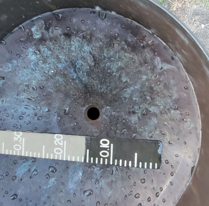
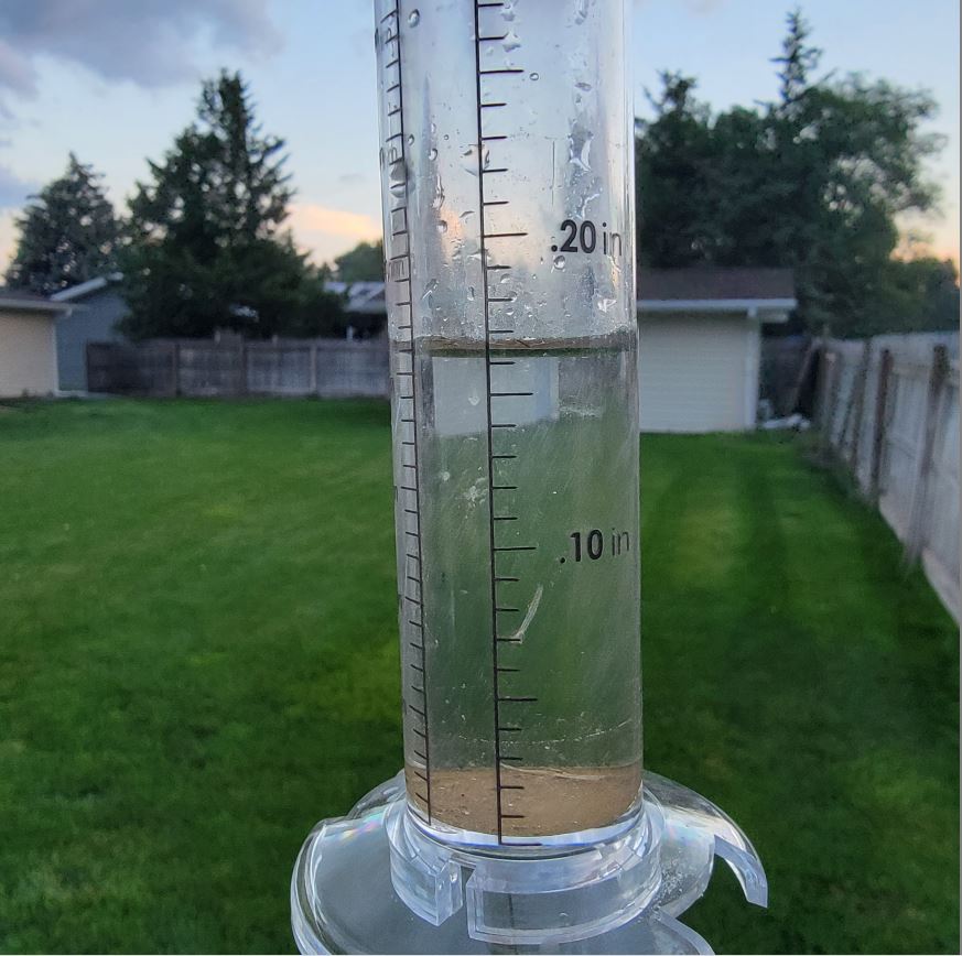
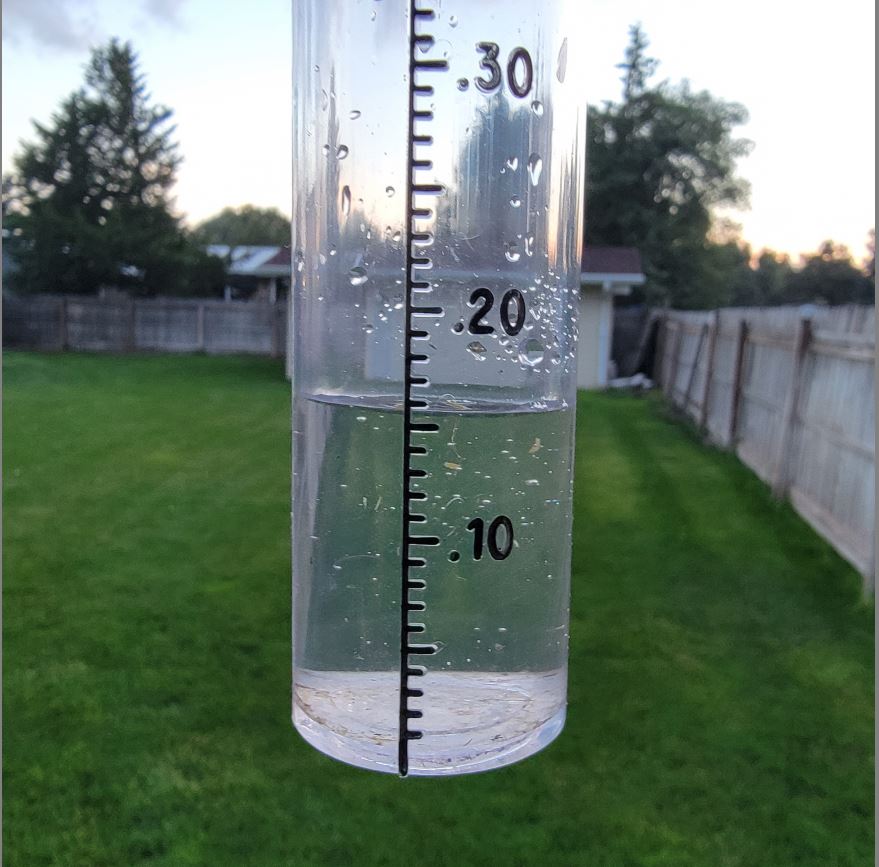
There was a Cocorahs 1" amount reported 11.75 miles east of Valentine and the only (1"+) amount recognized for Cherry County today. Glad to see more joining Cocorahs, especially ranchers. The 3-approved Cocorahs gauges also recognized by the NWS are HERE. Order the approved gauges HERE and join.
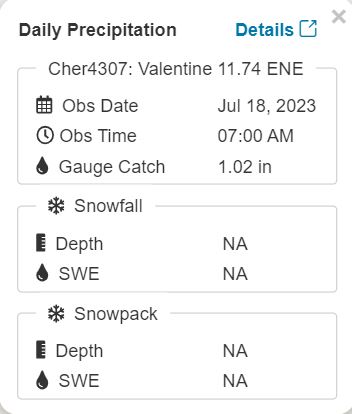
5:55 am: Big thunderstorm just east of Valentine with hail. Thunderstorms are avoiding Valentine like it has the gain of function plague again. Our AQ is getting worse again back at (99) currently thanks to the Eco Terrorist and Climate Cultist.. It did get down into the low 70s on the AQ index yesterday.
2:00 am: (.15") manual gauge in NE Valentine so far. (.19") at Miller Field. Looking at the older radar loop the thunderstorms earlier split around Valentine for the most part. Will be hitting the sack again in a bit looks about over, unless more development later.
07/17/2023...10:45 am: Our AQ is getting better quickly, now down in the 70s currently. Visibility at the airport is 10 plus miles also. The Nebraskastarparty.org Stargazers should have a better night, except for the likely thunderstorms.
The smoke haze continues this morning, improvement is expected tonight along with a likely chance of thunderstorms.
07/16/2023...Added the Purple Air Widget bottom of page under the forecast, scroll down to see.
4:45 pm: Saw this buck over on Candice St. caught jumping over a fence and here he is ... in the alley. He's an 8-point by whitetail count and not that afraid of people so apparently grew up around town. Same with the deer across the street here they don't really even run off just continue feeding. Back in the 160-170 range on AQ, ugh!
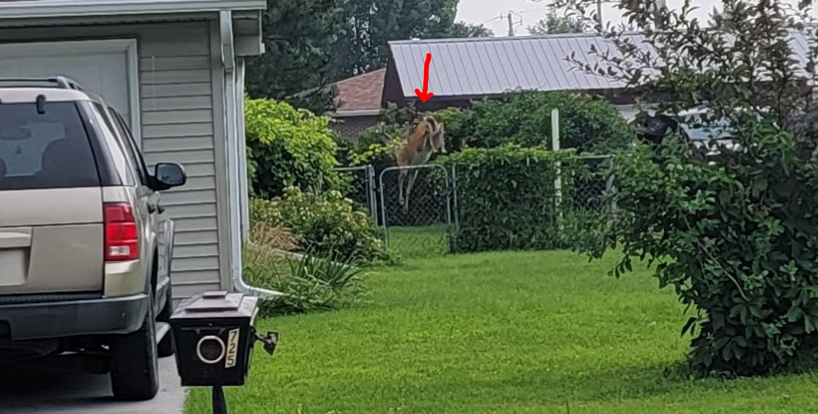
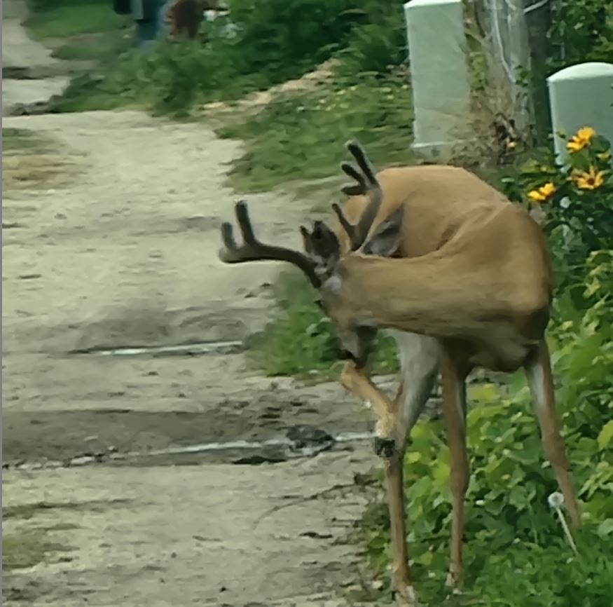
Thunderstorms did develop overnight some reaching severe levels, overnight image. Valentine did pick up (.01") on the airport side early on. (Just a trace on the NE side.) The main line of thunderstorms stayed south of Valentine. Visibility with the smoke has been down to 1.25 miles at the airport. Looking at the air quality monitor we are staying in the (170 to 180) US EPA PM2.5 AQI range overnight which isn't good. Accuracy is in the 100% range with both sensors having similar numbers.
07/15/2023...5:50 pm: There's a chance we get a thunderstorm tonight. Forecasters know they will occur just not sure where exactly is why the low 20%. Went to North Platte today it was hazy the entire way. It's a little worse the further north.
updated am: The Purple air sensor says 141 US EPA PM2.5 AQI so puts us in the red. Reminder the Air Quality live link is under 'External Links". Cameras clean the haze up but the airport visibility sensor see's it calling it (mist and 6 mi). No mist however just haze, the blue is not there the sky is a solid grey. Look at the sunrise with the east camera (cameras tab) at how thick the smoke is this morning.
This is my great-grandson Jaylen he turned a full handful of 5 yesterday. He lives in Arizona.
07/14/2023...3:30 pm: An air quality alert is in effect through Sunday at 10 pm for the Valentine area. Currently 70 US EPA PM2.5 AQI so not that bad yet. The "Air Quality link" is found under external links. The sensor is located here in NE Valentine.
8:30 am: Rainfall totals with light rain still scattered, includes yesterday evening here at the NE Valentine location on the short end (.75"), Miller Field (1.00"), KVSH Radio (.97"?). 3/4 mi. east Adams place (.74"). NW Valentine near Catholic Church (.83").
5:50 am: Rain continues moderate at times, this NE side of Valentine has been the furthest away from the main thunderstorm track just south and west of town so likely will end up with the least amount of rain. Mother Nature's way of spreading it around. Did do a quick manual check and the tipping bucket is close to actual. Once rain has stopped will do a final check of the manual 8" rain gauge and adjust website if necessary.
4:30 am: Noisy driving rain now with the wind 35 mph and gusts to 44 mph.
3:45 am: Another round of thunderstorms early morning. Image
07/13/2023...There was a couple funnel clouds spotted south of Nenzel Image Probably about the time a TVS rotation was radar reported... RADAR Image
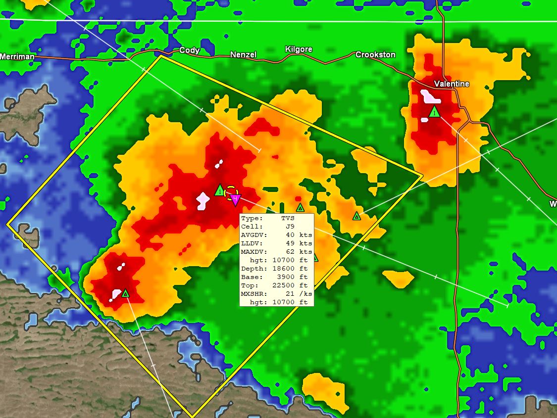
7:37 pm: The bulk of the TS stayed west of Valentine, here on the NE side measured (.22") image. Report from NW Valentine Catholic Church area (.24") and (.39") on the far west side of Valentine at end of 3rd St. Makes sense was closer to the main cell as it passed. Looking at Miller Field new rain looks like (.26").
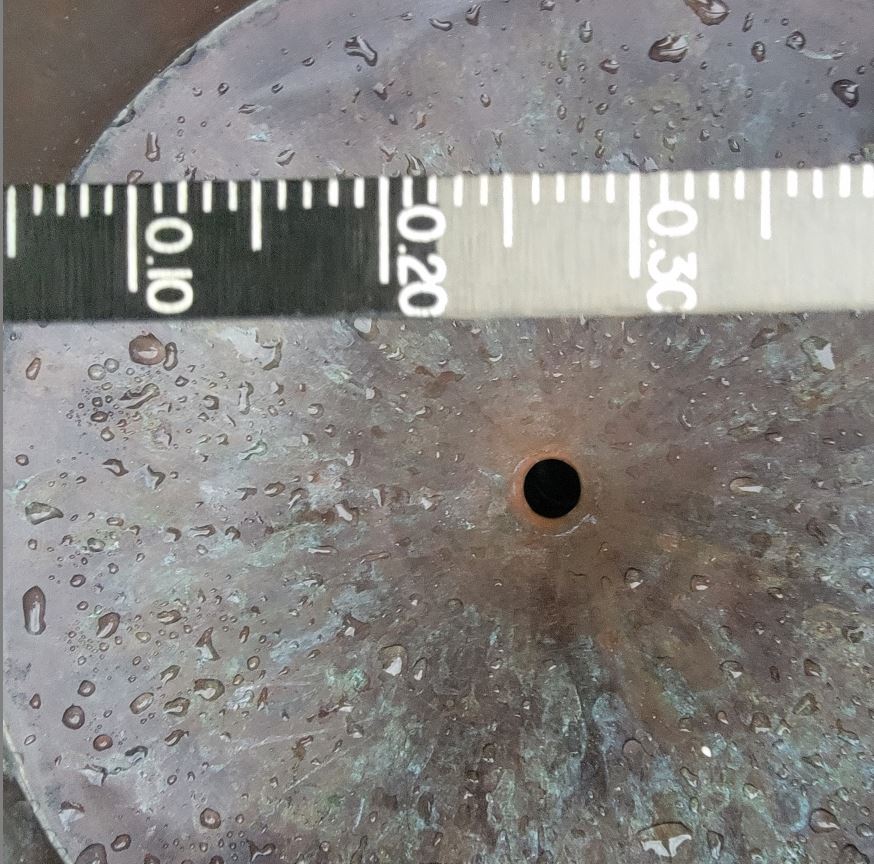
For those interested in the Cocorahs gauges the Tropo was the highest at 0.23" (image) and the Stratus .22 (image) . Not sure why the Tropo is working so well the last couple of rains but it looks not to be running low now.
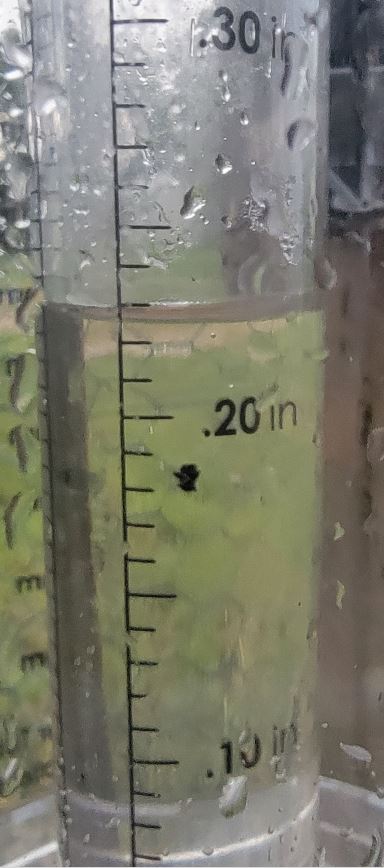
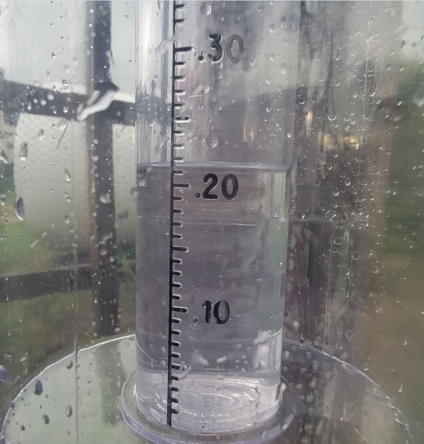
6:32 pm: A Thunderstorm with hail potential is bearing down on Valentine, rain has just started at this location. More later.
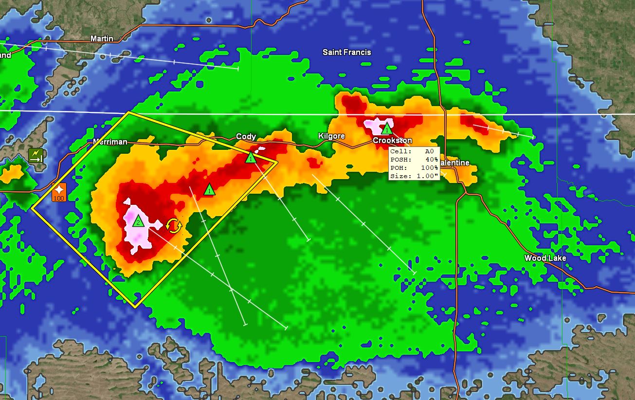
6:00 pm: A thunderstorm between Gordon and Merriman has a potential of 3" hailstones. . (POH) Possibility of hail, (POSH) Possibility of severe hail. The pink is the bigger hail marker. White smaller hail.
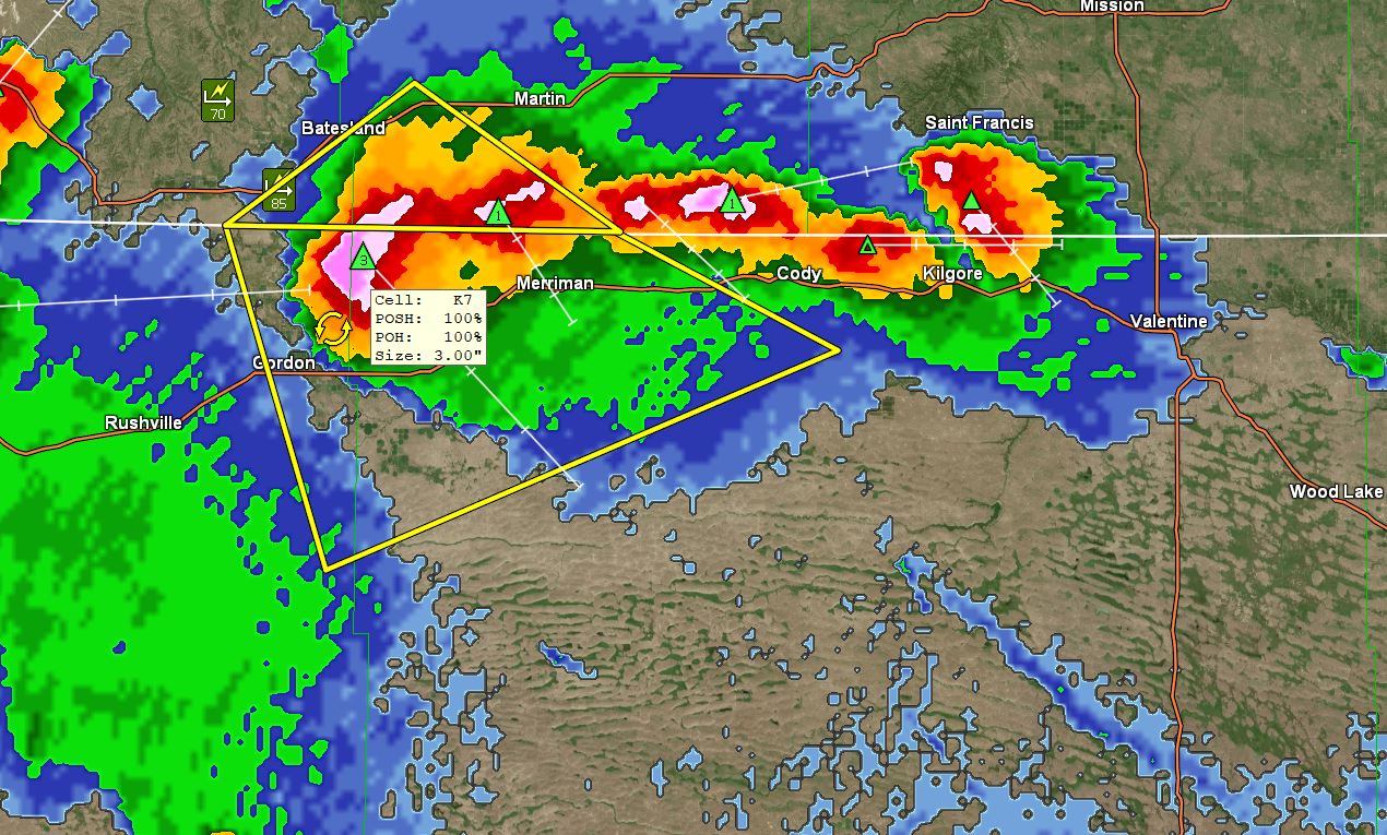
3:55 pm: There was a 1" hail report 10 mi. SW of Valentine from the public.
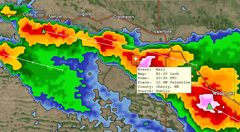
3:30 pm: Looks like the north side of town will dodge this ThunderStorm, the east camera has another look at this one as it goes by, under Cameras link.
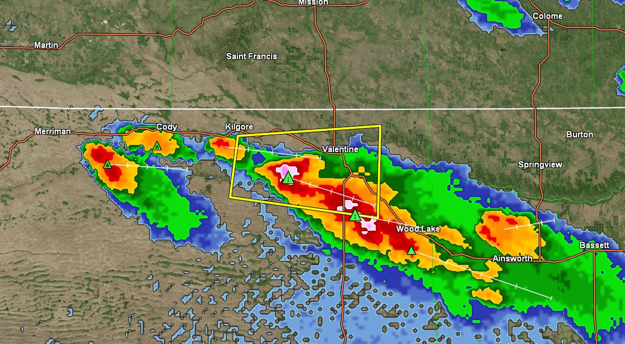
11:10 am: Going to start including the Adams place (0.74) miles east of here with the rainfall reports, the red dot is where the Cocorahs gauge is located. With the strong TS yesterday morning (.50") was recorded. Also played havoc on the garden even with the windbreak of trees. If you want to include your location for the rainfall event diary send an email. Only Official 4" diameter Cocorahs gauges (Stratus, Tropo) or the 8" SRG, and no electronic gauges please.
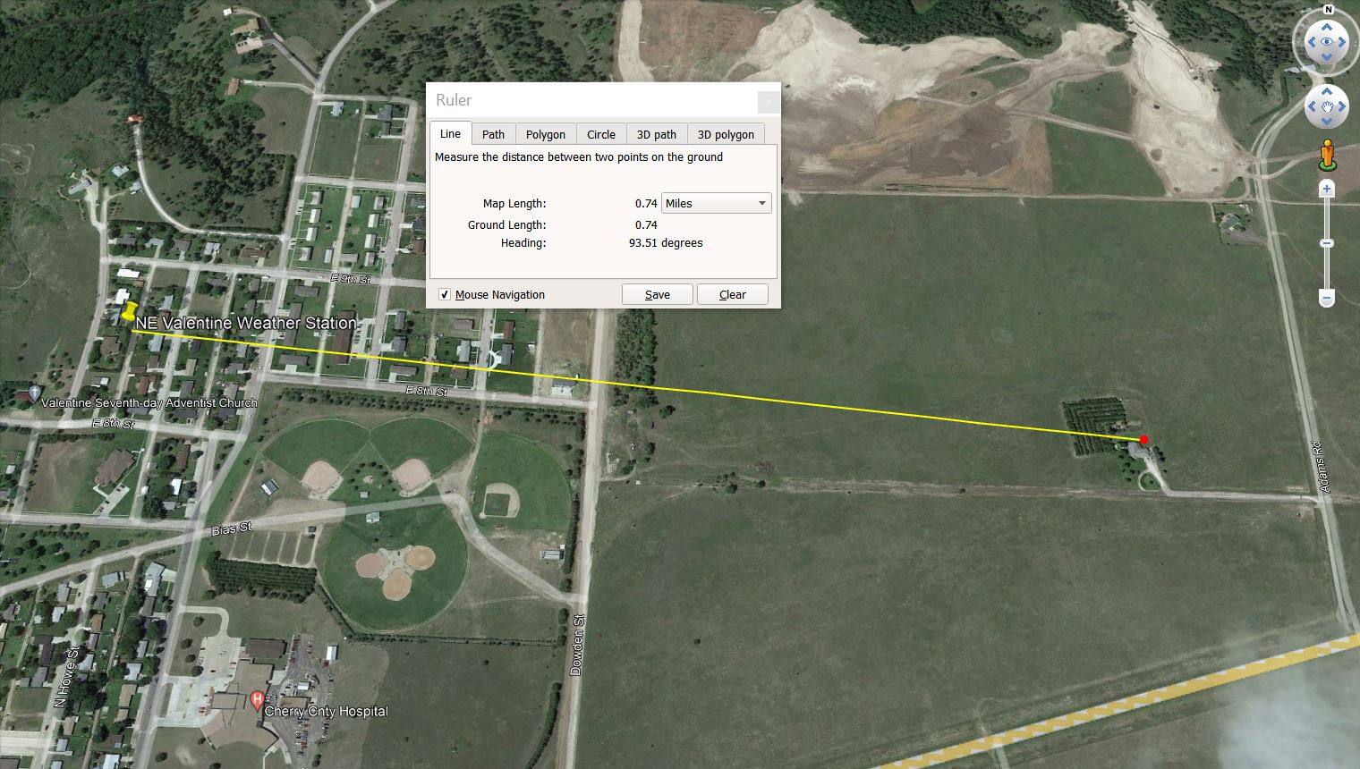
07/12/2023...6:30 am: A strong thunderstorm rolled through overnight with a wind gust of 55 mph here at the NE Valentine location and 71 mph at the Miller Field ASOS twice. The manual 8" SRG rainfall (.43"). The other two Cocorahs gauges recorded (.415") for the Stratus, and (.422") for the new Tropo. All the gauges are aligned on the same plane and close to each other. This was also a high-wind event. Looking at the Tempest here in NE Valentine the peak wind gust recorded 55 MPH also. Check back later for any additional rainfall amounts if reported around town, HERE: NW Valentine near the Catholic Church (.33"), KVSH radio station reported (.35"), 0.75-mile east Adams place (.50") Cocorahs gauge and Miller Field (.34").
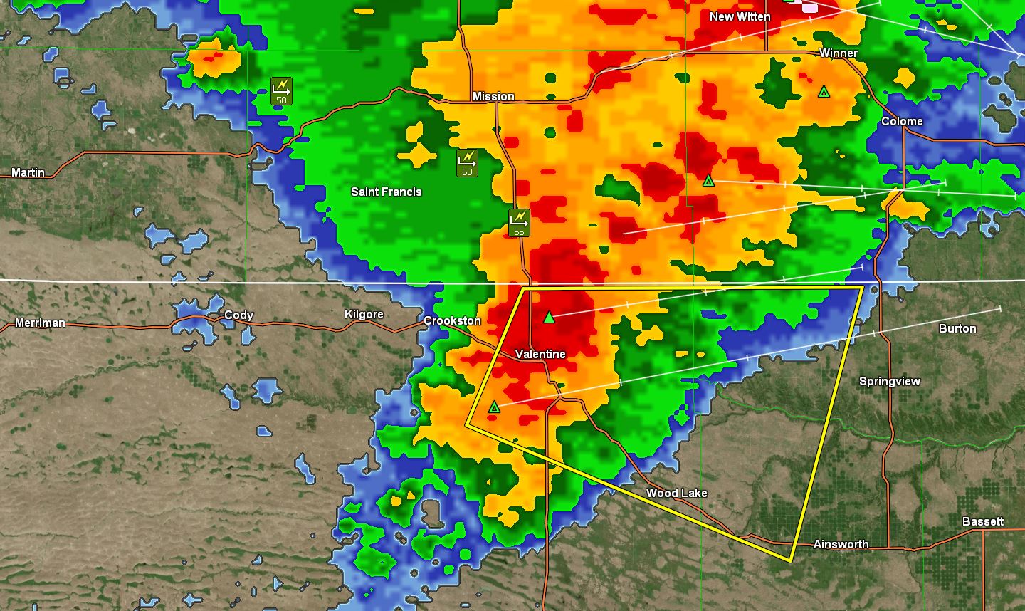
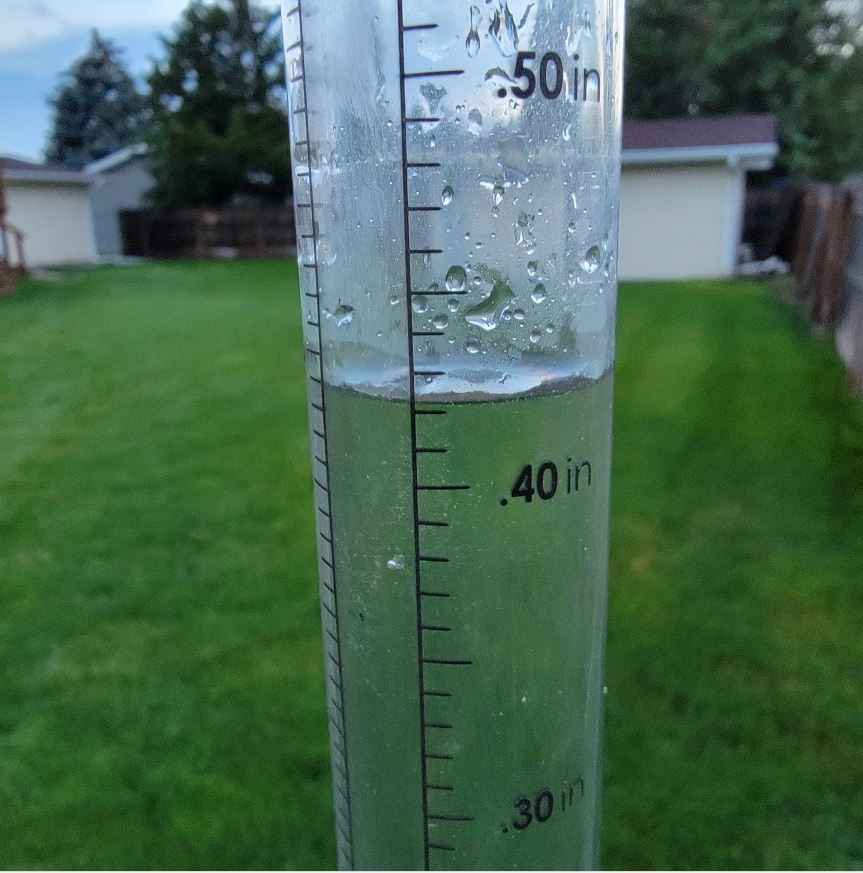
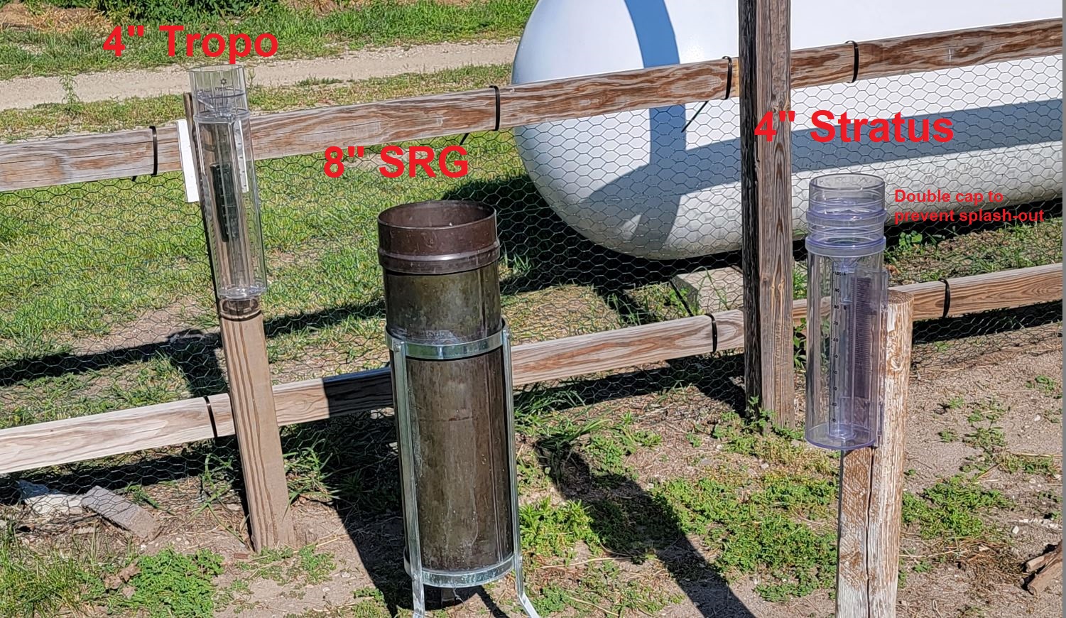
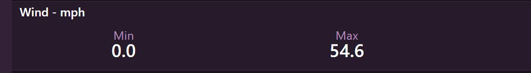
07/11/2023...3 pm: The afternoon forecast update from the NWS has dropped the chance of rain tonight down to 40% for Valentine. (.02") here in NE Valentine so far today. Miller Field looks like (.03").
Here's the storm report for the North Platte area last night. Storm Report NWS employee reported (2.75") hail 11 miles north. At the airport location the Official observation reported (1.75") hailstones.
6:25 am: Getting some light rain currently.
5:40 am: Looks like some scattered showers on radar and fog in the west camera this morning. Our high temp yesterday was 92° both here and at Miller Field. It felt warm too with the dew point upper 50s. Today it's running a little higher 63° currently. Several models are saying rain chances are pretty good late this afternoon. The forecast has a 50% chance.
The Cocorahs Stratus rain gauge arrived yesterday. I'll continue to compare against the 8" SRG and new Tropo gauge. Image One thing discovered years ago during heavy downpours the shallow funnel on the Stratus can splash-out so double cap, hacksaw the top funnel out and double cap preventing splash-out. The top caps glued together are best doubling the weight reducing blow-off chance during high wind.
Added the GRLevel3 radar under the Sat/Radar tab so it's always available if not up on the front page. It will focus on the local area mainly. Occasionally it does hang up and needs restarted if not updating.
07/10/2023...6:50 pm: A strong thunderstorm is approaching North Platte. IMAGE
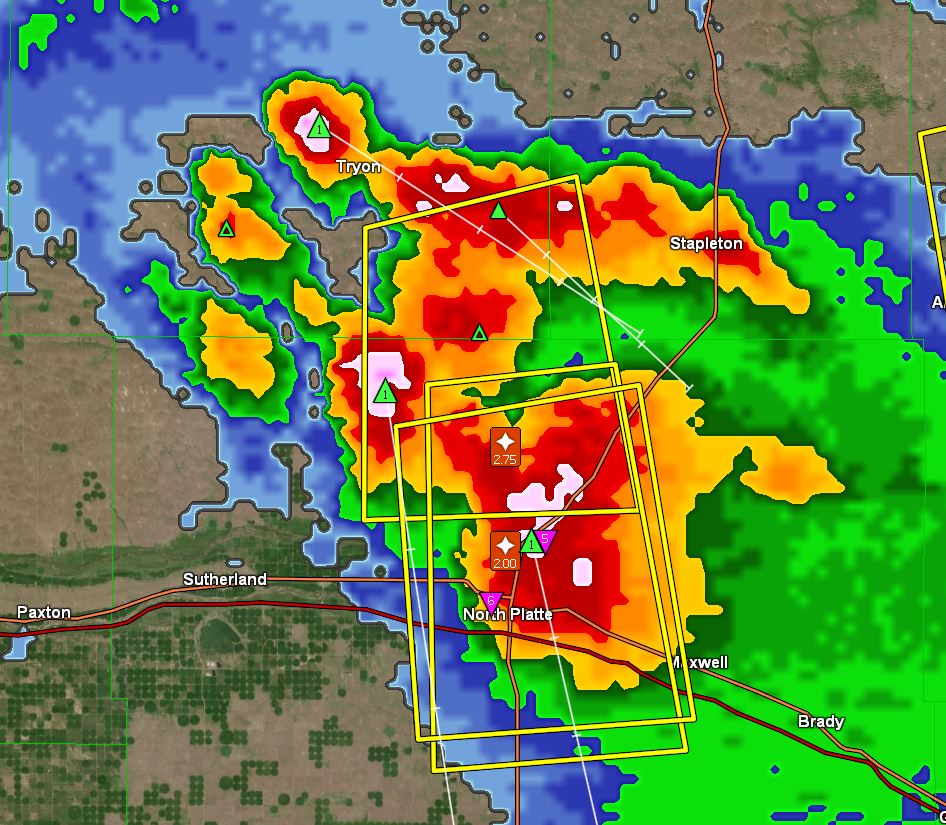
July-type temperatures today, low 90s. There are a couple of models that want to bring in a light shower this afternoon others are dry. One of them is the ECM with a good track record is why I mentioned it. Nothing in the forecast however, tomorrow will be our best chance of precip at 50% chance.
Yesterday did a field calibration on the tipping bucket rain gauge. Would like to see it perform a little closer to the manual rain gauge but these thunderstorms have such a varied rainfall rate anywhere from 17 inches per hour to a few hundredths and the tipping bucket is only exactly right at the rainfall rate it was calibrated. Just the nature of the beast that's why the website gets adjusted to the 8" manual rain gauge after each event. The airport ASOS uses a weighing-type gauge if I could get one that would integrate with the website I'd of already had one.
07/08/2023...6:00 pm: Rainfall total (.13"). The Tropo agreed too. Got a text from NW Valentine also (.13").
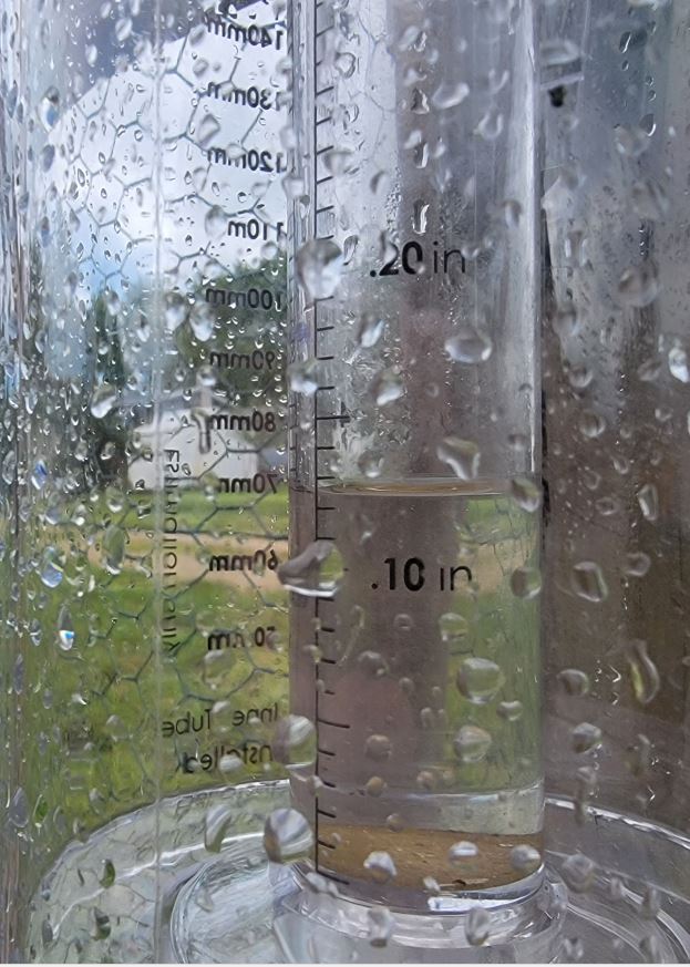
4:45 pm: I'll be doing a manual rainfall measurement and adjust website if necessary when it's over. Current radar image. South Dakota is showing more development on the heels so may not be over.
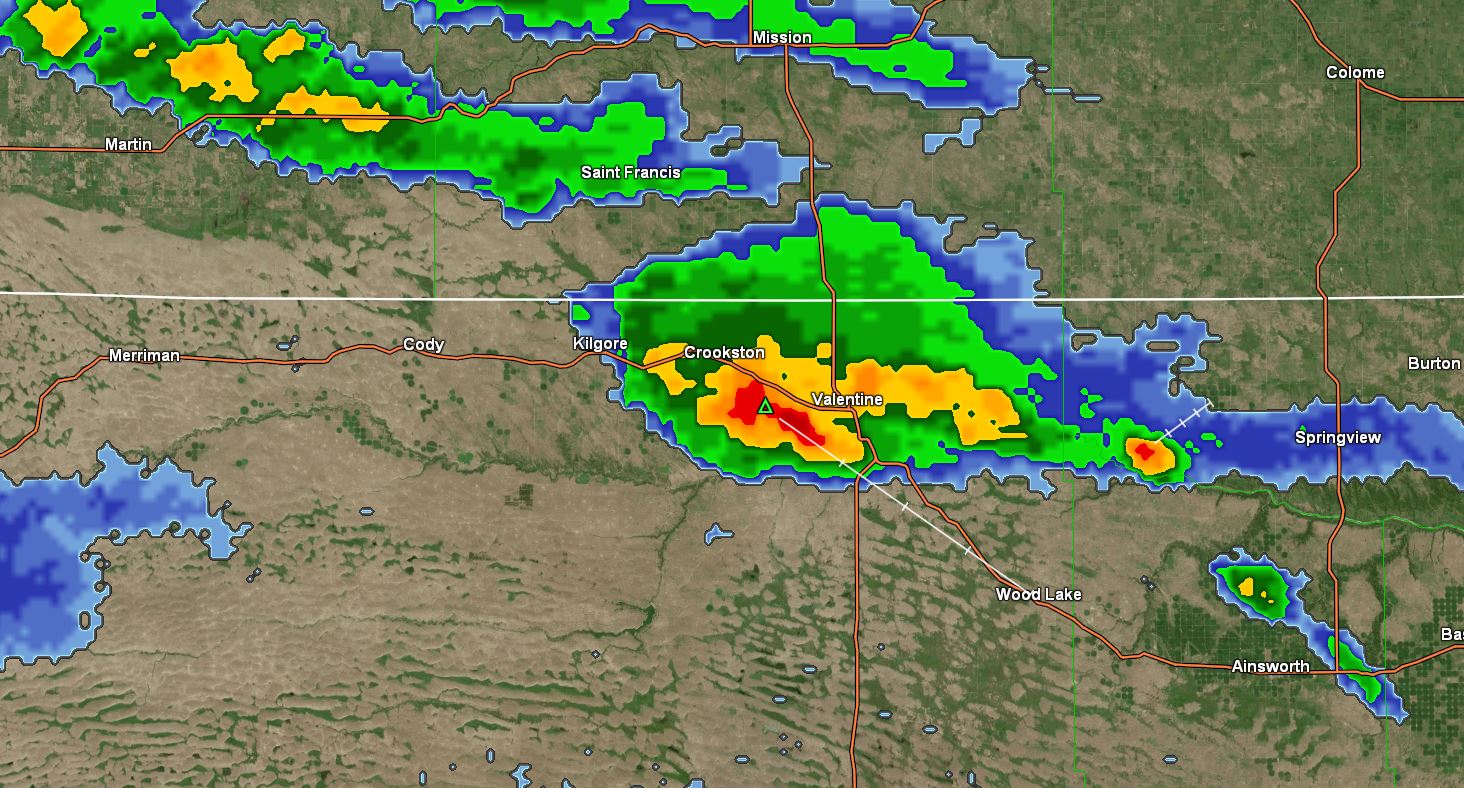
4:20 pm: Looks like this thunderstorm may skirt the west side of town mainly. Nailing Crookston currently.
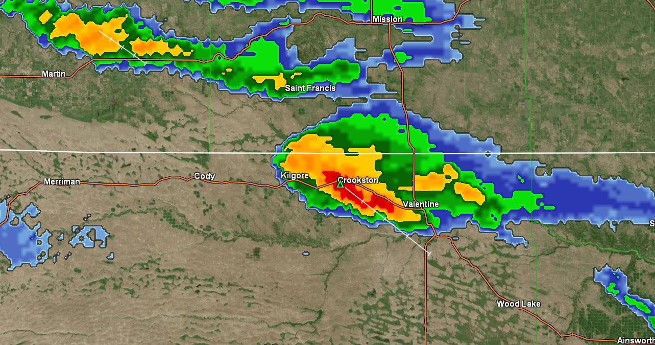
2:20 pm: Put both radars up. A little activity is starting to pop up around the area. Not expecting much but we could get a shower later meaning better mow earlier than planned.
07/07/2023...6:05 am: Will Update as new rain reports come in: Storm total here on the NE side of Valentine (1.49") measured with the NWS SRG, the Novalynx 8" SRG measured (1.51"). The Miller Field ASOS measured (1.52"), the NW Valentine Cocorahs gauge by the Catholic Church (1.53"), W.3rd Street report from another 4" Coco gauge (1.51"), Sue far SW side also Coco gauge (1.48"), two reports on Lake Shore Dr. on north end of town and the highest amounts reported (1.80") unknown gauge and (1.90") also using a 4" Cocorahs gauge and finally the new Cocorahs Tropo I'm testing here did better than expected (1.42"). But still (.07") low vs the NWS gauge or (-4%). Previous test it was coming in (-7%) low. The 8" has always recorded more or the same vs the Stratus. This is just a Red Herring to distract from the bottom line, the new Tropo model measures 4% low vs the 8" SRG. This comparison above was a substantial rainfall so a good sample size plus a low wind event and no reason the results aren't true. I don't think the 2-8" diameter gauges are both wrong.
2:40 am: Heavy rain continues radar IMAGE with (.74") on TB gauge. Wind still light 4 mph out of ESE.
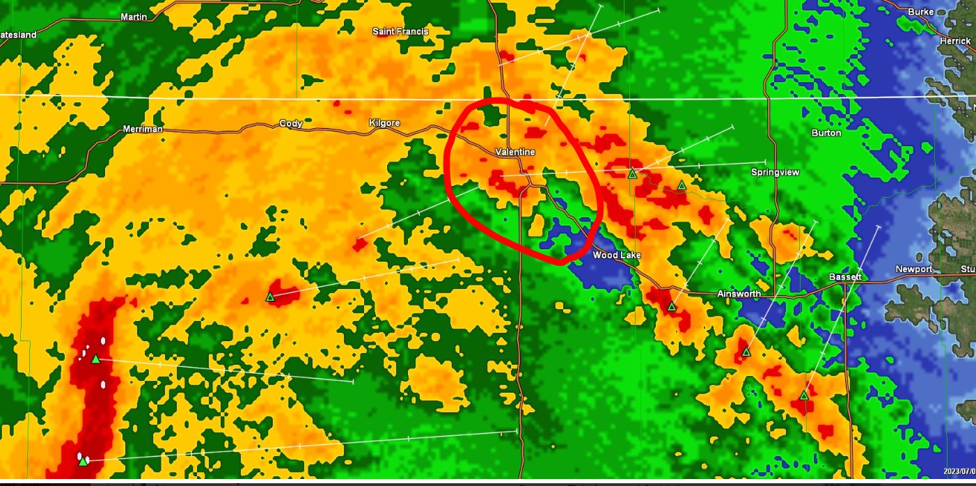
2:00 am: Thunderstorm activity IMAGE in the area. So far the TB (tipping bucket) gauge says (.14"). Peak rainfall rate reached (1.7") per hr. Currently between cells so light rain. As always the manual 8" SRG (Standard rain gauge) will be the final say on how much rain fell and website adjusted. Also doing a comparison on the new Cocorahs Tropo gauge against the 8" gauge so will post those results later. What's nice about this rain event very little wind currently 3 mph so no excuses.
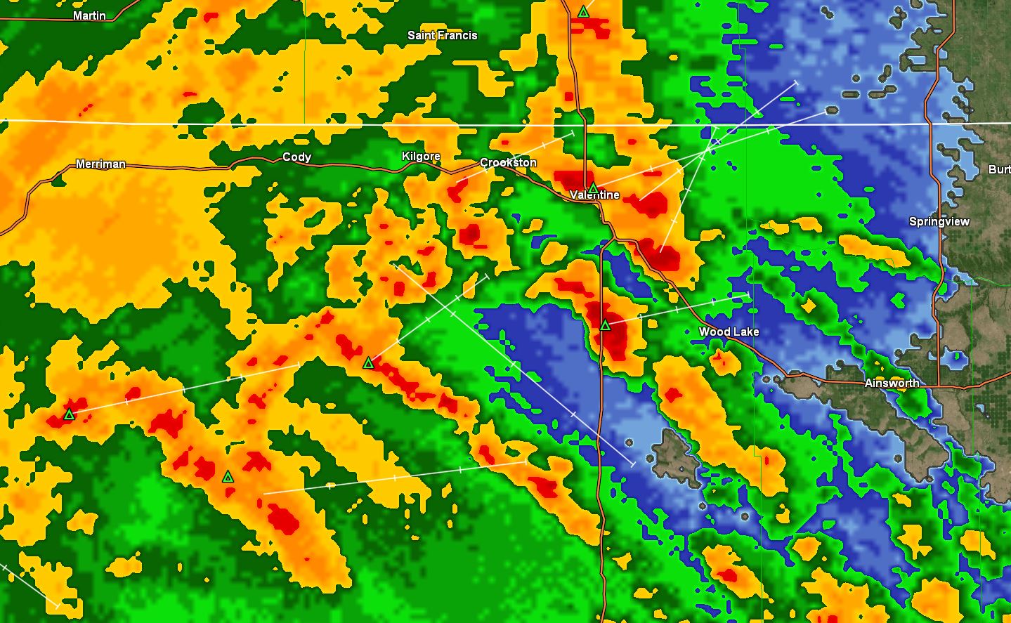
07/06/2023...The airport set a record low this morning of 45°, July 6th the old record low was 46° in 1999. The low here at the NE Valentine location this morning was (45.8°). It was a NE station record. The South side Tempest near the airport shows the low was 45° also.
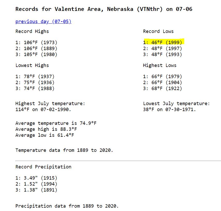
5:45 am: A little ground fog in the west camera. Noticed the airport was showing 100% RH at times, 97% here currently.
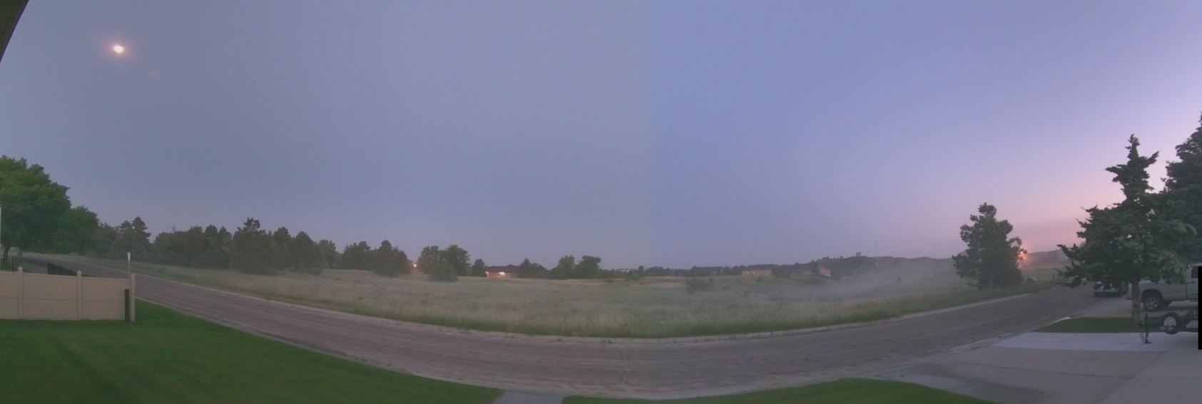
Temperatures are cool in the 40s this morning (46°) currently, (46°) at Miller Field. Yesterday here in NE Valentine the high temp peaked at (68°) late at 6:40 pm in the evening which is a little odd. It was a nice day for getting things done outside with a few sprinkles even mixed in. Today will be about 10° warmer but still cool for early July with likely thunderstorms tonight. Several models are putting the timing just after midnight on the early morning model runs but could change as the day progresses. Our forecast has a likely 60% chance tonight.
07/05/2023...Well below normal today on temperatures with the forecast high of 68° our normal is 89°. This week will stay below normal not reaching 80° until Sunday. Thursday night and Friday will be our best chances of precip. in the 60% plus range. Some areas suffering from drought picked up some much-needed rain last night with close to 2" in the Lincoln area. Other areas as much as 4" SE of Hastings.
07/04/2023...Updated 5 pm: Just a trace amount fell from a thunderstorm overnight at the NE location. Miller Field (.02"), also on the NW side of town (.02"). We reached the high temperature already 78° near midnight. The updated forecast has a 20% chance tonight and tomorrow with our best chance Thursday night and Friday.
Happy 247th birthday America...If not for the role the good ole USA played in the 20th century the entire planet would be one giant slave state dominated by National Socialists, Soviet Communists, & the Chinese Communists and no one would have any freedoms at all. You're Welcome World.
Our high temps Monday did reach 92° here and at Miller Field. Looks like some activity in SD so will put both radars up.
07/03/2023...Yesterday the high reached 92° both here and out at Miller Field. Today looks about the same with the forecast high of 92° then back into the low to upper 70s for highs through Saturday with daily thunderstorm chances starting tonight at 30%. Tomorrow night Independence Day we have a 40% chance so it's dropped from yesterday's 60%. Yesterday was only the 4th 90°+ this year. Last year 10-90°+ days by the end of June, so this year has had a cooler summer start and looks to continue this coming week. No complaints here.
07/02/2023...6:10 am: Fireworks in Valentine last night, couldn't have asked for better weather. Our temps will reach into the low 90s for today 91° and Monday 93° which has been rare so far this summer. (Knock on wood) There is a 20% chance of a T-storm starting tonight. Our best chances of moisture will be when a cold front pushes through on Independence Day with a 70% chance in the form of nature's fireworks that evening into Wednesday. This is also keeping our temps well below normal with only a 70° forecast for Wednesday and we don't get out of the 70s for highs until Saturday at 80°. So after Monday a coolish week with chances of moisture mainly in thunderstorms almost daily ahead.
07/01/2023...7:13 am: Getting a little rain shower on the NE side of town.
6:30 am: Updated rainfall amounts: On the first day of July, here in NE Valentine we received (.35") with both 8" dia. gauges agreeing. The June summary can be found HERE. Temperatures were normal only (-0.1f), rainfall (+3.31") with (7.27") monthly total. Our early July forecast has a couple 90° days Sunday and Monday and then cooling below normal 70s later in the week with rainfall and thunderstorm chances.
I'll report other rainfall amounts here: Looks like Miller Field is reporting (.30"). NW Valentine Catholic Church loop (.57") so they had a heavier shower, also downtown KVSH radio (.54") in their 8" NWS gauge.
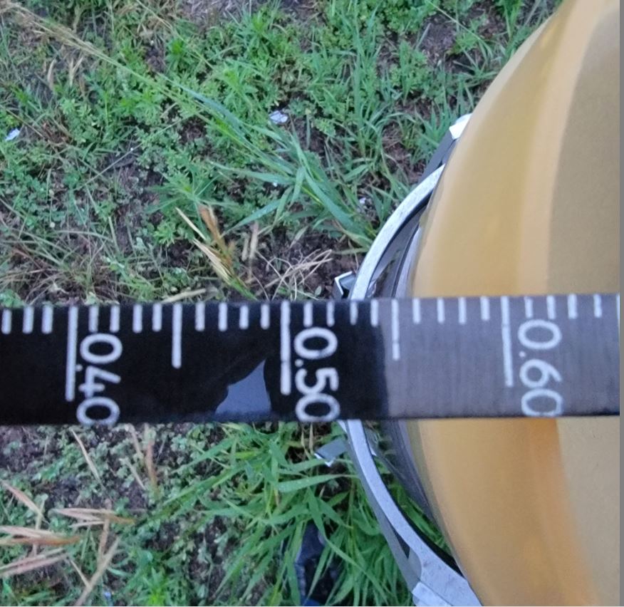
For older blog starting in June 2014. Go HERE. The file was getting to large so this section starts in 2023 Jan. 1.