06/30/2023...7:45 am: The NWS gauge (.35") as was the Novalynx (.35"). Used the matching dip sticks that came with the gauges. The downtown KVSH radio reported (.37"). The airport looks like (.31"). NW side Catholic Church (.37") and final report toward the end of 3rd Street (.40") far west Valentine. Last two were Cocorahs gauges. The forecast has another 60% chance today (Likely) and 50% tonight.
01:10 am: The NWS gauge measurement (.34") so far with light rain still falling. The final check will be around 6-7 am. Adjusted the website to match. With the moderate to light rain and rather light wind this will be another good gauge comparison event, results later.
06/29/2023...10:50 pm: Just dipped the rain gauge (.07") so far. Looks like lots of activity still to come tonight. A strong thunderstorm south of Wood Lake currently.
9:00 am: The drought monitor still has us abnormally dry with 15-17" of moisture. This is the 2nd wettest June since the station started in 2014.
6:20 am: Looking at the forecast and models this morning we do have a good chance (60%) tonight for rainfall but the heavy stuff (1" plus) will stay west and south of Valentine. This is subject to change but what it looks like this morning. We could still pick up (1/3 to 1/2") of moisture by (July 1) Saturday morning. Later next week looks wet too so our wet period continues and it sure is green, like it's been since late spring. Hard to believe they say we are still in a drought with 17" of moisture this year. The (Drought Monitor) gets updated around 8:30 am today. So can't wait to look at it.
06/28/2023...3:10 pm: Occasionally I check the Dew Point Temp using the Psychro-Dyne (image) making sure the weather station is close. The station DP varies as air moves over the sensors and can change rapidly being aspirated so looking for close to the average. As you can see our dew point temp is running in the (63-64°) range this afternoon and close to what the weather station shows. The wet and dry bulb temperature is used to calculate the dew point temperature. image Provided it's above 80° ambient the DP temp will start feeling muggy at 55° and sticky above 65° along with the heat index (feels-like) going up. So the DP temp is what you want to watch closely during the summer months.
A little scattered mist/fog around the area this morning. Our best moisture chance once again comes Thursday night and Friday. We could see another inch potentially before the month is over.
06/27/2023...11:10 pm: Thunderstorm had a couple of really close lightning strikes. Picked up an additional (.16") in rainfall (heavy) reached 2.6" per hr, rate for a daily total (.59"). FYI the difference between the NWS 8" gauge (.59") and the Novalynx 8" gauge (.60"). was .01" today.
9:25 am: Rainfall reports, looks like Miller Field (.56"), near the Catholic Church NW Valentine (.51"), KVSH radio downtown is reporting (.47"), and here NE Valentine (.43").
8:14 am: The thunderstorm has almost stalled and starting to see a little hail (white reflection) showing up to the west. So it may be getting stronger. The rains not real heavy (.40 to .50 inch per hr. rate) on the NE side but steady (.26") currently.
7:55 am: Sure is dark outside. The solar is only 4 W/m2
5:20 am: Active morning getting rain showers off and on briefly moderate at times but short-lived. There was a strong thunderstorm south of Merriman but weakened for now. Trajectory looks slightly SE so storms out of SD are more likely to reach the Valentine area.
06/26/2023...What a nice coolish June day yesterday with the NW breeze and high temp only reaching 78° both here and out at Miller Field. We have the potential for another wet week ahead, here is what models are saying from last night's runs. The ECM is the most bullish once again for Valentine bringing in another 1.5" by week's end.
06/24/2023...7:35 pm: (.05") in a shower. You can see the perfect rainbow on the east camera currently. Image
Looking at the Cocorahs map some of the heavier rainfall reports occurred along the Nebraska-South Dakota border with the highest ( 4.42 inches). Our air quality is really good today in the single digits currently 8 and has been down to 0 US EPA PM2.5 AQI. Looking at the station all-time monthly rainfall record, June 2014 was (8.52") so not in danger of breaking that record yet, currently sitting at (6.28") this year at the NE location. June is historically a wet month for Valentine. Hard to believe but some parts of Nebraska are still suffering from drought.
8:25 am Update: Since yesterday morning (1.79") Image + (.03") prior to 7 am dump (1.82") 2-day storm total on the NWS gauge. Website was adjusted to match. Other 2-day totals the Novalynx came in (1.87"). The Cocorahs new Tropo gauge came in at (1.78"). Got a new rainfall report from the old location in West Valentine toward the end of 3rd Street 2-day storm total was (1.83"). Latest updated report near the Catholic Church, NW Valentine (1.82") 2-day total. Both those reports are using the original Cocorahs gauges not the Tropo model (link)being tested here.
This was the last comparison of the two 8" gauges (Novalynx and NWS) they are close enough to each other. (.05") difference with over an 1.5" of rainfall is minimal with the wind we had overnight gusts reaching 54 mph so the comparison was flawed somewhat anyway. Yesterday morning with little wind the gauges were the same. I'll continue using the NWS gauge as the primary with the Novalynx as backup for now.
1:30 am: Just had a 54 mph gust with 34 mph sustained NW wind along with the rain. It's noisy. Current radar Image. Here is the image of the thunderstorm over Valentine back around midnight. Image. The cell was located over on the NE side of Valentine which seems to be a common track.
1:00 am: A flood advisory has been issued by the NWS for the area around Valentine. Manual measurements will be done and website adjusted to match the NWS 8" dia. SRG once rain has stopped. Just dipped the rain gauges (1.46") since yesterday morning but still coming down.
12:25 am: Couldn't sleep through this one. Really coming down approaching an inch since midnight.
06/23/2023...9:35 pm: You don't see cells with 3" hail potential that often. Image We don't want any of that here.
6:50 pm: It may look tranquil currently but we are under a tornado watch. For more of what to expect tonight look: HERE.
1:05 pm: Rain gauge comparison results: Novalynx (.31") image the same as the NWS gauge (.31") image and the Cocorahs reads (.29") image . Received a rain report from the NW Valentine location (.35"). Including the (.03") before gauges were dumped sitting at (.34") here at the NE location so far today.
7:15 am: Here in NE Valentine (.03") in light rain this morning. We have an 80% chance tonight. In comparing the 3 rain gauges all came in the same. (8" NWS, 8" Novalynx, 4" Cocorahs).... Had all 3-gauges together for the comparison but decided to move off the deck to a location near the main weather station. Was afraid of the potential of turbulence on the deck during high wind events because of the closeness to the building.
06/22/2023...7:00 am: Definitely have some haze this morning with reduced visibility. The airport ASOS visibility says 4-5 miles with mist but looking at the AQI in the orange it's likely smoke caused. Cameras don't pick up the haze well. For anyone who hasn't visited in awhile there is a camera page now showing the 3-cameras together.
5:am: Yesterday we peaked out at 81° both Miller Field and NE Valentine. So far only a trace of moisture this week, with a 60% chance tonight increasing to 80-90% Friday night into early Saturday morning. GFS and ECM are still suggesting 1.5" plus for the weeks total moisture. Next week an additional 1.5" range but it's still early. Noticed the UV index forecast is extreme at (11.2) today based on a clear sky. With scattered clouds actual UV is 89%, broken clouds 73%, and overcast skies 31%. Our air quality is a little dirty this morning in the orange at (108) US EPA PM2.5 AQI. probably still that Canadian smoke hanging around. The AQ sensor is located here in northeast Valentine linked under "External links".
06/21/2023...Today is the longest sunlight day of the year summer solstice. Meteorologically the first day of summer was June 1st. Our highs yesterday (89.6°) NE side and (89°) Miller Field with only trace amounts of precip. We did have thunderstorms in the area as we do this morning with rumblings early on but avoiding Valentine so far. Yesterday was humid with the dew point temps running mid to upper 60s. It's dried out some this morning with a DP temp of 62°. 40% chance of precip today, and not getting into the likely amounts until Thursday now. It starts feeling muggy at 55° dew point and gets worse as it goes up.
06/20/2023...SEVERE THUNDERSTORM WATCH IS IN EFFECT UNTIL 1000 PM MDT for Cherry County. The previous 70% chance tonight is down to 40% for Valentine however. So we may not see anything tonight.
5:45 am: An active weather pattern ahead starting late this evening with thunderstorms possible. We have a south wind this morning holding the temperature up with the low only reaching 70° so far, our high today is expected near 90° but shouldn't feel too bad with the breeze. Some areas could get locally heavy rain with thunderstorms over the next few days. Positioning of storms is always the key who receives the heavier rainfall and models aren't always right early on. A RAP shift to the east 20-40 miles in this area has been a common occurrence lately.
06/19/2023...6:15 pm: The highs came in at (94°) NE Valentine and both South and NE Tempest stations, Miller Field (95°). The wind also picked up this afternoon with a gust of (36 mph) making it more bearable.
Added an individual camera page making it easier to see all (cameras) at the same time. FYI at anytime you can click on the top banner image (Mill Pond) it takes you back to main page.
97° is the forecast high for Valentine today, the UV index is high too. Looks like a wet week starting tomorrow evening. Heavy rain is a possibility with thunderstorms during this period with chances of rain every day. How much rain depends on getting a direct hit from a thunderstorm or not.
06/18/2023...Our high today reached 88° both on the NE side and Miller Field. 97° is the forecast for tomorrow.
6:25 am: 47° and a little mist this morning. Our high today is forecast at (89°) and (98°) for Monday. So just a small taste of what they are experiencing down in Texas before chances of thunderstorms start Tuesday and look likely later in the week. We could see some significant rainfall amounts during the week. The latest ECM and GFS show 2"+. It's still early however.
06/17/2023...Another chilly morning (46°) here in NE Valentine (45°) at Miller Field for the lows. That ends soon with the Monday forecast high at (96°) then chances of rain again starting Tuesday. Looking at the models we may be in for some heavy rain again toward the end of next week.
06/16/2023...4:15 pm: Ran into a heavy shower about 15 minutes ago by the rodeo grounds and Cemetery. Showers have been spotty. (.03") on the northeast side today. The high temp occurred at 12:01 am 64°. It's running in the upper 50s this afternoon with a stiff NW wind. Light jacket weather.
Update 7am: KVSH radio downtown also reports (.05") from yesterday afternoon. Looks like the south airport side had the most from the thunderstorm (.14") that skirted Valentine. A cold front pushed through overnight, we have slight chances of showers today. Some areas received heavy rain yesterday with thunderstorms and a few hail reports in South Dakota and NW Nebraska.
06/15/2023... 5:50 pm: (.05") fell here at this location and at the NW location near Catholic Church. Looks like (.14") at Miller Field where the cell passed closer.
4:38 pm: A thunderstorm is approaching the Valentine area it may pass on the east side. FYI, added the east view camera yesterday which may also give a decent image should it pass on the east side. The camera is found under Sat/Radar/Cams tab.
06/14/2023...Added an East view camera with the dual-lens. Linked under Sat/Radar/Cams tab. The camera has 5-minute updates. It's a backup camera to the west camera should it ever fail and have had it just sitting around.
Still looks like precip chances are best Thursday night into Friday. We are in the 40s again this morning. Currently 46° here and out at Miller Field.
06/13/2023...7:10 pm: Our high today came in at 78° both Miller Field and here. The smoke likely hampered our potential lower 80s.
4:10 pm: Reading the forecaster discussion our high clouds this afternoon is actually smoke. It's not reaching the ground that much with our air quality at (47 PM2.5) currently in Valentine. Not the best green, we are in the yellow but could be much worse. Valentine AQ is linked under "External Links". The smoke is also keeping us a degree or two cooler. Only 78° so far today.
Another coolish morning in the 40s. 54° is the average low. Yesterday reached 75° at Miller Field and here in NE Valentine. Rain chances are likely again 60% starting Thursday night into Friday. Looking ahead some of that Texas heat may develop northward with 90° forecast next Monday.
06/12/2023...6:15 am: A cool morning for June the low 43°, Miller Field 44° our next precip chances looks like Thursday.
06/11/2023...Updated rain totals below: Looks like the forecast has dried out considerably so if you missed out on yesterday's deluge you'll have to wait until next Thursday when a slight chance is being mentioned again. Temperatures are on the coolish side today and Monday with only 70s for highs and lows into the 40s.
We ended up with (3.98") here at the northeast location with the 8" SRG. Another rain gauge same area just a block south went over 4". The NW Valentine location total was (3.53") with the 4" Cocorahs gauge. Downtown KVSH radio rain gauge recorded (3.28"). There was street flooding around Valentine yesterday.
06/10/2023...10:27 pm: Getting a heavy shower again. Looks short lived however.
9:10 pm: I'm hearing there was a lot of street flooding around town here are a couple pics down Main Street someone sent. Image-1, Image-2
7:55 pm: We've had rain continue since the real heavy downpour ended occasionally moderate. Currently here in NE Valentine (3.90") on the day. Another report I just received also uses a Cocorahs gauge just over 4" about a block south of this location. The NW location Cocorahs gauge just reported an additional .45" for a total (3.47") near the Catholic Church on the day. The two Tempest stations used for comparison only not accuracy across town show (3.97") here at the NE location and (2.80") on the south side of Valentine and close to the airport. These Tempest stations are linked under EXTERNAL LINKS.
1:00 pm: Still raining lightly 2 different gauge measurements the 4" diameter Cocorahs (3.28") and the 8" diameter SRG (3.48"). Adjusted website to match the 8" SRG @350 pm. The Cocorahs gauge report from NW Valentine near the Catholic Church (3.02"). Downtown the KVSH radio station (2.84") was recorded. Looks like Miller Field is around (2.07"). So (-1.5") less, not surprising the heavier red radar returns were hanging on the NE side throughout most of it.
12:20 pm: Still raining much lighter (.12") per hr. rate. The tipping bucket is over 3" total but not official yet. This is what I can see of the 4" dia. Cocorahs gauge over flow plus the 1" in the measuring tube. Image
11:38:am: 2.50" and not slowing down. One of the heavier rains I can recall and this storm looks almost stalled so be really carefull. Reports of flooding on this side of town says KVSH radio.
11:15 am: The NWS just issued a Flash Flood warning. Be careful out there especially driving, turn around don't drown. Visibility is even low around (1/16) mile currently here on the northeast side.
11:am: Heavy rain continues movement is slow so areas can get some large amounts. For history here is the current radar. (.89") on the tipping bucket currently. A manual rain gauge measurement will be done afterwards and website adjusted if needed.
Thunderstorms and rain likely today possibly heavy.
06/09/2023...Good chances of rain coming up, 50% today, 60% tonight, and 80% tomorrow.
06/08/2023...5:pm: The NW side of Valentine near the Catholic Church picked up (.04") in a shower. Only a sprinkle on this NE side. Looks like (91°) will be the final high today.
8:25 am: The forecast has us reaching (90°) here in Valentine today. The low temp this morning was 58° and 59° out at Miller Field. Our wet period coming up is unchanged with the highest chance Saturday at 90%. Expecting around an inch for Valentine over the weekend with more potentially next week. With the nature of thunderstorms even across short distances amounts can very. No mention of severe weather in the discussions or forecast.
06/07/2023...The high temp reached 88° both on the northeast side and Miller Field today. Forecasters have more confidence in rainfall chances with the afternoon update, now 80% Friday night and 90% on Saturday.
6:45 am: Not much has changed with the upcoming rain chances. A cold front will move through increasing moisture chances 60-80% Friday through Saturday night. Another beautiful morning under our warm high-pressure system, currently no wind. A good morning to sit out on the porch and drink coffee. That Canadian smoke is primarily east of us but have noticed our air quality is in the 80s PM2.5 this morning. So creeping up a little. For new visitors, the Valentine air quality link is under External links, 3rd link down. The sensor is located here in NE Valentine.
06/06/2023...4:40:pm: On D-Day remembrance day we've peaked out at a warm (86.6°) so far here on the NE side of Valentine. Chances of precip start Thursday with likely wording Friday night and Saturday.
06/05/2023...5:40 am: Calm and 59° with areas of ground fog on the NE side of town this morning. Not thick so should burn off rapidly after sunrise. Increasing chances of moisture starting Thursday evening. The airport sits at (.67") on the month and only (.39") here in NE Valentine. Yearly however the airport is still well behind (8.61" vs 10.59"). Part of the difference (around an inch) came in a heavy thunderstorm the airport almost missed completely out on. It was one of the heavier downfalls recorded here at 11 inch per hour rate. You couldn't see across the street at one time.
06/04/2023...9:55 pm: Picked up (.07") additional in NE Valentine for (.15") today and (.39") two-day total.
2:40 pm: Afternoon thunderstorm (.08") here on the NE side of town (.32") 24 hr. total, the NW location near the Catholic church (.14") so (.29") 24 hr. total includes last night. Miller Field looks like (.42") since midnight. So the south side received the most around Valentine with a (.61") 24 hour total.
Thunderstorm last night before midnight dropping (.24") here in NE Valentine. Checking other rain gauges early this morning NW side near Catholic church (.15"), downtown KVSH radio also (.15"), and the airport reports (.19"). We still have a slight chance 30% today and tonight. Beyond it looks like next Thursday precip mentions start again just in time for the weekend.
06/03/2023...12:00 pm: Midday forecast has rainfall odds continuing to decline with a 30% today, 30% on Sunday. Next week now looks dry until Thursday when chances increase again.
06/02/2023...9:30 pm: Rain odds for Saturday keep dwindling down to 50% chance now.
10:55 am: Looks like our best chance of moisture will be Saturday with a 60% chance in the morning forecast package, 30% today and 40% Sunday. Monday looks like a good day to mow with 0% currently.
06/01/2023...The first day of meteorological summer. Our morning forecast has every day over the next 7 days with a chance of rain. Highest confidence is Friday through Sunday with 60-70% chances currently.
The May summary for NE Valentine our temperature was (+3.9°) above normal with rainfall also (+1.89") making up for the below-normal April. Summary here.
05/31/2023...The thunderstorm yesterday started out with hail, a few as large as dime size for a couple minutes and very loud then turned to heavy rain. (.54") fell before midnight with a prolonged rain dumping another (.40") after midnight. The initial thunderstorm peak wind gust was 44 mph at this location. The total rainfall recorded was (.94"). Here was the radar image over Valentine you can see the white hail ball on the northeast side of town. This puts the NE Valentine location at (5.40") for the month of May.
Updated 6:30 am: KVSH radio (.80"), NW Valentine (.74") and only (.46") at Miller Field. What a difference a couple miles makes. Almost feel guilty that the NE side keeps getting hammered but it is what it is. Amounts varied once again with the heavier part of the thunderstorm on radar more north and east as the radar indicated.
05/30/2023...9:45 pm: A line of thunderstorms and rain west of Valentine and moving east. Looks like the travel speed is around 35-40 mph so the arrival time in about an hour. As we get further away from daytime heating these storms are expected to weaken.
05/29/2023...The forecast has rain chances every day throughout the week, it's that time of year. Rain amounts from yesterday are updated below.
Updated: (.97") on the 8" manual gauge. A nice rain, wasn't expecting near this much. Miller Field reported (.86"). NW Valentine only (.72") confirmed. KVSH radio (.83"). Comparison of the two Tempest stations haptic rain sensors which are not accurate they only show which area received heavier rain... NE Tempest (1.24"), South Tempest (.94"). Now keeping the quality control feature turned off on the Tempest stations for actual raw data output otherwise they would adjust to surrounding precip reports and even read the same. The fact they need a "quality control" option tells us a lot about Haptic rain sensors.
05/28/2023.. 10:10 pm: Still coming down too hard to get a manual reading. Soon though it should stop or at least get light enough. The tipping bucket rain gauge you see in near real-time reports (.69") currently and it will be close to the actual. The Tempest here in NE Valentine reports 1.15" and the south Tempest near the airport only .77". Neither is real however, but does show it was heavier on this side of town... Again.
9:00 pm: A line of thunderstorms developed and eventually reached the Valentine area. It's not over yet (.06") in the first heavy shower the electronic sensor on the Tempest recorded (.21") . That's how bad they over-count. I'll post the actual rainfall amount when it's all over from the 8" manual rain gauge.
Light rain early morning, radar is showing heavier activity down by Mullen and heading straight north which keeps it west of Valentine.
05/27/2023...Looks like most rain activity is going to stay in the panhandle west of Valentine today with only a 20% chance for Valentine. Very gusty winds both days. Tomorrow it bumps up to a 40% but still less than likely so not a lot of confidence at this time but always subject to change. If we get any activity nearby will put the GRlevel3 radar back up. The reason it's not left up all the time occasionally it stops updating and needs a restart. Checked the manual 8" diameter rain gauge this morning just under (.02") in yesterday's light shower.
05/26/2023... 5:30 pm: Noticed the flood warning down in the SW corner of Nebraska. These are the COCORAHS reports this morning from the Imperial and McCook areas. Here in NE Valentine picked up a whopping (.01") today, looks like (.02") at Miller Field and (.03") NW Valentine. To show how bad the electronic haptic rain sensors are both Tempest stations (south and NE) recorded (.13") . There is another area of showers near Broken Bow but looks like it will miss us.
10:55 am: Just noticed the NWS updated forecast for Valentine. Rain likely today with a 60% chance. So something has changed from last night. The moisture to the south may hold together as it moves north after all. Looking at the RAP it has the moisture starting to arrive around 1 pm with a total of (.13") today with (.66") by noon Sunday. Nothing to write home about but better than nothing which is what it was looking like this morning.
05/25/2023...7:20 pm: Starting to look a little iffy on rainfall. The afternoon forecast package dropped chances from 50% down to 40% each day. We'll likely get some rain but confidence doesn't look great for a gully washer over the Memorial Weekend. The good thing is we have chances every day through the 7-day.
05/24/2023...6:40 am: Another not much to talk about weather day. The air quality is expected to get better with each passing day but we are back above 100 (PM2.5) this morning. The 2.5 stands for micron size so very tiny and easily ingested as we breathe making it unhealthy even dangerous as levels get higher. As far as rainfall goes it's unusual to go 7-days this time of year without a sprinkle and today is number 7. It's looking more active starting Thursday but nothing stands out as a widespread gully washer right now. Low 80s today (81°) specifically for Valentine but if the smoke haze increases it might keep us slightly cooler on the high temp.
If you live in Valentine the Millers are everywhere. This is what Google says: " Why are there so many Miller moths? The numbers of miller moths in late spring is primarily related to the numbers of army cutworm caterpillars which occurred earlier in the season. Outbreaks of the army cutworm are usually followed by large flights of miller moths."
05/22/2023...6:40 am: Visibility is down to (6 miles) currently. AQ is at 100 (PM2.5) on the Purple Air monitor here in NE Valentine. It could be much worse like last week near 500 (PM2.5) and under 1/2 mile visibility. Not much going on other than patchy smoke caused by the Canadian out-of-control forest fires. Our best chance of rain comes later this week starting Thursday.
05/20/2023...Update: Miller Field low this morning came in at (33.1°) which shares the state low with Gordon Airport and Wayne Airport. Got a report from the NW side of town near the Catholic Church with trees in the area the low was 35°. Here at the NE Valentine location 34° with frost.
6:10 am: We've got frost in northeast Valentine so hope the petunias got covered. This is the front porch roof with visible frost developed. 34° currently. See a little ground fog also. It sure is nice and green now. Update: 6:35 am: Looking to see how widespread the frost may be around town the south Tempest says 34° also. Interior areas of town may have more protection, especially around trees that act as a blanket. Today was likely the last chance to tie the seasonal freeze data record of (183 days) for the station and fell short by (1.9°f).
5:20 am: (35°) currently in NE Valentine, with a calm wind. Air quality is looking good we went completely into the (Green) range around 6 pm last night. With the forest fires still ongoing in Canada, chances of smoke could redevelop later depending on the wind direction. The front range around Denver has the smoke this morning. The purple air monitor and map are linked under external links "Air Quality Valentine".
05/19/2023...11:45 am: The "Air Quality Alert" ends at noon. For the record this is what the smoke event looked like in Valentine. Image. Visibility at the airport reported (1/2 mile) at times, estimated (1/4 mile) at this location where the air monitor is located at times.
05/18/2023...Poor air quality all day due to smoke from wildfires mainly out of Canada.
05/17/2023...10:30 pm: Rainfall (.08") NE, (.07") NW Valentine reported today.
5:30 pm: Had a moderate rain shower, it was short-lived however only (.03') so far. No rain was reported at the airport or the south Tempest so it was rather spotty.
05/16/2023...Patchy fog this morning, the airport was reporting fog. 40° makes for a cool morning in the middle of May. We needed one more freeze to tie the station record of 183 seasonal freeze days, doesn't look like it's going to happen. The dual lens panoramic view camera is working out, yesterday was watching just how much sky it captures and it does really well including the clouds directly above the camera. How it's able to do this is the fisheye lens being used, this also makes it impossible to remove the front yard no matter how much the camera was raised it just distorts the image. So keeping the camera on a level plain is the only way to prevent the fishbowl look and mask areas you don't want in the image.
05/15/2023...5:50 am: Fog is beginning to develop. RH is up to 98-99% here in NE Valentine.
Updated video and report on the tornado intercept with storm chasers here in Nebraska. 20 years in the making to intercept a large wedge tornado (EF3) measured wind speeds 160 mph using a specially-made vehicle. Tornado part 2 . The pink-outlined area near Bartlett was where the tornado was located.
05/14/2023...7:50 pm: Total rainfall so far today (.18") NE Valentine. (manual gauge) NW Valentine location also reports (.18"). It came down light, off and on throughout mixed with mist. It may be over for us. Starting back on Thursday that brings the total here at this location (2.49"). It varies around town with the south side getting much less during our big thunderstorm dump on the 11th.
05/13/2023...Some may not have seen this yet, this was a large tornado on the ground yesterday here in Nebraska and it got wild. Including the Celebration. I guess for chasers this is like Christmas as a kid. Kind of like the 1996 classic movie "Twister" one of my favorites. Tornado
The 180-degree field-of-view camera came in and is now installed. Tried to aim the lens more upward to remove the front yard but the visual field is being bent badly (fishbowl effect) so left it on a level plain for now. I may end up experimenting with a different location later like mounting higher but not sure the yard will get removed anyway and then the neighbor's yards come into view. With the fishbowl effect the yard was still in the image just more sky. Do like the single camera and not having to stitch 3-cameras images together for a full view.
Update: 8:20 am: NW Valentine Catholic church area (.77") at 8:47 pm last night + (.37') this morning for a total (1.14"). This is a Cocorahs gauge. KVSH radio station reported (.95") since emptying the rain gauge yesterday morning. Not seeing any new rain on the radar yet.
We had a nice slow soaking 7 hour rainfall yesterday, rainfall rates stayed below the criteria of heavy rate 1/2" or more per hour except twice briefly rain rate image, (.99") fell during this period. The daily total was 1.06" with (.07") falling prior to emptying rain gauge at 7 am yesterday. Looking at the HRRR and RAP more rain could start around the 7-8 am hour today with another 1/2" potential by days end. The forecast supports this with a 70% chance. Today may be changing out the front 3-cameras to a single dual lens camera with a 180° field-of-view should the cameras go down for awhile.
05/12/2023...5:50 pm: Not exactly what was expected, this is a gentle rainfall. Thunderstorms bypassed us so far. It was almost like it purposely worked around Valentine saying you got enough yesterday. Currently (.16") of new rainfall. (.23") since midnight.
Update: The KVSH radio downtown reports (1.28") since yesterday morning. Another report on N. Wood St. (1.29") the street that runs north and south west of the radio station. The airport only recorded (.42").
05/11/2023...The manual rain gauge measurement from the big thunderstorm was (.95"). Rainfall rate reached (11" per hr.) at one time and you couldn't see across the street. The Cocorahs gauge down along the Mill pond just NW of here under a mile reported TS total (.91") and (.68") in NW Valentine. Miller Field looks like it only got (.19") out this thunderstorm so a great variance across town. Storm image here in NE Valentine.
5:27 pm: This is nuts sounds like hail too.
5:15 pm: Thunderstorm approaching Image.
...8:15 am: Manual check on rainfall so far today (.16") image. 8:30 am: Just got a report from the NW Valentine location (.18"). Currently rainfall has stopped.
5:20 am: The moisture from the south is just arriving. Starting to see a few rain drops in the yard camera.
Model runs overnight look like THIS . 1.5" on the low side to about 2.75" on the upper. This is a little less than what some were saying yesterday. The ECM however has stayed pretty consistent between (2.7 to 3.2") range for Valentine. I did get the lawn mowed yesterday figuring it was our last chance for several days.
05/10/2023... There is a plan to reduce the cameras to just a single front-view camera that has a dual lens with a panoramic 180° view. This will lessen the FTP usage instead of having 3 cameras constantly logging into the server and uploading images. More about that hopefully this Saturday when the new camera arrives.
05/09/2023 Updated at 8:20 am: Here in NE Valentine (.11 image) at 7 am. NW Valentine location reported (.12") in an official Cocorahs gauge. The downtown radio station KVSH was reporting (.10") in their rain gauge. FYI the rain gauge gets emptied daily at 7 am. This is the schedule COCORAHS wants followed. The website measures 24 hours from midnight to midnight so it can get confusing. All the website daily and NOAA reports totals are based on the midnight reset.
4:35 am: Starting to get some light rain early morning showing on the backyard (North view) camera. Did see a flash of lightning a few minutes ago about 11 miles north of town. Going to keep the GRlevel3 radar image on the main page during this upcoming wet period being more detailed but if the looping radar is preferred it's available under the Sat/Radar/Cams tab, right-click and open in a new tab. Same with any of the cameras they can be opened in their own tab and they will auto refresh if link is opened and not just image.
Added a Twitter profile for the website yesterday. Link found under External links.
05/08/2023 8:00 pm: Models are starting to put out some impressive amounts of moisture. Everything is over 1" now so that's a good sign.
05/07/2023 Did some camera rearrangement today, removed the east view, and added a west camera. This gives around a 160° field-of-view says google earth so should cover most thunderstorm directions. With the extra camera will only keep 1-radar image on the front page. The NWS looping radar is always available under the Sat/Radar/Cams tab.
Dense Fog this morning.
05/06/2023 Updated: Picked up (.03") in NE Valentine and (.05) on the NW side of town from the strong thunderstorm that passed south of town. Johnstown likely got hit by hail. Ainsworth is next but the hail ball is not quite as impressive. Looks like it wants to go down HW20. HW camera at Long Pine on the 511 link. Images Long Pine-1, Long Pine-2.
4:25 pm: Thunderstorms to the SW have strengthened considerably in the last few minutes. Tracking mostly south of town but we could get clipped.
Update: NW Valentine Cocorahs gauge Catholic church area (.67"). At the NE Valentine location image (.75") and image (.67") at downtown KVSH radio station both with the 8" SRG. Miller Field reported (.65"). We didn't get the 1"+ was hoping for but it does look promising this upcoming week with daily chances of 20-30% and then a likely soaker (1" plus) on Wednesday and Thursday.
10:25 am: The replacement Tempest Wx station from Weather Flow came in today and is now installed at the NE Valentine location. It should show up on the Tempest map under (External Links) soon. You may need to zoom the map in and out to find until fully populated. The wind exposure is less than the main NE station anemometer (26') vs (8 foot). But the station is still informative with solar, UV, and lightning detection including another temperature/hum/dewpoint for the location. The humidity sensor went bad on the previous unit is why the replacement was done. This replacement appears to read on the low side too but not near as bad. (dew point is about 1° low).
05/05/2023 Summary: Scattered thunderstorms developed in the early evening before the main complex of rain and thunderstorms moved through. It was a large impressive area of moisture with embedded TS extending from southern South Dakota into southern Nebraska. Storm Radar Image. Some areas got the one-two punch today with early-on thunderstorm activity then followed by the large complex.
Updated: Forecast changes since yesterday. Now it looks like our best chance is tonight around midnight as a line of thunderstorms roll through with an (updated) 90% chance for Valentine. Chances of moisture almost daily through the 7-day.
05/04/2023 7:00 pm: We picked up (.02") here on the NE side of Valentine. The heavier rain skirted around mainly on east and north sides of town. Movement east was either stalled or very slow at best.
4:50 pm: NWS statement, A strong thunderstorm 11 miles SW of Valentine. It does appear stationary currently. Lightning is 6-8 miles out.
am: Rain chances have increased to 80% Friday. Looking at some of the more popular models over the next 60 hours (2.5 days) RAP, HRRR, ECM, and NAM . The track meet in Valentine today should be okay if it's over by 5 pm. Only looking at (.02") with the ECM around 7-8 pm. Friday around noon is when most of the rain gets going (1st round) with more chances each day.
05/03/2023 Temperature difference across Valentine early this morning. It's been down to 34° in NE Valentine with dead still air while the south side has a slight breeze with 39° to 41°. Forecaster confidence continues with 1/2" to 1" of needed rainfall starting late Thursday into Friday spread over several days. Hoping for more like 1 to 2 inches.
The Tempest station here in NE Valentine humidity went bad. Weather Flow has shipped out a replacement unit.
05/02/2023 7:00 am: Final low temperatures this morning (26°) at Miller Field, (26.9°) here in NE Valentine and (27.5°) NW Valentine. This was potentially our last freeze of the spring season but won't be surprised if another one sneaks in later this month. Medium-range models are still advertising a wet period starting Friday. Forecasters are gaining confidence with dew points rising above 50°, current thoughts in the forecaster discussion is of 1/2 to 3/4" range. We could use a couple of inches but better than nothing.
05/01/2023 Models are already starting to back off on the upcoming wet period. ECM is now around (.35") total over the 10-day. Ugh! Forecasters are saying they have low confidence too, because models have recently been overdoing precip. It's still early in the week maybe it gets more promising as we approach Friday.
Final Low temps this morning (26°) NE Valentine and Miller Field. April ended well below normal on precip. (-1.55") with only (.93") in NE Valentine, the temperature was also below normal (-1.4°) making the first 4 months this year below historical average. Here are the monthly climate summaries.
04/29/2023 Updated: 12:50 pm: Just had a 49 mph wind gust, matches the thunderstorm we had on Thursday. About the same time 12:52 pm Miller Field reported a gust (49.5) mph.
04/28/2023 7 am: Updated: Total rainfall measured (.31") here in NE Valentine with the 8" dia. gauge. The peak gust overnight was 47 MPH. Looks like (.26") of precip at the airport on the ASOS weighing precip gauge.
There is a new COCORAHS-approved 4" diameter rain gauge called the Tropo Precipitation gauge with improvements, mainly a deeper collection area preventing splash out in heavy downpours over the current Stratus model. It was pre-ordered and got shipped out yesterday. I'll be doing a side-by-side comparison with the official 8" diameter (SRG) once it gets here.
04/27/2023 6:10 pm: (.20") here in NE Valentine both tipping bucket and 8" manual. Still light rain and possibly more coming.
5:30 pm: Thunderstorm, I'll get a manual 8" dia. rain gauge reading once it's over. We did get some small pea-size hail.
Expect showers and thunderstorm activity today with a 60% chance. Looking at the early morning hourly RAP, Valentine is in the (.30") range. Looks like a broad area of around a tenth so most should get something. NW Cherry will receive less and more toward the eastern and southern sides.
04/26/2023 Updated: Miller Field did dip below freezing this morning (29°), here at the NE Valentine location (31°), the NW Valentine location near Catholic Church reported (31.7°), the south Tempest airport side (30°).
6:20 am: Still looking good for rain showers and a possible thunderstorm tomorrow (Thursday). Between (.10 and .40") widespread with higher amounts if directly under a thunderstorm. We did make freezing this morning (30.7°) here in NE Valentine. If watching the freeze data page this season has a chance to set or tie the highest number of freeze days since the station started in 2014, the most occurred in 2019-2020 with (183) days. Currently, we sit at (180) freeze days. The freeze data page can be found HERE. Update: Not as confident now after seeing the warm stretch early May that a new record gets set.
Here's some info on Peter Sinks Utah, many may hear reported as being the cold spot in the Nation over and over. Not to worry nobody actually lives there it's a high-elevation mountain limestone sinkhole with no exit trapping and pooling cold air. It was discovered in 1983 by a college student. More on it here in Wikipedia and image HERE from the air. Here are the current conditions. People have been known to camp in the bowl so they can say they survived the extreme conditions. It freezes year-round and rarely goes more than a few days without freezing even in the summer.
04/21/2023 Very blustery day with a few snow showers. Last night a peak gust reached 54 mph in NE Valentine.
04/20/2023 Precip over the 7-day keeps backing off so not looking promising for a good spring soaker, unfortunately. This coolish below normal weather pattern doesn't bring in much moisture. We need a good warmup, the 7-day shows our high temps continue 40s and low 50s when it should be 60s. It's looking like April will finish well below normal on moisture. The next chance is Tuesday currently only a few hundredths and then again on 27th and 28th maybe 1/4".
04/19/2023 Rainfall amounts last night (.22") at both Miller Field and NE Valentine. (.21") reported downtown KVSH radio station. 31 miles south (.11") was reported. Looks like more below-normal temperatures ahead with chances of rainfall or snow mixed in. Nothing big until maybe around the 24-25th where several models indicate 1/2"-3/4" range.
04/18/2023 Total rainfall (.22") on the NE side of town using standard 8" dia. gauge.
11:30 pm: Thunderstorm, once it stops raining and lightning stops will get a manual rainfall reading.
12:20 pm: Last week it looked like a wet week ahead but now the forecast has our best chance tonight 60%. The ECM and GFS show about (.11 to .14") falling. Update: The RAP finally see's the moisture tonight on the last hourly run.
04/16/2023 5:10 am: Just below freezing currently, the wind is refusing to lay down on the NE side of Valentine this morning (15-22 mph). So running a couple of degrees above the south side but with a lower windchill (20°). It should get calmer around sunrise. Mid-50s today and back into the 70s Monday and Tuesday before another wet period starts Tuesday night.
04/15/2023 Been hearing turkeys gobble every morning lately. Deer and turkey come up from the Valentine City Park and Minnechaduza Creek area. The west-view cameras look across the open field feeding down into the park.
04/14/2023 11:59 pm: Picked up another (.14") just before midnight for a daily total (.27") here in NE Valentine. The rain has stopped. WSW camera went down, figure it out tomorrow.
6:00 am: Rainfall overnight (.13") 8" dia. manual. We have chances of snow back in the forecast, with little accumulation under (0.1"). The high temp for today has already occurred at midnight (51°).
04/13/2023 5:30 pm: It did start to rain, not just sprinkle and then stopped suddenly. Checking the lightning detectors on the two Tempest stations nothing detected yet. Our high temps today did almost reach the forecast of (78°) with both NE and Miller Field coming in at (77°). That cool air and north breeze had me wondering. 60 miles south today temps got near 90° so a big contrast across the area.
04/12/2023 6:30 pm: The airport set another record high today (89°). NE Valentine came in the same.
5:50 am: Another record high is expected today, the old record is (88°). Today may be warmer than yesterday with the forecast at (92°). S to SE wind speeds will be much lower. Was surprised to hear yesterday they had no local tanker air support for wildfires and considered calling Arizona for support at one point. Apparently, it got pretty serious when HW 20 was closed and Kilgore evacuated. Sounded like the fire may have started down along the Niobrara river and came up through one of the canyons. Local radio mentioned this but not sure that's a fact yet. Looks like good chances of rain Thursday night and Friday but with that comes lightning.
04/11/2023 6:15 pm: A new record high for the date was set at the airport reaching (91°). (90°) here in NE Valentine. Much less smoke south of Kilgore at this hour. Miller Field with the unobstructed south exposure was running in the upper 20s sustained wind this afternoon. Gusts reached into the low 40s. RH has been critically low 8-9% thus the high fire danger.
2:30 pm: You can see smoke toward the Kilgore area in the west cameras. It's showing up on radar too.
04/10/2023 Haven't mentioned record highs for ages but looks like tomorrow it's likely with the forecast near 90° expected. The old record is 87° so should be close.
04/07/2023 2:25 pm: Miller Field is back online with 5 minute updates. Linked under Menu Bar (external links). The south side Tempest station is also linked further below.
04/05/2023 A cold day ahead currently 17° with a WC near zero. Today may be our last sub-freezing high temperature for the season. Be careful outside, it's very icy. The cameras show the moonlight shining off the roads, that's ice.
Seeing the mid-70s forecast next week so taking the snow stake and camera down until next fall. The camera is currently offline. If we get a late-season big snow I may get it back on. Actually, it's not very accurate with high wind which is prevalent in these spring storms anyway.
04/04/2023 7:15 pm: The snow has all but stopped, snow and freezing drizzle manual gauge melt (.12").... (.06") fell as frz. drizzle (.06") as snow. Adjusted website and seasonal snow report page.
2:35 pm: Still getting freezing drizzle 23° and (.06") in ice. Warm water cleared the camera lenses. The only place you can safely walk is on grass even the dirt is slippery. Starting to snow on radar to the west, it may slowly work this direction.
9:38 am: Light freezing drizzle started and we do have a light coating of ice on exposed surfaces. Watch your step, the tipping bucket on the rain gauge just tipped. Something we don't see very often is freezing rain. Maybe all the closures wasn't a bad idea after all with the freezing drizzle.
5:40 am: The snowfall potential map has been updated, the likely amount is a couple of inches now, with possibly only 1" of snow. The high end amount with only a 10% chance is 8". The wind forecast has backed off a little also with NW gusts in the mid-40s starting tonight and tomorrow. Little or no ice accumulation is expected for Valentine. As of this hour the Blizzard Warning was still in place.
04/03/2023 Models have trended this upcoming major winter storm more to the NW giving Valentine some good news, now only around 5" expected. Blizzard Warning is still in effect because of the wind gusts up to 55 mph possible. The good thing about this time of year a foot of snow can melt in a couple of days.
04/02/2023 1:05 pm: Put up a snow fence to try and get a better snow stake and snowboard measurement with high winds. Snow fence image. The idea is to disrupt the wind preventing it from pushing the snow all the way to the fence located behind the instruments. If it works better will install at the start of next winter season. This upcoming blizzard is ideal for testing.
The snowfall potential map has been updated for the upcoming major storm. As mentioned before this may get adjusted as new model runs and information come in so check back occasionally.
Today will end consecutive freeze days at 94 both here in NE Valentine and the airport. It goes back to Dec. 28 2022 (33.9°) and (33°) airport. This is provided it doesn't freeze tonight before midnight. For more freeze data since this station started go HERE. This station was relocated from west side with heavy tree coverage in the area but was clear directly around instruments to this NE location in June 2019. Due to the trees surrounding the old location it was better for measuring snowfall in blizzard conditions with the trees acting like a giant Alter wind-screen. Blizzard snowfalls are hard to measure when falling horizontally and not staying on the ground until it finds a place to drift up against.
04/01/2023 8:45 am: This is why the snow stake wasn't accurate with the wind yesterday. You can see the area blown almost free of snow left-side (shadows) where the weather instruments, snow stake and cam are located and the deep drifting. Image . During the December blizzard, the drifting went up and over the 6-foot fence. The low this morning in NE Valentine dipped to (13.5°).
March summary we ended up well below temperature averages (-8.6°) and moisture also below (-.24"). You can look at departures: HERE. The morning low so far this April 1st (fools day) has been (16°) but with the clear sky and calm wind could drop more before sunrise. Looks like another storm is on the way starting Monday with a big dump of snow possible.
5:20 am: Yesterday's storm total melt (.26") (1.8") snowfall includes the (0.2") of graupel the night before. We have some new 2-foot-deep snow drifts. Had to make a correction on website the tipping bucket was (.01") short so the (.01") was added on April. (Can't go back) Will do a March summary later this morning. Updated the seasonal snowfall page.
03/31/2023 9:40 pm: Put the cameras into color mode, it doesn't pickup the snow as well but you can see.
7 pm: Heavy snow again. Blizzard conditions currently with gusts to 40 mph. Peak gust so far 48 mph last hour. Short video
5:35 pm: Did a snowmelt our daily liquid total this hour (.19") still snowing. Of that amount (.09") fell as snow (.10") fell as snow pellets overnight. Due to the wind estimated using 10:1 (1.1") total which includes (0.2") snow pellets from last night. Updated the seasonal snow report page. FYI the heated tipping bucket has been spot on with the manual melt this storm so far.
5:35 am: Heard the thunder rumbling last night it dumped graupel (snow pellets) which holds more moisture than snowflakes, the heated tipping bucket recorded (.10") matching the manual snowmelt also (.10") measuring (0.2") depth. The NWS has issued a "Winter Storm Warning". The forecaster discussion says "The main hazard with this system will be blowing snow and near zero visibility." Looking at models they vary with the ECM (European) being the heaviest around (.70"). The the GFS (.11") moisture which is wrong being we are already (.10"). The snowfall potential page has been updated.
03/30/2023 7:15 pm: Put the snow stake up on the front page for easy access. The "winter Storm Watch" was downgraded to an Advisory this afternoon. Here's the latest ECM at 7 pm. This model has been doing this now for 2 days. Brings the snow south on one run and takes it north on the next. It was a struggle but we did reach 53° today for a high temperature.
5:15 am: We should have a warm day today with the high mid 50s. Tomorrow for the "Winter Storm Watch" it looks like only a couple of inches is expected for Valentine but any wobble south could change that. Yesterday the ECM had us at 18" on one run so models are a little squirrely on the track so worth checking the potential map later as the morning and afternoon model runs come in. The snow measuring boards will get back down later today.
03/29/2023 6:15 pm: A "Winter Storm Watch" was issued by the NWS. Also the snowfall potential map (Linked) was updated. These potential maps may get adjusted as the winter storm approaches and the path becomes more certain so check again tomorrow for any changes. There is a link at the bottom of the page for the North Platte office showing more details.
5:20 am: We have a backdoor cold front this morning with a NE wind bringing in cold air. (16°) currently with the windchill at (6°). Models are still suggesting moisture chances mainly Friday with snow. Forecasters are waiting for another model run today for more confirmation before putting out advisories. The snowfall potential map has been updated.
03/28/2023 5:26 am: A pretty good model agreement for moisture this Friday. Mostly snow looking at the temperature profile. It's our last chance for March to reach the average moisture on the month. Temperature wise we are still running almost (-9°) below historical average. A clear sky and calm wind this morning currently (20°) on the northeast side (18°) at the airport. This is the second day reported of minor flooding on the Minnechaduza Creek. We still have large snowdrifts melting down daily.
03/27/2023 No precipitation is expected for Valentine today the "Winter Weather Advisory" is for Western Cherry county. Our next chance of snowfall comes late Thursday into Friday. The morning low 13° here at this location with the calm wind and clear sky.
03/26/2023 At the noon hour only 26° with the heavy overcast and NE breeze.
03/25/2023 5:55 pm: We have fog/mist developing. The air temperature is down to 30°.
7:45 am: 21° here and at the airport with heavy frost this morning. Noticed the RH hit 98% here, 100% at the airport.
5:50 am: Yesterday was a nice day despite the breeze at 55°. Chances of snow showers starting tonight through Monday night with below normal temps. The ground thawed enough so was able to pull the snow stake out and remove the collection board yesterday. We are getting into the warmer weather so can't leave the grass-covered all the time. The snow stake is still up without the flat board.
03/24/2023 6:15 am: A nice day with near normal high is expected at 52°, (54° normal) then a cool down again 30s and 40s with slight chances of snow Saturday night through Sunday night. Next week Thursday looks like our best chance of moisture. We've been running well below normal on temperature this month, currently (-8.9°) here in NE Valentine and with only 7 days to go not much chance of making it up. We're running behind on precip also but that can change.
03/23/2023 11:30 am: Snowfall measured 3 tenths of an inch. Snowmelt (.03") adjusted seasonal snowfall.
6:am: Looks like the snow stayed mainly south of Valentine. Looking at radar a little more is possible. The snow stake cam is found under the Sat/Cam/radar tab but only a dusting so far.
03/22/2023 5:05 pm: The afternoon forecast updated (1-2") with a 70% chance. Our high today was (34.5°) in northeast Valentine. High clouds blocked sunshine most of the day.
The NWS issued another "Winter Weather Advisory" for tonight starting at 8 pm through Thursday 10 am. Valentine could receive 1-3" of snowfall with an 80% chance tonight. The snowfall potential map has been updated.
Yesterday turned out pretty nice once the sun came out we warmed to 48° along with the snowfall melting. The airport also recorded (.19") moisture and (1.1") snowfall. Measured (1.0") here but the rain had started melting the snow when the measurement was done. It surprised me, really didn't think we would get much of anything because of what the ECM was saying (.01'). Not going to mention it today because it was so wrong yesterday. It may not have as good a handle on these less organized systems as some of the other models.
03/21/2023 2:15 pm: The sun is peeking out. Rain gauge total (.19") we picked up an inch of snow before the rain and graupel started. Adjusted website and updated the seasonal snow total.
1:15 pm: Heavy snow currently pushing an inch on the snow stake. 30° temp. (.09") so far on tipping bucket.
12:10:pm: The fog has lifted we did get snow pellets (Graupel) and sprinkles of freezing rain. Just enough to get the ground wet. The latest RAP and the latest ECM. They're still not on the same page. Only 29° currently, a little warmer than yesterday at this time.
6:45 am: We do have fog in the area water tank hill (.66 mile) is covered up.
Not much precip is expected today but could still coat surfaces with ice so the "Winter Weather Advisory". The official forecast has snow 1-3" tomorrow night possible. Here is the RAP bringing in 1-2" of snow. The ECM has less, models are not on the same page.
03/20/2023 4:40 pm: A "Winter Weather Advisory" goes into effect tomorrow from 4 am until 4 pm for a chance of freezing rain and light snow. So far today we've reached 37° which was cooler than expected.
12:20 pm: A deck of low clouds and some fog has been persistent the first half of today. Only 25° at the noon hour.
7:35 am: Looks like some fog is rolling in. Water tank hill disappeared. If you open front images you can see deer feeding next to the road. Looks like Thursday could be wet but not much model agreement in fact the ECM only has (.03") on Tuesday but nothing on Wed/Thursday. Done adjusting the front two cameras, almost a 180° view.
03/18/2023 Very cold this morning the WC was running (-9°) the air temp around (7.5°). Got a report from the NW Valentine location the low was (7.4°).... 7.3° was the low here in NE Valentine.
03/17/2023 1/2" of snow today with several heavy snow showers. (.03") moisture content. 32° was the high temp.
12:11: Just had a 51 mph gust along with another heavy snow shower on going. A couple trucks jackknifed on HW 83 north of town. Possibly the wind gusts.
5 am: We had a dusting of snow overnight you can see on the front lawn cameras. Not enough to record with the heated tipping bucket rain gauge. Continued chance of snow showers today (40%). The high-temperature today is expected near freezing and only 26° tomorrow as cold arctic air moves over the region before warming into the mid-40s Sunday.
03/16/2023 6:50 am: Correction on snowfall, (.12") manual snowmelt. (.03") fell as freezing rain prior so (.9") in snowfall using 10:1 ratio. Updated the seasonal snow report page, (62.9"). It's almost over just a few flakes, much of the snow blew off the snowstake and measurement board with the wind. The peak wind gust so far today was 46 mph. Before midnight 49 mph.
3 am: So far a little freezing rain overnight (.03") on the tipping bucket no manual measurement yet. The Tempest stations went nuts reporting (.22") and (.20") that's why you can't take rain gauges that use haptic rain sensors seriously.
03/15/2023 5:40 pm: The latest RAP looks like a couple inches of snow now. Short shirtsleeve weather today the high in northeast Valentine 73°, with Miller Field 74°.
The Warmest day of the year so far is likely today (66°) before a powerful cold storm arrives with wind gusts approaching 50 mph blowing snow around. For Valentine, it looks like (1.3") of snow is the likely amount with more possible. A "Winter Weather Advisory" has been issued starting 1:am Thursday. Yesterday was nice even with the breeze (65°) was able to run around without a jacket for the first time in months. Did notice the RAP model (09z) or (4am) run this morning is keeping the snow east of Valentine early this morning, a little unusual not to be onboard. Being it runs hourly it may adjust later today.
03/14/2023 A warm couple of days ahead 60s, this morning a south wind is blowing (20 mph with gusts to 30 mph) at the airport, this NE location is protected somewhat from that wind direction with trees as seen in the SW view camera. (Street runs south left side to north right side) Check the Miller Field link for unprotected south wind speed if interested. The south side Tempest station also has a good south wind exposure HERE, and it's in realtime with wind speed, just give it a few seconds to load. As of this morning doesn't look like much precipitation from a few hundreths to a tenth expected with the upcoming moisture starting Wednesday night through Thursday.
FYI the two biggest weaknesses of the Tempest weather stations linked above are the rainfall uses a haptic rain sensor so accuracy is questionable at times and the temperature uses a static non-aspirated radiation shield so can get several degrees warmer than actual on sunny low wind speed days.
03/13/2023 8:00 am: Overnight low looks like 12°, currently 13° with light flurries. We are running 10° below normal on the month of March, but the next two days Tuesday, Wed. 59-62° and then back into the cellar with highs in the 20s and 30s for the rest of the week. There is some sign we may pick up more snow Thursday with models . Still early on the snow forecast, however. Yesterday was downright cold with the low 20s, wind and snow flurries.
03/12/2023 11:05 am: Getting an isolated snow flurry. Very cold outside 18° and feels like 1-3° with the wind chill.
6:00 am: Currently 17° with the wind chill at zero. Cold today with a high temp in the upper 20s. Tuesday, Wed. a big warm-up in front of another cold snap with a chance of snow starting Wednesday night into Thursday. Doesn't look like much accumulation right now, less than an inch.
03/10/2023 Freezing rain and drizzle with a light glaze of ice possible tonight. Chilly day high 35° the low temperature this morning occurred around midnight 11°.
03/09/2023 1:40 pm: The sun is out and the snow stopped. The manual snowmelt (.07") and (.7") of new snow measured. The seasonal snow report page was updated, (62") total. On the backside of the snow stake, snow drifted that's why we measure officially off the flat snowboard. The heated tipping bucket only recorded (.02") so was (.05") short of actual collected. Normally for expected big snows I prep the heated tipping bucket with snow and ice repellent which helps melted snowfall bead away faster and not stay inside the heated cone filling the tippers quicker helps prevent as much evaporation. Didn't do it this time so saw the larger difference from the manual gauge.
7:45 am: We are getting some very light snow now. The RAP latest run has backed off to around 1" for Valentine. You can always check the RAP snowfall, linked. It runs hourly, what makes the RAP better than most it gets real-time feedback and adjust on the fly. Valentine is about 42.87 N, 100.54 W.
6:20 am: If waking up to a dusting and wondering about the snow the RAP still supports a couple of inches this morning. Roads are being reported as slick and covered. Just checked and yes it's very slippery even walking with the freezing mist.
03/08/2023 4:55 pm: Not much change in the afternoon forecast package. A "Winter Weather Advisory" starts tonight at midnight for 2-4" snow. Pretty nippy day our high temp was only 26° and overcast.
03/07/2023 5:05 pm: A "Winter Weather Advisory" was issued by the NWS starting tomorrow at 6 pm. Snow potential is 3-6". Fog is getting a little heavier at this hour, can't see the water tank hill. Noticed trees around town were coated white from the mist and ice fog. Currently 25°, our high today came in it at 26° here at the NE location.
5:40 am: The NWS updated the snowfall potential page. There's still uncertainty due to model differences. The wettest model is the GFS, some models are significantly drier which makes it difficult to pin down. The 48-hour 15z run of the RAP later today may shed more light.
03/06/2023 5:45 am: Patchy fog early this morning. Much colder with snow potential this week some uncertainty of amounts. The heaviest snow is expected in SD but any wiggle south would include Valentine. The GFS model has brought that heavier snow south occasionally on runs including Valentine but the ECM hasn't making for the uncertainty. The drier ECM is saying around (.13") moisture with the GFS around (.88"). Using the snow ratio 10:1 from (1.3" to 8.8") so a big difference in impact. It looks like Wednesday night into Thursday will be the main snow period if it does occur.
Here in NE Valentine the 52° yesterday put the snow ground coverage below 50%. Doesn't matter how deep the drifts (still have 3' drifts in areas) with less than 1/2 the ground covered it's measured as a trace on the COCORAHS report.
03/05/2023 A little disturbance moved through overnight cameras picked up light snow just before 2 am. Very warm morning 32° with the SE breeze 10-20 mph . High today upper 40s maybe even 51° says the HRRR with a 20% chance of a shower tonight.
The ECM made a big adjustment overnight other models will likely follow so now saying only 3" of snowfall and no below zero temps this coming week. Worth watching the forecast closely if any travel plans over the next couple of days sometimes models can overcorrect and comeback to a middle solution.
03/04/2023 Updated: This is what a couple of the more popular models are saying starting Tuesday night or Wednesday through Sunday. Can't say I've seen this much being projected even this far out. Here is the GFS 20+ inches . Here is the ECM not as wet but still high 12" . Also it looks very cold with the ECM dropping below zero. Stay turned to the forecast if any travel plains next week, it's still early and models generally do adjust from initial projections.
6:20 am: Snow has ended (1.2") measured. Manual snowmelt (.08") moisture, the heated tipping bucket was close (.07"). The evaporation rate seems to differ depending on how cold the air temp is. The colder it is the higher the evaporation rate. Updated website "Snow/Report" page. (61.3") for the season. Next week is looking like another dump (6"+) with models this morning. The ECM is at 9" and GFS 17" on latest runs. Just be aware if you have travel plans etc. it could get rough. Still, a little early, one thing all models agree with is a week of below-freezing high temperatures starting Monday.
03/03/2023 This is what the RAP is saying for snowfall tomorrow morning 6 am. Kind of came out of nowhere. According to the RAP it won't get going locally until after midnight so only about a 3-4-hour event. I'll clear the snow stake today.
Tonight and tomorrow we do have a 60% chance of snow, the snowfall potential map says 1.4" for Valentine linked on this site. Active winter weather next week starting Monday night with cold and snow. How much snow is still undecided with models spread out. The ECM next week shows temps stay below freezing.
03/02/2023 The calendar says this is March but it's looking like winter will continue. If the ECM holds true potentially another big snow, that's 1-inch of moisture and temperatures approaching zero again. So not a spring-like pattern, you can see several days ahead (6) below freezing starting Monday. The pattern this season has shown when the western states are active the Plains become active also. Even drags down arctic air behind systems.
03/01/2023 5:50 pm: Cold day our high temp came in at 1:43 am last night 33° with the temperature hovering in the mid 20s all day.
Here are the monthly summaries and departures. from normal for January and February at the NE Valentine location. Temperature departure was (-2.2°) for February and precip (+.09"). All but (.01") moisture came in the 8" snowfall so it was a dry month with the exception of the one snow.
02/28/2023 7:20 am: SW breeze kicked in so warmed up 34° and light snow, big flakes actually. Just starting to turn the pavement white.
Meteorological winter ends today. Chance of some snow showers this morning as shown on radar to our west. The Thedford radar is down so have Rapid City up, Valentine is on the outer edge of radar coverage.
02/27/2023 7:45 pm: Might get some snow tomorrow starting around the 7-8 am hour. Here's the latest RAP run. Did not clear the snow stake but the measuring board is clear. The forecast has 20% chance tonight 30% tomorrow.
6: pm: Good melting again today with the warm overnight low start, sunshine and wind it really cut into the snowpack with bare spots appearing especially around heat-retaining structures and south-facing slopes.
We made it to 50° yesterday here on the NE side of town. Drove up from North Platte yesterday afternoon the snowpack varied with the heaviest starting around the highway sign Valentine 16 miles. The melting continued with the snowpack reduced another 1.5".
02/26/2023 6:50 am: Mid to upper 40s today, tonight a wind with gusts to 45 mph, tomorrow, Monday a NW wind with gusts to 45 mph and cooler with a high in the upper 30s. Last night our overnight low temps 14° here and 12° at Miller Field. Currently 14° in NE Valentine if they change will update.
02/25/2023 4:45 pm: Love how fast fresh snow melts with 40° plus temps. Melted off 3 inches so far. This snow didn't get a chance to compact and ice over so melting fast. The old snow will still be stubborn to melt.
Updated: Morning visitors. Yesterday we got to 13° for a high temperature, today will be much warmer low 40s. Low temps came in early last night before the south wind kicked in. (12°) at midnight and (9°) at Miller Field. Already in the mid-20s here in NE Valentine, almost like a heat wave compared to the last few days. All this snow and cold will be just a memory in a few months. At (60 inches) it's the most snow recorded since the station started in 2014. The previous high was 2018-2019 at (55"). That was the year we had a blizzard in March and April. The thing about those snows it melted in a few days so not that memorable. Everyone will remember 2022-2023 for a long time because of the time of year the heavy snow came starting mid Dec. through Feb. The way this season has gone 80" is within reach. To set a all-time record it would need to exceed around 92" so another 33".
Northern Arizona where I moved from has had a wet season also. Similar to what occurred back in the 70s and 80s. Flagstaff is already 108" and it snows until almost June due to the elevation 7,000 feet. Flagstaff population 80k+ averages around 94" so it could be worse. The difference is it melts fast. Valentine gets much hotter at times summer months and has much colder winters with the continental climate and arctic air tap at times. Here's the place in Northern Arizona where I hung out occasionally grabbing a burger, snacks and gas while chasing monster mulies during August and September bow hunt on the North Kaibab, called Jacob Lake. Also high elevation 8,000 feet.
02/24/2023 5:20 am: As forecast clouds moved in overnight. The low temperatures so far (-12°) NE location, and (-14°) at Miller Field. Also (-12°) on the NE Tempest station. Currently, we have warmed to (-5°) at the northeast station. Looking at the satellite a slight chance of clearing off before sunrise. Will update later if low temps do change.
Something worth sharing and why I mention before a snow storm best to wait for a manual snowmelt due to the heated tipping bucket evaporation issue. On this last storm here is the difference. Both are 8" diameter gauges the tipping bucket recorded moisture total (.49") while the manual standard rain gauge (SRG) recorded (.69") so a 40% error between the actual and the heated tipping bucket. The model being used is Texas Electronics TR-525USW with the heater option. It was a very cold storm hanging around zero throughout.
02/23/2023 The high temperature stayed just below zero at (-0.1°) today. The forecast has clouds moving in tonight preventing temps from reaching negative 20s.
Winter view of NE Valentine weather station Image
Final low northeast Valentine (-11.5°) Wind Chill (-35°) @ 5:50 am. Storm total new snow (8.3") with (.69") moisture. Sitting at 60" of snowfall this season. Update: The low reported at the NW Valentine location was also (-11.5°). (Miller Field (-11.2°). The Tempest stations reported (-11.2°) NE and (-10.8°) Southside.
Picked up another .04" in the 8" dia. gauge overnight (.69") storm moisture total. The Seasonal Snow Report page has been updated. Amazing how close some models were on moisture, several models were right around (.7") moisture early on even. The snowfall ratio was the unanswered question, we came in at (12:1) storm average here.
02/22/2023 11:50 pm: Final daily snowmelt measurement (.60") + (.05") yesterday. Storm total so far (.65") moisture and (7.9") of new snow. It's still snowing lightly.
4 am: Just finished doing a snow melt primarily to see how the tipping bucket was doing and came up with (.13") vs (.10") on the tipping bucket. Adjusted the website. Accumulation on the snow measuring board is under an inch so doesn't reflect what the melt is. The NE wind is apparently blowing the fine snow off the flat snowboard surface. May end up measuring directly off the ground if the snow measuring board won't hold the fresh snow. Never really had a cold storm like this with fine powder and 3° air temperature.
02/21/2023 7:pm The colder air is about 2 hours ahead of the RAP, HRRR schedule. 23° at 7:pm and should be 30° so don't know if that pushes everything ahead or not.
5: pm: Latest RAP using kuchera ratio 11-12" . Same as the snowfall potential map. Saw a bunch of snowplows getting ready this afternoon.
02/20/2023 3:20 pm: The NWS has issued a "...WINTER STORM WARNING IN EFFECT FROM 6 PM CST /5 PM MST/ TUESDAY TO 6 AM CST /5 AM MST/ THURSDAY...". For the rest of today radar is showing shower activity to the west so have a 20% chance of some light rain/snow moving through.
6:00 am: The NWS has updated the Snowfall potential page: LINK High temps reaching mid to upper 40s today and tomorrow. Tomorrow night is when it gets going 70% chance and then 90 to 100% Wednesday through early Thursday. This may be 12:1, 14:1 or higher water ratio due to the arctic air mixing in while it snows so a fluffy snow which blows around easily. Also means the automatic heated tipping bucket rain gauge will struggle (not keep up) with evaporation so best to wait for a manual snowmelt measurement and website adjustment.
02/19/20232:15 pm: Getting some large snowflakes but melting at 36°. The NWS issued a "Winter Storm Watch" for all of Cherry and surrounding counties for the midweek snowstorm. 6-12" of snowfall is possible and accompanied by the arctic air. This will be a fast hitter and not linger like the last arctic air bouncing back by the weekend. The snowfall will take longer to melt but we are gaining 2:45 of light every day with a higher sun angle.
02/18/2023 7:10 am: Our low temperature so far this morning has been 15° both here and at Miller Field. I'll update later if they change. Yesterday's high temps were 43° here and 40° at Miller Field.
At midnight models look about the same between .6 and .9 tenths of moisture mid-week for Valentine. Using the 10:1 ratio, ( 6-9" ) of snow but it could be higher with the arctic air. Enjoy these next few days because it could get nasty again. Models are still saying around (-20°) is possible so just as cold as the December storm. How cold it gets depends on whether it clears off or not. Less likely to see -20° if it stays cloudy.
02/17/2023 The North Platte NWS office put out the 2023 winter edition of The High Plains Drifter. I find it a good read course it's right up my alley.
Something that could help promote tourism would be a live web camera to show off the new downtown area. I know people watch webcams and feel like they become part of the community and will eventually visit the area. Also would be added security for the city Police plus help out the NWS and road departments, live streams are better than still images. Jackson Wyoming Town Square is probably the most famous, used to have it up in the control room watching on graveyard shifts going back to around 2010. They have 3 streaming webcams now, here is another. The city of Valentine already has a website that could host the camera. But a better option would be one of the professional live webcam companies like On Sight a local Mitchell SD company. They do the installation and monitor the camera for issues and it doesn't sound that expensive between 1.4K and 4k for their best camera and system installed. If you watch Keloland when they do the weather segment many of the On Sight cameras are shown including Winner SD.
12:15 pm: Final lows this morning (7°) NE and (7°) at Miller Field. The Weather Flow Tempest station also NE Valentine reached 6° . You can see it in the SW camera near the fence and street. Not a great location but wanted the NW wind exposure. Looks like highs mainly 40s over the next 4 days in front of a vigorous and large winter storm. Temperatures are looking to get very cold with good snow chances. Amounts are still undetermined with SD likely receiving the highest snow totals but Valentine isn't out of the woods yet. Last night the ECM spread out and included Valentine in the 8" range but that could change again.
02/16/2023 12:45 pm: Updated Final Lows this morning (7°) here in NE Valentine, and (5°) at Miller Field. Noticed this morning while doing the COCORAHS snowpack measurement we have little specks of dirt in the snow which will help the melting process. That dirt blew in with our Valentine's Day windstorm.
02/15/2023 This is interesting, next week 10" of snow and about (-15°) below zero. This is the ECM so not the run of the mill model. Something to watch as we get closer, the models will adjust for sure. No matter how much snow it looks like quite the blast of arctic cold next week. The winter that keeps on giving.
The peak wind gusts yesterday 52 mph NW at 11:47 pm and today 48 mph NW at 12:27 am. The temperature this early morning is 14° and spitting light snowflakes with no accumulation. A cold day ahead with our high near 21° then a warmup starting Friday with mid-40s and over the weekend. Next week looks like another cold storm with snow chances brewing.
Here is some good news the NWS radar GIF loop is back with city locations. Not sure when locations were added back on, just noticed this morning. I may leave the GRLevel 3 radar still image up also because of its zoom ability for local communities so you don't have to guess. The last image on GIF loop when it stops is the current GR3 radar still image.
02/13/2023 3:pm: 8° warmer on the northeast side of town vs the airport side. The south Tempest station near the airport is running much cooler too currently 43° while 51° on the northeast side Tempest. The snowpack is the only thing different so likely the main influence. The northwest side including the radio station thermometer downtown are similar to the northeast side while a mile further south it runs several degrees cooler. Seems there is a SW wind much of the time when most noticeable.
02/12/2023 February so far has been dry, another chance of moisture Tuesday night and Wednesday but not expecting much again. Today Super Bowl Sunday mid-40s and Monday low 50s so should reduce the snowpack for sure. If fresh snow it would melt fast but being compacted and freezes over nightly the melting progress is slowed. Here is the front yard today. As the sun angle gets higher it's more intense so hopefully we see more melting soon.
Yesterday was a nice day for the Bull Bash.
02/10/2023 12:05 pm: The low this morning (9°) here in NE Valentine, NW Valentine reported (10°), and the cold spot (1°) at Miller Field. Gordon was (-1°) for the state low.
02/09/2023 Snowmelt in the 8" dia. rain gauge (.01") today. Updated seasonal snow report page. We did have a couple flurries enough to make the streets white and melted off.
9:15 am: Light snow, occasionally heavier still not showing on radar, the streets are white. Still not enough to tip the rain gauge tipper (.01").
We have a chance of snow showers today with gusty winds, nothing heavy is expected with accumulations of less than 1/2". Back into the 40s starting Saturday for Bull Bash and near 50° on Monday before another cooldown Wednesday with snow shower chances once again. Rather tranquil actually for this time of year and we still haven't received any moisture this February. Today may end that if we do pick up some light snow. Don't think the snowpack will blow around being iced over but any fresh snow could.
02/07/2023 Final highs yesterday (41°) -NE, (40°)-Miller Field. The snowpack is slow to melt, it didn't really move at all yesterday even with the 40° high temperature, early morning still measuring 8-9" here in northeast Valentine. The snow being no longer fresh has completely settled and compacted, then ice's over at night which seems to have slowed the melting progress. It may take temperatures warmer than 40° for an hour in the afternoon to melt what's remaining. I'll clear the snow stake before Thursday. Models are hinting at something bigger on the 15th and 16th.
02/06/2023 A beautiful winter day yesterday our high temperatures 43° here and 42° at Miller Field. The forecast says snow shower chances on Thursday. We have a very warm morning start, (29°) currently our average low this time of year is around 12°. Heard on the radio the other day someone saying the frost level wasn't very deep in areas with the heavy snowpack acting like a blanket giving the vegetation including lawns a good jump start this spring. Makes sense, last winter was so dry we had areas where lawns actually burned and died. BTW started seeing geese again yesterday so they are back.
02/04/2023 5:15 pm: We reached 43° both here and at Miller Field today. This upcoming week looks like changes starting Thursday with chances of snow showers in the forecast.
02/03/2023 5:20 pm: Northeast Valentine High (41°) Low (3°), Miller Field High (39°) Low (-1°). Felt good with the sunshine today. Main roads around town are mostly clear with the less traveled side roads mostly covered but a couple more 40° days should change that especially if it doesn't start out near zero the melting process will start much earlier in the day.
It got down to (0°) at the airport, (0.5°) here in northeast Valentine before midnight yesterday. A warm front pushes through today with upper 30s expected. It could be much warmer without the snowpack. Upper 30s and lower 40s over the 7-day forecast with no precip mention yet. This will clear roads and rooftops of snow while reducing the total snowpack.
02/02/2023 4:00 pm: A cold 9-10° in Valentine. The website went down this afternoon, was getting a server-side error 503 so-called GoDaddy tech support and after about 25 minutes of not finding any issues they finally rebooted the server the website was on and it's working again. Some kind of server issue hopefully it doesn't become a problem. They also scanned for viruses and said the website was clean with nothing malicious running.
9:35 am: Seeing a few snow flakes, there is an area of green radar returns in South Dakota. It looks like most will slide east of Valentine. I can put the radar in motion but can't put the motion on the website unfortunately. The interactive radar does show motion under external links. The temperature is currently down to 14°.
Had a couple of requests to continue the event diary/blog. Something worth adding was the NWS Summary where this January stood historically for Valentine: The summary is HERE. For Valentine, it was not only the wettest January but also the snowiest on record. All time it comes in as the 6th snowiest month so it's been worse, or better if you enjoy snow. Arctic air arrives today but it's short-lived recovering to the upper 30s tomorrow and a few low 40s in the extended so should get decent melting over the coming week. If it starts melting too fast with the frozen ground it could cause low spots to start pooling so not seeing 50s right away may be good.
02/01/2023 5:30 am: It's been down to 0° at the airport. So far 4° here at the northeast location. Will update the final low temps later if they change. The Miller Field final low doesn't get reported until noon much of the time due to the fact it occurs around sunrise many times. FYI the NWS reports highs and lows every 6 hours so if it occurs after 6 am the next update is noon.
A slight change in the forecast with this backdoor cold front expected Thursday now a chance of snow showers. The upper 30s to 40° are still expected over the weekend and even beyond with a warmish zonal flow. The deep snow will temper the daytime highs until it melts down further. TV forecasters mentioned yesterday, Rapid City had missed out on much of the snow so their highs were expected to reach 50° Friday and Saturday.
The climate summary for northeast Valentine and the month of January HERE . It may not have been as cold as expected (-1.7°), with the daytime average high just below freezing but nighttime lows were a little above normal in NE Valentine primarily because of all the cloud cover and snow events. Something different this winter not seeing geese flying around like previous so take it they decided to winter further south. Did see a flock of robins just a couple of days ago while it was snowing maybe 50 or more in a cedar tree.
01/31/2023 The forecast high is 32° tomorrow. Thursday another backdoor short lived shot of arctic air with only 23° but Friday and the weekend are still looking good around 40° so we should see some melting at least on the roads. We are gaining about 2 minutes of sunshine each day and the sun angle is getting higher which also helps with melting the snow and ice. The high temp was 19.5° here in NE Valentine and it looks like about 17.6° at Miller Field.
9:30 am: A large temperature difference across town currently (-7°) at the south Tempest (-1°) here in NE Valentine. Miller Field (-8°). Been noticing this often with the deep snowpack. The South Tempest was (-14°) for a low this morning , Miller Field also (-14°), and (-9°) here in NE Valentine. I guess this is the banana belt above the canyons.
01/30/2023 (-16.1°) for the Miller Field low. (-12°) here in NE Valentine and the same at the NW Valentine location near the Catholic church. Good news no precip for the rest of the week and warming to about 39° starting Friday and over the weekend.
01/29/2023 Our high today was only 4° with a morning low of -4° here in northeast Valentine. Miller Field's... High 4°, Low -3°. Whats saving our bacon tonight will be cloud cover.
7:40 am: It warmed up a little since last night. The storm total 5.2" snow (.38") moisture. Cleared the snow measuring board. Currently -1°. The snow started out wet 10:1 and changed to about 20:1 plus. I had to add (.05") to website to adjust to the 8-inch official size rain gauge. When it's this cold and the snow this dry the tipping bucket doesn't perform very well. Much of the moisture will evaporate before it gets measured. Just the nature of the beast. We are at 2.40" moisture on the month which is a staggering number all falling in the form of snow, (27.8") at this location. I don't know where all this moisture is going with the ground frozen. Be careful walking around the black ice can sure fool you.
01/28/2023 Update plus 1.7 from 7:am so 5.0 inches total 11:45 pm. The temperature is below zero (-3) currently. Updated the seasonal total.
6 am: With the arctic air moving in temperatures will fall steadily throughout the rest of the day approaching near zero around midnight and continuing below into Sunday morning. Last check 2 am, we had (3.2") of new snow measured on the snow measuring board. It has started snowing again. I'll be doing another snow measurement around 7 am for Cocorahs and update Snow Report page . At that time the measuring board gets cleared for a fresh start.
01/27/2023 6:30 pm: Light snow has started. Looking at the hourly RAP it's giving us about (4.5") if (10:1 ratio) tomorrow at 2 pm. Linked HERE . It updates hourly, use the drop-down menu for the latest run.
This morning eastern Cherry County has a WINTER WEATHER ADVISORY IN EFFECT FROM 6 PM CST /5 PM MST/ THIS EVENING TO 6 PM CST /5 PM MST/ SATURDAY... Looking at the RAP this morning, Valentine is on the edge around 2", but any wobble could change to more or less. Not all models are in agreement some still around 5-7" like the GFS. This is just my thought, leaning toward the RAP solution so will watch how it evolves today. Since midnight we picked up (.01"). It may have been in the form of rain looking at the upper 30s and wind last night, even melted the snow stake down. It was at 1" around 9 pm last night now just a trace.
01/26/2023 6:15 pm: Snow squall picked up (0.6") of an inch.
WINTER STORM WATCH IN EFFECT FROM FRIDAY EVENING THROUGH SATURDAY AFTERNOON for eastern Cherry county. The snowfall potential map linked has also been updated. (4.6") likely Valentine and as much as (8"). At the bottom of page is a link directly to North Platte FCO with more options to look at. Update: Snowmelt (.05") and measured (Cocorahs) 1-inch of light fluffy snow so a (20:1) ratio. Updated the seasonal snowfall page for this location. 22" for January and 45.8" for the season and we haven't got into our highest snowfall months yet.
01/25/2023 8:45 pm: Picked up new snow. I'll leave the snow stake camera up tonight.
10:20:am: Getting some light snow falling on the northeast side. Visibility has dropped, nothing on radar right now but getting blue sky occasionally with flurries. Cracks are filling in.
01/24/2023 4:00 pm: Our afternoon high has been 35.6° so far. Miller Field reached a low of (11°) this morning and only (18°) here in northeast Valentine where the wind was keeping a mix going.
01/23/2023 6:am: Dipped down to 9° before clouds and wind rolled in overnight. The temp is shooting up now 31° with the wind mixing the cold air out. The high temp today will be near freezing. Looks like we will end January with a shot of arctic cold making sure our deep snowpack doesn't melt anytime soon. We may even pick up several more inches before the month is over. What a winter we are having and it came on the heels of a severe drought. The deep persistent snowpack will continue to influence temperatures.
01/22/2023 Miller Field's overnight low reached below zero (-2°), here at the northeast station location (3°), NW Valentine location near Catholic Church (4°). Afternoon models show more are getting onboard for next weekend snow potential with arctic air, always fun.
6:45 am: Single digit morning with (5°) here and close to (1°) out at Miller Field. I'll update the final lows later which could occur closer to sunrise. The models are back onto chances of snow this upcoming weekend in the 1-5" range with arctic air. But nothing for certain with the exception of arctic air arrival.
01/21/2023 Highs and lows today, Airport... H-33, L-18° ditto NE Valentine... H-33°, L-18°. That's 2-days in a row. The low temp could change if we get below 18° before midnight. Models in the afternoon backed off on the snow next weekend but it's still early.
01/20/2023 Final numbers today Airport... H-31, L-7° ditto NE Valentine... H-31°, L-7°. For the record what it looked like over at Miller field today IMAGE
Single digit lows this morning with a light wind and a clear sky. Looking at the 7-day high temps at or below freezing with low temps in the teens and single digits. A slight chance of precip Monday, the ECM is saying something is in the making Thursday and beyond. IMAGE ... BTW the Mapclick forecast is hanging up this morning slowing website down. Currently completely down nationwide.
01/18/2023 9:00 pm: Update picked up another 1.5" since 5:15 pm, the daily total is now at (7") of new snowfall. The snow stake has had some settling and just shy of 7" currently and why the measuring board was cleared at 5:15 pm, settling just naturally occurs after 12 hours.
The airport set a record in precip (.54") but is only reporting (3") of snowfall, maybe not the final report however. Currently still snowing we can expect another 2-4" per the forecast.
7:20 am: Here we go again. The snowfall potential map was updated overnight. The website precip (heated tipping bucket) with snowfall isn't always accurate so best to wait for a manual snowmelt measurement. The colder it is the more the tipping bucket evaporates. It's most accurate with warmer temperatures and today's not one of them 22°. I'll update the website to match and mention when done in the weather diary here.
01/17/2023 5:10 pm: The NWS updated the snowfall potential map, Valentine (8.4"). The Winter Storm Warning was expanded to cover all of Cherry county now.
The eastern side of Cherry county is under a "Winter Storm Warning" primarily to cover the SE section which could see heavy snow. The snowfall potential map shows the divider line. Valentine is in that cutoff area from heavy snow to the south and no snow going north landing around 4.8". Models this morning are in pretty good agreement with the ECM and GFS around 4" and the highest amount German Icon at 6". So the (4-6") range for Valentine. Keeping fingers crossed for a wobble south myself, I know this has burdened many especially the elderly seeking snow removal and city crews. Interior roads are just now getting better. FYI removed the airport conditions icon this morning it wasn't loading and slowing website down. Try it again later today.
01/16/2023 3:30 pm: Getting some light snow.
1:05 pm: The NWS has issued a winter storm watch for the area " TUESDAY EVENING THROUGH WEDNESDAY EVENING". Cleared the snow stake board so good for new snowfall only. It wasn't accurate anyway with the sun heating the metal stake.
12:25 pm: The snowfall potential map has been updated by the NWS. Here are the latest model runs at the noon hour, Euro ECM , Canadian GEM and finally American GFS keeping Valentine mostly dry. The German Icon no image is similar to the ECM (7-8") for Valentine. Fingers crossed the GFS wins.
Overnight (.01") was picked up in rainfall NE Valentine. (.02) at Miller Field was reported. FYI several models are bringing the midweek snowstorm north into our area. Models . As you can see the GFS is the outlier. Right now the forecast is uncertain with a 60% chance. Normally these southern Rocky storms track more to our south is the issue. But this hasn't been a normal year and with several main models bringing it north leaves uncertainty.
01/15/2023 12:50 pm: The ECM is now bringing the powerful southern Rockies storm north through Nebraska. IMAGE Not as far north as the GEM Image but with each run it's getting closer. The GFS still tracks the storm south through Kansas so models are in disagreement.
Linked one of the webcams to Windy.com so added to External link Menu-Bar. It's a fast easy way to view numerous webcams and easy to maneuver. If missing any cameras try to zoom in with mouse scroll button for more cameras.
6:00 am: Turned on the snow stake light this morning. We are down to about 4" on the snowpack level not counting the 4-5 foot deep abundance of drifts here on the northeast side of Valentine. The neighbor's lab can just hop over the 6' fence if wanted to. The 52° yesterday heated the metal stake up melting around it. We do have a 70% chance of precip mix tonight possibly rain changing over to snow with a potential inch or less. The bigger vigorous storm moving through the southern Rockies has shown a more northerly track but should still stay mainly south of the area. However, there are a couple models this morning bringing it into the area GEM and even Icon. That may change later however it's still a little early.
Added a link to the local AM radio station under (External Links) menu bar (KVSH) radio since they use and mention the website and have for several years.
01/14/2023 Highs today 51.5° northeast Valentine, Miller Field reached 48° today. With the snowpack, we are getting larger temperature differentials across town recently, today almost 4°.
6:50 am: Warm start for mid-January, only 34° currently. Our high temperature is forecast at 44° so more melting for sure today. Our forecast has a 50% chance of snow Monday. The snowfall potential map has been updated (0.6") for Valentine likely with 1" potential. The big vigorous storm later in the week is expected to pass mainly south of Interstate 80 but things could change as it gets closer.
01/13/2023 10:30 am: Final lows were 5° northeast Valentine, Miller Field also was 5° @6:55 am, not official yet, NW Valentine near Catholic church reported 6°. Other thermometers around Valentine Tempest southside 4° and the Tempest NE Valentine 5°.
5:45 am: Dense ice fog started late yesterday afternoon and ended about 1:am this morning. Single digits currently 7° NE Valentine and Miller Field this morning. A couple models ECM (.16") and German Icon (.28") are saying 1-3 inches of snow could fall this Monday. Other models are not onboard yet. The big storm expected later next week should pass mainly south through Kansas where they need the moisture. Fingers crossed we need a break our interior city streets and many parking lots are still mostly covered.
01/12/2023 5:30 pm: The NWS issued a dense fog advisory for tonight starting at midnight. It's very dense currently under 1/10 of a mile. The cameras really clean the fog. They do the same with snowfall unfortunately. Temps today H-27°, L-21°. Miller Field H-28°, L-21°. Final lows likely to change prior to midnight.
10:25 am: Trees are covered in hoarfrost this morning. Can still see a little fog on the hills at this hour.
01/11/2023 Miller Field low was 14°, 18° here in NE Valentine. Our high today will be near the freezing mark.
01/10/2023 4:40 pm: Our slight chance of snow showers tomorrow was removed but a potent cold front does move through best chances of snow west and SW. The weekend looks uneventful but a mention once again Sunday night and Monday for snow showers.
01/09/2023 Highs and lows today.. Miller Field H-41°, L-23°, NE Valentine H-41°, L-26°. We melted about 2" of snow today.
01/08/2023 5:25 pm: The final highs and lows this Sunday with light wind and a sunny sky, northeast Valentine 34°-4°, Miller Field 31°-7°.
01/07/2023 6:30 am: Starting out cloudy and well above normal this morning with no wind. The high-temperature today is forecast at 33°. Our daily low temp may occur later tonight toward midnight. With a mild zonal west-to-east flow the only thing preventing high temps from reaching the 40s this week is the snowpack. Our snowpack depth is around 9" in northeast Valentine this morning. This doesn't count the numerous blizzard drifts from December. You could add another inch or two for the deep drifts if spread out.
01/06/2023 11:25 pm: Highs today Miller Field 21°, NE Valentine 22°. Clouds are thicker tonight with fog development possible.
Final lows Miller Field 0°, northeast Valentine 2°, NW Valentine 4°. At 11 am it's still 10° at the airport.
Good morning, It's hanging around 0 to 3° early morning with no wind and a mostly clear sky without any arctic air but the deep snowpack is still dominant and in place with little melting yesterday, so the forecast high 24° same as yesterday.
01/05/2023 Update almost reached 0° at the airport ( 1°) was the official low around 23:20 pm. (3.8°) here in NE Valentine around the same time. Clouds have thickened and may prevent further cooling tonight.
10 pm: Down to 5° northeast Valentine, 7° at the airport. It's been down to 5° at the airport also. We do have some high clouds but not very thick.
6:25 pm: Update: The airport may reach zero before clouds move in after all. It's already down to 7° at 6:25 pm. I've seen this happen before with deep snow it can get really cold fast at the airport location.
Highs today didn't reach what was expected due to the deep snowpack. Only 24° at the airport and 28° here while NW Valentine only reached 25°. What's going to keep temps from reaching zero tonight are high clouds expected to move in after sunset. The snow depth didn't decrease much today either. Most of the natural post storm settling has occurred so it needs to melt down now.
10:40 am: The airport has a cold air inversion going on. Only 10° so a pocket of cold air is trapped near the surface. It should mix out soon.
It's beautiful with the deep snowpack, here is a photo someone posted on FB from Valentine. Image
8:55 am: Final lows across town this morning, 5° at the airport, 9° here in NE Valentine, 8° at the NW Valentine location. The snowpack is around 10" at this location. The airport low is not official yet.
5:00 am: We still have a wind blowing in NE Valentine west at 13 with gusts reaching the low 20 mph range preventing the thermometer from bottoming currently 16°. The snowpack will hold temps in low 30s for highs today which is 5-8° cooler than without snow. One of the cameras stopped working overnight it may start later today as it warms, it's the first and oldest camera looking west.
01/04/2023 7:20 am: You can see a little patchy fog developing, not everywhere just pockets. If one of the cameras or radar isn't showing on the front page all are available on the 3rd tab down left side. Also available under the "external links" if you prefer radar loops try the "Interactive Radar" tab. Enable mouse so you can move around. Here's a image of front side of house today. We've already lost several inches from settling. The snow stake will melt fast around it because it's made of metal and painted black. FYI the website aspirated air temperature and automatic tipping bucket rain gauge are located above the snow stake cam and out of the way of the sprinkler system during the summer months.
01/03/2023 The storm snow total for this location was (13.0"). You can also visit the Snow Report page linked on the left side it has been updated. (36.8") so far this winter. Having big snows in December and January are unusual but not unheard of. Normally the bigger snows hit during the spring months only sticking around a few days.
My neighbor (south) clearing the front drive. Thanks so much, Ryan. We're running out of places to put the snow. The blizzard we had in December blew the back side where the weather instruments are located down to 2" deep creating 6-foot snow drifts this storm had much less wind and a more level snowfall.
8:15 am: KVSH radio just announced the Department of Transportation closed all Cherry County roads due to difficulty keeping open. The wind has picked up today blowing snow around.
7:55 am: Since the snow continues put the snow stake cam back on front page. There has been at least 1" of settling so add a minimum of 1-inch, possibly 2" to the stake total if interested in how much snow has fallen. Moderate snow this morning, if the water tanks on the WNW camera aren't visible on the hill we are under 1/2 mile visibility.
6:25 am: As of 6 am measured snowfall from this storm (11.6"), Moisture content (1.05"). The snow stake represents storm total after settling here in NE Valentine.
01/02/2023 9:45 pm: Did the last snowboard measurement today, (10.8"), and still snowing. We could get another 5-8" before it's over Tuesday sometime. Didn't do the snowmelt but will in the morning and adjust the website. As it gets colder the heated tipping bucket gets behind and we are down to 25° currently. Turned off the snow stake spotlight you can't see the snow falling but the IR is much clearer for reading the snow stake. Click the image twice for full size.
4:10 pm: We are getting very light freezing mist now at 28°, snow is currently very light so went out to sweep off the measuring board when the mist was noticed. The measuring board gets cleared every 12 hours because of settling.
3:20 pm: Snowboard measurement 5.5" snowmelt (.52"). The snow stake is close to actual.
5 am: A Major Winter Storm snow event is just getting started. The heaviest snow will occur tonight on top of what we get today. Looked at different models this morning the largest amount I could find called "The Weather Research and Forecasting (WRF) Model" shows Valentine at around 20", here's the Link. Increased the upload time to 60 seconds (night only) on the snow stake cam due to falling snow streaks blocking lens at times. Refresh manually for a new image. The Snowfall potential page was updated. For more info at the bottom of the page is a link to the North Platte Forecast office winter weather page. The automatic rain gauge and heated tipping bucket looks like it may be keeping up this morning but as temperatures drop it will fall behind. For accurate moisture, best to wait for manual snowmelt checks.
01/01/2023 Final northeast Valentine numbers including departures for 2022 can be viewed here. 4:40 pm: Jan 1, our coldest day of the season so far with daytime high of (4°) at both NE Valentine locations, and 5° at the south side station. The forecast has negative teens tonight likely with good radiational cooling. Big warm-up Monday, Tuesday followed by another arctic cold snap mid-week.
Manual snowmelt 8" SRG (.07"), snowboard measurement 1.0" of accumulation. Seasonal snow report is updated.
12/31/2022 4:20 pm: Looks like the airport ASOS hasn't reported since this morning, the website condition icon comes off the ASOS so turned it off for now.
The heated tipping bucket gauge for snow isn't that accurate, wait for a manual snowmelt and adjustment. The heated gauge works for heavy wet snows but once the temperature drops below about 25° it falls behind and the colder it gets the worse.
Last day of 2022. The big weather story was the severe drought followed by the December blizzard. For this upcoming winter storm the NWS snowfall potential for Valentine, Likely amount - 7", High end - 13", and Low end - 4". Sounds about right maybe a little low on likely but considering some precip could fall as a mix lowers the total. The GFS still has a more northerly track which would favor the 4" low-end amount. The ECM run this morning has us at 14" which would be on the high end. Here is a look at total moisture this morning as you can see the ECMWF (European) is really wet (1.4"). The GEM (Canadian) is over an inch too. Total moisture .
12/30/2022 The NWS issued a Winter Storm Watch for a large portion of western Nebraska. Watch for updates over the weekend as this major winter storm evolves.
1:15 pm: Here is a look at the latest medium range model runs the ECM adjusted further north and now the same as several others. Subject to change but what it looks like Friday afternoon. Lots of model consistency (deep snow) at least for this area. There is another model German Icon also saying around 12", Pivotal doesn't carry that model so don't have an image. Unusual to get 2-big snow dumps so close together, even in the same winter season. Makes watching the weather interesting for sure. ECMWF (European), (Canadian), (UK), GFS (American).
We picked up two-tenths of an inch of snow yesterday measured on the snowboard with snowmelt (.02"). The Seasonal snow report page was also adjusted. (20.3") snowfall for December.
A look at models this morning for the upcoming storm still no consensus but the ECM is starting to move north slightly. Valentine looks to be in the 7-12" snowfall range for most with the least amount the GFS 3.6" but it's an outlier taking the stormtrack further north. Here is what the NWS put out for the area most likely. Image
12/29/2022 4:25 pm: Getting snow in northeast Valentine.
2:45 pm: Made a short video on the way home typical of what most interior roads around Valentine look like 8 days after the blizzard. Video
We didn't freeze yesterday, this zonal warm flow is responsible. Yesterday the high temp came in at 47° both here and airport. This upcoming storm Jan 1-3, is another big one and like the last expected to tap into Gulf moisture. Pinning down location for heaviest snow is the issue this far out. Several models have a similar track of the last one. No arctic air on the heels this time so shouldn't have another 3-day plus blizzard. That last storm will be remembered for a long time. (The perfect winter storm)
12/28/2022 7 am: Today temperatures not expected to move much. Final high temps yesterday 47° Miller Field, 49° northeast Valentine. There is a slight chance of snow tonight then the focus turns on the New Year with several inches of snow possible. Models still differ where the heaviest snowfall occurs with the ECM taking a southerly track hitting most of Nebraska and the GFS and Canadian more northerly. Streets around town turned to slush with the warm temperatures, and some of the more traveled got partially cleared off yesterday.
12/26/2022 Low this morning (-2°), the wind chill reached -20° last night. This arctic air will move out tonight warming on a southerly wind, tomorrow's high will reach around 46°.
12/25/2022 12:13 pm: Getting some light sprinkles, 38°. NW wind 17, gusts to 27 mph. Many I'm sure remember the thunderstorm we had several years back (2016) on Christmas day, it was very loud with cracks of lightning and a downpour (.54") of rain.
Merry Christmas everyone, Santa had no problems last night. High clouds once again overnight with lows this morning staying above zero, 4°. It's gonna feel like a heat wave today with around 41° expected. We have a fast-moving clipper moving through tonight so winds pick back up this afternoon out of the NW 15-25 mph gusting to 35. Drove around last night looking at Christmas lights, very beautiful with the deep snow. The street here with the cameras is one of the few, not 100% snow covered due to the wind swept location.
12/24/2022 The wind did get light overnight but it clouded up preventing any good radiational cooling. The overnight low was (-9°), (-11°) at Miller Field. Looks like with the exception of Monday next week temps will be warmer than normal low to mid 40s° through Wednesday. We do have a deep snowpack impacting how much warming will occur until it gets melted down. The 4-6 foot snowdrifts will stay around until spring with areas where wind-prevented buildup melting off much sooner.
12/23/2022 5:30 pm: The afternoon high with sunny conditions only managed (-0.2°) here in northeast Valentine. The wind chill did manage to reach into the -17 range for about an hour this afternoon before dropping back below -20°. The wind should get light after midnight so will be interesting what the thermometer does.
Looks like the lowest max record for December 22nd was set yesterday (airport) with (-9°). The info I have says the old low/max was (-6°) in 1983. Here is the the 3-previous low maximums for Dec. 22nd. For today we won't set any record but may come in 2nd or 3rd coldest.
5:35 am: The stars are out this morning and -7.6° currently, also at Miller Field. The wind is 26 mph, gusts to 37 but not seeing the blowing snow with all the fresh powder being displaced somewhere else.
Looking at this station's mean temperatures going back to station start 2014, this Dec. will rank as the 2nd or 3rd coldest month running around -10° below average. Here is what all months look like Image. Also linked under the Summary tab. For more on departure from normal (average) look at the NOAA Reports page. At midnight we were (-9.5°) behind on the month of December. This is northeast Valentine compared to the historical average not the airport.
12/22/2022 8:10 am: The wind is still howling with 31 mph sustained, gusts low 40s, and the WC -38°. What's odd the airport has much less wind, was even down in the teens for a while.
1:35 pm: Conditions have deteriorated with visibility well under 1/4 mile. -12° with a (-41°) wind chill.
11:45 am: Snow plows have been pulled off Cherry County roads due to low visibility. The house across the field (.14) mile (WNW camera) is not easy to see. The snow that fell yesterday was like powder so moves easily. (.08") moisture in 2" of snow.
6:40 am: We've warmed up from our overnight low of (-19.5°) currently (-17.6°). Miller Field got down to (-18.9°). The Lowest wind chills have been (-50°) NE and (-51°) airport. The forecast high -12° today, low -21° tonight, -6° high tomorrow, low -20°. Any wind will lower feels like temps drastically.
The wind chill has been down to (-50°) so far and is a station record. The Trends/Records page shows this. Currently, at 2:35 am it's (-19.3°) with a WC of (-48°) in northeast Valentine. Looks like Miller Field WC has been been down to -51° so far.
12/21/2022 7:30 pm: Final snow melt check and daily total (.08"). The Snow has almost stopped completely. Measured Less than (.01") since 6 pm. (1.8") of new snow on measuring board, (2.3") on the snow stake. HW 20 west and HW 83 south and north bound out of Valentine are closed for travel currently. The wind chill is -40° in northeast Valentine currently (-12°) air temp forecast to reach (-25°) by morning so the wind chill can get much lower.
4:55 pm: New Video snowflakes are larger, approaching two inches of new snow on the snow stake. The board was cleared off prior. The tipping bucket won't work correctly at these temperatures so I'll manually adjust the website to match snow catch.
4:15: NWS issued a "Snow Squall Warning". No travel advisories are also out for all roads leading in and out of Valentine. HW 20 is closed. Blizzard conditions are likely until mid-evening tonight when it clears out.
2:50 pm: Getting pretty heavy snow currently. The heated tipping bucket won't work with these cold temps so a manual measurement will be needed and website adjusted.
12:30 pm: Starting to see light snow and some reduced visibility. The two blue water tanks on the hill (WNW camera) are (.65) of a mile. Image . The house across the way is (.14) mile Image
10:20 am: It's here, NW wind and a drop of 5° in about a minute. Seeing blowing snow too. Oh and today is the official first day of winter based on the winter solstice the day when the sun at solar noon is the lowest in the sky, and the time from sunrise to sunset is the shortest of the year.. Meteorological winter started Dec 1st.
- Headline from NWS: "Dangerous winter weather is begins to arrive into the area today as an Arctic airmass brings a stretch of cold temperatures rivaling records from the 1980s." Recommend reading the Forecaster discussion for details.
The RAP model last night had zeroed in on Valentine again at about 8 pm but has backed off so less than an inch now of fluff is expected. (.05") in moisture could measure an inch of snow. The extreme cold wind chills are still expected. * "WHAT...For the Wind Chill Warning, dangerously cold wind chills. Wind chills falling to 45 to 55 below zero Thursday morning and 35 to 45 below zero Friday morning" *
Looking at models for high temps on Thursday the ECMWF (European) is saying -17° with the warmest GFS -9°. Image. Highways leading out of Valentine look like they are open again according to 511. Still fully covered in the Valentine area as are all the city streets. Trash pickup is also scheduled for today after missing last week. Alleys have been plowed.
12/20/2022 Updated final lows: No changes in the dangerously cold wind chill but models did back off on snowfall. We'll likely see some with a 70% chance of an inch or less. The snowfall potential map says (0.8") likely for Valentine. Christmas day actually looks nice with a slight chance of snow and 32° which will feel like a heat wave. Funny how we adapt to the cold, just the other day 20° and sunny felt pretty good.
Lows this morning,(-12°) here in northeast Valentine, the airport (-14°), the south side Tempest (-14°), and finally NW Valentine (-12°). If it wasn't for the thin layer of clouds this morning it would have got much colder. The wind was perfect almost calm for good radiational cooling but the clouds held the temps up. As cold as this upcoming Siberian air intrusion is, there is no mention of good radiational cooling opportunities so we may avoid negative -30s or even -40°. Wind chill is a different story with -50° possible.
12/19/2022 Here is the current Snow depth map.
From NWS forecast discussion:" -The harshest winter weather since 1983 appears to be heading toward Nebraska. Dangerous wind chill readings of -30F to -50F, strong winds, snow and blowing snow are likely this week." Our high now for Thursday is forecast at around -16°. If we do get snow Wednesday and it's looking likely now it will be the dry fluffy variety which likes to pile higher than wet snow.
12/18/2022 2:08 pm: Looks like some colder air just moved in from the NE with a (5°) drop in 5 minutes. We had reached 15° at the northeast location.
Low temps this morning (-4°) Miller Field and (-5°) here in northeast Valentine. NW Valentine location reported (-2°). This location is using the same type of air sensor Sensirion as NE main station in a good radiation shield.
Potential record cold windchill is still on schedule. Dangerously Cold (-50°) Thursday looks like the coldest day with the high near (-10°) and we may end up with a few more inches of snow starting Wednesday night into Thursday. Image. Should it snow with the cold air we are likely looking at a high inch-to-moisture ratio which could pile up with little moisture content. Just checked the snowpack all measurements are the same so most settling had finished the previous day and no melting occurred yesterday.
12/17/2022 Updated again: The best I can come up with due to the blizzard, snowfall totals look like this: 13th- 10.2", 14th-0.1", 15th-0.5", 16th-1.0" = 11.6" storm total. We already had 2" on the ground when this started. We've had a couple of inches of settling since yesterday so estimate around 12" currently rounded off to the nearest 1/2". Going forward it's a lot of estimation due to the deep snowdrifts. I should add the east side where snow stake, camera and weather instruments are located has little snow compared to the west side where it's measured in feet. The 12" snowpack is being conservative.
Our next snowfall looks like it will arrive Wednesday, hopefully only the 1-2" variety. I'll have the snow stake camera positioned back on the snow stake later today. A huge thank you goes out to everyone that has been working day and night dealing with the relentless wind and snow. This goes out to neighbors helping neighbors too. We still have days of digging out ahead, even getting alleyways open for trash pickup is going to take time. Up next is arctic cold something Valentine has dealt with many times but what's unusual this time will be the extended length of time and possible record cold.
Just a few images for the weather diary here in northeast Valentine Image.
This is what the back deck looks like Image.
12/16/2022 1:45 pm: Update: The Blizzard Warning was extended to 6 pm central. Almost another whiteout currently and the wind picked up with a 50 mph gust. The wind had calmed substantially 25 - 36 mph but it didn't last.
7:15 am: Getting new snow right now. Not just blowing snow. Low visibility, you can't see the blue water tank hill. (.66 of a mile) Image
The ground blizzard continues with a 52 mph peak gust overnight so far, with Miller Field coming in at 61 mph.
The blizzard warning has been extended by the NWS into late Friday afternoon Expires: Fri, 12/16 3:00pm. Arctic air is poised to move into the area early next week.
12/15/2022 1:35 pm: Getting reduced visibility just had a 64 mph gust of wind here. Miller field had a 63 mph gust and reports heavy snow. It's blowing snow with the sun peeking through.
6:30 am: Blizzard continues this morning, still getting 40-48 mph gusts this morning in northeast Valentine. Current WC -7° and 14° air temperature. The front door is pretty much socked in too so the garage will be the main entry and exit until this wind slows.
12/14/2022 9:30 am: Needed to go pick up packages I forgot to get at the cluster box yesterday. Don't even think of going on the roads without a 4x4 due to drifts that have already filled back in since the city plowed last night. You may need a little run to make it through some drifts.
6 am: Well the nice flat snowfall is no more, drifts everywhere. Looks like (.01") since midnight, haven't done any snowmelt today. The peak wind gust so far 52 mph the air temperature 21.5° currently. The snow stake is no longer accurate. Still available under Satellite/Cams tab... We had around 10.3" new snow yesterday total depth 12" before the wind rearranged. Visibility near zero at times reported by KVSH radio this morning. All highways are closed currently around Valentine this includes most businesses. It will also affect mail and package delivery. Highway Snow plows will start working after daylight. Looks like city plows were out last night with plow drifts on this street. Thank you. The difference between this blizzard and a March or April blizzard this snow isn't going anywhere fast. This is very unusual for December. We could get another 1 to 3 inches before it's over. I know ranchers that were praying for moisture, it got answered.
12/13/2022 2:15 pm: Updated snowfall 10" total, moisture so far today is 1.26" which included rain through about 3 am, 1.38" storm total includes yesterday. Heavy snow around 9:1 ratio, no blowing snow yet the wind still hasn't picked up. Cleared the snow measuring board so ready for round 2. Still light snow currently even though the radar shows nothing.
12:35 pm: Snowboard measurement is 9" of new snow, still heavy snow. Snowstake is just over 11" subtract 1.7" that was already there. Little wind so it's accurate. Plus the snow is heavier 9:1 making it harder to blow around. That 9:1 will change as this storm gets colder. Could eventually be 14:1 by Thursday.
11:25 am: Listening to the local radio KVSH also available online for those outside of Valentine, many businesses have closed or will soon. Haven't heard of any grocery store closures yet. Last I heard city crews stopped plowing. HW crews stopped some time ago. The airport ASOS is having issues with the heavy snow reporting ice fog much of the time, kind of understandable if you weren't here to see the heavy snow.
10:52 am: Very close to a Whiteout right now. It's heavy snow the wind is under 10 mph average. Appropriate song "If We Make It Through December" Merle Haggard
9:25 am: Just did a snowboard measurement. 3" of new snow total today. Looks like about (9:1) ratio right now. This may change as it gets colder today. Don't seen a ratio below 10:1 very often. So it takes .11" to make an inch of snow. Just means it's wetter and heavier taking more wind to drift which is good plus won't pile as high. The snow stake is close to actual, reads 3 tenths below what is actually on the ground.
7:15 am: FYI the snow stake started just shy of 2" this morning most leftover from the previous snow. The snow stake made of metal heated up melting the snow directly around it. So that area had to fill back in with new snow and now is level again. Today's forecast for Valentine is 4 to 8" , tonight 2-4", Wed. 1-3" and no stated amount for Thursday yet. This won't end until Thursday, per several models 15-18" is very possible for Valentine. So far wind is light only 5-15 mph.
6:10 am: Made a website correction to match the 8" SRG 2-day total (.42") at 6am. Tipping bucket must be out of calibration slightly. This is the second time it was lagging a few hundredths behind. We received .3 in new snow overnight. Cleared the snow measuring board.
5:00 am: Light snow early this morning. We reached freezing around 2 am. Lastest RAP and ECM look almost identical where the heaviest snowfall occurs. 18" for Valentine with the bullseye just to the north. Checking what fell overnight looks like mainly rain with about .3" of new snow/ice mix crusted over everything.
12/12/2022 4:40 pm: We may end up in a snow emergency the latest RAP which projected the 7" last storm accurately now says 22" for Valentine. HERE. Valentine is now located very close to the bullseye.
3:30 pm: The Blizzard Warning has been updated combining Arthur - Deuel - Eastern Cherry - Garden - Grant - Hooker - Sheridan - Western Cherry and now includes Springview and Ainsworth. The forecast is tracking the low further east was why the expansion of counties was made. 10-20" of snowfall now for all counties under the Blizzard Warning. Latest model updates you can see the eastward track of the low has also increased snowfall for Valentine ECM 15" and GFS 17". Fog and mist currently with a temperature of 35°.
11:20 am: The RAP is finally within range through Wednesday at noon so the storm isn't quite over at this point. Currently at 15" for Valentine. HERE This is the model that projected the last storms 7" and was right on. This model also is focusing the heaviest amount just northwest of Valentine 25". I'm more confident now of receiving a foot of snow with this model onboard. I'll add a link on the menu bar. Like the HRRR the RAP disseminates hourly but only does the longer 51 hour run every 6 hours so may have to wait if not within range of event.
6:am The snowfall potential map was updated, Likely looks like 11" this morning. Go to link bottom of page is direct link to NWS for more info. The range is 8-12" for Valentine high end potential 18". How much of the approximate 1.5" of moisture falls as snow all depends on changeover from rain.
The Blizzard Warning was expanded to Eastern Cherry including Valentine. Overcast this morning patchy fog is possible. Blizzard statement: -Dangerous blizzard conditions are expected for much of the Panhandle, western Sandhills, and portions of northern Nebraska. -Potentially life threatening travel conditions are expected to develop Monday night into Thursday, especially in the Blizzard Warning area.
5:50 am: Website issues with GoDaddy this morning should it go down WU has the same real-time information minus the cameras. Also has nice graphs. Link: :Bookmark link for backup for any future issues. Currently it's back up.
12/11/2022 These 2-graphs are interesting the first is precipitation (not inches of snowfall) expected by various models HERE and then how cold it may get in front of Christmas HERE. Well below zero and single-digit highs.
2:45 pm: Changes in the Winter Storm: "Blizzard Warning" for western Cherry. For the east side including Valentine: Winter Storm Watch.
The final low here in NE Valentine was 11° at the airport only saw 15° unofficially. You don't see this often where it's colder on the northeast side.
12/10/2022 City crews spent most of the day plowing streets yesterday, we still have around 5" of snow this morning at the northeast Valentine location. FYI there is an update on the "Winter Storm Watch" * WHAT...Heavy snow with some mixed precipitation possible. Total snow accumulations of 12 inches or greater and ice accumulations of one tenth of an inch possible. The highest snowfall will likely occur near the Pine Ridge. Winds could gust as high as 50mph.* WHERE...Sheridan and Cherry Counties.
12/09/2022 2:30 pm: The NWS already issued a 'Winter Storm Watch", showing how impactful this upcoming storm could become with (10 to 19") of snowfall forecast along with 55 mph wind gusts. Expect major snow drifts so be prepared with necessary supplies should the roads become impassible.
7:50 am: It's deep, here is the street out front Image. It's also cold low (4°), and (3°) at the airport.
Single digits (4°) here this morning under the blanket of heavy snow. Highs will be warmer than what we've been seeing 37° today and 47° on Sunday in front of the next major storm. This is what the RAP said yesterday (pink 7") for anyone that missed the previous post. The NWS did adjust the snow forecast around 10 am when I noticed up to (3 - 7") for Valentine. This website gets the updated forecast adjustments automatically unlike some other sources including phone apps.
Statement from the NWS: "The 7" of snow at Valentine yesterday set a new daily record for Dec. 8. It also ranks 9th for highest one-day totals for December (since 1889)"
12/08/2022 10:20: Snow has almost stopped just a few flakes occasionally so think it's over. It's deep (6.5") measured on the snowboard. Moisture content 8" SRG (.61"). Updated the seasonal snow report page, we stand at 10" on the season here in northeast Valentine. Nice gentle snowfall with light wind makes measuring easy. This next storm won't be as easy it's reportedly going to be packing a lot of wind. The airport may have gotten another inch looking at the precip reported (.71").
5:00 pm: Snowboard measurement 1.9". Little wind so no drifting but it's heavy the visibility being low under 1/4 mile is all snow. The website precip amount may or may not be right I'll do a manual snowmelt later and adjust. Looks close though.
2:45 pm: Light snow started.
8:20 am: Worth a mention the RAP has decided a heavy band of snow 6-7" would fall over Valentine. Something to keep in mind today. This heavy band was in SD previously but has moved south. You may ask what is the RAP? The Rapid Refresh is a high-frequency weather forecast (numerical weather prediction) that runs hourly and sees changes so adjusts rapidly. The HRRR is currently making the same adjustment. RAP doesn't have the precip start locally until the 3-4pm hour.
The NWS issued a "Winter Weather Advisory" today for a mix of freezing rain mainly east and south of Valentine and snow up to 2" eastern Cherry. Freezing rain isn't ruled out for Valentine we are on the edge however. Models are kind of all over the place from barely an inch up to 4" (.44") on the GFS. The ECM has Valentine getting (.19") so a couple of inches in snow if it falls as 10:1. The snowfall potential map has been updated. (1.7") likely with 3" potential. Precip won't get started until after the noon hour.
I'll start posting a daily ECM update of next week's major storm, with expected Snow Totals through Thursday 6 pm: The first update on 12-8: HERE The storm is expected to stall out bringing several days of moisture then move SE, possible starting out as rain turning over to snow throughout the rest of the week ending by late Thursday. Valentine is the red dot. I can't express enough how unusual this is, especially for December. That's why I'm having a hard time believing it and keep waiting for a model adjustment.
12/07/2022 Here's the latest NAM and the wettest model so far HERE The latest ECM HERE. Looking toward the end of the ECMWF run starting Monday into the middle of next week still a very wet and snowy period. Some areas nearby (20"), but before the party starts it's still out several days so things can and usually do change. Haven't seen the models advertising this much winter moisture (in our area) for a long time so almost hard to believe. HERE ...Clouds are refusing to burn off today. We are still sitting around 17° @1:45 pm. The flakes did stop. There is one change the wind shifted from NE to south so warmer air could arrive.
10:25 am: Still light snow falling, flakes are a little bigger now. Also just had a decent 8-point whitetail walk by Image.
5:20 am: We have some mist/fog developing this morning with the arctic air in place. You can't see the lights (0.66 mile) at times on the water tank hill, WNW camera. Looks like we are going to get snow tomorrow. 70% chance. Waiting on the next ECM run in about an hour. All eyes are focused on the storm next week but still some uncertainty of the storm track and types of precip rain/frz.rain/snow.
12/06/2022 This is what I was talking about with the models going bonkers on moisture starting next Monday even the ECM +1"... HERE, so not the sub-zero arctic cold but very snowy. Still way early, we can still hope for even half of it.
12/05/2022 Removed next week's cold arctic outbreak info some models have already changed. It looks cold but not as with the ECM now advertising over 1" in moisture so will wait until there is more model stability, lots of sign of active winter weather ahead but 8 days out is just too far.
A cold front moved through overnight, our high temp occurred right at the midnight hour 40°. Expected daytime high only around 30° today with a slight chance (10%) of snow showers between 3am and 4am tonight. The latest ECM has moisture back on the 8th Thursday.
12/04/2022 3 pm: A peek at the week ahead with models, HERE The GEM is advertising sub-zero toward the end. Something to watch on later runs. The ECM dropped the moisture on Thursday.
Was a little surprised it got down to 6° here in northeast Valentine. Checked the other thermometers they were the same or close 6.8° on Tempest measured at 8' off the ground. Visible in the SW camera near the end of the fence.
12/03/2022 Calm conditions early morning northeast Valentine. It's been down to (-4°) at the northeast location, and (-5°) southside Miller Field, NW Valentine location low was (-1°). Nice warmup low 40s today. Looking at the forecast a roller coaster ride with short lived arctic air intrusions followed by warmups.
12/02/2022 12:25 pm: Another snow flurry, 20° here in northeast Valentine, brisk outside the WC is 4°. Radar doesn't show it will continue for long.
Update: 8:04 am: The Cold Front arrived 15 mph NW wind. I think the front is ahead of schedule slightly so temps will fall soon. 36° currently.
A strong arctic front is approaching with SW winds this morning at 5-10 mph switching to the NW 20-30 with gusts to 45 mph. Flurries are possible between 4-5 pm 40% chance. It's not going to warm up much only about 33° early on and down into the low 20s for the rest of the day. The overnight low is forecast at 5° but bounces back to 41° tomorrow so a roller coaster.
12/01/2022 This was our second coldest November since the station started back in 2014. The mean temp was 30.1° which is 6.1° below the average (36.2°). Last November 2021 was our warmest (41.8°). So we are now (-0.5) behind average on the year. So it comes down to December how we end 2022 on temperature. The Mean temperature is the sum of the monthly highs and lows divided by two.
With the sprinklers off for the season moved the rain gauge closer to the snow measuring board, red flag. The house roof is 14' high at the outside gutter, the rain gauge is 56' away so 4 times the height. The gauge is out this far to avoid blowing snow off the roof. Trees would make it difficult to meet the gauge placement guideline. Look at the neighbors cedar tree it shows how the snowfall was blocked where the ground is free of snow. 14 trees got removed primarily cedar, cottonwoods and Chinese elms, 4 were very large trees. It's so much easier to maintain and have a nice lawn without trees almost cheating compaired to what it was with areas over shaded and dealing with branches and leaves.
11/30/2022 We did get down to (-3°) here in northeast Valentine. Nothing like the south Valentine stations (-9 and -7°). Image of the front yard this morning and for the record, the sidewalk did fill back in yesterday so needed shoveled twice due to the wind.
06:30 am: The airport is -9° currently. The Tempest south side near the airport is -7°. With the ongoing breeze here in NE Valentine only 1° above zero but the feel factor is -12 here.
11/29/2022 11:50: pm: Miller Field reached zero at 10:52 pm. We still have a moderate breeze 13 mph getting gusts to 21 mph here in northeast Valentine. The wind chill is -8°. Not sure if it will calm down tonight or not.
10 am: Getting some blowing snow now with gusts to 31 mph. So that sidewalk may fill back in. WC is currently 0°.
Snowfall total (3.2") on the snow measuring board, snowmelt (.19"). Looking at the snow stake it's between the 3 and 4" mark. Image This is a fluffy light snow as you can see with the moisture content about 17:1 ratio. Current temperature (17°) with the high temp today expected to reach mid-20s. Tonight could get close to zero depending on wind and how much it clears off. The forecast is 2°, the fresh snow breathes cold nighttime air. Side note the snow fell steadily in Valentine from 6 pm to 2 am, about 8 hours, the wind stayed rather light throughout so very little drifting. Visibility of 3/4 mile was the lowest.
11/28/2022 11:55 pm: (2.9") of new snow measured on snowboard.
9:40: Measurement 1.2" new snow. Coming down pretty good right now around 1/2" an hour maybe more right now. AP visibility is showing 3/4-mile currently.
9:00 pm: Snow depth measurement 0.9" and coming down pretty steady still. Almost couldn't find the snow measuring board, have it marked now. Looks like the snow stake is close, maybe a tenth low.
8:00 pm: Snow stake cam is under Satellite/Cams Tab. The snow is piling on the back side so need to reposition the stake and camera for it to work correctly. I was afraid it might do that with the north wind. Once it goes over the first inch it may not matter however. The snowboard is out for manual measurements. I'll get a measurement at about 9 pm. The manual Snowmelt I probably won't get until tomorrow morning. The heated tipping bucket isn't always correct due to evaporation in fact generally falls behind actual so don't depend on the website until an actually manual snowmelt measurement is done. If it doesn't get too cold it may keep up, however the colder it gets the less accurate the tipping bucket gets.
5:35 pm: Light snow started.
2:35 pm: Looks like we are finally gonna get moisture. The latest ECM supports a couple of inches for Valentine once again HERE. The RAP model is on the same page with about 3". Timing both ECM and RAP shows start about 6 pm tonight so this will be the last model update before it starts.
We are under a "Winter Weather Advisory with a 70% chance for 1 to 3 inches of snowfall for Valentine possible starting about 9 pm. The snowfall potential map has been updated by the NWS. (2.4") for Valentine. With Valentine on the northern edge of precip you may want to check the map after the afternoon forecast package should there be any changes.
The overnight ECM run brought moisture back north Image of estimated 10:1 snowfall totals. Back where we started at (.20") in moisture for Valentine. Yesterday put the snow stake up again, found under Satellite/Cams tab.
11/27/2022 4:20 pm: The latest ECM has just a few hundredths (.05") now. Image of snowfall. Models are moving the moisture south. Movement could still occur but not looking promising because the trend has been south. This was the 12z, 6 am central run.
11/26/2022 5:30 am: Moisture chance continues late Monday into Tuesday. The ECM has (0.21") for Valentine. Image .
11/25/2022 5 pm: Starting to look a lot more like Christmas starting Monday night. Around (0.2") in moisture in the form of snow. Hard to get real excited it's been so dry so long but most models are in agreement as are the forecasters right now. Accompanying the snow will be arctic air. Stay tuned it's still early. Our high today was 64° here in northeast Valentine.
11/24/2022 Happy Thanksgiving. Something of interest we haven't froze yet, 34° currently (6:30am) on the northeast side of Valentine with a stiff NW breeze 15 with gusts to 25 mph. Hope everyone has enjoyed this week of warm temperatures after the brutally cold period prior. Yesterday we reached 64°, both at Miller Field and here in NE Valentine. Next week as we get closer to December chances of snow.
11/21/2022 A decent week ahead, with Wednesday a little gusty 30s mph and Turkey Day our coolest with a high of 43°, then 57° on Friday. Lows this morning (11°) at Miller Field, (13°) here.
11/20/2022 7 am: Currently (13°) at the airport light wind, (21°) NE side with a 12 mph wind gusting to 25 mph this Sunday morning. Lows so far 12° Airport, 15° northeast Valentine.
11/19/2022 6:00 pm: Our low temp today looks like it will come in just before midnight. Happens a lot this time of year with systems moving through. Already 20° at 6 pm and looking like good radiational cooling tonight (clear and calm) unless the wind picks up. Warmer air is scheduled to move in tomorrow so maybe that will slow the cooling tonight. 27° was our high today was hoping for a little more.
Flurries with the passing cold front. The WC is 4° currently. A big warm-up ahead starting tomorrow with mid to upper 40s. No complaints here. We really do need moisture to break the dry pattern. Though the 18th we are way behind on temps for November (-6.5°) HERE and also way behind on precip for the year (-7.28") HERE . This is the northeast Valentine location the airport ASOS almost 2-miles south is even drier.
11/18/2022 7:40 am: Looking at the satellite loop now it's gonna clear after sunrise so no negative temps.
11/17/2022 10:40 pm: The lowest windchill today has been -9° so far. Currently 9° with the WC at -7°. Turning the front camera lights off so the stars can be seen at night if they come out. Still spitting flakes at this hour. The snow stake camera is still available with light. Trends/Records tab has windchill and wind data. Today's peak gust was 50 mph.
4:12 pm: Front yard here in NE Valentine. It's been a brutal day with the wind. Image. If it clears off at all and the wind calms it will drop below zero tonight with the fresh snow coverage.
3:19 pm: Snow squall, gusts to 42 mph
12:19 pm: Currently a whiteout. Down to 18° with WC at 0°.
11:26 am: We've had at least one heavy snow squall with low visibility this morning. Currently, the wind is 25 gusting to 41 mph with air temp at 21° making the WC (4°). Starting to see breaks in the clouds.
7:18: Snowmelt (.03"), 3 tenths of an inch. 10:1 ratio. We've reached our high temp today, steady or declining the rest of the day with snow showers possible.
11/16/2022 Bitter cold this morning with the windchill reaching -9°, the wind was around 10 mph with gusts to 18 mph in northeast Valentine. Miller Field with less wind and mixing dipped to (0°). Southside Tempest also dropped to (1°). Here in northeast Valentine looks like the warm spot with more mixing the low was (5°). It has something to do with nighttime cold air drainage because once the sunrises it calms way down. Tonight a 30% chance of snow (.03") in moisture using the ECM model, equivalent to around 1/2" of snow (Kuchera scale) with our cold temperatures. This snow chance late tonight is preceding the coldest air moving in. Update: Looking at the HRRR it also supports a snow chance tonight with around (.06") so we'll see how it evolves. Already seeing snowflakes this morning with the few clouds we have so whatever moisture is out there is getting squeezed out.
11/15/2022 1:15 pm: We've been having light flurries now for several hours with a light dusting.
A dusting of snow overnight. Sounding like a broken record very cold all week with Saturday added to the blustery and cold list with a high of 28°. Possibly starting Sunday our high temp may reach 40° which is still 10 degrees below normal.
11/14/2022 Continued cold throughout the week. It's looking like possibly Sunday back near 40° which is still about 10 degrees below our norms. Thursday and Friday will be our coldest days, highs low 20s. Flurries are possible a few times but no accumulation is mentioned. Lows this morning 7° at Miller Field and 12° here in northeast Valentine where more mixing (wind) was occurring.
11/13/2022 Overnight lows (5°) at Miller Field, (7°) here in northeast Valentine. Not much change in the forecast with the exception of flurries mentioned and some uncertainty on the upcoming weekend cold with model differences.
11/12/2022 Below zero lows (-7°) Miller Field, (-6°) south side Tempest and (-4.4°) here in northeast Valentine. NW side of Valentine near Catholic church reported (-3.4°)...The record low at Miller Field -12°F (1986) so no record. It would be a different story with snow cover. Another shot of Canadian air Monday but even colder air this upcoming Friday with the high temperature currently forecast at 19°. Some models only mid teens for the high on Friday. No snow mention in the forecast as of yet so continued dry and very cold for mid-November.
11/11/2022 8:20 am: This morning the wind refused to lay down in NE Valentine with a low of (8.5°) the airport had a little less wind (7°) low. Negative windchill's down to (-7°).
The cold will continue through the 7-day and even possibly double down toward the end. The one silver lining it could be another 10° colder with snow cover. One of the cameras stopped working last night, I think it's just the cold. No mention of snow chances until possibly next Thursday. This November is acting more like December so will be interesting what winter brings once La Nina establishes.
11/10/2022 8:30 am: Did a melt of the freezing rain from yesterday and last night using the 8" SRG ,(.03") came in the same as what the heated tipping bucket recorded. Looks like (.04") at Miller Field was reported.
Be careful going outside this morning, everything exposed is covered with ice. Avoid stairs if possible and walk like a penguin or hold on to something. The street (asphalt) is also slick just not as bad as sidewalks and decks.
11/09/2022 3:35 pm: The NWS expected ice accumulation tonight. Ice MAP HERE. No snow is expected just freezing drizzle/rain. We've had freezing mist all day, the visibility is about 1/2 mile now.
4:15 am: Getting some freezing mist maybe even light freezing drizzle with the back deck slick. Nothing recorded yet with heated tipping bucket or showing on radar. Camera lenses are freezing over.
11/08/2022 4 pm: The linked snowfall potential map from the North Platte NWS has been updated.
This will be our last warm day (60s) for some time. Make sure everything is winterized with temps getting near zero so the ground will freeze. I'll put a snowboard down under the snow stake later today should we get snow. The snow stake can be viewed under Satellite/cams tab. The ECM model shows less than an inch for Valentine so not expecting much but things can change.
11/07/2022 Windy today with 45 mph gusts but the main headline is winter returns later this week with chances of snow and cold starting Wednesday night. High temps low 20s Friday with near 0° lows for a couple of days.
11/06/2022 More mixing this morning on the NE side of Valentine keeping it warmer. Over on the south side of town the airport has dipped down to 21°. The low on the northeast side may not come in until just before midnight tonight, it's that time of year when this does occur.
11/05/2022 It got down to 15° in Valentine overnight. Warming to 62° today enjoy. Single digits next week with below freezing high temp on Thursday.
11/04/2022 8:24 am: It's been down to (17°) at Miller Field and (18°) at the nearby Tempest station. (21°) here in NE Valentine. The south side Tempest is linked under external links.
Once again the ECM (EURO) proved the superior model in forecasting snowfall saying (.03") in moisture. We did manage to pick up (.01") in the tipping bucket with a trace in accumulation. Here is what the ECM was showing early on yesterday for moisture.
As far as our next chance goes, this is from the forecast discussion: "-The next impactful weather system arrives into midweek, with increasing precipitation chances Wednesday evening into Thursday." This is what it looks like this far out HERE .
11/03/2022 8:35 pm: Light snow started. The snow stake cam is turned on under Satellite/Cams tab.
We had a 16° jump in temperature along with a wind switch out of the north as a front moved through. Finally we may get some moisture in a wintry mix 70% chance, with 1/4" of moisture on the latest HRRR run.
11/02/2022 The high temp yesterday was 78° and expected again today before a front moves through with 60% chance of rain and snow Thursday night.
10/31/2022 Lows this morning 22° Miller Field also 22° here in northeast Valentine. Nice day ahead near 70° for the high temperature.
10/30/2022 Another great day, sunny with high temps 65° here and 66° Miller Field. Lows this morning (23°) at Miller Field, (25.5°) here in NE valentine. High temperatures over the next 3 days 70s before a storm system moves in Thursday. It's starting to look a little wetter with at least snow showers and possible snow.
Climatologists expect colder pacific water "La Nina" which isn't favorable for moisture but may bring colder than normal temps for northern Nebraska. Last winter 2021-2022 was also a La Nina year. It's done this before multiple years in a row so not unprecedented. It sets up a blocking high pressure off the west coast forcing the storm track into Canada. For Valentine, it can go either direction 2021-2022 was our driest only 21.8" snowfall but 2017-18 also a La Nina year brought (53.3") of snow and very cold (-20° Dec), (-26° Jan), (-17° Feb). Occasionally especially early winter the high will break down and allow pacific storms through but tends to strengthen later on and sometimes brings that -30° air down if the polar vortex wobbles enough causing chunks to break off and drive south. Last winter it had very little wobble so it ended up not only dry but wasn't that cold either.
10/29/2022 It was one of those days when the low temp came in just before midnight. (30.0°) Miller Field, (31.2°) @ 11:55pm here in northeast Valentine. Sunny with a light WNW wind throughout with the highs, 66° here and 67° at Miller Field.
10/28/2022 Final lows 24° northeast side, 21° at the airport. Yesterday highs 58° NE side, 60° airport. The forecast says 66° today and sunny with light wind.
10/27/2022 Final lows this morning with fog 28° northeast Valentine, 25° at the Miller Field ASOS.
7:30 am: We have a little fog developing, Currently 30° so this will be ice fog.
7:am: Even with the high wispy clouds, we reached freezing this morning. No wind currently, looks like Miller Field has dipped to 28° and 31° here in northeast Valentine. After the 55° forecast high today almost Chamber of Commerce weather with highs in the 60s over the 7-day. We are dipping to near-freezing most nights which is normal. We do need moisture and none in sight right now. The airport reported a trace yesterday, I missed it if it did occur here.
10/26/2022 Final high today 57°, Low 23°. Miller Field H-59°, L-21°. Lots of virga but nothing reached the ground so far today. Still a 50% chance tonight.
10/25/2022 The wind was finally calm across Valentine this morning. Lows 23.5° northeast Valentine and 22° Miller Field. The forecast today is sunny and breezy with gusts to 30 mph this afternoon. Cool today upper 50s for high temps. Normals are H-61°, L-31°.
10/24/2022 10:25 am: It did freeze this morning, 30° Miller Field, 32° here in NE Valentine. The wind never did lay down on the northeast side currently 14 mph with gusts to 24 mph.
6:35 am: Only a trace yesterday. The wind is blowing here in northeast Valentine (12-17) mph and 37° currently. Miller Field is much calmer and 34° currently.
10/23/2022 7:35 pm: We've had a few sprinkles so far. Unwrapped and turned the snowstake camera on for a little better nighttime view. Linked under Satellite/Cams tab.
The afternoon forecast has bumped precip chance up to 50% tonight. Only a few hundredths expected however. Our barometric pressure reached the lowest point it's been all year at 29.15".
Another warm one today, (79°) expected in front of the cold front arriving this evening. The moisture forecast for Valentine has a 30% chance tonight, and 20% Monday. I wouldn't be surprised to see around (.10") in moisture looking at several different models some are dry but others are not. We are due for sure, 16 days since the last moisture. The atmospheric pressure is really low (29.27") and falling. When it gets this low something will happen, wind, rain, or both.
10/22/2022 We only made 80° in northeast Valentine today so well shy of the record. The airport reported 83°.
The airport record high is in danger today. 87°F (2003), enjoy.
10/21/2022 Air quality isn't great this afternoon, looks like smoke with the AQI 10-minute average at 100. 72° for a high so far 73° at Miller Field.
Large temp difference across town again pre-sunrise. Here in northeast Valentine, it was running + 9° at times vs Miller Field and other parts of town. The final low was 39° NE side and 34° at Miller Field.
10/20/2022 6:00 am: 46° on the northeast side this morning with a breeze blowing even an occasional gust to 17 mph while other parts of Valentine are 3-4° cooler with less wind. Fingers crossed for moisture starting early next week. The ECM is the most bullish but other models show little so no consensus yet.
10/19/2022 Lows reported this morning (20.5°) here in northeast Valentine, (19.9°) at Miller Field. A big warmup ahead as warm western air moves into the region starting today into Sunday.
10/18/2022 Final Low temps: Miller Field (16°), here in NE Valentine (18.6°). Our forecast high today is 50° for Valentine. Yesterday both NE and Miller Field came in the same at H-49°, L-24°. The old record low for Oct. 18th was 13°. October 1917 was cold, record lows occurred 4-times. FYI, if the airport low occurs after 7 am it doesn't post until about 12:52 pm. Sometimes the final number doesn't show in the 5-minute ASOS updates. The daily low or high temperature can occur anytime all the way up to midnight.
10/17/2022 7:00 am: Final low temps (24°) NE Valentine and (24°) at Miller Field, clouds have moved in preventing further drop prior to sunrise. Looking at the Tempest station located northeast side of Valentine was also 23.9° . Tomorrow morning the forecast is upper teens. We may have gotten there this morning had it not been for the clouds. The high temperature today is forecast to reach the upper 40s.
10/16/2022 6:50 am: Canadian air is filtering in this morning currently 44°. Our daily low-temperature will occur tonight just prior to midnight. The hard freeze low 20s is still on for tonight and Monday night with the morning forecast adding Tuesday into the mix with mid-20s. So 3-days of hard freezes upcoming.
10/15/2022 5:55 pm: Peak wind gusts today (40 mph) here, (42 mph) at Miller Field, both locations froze last night, high temps 65° NE and 66° airport. Still on schedule for the hard freeze low 20s Sunday and Monday nights.
Looks like a (Hard) killing freeze Sunday night and Monday night with low 20s.
It did freeze here in NE Valentine last night (30.8°) at 1:45 am. Since then a breeze has picked up (13-21 mph) with clouds warming into the (50s).
10/14/2022 1:00 pm: Getting sprinkles again, checked the rain gauge still shy of (.01") so only a trace so far. The peak wind gust so far 37 mph. So not in the same ballpark as yesterday.
10/13/2022 5:00 pm: Miller Field peak gust today was (58 mph.) Here in NE Valentine (55 mph). Winds have decreased some at 5 pm and are expected to decrease into the 10 to 15 mph range after midnight and then increase again after sunrise tomorrow. The current forecast has gusts only near 40 mph Friday. Fingers crossed. Just noticed the dew point is only 5°, also at Miller Field. If the wind stops the temperature will plummet.
10/12/2022 06:30 pm: Today's peak wind gusts (49 mph) here in NE Valentine, (48 mph) recorded at the South Tempest station, and (52 mph) reported at Miller Field. We haven't had one of these all-day wind events for some time. 2 more days of wind expected maybe not quite as high decreasing about 5 mph each day so only 40 mph Friday. The wind at night should keep us from freezing unless it decides to go calm around sunrise.
9:12 am: Wind gusts already this morning (43 mph) here in NE Valentine, (45 mph) at Miller Field. We didn't freeze in NE Valentine (34°), Miller Field did at (30°).
6:30 am: (34°) has been the low so far this morning, if the wind goes down it could freeze around sunrise here in NE Valentine. The wind is the main thing later today with gusts reaching 50 mph in the forecast. Still no mention of moisture in the 7-day forecast. Looking at other temperatures currently (30.0°) at the Miller Field ASOS and (31.6°) at the South Tempest station a couple of blocks west of airport in the industrial area. Linked near the bottom of "External Links". The south side of Valentine is away from the rivers and hills so tends to have still air more often in the mornings which leads to lower temperatures. Along the canyons and hills, it tends to have more air movement due to thermals.
10/11/2022 6 am: Another day with different conditions across town. South side of town the wind is almost calm (1-3 mph) and 51° at the south Tempest station while here in NE Valentine 11-17 mph and a warmer 54°. Miller Field shows 52°. This actually is a common occurrence fall and winter with different morning conditions across town caused by the wind on the NE side of town. Was a little surprised at the reported 84° high yesterday at the Miller Field ASOS with it only reaching 81° here in NE Valentine. The south side Tempest came in at 83° so only -1° different from the ASOS.
10/10/2022 Updated lows: Starting off at (30.3°) NE Valentine, (30.0°) at the Airport. The 2-Tempest Stations South Valentine (29.8°), here in NE Valentine (30.0°). Last night was the perfect night for radiational cooling, dead still under a clear sky. 2 mph has been the peak gust since midnight. "Indian Summer" today with a high temperature near 81° expected.
10/09/2022 6:35 am: Another freeze this morning at some locations. NE Valentine so far (31.5°), Miller Field (31°). Some areas may have not froze this morning depending on the location. Yesterday most areas did reach freezing.
10/08/2022 Our first area-wide freeze: NE Valentine (29.6°), Miller Field (27.0°), Tempest South Valentine (27.5°), Tempest NE Valentine (29.1°)
5:30 am: 34° currently here in NE Valentine. The steady light WSW breeze has prevented a freeze so far. The frost on exposed surface areas is present rooftops are white even though the air temperature hasn't reached freezing yet. With a couple of hours left before sunrise, it'll likely freeze at the thermometer level. Miller Field has been down to 30° in the last 1/2 hour.
10/07/2022 It's not in any hurry to freeze, at 9 pm we have a light SW wind and 43° with a clear sky. Here is what other years have looked like dating back to 2014. Freeze Data ....The station was relocated starting (2019 / 2020) from west Valentine to NE Valentine.
Updated airport low report shows (35°). This happens when the low occurs after 7 am it doesn't report until 12:50 pm. Final lows this morning (33.9°) NE, The ASOS at Miller Field reported 35°. More likely it freezes tomorrow morning with our forecast overnight low saying 30°, this morning the cloud cover was just too much acting as a blanket does.
4:25 am: The overcast sky this morning has prevented much temperature movement overnight. Currently 37°, the Goes Satellite loop shows the low-level and upper-cloud cover nicely. If the cloud cover thins out our temps will drop toward sunrise.
The (.01") precip occurred before midnight but the tipping bucket didn't tip the manual rain gauge confirmed the (.01) fell.
10/06/2022 The NWS afternoon forecast package has included Valentine into a "Freeze Warning" with the forecast low now set at 31°. The heavy overcast has lightened with some sun slipping through occasionally. Our high temp so far 55° here in NE Valentine.
10:00 am: Seeing reduced visibility with heavier mist developing along the hills now. Cooler air has moved in, down to 45° currently. Airport visibility is down to 2.5 to 3 miles. Also running same temperature 45°. With this heavy overcast and cooler air we may have already reached our daily high (52°) early this morning.
Our forecast has areas of frost on both Friday and Saturday mornings with a forecast low 32° for Valentine. We do have a slight chance 30% of showers tonight but no mention of frozen precip in the morning forecast. Not sure if the green tomatoes need to be picked we've already reached 32° earlier at Miller Field but only 32.9° here in NE Valentine. Lawn sprinklers should be okay, especially those with self-draining heads. Too early to stop watering anyway. Learned my lesson last winter with dead areas of grass so the hoses will be coming out more often this winter if it stays dry.
10/05/2022 5:30 am: A lot more wind in NE Valentine (11-17 mph) than Miller Field this morning thus the temperature difference. Temps will come closer together if the wind calms towards sunrise.
Some change in the Frost and Freeze map with more clouds expected, it's not as widespread HERE . Colors this fall are just brilliant around Valentine. The Borman Bridge area is really nice.
10/04/2022 3:45 pm: (.06") fell in a heavy couple minute downpour in NE Valentine. (.02") NW Valentine, (.03") at Miller Field.
Our first widespread frost and freeze is expected later this week. The airport ASOS has already reached 32° but fell short 32.9° here in NE Valentine on Sept. 26. Historically Sept. 30 is the average first freeze for Miller Field.
10/03/2022 09:00 am: Updated rainfall here in NE Valentine (.22"), (.20") downtown at the KVSH radio station, (.18") official size 4" diameter COCO gauge on Elenora Dr. but that report came earlier so likely more now.
7:40am: Storm total as of now (.09") here in NE Valentine. The tipping bucket gauge also recorded (.09"). We are getting more rain currently.
10/02/2022 11:55 pm: Just before midnight (.03") daily total. Radar shows possibly more could fall. Disappointing was hoping for more activity. With the mention of snow showers possible later in the week turned on the snowstake camera for night time activity and better visibility. The snow stake isn't out yet. Linked under sat/cams tab.
7:25 pm: ESE of Thedford near Halsey, showing on radar is likely smoke from the forest fire. Keeps developing in the same area. Rainfall has refused to move east of HW 83 so far with only a sprinkle here in Valentine, just WNW of Valentine did receive a heavy shower early on according to radar and cameras.
10/01/2022 Finally seeing a decent chance of precip Sunday night into Monday, currently models are saying around (.10 to .20") . September continued with the theme above normal (+2.3°) and dry (-.92"). Summary with departure from normal in NE Valentine HERE , scroll down.
09/30/2022 12:44 pm: The website went offline for a while, it was a GoDaddy server issue, starting at 12:05 pm ending at 12:36 pm. If weather information is needed and server is down you can link directly to the Weather Underground feed : HERE . It's also close to real-time.
09/26/2022 Miller Field and NE Valentine have reached 81-80° from an overnight low of 32-33°. (49°) swing at MF. Gordon Airport and Alliance also reached 32°. The Alliance swing was even more 52°. This doesn't happen at many places in the USA.
The final low was 32.0° at Miller Field, and here at the NE Valentine station 32.9°. I didn't see any ice formation on the wet lawn.
Good radiational cooling this morning our low temps so far 33° NE Valentine, 32° at Miller Field. Almost no wind here in NE Valentine the peak gust has only been 5 mph since midnight. We could drop another degree or so just before sunrise. Reminder it's colder at the ground level when it's this calm outside.
09/25/2022 8:00 pm: With the 31-32° dew point temp it could get rather chilly tomorrow morning unless something interrupts the radiational cooling. (wind, clouds, or warmer air mass). Wind shifts to the West, SW after midnight.
South Valentine including Miller Field and the south Tempest station got down to 41° this morning, here in NE Valentine with more mixing only 45°. High temps yesterday 78° NE and 81° at Miller Field so cooler at night south side but warmer in the day has been the fall trend lately with the mean temps about the same. We are losing about 3 minutes of daylight each day.
09/24/2022 7:55 am: Miller Field is running cooler (45°) also 44° at the south side Tempest station while (48°) here at the NE location. Yesterday's final low temps didn't come in until just before midnight last night. 49° NE Valentine, 47° at Miller Field. Highs yesterday, 76° NE Valentine, 78° at Miller Field. The forecast has low 80s today then back into the 70s for a couple with no mention of moisture in the 7-day.
09/22/2022 4:45 pm: The airport did report a sprinkle so appears to be working. Also has been seeing the cloud cover since early afternoon. North Platte FCO said the airport ceilometer is only capable of determining cloud cover below 12,000 feet above ground level so anything higher reports it as clear skies. Our rain chance isn't looking great according to radar, 30% chance tonight and dry in the extended so tonight may be the last chance for a while.
Added a satellite loop to the front page because the airport ASOS METAR says clear even with clouds since 10 pm last night and we've had some pretty thick cloud cover overnight.
09/21/2022 10:00 am: Just a trace here in NE Valentine. Pavement did get wet but less than .01" fell.
09/20/2022 After today's mid-80s a nice cooldown with a chance of showers Wednesday and Thursday. Models right now aren't showing much with only a tenth of an inch in precipitation. Today if heading south the cooler air doesn't reach down as far so record high temps are possible this afternoon. Much drier air this morning with the dew point temp in the mid 40s. its been down to 51° here and 50° at the airport.
09/19/2022 1:pm: Conditions icon coming off the airport ASOS METAR is running again.
8:05 am: Fog now, under 1/2 mile visibility, you can't see the blue water tanks. If wondering why the conditions icon is off, it comes off the airport ASOS and isn't working right now.
09/18/2022 Final rainfall (.22"). Puts us at (.80") for the middle of September. All but (.06") fell Friday evening and today.
6:40 am: Total rainfall currently at .13" . More showers likely before it stops.
5:40 am: Another round of showers is moving through. Looks like more is likely later. Currently (.06") overnight. Still, a long line of showers extended below Hyannis heading this direction so expect shower chances for a couple more hours. Hearing an occasional distant rumble this morning with 50 strikes recorded in the last 3 hours.
4:08 am: Thunder, getting a little downpour currently. This looks short-lived but more to the SW heading this general direction. Lots of areas needing rain are getting it south of Valentine this morning. Got a report from one of the dry areas off Goose Creek Rd. (1.2") fell Friday night. Kind of an unexpected bonus rain this morning.
09/17/2022 Have another Cocorahs rain gauge located off Lake Shore Dr. along the Mill Pond, it recorded .59" yesterday. If looking for an accurate rain gauge these are officially recognized by the NWS. They have done side-by-side testing. The gauge can be purchased HERE . Also available on Amazon called Stratus Precision Rain Gauge. Stay away from the look-alike, this gauge was tested and failed. It's marketed with different names and comes in different colors red, black trim etc. A warning was put out by Cocorahs not to use. The only other gauge allowed is the official size 8" diameter metal (SRG) which is quite pricey.
09/16/2022 Rainfall total (.52") here in NE Valentine. The rainfall rate reached 5.2" per hr. at its peak. The highest wind gust was 47 mph at this location. Due to the lightning threat, the prep football game started at 8:41 pm and ended around 11:15 or so.
7:00 pm: Heavy rain the airport ASOS is still broke reporting haze/mist and no rain.
6:30 pm: Looks like storms are running a couple hours ahead of schedule. Hear thunder and see lightning already,
11:20 am: Updated images from latest HRRR run, A good chance of rain showers and thunderstorms rolling in around 8-9 pm. The timing per several models is bad tonight for prep football. Here is the latest HRRR 11 am: 7 pm , 8 pm , 9 pm . And other models some as early as 8 pm (European) rain totals HERE . Not all in 100% agreement but several are with the NWS forecast at 60% chance tonight. There is mention of supercell potential in the forecast discussion. You can check lightning strikes how many and distance using the Tempest station South Valentine linked under "External Links".
Being the airport ASOS doesn't recognize fog it probably won't recognize rainfall tonight either. This started around the questionable record high of (106°). On our last rainfall, it recorded nothing, reporting it as mist. That side of town received more than the NE side (.06") and it doesn't look like anything has been fixed. Maybe they took my sarcasm as actual when I said somehow the rain missed the airport. We'll find out for sure tonight. Why they won't fix it, no idea... There is an airport there, somebody has the responsibility making sure the equipment works.
5:40 am: Looks like a little fog has developed here in NE Valentine looking at the WNW camera. Not heavy currently, the 511 cameras at the Y show heavier fog. "Links" tab has the road cameras and 511 link.
09/13/2022 12:40: AQI is getting better now 121.
11:30: The AQI is hanging around 157 (Red ) .
Haze from smoke expected today with a high near 90°.
09/12/2022 Final lows this morning here in NE Valentine and the two Tempest (S and NE) stations (38°) the Miller Field ASOS reported +1° (39°).
06:40: Another cool morning it's been down to 39° so far in NE Valentine. Miller Field is the same, Linked under external links. Was checking out the remote Tempest stations down on Goose Creek Road 32° so a few areas with possible frost at ground level. That same area last winter reached -19° when we were -14° in early January so it may be down in a low spot where cold air pools under certain conditions. The forecast has Valentine back at 90° today.
09/11/2022 06:20: Chilly morning the low so far 36°. This is our first time this season reaching down into the 30s. The Tempest station here in NE Valentine says 35.4° currently with the main station aspirated sensor 35.6°. Both stations use the Sensirion SHT-31 sensor for temperature. (+/-) 0.3f accuracy
09/09/2022 15:00: Here in NE Valentine (.06") has fallen as of this afternoon. I see nothing being reported at the airport as usual. I'm sure even though the heavier showers on radar were on the southside of Valentine the airport managed to get missed entirely again. It did report mist but that's it. 0.00" in rainfall.
09/08/2022 18:05: I guess they are going with the airport ASOS high of (106°), also sets an all-time September record high. IMO very questionable but I'm a skeptic after seeing 6-years of questionable data as did many others living here. This isn't just my opinion.
15:20: Temperatures peaked at (102°) here in NE Valentine, the same (102°) reported at the KVSH radio station downtown. (103.6°) at the south Valentine Tempest station. I'll need to wait for the airport's final numbers once published due to C to F conversion. It doesn't look right going from 102° to 106° in 10-minutes. Image . It didn't get this hot anywhere else or have a jump like this. I pulled up all the other station graphs and this didn't happen, there was no (4°) 10-minute jump. The largest temperature increase I can find for any 10-minute period was (1.7°). I did find a (2°) decrease in temperature. The ASOS only sends out whole C° numbers on the 5-minute update not broken down in tenths. One thing is for sure the daily high record was broken. We are on a decline now, currently (95°).
10:38: The latest HRRR model now has our high temp in line with the forecast 100-101° between the 12 pm and 2 pm hours then trailing off slightly below the century mark the rest of the afternoon as cooler air works in.
A week into September, we are running +11° above the mean here in NE Valentine. Today the old Valentine record is 101° so could fall with the forecast 100°.
09/07/2022 Updated: With a hazy sky, we reached 98° here in NE Valentine, the downtown radio station was reporting 98° also. The South side Tempest reached 99° and the airport reportedly tied the record high of 100°. Tomorrow the forecast high has been raised to 104°. Models are anywhere from 95 to 107° so all over the place. We do have a major cooldown starting Friday with several 50% chances of rainfall starting Thursday night in the forecast. Looking at model rainfall amounts doesn't look like anything above maybe a couple of tenths at best to a few hundredths so no drought buster for sure. It may start more fires with dry lightning than do good.
09/06/2022 The smoke haze is here, it started this morning and may get thicker tomorrow per the forecast. Currently running 90-100 on the AQI (Air Quality Index) monitor linked under external links "Air Quality Valentine". This sensor is located here at the NE Valentine location.
07:20: Low Temps so far this morning (55°) both Miller Field and NE Valentine. Final highs yesterday (101°) NE Valentine and (102°) at Miller Field. Today the HRRR/RAP model which is usually the most accurate for high temps surprisingly is the cooler model coming in at (95.4°) for Valentine. Other models are the upper 90s to 101°. I'll be rooting for the coolest model being it's September. As always you can look at the Miller Field conditions updated every 5-minutes linked under external links.
09/05/2022 17:25: A little surprised we reached (100.4°) so far. I thought we would fall short of the forecast 97°. The Tempest station here in NE Valentine is currently (100.8°). South Valentine Tempest currently (100.9°). Both those stations are linked under external links.
06:50: So far only 58° NE Valentine and Miller Field, normal low 54°. Expect the upper 90s peaking at 101° Thursday then a nice cooldown Friday and over the weekend. Normal highs this time of year (85°). As always you can look at the Miller Field conditions updated every 5-minutes linked under external links.
09/04/2022 Cool morning, it was (49°) on the NE side. Be prepared for a hot week ahead approaching 100° a couple of times then a cool down by the upcoming weekend. Today is our 12th consecutive day without any moisture. Fire danger has to be very high.
09/03/2022 Low temperatures this morning 46° everywhere, NE Valentine, airport and Tempest stations. The airport ASOS cloud ceiling height & sky conditions has stopped working so turned off on the website.
09/02/2022 The high temp was (91.5°) NE Valentine also (91.4°) on Tempest station same location. The airport ASOS reported (94°) while the nearby Tempest station only had (91°). The airport was above everyone including the downtown radio station surrounded by concrete and buildings.
06:45: Coolish 57° at Miller Field currently. 63° here but has been down to 60°. The 3 pm prep football game temperature at Cairo around (95°), Ouch!. Drink milk it's better than sports drinks.
Looking at models there is a huge difference as much as 20° temperature spread over the 10-day. Here is the GFS vs the ECM Image.
09/01/2022 High temperatures came in (96°) here in NE Valentine, Tempest station same location also recorded (96°). Miller Field ASOS (98°) and the nearby Tempest station (97°). Looking at the 7-day it doesn't look much different. This might be a first for September. Correction 2015 started out hot with a 101° on the 2nd with 90s occurring the first 5-days and later on in the middle of the month 100° again. Nov., Dec., and Jan. were slightly below station averages following our warmest September. So fall months aren't necessarily a indicator of how cold winter will be.
How hot was this summer? Historically for Valentine it ranked #10, and for North Platte #2 Image . The difference between Meteorological and Astronomical seasons HERE. Courtesy of North Platte NWS forecast office.
Low temps this morning Miller Field 55° and 56° here in NE Valentine. Meteorological spring starts today but it won't feel like it with the high temperature approaching 100° (97° forecast). Yesterday topped out at 93° here and 94° at Miller Field.
Was looking at the afternoon varsity football game temperature down at Cairo Friday. (94°)
08/31/2022 High temps yesterday came in 92° here and 93° at Miller Field. So didn't see the big spread with the S-SE breeze as we did with the north on the previous day. Hopefully, the 90s end soon, still more in the 7-day with no mention of moisture. Not counting today NE Valentine is (+1.6°) above normal for August and (+.33") moisture. You can always check the link NOAA reports and click on the year brings up where we stand with departures from normal. These departures are based on historical Valentine numbers.
08/30/2022 Cool morning! We've been down to 46° here and 45° at Miller Field. Gonna heat up today with 91° the forecast high.
Decided to leave the snow stake cam online with 5-minute image updates, works well for nighttime conditions and the connection seems solid using wireless. That's why previous camera was taken down during grass mowing season it needed a cable for POE connection. But with the wireless working so well can now leave online. This camera has a spotlight that comes on with motion detection so during events of precip may actually go into color mode. Model number is Reolink RLC-511WA, 5 MP with dual-band WiFi using the 5 Ghz. For anyone interested in camera setup I'm using software called Blue Iris to upload images at scheduled times like (5-minutes) instead of camera software designed to upload motion detection only. Blue Iris is much more versatile but requires a PC running. Click image to open and for full resolution click again. This camera is (2560 x 1929) while the other two cameras WSW (2560 x 1440) and the highest resolution camera cabled POE WNW (3840 x 2160).
08/29/2022 18:05 Measured 85° near Miller Field, the ASOS shows 86° so to close to say it's messed up again for sure.
Here we go again Miller Field +4 over NE Valentine +3 over the Tempest near Miller Field. Not jumping to conclusions but doesn't look right. Maybe I'll take a ride and see if that side of town is really that warm.
Testing the snow stake cam for wireless connection. Think I finally figured out the wireless connection issue. Turns out once I selected the proper camera the connection is solid. Knock on wood.
08/28/2022 A cool front pushed through with NW winds around 20 mph gusts to 33 mph earlier, the high temperature 86° in NE Valentine. A couple models are hinting at possible moisture late night ECM (euro) and NAM, likely just sprinkles if anything.
08/26/2022 The high today did reach 90° in NE Valentine. The HS football game kickoff temperature was 89° and 78° at the games end.
13:05: A warm front is expected to push to the SD/Ne border this afternoon. We do have a south wind currently but still only 81° both Miller field and NE Valentine. With any luck, it won't push as far north as expected keeping our high temperature below 90° with tonight being the first home football game. Ainsworth is already 86° so the warmer air boundry is close.
08/25/2022 07:30: Fog now with around 1/8 mile visibility.
07:10: Updated fog, Morning visitors Image . We get deer all the time just not always on camera. A little bit of mist/fog visible on the hills to the west the cameras don't pick up well. The 2-blue water tanks (.6 miles) disappeared now.
08/24/2022 12:15: METAR report showing ceiling cloud cover is running again. Turned on for website.
08/23/2022 The airport picked up (.09"), just (.01") in NE Valentine. Highs and lows Miller Field H-98°, L-63° : NE Valentine H-97°, L-65°.
17:00: Parts of Valentine getting rain, getting big drops but no downpour yet. (.08") reported at KVSH radio.
Was hoping we wouldn't see the upper 90's again but today looks like 96-97°. The chance of a T-storm is 20%. Not much cool down overnight currently 69-70° as usual toward sunrise may peel a few more off. FYI the airport sky conditions are missing so have it turned off on website. METAR link Look at ceiling and clouds.
08/22/2022 Warm one today final highs and lows Miller Field 95-62°, NE Valentine 94-63°. Tomorrow identical but with a 30% chance of a T-storm.
05:50: Low temperatures so far 64° airport, 65° NE side. The two Tempest stations show. Image . We may drop another degree or so by sunrise. Every day we are losing around 2:40 and growing of sunlight so about 20 minutes each week. Normal temperatures this time of year are H-88°, L-58°.
08/21/2022 06:25: Dead still this morning, cooler here on the NE side of town for a change vs the airport. 55° vs 57° currently. The two Valentine Tempest stations confirm the difference Image
08/17/2022 Here in NE Valentine rainfall for the month of August (2.36") is running above the airport historical average by (+.32") with almost half the month left. We are still running (-4.75") behind on the year. August is our first month to reach or exceed the historical average this year. The airport 2-miles away is running (1.69") for August.
08/16/2022 06:15: The heavy mist/drizzle has currently stopped. We recieved just under .05" so (.04") overnight in NE Valentine. Image . KVSH radio is reporting (.05") in their rain gauge downtown.
Very heavy mist early morning hours. Just dipped the rain gauge (.03") currently not sure if it was all mist or rain mixed in overnight. Not seeing anything on radar. 4:am: (Update) Tipping bucket just tipped again at 4 am so it's the heavy mist/drizzle accumulating.
08/15/2022 11:25: Airport METAR sky conditions is turned back on for website sky conditions icon.
Totals at 7:am, NE (.48"), East-side (.43"), KVSH radio station 2-day total is reporting (1.10"). Some question whether the gauge got dumped on the 6th. If not the total around (.50"). I say around because of the heat last week it's hard to tell how much evaporation occurred.
04:55: Light rain currently the manual 8" SRG total (.46"), tipping bucket website (.45") so was running (.01") behind actual. Looks like rain chances wind down around 8 am and may pick up later in the day. I'll report East-side and downtown KVSH totals once they come in so check back. I don't include the Saint Francis amount because it's coming off a haptic rain sensor and they are very inaccurate reporting 3X sometimes 4X actual. I see the same thing on my Weather Flow stations using the haptic sensor.
08/14/2022 Today's high temp topped out 80° both NE Valentine and Miller Field so all models had a bad day +8-14° high. The 67-69° dew point has the atmosphere juiced for tonight's storm activity, where ever the most instability 1-2" rainfalls may occur.
Updated: Final rainfall numbers overnight here in NE Valentine (.23"), East-side (.19"), Miller Field looks like (.18") being reported. FYI the HRRR (latest run) has our high today near (88°) and it's been pretty good all summer with the high temperature for Valentine so won't be surprised if we fall short of the forecast by a few. Tonight the forecast has a 80% chance of rainfall. This is monsoonal moisture wraparound originating out of the southwest. They are finally getting a active monsoon this year. Doppler Radar is back up. Should it go down again use the interactive radar under external links. It patches surrounding radars together.
03:40: Rain started and did get heavy for a period and continued light until around 5:am.
03:15: Hearing thunder and seeing lightning in camera looking SW. The Thedford Doppler radar went down before midnight use the interactive radar under external links.
08/13/2022 18:20: A nice coolish overcast day until about an hour ago when it started to clear off. High temp 84° both at Miller Field and here in NE Valentine. 40% chance of showers tonight. Better chance tomorrow night and Monday.
13:25: Right now the HRRR model looks brilliant with a forecast high of 84° today. We'll see what happens later this afternoon. Really nice outside with the cloud cover.
The high temperature in Valentine yesterday was 97° at Miller Field and here at the NE Valentine location. Today has a wide temperature variation across the models probably due to cloud cover differences with the outlier HRRR only 84° and the warmest model GFS 93°. The NWS forecast has Valentine at 94°, I'll be rooting for the HRRR along with all the Cherry County Fair goers. For some reason the ASOS metar doesn't include sky conditions so have it off this morning.
08/12/2022 15:15: We won't reach 100° but the heat index is up to 98-99° here in NE Valentine. That NW wind has brought some lower level moisture in with our dew point now 63-64°. We started out at 50° this morning.
Another hot one today with the forecast at 102° for Valentine. Our dew point temp is starting out 49-50° so the feels like should run slightly lower than actual air temp like yesterday. HRRR is showing a slightly lower high temperature coming in at 99° with a north wind direction starting about noon. Hopefully this is the last of the 100° temps. Starting Saturday night it's looking like monsoonal moisture from the southwest makes its way into the area, so something to look forward to. Oh yeah this is the last supermoon this year and it's about to sit, 7:09 am.
08/11/2022 19:35: High temps today came in at 100° NE Valentine, 101° Miller Field. Max Feels-like (heat index) came in a couple degrees cooler.
Today the forecast high is 101° for Valentine the good thing is our humidity is starting out lower with the dew point temperature down 10° (51°) vs yesterday at this same time. So the feels-like will run below the actual air temperature today if it stays this dry. Starting out warm, here in NE Valentine 73° currently. It's been down to 71° here and 65° at Miller Field so much cooler. Reminder you can always look at Miller Field under External links. (It's accurate now.) With 5-minute updates, the only issue is updates run about 10 minutes behind.
08/10/2022 It came in a little cooler than expected today, 96° NE Valentine, 97° Miller Field. Feels-like once again is running close to the actual temperature.
Highs yesterday 100° at Miller Field ASOS and 99.4° here in NE Valentine. It was kind of miserable too with the feels-like running the same.
08/08/2022 06:45: Cool morning, checking the Tempest weather station (linked external links) near the airport 50° also Miller Field ASOS and NE Valentine while 49° at the East-side station. High temps yesterday 72° East-side, 73° NE, and 74° Miller Field the warm spot. Another hot week ahead possibly reaching 100° again on Friday. Normal temperatures are 90° and 61° this time of year. Something just noticed Miller Field picked up (.02") in rain yesterday morning around 7 am. Nothing was recorded in NE Valentine yesterday.
08/07/2022 A little website change bringing looping radar to the front page. I realized after talking with folks not everyone was familiar with website navigation so making it easier. This will allow the more detailed radar image free to focus on areas of interest and still have the full radar loop available. The loop is 9 still images stacked. These images are available to the public but not near as detailed or clean as the GR3 Doppler feed being provided. To make the loop image larger just hold down Ctrl+scroll up with the mouse wheel. Most browsers will save the enlargement for the next visit so only needed once. You can do the same with any website for better viewing adjusted to monitor or that 65" HDTV screen many now use along with a wireless mouse and keyboard.
08/06/2022 Storm total (.62") in NE Valentine. (.62") also reported at KVSH radio downtown, (.33") East-side station.
01:50: Picked up another .07", manual 8" gauge. You can really feel the humidity and high dew point temp 70° (very sticky) so don't think it's over yet.
00:40: NE Valentine picked up (.55") this included some small hail, a few marble size. Dumped the manual gauge after measurement thinking it was over. But looking at radar we may pick up more before it's over with lots of activity to the west and SW moving in this general direction. The area 30-40 miles south and east-side of HW 83 looks to be missing out again unfortunately.
00:17: Getting some small hail mixed in with the heavy rain. (.29") so far. (4" per hr. rate) Image Main cell is directly over NE Valentine.
08/05/2022 23:55: Light rain just starting in NE Valentine. Pick up blog after midnight.
Here is the storm cell X8 Image attributes for the weather diary. Quite the light show in the cameras.
23:04: Gust of wind from the NW 46 mph. You can hear distant thunder now in Valentine.
17:40: Looking at one of the models projecting rainfall tonight, if we get anything tonight it looks like a late event. The heat index has peaked at 108°. It feels like it too, it's miserable outside. The afternoon forecast bumped up the chance of precip to 60% tonight.
13:20: Just got back from the airport, was picking up the rain gauge. Some may find this interesting, usually the airport is warmer with a strong south wind like today but after our rainfall yesterday and the wet ground it was actually slightly cooler than NE Valentine. So it looks like the extra heat is linked to the amount of ground moisture or lack of. NE Valentine everyone waters their lawns while at the airport the ground is usually dry. I suspected something like this was going on and today shows it. Now as the airport dries out again it will crank up the extra heat again. It's really blowing so may not take long. (96.8° airport - 97.5° NE valentine) Currently.
"Excessive Heat Warning" today starting at 1 pm. The heat index Feels-Like could reach 107° so take precautions if working outside. The chance of precip tonight was lowered to 50% but we still get in the likely range tomorrow, Saturday night at 70%.
I'm going to remove the Cocorahs gauge near the airport today mainly due to the cost of gas driving checking and dumping.
08/04/2022 Here in NE Valentine (.96"), West 3rd St. (.94"), downtown radio station (.87"), East-side station COCO gauge(.87"), airport nearby COCO gauge(.80"), Miller Field (.71"). Something I should mention we had several (5) grass fires due to lightning and all were put out by the heavy rain.
21:00: This rain is incredible very unexpected and still pouring heavy.
20:55: 4.7" per hr. rate already (.49").
Today here in NE Valentine 97° was the high temp. East-side running warmer +2 at 99°. Tomorrow a heat advisory has been issued by the NWS with another 100° plus day. I'm sure liking the 70% chance of rain Friday night and again Saturday. That's the best chances I've seen all summer being forecast, 2-days in a row 70%.
08/02/2022 Updated: Today was the hottest temperature here in NE Valentine this year (106.4°). The East-side station off HW 12 leaving town (108.5°) and also recorded a 54 mph gust with the north wind shift at 6:29 pm. Miller Field set a record daily high (109°) rounded was reporting 108.4° on 5-min updates. FYI the two Tempest stations one near the airport recorded a high of 107.6° (-1.4) vs the ASOS and the one located in NE Valentine 106° (-0.4) vs the NE station. The tempest near the airport is about 1/4 mile distance vs just feet in NE Valentine.
Today will be our hottest day this week the record is 108° at Miller Field. The forecast is 105°. We also have a decent shot of a T-Storm 40% tonight.
08/01/2022 Highs today 100° NE Valentine, 101° Miller Field, 102° East-side. Today was only the 2nd time in August a 100° day was recorded at this station going back to 2014, the other occurred on Aug. 25th, 2020. Potentially 3 more this week with the forecast. All the station daily records are available HERE
NE Valentine picked up (.03"). East-side (.06"), Miller Field (.05") and nearby Cocorahs gauge (.06") in a light T/storm.
Hot week ahead just hope models are overplaying it. Noticed the HRRR has Valentine at 103° that's up +3 over what it was predicting yesterday so heading the wrong way. UGH!. The forecast this early morning has a more conservative 100° for today. Tomorrow will be the hottest day (104°) followed by (102°) on Friday. So all week the heat is on.
07/31/2022 High temps today with a north breeze (95°) Miller Field and NE Valentine, (94°) at the East-side station.
05:55: Looking at models (HRRR, ECM) this morning won't be surprised if Valentine doesn't warm as much as previously forecast. Looks like the low to mid-90s are more likely today.
07/30/2022 21:50: Highs today came in normal 91° here in NE Valentine and 92° at Miller Field. The forecast is unchanged starting tomorrow HOT near 99° with Tuesday the hottest day around 105° and the rest of the week staying near the century mark with next Saturday finally getting closer to normal back down into the low to mid-90s. Dog days of summer is upon us.
07:00 am: Lows reported 63° Miller Field, 64° here in NE Valentine. Today the forecast high 93° is slightly above the (Normal 91°) with the upcoming week getting "HOT", Tuesday at 106° and near 99° for the rest of the week through Friday. We do have a slight chance of precip 20% tonight. Highs yesterday 87° here in NE Valentine, 88° at Miller Field and the East-side station.
It's getting near that time of year the low temps will start coming in after 6:52 am with the later sunrise. It only affects the NWS posted low temps they won't show until the 12:52 midday update. Today is a good example, Miller Field at 7 am: was (17c), 62.6° but the low could actually be 62° because the ASOS only puts out whole numbers in Celsius. So 16.5, 16.6 16.7, etc. are the possible lows instead of 17°. Why it doesn't report in tenths no idea.
07/29/2022 Today (Friday) is our last below-normal day for a while, with the forecast high of 89° for Valentine. Starting Sunday 99° with Tuesday our hottest day at 104°. Yesterday's high temps 81° here and 82° at Miller Field. Lows this morning both locations 55°, East-side 54°.
07/28/2022 Below normal 84° expected today so enjoy, but WOW, next week looks ugly. Not reflected quite this bad in the forecast but some models are showing as high as 112° Tuesday. All are onboard for 100+ which is rare for this station in August occurring only once since 2014.
07/27/2022 17:35: Miller Field was the winner, playing catch-up with (.15") Image in Cocorahs gauge nearby. Other totals, (.05") here in NE Valentine, (.06") at the East-side station and (.04") KVSH Radio station downtown. High temps today 90° NE, East side and Miller Field.
16:40: Getting rain in NE Valentine.
Coolish morning, under a clear sky it's been down to 54° East-side, 55° both Miller Field and here in NE Valentine. We have a 30% chance of precip late today and tonight with temperatures staying below normal until the weekend. High pressure builds back in next week bringing hot weather again. Hopefully, it's short-lived.
07/26/2022 The nearby airport Cocorahs gauge recorded (.36") Image .
09:15: Got a couple healthy rain reports from one of the areas that had been really hurting, 40 miles south. (1.08") in Cocorahs gauge and 1.2" about a mile away. Heading out to the airport to check the Cocorahs gauge, suspect it will read the same as ASOS did yesterday.
(.16") fell here in NE Valentine, confirmed against SRG. The airport was heavier (.36"). Only (.11") at the East-side station. The radio station KVSH downtown reports (.36"). This was a little unexpected bonus rainfall.
04:50: Heavy rain.
07/25/2022 11:40: (.24") Image fell near the airport. This was the same amount the ASOS reported. Unfortunately, some areas that have been worse off only received a few hundredths. (.25") fell at the East-side station and here in NE Valentine (.16").
(.14) 2:40 am overnight the ECM was wrong forecasters were more right with Miller Field (.22") I like being wrong. High temps this week below normal,
07/24/2022 Not overly confident we will get rain tonight or tomorrow. NAM and GFS say yes but my favorite model says no. (ECM). A day ago was saying yes so fingers crossed. WE need it, it's not as dry in NE Valentine as the airport but some outlying areas are.
Warm morning with the south wind blowing in front of an approaching cool front. The high-temperature forecast has been lowered to 94° with the cooler air expected to arrive prior to peak heating. Highs yesterday, NE Valentine 97°, East side 98°, Miller Field 99°. There is a slight chance of a shower this morning. Our best chance will be Monday, it's looking good with several models.
07/22/2022 After yesterday's thunderstorm coming down from the north and completely missed by the west view camera decided to set up another camera that's been sitting around to cover that direction. Will leave this camera pointed low enough the street conditions are shown during rain and snowfalls. Eventually may turn the west view camera more toward the SW direction. If using a PC mouse you can click to enlarge and click again for full size.
Lows this morning 61° at Miller Field, 63° here in NE Valentine. Yesterday's High temps 95° NE, 96° East-side, and 97° Miller Field. The high heat index yesterday was only 92°. (.01") fell at the East-side station last night. Trace here in NE Valentine. The forecast hasn't changed much exception removed TS chances tomorrow, sunny and hot (100°) today with chances of thunderstorms starting Sunday throughout (7-day) with near normal temperatures. (Normal 91-62°)
07/21/2022 Got the ground wet but just shy of .01" so a Trace. (.01") did fall at the East-side station.
The thunderstorm is big but has a smallish rain shaft. It started a couple of grass fires the fire department responded to.
Big thunderhead to our NW at 9:22 pm. 1.25" hail reported.
17:40: Active weather with thunderstorms SW of Valentine, even with hail returns (white, pink). Reading a previous forecast discussion these are high based thunderstorms so the amount of moisture reaching the ground could be less than indicated due to the dry surface air. At this time it looks like everything is staying south of Valentine. The afternoon forecast has lowered the expected high temperature below 100° now (99°) for tomorrow. Thunderstorm chances every day with the exception of tomorrow throughout the 7-day.
Update the NE Valentine low, dipped to 56° after 7am. Happens a lot during the winter months and summer occasionally... Low temps this morning (55°) at Miller Field, (56°) here in NE Valentine. The forecast has today at 98° and hotter tomorrow at 102°. Heat indices are expected to stay in the mid 90s so not real humid. We do have a slight chance of a TS 20% tonight. Starting Sunday more normal temps and into the 80s next week with chances of thunderstorms every day.
North Platte Doppler radar KLNX is running again. Not sure when it became available, checked this morning and it's up. My understanding is they replaced the pedestal it sits on. When you drive south it's located on the west side of the highway near the Thedford airport. It's hard to see from the highway.
07/20/2022 High temps took their sweet time coming around the 6 pm hour, (98°) here in NE Valentine, (99°) East-side station, and (100°) at Miller Field. The Heat index peak wasn't too bad (94°) with a 40° dew point temperature so it's felt hotter many times this summer. Update: (3 am) dew point has risen into the mid-50s.
Yesterday was a nice example of how good the drier air feels. Even at 94° had to do a double take on the air temperature. The heat index high was only 89°. Looks like 3 more near 100° days followed by more normal temps going ahead even down into the 80s possible next week according to several models. The ECM thinks we may get rain Thursday night with a 30% chance showing on the forecast. This morning Miller Field dipped to 57°, here at the NE location 59° with the 52° dew point temp.
07/18/2022 19:00: Final highs here in NE Valentine 105°, East-side 106° and Miller Field 108° which was a record. Heat index peak was between 105 and 106°.
Focus today is on the heat and lots of it. Currently, the forecast has 108° for Valentine the record is (105°). Here on the north side of town, it'll run a couple of degrees cooler than the airport. Over at the East-side location, it can get just as hot as the airport with the openness of no trees and just prairie grass under these conditions along with those areas toward the south side of Valentine. One size just doesn't fit all here in Valentine with the geographical feature differences with part of town next to tree-covered hills and river below and you head south two miles it's wide open prairie at the airport. This difference has really shown itself with rainfall this year and not just the temperatures. Here is the real-time East-Side station LINK, also under external links if you want to follow the heat today or anytime.
07/17/2022 Dense fog this morning visibility 1/4 mile or less our high temp expected around 96° today and (108°) tomorrow, ouch! This is not a typo.
07/16/2022 15:35: Sudden downpour with large raindrops we picked up (.10"), measuring stick The thunderstorm has moved east of town. Bumps total to (.36") here in NE Valentine. A whopping (.27") fell at the East Side station. (.52") total including last night. And as usual Miller Field only received (.01"). Almost unbelievable it's staying that dry on the south side of HW20. (16:25) Update the COCO gauge near airport was just shy of (.02") so (.01") the same as ASOS.
Here is a radar that seems to work even with North Platte down. It's linked on the links page HERE. Bookmark for future reference. It's interactive so you can move around, just enable mouse wheel toward the bottom. You can drag image also with left mouse button held down.. Found under the links tab labeled "Interactive Radar".
A couple more rain reports on LakeShore Drive just under 1/2" one report was using a Cocorahs gauge.
Overnight rainfall (.26") NE Valentine, (.25") at the East Side station, and (.16") was reported off the Miller Field ASOS. The Cocorahs gauge near the airport ASOS was (.18"), the radio station downtown reported (.30"). What a nice little break today during the middle of a heat wave with 1/4 inch of rainfall and highs in the upper 80s. Just don't look at that 107° forecast high on Monday as a reminder it isn't over yet. We still have a 30% chance later today and 20% chance tonight of more moisture.
07/15/2022 Getting a nice little rain with thunder just before midnight. (.14")
The high temperature yesterday was 102° here inside town. 104° at the airport. Chance of thunderstorms tonight and Saturday, 40% tonight 30% tomorrow. Our dew point temp is running +5° (65°) this morning vs yesterday, so it's more humid this morning. The Heat Index yesterday reached 102.3 °F at 2:45pm. Heat indices above 100° is when heat advisories can get issued like yesterday. This info is available under the Trends/Records tab.
07/14/2022 Starting to sound like a broken record, another hot one. The heat index is expected to reach above 100° so a "Heat Advisory" has been issued by the NWS starting at noon. 103° is the forecast high. In the station's short history since (2014), this is our second hottest July (so far) with 2017 the hottest when 9 days reached 100°+. Extended hot spells are rare but looks like this is going to be one of them. Friday night is still looking like our best shot of rainfall depending on the model with the GFS dry but others like the European bring moisture in both Friday night and Saturday. We do have a slight chance tonight (20%).
07/13/2022 Friday night and Saturday are looking rather active for precip.
Mid 90s today with our best chance of precip Friday night at 40%, Thursday night also has a 30% chance. High-temperature Thursday is currently forecast at 103° and continued hot through the 7-day.
07/12/2022 A cool 52° this morning, 51° at Miller field and 51° East-side. High temps yesterday 83° Miller Field, 82° here and East-side. Looks like another extended period of hot weather through the 7-day with only a couple slight mentions of moisture. The ECM is showing (.14") on the 16th. Radar out of North Platte never did go down yesterday as announced. Some kind of delay apparently so have it back for now. Ctrl +F5 will clear cache if old images get stuck on some browsers.
07/11/2022 Radar will be down for 2 weeks, meanwhile I'll connect to Rapid City. Valentine is on the outer edge for coverage.
Updated: Rainfall totals (.11") here in NE Valentine, KVSH radio station downtown (.15"), the Miller Field ASOS only reports (.04") however the Cocorahs gauge a little over a stone's throw away recorded (.08") so double the "Climate Station". The East-side station is reporting (.10"). Another Cocorahs gauge SW side of Valentine near Sunshine Greenhouse (.75 mi) west of airport reported (.10").
06:00: Thunderstorm currently, mainly south side of town.
03:40: Radar shows a large swath of heavy rain south of Valentine. (.05") so far here in NE Valentine, with only a trace amount reported at Miller Field coming off the "Climate Station". Going back and looking at the radar loop the rain moved in earlier than expected around 2:30am.
07/10/2022 18:50: High temps reached 93° at both NE and East-side with a light breeze (Valentine standard) out of the NW today. Still on the humid side but the clouds held the temps down. Forecast has chances of thunderstorms after 4 am tonight was lowered to 30% now. Just a couple days ago the forecast was 103° for Sunday shows how fast things change and sometimes for the better. The ECM was right about today so hopefully with the upcoming week too because it's not as hot as some models keeping temps below 100°.
Another hot one with 97° the forecast high, if heading south 107° for North Platte...ouch! The Heat Advisory continues starting at noon. (updated) 50% chance of precip late tonight, all models have the activity early Monday morning hours around (3am) and nothing before midnight. Some models (ecm) even take it into the 7 am hour Monday.
07/09/2022 21:20: We reached (96.4°) here in NE Valentine, East-side (98.6°) and the airport reported (100°). The Heat Index was high here in NE Valentine at a 103.5° peak. Today was one of those south wind days where it just doesn't get as hot on the northeast side of town due primarily to the vegetation cooling effect by the time it reaches this location. Both East-side and the airport have a similar station siting with wide-open prairie grass and no trees or watered lawns.
Forecast highs this morning 99° on both Saturday and Sunday. Humidity will be high with a "Heat Advisory" in place starting at noon. The Heat Index could reach 104°. The forecast bumped up the chance of thunderstorms to 50% Sunday night. Lows this morning are starting out at 65° here, 64° at the East-side station and airport.
07/08/2022 15:15: The fog cleared out before 10 am. The weekend is still looking hot with 101° on Sunday in the forecast. Also Sunday night looks like our best shot of moisture at 40% currently.
05:25: Dense fog this morning under 1/4 mile visibility.
07/07/2022 Updated: Here in NE Valentine (.31") in the 8" diameter rain gauge. The further south the less rain (.12") at KVSH radio downtown also using the 8" dia. rain gauge, the nearby airport Cocorahs 4" dia. gauge (.03") IMAGE . Circled the ASOS showing distance. The ASOS at Miller Field only reported (.01"). Update: Just received call the Cocorahs gauge East-side (.20") so spot-on with the tipping bucket gauge. BTW a new camera was ordered for the east side location.
Looks like the heavy rain stayed on the north side of town again. We exceeded the 2" per hr. rate here in NE Valentine. What I saw occur was the cell stalled and started falling apart as I've seen before as it approached. The NE side of town still received heavy rain at the end of Green St. near Chapel of the Pines (.45") but didn't advance much further and eventually dissipated. Reports west of town received nothing and near the SD border around 1.5" fell. So when the cell stalled it just dumped on those areas. It's become apparent the south side of town is drier than on the NE side where ponderosa pines naturally grow we average (26.76") years 2015-2021 vs (24.79") airport so around (+2") on the year based on a small sample size since 2015.
14:40: A thunderstorm is pointed our direction moving SE out of SD. Lightning 7-9 miles out.
Someone got rain yesterday. HERE is the doppler radar estimate (last 72 hours) for those living in St. Francis. (.56"). Gonna get hot again (99°) forecast this weekend both Saturday and Sunday.
07/06/2022 10:20: Models have updated the ECM no longer brings rain in while the HRRR now is starting too. It's a late afternoon early evening start if it does happen. These types of popup thunderstorms are random and hard to predict exactly where. The forecast currently has a 40% chance today. Areas south of Valentine got some nice rainfall according to 12-hour doppler estimates, while Valentine was one of the few areas left out. Mother nature usually has a way of remedying this.
07/05/2022 17:20: The cooler air from the thunderstorms outflow across SD has squashed thunderstorm development in this area for now. A lot will depend on temperature recovery when they can develop again. We are only back to 80° currently, the quicker it heats up the better for TS development. The good thing is it feels nice outside but we need more moisture.
12:38: Getting outflow wind gusts (49 mph) here and 52 mph from the East side station from the thunderstorms to our north that are rapidly developing. We went from 97° to low 70s.
13:26: 96° and clouding up so this should slow further heating. Our-Feels like currently 100-102° we did set a yearly high heat index at 103.9 °F. Still currently running +9° air temperature vs yesterday. Thunderstorm Warning Box just went up for Valentine.
Decaying thunderstorm around midnight we picked up (.01") here in NE Valentine. The Miller Field ASOS says 0.00" so only a trace. The Cocorahs rain gauge which is now setup near the ASOS recorded just a trace also. The best chances of rain are tonight through Wednesday 50%.
07/04/2022 19:25: The high temperature reached (97°) here in NE Valentine while the East-side station was a degree cooler at (96°). The airport somehow managed 100°. Our high heat index was 103° in NE Valentine with the high humidity. It was rather stifling staying 100°- 103° most of the afternoon. Currently have a dew point of 71°.
Happy Independence Day. Hot one today (99°) specifically for Valentine. Our dew point temp has dropped a little this morning down to 64° from around 68-70° yesterday but the heat index is still expected to reach the low 100s so a Heat Advisory starts at 1 pm. High heat index yesterday NE Valentine was 98.8 °F at 5:16pm. Looking at the upcoming week we have several rain chances which is always welcome. High temps yesterday 93° everywhere Miller Field, East-side Station and NE Valentine. Usually NE side drags up the rear with a SE wind but not yesterday. The wind didn't get real strong.
07/03/2022 22:45: Doesn't look like anything locally tonight unless real late, several areas spread out with activity some even with Tornado Warnings like Bennett County SD. The severe stuff is north of Martin.
10:25: The HRRR is saying thunderstorm chances tonight look good. The ECM isn't as much in agreement however. Here is the latest The HRRR at 5 pm has our dew point temp at (48°) with a air temperature of (107°) making the heat Index (104°). So between about 3 pm and 7 pm we are going to be in that 102-104° range maybe higher toward the north side where the dew point can run higher with the abundance of vegetation releasing moisture. Something I've noticed as Miller Field heats up the humidity really drops. Here at the NE station, the humidity drop isn't as much. This has to be the vegetation influence or lack of at the airport. It was right the other night (.64") but the ECM was onboard too. The NWS forecast has a 40% chance. Once again this is a late night occurrence arriving about 11 pm if it does occur.
07/02/2022 Total rainfall amounts yesterday, NE (.64"), KVSH downtown (.55") both using 8" dia SRG. East-Side (.55") Coco gauge, Miller Field once again way behind (.37"). Got a report from the north side of Goose Creek Rd. 8 miles in. (.55") and was really needed that area was missing out on much of the rain we were getting.
07/01/2022 21:00: A cluster of cells to our west are rapidly moving eastward toward the Valentine area, movement has slowed to around 30 mph from 50 mph earlier.
18:30: SEVERE THUNDERSTORM WATCH through 11 PM, HRRR has changed it's storm track locations substantially. It does this often as events approach. LATEST
Looks like we have a pretty good chance of thunderstorms tonight in Valentine specifically (50%) and NW Nebraska with the severe threat elevated. We don't see this elevated risk level-2 frequently so worth taking notice.
06/30/2022 Some big wind gusts last night 68 mph at the airport and 60 mph at the East-side station. 51 mph here in NE Valentine.
06/29/2022 Picked up a 51 mph gust on the backside of the thunderstorm after it went through. Only a trace amount of rain.
17:55: Highs temps today. Miller Field (104°), Tempest south side (103.8°), East-side (103.6°), (103.2°) here in NE Valentine. It has clouded up with thunderstorms in the area. Our high heat index was (99.6 °F) at 3:56pm. This still did not surpass (100.3 °F) on 13-Jun-2022. You may remember it was our steady 70° dew point day with a high of 94°.
Conditions across town were totally different early on with almost a 10° difference. The wind was calm 0-3 mph on the north side of town while south Valentine was running 10-23 mph. Eventually, the wind will pick up across all of Valentine with the forecast high today at 104°. The hot south wind just doesn't have the same influence on the north side so won't be surprised if the high temperature lags a couple of degrees behind the south side of town. 100° days are rare with the exception 2017 when 9 occurred in July. Average since 2014 is 1-2 days all summer, today will likely be one of them exceeding the 99.3 °F back on 19-Jun-2022.
06/28/2022 Highs today (90.4°) NE Valentine, (90.5°) East-side, (91.9°) reported at Miller field. IDK...light north wind today and there was never a 5-minute update that warm. High heat index (87°) here in NE Valentine.
Morning lows got down to 55° here in NE Valentine, and 52° at Miller Field this morning. Forecast highs, today 92° and a hot one tomorrow at 103°. Looking at models they show the dew point temp from mid-30s to mid-40s during the peak heating period depending on the model used. The feels-like will run 97 to 99° if it reaches 103° so still plenty hot.
06/27/2022 20:00: You can sure feel the dry air with the dew point under 50° the feels like has only reached 85°. It's very comfortable in the shade even coolish with the breeze. We landed right on the forecast high of 88° here in NE Valentine, 89° at the East-side station, 89° Miller Field.
17:00: Updated "About" page with a new IMAGE of the weather station here in NE Valentine. Forecast has 104° for Wednesday, the good thing it's only for 1-day.
06/26/2022 19:00: Lows this morning were a cool (42°) at Miller Field & (44°) here in NE Valentine. Highs today with light wind, (79°) Miller Field, (78°) NE Valentine, (77°) East side. It really was the perfect day.
06/25/2022 19:40: It's gonna be chilly in the morning the 39° dew point says so if the wind subsides. Afternoon highs (75°) Miller Field, (74°) NE Valentine, (73°) East-side.
06:15: Rainfall totals from yesterday NE Valentine (.41"), Downtown 8" gauge radio station (.40"), East-side (.33"), Miller Field (.19"). High temps reached 96° everywhere except 97° at Miller Field. Windy this morning with NW wind gusts into the 40s. High temps forecast in the 70s today and Sunday. Next rainfall chance looks like Wednesday night.
06/24/2022 21:20: Finally got more rain and it did get heavy (2" per hr. rate) with the radar in red. So far today (.40").
20:30: Whitetail deer feeding across the street, eating the yucca plant flowers and acting like nothing is going on. They don't even startle with the thunder/lightning cracks. This cell has all but stalled, it's barely moving. Seen that before something about Valentine's location. I've been told it's not immune from baseball-size hail however by my insurance agent and others.
20:00: Second round on the way. Looks to have slowed. Big hail though 2.5", 45,000' top. Severe Thunderstorm Warning box just went up covering Valentine.
19:30: Well, the cell just did clip mainly the far north side of town, the rainfall didn't get real heavy, never exceeded 3/4" per hr. rate. We may get more activity tonight. Manual check (.16") Update: Miller Field only reported (.02"). Got a report someone living just inside South Dakota north of town (.80"). This next large cell looks to be heading directly at Valentine. Already hearing the rumblings.
05:00: Starting to see a little mist east side camera as the temperature drops closer to dew point. Juicy atmosphere this morning with the dew point temperature at 67°. Our low temperature is on the warm side because of the moisture. Chance of thunderstorms today 30% and this evening 60%. Our last rainfall occurred 12 days ago on 12-Jun-2022. We've had several thunderstorms march toward Valentine only to fizzle on our doorstep, maybe tonight one will hold together and bring needed moisture.
06/23/2022 18:26: High temps today were on the toasty side NE Valentine 97°, East-side also 97° and Miller Field reports 98°.
Peter Sinks Utah gets reported as the national low temperature much of the time. It's a big sinkhole high in the mountains where the Utah State University set up a monitoring station. It's so cold at night down in the sinkhole year-round no trees just sagebrush grow. Thought everyone should know nobody actually lives there. There is a link to Peter Sinks monitoring station on link page. I've followed the temps since the mid-80s when it reached -69°f. Here is an image from the early years and audio clip HERE. Nowadays they have solar-powered fan aspirated radiation shield using Apogee instruments. 4 different sensors 2-prt type, 2-thermistors and 2 shields.
Hot summer day ahead with the forecast high of 97° for Valentine. The best chance of moisture looks like Friday night at 50% before the nice cool down over the coming weekend with highs in the 70s.
06/22/2022 19:00: Warm one today with the south wind. Miller Field high-92°, East-side-91° also no in-town influence (lawns, trees, etc.), and 90° here in NE Valentine. Warmer even hot tomorrow with 95° in the forecast. Still looking at slight chances tomorrow and a better chance Friday night currently 40% of a thunderstorm. Really our last best chance for a while with nothing forecast precip-wise through Wednesday.
Nice cool morning low temps 47-48°. High temperature expected to reach near 90° today. Yesterday the high was 82° here, 83° at Miller Field. Only 81° at the East-side station.
06/21/2022 On 6-19-2022 set not just June but an all-time station record high minimum temperature (77.6°). Station records started June 1, 2014. The airport looks normal this morning so what happened yesterday may have been an anomaly. Still a nice cool down for the weekend ahead with rainfall chances Thursday, Friday, and Saturday but nothing substantial.
06/20/2022 20:10: The high temperature for Valentine was 90° everywhere except the airport ASOS somehow managed 93°. Not a good sign, hope it's not starting this again. No reason for it either the wind was even out of the NW at the time. We ended up with a trace from the thunderstorm that fizzled as it approached.
13:40: Severe Thunderstorm Watch issued by NWS until 20:00 tonight. The wind has already switched to the NW. I don't know where this 93° at the airport came from. Nothing else was close at the time.
Another hot day forecast with the south wind not as bad and the high temps near 95° today, a cool front pushes through later triggering chances of thunderstorms 30% this afternoon and 40% tonight. The wind will switch around to the NW tonight as the front moves through gusts to 30 mph. A nice cool down after a hot week of 90s for the upcoming weekend with all models onboard now with high temps dropping into the 70s. The GEM (Canadian) has the high temp down into the 60s Saturday. Besides tonight's 40% chance this upcoming weekend looks like the next best chance of precip on Friday night into Saturday. This morning the dew point is starting out at 61° so do have decent moisture at the surface. It will likely peel off into the mid 50s during our peak heating period leaving our feels-like slightly below the actual temperature.
06/19/2022 19:00: High temperatures today: Miller Field 102°, East side 101°, Tempest south-101°, NE Valentine-99°. High wind gusts-51 mph at the East-side station, Miller Field-48 mph. High heat index here NE Valentine was 98.0 °F at 2:35pm.
The "Heat Advisory" continues through 8 pm tonight with another hot one expected today along with the south wind continuing. Here in NE Valentine, it fell just short of the century mark at (99°) yesterday. Looking ahead next weekend the ECM has a nice cool down, hope it's right. Forecast discussion says it may bring our best chance of precip too. We do have a few chances prior 20% today and a better 30% tomorrow. A little more moisture today so may feel stickier than yesterday with slightly less wind expected. Our dew point is starting out at 61° early morning. If the wind is going to be less it sure isn't showing, early on already 43 mph gusts on the east side. .
06/18/2022 Final high temperatures today (101°) Miller Field, (100°) East side, (99°) NE Valentine. The heat index here in NE Valentine topped out at (96.8°F) at 4:45pm. So today didn't beat the high index of 100° back on the 13th of June. That was our 69-70° dew point temperature day. Wind gusts looked like this: Miller Field (51 mph), East-side (52 mph), NE Valentine only (41 mph) and was protected by the city of Valentine itself. The Tempest station south Valentine near the airport recorded a high temp of 99.9° and had a wind gust of 49.5 mph.
The heat advisory starts today at 12 noon. Breezy this morning the dew point has fallen from 70° to 64° and is expected to reach the 50s this afternoon. The Heat Index will still be pushing 100° later in the afternoon. As far as reaching 100° today it's unusual for this station with only 3 occurrences since 2014 for all months of June, but can't be ruled out. The airport and south side of HW20 have a better shot where it runs slightly warmer than inside town with the stiff south wind gusting to 40 mph. The record high today is (101°). Our forecast highs have been coming up short lately mainly (IMO) because the humidity has been running higher than anticipated. Looks like next weekend may be a repeat so more hot weather, how fun. Hopefully, we can squeeze some moisture out before it dries out too much. The best chance looks like Sunday night at 40%.
I had a long-time resident tell me they thought the summer humidity here in Valentine had increased over the years. The rainfall average has gone from (18.5") 07/01/1889 to 06/10/2016 now (20.9") NCDC 1991-2020. This station average since 2014 has been (25.75"). But we had a couple really wet years unprecedented (roads flooded) that skew that average.
06/17/2022 Final highs with the stiff south breeze both thermometers south side of HW20 Miller Field and South Tempest 90°, NE and East-side station 89°.
16:25: The peak wind gusts today so far is 40 mph at both north side weather stations and 43 mph at the airport. The airport is running warmer up to (1.6°) at times but it's the real deal nothing is wrong with the thermometer. I've measured the air temp many times at the airport under these conditions with the strong south wind, it's about the location. Even the east side station will get in on the act occasionally and read warmer vs inside town. The afternoon forecast still says 100° tomorrow so could tie or break the old record of 101°. Forecast wind gusts near 40 mph again tomorrow means it's possible at the airport.
13:30: We did get a light shower here in NE Valentine.
12:45: Just had a couple of lightning strikes and hearing the thunder. Smelling rain too. Check out the Tempest South station shows the lightning and how far out. Notice folks the dew point temperature (63°), it's really moistened up. I wonder about the century mark tomorrow with a dew point like that. Plan on taking advantage of the clouds and 80°, mowing as soon as the lightning threat is gone. Twice a week don't bag, mulch so have to look for opportunities between heat waves and rainfall.
NWS statement "EXCESSIVE HEAT WATCH CANCELLED FOR FRIDAY BUT REMAINS IN EFFECT FROM SATURDAY AFTERNOON THROUGH MONDAY EVENING". Noticed a little change in the forecast now 100° for Saturday vs 103° while Sunday is 102° as of the early morning forecast Friday. Still hot just not quite as. Looking at models 4 pm Saturday the HRRR has us at 102° but very dry with the dew point of only 44°, while the ECM (European) has us at 97° and more humid with a dew point of 51°. More humidity slows the rise in air temperatures and also slows the descent so won't cool off as much at night. It's more humid early this morning (52 dp) vs yesterday (43 dp) at the same time of day. Low temps this morning so far 55° at Miller Field, 56° East-side station, also 55° here in NE Valentine. Highs yesterday, Miller Field came in at 86° plus 1° over the other stations all at 85°.
06/16/2022 Clear and calm this morning the air temperature is trying to reach the dew point temp of (43°) with the dry air and great radiational cooling conditions. Lows so far 44° airport, 45° East-side, and the warm spot 46° here in NE Valentine. The forecast says Hot Hot Hot coming up. Of course, Hot weather is relative to what we are used to. Same with cold depends on where you live and what you are used to. Valentine is unique it gets very hot and very cold.
06/15/2022 20:15: Comfortable day with the breeze, 83° was the high temperature from airport to the north side of town, and dry, saw our RH dip into the teens at times. Not good for the hay fields and wildfires, however. The forecast still has 103° for both Saturday and Sunday with 94-96° on the corners Friday and Monday. The 90s continue through the 7-day.
05:40: Radar is showing some returns but doubtful much is reaching the ground. (sprinkle currently) A cool front moves in today with a westerly wind with gusts to 35 mph. A good day to do outside chores before the heat arrives this weekend starting Friday 96°, Saturday 104°, and Sunday 102°. Something interesting this station has recorded only (3) 100°+ days in June total, ever. So having 2-100° days in a row is unusual for sure. Hasn't happened yet so we'll see. I won't be shocked if it doesn't happen something like humidity will move in and temper the high temperature like the other day. This dates back to June 2014 when the station went in service.
06/14/2022 Looking at the weekend forecast of 103° Saturday and Sunday you may wonder how humid will it be? Well, the dew point temp forecast is around 56° so could be worse, this will make the forecast high 103° heat index actually lower by 1° so 102° feels like. What can change this should our dew point be lower or higher than 56°. Don't have to go far east to get into the 60° dew point range HERE . That 70° stuff in Omaha is what we experienced yesterday, they can keep it.
12:30: There has been a revision to the forecast now with a 20% chance of showers. Light showers currently showing out west.
Wind gusts overnight have reached 48 mph, airport 49 mph. The atmosphere has really dried out compared to yesterday with our dew point back down in the low 50s. The forecast is still looking at 100s for the weekend starting with mid 90s Friday. Little chance of rain in the forecast until next Sunday night where a slight chance is mentioned. This isn't good to go for days during June during our peak solar period with no moisture, it'll really start to dry out everything again increasing our wildfire danger. Only (.05") in the last 4-days and now another long period moisture free ahead.
06/13/2022 Here in NE Valentine it reached 94° our heat-index reached 100°. You can look at details HERE under Records and Stats. East-side was slightly cooler by a few tenths at 93° rounded. Looks like Miller Field came in the same 93°. Valentine doesn't get that many days where the dew point hangs around 70° but this was one of them. Several records down south where the air was dry and temps shot way up.
15:00: Currently 91° heat index 97°. Our forecast high temperature for the day has been revised down slightly with the afternoon forecast package, now (96°) by the NWS. The high humidity has slowed the ambient temperature rise somewhat. Dry air both increases and decreases temperature faster vs moist air.
Was looking at the "Heat Advisory", Valentine is not included however Springview, Thedford, and Ainsworth are. I would still take precautions later today as the clouds burn off.
06:50: The forecast high today is 98°. My concern is our dew point temp is 70° this morning. If it stays in this range today our heat index will be around 105° later this afternoon. Maybe the dew point will lower some as the heat builds. Our forecast low tomorrow morning is 61° so the dew point will lower but that's tomorrow. That thunderstorm last night is still puzzling how with our atmosphere being so juiced it didn't produce much rainfall (.05"). It hung over us long enough to produce a 1/4".
06/12/2022 Update: 23:08: The manual gauge agrees (.05") still some sprinkles however. Same at the East-side.
22:55: Sure not getting much rainfall for how the radar looks and the noise it's making. We've had heavier showers than this with a lot less showing on the radar.
21:50: Looking at the storm attributes one of the cells furthest north is a supercell (Mesocyclone) tops just over 42,000 feet. Not seeing any indication of large hail as of yet. Radar will show larger hail with white and pink returns. Further north near Murdo SD there are some monster storms. 56,000 feet and large hail with a Tornado Warning the red box.
A 50% chance of thunderstorms tonight fueled by our daytime temperatures around 91° and surface dew point temps near 60°. Some could be strong with large hail. Monday high temps will warm up even more near (100°) in front of a strong cold front moving through Wyoming. Some of the higher elevation towns in Wyoming mention a snow mix like Jackson and Big Piney.
06/11/2022 The NWS afternoon forecast bumped up chances of precip slightly 30% tonight and 40% tomorrow night. Still near that 99-100° mark for Monday. High temps today across town with full sunshine 1042 W/m2 peak solar and light wind 87°.
Cooler at Miller Field this morning at 59° while only 61° on the NE side of town. The way it should be occasionally. Today's forecast high temp backed away from the low 90's now at 88° with a 20% chance of thunderstorms tonight. The forecast high for Monday is now 100°. North Platte's forecast high Monday is 105° which will break the record. Sunday night looks like a decent chance of rain per (ECM) model with 30% on the forecast.
06/10/2022 5:30 pm: Replaced the NE station temp/humidity sensor with a new unit. Being this NE station uses a high-speed fan for aspiration (51 cfm) the humidity sensor can dry out so needs replaced yearly. Spring is a good time to replace. Sensors in non-aspirating fan units can last twice as long. Sensor life can be extended by going to reduced fan speed at night this is also the trick for high humidity areas to prevent instrument saturation and dripping water out like yesterday morning.
Dense Fog this morning. Airport has .24 mi, visibility and 100% RH. at 55°. All the same here in NE Valentine but shows 99%. The East-side station has a newer humidity sensor shows 100%. Maybe it's time to replace this NE sensor, do have a new backup ready to go. Water was dripping out of the main FARS shield this morning so it reached 100% saturation. A friend down in south Texas ( Victoria area) has this issue almost every day, it's a rare occurrence here to have extended hours of fog where water starts dripping out. Water doesn't cause sensor damage they just take longer to dry out so will read higher humidity than actual during recovery.
06/09/2022 Highs, lows with precip reported across Valentine today here. High temps came in late at both Miller Field and the South St. station just before 8 pm, a rather late time of day. Checking conditions to see what may have caused this late hour occurrence the wind went dead calm for about 15-20 minutes on that side of town. Here on the north side our highs came in around 4 pm.
1:30 pm: Updated East side amount: Our rainfall total here in NE Valentine (.28"). The radio station SRG reports (.27"). Everything has worked east of Valentine. FYI East-side tipping bucket reported (.23") I'll head out there later check and dump the Cocorahs manual gauge. I may have to stop doing this with gas prices approaching $5 a gallon. (Update:) land owner is going to check and dump the gauge. (.24") in coco gauge, thank you Merle. That's as close as a tipping bucket gauge can get, within (.01") the last few rainfalls. Calling the calibration good.
11:05: am: Getting thunder and lightning that cell heading our way has a top of 29,000 feet. IMAGE The big thunderstorms approach 40,000 feet plus.
Our forecast has decreased chances from likely yesterday to a 40% chance of thunderstorms today and 30% tonight. Radar is showing some light showers developing to the west of Valentine this morning at the 5 am hour. The heat is turning up with 92° forecast Saturday, Sunday, and 96° on Monday.
06/08/2022 Low temps around Valentine this morning here. The north side of town was slightly warmer where the wind didn't settle down as much.
High-pressure is building in today with a slight chance of precip 20% chance tonight.
06/07/2022 Two different light showers 7:35 (.05") and 8:45 pm (.02").
Last night when I mentioned the Miller Field ASOS is back this is what I was talking about Click here. Haven't seen it reach 100% humidity for years or even exceed 94%. And at the same time was matching temperatures of other stations. I like to use this LINK for a quick station comparison. (Desktops work best) Miller Field is the south station. It updates about every 5-10 minutes. This link is at the bottom of the external link menu bar too. Radar is showing a big thunderstom down south and we have a little development west of Valentine over Cody currently (4:45 pm).
Low temps across Valentine this morning here. They came in last night around 2:20 am during our fog.
6:20 am: The fog that developed last night has dissipated this morning. Forecasters are giving us a 30% chance of showers & TS today with our best chance Thursday at 80%.
1:25 am: Folks the airport ASOS is back and real again showing accurate conditions temps match other stations and even 100% humidity... Thanks to whoever did this bringing back what our climate is actually like. I'm still envious that my Sensirion instruments take a long time to saturate and reach 100% RH. "Currently 98%" I can see fog developing on the east side camera.
06/06/2022 9:53 pm: We did get a heavy shower here in NE Valentine just now (.11") in about 6 minutes the 8" NWS style SRG agrees. Yellow on the radar. (.09") at the East-side station.
Highs temps today around town here. Added the Miller Field (ASOS) back to external links.
3:45 pm: Thunderstorms being this spaced out across a region have a better opportunity to get big. Nothing around Valentine currently. I see west of Merriman a twister was reported with an actual tornado on the ground.
6:00 am: We have some fog developing again around sunrise. Hills to the west 1/2 mile aren't completely covered yet.
06/05/2022 7:15 pm: The reported high temps today with precip since midnight here. An uneventful afternoon for Valentine. I didn't bother with doppler estimate images because they are high like 1.70" airport and 1.73" here in NE Valentine. IDK why the overestimate is so much, almost double.
10:25 am: Just got back from the East-side the calibration was almost spot on (.78") in the Coco gauge vs (.79") tipping bucket. Hee-Haw, finally.
7:45 am: (.80") is today's total rainfall so far and still a light sprinkle. We have fog developing the hills have disappeared. The Tempest Weather Flow station shows 99% Rel.humidity while the main NE station shows 97%. The East-side station tipping bucket says (.79") so maybe it's finally adjusted. Been chasing the calibration all spring. I'll head out there later and check the Cocorahs gauge. What happened we had to move the gauge because cattle got brought in. So it knocked the calibration off.
6:20 am: Heavy rain 4.2" per hr. rate at one time. Steady around 2.2" rate. Good things happen with the dew point at 57.6°, RH 97% with our 58° ambient temp.
5:25 am: Active with thunderstorms early this morning. Forecast overnight 30% chance with a better chance 60% mainly after 4 pm today. Looks like cells to the west in the Cody area moving at 25 mph will arrive around 6 am if they hold together. (.04") in rainfall so far today.
This is what you get at the airport ASOS with the (+1.8°f) error and relative humidity. The computer doesn't recognize the fog because the RH is only 88%. So reports it as mist HERE. What a great "CLIMATE STATION".
06/04/2022 7:22 pm: Highs and Lows around town today HERE , Same Ol' story with the airport.
10:15 am: 2-day rainfall total now (.22"). FYI the East-side station total was (.20"). So less than the NE gauge by (.02"), made an adjustment on the tipping bucket. Been chasing the east-side calibration too long now. Not a lot of change with chances of moisture every day except next Wednesday. Sunday is our best chance currently at 80%. Forecast temps are expected to stay below normal not reaching 80° throughout the 7-day with next Thursday and Friday being the warmest at 77°. Worth mentioning our dew point temperature is 55° now, so our lower atmosphere is moist enough should rain develop we can start seeing higher rainfall amounts. The dew point is forecast to stay near 50° or above for the remainder of the period.
2:40 am: Heavy rain and small hail for a few minutes.
06/03/2022 7:15 pm: High temps around Valentine today here. All stations are the same with the exception airport 'CLIMATE STATION" (+4°) at 71°. We're melting...Confidence in rainfall tonight by forecasters has varied today from 50,80 now 60%.
Here are the doppler estimates at 1:pm and what was reported comparison St. Francis reported (.27"), NE Valentine actual (.09"), Miller Field reported (.07"), and finally the Radio Station reported (.10").
1:10 pm: Update: (.09") now, also (.09") East-side reported, airport shows (.07") .... Previous: This is good the forecast had a slight chance and now getting a little moisture along the warm-front boundary. Currently (.07") and light rain. A better chance tonight at 50%.
Well, I'm going to miss Dave Dent "Radio Hall of Fame". Retires June 6th. He knows the weather.
For today 40% chance with the best shot of precip coming tonight at 50%, models show timing late around midnight into early am hours. As far as how much these models show (.12 to .25"). The forecast continues with chances of moisture every day over the 7-day period but nothing above 50-50 chance right now. Temperatures look to stay below normal throughout, next Thursday 77° forecast is as close as it gets to the 80° mark. Normal today is H-79 L-51.
Here are the lows around town. Plus 2° at the airport ASOS not surprising over the South Valentine station.
06/02/2022 Highs today around town here. The forecast has moistened up some now seeing chances of rain every day starting Friday. Lows in 50's too this is a good sign, need the dew point temps out of the 40s. The current DP is 38° here 36° East-side meaning our low temp potential is right around that number. The forecast low is much warmer at 49° so possible clouds and moisture moving in later tonight. Update: discussion talks about a warm front moving north and stalling near the SD border by morning.
Highs yesterday around town here. Every station 69° except you may have guessed the airport 72°. This cool influence continues making chances of soaking rainfalls not that great. 50% chance Friday. Our low here in NE Valentine 39° this morning. Still needing the heat pump to cycle taking the chill off in June. Here are the final lows locally on this chilly June morning. Subtract the +2° airport error and it's the same as South Valentine station. This website keeps daily records here, showing both June 1 and 2 have set station low temps for both and low high for the 1st. Not historical records but June hasn't started this cool since at least 2014.
06/01/2022 For May we ended below normal, temperature (-.9°). precip (-.62"), for more including the rest of the year, click here.. Scroll down you can see the departures from normal. Coolish temperatures with no 80°'s in sight through the 7-day with chances of rain starting Friday.
05/31/2022 Update: We've had several light showers today picking up an additional (.01"). (.02") since midnight. Did make it out to the East-side station manual rain gauge. (1.14") so (.09") less rain than NE Valentine location. Doppler agreed was (-.13) less.
5:00 am: Heavy mist this morning not seeing fog yet, the manual SRG (.75") since yesterday morning + (.48") from yesterday makes storm total (1.23") for NE Valentine. The website totals reset at midnight making things more confusing but they are within (.01") of each other. On the month departure is now only (-.64") so it was a very welcome rainfall. FYI the East Side station located .68 mile east recorded storm total manual gauge (1.14").
Doppler estimates are going to come in high of actual due to the dry lower atmosphere we started out with. Here are the 72 hour estimates. St. Francis , NE Valentine , Miller Field and finally the old station location west Valentine HERE . The doppler estimate is running about (.12") high as previously mentioned rainfall wasn't reaching the ground with green radar returns until yesterday is the reason. For others check your location the doppler estimate is linked under external links. Many times it's right on or within a few hundredths of the NE station location using the 8" diameter rain gauge.
05/30/2022 7:50 pm: The last update today we just had a nice downpour here in NE Valentine (1.18") storm total so far. The wind continues from a westerly direction at 21 mph with gusts near 30 mph. Storm totals will get summarized tomorrow along with Doppler radar estimates.
On this Memorial Day, we had early morning rain (.16"), prior to midnight (.32") making the event total this hour (.48"). Valentine avoided any damaging storms last night. Gusts of 50 mph at midnight in NE Valentine, East side just after midnight 49 mph. South side near the airport only 43 mph reported. The airport reported 58 mph. I did get a report of pea size hail that lasted a few seconds from the westside of town but the TS had pretty much weakened by the time it reached Valentine. Update: The (.48") total is the manual reading from the 8" dia SRG. If we don't get a major rainfall event in the next 45 hours we are ending the month of May well below normal. It's almost like pulling teeth just to get an 1/2" this year. Normal May rainfall is 3.52", here in NE Valentine sitting at 2.13" leaving a departure of 1.39". The airport is worse.
Here are the 72 hour doppler estimates. Here in Valentine it's higher than actual due likely to evaporation. St Francis , Miller Field , NE Valentine . Added the Doppler estimate back to the external links menu bar so you can check against your rain gauge. It's usually pretty close even right on at times but today it overestimated.
05/29/2022 10:44 pm: Movement has slowed or stalled, moderate/light rain. (.14") has fell currently
Lows around town this morning, here. Highs yesterday around town here.
Trace amounts of rainfall last night, everything stayed just W-NW of town starting at least 3-grass fires with lightning and lack of rainfall. A photographer could have got some spectacular lightning images last night. 70% chance again tonight with thunderstorms and 80% Memorial Day. Our dew point is slightly higher 55-56° (+2°) over yesterday this morning so feel a little better about getting rainfall tonight. Ideally closer to 60° plus is what we need for a good soaking. Last night was another example of our dry lower atmosphere, rainfall was only reaching the ground with the yellow and red radar returns. So our thunderstorms are pretty much shooting blanks unless parked directly under the main cell with lots of wind and lightning.
05/28/2022 8:20 pm: Update: We are under a Severe Thunderstorm WATCH currently. Thunderstorms to our west and SW are moving about 25 mph. Already hearing thunder so the arrival time may be earlier than thought. Lightning strikes 19-24 miles out. The stronger storm is the furthest out to our SW aimed toward Valentine.
Lows around town here. NE Valentine the warm spot +4 vs South and East-side. Notice the airport still runs +2° over the nearby station. Good chance of thunderstorms tonight at 60%. Hopefully not high based and we get some moisture.
05/27/2022 Highs today around town here. The Airport "Climate Station" +4° over the nearby south Valentine station. +5° over this NE Valentine location. The radio station downtown location surrounded by concrete and buildings high temp using NWS instruments reported (91°).
6:30 pm: The lower atmosphere is just too dry (44° dp) so hardly anything is reaching the ground even with dark green returns, seeing lots of virga from high base clouds. A sprinkle so far is all. We did get a gust of 41 mph here in NE Valentine. 34 mph South-side.
5:25 pm: update: The radar shows activity to the west the strength of cells are dying down some (no red). We might get a shower before it's over tonight. The dew point temp just crashed both NE and East-side. We were pushing 50° about 15 minutes ago now 42°. Seeing lightning 22 miles away, 8 strikes total.
The ECM is bullish on rainfall lets hope it's just half true.
Low temps this morning around town here. Our afternoon dew point temp was 43-44° 4-pm yesterday so was a little puzzled at the forecast low of only 51°. Unless there is a airmass change, clouds moisture cold front etc. you can get a good idea what the low temp will be by the afternoon dew point temp. That's the forecasters of old general rule before models.
05/26/2022 High temps today around town, here. The ASOS always runs +2° but why +5° IDK. ASOS stands for (Automated Surface Observing Systems). I have another name for it.
6:30 am: Final lows on this very chilly morning: NE valentine 35°, East-side 34°, South side near airport: 35°.
5:15:am Update: There may be some scattered patchy frost this morning, especially in low-lying areas. here on top of the hill above the city park and Mill Pond sitting at 37°. Noticed the 40° afternoon dew point yesterday and should have mentioned it. It doesn't need to freeze where air temps are measured for frost to form. Colder air is denser and sinks toward the ground making it several degrees colder, especially with good radiational cooling and dead calm like this morning. The airport area Tempest station is 36° at 7' above ground. (35°) at the East-side station. Still time to cover those tenders if you happen to be up at this hour.
05/25/2022 Update:3:pm: Well not one issue all day since posting this early this morning 5 am, maybe the problem on server end has been corrected: Previous: Been having an issue with the GR3 radar not connecting to the server. Recently it's gotten worse and really at a loss as to why. I'll try to keep it going and upload the message when noticed down. If you suspect the images are not updating use the loops under Sat/Radar tab. They are not near as nice or detailed but better than nothing. Hopefully, this doesn't continue especially when needed.
05/24/2022 6:34 am: Starting to see a little fog on the hilltops .
Doppler estimate agrees with rainfall in NE Valentine, the airport was .08" but only (.06") reported, so was low once again. The temperature runs high and the rainfall low on the "Climate Station", get it? Here is the estimate for St. Francis (.02"). For those living on the far westside and down on Lake Shore dr. the same .07". RH is running high this morning 97%-98% on all stations, the exception, airport Climate Station that can't run that high with the temperature +2° error. A couple more below normal days before we get into the 80's and possible weekend thunderstorms including Memorial Day.
05/23/2022 We picked up (.07") here in NE Valentine, (.08") at the East-side station here. As far as models go the winner was the GEM predicting only (.08"). It was also the first model to pickup on the freeze yesterday some 7-days out. I rarely give it a second look because it's all over the place maybe it's worth another.
12:45 pm: Hate to be the bearer of bad news once again, the curse of the 100% chance has struck again. Valentine looks to be in a dry slot. HRRR latest for future precip shows only .08. I hope not but at the noon hour using the HRRR, it doesn't look great for Valentine. So far not a sprinkle. We are up to a 42° dew point so that's going in the right direction, maybe the slot will fill in and bring some rain.
9:15 am: The forecast was adjusted down to 90% chance of rain today. Radar is showing some green returns over Valentine but nothing is reaching the ground yet. The dew point has come up 5° to 39° so the lower atmosphere is getting wetter.
5:30 am: The models have trended drier it started yesterday afternoon. The HRRR is the wettest here is what they say to expect in rainfall. The surface is dry this morning (34° dp) so expect early on radar returns not to produce much. Using the HRRR model rain in Valentine will begin between 10-11 am. It's gonna be another unseasonable cool day (52°), we've had plenty of those this spring with the La Nina influence along with the below-normal moisture. Some heat Friday, 90° followed by thunderstorm chances Saturday and Sunday.
05/22/2022 It's been down to (25.7°) at the South St. station near the airport. That's a pretty hard freeze over on the south side, here in NE Valentine only 29.5°. The East-side station low came in at 28°. Looking out the front window the lawn is frost-covered. Here's a shocker the airport ASOS low 28° and looks normal, Right? Wrong! The actual low was (25.7°) nearby so still runs +1.8° (1°c) high. The Tempest Weather Flow stations publish temperature similiar to the ASOS that 25.7° was a one minute average temperature. And the temperature is very accurate better than .2f is their claim.
Hopefully, we get a good soaking tomorrow some models show over an inch possible with ECM coming in at .60" and the lowest around .40". We are below normal for May our wettest month and if we don't get it now, may not come. Clouds will start rolling in from the SW after 2 pm today. The HRRR doesn't start rain chances for Valentine until Monday morning after 7am.
La Niña Synopsis issued May 12th: Though La Niña is favored to continue, the odds for La Niña decrease into the late Northern Hemisphere summer (58% chance in August-October 2022) before slightly increasing through the Northern Hemisphere fall and early winter 2022 (61% chance). The stronger La Niña is brings in more northerly drier flows for our area. So the weaker it gets the better for moisture.
05/21/2022 "Freeze Warning" is in effect starting tonight 10 pm for the Valentine area and Eastern Cherry. The Forecast low for the immediate area is 28° with widespread frost so most areas will freeze. Rainfall chance for Sunday night 60% into Monday 80% still looks good with most models saying around a 1/2". FYI: Noticed the dew point temp is 32°, that's the potential low temp should the clouds clear out this morning. Currently at 5:30 am it's 35° with a 10-14 mph wind so not ideal radiational cooling. South St. near the airport with lighter wind 3-5 mph is down to 34°.
Just how dry has this May 2022 been compared to others going back to 2015 HERE . May has been our wettest month with over a 5" average. This data is available under Reports/Daily summary. Reload the page if it doesn't open the first time.
05/20/2022 Rainfall overnight (.04"). Also at the East-side station, all fell prior to midnight. Some of the light radar returns this morning are not reaching the ground with drier air at the surface. High temps today and tomorrow only mid 50's. Saturday morning clouds will likely prevent a freeze for Valentine but Sunday skies will be clear with a current forecast low of 32° at 6 feet. As far as rainfall this coming Monday looks really good with a 70% chance with thunderstorms possible, models are saying around 1/3" ECM to 1/2" with others. As mentioned drier air at the surface shows with the doppler estimate overnight .07" here at the NE station actually reaching the rain gauge was (.04"). The airport estimate was .05", reported (.02"). The one exception St.Francis doppler estimate .15" , there was a report 3X that amount (.45")?
As with measuring air temperature, rainfall requires certain siting guidelines, along with an accurate gauge. The NWS recognizes two rain gauges the 8" diameter standard rain gauge and the 4" diameter CoCorahs gauge. Cocorahs gauges are affordable and can be purchased HERE.
05/19/2022 Today we have a 30% chance of showers during the evening with wind gusts reaching 40 mph with the approaching cold front. We've had good luck with 30% chances. Friday very cool, the high temp in the 50's with a few snowflakes into the early morning hours Saturday with the clouds and precip keeping any frost away per the forecast. Sunday morning we are not as lucky, with a clear sky it looks like scattered frost is likely with a 33° low temperature. Nice warm up Sunday during the day back to 67°.
05/18/2022 6:pm: One last update with so many wondering about the frost potential this weekend. Saturday morning looks like only 35° and maybe a few sprinkles or flakes but Sunday morning the forecast has 34° with patchy frost. I looked at the ECM cloud cover for Sunday morning from midnight on it's mostly clear. We got down to 40° just a couple days ago, even 39° on the East side with a much warmer air mass in place. The only thing that may slow it would be the wind around 3-5 kts at 10 meters, but when it says 5 knots it could be much less at the surface. Was given a list of flowers and while checking temperature tolerances ran across one (Marigolds) they don't like anything below 40°. What it says is 40° might not kill a healthy plant. Yikes! So some are more tender than others.
3:50 pm: Update: The 8" diameter SRG (.11") . The East side Cocorahs gauge was (.12"). This was what the TS cell looked like after it had weakened slighty. Here are the Doppler estimates NE (.11") and I added St.Francis here at (.01") . Some may understand what this is about. The airport doppler estimate says it was only (.04") where the instruments are located. West 3rd St. at the old station location came in at (.14") on the doppler estimate.
1:35 pm: Well that little cell got a little bigger and turned south slightly so we might get a shower. It's very weak right now with only 8 lightning strikes.
1:15 pm: This little cell looks like it slides just north of Valentine. St. Frances probably picked up an inch at least. Just kidding.
Thursday night is our next best chance of precip. Looking at the freeze/frost potential over the coming weekend it really comes down to clouds acting like a blanket holding the ground heat in or good radiational cooling with clear skies. Using the ECMWF model Saturday looks cloudy while Sunday looks clear around the 7am hour. Models differ at this point with the GFS MOS freezing Saturday and still being a few days out they will jockey around more. Yesterday the ECM model was clear Saturday morning and if the timing is off a little maybe clear again on Saturday. As of today the best chance of a frost/freeze looks like Sunday morning. I know this potential frost is on many gardener's minds with planting in full swing, if still sitting in pots ready to go in the ground I would just wait until after the weekend before planting to be on the safe side.
Need to make a correction on how HW 12 came into Valentine years ago. Thanks Gerry for the information, instead of connecting to Bias street which made sense because the Bias St. layout makes little otherwise it actually made a hard left and then a hard right. The 1957 yearbook verifies this, plus you can still see the outline on the google image. The NE station location looked much more wooded back in 1957 before developed.
05/17/2022 FYI if any interest in the thunderstorm cells out in far Western Nebraska, under the Sat/Radar tab open Cheyenne radar.
Last night it was looking like we might get something today but now looks less likely. Still a 30% chance with the forecast, the only model showing more than a .01 or .02" is the GEM with the ECM showing nothing. The potential freeze over the weekend is still on. Saturday and even Sunday mornings are possible. As far as station freeze data on the season we sit at 160 currently. (Correction made I'm half asleep sometimes when I do the morning blog) This season the only record was, we had the fewest days where the high temp stayed below 32° only (25). The next fewest was (33) back in 2015-2016.
High temps yesterday here in NE valentine (83°), at the south side station next to the airport (84°) as was the downtown radio station thermometer with (NWS Instruments). As is standard now the airport ASOS KVTN (Climate station) tongue in cheek, reported +2° at (86°).
05/16/2022 11:am: The Doppler radar is back and so is the current forecast thanks to KVSH radio giving a heads up. Wasn't paying attention this morning. The North Platte forecast stopped working so reverted back to an older script.
5:45 am: Cool morning currently 39-41° from South St. to NE side. Not seeing much accumulation of rain this week, maybe a few hundredths each event. Potential frost Saturday morning with forecasters in discussion mentioning growing confidence as a colder air mass moves in Friday. What it comes down to is whether it's clear or cloudy Saturday morning the air mass will be cold enough to freeze. Sunday also has a potential. Most models have high temps Friday around 50° exception is GFS currently 56°.
05/15/2022 Updated Doppler estimates around town after a few more showers occurred ranged from NE side, actual (.38"), airport side here , reported (.26") as you can see south side had less. Here is the far west side of town at the old station location. The St. Francis estimate here at (.21").
9:35 am: Checked the Cocorahs gauge at the East-side station (.34") . So calibration is a little low (.31") easiest way to fix is software adjustment so that was done. Also we have had a couple more showers (.04") so total rainfall is now (.38") here at the NE location.
7:40 am: Slept through the rain last night, just checked the 8" SRG (.34") The website tipping bucket was very close within (.01"). Also, put a Cocorahs gauge back out at the East-side station because the tipping bucket got calibrated a few days ago. I'll head out there later and compare the gauges. Well a nice little soaking, not totally unexpected. The European ECM model was on track and had been for some time. Anytime the ECM keeps saying the same thing it usually is more right than not. The America models even the HRRR, never mind I'll zip it.
05/14/2022 Here is what Doppler says fell over the past 24-hours in the area. This was the evening showers (15 lightning strikes occurred) just to our east under a tenth of an inch.
6:00 am: Strange occurrence the wind just gusted to over 30 mph from almost calm conditions. Temps bumped up to 48° also.
5:30 am: Temps this morning on the cool side 42° and dropping across town. Model runs early on look about the same as yesterday with the ECM still saying a couple of tenths late toward or after midnight tonight. The German Icon is onboard also. American models not so, this includes HRRR. Won't surprise me to see a shower but not near enough. The month of May is generally such a wet month for us and being 1/2 way through with only 1-inch is concerning. Things can sure change however look at Ainsworth over 2" in one storm reported from city observer. Wasn't long ago the same happened to Valentine where nothing could miss. One last freeze is back on the table for the 22nd per the GEM (28°). Still a ways out but something those planting tenders are concerned with. Not many places have to wait until almost June for their last freeze.
05/13/2022 12:30 pm: The forecast doesn't look great for precip at 20% but the latest hot off the press ECM continues to move moisture in around the 10-11 pm hour Saturday night (tomorrow). Not a lot but is something to watch for being this is the best medium range model.
05/12/2022 6:10 pm: The peak gust so far here in NE Valentine is 56 mph, East side 52 mph, and the airport ASOS looks like 58 mph.
5:25 pm: I can't remember thunderstorms moving this fast. 60 mph according to the direction barbs. Ainsworth doesn't need more rain and they're about to get it.
HRRR at 6 pm today. Gusts will reach the 40's around the 5 pm hour according to the model. Sticky outside today with the 65° dew point temperature.
05/11/2022 Updated 5/13/21: Yesterday turned on a new Weather Flow Tempest station for public viewing. The station is located next (13-feet) to the NE station so you can compare temperature and dewpoint. Don't use the wind speed it's mounted near ground level and surrounded by obstructions so not accurate at all. That's the problem with any all-in-one weather station is finding an open unobstructed area where wind can be measured accurately like at the South St. station. The link for the new station is found on the external links menubar or HERE. If you click on the cloud toward the top right you get a forecast with rain chances etc. Also, you can click on history for comparing highs and lows you may be surprised how accurate it is sitting next to the professional NE station. Follows much closer within a few tenths vs the +1°c (+1.8f) airport ASOS. The temperature isn't real-time but a 1-minute average similar to how the ASOS reports. What's nice about these all-in-one Tempest stations they also do lightning detection, UV and solar so really a complete package provided accurate wind speeds and rainfall iffy at best aren't a necessity. The strong point is the temperature and humidity they have quality sensors and with AI technology for accuracy claim (.2f) or better and you can see it sitting next to a fan aspirated station.
05/09/2022 Here is the doppler estimate over the last 72 hours, Valentine around (1.07") , St.Francis has got the least by far according to doppler here . This covers Friday and the 2-weekend storms Saturday and Sunday nights.
A large thunderstorm capable of 2" hail according to GR3 doppler rolled through. Checked the manual gauge (.46"). Here is what doppler says fell here also (.46"). At Miller Field (.51") but only reported (.39"). Miller Field seems to always report lower. The barometer is low this morning 29.26" with the forecast having wind gusts reaching 45 mph later today.
05/08/2022 7:30 pm: 2 models are now saying Valentine will get 1" plus precip tonight. ECM, and Icon. Doesn't look very threatening but starting to see some development out west. Make that 3 the HRRR got onboard with the last hourly run. Looking at the HRRR timing around 1-2 am for arrival time.
*UPDATED* Today did rain gauge calibration checks on both the East side and NE station automated tipping buckets. Made adjustments as needed. The SRG 8" diameter manual gauge is the final say, but still want the best calibration possible for website visitors in real-time. About 3% accuracy is the best a tipping bucket of this design can do depending on rainfall rate. The East side station tipping bucket gauge has a 5% accuracy. There is a single spoon rain gauge bucket coming out in about 8 weeks according to the manufacturer RainWise with a 2% accuracy I"ll be looking into. I've spoken with them about the single spoon, the claim is it resets much faster than alternating tipping buckets so less loss between tips.
05/07/2022 Wood Lake had some larger hail. (1.25"). Not sure when the power east of town gets restored. Meanwhile, the east side camera image (middle) won't update nor will the East-weather station report.
Update: The peak wind gust as the thunderstorm rolled in, at the NE Valentine location (57 mph). We did get an abundance of pea size and slightly larger hail. The hail pad showed mainly pea-size with a few larger but nothing near 1". We had 3 nearby lightning strikes knocking power out each time. The east side station power is still out.
5:43 pm: We are under a Severe Thunderstorm Watch. A "Warning" was issued for NE Cherry county. Quite the lightning show to the west of Valentine. 12-15 miles are the closest strikes currently. 2000 strikes and building. Open the South St. station it will show the lightning strikes. Current image as it approaches. Reminder that white reflection is hail.
Cody got wet, Kilgore is next image here. When you see white reflected back that is likely hail. The pink triangles are TVS ( Tornado Vortex Signature ) indicated by radar. Doesn't mean a tornado, rarely does just rotation is detected.
4:45 pm: HRRR has most of the activity east of Valentine but looking at the current radar it's well west so not sure how this plays out. It's behind on timing for sure with thunderstorms developing at least 1-hour ago.
05/04/2022 2:20 pm: Today we did pickup (.02") in moisture. Our next best shot of precip comes in late Saturday evening into Sunday, the forecast says thunderstorms.
11:30 am: Light rain and the doppler radar is back up. Keyboard (Ctrl+ F5) if image hasn't refreshed.
Doppler Radar at North Platte (Thedford) is down for maintenance again. The backup Doppler that covers Valentine is Rapid City. The loop is found under Sat/radar tab. Valentine is on the very outer edge so may not show actual intensity.
Not looking very impressive for moisture again. HRRR has pretty much backed away from the idea (.01"), here is what some different models look like early this morning.
05/03/2022 Lows this morning before it clouded up. NE: 28°, East: 27°, South St.: 28°. I doubt this is our last freeze the way this spring has gone with below normal temps. Station average last freeze is May 13 so wouldn't be surprised this year to see a freeze sneak in toward June. Looking at the HRRR this morning we may get around 1/4" plus of moisture Wednesday.
05/02/2022 Here is what doppler radar says about rainfall over the past 24 hours.
4:pm Starting to look like we won't even get a sprinkle out of this. Wonder how often this occurs, going from 100% to nothing? Yesterday I could tell it was a stretch getting much anyway because all but one (GFS) had us on the outer edge so any shift south we get left out and that was exactly what happened. It's too bad events got moved unnecessarily.
9:05 Added the Cheyenne Wy. doppler radar which covers the western Nebraska panhandle area. Linked under Satellite/Radar tab. Update also added the Omaha doppler. FYI the radar you see on the website front page images are generated from GR3 Doppler Radar software so a private feed that uploads automatically to the website. GR3 is much more detailed and has a higher resolution than what the general public gets with the green blob radar loops.
7:55 am: The HRRR this morning is showing showers moving in around 11 am....Update now showing nothing. So maybe not a total bust. (update)...It was.... You can look at the "Model Hourly " link scroll down and look at each hour with temperature.
2:40 am: The power outage is over. Looks like the East-side station is back up not sure why updates are not going through. Updates never went down here in NE Valentine thanks to the cellular hotspot.
05/01/2022 3 pm: Hate to break the news on this next round of moisture, been holding off waiting for a model shift northward instead the moisture keeps moving south. Here is what HRRR says, bone dry. Hope it's wrong. I have very little faith in the GFS which still says Valentine is very wet (1.5")+ while other models are all under two-tenths. The GFS is the outlier and doesn't have a good track-record when it is. Now if it was the ECM it would be different. Hope the forecast and GFS are correct and the HRRR gets its act together. We still have more chances later this week should everything stay south.
For April we ended up (-3.3°) below normal on temperatures but only (-.13") on moisture thanks to the last storm. For the year however we are still (-1.51") behind. Our temperatures with the strong La Nina influence bringing down more dry Canadian air are running (-1.4°) with all but January running below normal. For the full summary go HERE. For April HERE. Something many can relate to I've heard a lot of complaining including myself, using wind-run data starting from the station beginning of June 2014, April has been by far our windiest month with more than (1,000 miles) further than the 2nd windiest month also in 2022 (March).
04/30/2022 After 7:am an additional (.04") fell upping Storm Total (1.84") with the East-side (1.79"). Peak wind gusts today, 55 mph with 50 mph at the East-side location.
04/29/2022 The 2 am HRRR around 3.5" just through Sunday 1 am. I'm going to stop posting model predictions it's pretty clear we are in for a good soaking by the end of next week. Enjoy the moisture it's been a long time coming. Valentine residents continue to boil drinking water until the all-clear, listen to local radio or visit here .
04/28/2022 I keep waiting for models to say "Awe shucks nevermind, we messed up again" but they continue to advertise heavy rainfall amounts. Here is the latest 1 pm: ECMWF run. Even wetter now for south central SD showing 5" amounts. SE Cherry County has been very dry, worse shape than Valentine so this is good news if it holds true. This only goes through Monday 7 am with more coming during the week.
Beginning to look like a drought buster over this upcoming 6-7 day period starting Friday. The last couple of model runs Valentine 2" plus likely by Monday but even more throughout the week totaling (3.21") according to the ECM model which would put us only slightly below normal on the year. This is our rainy season so normal keeps growing (.10") daily (.70") weekly so seeing rainfall amounts in the 3" range over a week is not that abnormal.
FYI the forecast dropped chances from 100% yesterday down to 90% today but see no reason the models have only gotten wetter so wouldn't read much into it. The power outage scheduled for all of Valentine Sunday midnight for 2-hours doesn't look like it will be during rainfall, showers forecast to start later. The weather station here in NE Valentine and East-side are solar and battery powered so no information is lost. The NE station (valentinenebraska.net) will be put over on the backup passive shield for temperature and humidity prior to the outage because the (52 CFM) aspiration fan inside the main solar radiation shield needs 115v AC power.
04/27/2022 Here is last night's ECMWF run for Sunday 7am . Looking pretty good for at least 1-inch of moisture for the Valentine area and leaving wiggle room for more. For other models use the "Model Hourly" link under external links/Menu Bar. We are currently around 3" deficit this year but it's actually worse when you combine the dry Oct. Nov. fall months of last year. BTW the North Platte doppler radar is currently down for routine scheduled maintenance but will be back before the moisture arrives.
04/26/2022 Here is what models are saying this morning Valentine , North Platte . You can see the one outlier is the UK. The ECMWF is the one to pay the most attention to. This is linked under menu bar "Model Hourly" Also included is the HRRR daily temperature trend which is the most accurate for the next 18-hour temps. We've been down to 28° this morning but since warmed above freezing currently, fluctuating around this morning.
04/25/2022 If this comes anywhere close to actual it would be wonderful. So Friday the 29th is the big day if it happens, followed by Sat, Sun and maybe some on Monday.
04/24/2022 Light flurries and wind-driven sprinkles throughout the day, high temps only managed 40° at all 3 stations with wind gusts reaching 51 to 53 mph. The airport "climate station" as usual (+1.8°) or more, the max wind gust at the airport 56 mph. This April will end up being the windiest month since this station started in 2014. Current wind run 8,083 miles with 6 days left, the next closest happens to also be this year (2022) March 7,076 mi so if you thought it has been windy you would be right. Average wind speed 14 mph, avg. daily high gusts 39 mph with a peak gust of 67 mph. All this information is available under Reports/Daily, Summary.
6:00 am: We picked up an additional (.03") in mainly snow before midnight making the storm total (.28") in moisture. At 6 am we are 35° and very windy again with gusts into the 40's. More precip is possible in the form of snow showers 50% chance today. FYI this total was more than expected looking at models, grateful but still leaves 3" dep. on the year.
04/23/2022 High Wind Warning was reissued by the NWS, it expires at midnight. Something happened with the East-side anemometer direction. It's came loose or the mast has rotated maybe even bent, I'll need a calm day to investigate and fix. meanwhile I've added some direction offset inside the Davis console to compensate. The wind speed looks close to normal.
Noon: (.25") moisture total here in NE Valentine, also at the East-side station (.25") so far. Radar is showing less retuns now with only a 30% chance going forward.
4:40 am: (updated) Rainfall from area TS activity (.14") still light rain in the area as of this hour. The same (.14") in the east-side gauge (.68 mi) east of here. We had lightning-started grass fires going on last night along with the 60 mph wind gusts south of town hopefully they got extinguished. The peak airport wind gust was 63 mph. The 73 mph HHHR predicted gust never developed for Valentine. Other peak gusts at the South St. station 57 mph, East-side 55, and here in NE Valentine 49 mph. It really wasn't that bad compared to some of the other wind events this year. If you live on the south side of town you may of thought it was worse. A little taste of what the north side gets all winter long. Here is the doppler radar image of thunderstorm cell as it passed over Valentine.
Don't know if you heard the radio station this morning talking about the record high temperature supposedly at the airport yesterday. They measure the air temperature at the radio station location and have been for many years using NWS instruments for the NWS and the high recorded was 93° yesterday vs 97° at the airport. The Weatherflow (tempest) station near the airport recorded 94° the same as the NE station here. We have a serious problem of fake climate warming records being created right under our own noses. Reminder the KVTN ASOS is considered a Climate Station one the scientist trust as accurate and it's anything but.
04/22/2022 Make sure everything is battened down. Already seeing 55 mph at South St. and east side, 63 mph at the airport. The NE station won't have as strong of south winds due to the location with the City of Valentine being the windbreak so watch the East-side or South St. stations for a better indication of wind speeds tonight.
Some may find this interesting the South St. station shows how many lightning strikes in the area and how far away. Linked below menubar.
5:50 pm: Many thunderstorms popping on radar in SD mainly, the lightning detector on the WF stations says 22 miles distance. Maybe a better chance tonight around 2 am HRRR has activity moving in with about 1/4" of moisture. So far It's reached 95° at the east station, 94° here in NE Valentine and 94° at the South St. station near the airport.
5:10 am: Wish I could say all is looking good for moisture. It may be more thunderstorm dependent initially and that puts us in a hit or miss situation. If we can somehow pick up a quarter-inch that will be a plus. One thing for sure is high wind speeds tonight between 11 pm and 1 am, we could see south wind gusts in the 65+ mph range per the HRRR which is pretty good at projecting wind. South is a different direction from our usual high winds NW. Unless you have a Pivotal subscription wind gusts aren't available so here is the 11 pm graph
04/21/2022 The late afternoon forecast dropped our chances of moisture down to 60% Friday night and Saturday. Looking at models this afternoon you can see why. Hopefully, they look more encouraging tomorrow. (Check out the next HRRR (048) tab about 8:45 pm, linked) The forecast high for tomorrow was also moved down a couple to 90°. Today's high reached 71° at both South St. and NE locations, 72° at the east side station. As usual, add a couple (+2°f) or (+1c), 74° reported at the airport ASOS. Peak wind gusts ranged from 41 mph to 46 mph. The HRRR this afternoon projects 66 mph out of the south tomorrow evening for Valentine starting around 11 pm.
Looking like better chances of precip 70% Friday night and 60% Saturday along with some serious heat for this time of year (92°) on Friday....Fingers crossed.... We still have the wind in the forecast especially Friday night into am hours Saturday with gusts to 50 mph along with thunderstorms. Rainfall amounts with thunderstorms always vary. The only location that froze this morning was the east side location (31°). South St. reached (32.4°) and here NE Valentine (33.7°) as of 6:30 am.
04/20/2022 Last night just after midnight anywhere from (.01 to .03") fell in certain areas. It was pretty spotty around Valentine where some areas got nothing, more fell to the east. Lows around town this morning only got down to 46° at all 3 locations, NE, East, and south near the airport. The airport ASOS as usual came in much warmer at 49°. Nice not to freeze for once. Looking at freeze data we are sitting at (157) this season and it's not over with May 13th the average last freeze since 2014. Freeze data is linked under Reports/Daily tab.
04/19/2022 8:10 pm: We may pick up a little something tonight here in Valentine. The 40% chance looks about right with radar starting to show returns to our west.
6:00 pm: High temps today, NE-71.0°, East side 71.7°, South St. 71.1°. For the airport ASOS just add anywhere between (1.8°) to (3°) to the South St. station. The peak gusts today, east-side 47 mph, NE-44 mph while the airport with excellent south exposure topped out at (49.5) mph
8:00 am: Well the air temperature did reach 32.0° this morning in NE Valentine and the lawn sprinklers showed it. Here. and Here, very crunchy underfoot. Other lows (32.1°) at the east side and (32.4°) South St.
5:15 am: Finally starting to see air mass changes starting today with much warmer temperatures unfortunately not seeing a whole lot of moisture yet, maybe 1/4" this week when we need 2.5" just to catch up. Mid-April through about July is our rainy season so we are inside it now. (33°) everywhere but the airport ASOS (35°) this morning so we may freeze before sunrise. Do have the lawn sprinklers going this morning but they are the self-draining heads. Being so dry have to start watering to prevent weed take over, especially with no guarantee we are going to get anywhere close to normal rainfall with La Nina expected to continue into June.
04/18/2022 Some information for visitors, I've had several WF (Weather Flow) Techs look at the South Street station because of a little concern it was running around 1/2 to 1 degree cooler than this NE station at times and was assured there was no offset on the station and it was accurate. Here was just one of several correspondence emails, note (tech) William said the green station ASOS was a touch warm. LOL, it's not just a touch, it runs (+1.8f) warm or (+1°C). Here is the correspondence Image . My response was no offset necessary I just wanted to confirm there was no offset. Oh yes! And I let them know what I thought was going on with rural ASOS climate stations. Also had to clear up where the ASOS location was in comparison to the South St. station by sending images from both satellite and camera. Something else of interest, WF stations update temperature using AI every 1-minute giving the 1-minute average so similar to how ASOS stations report temperature, this removes many peaks and valleys with average data. I don't like it, IMO it's not the proper way to measure air temperature but it is what it is.
Another chilly morning running 13°+ below normal. The sun isn't up yet so may not be final lows, South St. near the airport (17.6°), here in NE Valentine (20°). I've been following South St. closely it's actually the cool spot for daytime highs much of the time, yesterday was 58° while here in NE Valentine 58.6°, and the airport ASOS reported 62° yesterday, or (+3°) just a block away from the South St. station location. All stations linked under menubar.
04/17/2022 A trace amount of rain this morning and still sitting at (.21") on the month and (.77") on the year so almost 1/4 of the year has gone by with well under an inch of moisture. In comparison to last year 2021 on this date we were (1.67") for April and (5.75") on the year at this location.
04/16/2022 Calm and clear this morning, final lows the South Street station next to the airport was (13°). The remote east station was (14°) and the warm spot here in NE Valentine (15°) coming in late (7:20 am) 20 minutes after sunrise. These temps are around 20° below the normal low of 33°. All these station thermometers are linked under external links.
04/15/2022 7:35 am: The light snow has stopped, it was just enough to fill the cracks.
6:00 am: Getting some light snow this morning. The low temperature dropped to 16° at both South St. and here in NE Valentine before it clouded up. The wind is only 10 mph with gust to 16 mph so that's a plus.
04/14/2022 We haven't set any low temperature (station Records) this April but we have set several (13) daily high wind speeds and gusts records. Here is the link to the NE station daily records . Look over on the right side highlighted in maroon all daily wind records for this April 2022. Records date back to June 2014. We continue to run below normal temps and dry with the La Nina Pacific influence. If the wind decreases to calm toward morning we could see some low teens if not upper teens as the forecast says.
04/13/2022 7:00 pm: Our high and low temps today didn't set any station records but the wind kept the "feels like" well below freezing.
5:05 am: Bitter cold for the time of year (17.4°) currently, the feels like is (zero to 2°f) above zero. High wind gusts last night came in between 9-10 pm, pretty much what the HRRR predicted, (53 mph) here in NE Valentine, (51) at the remote east side, (53) mph at the South St. WF station, (53) mph at the airport.
04/12/2022 12:25 am: Looking at the barometric pressure (29.20") indicates just how deep the low pressure is...Hang onto your hat. The HRRR has Valentine gusts to 54 mph this evening 2200. I'll go with it over the GFS 44 mph based on how deep the low pressure is. At the noon hour we have a lighter west wind 12-18 mph and trying to switch over to the NW direction.
04/11/2022 The potential big midweek storm looks like mainly a North Dakota event. As of this morning, it looks like just a chance of rain and snow showers for the area.
04/10/2022 Daily moisture (.06") in light rain.
04/08/2022 Next week something is brewing according to the European model. A possible blizzard with 68 mph wind gusts and up to 15" of snowfall (1.5") moisture is what is being projected for Valentine right now on the latest run. Being 5 days out and not all models in agreement it could fizzle on the next forecast run but serious enough to keep an eye on what forecasters say as we get closer.
04/07/2022 6:00 pm: Updated peak gusts today: Airport (64 mph), Remote east (64 mph), NE Valentine (60 mph), South St. near airport (59 mph). Total moisture in the form of 1" snowfall was (.12").
6:29 am: We just had a lightning strike and thunder, (thundersnow). The distance was 3 to 6 miles.
6:12 am: Getting moderate/heavy snow now with the temperature at 32°.
5:25 am: Getting snow showers this morning (.03"). We are above freezing at 34° so melts on contact. Current wind speeds are 20's with gusts 30's mph. Later today the wind gets back into the warning criteria 60-65 mph again.
04/06/2022 2:35 pm: Looking at the forecast for Thursday forecasters expect potential 65 mph wind gusts again. Even Thursday evening 55 mph before the warning expires at 9 pm. Currently hanging in the 25 mph range with gust to 40 mph. Course as soon as I type it 30 with gust to 46 mph.
12:20 pm: We've measured (.02") in NE Valentine in the form of mainly snowfall. This is coming from the automatic tipping bucket haven't done a manual check yet. Still, 25 mph NW winds with 40 mph gusts.
6:15 am: The wind has relaxed some sustained wind currently 32 mph vs gale force of 40 mph just over an hour ago. The "High Wind Warning" statement potential gusts is back to 70 mph which has occurred.
5:00 am: Just had a 67 mph gust here in NE Valentine. It's noisy, we may have some damage around town. Once it approaches 70 mph stuff starts breaking. Also on (South St.) Tempest station 65 mph
4:10 am: New peak gusts (NE) 59 mph, (Remote east) 68 mph, (South St.) 57 mph, (Airport) 62 mph..
3:21 am: Our strongest wind gusts so far (Remote east) 59 mph, (NE) 54 mph, (South St.) 53 mph, (Airport) ?
04/05/2022 5:15 pm: A little good news with "The High Wind Warning" expected peak gusts have decreased to 65 mph . Today the highest gust so far has been 49 mph and was associated with a rain shower. Snow shower chances tomorrow have decreased to 60% in the afternoon forecast package.
11:20 am: Getting some light rain 38° currently. Peak gusts so far (NE) 49 mph, (Remote east) 47 mph, (Airport) 46 mph. It's just getting started though 3-days of this ...Ugh!
"High Wind Warning" The NWS has moved the warning up to start (NOW) through Thursday evening at 9 pm. So this will be a very extended period of high wind speeds (3-days) with gusts to 75 mph possible. The highest wind speeds are likely Wednesday. I enjoy weather observing but am not a fan of extended hair pulling wind events. Looks like forecasters are feeling better about the chances of snow with this vigorous spring storm with a 70% chance of snow showers on Wednesday morning before 11 am. Not seeing much accumulation however. The barometric pressure is sure low early this morning at 29.28 inches. Notice our high temp came in at 12:52 am (65°) today.
04/04/2022 6:45 am: update: We have widespread freezing ground fog around Valentine this morning, from the east side camera you can't see the fairground lights so it's dense. Calm wind everywhere south side currently 98% RH, here in NE Valentine 97% RH. If you want to see what the ASOS is saying for humidity and temperature here it is. Check that 88% RH and dense fog, visibility -0 at times. This is what happens when you raise the ambient temperature sensor +1°C (1.8°f). Update: Now the ASOS went to haze and 80% humidity it's not broke what it does is look at the RH and visibility, calculates there can't be fog so says HAZE, the only thing broke is the thermometer calibration. I guess this is the new normal raise the temperature calibration for the climate activist and fake out the scientist.
Looking early this morning what models are saying the wind could be like later this week, the ECM has gusts reaching 62 mph on Wednesday. This graph shows gusts not sustained.
04/03/2022 6:50 pm: Updated final peak NW wind gusts today in mph. (NE)- 48, (Remote east)- 54, (South St)- 43, (Airport)- 45,
04/02/2022 Heavy frost this morning, we have our micro-climate going on this morning with a 12-17 mph wind on the north side holding the temp at (33°) while the South St. station is (27°) with only 4-7 mph wind. Temperatures may come closer together if the wind subsides toward sunrise.
Pinned : Many if not all "Rural Climate Station" thermometers have been compromised running (+1°C) Celsius, this is the same error I see in Fahrenheit (+1.8°F) with multiple field checks done using a NIST certified (calibration certificate traceable to NIST is available) thermometer with (.1f) accuracy at the Miller Field ASOS. This also throws the Rel/humidity off so these compromised stations can no longer exceed 94% humidity without a manual input to cover it up. Most of the record highs the Valentine ASOS (KVTN) has set are not real dating back to early 2016. When I first started recognizing something was wrong along with others who also measure the temperature, I couldn't imagine this was being done on purpose but it's spreading across the country with other rural climate stations. Notice I say "Climate Stations" the stations scientist rely on for accurate data and it's anything but. It's no longer just the Miller field ASOS as mentioned, 2 other contacts with CWOP wx stations are reporting the same issue with their nearby ASOS suddenly running (+2°) warm and can no longer go above 94% RH. So it's not going unnoticed amoung the CWOP community. If it looks like a duck, swims like a duck, and quacks like a duck, then it probably is a duck.
04/01/2022 9 pm: Both the NE and remote east only picked up (.01"), the South Street station, and the airport (.03"). Was down in North Platte today doubling sometimes quadrupling spendable income grocery shopping and there were just a few raindrops. Note to self don't go on a Friday again it was very crowded even at Margarita's. Rumor has it we may have a Mexican food restaurant coming to Valentine soon. Hope it's true.
10:35 am: Temperatures are warm enough we should get mainly rain if the precip ever gets here so took the snowboard/stake down to allow the grass underneath to breathe and get moisture. The camera is still running available under camera tab.
If you thought March was running on the cool side you would be right just like February at (-1.9°) which included 3 days reaching below 0. The arctic and Canadian air visits were frequent but the downside it's been dry. Climate summary HERE .
03/31/2022 HRRR has dropped the predicted precip tomorrow down to (.10") Still above the ECM (.02").
Looks like another shot of moisture Friday with the HRRR more bullish (.17") than the ECM (.02"). The more the merrier going south and east of HW 83 along the Goose Creek road didn't get as much moisture as we did. Over on the west side of 83 they received more moisture the yellow is .50" plus. The Valentine estimate was (.17") , St. Francis (.17") . Actual here in Valentine was (.18") north side (.19") south at the airport. I've always found the Doppler estimate very close to actual. Added the Doppler rainfall estimate back to external links.
03/30/2022 Storm total was 1.7" of snowfall with (.18") water content. Most of the snow fell before midnight on the 29th. Accidentally deleted the whole day so this is the summary. I use Notepad++ a text and source code editor to do this blog, it's not the easiest software to use and if not paying attention can mess up.
03/29/2022 2:35 pm: Seeing lots on the radar but nothing reaching the ground here yet. The lower atmosphere has been so dry it may need to moisten up before the lighter radar returns start producing. The dewpoint temp is 33° and the RH only 51% so what's falling is evaporating.
Moisture chances for the area picked up overnight, models indicate 1/3" on the low end to 1/2". NWS forecast chance was bumped back to 80%. I'll get the camera snowboard & stake setup today in the event we do get snow. We could have periods of snow squalls with lots of wind once it changes over to the NW direction but not expecting more than about 1". Travel could become difficult during these periods. Yesterday we made 66° in NE Valentine but it was a struggle coming late in the day and the wind chill didn't help. We won't freeze this morning which is rare it's only our 3rd time this month with the dry atmosphere and low dew point temperatures. Changed the HRRR link from snowfall over to total moisture. Also added the front porch camera back just for the storm you may need to (ctrl + F5) to clear cache if an old image shows up.
03/28/2022 5:30 am: Valentine today will be on the divide line between very warm air near 80° to the west and cooler March-like temperatures 50's to the east. Our high temperature will occur late today during the 5-6 pm hour. The Red Flag Warning is for the western side of Cherry county where temperatures are warmer with lower humidity. We are still on track for moisture anywhere from a tenth to 1/3 of an inch starting late Tuesday into Wednesday. The forecast chance has dropped slightly down to 70% reflects the lesser amount on the GFS only a tenth of a inch. The ECM however is still showing 1/3" of a inch. Later today the HRRR will be within range and another adjustment could be done.
03/27/2022 Still on track for moisture starting late Tuesday into Wednesday around 1/4" is the model consensus. Today's forecast by the NWS has a 80% chance of moisture. Getting excited over a 1/4" of moisture in March is a sure sign of drought. Here is some good news back in 2015 it was also dry (.03") and then the dam broke with one of our wettest May's on record 8" plus.
03/26/2022 Final lows across Valentine with the dry air and good radiational cooling, the warm spot (17.9°) here on the NE side, (17.2°) at the South St. location and (17.1°) at the remote east side. Still looks like possible moisture coming next week. It's not near enough but at least something.
03/25/2022 12:12 pm: Starting to see a good chance of moisture on Wednesday. Slight chance on Monday, right now models are saying around 3 tenths is possible on the 30th and 31st. Today we are getting NW wind gusts in the 35-40 mph range as we have another dry clipper with Canadian air moving through. (48°) at noon so it's chilly without a jacket.
03/24/2022 7:55 am: Final lows today across Valentine, (14.2°) at the South-side location near the airport, (14.3°) at the remote east side with the warm spot (14.9°) here in NE Valentine. This calm wind is nice but it does make for chilly morning lows with the dry air. We are gonna warm to almost 70° today so enjoy.
5:10 am: No wind this morning it's calm here in NE Valentine. Also, the warm spot (19°) while the south side near the airport is running 16° (linked menu bar). Still no serious moisture chances in the 7-day forecast other than a slight chance toward the end. Looks like these cold dry clipper-type systems will continue with above-normal temperature spikes between. The wetter pacific systems will run the southern route leaving us dry. Unfortunately, this is the pattern of La Nina we are stuck in, and now being warned by SD state Climatologists this may continue through June. Let's hope not.
03/23/2022 Final peak gusts (NE) 45 mph, (Remote east) 50 mph, (airport) 46 mph.
03/22/2022 7 pm: Peak gusts today (remote east side) 50 mph, (airport) 47 mph, (NE Valentine) 44 mph
1:39 pm: Starting to get some decent gusts (46 mph) at the remote east side station. Just checked the airport ASOS the same (46 mph) gust. Only 39 mph at this location. The remote east side wx station is linked with real-time updates every few seconds. This station is located on the wide-open prairie and uses the same wind, temp/humidity, pressure instruments as the NE station. The only difference it doesn't have a heated rain gauge being remote and no electricity. Everything is battery and solar powered.
03/21/2022 11:30 am: Updated peak gusts, (50) mph here, (53) mph at the remote east station, (48) mph at the airport and (47) mph at the south Valentine location. The HW 83 station just north of the SD border peak gust has been 62 mph. BTW you can link to these stations under menu bar "Area Observations" and click to open, use your scroll wheel to zoom etc. Moisture chances have pretty much disappeared with a 20% chance of snow showers Wednesday.
03/20/2022 6:00 pm: Very nice springlike day with all 3 locations across Valentine... southside, NE, and remote east reaching 75°, while the airport thermometer reported its usual (+1c) (77°). Very light wind currently (2 mph) with high clouds the peak gust was (26 mph) here at the NE location. Forecast has a slight chance of precip Tuesday night with a better chance on Wednesday but below the likely criteria.
03/19/2022 10:20 am: Did a soil temperature check in the middle of backyard near the snow stake where it gets full sun all day. At the 4" depth 10:am it was 34° and was able to reach the full 6" length of the thermometer probe without hitting any frozen ground. Not sure if that means totally thawed further down. I've got soil temperature sensors for 4 different depths I still haven't setup since moving to this location. Maybe later this year it gets installed.
Still major model differences this morning. ECM and NAM have a large area of no precip including around Valentine and the GFS has moisture and lots of it, (1.43") here in Valentine. The main concern today is the elevated fire danger and it is tinder dry out there so the NWS has issued a "Fire Weather Watch". Morning temps across Valentine 23° north to south with light wind almost calm and clear sky so could drop a degree or more before sunrise.
03/18/2022 7:00 am: Looking at models this morning doesn't look promising with the upcoming system, unfortunately. Still some hope however the GFS is still wet but the ECM (Euro) has consistently stayed on the dry side. I did notice the German ICON got wetter this morning after being dry yesterday. It looks more like showers vs a soaking. The forecast also says showers and slight chances in the 30% range. Current temps this morning across Valentine (17°) at the remote east side, (18°) here in NE Valentine, (17°) on South St. happens to be the same as the airport ASOS (19°) , (shocker) by removing the (+1°c) error.
03/17/2022 Over halfway through March and still very dry. La Niña years generally bring drier arctic systems into the area vs wetter Pacific and it's really played out this year. We had weekly dry arctic clippers for the ladder part of winter and now La Niña is favored (53%) to continue into the Northern Hemisphere into the summer maybe even August with colder pacific water. Scattered showers to the west on radar this morning with a better shot of precip starting Monday but questions still remain on how much and when this happens we generally get the lesser amounts projected by models which could mean little. Fingers crossed this is as dry as I've seen it around Valentine in 7+ years.
Pinned : Many if not all "Rural Climate Station" thermometers have been compromised running (+1°C) Celsius, this is the same error I see in Fahrenheit (+1.8°F) with multiple field checks done using a NIST certified (calibration certificate traceable to NIST is available) thermometer with (.1f) accuracy at the Miller Field ASOS. This also throws the Rel/humidity off so these compromised stations can no longer exceed 94% humidity without a manual input to cover it up. Most of the record highs the Valentine ASOS (KVTN) has set are not real dating back to early 2016. When I first started recognizing something was wrong along with others who also measure the temperature, I couldn't imagine this was being done on purpose but it's spreading across the country with other rural climate stations. Notice I say "Climate Stations" the stations scientist rely on for accurate data and it's anything but. It's no longer just the Miller field ASOS as mentioned, 2 other contacts with CWOP wx stations are reporting the same issue with their nearby ASOS suddenly running (+2°) warm and can no longer go above 94% RH. So it's not going unnoticed amoung the CWOP community. If it looks like a duck, swims like a duck, and quacks like a duck, then it probably is a duck.
03/12/2022 Just another 59.5° swing day.
Both NE Valentine and remote side thermometers went below zero before midnight and just after (-2° NE), the remote station (-4° and -5°), while the South St. station stayed above zero at +(1°). Everyone has warmed up since with the cloud deck showing on satellite and cameras. It may clear off again just before sunrise but warmer air is also moving in today after 3 days of sub-zero lows on this side of town. Sub-zero lows in NE Valentine is (19) on the season, several have occurred just prior to midnight and just after but they still count as 2 separate occurrences in the climatological books.
03/11/2022 2:45 pm: Updated seasonal snow report. The new snow today had (.01") in moisture.
5:15 am: Wind overnight was stronger than forecast mid-teens gusts to 24 mph here on the north side of Valentine most of the night. It has slowed below 10 mph as we approach daybreak. Areas, where the breeze is the calmest, will also have the lowest overnight lows. Currently, at this moment 6° south side where the wind is only 2-3 mph and 9° here on the north side with a 8-11 mph wind.
03/10/2022 7:20 am: Our overnight lows so far South Street (-2.0°), Remote east side (-2.5°) here in NE valentine (-0.7°), I'll update later if they change. The airport ASOS reports (-0.4°) removing the (+1°c) error it's actually (-2.2°) or the same as the South Street temperature which is only 1-block away.
03/09/2022 8:55 pm: Clear sky and calm wind currently, looks like the (-2°) forecast low is very reachable. We are already between 8 to 10°. The 8° location is on South St., 9° here and 10° at the remote east side location. FYI we did get a late afternoon snow flurry but nothing measurable. Added a few more locations to the forecast pull-down box for personal localized forecast at different towns and cities.
2 pm: The forecast this afternoon has been updated, changes are we dropped to 30% chance of snow today, tonight 20% with the low in the morning below zero at (-2°).
5:00 am: Below zero wind chill this morning, currently (12°) and slowly dropping toward the forecast low of 11°. Snow chances for Valentine have dropped to 40%, we may see a few tenths of a inch or maybe not. If heading south today there's a "Winter Weather Advisory" for the North Platte area with 2-4" and a additional 1-2" possible tonight. The heaviest snowfall will occur along the Nebraska/Kansas border concentrated on the Kansas side.
03/08/2022 10:15 am: We are currently getting that 30% chance of snow in the forecast. Currently light snow here in NE valentine.
Don't be surprised if Valentine only gets a skiff of snow from the upcoming event. The NWS uncertainty of the upcoming storm track is because models keep pushing it further south down into Kansas. Hopefully, models get a better handle today. The NAM (North American Model) is disseminating right now and looks like this. Valentine is in that sub 1" range. Same thing with the ECM (euro) . One thing we won't miss out on is another shot of arctic air. HeeHaw!
03/07/2022 4:00 pm: Looks like this upcoming snow event is a repeat of around 1" or so for Valentine. Only one model out of several is disagreeing. Heading south it's a different story however. FYI I added the EURO ECMWF under the menu bar you can check for any updates twice a day. The HRRR updates hourly but to be frank hasn't done as well as expected predicting Valentine precip recently.
5:30 am: Here in NE Valentine, currently (10°) with a 9-12 mph wind making the windchill (-3°). 2-miles away the south side of town has less wind so running a degree or two colder on the thermometer with less windchill. It's gonna get worse this week before it gets better if not a winter weather fan with much colder air moving in mid-week and chances of snow again. We are still running about half of normal (moisture & snowfall ) this season so hopefully, we get some of that needed moisture. These 1" snowfalls just aren't getting it done. Historically March is our snowiest month but since 2014 it's been February. This upcoming storm is more of a dead of winter type with arctic air instead of a typical spring storm.
03/06/2022 4:10 pm: Getting light snow here in NE Valentine but nothing showing on radar.
03/05/2022 Updated: We picked up another (.01"), since the manual snowmelt check so (.08") total moisture today. Updated the seasonal snow report page. Only 18.8" on the season, about 14" below the Valentine seasonal average (33") but we still have most of March left which can be our highest snowfall month. Having (0") of snow during October and November is why we are lagging so far behind this season.
9:20 am: Snow is heavy around 1/8 mi visibility currently, the distance of the house across the field on the west view camera. We had a few flakes off and on wetting the ground but it didn't really get going until about 9:00 am. I didn't notice any freeezing rain today.
03/04/2022 The NWS has issued a Winter Weather Advisory starting Saturday 6am for Ice and snow accumulations. The snowfall potential map has been updated and it looks like 1.6" for Valentine and .07" of ice. Haven't seen any fog development so far this morning. Looking at next week a couple models are hinting at below zero temperatures with others in the single digits again around the 11th.
03/03/2022 5:00 pm: The fog finally lifted after 1 pm today. Something similar may occur tomorrow with fog again per the forecast discussion with the high temperature-dependent on just how long the low clouds can hang on and limit sunshine. The air is very warm should it clear off early so reaching 60° shouldn't be a problem.
At noon still ice fog, 1/4 mi visibility here in NE Valentine and 26°.
8:50 am: Still ice fog, noticed as I went downtown bushy trees are starting to turn white. Visibility has been as low as 1/16 of a mile at times.
03/02/2022 The image occasionally going on the front page is from the (remote east side) weather station location. The area has 30 head of cattle currently so has a makeshift fence around the instruments. If traveling east on HW 12 just out of Valentine and look off to the left it can be seen. This station is running on solar and is a great location for measuring weather conditions due to the wide-open area but has no power source for snowmelt. It uses the same professional instruments as the NE station with minor differences like the radiation shield is naturally aspirated and no rain bucket heater. Real-time conditions from this station (remote east side), linked under external links.
03/01/2022 We did reach 70° across Valentine today. All 3 locations South St., NE and (remote east side) all occurred around the same time 4:30 pm.
7 am: Below freezing (30.6°) at the South Street station with only a light breeze while the north side of Valentine is 39°. South St. station is linked (external links). This is what's called a microclimate usually occurring pre-sunrise, it's been a common occurrence here in Valentine between storm systems.
Big temperature differential (10°) across Valentine this morning with a brisk west wind (17-25 mph) blowing across the north side of town. The South St. station is near freezing while NE Valentine is 41°. The Forecast has us reaching 72° today, turning much colder this weekend with chances of snow.
02/28/2022 February will go down as our coldest winter month again for (2021-2022) season with 7 sub-zero lows. There is a clear pattern that's developed with our climate, starting in 2018 (4 of 5) February months have turned into the coldest months. The only year Feb. wasn't the coldest month occurred 2020 when Jan. came in (.6°) lower. Here is the station mean temps.
02/27/2022 5:20 am: Calm wind this morning clear skies, the cold location so far is here in NE Valentine (11°), remote east side (13°), South St. (14°). A big warm-up is expected this coming first week of March pushing 70° Tuesday, Wednesday. This is a whopping 83° temperature differential from 2 days ago. The METAR conditions icon is back on, I don't think it's working right still but with no moisture expected until Friday will leave on for a while anyway.
02/26/2022 3 thermometers 39° for high temps today across Valentine today.
6:30 am: Another cold morning but so far its stayed above zero. Lows so far (1°) remote east side and here in NE Valentine. (3°) near the airport at the South St. location. It sounds cold but we are running +13° above yesterday at this same time.
02/25/2022 6:45 am: The calm wind and clear skies this morning is creating good radiational cooling. With a 3 mph wind our wind chill is running (-20°)...Lows so far (-16°) at the remote east side station (-14°) here in NE Valentine (-13°) on South St. Expect a healthy warmup today with upper 20's. Webcam images this morning: HERE. and HERE.
02/24/2022 Final highs today were still very cold with the fresh snow. 10° NE, 10.8° remote east. Tomorrow will approach freezing followed by a steady warm-up getting above normal over the next 7-days.
Light snow started about 6 am and still falling 11 am but radar shows it may stop soon. (.6") measured new snow. Final lows this morning came in at (-6°) both NE and South St., (-8°) remote east side.
02/23/2022 Another cold one today. High temp today NE Valentine (5.8°), remote east side (5.7°), and the warm spot South St. (7.0°). I think there is a snow reflection issue with the Tempest passive shield not really shown today it was partially cloudy but others where +3 or more was recorded. Both NE and the remote east side have the best sensor radiation shields with extensive testing done when it comes to snow reflective glare. My correspondence with Tempest Station tech support says they never addressed the issue and didn't even know about it. Whatever, it's a known issue with shields. Snow glare can heat a shield up.
02/22/2022 5:05 pm: The NWS reissued the "Wind Chill Warning" for tonight starting at 6:pm, so possible negative -30's again. Our high temps across Valentine today (-0.1) NE location, (-0.8°) remote east side, (+0.3°) and that's above zero (barely) at the South St. location near the airport. The wind chill has stayed in the -23° or lower range all day. I believe this is the coldest day (feels like) I've experienced in Valentine since moving the station here in 2014. We've had other below zero daytime highs but not with this much wind.
10:20 am: Total snowmelt (.06") here in NE Valentine. (-6°) air temp and starting to see blue sky but the wind is still rearranging the 1" of powdery snow. The lowest wind chill recorded was (-37°) around 7:15 am this morning. Unfortunately .06" isn't much moisture, the good thing is what snow fell will rapidly melt once it warms up.
5:00 am: Ongoing winter event with extreme cold and light snowfall. Air temperature this morning (-9°) with a -30 to -34° windchill. Wind has ranged 14-20 mph with gusts near 30 mph here in NE Valentine. Yesterday the air temperature dipped below zero by late afternoon, today the forecast high temperature is 1°.
02/21/2022 8:20 am: Visibility has dropped some looking like a haze on the horizon with very light arctic type (small) flakes falling. The airport ASOS has it as haze which is the norm now. We have dropped to 4° with a -13° windchill currently. The temperature continues to fall even after sunrise. The latest HRRR has our moisture at (.13"). Not much room for error should the track shift slightly one way or the other.
6:00 am: Currently 6° with a windchill of -10° and a few flakes falling. The forecast high today went from the previous forecast of 12° to 17° ? now. The 24 hr. high occurred at midnight 21°. Looking at the HRRR Valentine temps should peak around 9-10° at most during the daylight hours before falling again this evening. It looks like we could pick up some needed moisture ranging from (.12 to .20") in snow water content. The snowfall/moisture ratio is expected to range between 15:1 and 17:1 for calculating how many inches in snowfall. Example: at 17:1 (.10") moisture is 1.7" of snowfall. FYI snowfall isn't expected to start in earnest until after 9 pm.
02/19/2022 Snowfall potential forecast was updated last night linked on this website.
02/18/2022 6:45 pm: Getting some light snow now, the snow stake board is covered. 5:25pm: light rain.
02/17/2022 Final Lows this morning: South St. (0.3°), remote east side (-0.1°), NE Valentine (0.4°).
The winter storm next week could be impactful. If any travel plans make sure to watch the forecast and adjust accordingly. Very cold sub-zero at times with chances of snow is pretty much the theme next week.
02/16/2022 Today it looks like our high temperature came in at midnight (29°), currently we are at 24°. We do have a few light flakes starting to fall at 2:20 pm. It's taken a while for the atmosphere to saturate down to the surface even though radar shows light snow.
02/15/2022 Last year today Feb 2021 the all time station low (-32.2°) occurred. We ended up with 8 below zero station records that week. 3 of those days (12,13,14) the high temps never got above zero. Station daily records going back to 2014 are available HERE.
02/14/2022 After the Wednesday clipper our next shot of winter looks like Monday the 21st. Usually, when you see this type of consensuses it holds true even if it is a week out. We've had a steady diet of these clippers that just don't stay long since the end of December. Maybe this one will be different and bring some needed moisture. The ECM usually conservative with low temps is pointing toward -20° so something to watch how it evolves with upcoming forecasts.
(50°) temperature differential yesterday. We went from 8° to 58° here in NE Valentine the same east remote station 8° to 58°, the South St. Station near the airport 10° to 57°. The special airport ASOS thermometer reported 12 to 60° so the mechanically aspirated radiation shield on the ASOS reported +3° warmer than a naturally aspirated thermometer a block away. I did notice several other stations in the region also reported large spreads of upper 40's. The 50° spread is the most I can recall at the NE station without digging through the station data.
02/13/2022 5:30 am: Arctic air back over the area this morning with the low coming in at (8°) here in NE Valentine. A warm front will quickly replace the cold air warming us back around 49° later today per the forecast. No mention of precip. in the forecast. Yesterday our high temp stopped short of the forecast coming in at 38°. With Valentine located near the edge of these arctic clippers just a few miles separation temperatures can vary greatly so being a few degrees off does occur. I've mentioned this before this area is unique with the rapid change of air masses. Very few places does it go from single digits to 50° the same day.
02/12/2022 Light snow this morning. We've really warmed up currently 20° from the overnight low of (10.4°) at 2:25 am. Other lows (11.3°) on South St. near the airport and (10.6°) at the remote east side station. We have a warm front moving through which has triggered the light snow. Our high temp forecast today is low 40's late in the afternoon.
02/11/2022 Snowmelt (.02") making the daily moisture total (.06"), (.04") fell as rain. Updated the seasonal snow report page. Peak wind gust today 47 mph at the remote east side, 41 NE station, 40 airport, 38 mph South Street. Our high temp today occurred at 12 am (41°) during the daytime hours as the arctic air spilled in it dropped into the 20's.
8:45 am: Moderate/heavy snow NE Valentine visibility around 1/8 mile. FYI the house across the field is .14 mi distance.
We picked up a little welcome moisture overnight (.04") in rain. We do have an arctic clipper cold front moving in today with a skiff of snow possible and 40 mph wind gusts just in time for the Bull Bash Saturday but not near as cold as 2021 when it ended up being canceled due to the bitter cold. February of 2021 was one of the coldest on record, inside top 10 dating back to the late 1800s for Valentine. All the remnants of the December snows melted yesterday here in NE Valentine with the high temperature of 60°. There was even a little green grass underneath.
02/08/2022 4:00 pm: Updated peak gusts, (51 mph) here in NE Valentine... (55 mph) at the remote east station and (52 mph) at the airport.
5:30 am: We have a (10°) split in temperature across town pre-sunrise. The south side has less wind and is running around 10° cooler. Here on the NE side wind is NW 17-29 mph currently. The south side of town has the micro-climate going on with other stations in the area similar to NE Valentine. Temperatures will come together once the wind mixes to the surface on the south side. "Red Flag Warning" goes into effect starting at 11:am until 6:pm central. NE Valentine has had gusts to 34 mph already this morning.
02/04/2022 3:15 pm: METAR conditions icon is back on. BTW we are going to have for the first time this winter 3 continuous days where the temperature never made freezing. All winter long cold snaps have been unusually short.
02/03/2022 5:30 am: Below zero again this morning. Lows so far vary by location, same with the wind: (-6°) NE, (-8°) remote east side, (-4°) South St. Here at the NE location very little wind but the remote east side has a (-14°) windchill currently. I'll update the final lows later today if they change. Today we start pulling out of the deep freeze reaching into the mid 20's as the arctic air moves away. A little change to the forecast, Friday won't be as warm as previously thought only low 30's but back into the 50's Saturday.
02/02/2022 5:20 pm: High temps today 9° South St. and remote east, 10° NE Valentine location.
Final lows on (2/2/22), the remote east station (-4.0°), South St. near the airport (-3.6°) NE Valentine (-3.2°).
4:55 am: Below zero this morning currently (-2°) NE Valentine, South St. (-3°) and at the remote east side. Areas where the light breeze is blowing the WindChill is around -11°. Temperatures may drop more before sunrise so will update the final lows if they do. Today will be a cold one struggling to get out of the single digits and back below zero tonight. Looking ahead nothing but 40's and 50's starting Friday so this is another short-lived cold snap followed by above normal temperatures. Pretty much the theme of this winter.
01/31/2022 We had a peak wind gust of 53 mph from the west around 4:08 pm in NE Valentine as the wind shifted from SW to NW. Since has calmed to 16-28 mph at 5:50 pm. Our dewpoint dropped into the single digits between 1:30 and 4:20 pm this afternoon. Around 5 pm a grass fire over on the west side of town was reported. The low RH reached 10% and DP 2° here in NE Valentine. Our high temperature was 61° at both NE Valentine locations and at the South Street location near the airport.
High temps reached 59° across NE Valentine yesterday, the forecast has it 64° today. The record is 70° back in 1989 so not in jeopardy. Today it looks to be very breezy with SW gusts reaching 50 mph and tonight W-NW reaching 45 mph as the arctic air moves in with a 30% chance of snowfall holding off until Wednesday.
For January it's been dry with only (1.8") of snowfall, (.12") moisture which is a station record for the lowest amount dating back to 2015 (4.6") (.32"). Watching the SD news going north it's been drier with Pierre only receiving 1.8" of snowfall all season including the fall months. So Valentine is fortunate to have had double the normal precip (.80") in December with two good snowfalls.
01/29/2022 (3) above normal days (50's) ending the month of January before another arctic cold snap and the accompanying chance of light snow arrives Feb. 1st (Tuesday). The forecast has our high temps back into the upper 30's next Friday so another fast rebound. So far this winter we have avoided consecutive below-freezing days lasting more than (2) days, we may reach (3) this coming week (Tues,Wed,Thur). This is not the norm our average winter stretch of consecutive completely below-freezing days has been (11) since 2014 with (22) the most back in 2018-19 and this year having the least at only 2 so far. Going back to the end of December the somewhat numerous arctic air visits have been short lived this winter season with temperatures going above normal in-between.
01/27/2022 Looking ahead to February right on cue, arctic air and possible snow the first week. Enjoy these upcoming 50's ending the month of January. For today 30% chance of snow. We got an inch with 20% on the last system but this one is a little different the air is not as cold.
01/26/2022 Yesterday it got down to (0°) before midnight at both the South Street and NE location. The remote site east of here was (-2°). The south wind has since kicked in and we have been on a steady temperature rise. The climate here is one-of-a-kind located on the divide between warm and cold, even dry and humid summer air making it one long rollercoaster ride. I've mentioned before how we can and do on a regular basis have several different air masses over a 24-hour period and why our high and low temperatures can occur at the oddest times.
01/25/2022 9:35 am: Sun popped out so did a snowfall measurement before the light fluffy snow settled, exactly 1" today (.04"). 25:1 ratio at 13° air temperature. Updated the snow report page. FYI the snow stake matches snow board measurement.
8:55 am: Visibility 1/8 to 1/4 of a mile moderate snow. Radar shows almost nothing so it will likely not last. We are around 1" now of accumulation.
8:14 am: Light snow continues just over 1/2" of snow today. Looks like moderate snow (green radar returns instead of blue) south of here but looking at the HW camera near Brownlee we have as much snow on the ground here. We are far enough away from the radar I'm not convinced the returns are correct for snow because it's so shallow.
5:00 am: Currently light snow again. Snowmelt yesterday was (.01") and (.01') today. Our high today forecast low 20's with single digits tonight warming into the 40's Wednesday and 50's starting Saturday. It will be interesting if this February continues the recent trend as our coldest month. Winter temperatures were really delayed this year with November being more like October and December more like November. January has been closer to normal but dry only (.09") in moisture.
01/24/2022 1:45 pm: Light snow continues on and off, the rain gauge tipping bucket finally tipped (.01"). We are already down to 24° so well ahead of the 5 pm temperature expectation. The manual snowmelt check for Cocorahs gets done tomorrow morning.
10:40 am: Flurries continue web cameras are not picking it up well but roads are wet. Our temperature has already slipped below freezing (29°). Looks like the airport ASOS isn't fixed, reporting HAZE. ..The radar is picking up on the light snow.
7:15 am: Fast-moving arctic clipper will move through, high temperatures already occurred, falling to around 25° this afternoon with a 30% chance of snow. Wind gusts this morning 43 mph, remote east-38, HW-83 north of town 45 mph, so wind gusts over on north side higher than forecast but should lighten up over the next hour says the HRRR. HRRR has freezing temps arriving around 4 pm, 26° by 5 pm.
01/23/2022 6:25 am: Light snow this morning didn't last long this is the trace amount.
01/22/2022 6:00 am: Stable and above normal temps again between these glancing-blow arctic air systems every few days. The next one is due Monday night and back into the 40's on Wednesday. This morning across town currently 16° at the south side station and 17° here in NE Valentine. Normal low is around (11°). Yesterday we had a trace amount of both sleet and rain as a warm front pushed through scouring out the arctic air.
01/20/2022 7:00 am: Lows so far (-14°) at the remote east station, (-13°) South St. near the airport, warm spot (-12°) here in NE Valentine. I used to think this NE location was a cold spot until the station went in on South St. near the airport where it's currently -13° linked on website.
4:55 am: Making lots of ice, the 3 stations low temps so far -12 to -13° across town, the area cold spot is the new Tempest station off Goose Creek Rd. (-19°). It must be located down in a cold air drainage area (valley). The thermometer sensor (SHT31) on these Tempest stations has no user calibration so it's correct within the (.3f specs). That station is linked under Tempest area map. Our daytime high here in NE Valentine yesterday topped at 11.7° but the 24 hr. daily was 17° occurring at midnight.
With the big ice fishing tournament coming up on Jan. (28-29th) I heard an interview talking about Merritt not being fully frozen over and how unusual it was for late January. Last year was the same. I think the issue goes back to the super mild fall weather October-like in November the water just got a late start at cooling down. January has been normal on temperatures actually running slightly below as of today. 6 sub-zero lows but no extended days of cold exceeding 2 consecutive days of below freezing highs with several high wind events that can eat at the ice if above freezing. All this has contributed to Merritt having thin ice in certain areas. It may be frozen over solid by Jan. (28-29th) hopefully for the 400+ fisherman.
01/19/2022 6:35 am: Arctic air is fully entrenched this morning currently (7°) and still slowly falling. TRENDS page. NW wind at 16 gusting to 28 mph gives a -11° WC currently. Most of the light snow is falling well south of Valentine. Our high temp today mid-teens bottoming around -5° tomorrow morning.
01/18/2022 Another arctic air visit today and like the last one doesn't stay long. We've had our share this winter but nothing super cold (-20's) and they tend to be the glancing-blow variety. Timing on arrival the HRRR has our temps dropping below freezing just after 6 pm today, forecast has temps dropping into single digits (4°) around sunrise Wed. and below zero the next morning Thursday. As usual with these visits, there is a chance of snow mainly in the panhandle with Valentine seeing flurries. Windchill could get pretty low with any wind. If you live on the south side of town the station has been hanging around 31° this morning. Warmer with more wind mixing on the NE side.
01/17/2022 We've got an all-night full moon, with any snow cover it would look really bright out tonight.
Was able to get the snow stake closer to the ground using a long-shank drill bit for the frozen sod. It should give a more accurate snowfall total during high wind and powdered snow events. The elevated board wouldn't collect anything. The camera and stake is a visual aid only and is not the actual amount measured officially for Cocorahs.
01/16/2022 12:45 pm: We are getting some light snow flurries.
01/15/2022 8:00 am: Deer browsing out front in the fresh snow this morning. Our lows this morning were 9° in NE Valentine, 7° at the south side and remote east side stations, all occurred around 4 am before it clouded up.
01/14/2022 6:15 pm: Snowfall measurement .3" (.02") melt. Still snowing lightly seen on the snow stake camera catching the flakes falling, update on seasonal Snow Report is done. We stand at 15" exactly.
FYI the airport ASOS has broke again not reporting any snow or moisture falling after (15:40) while snow continued for several hours. I mentioned this before how it shorts our actual precip during winter storms dating back at least 8 years for Valentine. I'm thinking of removing the METAR conditions icon for good. The cameras do a better job anyway.
4:06 pm: We've had enough snow the ground is white and the tipping bucket just tipped (.01"). Nothing has stuck to the snow stake board with the wind and powdered snow so being elevated isn't accurate but the ground was so frozen couldn't get stake down any closer even with hot water after moving closer to the camera. Visibility is pretty low, currently about 1/8 mile. We've already had more snow than I was expecting, these arctic air invasions have done this before over the years even with low chances.
11:18 am: Just looked at the remote east side station (59 mph) gust recorded. The airport ASOS reports a (55 mph) gust, and (52 mph) here so far. South side station only (47 mph) but that's being measured at just 7.2 feet.
Glancing blow of arctic air moving in but won't stay long. It's still looking like a more significant arctic air intrusion around the 19th with chances of snow mixed in. 41 mph gusts out of the NW here in NE Valentine this morning.
01/13/2022 Another breezy night but warmer preventing any chance of a freeze today breaking our freeze streak at 40-days dating back to December 4th. It almost froze at the industrial area South St. station (32.4°), NE Valentine (32.5°). Looking beyond the chance of moisture tomorrow, models are pointing toward something brewing around the 19th with arctic air and a chance of precip.
01/12/2022 The night-time moderate wind is blowing again on the NE side of town. (14-24 mph) This seems like a common occurrence in the winter. Over on the south side near the airport only 3-8 mph and several degrees (5-8°) cooler with less mixing. The nighttime microclimate is actually the airport and portions of town where the wind is unusually light at night usually SW direction , most all other stations in the area show this same moderate breeze being experienced on the NE side with a WNW wind direction. I've stood next to the airport ASOS when it says 8-10 mph average wind with barely a breeze felt. The wind is being measured at 33' not at the ground level. The south side station (Tempest) wind is being measured at 7.2' so what you see is actual near the surface. 26' feet here in NE Valentine with the anemometer measurement.
01/11/2022 5:30 pm: Snow stake camera is back up using an older spare camera without zoom but think it will work. With the frozen ground can't move any closer so this will have to do. The other (2) cameras both same model must have fried internally with the power outage. Spent a portion of the day with no joy they were completely dead so went with the spare camera. Some electronics just can't handle any line surge.
6:05 am: Breezy and warm (34°) NE Valentine this morning. Running 8° warmer than the south side station. If the wind subsides temps will drop. The power outage knocked out both the east and snow stake cameras yesterday. I'll be looking more into it today, looks like the power supplies may have got toasted because the IR lights aren't coming on at night which is automatic normally.
01/09/2022 Lows (1°) at the south side station near the airport and here in NE Valentine. The Remote east side came in below zero at (-.4°).
01/08/2022 We reached (47.2°) in NE Valentine (46.4°) near the airport, our high temps came in around 10:40 am so very early and prior to modified arctic air filtering back in. Our forecast low is back down in the single digits for tomorrow morning. The special airport thermometer was 50° today.
01/06/2022 Our low temperatures today (-12°) both NE stations and south side Tempest. As does happen here with different air masses the high temperature today came in late 10:34 pm at 10°. At 11:30 pm we are (9°) with a 12-18 mph SE wind. Looking at the 7-day no mention of moisture, starting Monday above normal temperatures after this cold start to 2022 currently running (-14°) below normal.
Lowest wind chill so far (-33°) @ 3:18 am, more station information including time of occurrence is HERE . This page summarizes yearly (2022) information.
01/05/2022 Noticed there is another Tempest weather station south of Valentine off Goose Creek road that just recently went online in December. HERE I'll link the Tempest station map below menu bar having ranchers living in the area that visit website. For those that do live in the area of Goose Creek Rd. your 7-day NWS forecast specific to the area is available with pull-down forecast menu called "Ranch".
12:30 pm: Currently -2.1° and with the increasing clouds, it's starting to look iffy whether we'll reach zero today. Our WC is still running -25°. (Correction we were 1.9° at midnight) so we did get above zero today.
If traveling today this is what the HRRR is saying for snow. North Platte could pick up 3.4 inches, going north from NP it will clear up fast but with the cold and wind any snow could be an issue.
6:45 am: Bitter cold 24 mph wind with 38 mph gusts here in NE Valentine. Current temperature (-4.5°) and still slowly dropping with our windchill -30°. Also (-4.5°) on south street and the remote station east of here. The snow mention has been removed from the forecast until Thursday night with only a slight chance (30%). This current system dug a little further south taking the snow chance away and brought in a little colder arctic air. Our high temperature is forecast at (2°) for Valentine today (-13°) tonight and only an (8°) high temperature for tomorrow. The airport ASOS always runs (+2°) higher than actual if it helps to feel warmer.
01/04/2022 4:05 pm: Still getting wind gusts to 53 mph and some light snow flurries, the air temperature is 20°.
2:40 pm: The arctic air has arrived our peak gusts so far 53 mph. Mostly cloudy with an air temperature of 26° and crashing. The HRRR has our temperature in the single digits around 9 pm tonight and below zero in the morning.
7:45 am: The arctic air should start filtering in around 2 pm per the HRRR model. We may see some west to NW wind gusts around 50 mph during this period. Not much snow is expected for the area, around half an inch at the most.
01/02/2022 Overnight lows so far this morning (-14°) NE and south side. Remote east side (-16°). Warmer air is moving in with high temps expected to reach into the mid 30's today, 40's Monday and Tuesday before the next arctic front arrives. Currently doesn't look like much snow with this system but there is still some question. Final lows will get updated later today if they change.
01/01/2022
2021 was a warm year with 9 months of above-normal temperatures. Thanks to the extremely cold 2021 February our average for the year only came +(.9°) above normal. Moisture wise the wetter trend continues coming in at +3.35". The final yearly summary is HERE for 2021.
12/31/2021 5:25 pm: Very light snow continues, down to (-2.3° ) with a WC -19 to -21°. (-2.2) at the south side station with WC (-21), (-2.5°) remote east side WC (-22°). As far as snowmelt goes I'll have to do a manual check. This dry snow with the heater will evaporate most of it before the tipping bucket will tip.
12: noon: There was an area of localized heavy snow this morning in SD some of these reports came from trained spotters. Here in NE Valentine we are down to (3°) at 12:10 pm. (4°) on the south side of town near the airport. Our WC is currently (-15°). We may end up below zero late this afternoon the way the temperature is falling. Reports
5:55 am: 13° across Valentine everywhere but the airport and the special thermometer (16°). Radar is showing some green echoes in the area with the dry atmosphere (8°) dewpoint not sure if any snow is actually reaching the ground yet. Temperatures bounce back Monday, Tuesday in upper 40's before an even colder shot of arctic air arrives. This time temps may approach -17° Thursday morning per the ECM model.
12/30/2021 Our low temperatures came in early around 1 am (4°) here in NE Valentine and at the south side station. Doesn't look like much snow for Valentine maybe 1/2". The main story for us will be the cold temperatures and windchill. This is what the HRRR has for snowfall through 6 am Jan 1. Being not much snowfall temps should bounce back easily next week for Valentine.
12/29/2021* So everyone is aware the airport ASOS (KVTN) is still coming in + (1.8°) even with winter temperatures. Was looking at state high temperatures the Valentine airport reported 38° today for a state high while the passive shield near the airport, passive meaning natural-aspiration with no outside source moving the air came in at 36° (-2°). Overnight yesterday, ASOS 1°, south-side station -1° also (-2°). The ASOS has an active shield with a high-powered fan called (FARS) Fan Aspirated Radiation Shield. Anytime there is a state high and especially record high I'll cover this topic about the ASOS. The only thing special about the ASOS thermometer is the fact it runs (+1.8°) and doesn't allow the RH to go above 94%.
12/28/2021 7:00 am: Our temperatures bottomed at -1° around 5 am and started climbing with the cloud cover but has since steadied out between 1° to 2°. Windchill this morning is ranging from -17 to -21° around town.
5:00 am: This is the coldest windchill this winter by far (-20°) with (-1°) air temperature currently. The colder air is further south than expected by the models. Shouldn't have any problem getting out on the ice safely after this week. The Canadian geese may even decide to winter further south. I've been told by long-time residents years ago the geese didn't winter here as many do now. Golf courses can attract geese too, that happened in northern Arizona after an 18-hole course went in Canadian geese started wintering on it. It got so bad you couldn't use it so they tried to scare them off with noise makers.
Big temperature crash of (25°) in one hour as the arctic air arrived. The HRRR model is about 2 hours behind what is actually occurring at the surface. The HRRR has Valentine bottoming out around 4° at 8 am. But that may be on the high side, 0° or slightly below wouldn't be a surprise with the colder air a little further south than the model projection.
12/27/2021 8:30 am: Final lows across Valentine (5°) here in NE Valentine, (5°) at the south side station. Once the plus (1.8°) error is removed from the airport ASOS (5.0°) also.
Today wind gusts have reached 45 mph near the airport station, 37 mph here in NE Valentine. Yesterday gusts reached 52 mph here at 11:28 pm and it warmed up to 39° around 11 pm after hanging in the 20's all day. Currently (4:55 am) it's down to 10° at both NE Valentine and south Valentine. It looks like we will dip into the single digits (6-9°) around sunrise. If you live on the south side of Valentine check that station out linked "External links". It's also starting to look like a chance of snow (models today .09 to .26" moisture) around New Years along with our coldest temperatures this season.
12/26/2021 2:55 pm: Visibility is currently between 1/3 to 1/2 mile with the temperature hanging at 25° this afternoon. Light wind out of the NE, everything exposed has a light ice coating. Some reports of vehicles sliding off the icy-roads north of Valentine.
12:50 pm: Started to see a little fog developing to the west. The temperature is running much colder than expected at 23.4°. The HRRR has been adjusting with colder temperatures each hourly run.
12/24/2021 Our daily high temperature has already occurred 51° at 2:25 am with the daytime high forecast around 48° so not much change. These temperatures are exceptionally warm for this time of year. It's not often we see such a low barometric pressure (29.29"). 47° forecast for Christmas, 43° Sunday before arctic air starts filtering in. The forecast continues to have a 20% chance of precip tonight on Christmas eve. Conditions icon coming off the airport METAR is back on.
12/23/2021 The forecast has a couple more 50+ degree days, today and tomorrow with a slight chance of precip Christmas Eve still at 20%. Starting next week turning much colder with arctic air and chances of light snow all together showing less than a (.10") in moisture so nothing substantial. FYI we are mostly cloudy this morning being the high thin variety the airport reports it as clear. The Goes 16 satellite shows the clouds and looks to be staying around for a while. Removed the conditions METAR for now.
12/22/2021 The forecast has high temperatures reaching into the 50's over the next 3 days then a slight chance dusting (20%) of snow Christmas Eve with our high around 41° Christmas day.
All models are still not together Christmas day with high temps ranging from 20's to near 50° with the ECM being the warmest and the GFS coldest. This is the GFS at 3 pm showing cold air draped over northern Nebraska. In contrast the ECMWF shows the arctic air well north of the area.
12/21/2021 Today is the winter solstice our shortest day of sunlight in Valentine (9 hrs. 1 minute), meteorologically winter started Dec. 1st. Some changes occurred with models bringing in a chance of precipitation around Christmas and again on the 28th, 29th and 30th. Looking further on it's turning much colder with temperatures staying well below freezing. So an active snowy period ahead is possible.
12/18/2021 Today was our coldest day of the season, highs came in at 20° on both NE stations with the morning lows just below zero (-.8°), (-.7°). The radio station reported (0°) downtown. Short lived 48° for tomorrow Sunday.
5:40 am: Making lots of ice this morning. ( 2°) currently. The wind has lightened up from gusts near 20 mph earlier with a windchill -11°. With the lighter wind current windchill -9°. If the wind goes calm around sunrise we could dip below zero especially at the remote station east of here. The wind chill calculation is based on the sustained wind not the gusts.
12/17/2021 3:40 pm: Arctic air has arrived (23°) and dropping with a NW wind 17 mph gusting to 30 mph, windchill 9° currently. It looks like it wants to snow a little but the radar doesn't show any returns yet. We do have a 20% chance tonight. Radar loops are always available under the Sat/Radar tab.
12/16/2021 Here is the west side of the house this morning.
Sunny today the HRRR model has our high around 33° today and is the coolest model taking into account the fresh snow I'm sure. Many of the other models had little to no snow falling. A shot of arctic air moves in tomorrow but won't stay long. Saturday morning temperatures will hover just above zero. The snow stake doesn't represent snow depth correctly because of the drifts. It's really only good for new snowfall providing the wind doesn't exceed 35 mph.
12/15/2021 Winter Storm Summary: Barometric pressure dipped to the lowest point of the year at 29.20". The wind gusts came in a little lower than expected here only peaking at (56) mph, (58) at the remote east side. The airport ASOS reported (62.1) mph. The highest area gust reported was at the HW 83 road station 10 miles north of the SD border at (71) mph. Snowfall was heavy with near-zero visibility for a couple hours during this period a "Snow Squall Warning" was issued by the NWS. (.20") moisture content 8" SRG, with 2.2" of snowfall. The airport ASOS stopped reporting precip for a full hour during the peak period of heavy snow. This is a repeat issue every time heavy snow conditions occur something trips it out so it comes up short on precip. First time I noticed was living in Arizona 8 years ago, I didn't understand how it could go from heavy snow to no snow in a few minutes but now I do. Here in NE Valentine, the heated tipping bucket recorded (.21"). NDOT pulled the snowplows locally with zero visibility. As far as models go the HRRR (48 hr. run) has been impressive the last couple of winter storms.
4:10 pm: New video of conditions Video
3:45 pm: "Snow Squall Warning" has been issued by the NWS. We are a solid hour now with blizzard conditions.
3:00 pm: Near whiteout conditions here in Valentine currently. Visibility (.13) at the airport I would say it's less here. It's worse now than what the video shows. Video
2:36 pm: Visibility is dropping the snow has picked up here in NE Valentine.
2:00 pm: Starting to get snow/sleet (32°) and dropping. Peak wind gust so far 41 mph but it's just getting going.
12:30 pm: Showing how much energy is in this approaching storm, today we've set a low barometric pressure for the year (29.20").
High Wind Warning still in effect today. Winter Weather advisory has been expanded by the NWS to include eastern Cherry County. Looking at the HRRR the wind doesn't really get going in this area until after the noon hour peaking around 4-5 pm with gusts near 63 mph and continuing with upper 50's until after 9 pm.
What's a little strange is the HRRR keeps insisting we are going to get snow while some other models like the ECMWF (Euro) show under 1". The HRRR runs hourly showing anywhere from 2-5" depending on the run. This may change but is worth watching because any snow with the wind will be impactful. The HRRR snowfall model is linked (External Links). Center of town main street and HW 83 left-turn decimal degree 42.87°N, 100.55°W. for finding on map. Our snow depth this morning here in NE Valentine is around 1". It starts taking longer to melt once compacted and can go on for days at 1" this time of year especially if the ground is frozen (currently 36° @ 4") until there is less than 50% ground coverage.
12/14/2021 The NWS has issued a "High Wind Warning" for Wednesday, in the discussion it's called "extraordinarily vigorous storm with remarkable amount of energy" in the 99% + of wind events. Rain showers 60% possible before 4 pm then snow showers after. Tomorrow night chance of snow (60%) but no significant accumulations under 1". I'll throw this out there the HRRR does have Valentine getting 2-3". Maybe our best chance of having a White Christmas is if a surprise snowfall in this case (blizzard) occurs with this vigorous storm and temperatures stay cold for the upcoming week. Our snow cover is down to 1.5" here in NE Valentine early this morning.
12/13/2021 During periods radar isn't needed I'll rotate different camera images to the front when we have snow on the ground. Over the weekend I tried 4 different images at once but didn't like how it turned out so this is the compromise.
Another sunny 50° day should just about melt the remaining 11.5" of snowfall. We really aren't getting the hard freezes either running well above normal (13°) keeping snow temperature warmer also helping melt the remaining snowpack. There seems to be some discrepancy on how much snow is on the ground with the airport reporting 6". Here in NE Valentine even measuring straight down into the grass which is not the correct way to measure because the grass builds the snow depth 1 to 2", measures only 4" this morning. At most we have 3" of snow depth this morning "here" and what was reported to Cocorahs . The best way to measure is have several snowboards down in different locations and do an average comparison.
12/11/2021 4:30 pm: Highs today 33° NE Valentine, 32° at the remote east side station.
12/10/2021 Storm total (11.5"). Snowmelt (.57") including yesterday. It looks to be over at 5 pm with light snow currently. What was unusual about this snowfall is the lack of moisture vs inches accumulated in the 20:1 ratio and it wasn't that cold 26-27° throughout most. Other nearby partial Cocorahs reports with similar ratio's just north of here Olsonville 4.5 SE (.54") 10 inches snow and a couple others east (.30) 6.5" snow, (.19) 5" of snow also near the SD/NE border. I'm sure theirs some explanation just don't know what it is.
8:20 am: Heavy snow again.
6:30 am: Snow has started falling in NE Valentine again. The snow measuring board has been cleared for a fresh start. The reason this is done the weight of the existing snowpack along with melting won't give an accurate measurement of new snowfall otherwise.
5:40 am: Manual 8" SRG matches the tipping bucket exactly (.24") as of 5:40 am. Snowboard is still at 5.5" so likely had a little settling since midnight with continued light snow but no additional accumulation. FYI the snow stake reads slightly high due to snow stuck to gauge and sluffed off.
12:10 am: Just after midnight 5.5" on the snowboard. I'll be doing a special Cocorahs report to indicate the heavy snowfall. Moisture content must be real low just looking at what the heated tipping bucket indicates on melt.
12/09/2021 Snow started about 9 pm. Looks to be much deeper than tipping bucket melt indicates. FYI the tipping bucket with snowfall isn't always the best due to evaporation and other issues involved when using an internal heater for melting snow so manual snowmelt will be done tomorrow morning around 7 am.
NWS issued a "Winter Storm Warning" for the area. If looking for snowplow tracker and road conditions they have been moved to the "Links" tab at the bottom of the Navigation bar. External links got too big so had to start moving less used links to the Links tab.
12/07/2021 With the winter weather in the forecast Friday updated the script for snowfall potential it's now working again. (Thanks Jerry) I'll get the snowboard and snow stake in place before Friday, the snow stake camera is online again.
12/06/2021 4:40 pm: Our coldest high temperatures so far this season occurred today, NE Valentine (23.8°), Remote east side (23.9°).
12/05/2021 6:15 pm: Peak gusts today, NE Valentine 47 mph, the remote station east of here also 47 mph.
11:30 am: Some light snow in NE Valentine, peak wind gust so far 37 mph, gusts could approach 45-50 mph later today.
12/04/2021 1:45 pm: HRRR model shows in yellow where the 50 mph gusts are likely tomorrow afternoon. This includes much of northern and eastern Cherry County.
9:30 am: Image of ice buildup on deck furniture. Ice fog continues while Miller Field ASOS is almost 34° with 1/4 mile vis, the real conditions are 30.7° and ice fog.
8:55 am: Visibility at the airport is 1/2 mile here in NE Valentine it's less. As you can see the 86% humidity at Miller field is due to (+1.8°) temperature error. Everywhere else it's 95, 96% RH and 30° currently. This is considered ice fog at 30° and there is a difference the ASOS is reporting false conditions due to the ambient temperature error. But they have known about it for a long time. You would think someone would pick up the phone and say enough is enough, fix this ... But nothing changes.
8:20 am: Fog has developed north side of Valentine. Dense fog advisory has also been issued by the NWS. Noticed both air quality sensors NE Valentine and Niobrara Visitor Center & Headquarters have dropped into the yellow this morning.
12/03/2021 6:30 am: Light wind from the SW near the airport where it's running -10° cooler (32°) than NE Valentine with an NW wind 8-14 mph. This (image) appears to be commonplace this year creating a wide range of morning temperatures across town. Last year it only occurred occasionally. Temperatures will come back together should wind calm across NE Valentine or the NW wind spread south across town.
12/02/2021 6:00 pm: A beautiful day and sunset, the wind was even on the light side. Highs today (71.1°) remote east side and (69.8°) NE station. The airport ASOS high stayed below the record coming in at 73.4°. High clouds kept temperatures at bay until later when it became mostly clear.
Potential for a record high today. The old Valentine record is 74° in 1998. Here are a few model projections . The early morning forecast has the record being tied but high clouds could come into play. Won't be surprised if the airport ASOS running +2° above actual sets another record. We're warming for sure but don't need any help to show it. The actual high may fall just short but we'll see. It will be interesting where the high temp comes in on the "near" airport station.
12/01/2021 3:30 pm: Afternoon high temperatures have occurred we have dropped about 1.5°. It didn't feel as warm today as some recent warm days due to the clouds and westerly breeze. Recorded highs, 65.9° here in NE Valentine while the remote station east side came in at 66.3°.
12:25 pm: With the wind mix and clouds limiting solar all (3) of the weather stations (linked external links) inside and just outside town are currently reading within one/tenth of each other (59.0°) including the station near the airport ASOS. Meanwhile the ASOS (60.8°) (+1.8°) as usual.
10:30 am: We are supposed to reach the low 70's today but looking at the satellite loop starting to have doubt but I've been surprised before. If we get into the 70's with clouds this time of year it's very warm air. (unprecedented I would say) Without clouds near 80° which would shatter the all time December record high.
11/30/2021 We ended up with (.02") of moisture here in NE Valentine.
11/29/2021 9:50 am: Update the NE anemometer is working like new with new bearings. Didn't see anything wrong with anemometer bearings but 2 years and 5 months it was only a matter of time. The wind vane was in worse shape very stiff so dry Teflon lubed and now working well.
Today the NE station anemometer bearings get changed out should the wind speed go down for a while. Downtime estimated around 30 minutes if all goes as planned. I'll post here just before starting.
11/27/2021 Since this station started (2014) the previous driest November was 2016 (.32"), this year NE Valentine is sitting at only (.07") and chances for measurable precip for the rest of the month not good.
11/26/2021 If wondering about winter or lack of my youngest daughter (Happy Birthday Nicole) a resident of Anchorage Alaska says this is the coldest she has experienced and it comes in November. I was looking at their forecast and it does look brutal for a coastal city even with below zero highs. It seems when Alaska is cold we are warm and vice versa.
11/20/2021 Updated images of east side remote station after moving radiation shield away from cement blocks. image-1 and image-2 . Quite a pile of blocks weighting base down, the mast will bend before it blows over again.
5:15 am: The local radar has been down since 10:20 pm yesterday, alternative radar site is out of Rapid City look under Satellite/Radar tab. Another option is the "interactive radar" under Menu bar. Temporarily I'll upload the Rapid City latest radar image to the front page. Valentine is on the outer range of the RC radar beam.
11/18/20212:40 pm: Final lows with airport updated: Here (9.7°) in NE Valentine, (7.6°) at the remote station to the east... Updated (10.0°) reported from data off the airport ASOS: (10.4°) also reported off the new Tempest station.
11/12/2021 List of wind gusts from yesterday highlighted immediate Valentine area. GUST . High wind warning expires at 6 am. The windchill this morning is running 11-12°. The HW-83 weather station a few miles north of SD border recorded a 76 mph gust yesterday. ypically see.
11/11/2021 5:50 pm: The remote east side station is offline, the 69 mph wind gust pushed it over and destroyed both anemometers IMAGE. I'll post when the station is available again. This was the highest gust recorded at the site and the weight of cinderblocks a couple filled with concrete wasn't enough apparently. Doesn't look like the mast pole is bent so should be up and running once the anemometer gets replaced.
5:10 pm: Our highest gusts so far today (67 mph) NE Valentine, (69 mph) remote station .7 mi to the east. Airport is reporting (67.9 mph). The NWS extended the high wind warning until 6 am Friday morning. Looks like the remote station anemometer pole didn't survive the wind. I'll head out and inspect the damage.
High Wind Warning is in effect today starting at noon with gusts to 55 mph. Tomorrow (Friday) is going to feel cold with temperatures staying in the 30's with gusts still reaching 45 mph especially early morning.
11/10/2021 3:45 pm: (.07") fell in light rain this morning. The NWS has issued a "High Wind Warning" for tomorrow, Thursday from 12 pm through midnight. The HRRR is keeping wind gusts 50+ mph well beyond midnight so still suggest high wind into the early morning hours Friday. HRRR Friday morning 6:am 50 mph gust.
11/09/2021 Hasn't been much to blog about but we did manage to dip below freezing before midnight and then warmed up as clouds accompanied with a light sprinkle arrived overnight. Looks like we may get a little rain Wednesday, we are going on 2 weeks now without any measurable precip.
11/07/2021 7:45 am: Freeze #14 of the season, this one I admit didn't see coming after a 78° high temperature yesterday and the forecast had 38°. Lows came in (31.1°) here and (29.9) at the remote station to the east so all of NE Valentine froze overnight. The 29° dewpoint yesterday afternoon was a good indicator with good radiational cooling we could reach freezing.
11/06/2021 8:00 am: Low this morning (27°), freeze #13 this season. Looking at + 20° above normal with mid 70's for high temperatures today. I was looking back at old NOAA reports for November, high temps getting into the 70's isn't that abnormal with 23 total days reaching above 70 since 2014. It's the way this climate rolls with warm temps and then very cold. The temperature swings are incredible here and doesn't happen in most of the country, this area is just unique.
11/05/2021 We had a 46° temperature swing yesterday going from 23° to 69°. 70° is expected today for a high and breezy with gust to 30 mph.
11/04/2021 Moved the radblast radar loop under navigation menu "Satellite/Radar" tab. Included satellite loops by region. Also added Hastings and Rapid City Radar.
Another good radiational cooling morning with calm wind, our low temps across NE valentine 23° coming in at both weather stations. The backup shield non FARS came in at 22.5° so slightly lower without a fan. The airport is reporting 24.8° low so far, if you subtract the (1.8°) 23° and the same as NE Valentine.
11/02/2021 7:55 am: Lows so far across Ne Valentine 15 to 16° this morning. Airport ASOS has reported 17.6°. Benign temperatures this time of year under high pressure starting Thursday high temperatures low to mid 60's through the weekend. I'll update final lows if they change. The backup non fars shield has been slightly lower 16.4° vs 16.6° on the FARS shield. Update: 8:05am: Never mind we just dipped to 15.8° on backup and 16.1° on the fan aspirated (main) shield. The remote station to the east has been hanging around 15° most of the morning.
The radio station has been reporting 20° so 4° warmer than NE Valentine. Not sure of the final low but remember they are downtown surrounded by heat-retaining objects so the discrepancy. It's calm days like this where radiational cooling gets interfered with if around concrete, trees, buildings and why the thermometer siting guidelines are 4 times the height from any object and a 100' setback from concrete. That was the reason trees were removed at this location because there was no way to get even close to 4 times the height of trees. The airport low if you remove the error was 15.8° the same as NE Valentine. Another reason I'm disgusted with what is going on at the airport thermometer, after spending thousands of dollars here to be as accurate as possible they are faking the warming.
11/01/2021 Moved the radblast loop to menu bar. The Gr3 Doppler feed works better at picking up actual precip reaching the ground in green using custom colors while the radblast with light precip was hard to tell the difference being the all green shades. It works fine during summer thunderstorms but not great with snowfall where cloud tops are much lower. The further away from the radar site the harder it is to differentiate between ground clutter and snowfall reaching the ground, Thedford doppler site is about 64 miles south. If a radar loop is needed look under the menu bar with two options available.
9:50 am: Snow has picked up but still very light, just enough to get surfaces wet. (34°)
6:40 am: We have had a few flakes but not enough to get things wet. (34°) currently. Lower levels are rather dry 23° dewpoint, 66% RH so many of the flakes aren't reaching the surface even with the radar showing light precip. It looks like the 40% chance of any accumulation is about over on radar.
10/31/2021 Radblast radar is working again, hopefully it continues. It's nice having the loop along with the ability to zoom in locally with the GR3 doppler feed so will keep both up. Changed the GR3 radar color table with a high resolution custom Reflective file. The interactive radar (Menu Bar) is also available for going outside the region.
10/30/2021 Our nice fall weather is about to end over the next week or so. Nothing super cold in the forecast maybe 19° Tuesday morning and some slight chances of snow flurries mentioned. Still haven't seen a buck across the way this year but I'm sure the rut will start soon. Today is going to get windy with a few gusts 45-50 mph possible.
10/29/2021 6:54:Am: Low was 27° here at the NE stations.
10/27/2021 Nice to finally get some sunshine today, our high temp today 58° was dead-on with the forecast high. The remote station was slightly warmer by a few tenths reaching 59°. Our 32° dew point temp this afternoon supports freezing overnight lows but looks like the wind forecast is expected to prevent freezing post strong cold front. Looking at the discussion they expect the wind to decouple prior but pick back up after midnight is why it won't freeze.
Rainfall overnight (.28"). Looks like this NE station will end the month of October around 1/2" below normal but for the year it's all bonus moisture already sitting (+3.4"). The snow stake is now out but temporarily because the grass still needs mowed, at last check the ground temp was around 52° @ 2" depth and won't become dormant until 45°. Once it stops growing I'll put a board down for the stake to rest on. Ordered (not here yet) a different snow stake that may be easier to read.
At 6 am: Doppler rainfall estimate for St.Francis (.14"). ... Valentine shows (.21") with actual at 6 am (.25"). Look under "links" above Menu Bar for the doppler rainfall estimate in your area.
10/25/2021 6:00 pm: The expected high temp today was undercut struggling to get out of the 40's for a good chunk of the day coming in at 52° at both NE Valentine stations. The wind made it feel even cooler cutting right through my light jacket. The upcoming precip according to afternoon model runs is between .07" and .52".
Cleaned up Menu Bar moving several to links section, also added Peter Sinks and Mt. Washington observations. Mt. Washington in the White Mts. of New Hampshire is known for extreme weather conditions pretty much year around while Peter Sinks in northern Utah Wasatch-Cache National Forest is a high elevation cold air drainage sinkhole known for extremely low temperatures (-67°).
10/23/2021 5:45 am: Patchy fog around town this morning. No freeze so far, currently sitting at 33.5° with 97% RH. A friend asked about the east view camera and light near the weather station. The light is the IR coming off the snow stake camera mounted on the weather station post. It looks bright with night vision on but to human eyes we really see this. If you look toward the lower right you can barely see the IR light looking like a dot of light.
10/21/2021 8:11 am: Frosty morning our lowest temp this fall season (25.5°), (25.0°) at the remote station to the east. Freeze #6 here in NE Valentine this season with many more to come in the range of 165 or so. The backup thermometer/shield naturally-aspirated low was 25.6° this morning.
10/20/2021 5:35 am: Heavy mist this morning currently 38° with 95% RH, & 15 mph NW wind. Rainfall total overnight (.20") with .19 falling before midnight. The (.01") since midnight fell as the ongoing mist.
10/19/2021 2:00 PM: Looking at the latest model runs the ECM got wet (.97") down to GFS MOS (.11").
5:25 am: Below freezing at the weather station (.7 mi) east of here this morning. Link to live data HERE. Update: It also got down to 31.4° here in NE Valentine. The strong cold front tonight has a 70% chance of rainfall with somewhere around 1/4" of precip possible. Wednesday morning has a 30% chance of light snow/rain mix depending on the temperature. Our high temp for Wednesday is only forecast at 40°.
10/18/2021 8:20 am: Final low temps this morning 35° (.7 mi east) and 36° (here) in the NE Valentine area.
6:30 am: Cool morning currently 39° and likely to bottom around 37° with no wind. Today another very warm 79° in the forecast after 79.5° yesterday, currently the morning forecast has an 80% chance of rain Tuesday night then cooling way down to 42° for our high temp on Wednesday. We'll be back into freezing overnight lows for at least a couple of days following the upcoming strong cold front. Upcoming rainfall Tuesday night models are showing (.13 to .78") range.
10/17/2021 6:05 am: Below freezing 31° currently in Valentine. Looking at area observations Valentine is in a cold air drainage area with 40's at higher elevations surrounding. Even Kilgore (2954') + 360' higher is at 42° this morning.
5:00 am: Gonna be a warm one today for mid-October upper 70's. The temperature is hovering around that freezing mark this morning currently 33°. Dewpoint temp at 30.5° does support the potential to drop below freezing by sunrise if it remains calm like it is. It did reach freezing at the remote station just east of here currently 31°. Looks like rain chances for Tuesday night are looking good at 70% and we could use a little with October so far below normal on moisture.
10/16/2021 5:45 am: Bottomed at 27° this morning. Today looks like our last freeze according to the forecast until Wednesday night Thursday morning. We do have a chance of precip on Tuesday no POP% posted yet so confidence unsure of. We may even see a flake or two per the discussion. Frost once again is abundant this morning with RH in the 80%+ range and being below freezing since 1:30 am. Highs 60's today and 70's in the forecast for Sunday with a down-sloping south wind in front of the next weather system.
10/15/2021 4:10 pm: We did get a few sprinkles this afternoon with a brisk NW wind. The peak gust so far is 39 mph here in NE Valentine. The freeze is still on for tonight and like the other night, a lot depends on when the wind calms down.
7:15 am: Our second freeze of the season, another expected tonight. Here in Valentine the low temp was (28.5°). The remote east side station low was (28.6°).
1:30 am: Excellent radiational cooling early on reaching the freezing mark soon after midnight. Almost no wind with this location 4 mph max gust since midnight, currently 30° across Valentine including the airport.
10/14/2021 Final low temps on our first freeze of the season, here in Valentine (30.8°) and the remote station to the east (30.6°). The wind never did completely go calm staying in the 7-11 mph range so the potential of getting colder was there had it been calm. 2 pm: (Note to self) winterguard is down, sprinklers off. UPDATE: Turned back on Oct. 24th, 50 min runtime on 14th due to only .20" rainfall in 10 days and 3-60's still mixed in forecast over next 7 days. Likely the last watering of the season lawn temp 2" deep 52° we have had 7 freezes thus far. Dormacy starts at 45°.
5:00 am: Currently 31.2° in NE Valentine despite the ongoing breeze 7-11 mph so the air is rather cold. At 4:46 am NE Valentine reached 32.0° making it the 2nd latest freeze date since the station started in 2014. The Previous was Oct. 16, 2015. Station freeze data HERE.
10/13/2021 4:07 pm: Just had a (54 mph) gust here in Valentine. (57.5 mph) reported about the same time at the airport.
2:00 pm: Forecasters just put out a widespread "Freeze Warning".
The freeze in the morning may be interrupted in certain areas if the wind doesn't decouple overnight. Thus the patchy frost mention. The HRRR is still showing 12 MPH gust at 8 am so won't be surprised if it doesn't freeze in NE Valentine. Doesn't mean some areas won't freeze around Valentine. This NE location overlooking the city park and Mill Pond for geographical reasons is one of the last to calm down after a storm. This may be one of those wait and see what happens with the wind toward sunrise. Here are some SD rainfall reports . Much of this fell as snow around the Black Hills. Link for Cocorahs map is under menu bar. Peak wind gust so far in NE Valentine 50 mph. 52 mph just east of here, the airport had a peak gust of 55 mph last night just before 2 am.
7 am: Another round of showers this one actually had a little thunderstorm embedded. NE Valentine got the least storm total around town with (.39"), far west Valentine on 3rd St. and Thatcher reported with text message (.45") in 4" dia. Cocorahs gauge and the radio station official 8" dia. coop gauge downtown (.50"). Airport is reporting (.40"). NE Valentine pretty much missed out on the moderate shower yesterday afternoon around town is why the difference.(only got a trace) Happened to be downtown when it occurred and it went on for about 10 minutes of moderate rain. Update 10:40am : Even less fell at the remote station (.7 mi.) east coming in at (.37"). Keller ranch 42 mi. south reported (.60"), almost identical to Doppler estimate (.61").
2:15 am: Wind gusted to 52 mph from ESE at the remote station east of here, in town (here) only 44 mph with ESE wind direction. Looks like most of the heavier rain has worked around Valentine with (.27") at 1 am, also (.27") at the remote station east of here. That's kind of the way it goes here with a few exceptions the bigger the storm the less precip. Right now it's looking like the German Icon model was the most accurate yesterday morning on predicting rainfall for Valentine. Short-range HRRR was also pretty accurate. We may pick up another round with a few hundredths later but the radar doesn't look very promising. Looking at the wider radar view linked interactive this is going to be out of here pretty fast. Next up is the NWS issued "High Wind Warning" with 35-45 sustained gusting to 60 mph possible from a westerly direction. Starts at 4 am and expires tonight at 6 pm. According to HRRR the highest sustained wind will occur around the 4pm hour. Tie down the garbage cans. The snow stake camera is on minus the snow stake with 5 minute updates. Still have a few weeks of mowing before the grass becomes dormant.
10/12/2021 The forecast has a 90% chance of rain and thunderstorms tonight. Wednesday the main impact will be 50+ mph gust out of the west. As far as rainfall the ECM has Valentine around (.84") with other models less, anytime you have thunderstorms rainfall will vary. Expect several potential light freezes post-storm Thursday, Friday, Saturday, and possibly Sunday morning with current forecast 34° and again on Tuesday morning with 32°.
Sometimes these light freezes can become a little harder freeze around Valentine if wondering about the lawn sprinklers. Thinking about when to drain and put the Scotts Winterguard granules down. I'm leaning toward turning them off and draining with 5 potential freezes coming up. If there was a hard freeze mixed in it would be a no-brainer. With calm conditions the ground level can be several degrees colder (cold air sinks) vs where the air temperature is normally measured 4-6' off the ground.
10/11/2021 Getting close to that freezing mark at the station .7 mile east of here. It got down to 33°, here is the real-time dashboard for the station. Here in NE Valentine it dipped to 36°. For anyone unfamiliar with the (remote) station (.7 of a mile) east of this NE Valentine location, it's on a friends property being remotely located it's all solar-powered and uses the same professional instruments as this NE station but due to lack of AC power has no heater on the rain gauge so no snow-melt measurements. The station transmits real-time data wirelessly to a computer that uploads it to Weather Underground and viewable on the linked dashboard. That same computer uploads the camera image east of Valentine looking WSW. If the airport ASOS wasn't reading +(1.8°) warm it would be most similiar to this remote station on temperature anytime there is a good air mix.
10/10/2021 7 am: Overcast and windy this morning, 20 mph sustained gusting to 37 mph. Currently both NE Valentine stations have identical temperatures with the good mix occurring 51.2° and dropping. Looks like this Tuesday night/Wednesday storm has a 100% chance of moisture now in the forecast. Most models have between (.5 to .8") of moisture for the Valentine area with outliers as much as 1.2" to 1.6".
10/09/2021 9:35 am: Starting to see a line of thunderstorms develop to the NW they are moving in NE direction. UPDATE: 9:40 am: Airport sky conditions looks like it's working again.
am: 55 and 54° across NE Valentine, we had a very light sprinkle this morning that didn't show up on radar, cameras (east) picked it up. Not sure why the airport is saying clear , cloud base should be around 1000' if this is accurate. I may have to remove the metar, possibly the ceiling ceilometer is off because it's anything but clear. As far as the storm next week forecasters are talking about a dry slot that may limit precip but it's still early. The further north the better chances of decent precip.
10/08/2021 7:20 am: This may be our last 80°+ day this year so enjoy. Forecasters are still getting a handle on the storm brewing for next week with models having different solutions. I can see a little virga this morning so we could get a sprinkle.
10/07/2021 Most models show good moisture coming in on the 13th . You usually don't see this kind of model consensus 7 days out. Somewhere around that event we will likely have our first freeze. Meanwhile another above-average day. I wouldn't put much into October as the way the rest of the winter will go, I see no pattern our warmest October 2016 was followed by the coldest December and January based on this station's small timeline starting in 2014.
10/06/2021 6 am: It's dead still here in NE Valentine this morning allowing the temperature to dip currently 42°. The remote station to the east is much warmer at 46° with a slight breeze.
A good read about what we may expect to see this winter including some human interest stories Fall 2021 edition of High Plains Drifter . Accuweather also talks about it. Quote: "La Niña will be weaker than the one experienced last winter. This "opens up the door" for other elements to factor into the winter forecast, especially during the second half of the season. There are also indications entering this winter season that, unlike last year, the polar vortex can be weaker. This could allow colder air from the Arctic to slide southward into the U.S. before the official start of meteorological winter, which is on Dec. 1."
So this may actually turn out to be a more typical winter with more Arctic air visits unlike last winter it waited until February and then came with a vengeance (-32°f). I feel like this polar vortex is really the key determining factor on just how cold or warm the winters are, the weaker the polar vortex the more wobble causing chunks of Arctic air to break off and drive south. This vortex is a large cyclonic low pressure area of cold air rotating around the north pole, the stronger it is the tighter the rotation not allowing chucks to break off. This is all rather new to me they really didn't start talking about the polar express and vortex until about 7 years ago and thought it was just another Weather Channel gimmick. Apparently all those decades of cold winters we had a rather weak vortex. We even had Arctic air spill into northern Arizona Utah border at least once (around 91 or 1992) and it was really unheard of to drive that far south especially on the west side of the divide because Arctic air is shallow so making it over mountains is very rare. More about the Polar Vortex HERE
10/05/2021 Like a broken record above normal with highs coming in at 82 and 83° in NE Valentine today. Tonight the south wind is expected to stay up around 10 mph preventing our morning lows from dropping much below 50°. Looking at the rest of the workweek more of the same, near 80° high temps. A slight cool down for Saturday and again Sunday with upper 60's. Updated model runs not much if any moisture is expected Sunday, the ECM is completely dry now.
10/04/2021 Another above normal warm day. No freeze in the forecast yet. Today Oct.4th is this stations average first freeze date starting back in 2014. Other airport freeze dates going back to 1960 adjusted in blocks of 20 years with the average date highlighted at the bottom. 2020-2000 ... 2000-1980 ... 1980-1960 . October 28th in 1963 was the latest first freeze while September 3rd was the earliest first freeze back in 1974. The warm weather hasn't stopped trees from turning and leaves falling, here are neighbor's trees . The low temp this morning in NE Valentine was 40°.
10/02/2021 Dense fog did develop this morning around 1/16 mile here in NE Valentine but didn't hang around long once the sun came up. We did almost reach full saturation at 99% relative humidity. This is a rather new sensor so still hasn't reached 100% RH yet but we haven't had that much dense fog either.
10/01/2021 8:44 am: We do have a little fog developing on the hill tops to the WNW. The dewpoint temp is 54.0° and the temperature is 54.8° so (.8) difference comes in at 97% RH. If we added the ASOS +1.8° ambient error you come in with 55.8° and 93.66% RH . This is why the airport ASOS can never go above 94% RH . If I had unlimited resources this fraud would come to an end.
October is starting out the same way September ended with some light rain. For September here in NE Valentine our temperature was +1.2° above normal (mean) and very wet for a fall month (3.87") which is +2.15" above normal so we doubled our normal precipitation. The east camera is down due to communication issues after doing router updates last night, these Reolink wifi cameras can be a pain so will work on it later.
09/30/2021 8:20 am: Doppler radar estimate is showing (1.48") 42 miles south at the Keller ranch, actual came in at (1.43") with 4" dia. manual Cocorahs gauge. The Doppler radar usually over estimates slightly but a large area south of Valentine likely received around 1.5" plus east of HW83. That doppler radar estimate is linked below menu bar. St. Francis estimate is .71", .59" here in NE Valentine but only (.50") actually fell.
am: (.50") of rainfall here in NE Valentine putting us over double the monthly normal rainfall at 3.85" and the second-highest Sept. amount since the station begin back in 2014. The drought monitor continues to show the NE part of Cherry County is still somehow abnormally dry. Yeah right, and the airport ASOS set a real record high on Tuesday too. If you go to the summary page and click on rain you can compare previous month's SUMMARY . Todays rain (.08") since midnight is missing on the summary page it updates daily at midnight. I moved yesterday's ASOS rant to opinion blog not because it's just an opinion it's all factually based but to keep the weather event page less cluttered.
09/29/2021 am: NWS forecast lowered pop but still has rain chance in likely range at 60%, the ECM is more onboard today than yesterday for Valentine getting around (.54") you can see Valentine is on the outer perimeter with heavier rainfall to the east a few miles. The HRRR runs hourly and is on the same page this morning so any movement back to the west we could end up with more rainfall. What Valentine has actually been receiving in rainfall is about twice what models suggest throughout most of September so won't be surprised if the heavier precip doesn't move slightly west.
09/28/2021 High temps yesterday 92° at both the NE station and downtown NWS Coop with 93° at the remote location 3/4 mile east of here. The Airport ASOS as usual with the (+1.8°) error on the thermometer came in at 96.1° so actual (94.3°).
We may reach 90's again today according to the forecast, the latest ECM has us just under at 89°, either way another warm one before cooling down with a potential of rain on Wednesday.
Here is a list of first and last freeze dates with average at the bottom. The years are broken down in 20-year increments. 2020-2000 ... 2000-1980 ... 1980-1960 . What this station is seeing is Oct.4th for first freeze since 2014 so we are trending later for sure. Notice May 13th for last freeze hasn't changed from 1980-1960. Another trend not shown here is February has become the average coldest month since 2014. With a couple of them being well below historical normals approaching top 10 coldest and that's saying something with records going back to the late 19th century. That ice storm and cold (teens beaches, single digits inland) in south Texas was a direct result last winter and something they had never experienced before.
09/27/2021 7:08 am: 90's are back we reached 91° yesterday at both NE Valentine stations. Forecast has 94° for today. Currently a cool 44-45° across NE Valentine. We are losing 2 min. 54 sec. of sunlight daily, 20 min. 30 seconds every 7 days.
09/25/2021 Good radiational cooling and completely calm, 0-mph wind. The first time this fall we have been below 40° at the NE Valentine location. Even cooler at the remote station 3/4 mile east currently (37°). Dewpoint temp is running 36-37 degrees so could potentially cool a little more before sunrise.
09/24/2021 7:35 am: Getting a sprinkle in NE Valentine currently.
09/23/2021 Update 7:35 am: It did dip to 39° at the remote station just east of here. Linked on the menu bar also. 7:20 am: Unlike yesterday morning the breeze calmed down enough allowing the temperature to drop across NE Valentine, currently 41° at both weather stations and could potentially peel off a couple more just after sunrise (7:32 am).
09/22/2021 Today had the opportunity to pre-order a (dual lens 150°) viewing angle camera so will have a complete NW through SW view using dual lenses. More about the camera HERE . Hopefully it will work with the software I use for posting images to the website. The plan is replace the west view camera with the 150° camera.
09/19/2021 6:25 pm: High temp today 89° here in NE Valentine and 90° at the remote station just east of here. Chance of rainfall tonight with the forecast focusing on the early morning hours (4-5 am) as best odds. Say goodby to 90°, temps look much more normal over the extended, and we are losing around 3 minutes of sunlight each day. Noticed trees are also starting to turn. No sign of our first freeze yet but it will be coming soon. Oct. 4th has been the average date since 2014. Visit the station freeze data HERE .
09/18/2021 5:15 pm: Humidity moved in today with the dew point temperature rising from 50° early this morning to above 60° starting around 10:30 am this morning. We've peaked at 87° and (88° remote station) so far here in NE valentine. It's a different story in western Nebraska where it's much drier and hot, the Gordon airport ASOS is 92° with the dew point temp down to 38° and 15% RH. Eastern Cherry county leans toward a more humid climate usually. It's also wetter now with a yearly average of around 26" . Officially it's 20" 1991-2020 but recently 2015-2021 it's been 26". All this is likely connected to our climate changing and it does look like we are warming somewhat just not at the airport KVTN ASOS rate.
09/17/2021 7:25 am: (.47") rainfall at both NE weather stations, this puts NE Valentine at 3.20" on the month. 6 days in a row, starting on the 11th we've had measurable rainfall. It did make (90.4°) yesterday here in NE Valentine and just may end up being our last actual 90° day this year. The forecast for Sunday has 90° but we could fall just short with most models below with the exception GFS which errors on the warm side much of the time. This is the real temperature, not the fake globally warmed thermometer at the airport ASOS I'm talking about.
If wondering about different areas of rainfall last night (select last 12 hours accumulation), here is the Doppler radar rainfall estimates link. Some of the heavier amounts last night include 1.10" at St. Francis. From experience these estimates are usually on the high side of actual, example radar estimates .59" here in NE Valentine and actual was .47". This Doppler radar estimate link will get added to the menu-bar external links lower left so to stop linking on blog. It comes in handy for ranchers/farmers wondering about acreage outside of the rain gauge.
09/16/2021 8:20 pm: Pretty good line of T-storms to the west. This development is further west than most models had it.
09/15/2021 6:20 am: The T-storm to the west looks to be weakening but still could bring brief rain as it moves through. I'll zoom the radar in as it moves through. 6:00 am: Thunderstorm to the west of Valentine is building and heading east.
09/14/2021 9 am: (.17") rainfall so far today. (Manual 8" diameter gauge), (.18") tipping bucket at the remote station to the east. Looks like on radar we may get another shower.
6:15 am: Had a light shower (.01") here in NE Valentine, radar shows more showers heading this way. We are above normal for September with the early on (2 1/3") rainfall so any additional rainfall is bonus. Our yearly rainfall average is 20", so above on the year also at 21". We dry out during the fall months Sept. Oct. Nov. and become much drier during the winter months where precip falls mainly as snow so may not seem drier but is because of the low moisture content snow we usually get. I've measured as dry as (26:1) but (12-14:1) is more common here. The standard (10:1) ratio during the winter months is less common because many of our snowfalls have an arctic air origin. Snowfalls can start out at 10:1 and end up at 16:1. Snowfall moisture content ratio if unfamiliar, example of the standard average (10:1) is 10" of snowfall for ever 1" of moisture.
09/13/2021 11:am: (.15") rain fell in a short period here in NE Valentine. (.25") fell at the east side remote station.
10:am: Starting to hear thunder. Lots of development to the west.
7:am: Dense fog this morning.
09/12/2021 Looks like only (.08)" total in NE Valentine, south side is reporting much more (.35") airport.
09/11/2021 6:25 pm: It cleared off around 10:45 am and was mostly sunny for the majority of the day, our highs reached 83° in NE Valentine at both stations. One little thunderstorm showing in far western Nebraska currently.
9:40 am: I think what we are seeing is clouds and not all smoke overhead hopefully. It's gotten thicker since this morning.
A horrible nightmarish day 20 years ago on 9/11 (2001), was living in Arizona and about ready to head home after working a 12 hour night shift while listening to the radio news broke saying an airplane had just hit one of the twin towers. After getting home turned on CNN, this was back when it was actually a respected news organization before the DNC takeover, anyway watched live as the second passenger jet hit the other tower. The place of my career was the largest western power plant non-hydro and joint government (USBR) owned so we went on full lockdown with barriers to stop vehicles even had snipers surrounding the area for weeks afterward. It sure doesn't feel like its been 20 years. (Alan Jackson) Where were you when the world stopped turning?
6:48 am: Added the east view camera back for primarily nighttime viewing ability. It also shows the the weather station instruments with anemometer the exception.
09/10/2021 6:30 pm: Our high temps here in NE Valentine, 89 and 90° at remote east station, the smoke wasn't as thick as yesterday but still moderated the forecasted heat (97°) substantially. Some of the smoke has worked down to the surface, our AQI is 125 and into the orange.
8:35 am: The smoke haze is continuing today, not showing currently on satellite but it's here. How thick the smoke is during the max heating period this afternoon will determine just how hot it gets. We may also get a few clouds moving through this afternoon. The air is very warm but blocking the powerful sun's rays will make a difference. We are starting to see a little smoke mixing to the surface this morning with the AQI in the orange at 88 and climbing.
09/09/2021 6:35 pm: The Goes satellite loop shows just how thick the smoke is. It still hasn't worked down to the surface with AQI staying okay. This may be a good thing if it stays this thick tomorrow for prep football acting like cloud cover we may not reach the upper 90's or even come close. Not sure if the ECM anticipated this smoke but that model has been cooler all along with low 90's for tomorrow. Nothing was mentioned in todays forecast about smoke so doubt it.
3:25 pm: After looking at the satellite loop it does look like smoke coming from the same areas as the fires out west. 81° is the high so far at the NE station location today so really doubt we come close to the 90° mark being this late in the day. Even the rogue airport thermometer may not.
Another cool morning down to 45° almost the same as Wednesdays 44°. The forecast of upper 90's Friday and prep football games don't mix well, especially those afternoon day games.
09/07/2021 3:50 pm: Air quality really cleaned up with the moderate north wind 16-25 mph we are down to 9 on the AQI scale. Beautiful day with a high temp so far 77.5°, the DP temp is near 45°, and the breeze making it perfect outside, Chamber of commerce weather. The late afternoon DP temperature can sometimes indicate what to expect for the morning low temperature provided there is no air mass change.
7:45 am: With the north wind, it's bringing in a little smoke with the airport visibility sensor below 10 miles. Also, the purple Air monitor is in the orange at 118 AQI. This north wind is drier with the dew point in the 40's this morning. Tomorrow morning will be on the cool side with temperatures down into the 40's so light jacket weather. More 90's forecast for Friday.
09/05/2021 7:25 am: A little fog has developed along the hills to the west and NW, the west view camera picks some of it up. It's not widespread and with the sun up should burn off rapidly.
09/04/2021 Haven't updated info on the NE wx station lately, image of the automatic tipping bucket and temp/humidity shields. This website uses the FARS (fan aspirated radiation shield) with a higher-powered 110 volt AC fan, the static shield is naturally aspirated Meteoshield and is the station backup should the power go out on the aspiration fan of main shield. The FARS inlet is 4'10" above the ground (grass), the static shield 6'6" at the sensor height. In the image the 6' high fence is (18') and 11' tall building (41') away from sensors, they may look close but really aren't. Everything is within siting guidelines and then some with 3 to 4X the required distance. Siting Guideline Quote: "Sensor height between 4’ 1” and 6’ 7” above ground (1.25 – 2.0 m)• Place sensors at a horizontal distance of 2 times the height of the nearest object (tree,structure, etc.) [Example: 40 feet away from a 20-foot tall tree]."
No rain last night, and looks like nothing for the upcoming week. Fall months generally are drier with well under 2" rainfall on average and why we are already above normal.
09/03/2021 Think they found the issue with the remote east side wx station internet service. The buried power line feeding the tower has a short underground somewhere so when it rains it goes to ground. They ran a temporary line above ground and have electricians coming to replace the buried cable. Previous: The remote Wx station and camera east side has been down since 1:20 am. The problem is the tower that provides the area internet keeps going down. I'm going to stop mentioning it since it's become an ongoing problem almost daily now.
Looks like a cloud deck of stratus has moved in the cameras show the light reflecting off the low-hanging clouds, the forecast has it degrading later in the day and becoming sunny. A good chance of more moisture tonight with medium-range model amounts (.10 - .50"). We have already reached our September precip normal plus some so any additional is a bonus. Too bad a lot of this rain is coming after the growing season but it still helps maintain ground moisture for the next season and is good for both wildlife and erosion prevention with native plants thriving. Across the road here in NE Valentine there is an area undisturbed and the native plants are thriving with growth. The most I've seen since relocating here in 2019. A lot of fuel for fire too once it dries out.
09/02/2021 11:40am: Picked up an additional (.24") as the cold front boundary moved through making the daily total (2.29"). Remote east side wx station picked up (.20") additional making for (2.57") daily total, unofficial at this location with no manual gauge for reference. NW wind behind the front but the atmosphere is still wet with mid 60's dewpoint. Most medium range models underestimated rainfall amounts the ECM was on the right track early on but then backed off.
7:40 am: Rainfall amount with 8" dia. manual gauge is (2.05") here in NE Valentine. Pretty common number 2.10" at downtown Co-op, On West 3rd St. 2.07". Airport reports 2.08" Rainfall map agrees 2" plus except the St. Francis report of 3" only shows .98" fell in that area. The area from Crookston to about Brown county line 25 miles SE of Valentine received the heaviest amounts on this side of the state, with the south side of Y area, between HW 20 and 83 the sweet spot. The remote gauge to the east of here is coming in at 2.36".
This tipping bucket rain gauge can be right on at times, others not. This time +.09". It's all metal so made to last but I've noticed calibration changes with temperature and have notified the manufacture Texas Electronics about the issue.
5:45 am: Heaviest rainfall so far 3.8" per /hr rate and the radar just doesn't reflect it for some reason. Unsafe to get the 6 am manual gauge reading with lightning strikes nearby. Will get as soon as possible, I can see areas of standing water on the lawn so the ground is saturated.
5:15 am: The remote east side station is back online and showing 1.46" currently. Linked at bottom of menu bar. It's raining a lot harder than the radar shows here in NE Valentine currently.
4:am: Rain with rumbles of thunder continue. The automatic tipping bucket gauge is currently at (.84") in NE Valentine. Manual rainfall reading from 8" diameter rain gauge will come around 6 am and make website adjustment if necessary. Then a Cocorahs gauge reading just before 7 am. Once again the remote east side wx station went offline around 9 pm last night. This station should collect rainfall amounts even being offline.
01:20 am: T-storm and moderate rain started.
09/01/2021 8:25 pm: The latest HRRR for what it's worth this model runs once an hour and linked under menu bar, with the NE station location. Purplish starts 1", red 2", whitish red 3", yellow 4". A lot more rainfall being suggested here than other models so not sure about it with a good chunk of Cherry county getting 3-4" according to this. I was okay with an inch or so.
3:48 pm: Getting a little sun breakthrough finally. What some of the models have for precip totals coming up. Looks like well after midnight for the start. Image
Here in NE Valentine, this was our second warmest August since this station started in 2014 coming in at (+ .4°) under the new skewed high temperature numbers (NCDC 1991-2020), rainfall (3.24") was also on the plus side at (+1.20"). We are still on track for starting September out with decent moisture chances Wednesday/Thursday. Models have backed off on amounts as they usually do as events near coming in at around an inch of moisture now, initially the ECM was around 2.5".
For some like the Russians who use the meteorological seasons today is the first day of fall. Makes more sense to use meteorological vs astronomical seasons. Calling the summer and winter solstice occurrence as the beginning of a season never made any, especially winter. The solstice are not just the shortest or longest but a turning point for day lengths so not the beginning but the beginning of the end as Churchill would say. I can remember the first week of December even as a pup with knee-deep drifts after 14" of snow and people were saying, "And we haven't even reached winter yet" which was true if using the astronomical seasons but meteorologically December is winter. Calling Dec. 20th a fall day because it has a couple extra seconds of sunlight over Dec. 21th (shortest day) didn't make sense back then and still doesn't. Like with the Russki's the fall season begins today with this website where seasonal graphs are broke down meteorologically. March, April, May (spring): June, July, August (Summer), September, October, November (Fall), December, January, February (Winter).
08/31/2021 We picked an additional (.22") since midnight. This was the radar image of the T-storm at its peak as it started turning SE. Image
08/30/2021 11:26 pm: The cell stalled and then turned SE taking the main hail ball just south and west of town it looks like on radar. Was sent an image of hail from Crookston just over quarter size fell. Rainfall (.56") fell from this storm in NE Valentine and looks like (.52") at the airport, (.38") at the remote station .67 mi to the east was result of stalling out then abruptly pivoted and headed SE leaving areas straight east dry.
10:45 pm: Starting to get a few pea-size hail NE Valentine, but not much so far.
10:34: Z3 cell is at 50,800 feet now so strengthening and slow movement.
10:20 pm: image of radar cell Z3 as rain is starting here in NE Valentine.
9:56 pm: Severe T-storm warning is out: Movement is straight west now we may get hail especially on northern side of town.
9:35 pm: Movement has started NE showing a little pink hail now and may skirt by just north with the heaviest precip. Crookston likely got drenched the top has grown to 41,100 feet.
9:10 pm: T-Storm is developing just west of Valentine and not showing much movement yet but is increasing rapidly in size.
08/29/2021 6:30 am: Remote east side wx station and camera image are back up. (Ctrl + F5) may be needed on some browsers to clear cache for updated images to start working. One time should be enough.
08/28/2021 7:52 am: The T-storm cell aimed at Valentine was at 31,100 foot top and is currently down to 25,000 so weakened.
Severe thunderstorm warning was issued prior to 4 am by the NWS and allowed to expire. We did pick up a 62 and 59 mph gust here on NE side and a 63 mph was reported at the airport as the storm approached. Rain amounts .18" and .14". Something unusual in front of the T-storm our temperature rose to 87° and will likely end up being the daily high temperature 2:31 am. For those that were asleep this is what it looked like on radar.
08/27/2021 The "Feels Like" along with heat index is working correctly, still not sure why "apparent" was showing the other day. Days like today with the dew point mid 60's to 70's the heat index will start showing at 78.9° ambient temperature. It could even be set lower with high humidity even 70° feels different at 70° DP vs 50° DP but will leave it to kick the heat index on just below 80°.
08/26/2021 2:16 pm: The dew point just crashed went from 70° to 61° in 15 minutes. So a much drier air mass just moved in.
08/25/2021 5:00 pm: Image of the hail pad that was out. The largest hail was 7/16" so just shy of 1/2" hail. Waited all summer for hail and forgot it was out until emptying the rain gauge and looked down.
Storm sequence First , second , third , Forth , fifth, sixth
1:00 pm: Storm total (.83") and matches the 8" manual gauge. We did get a bunch of small pea size and a few just under dime size hail mixed in. It was by far the most hail I've seen on this side of town since (6-2019). Rainfall rate peaked at 8.8" per/hr with a wind gust of 53 MPH. The storm actually peaked just as it reached Valentine with a pink radar hail ball over on the north side of town and weakened as it moved east with a wind gust of only 38 mph on the far east side of town Wx station, also less rainfall (.73"). Downtown Co-op reported in their 8" gauge (.70"). The airport is only reporting (.41").
Showing some pink, going to get some small hail...... Saving some of these images they are really good if you like T-storms.
08/17/2021 Stevenson Screen has been taken out and summer projects complete so football can't get here fast enough. A long summer without baseball or the Olympics means a lot of DIY. Really glad the Stevenson-type she Hail padlters weren't available for purchase anymore after testing the homemade unit. Focus now is on the chance of rainfall coming up. Valentine has been known for not getting anything when pop chances are high. Fingers crossed this ends because we are way below normal on the month. The one caveat I see for Thursday is the ECM isn't as bullish as other models. Seen that before and it never ends well for our chances so hopefully it changes on the next model run.
5 pm: Finished testing the Stevenson screen it appears to be similar to the COOP downtown static shield judging from the radio reports during the day. So the temperature varies by the type of radiation shield being used for measuring. A lot of people would be amazed if they watched these tests and observed how changing a solar radiation shield out with another can make a difference of 2-4 degrees. It actually brings a problem up when you run the best equipment it causes temperature readings to look too cool. Catch-22 I guess, but it's as close to the actual air temperature as possible with the least amount of solar error.
Running log below comparison fan aspirated radiation shield (fars) vs Stevenson vs airport (ASOS) every so often today for anyone interested.
7:55am: steve-68.0, fars-68.0, ASOS-69.8° ....And the magic number (+1.8°) prevents full DP saturation and 94% max RH.
8:55am: steve-74.9, fars-72.1, ASOS-75.2°
10:20am: steve-82.9, fars-79.9, ASOS-82.4°
10:52am: steve-84.4, fars-82.0, ASOS-86.0°
11:30am: steve-88.5, fars-85.5, ASOS-89.6°
12:15pm: steve-91.6, fars-89.0, ASOS-93.2°
12:45 pm: steve-93.1, fars-91.1, ASOS-96.8°
2:25 pm: steve-95.5, fars-93.5, ASOS-98.6°
2:52 pm: steve-96.0, fars-93.8, ASOS-99.0°
3:15 pm: steve-96.4, fars-94.6, ASOS-98.6°
3:30 pm: steve-96.5, fars-94.6, ASOS-98.6°
4:15 pm: steve-96.5, fars-94.4, ASOS-100.4° the ASOS feeding
Glaring issue with Stevenson shelter and "sprinklers", something I don't have with the aspirated shield where you can't tell when sprinklers run. UGH! Well, this may be a one-time test the way it's looking. This is a real problem I didn't anticipate with a major disruption and these boxes are big and can't just get tucked behind something to avoid sprinklers. In the wx station siting guidelines they say to avoid sprinklers, this is why. Everything has recovered and the same as the aspirated shield now. DP 60° and the Stevenson temperature -.3 tenths lower is where it's been running all night.
High temp yesterday was a cool 97° here in NE Valentine and really wasn't bad, spent the day outside on the Stevenson screen build mostly in the shade. Downtown Coop station reported a 98°. The east remote station reached 99° with wind speeds much lighter than the previous day with a max gust of 29 mph. The 99° was identical again with the Neb. Mesonet station (AKA Sparks) 18 miles to the NE.
08/16/2021 The weather station is on the Stevenson screen shelter this evening so left a message on the front page above the images. The message will stay up as long as it is in testing. I was going to side test but decided to share for everyone to see how these older style shields may have performed especially with the forecast at 100° tomorrow. Being a first-time build and untested this may end up getting aborted should heat build excessively inside tomorrow, I should be able to tell well before the max heating period if the screened shelter is working or a complete dud by comparing it with the fan aspirated shield. All radiation shields without fan aspiration heat up inside some worse than others and why fan aspiration is popular. The east wide-view camera shows the Stevenson Screen shelter.
08/15/2021 High temps today downtown NWS Coop (95°) here in NE Valentine over grass (94.7°) and (95.9°) at the east side remote station with almost identical airport siting conditions where the peak wind gust was 43 mph, here in town our peak gust was 37 mph. Those peak winds came early on when I was out at the remote station. The Nebraska Mesonet station called AKA Sparks 18 mi NE agrees with the east side station the high temp was 96° and not the 99° as reported by the hot running ASOS. The airport ASOS as usual is in its own special temperature bubble. Besides the heat and a little more wind today our dew point was lower 50's vs 60's yesterday. I'm liking the 100% packet throughput now on the east remote station, catching wind gust is no longer hit and miss like it was.
Made a visit to the east side remote station, wanted to watch how the pole (mast) was handling the wind, at the time it was steady around 23 and gusting to 42 mph. It's much windier out there than the far north side of town with the south wind. I was a little concerned about going up that high (21') without guy wires and there was a little flex but looked okay. Dyacon makes a nice weather station tripod I've been thinking of getting due to horses and not wanting guy wires sticking out. Waiting to see how this existing pole setup works before making the move to upgrade.
6:50 am: You can see another thunderhead building near Kilgore on the west view camera. Also streaming live.
08/14/2021 Airport ASOS (KVTN) had Valentine the warmest in the state at 91° yesterday. We only reached 87° at both NE stations the Coop downtown surrounded by buildings using NWS instruments was 86°. Valentine isn't unique anymore it's spreading with certain ASOS stations all with the same symptoms running warm and can't get above 94% RH even in dense fog unless manually inserted.
08/13/2021 CWOP east side station new location got updated and shows correctly at the bottom on the Menu bar under (Area Observations). However real-time WU link still shows the old location and will continue because they don't allow moves even on the same property without starting a new station.
7:pm: Test complete it was a very light wind day, the wraparound bug prevention screen caused no issues with the remote station radiation shield. High temps today (87.1°) at both stations NE and remote .67 miles to the east. For more on this check the post below 08/12/2021 with images of screen wrap.
We dropped to 50° here and 48.5° at the remote station east of here this morning. I don't want to discourage anyone from visiting this website for cameras and in-town conditions but the remote station being located outside of town with drier conditions gives a little different perspective especially during the summer months when it gets so green in town with lawns and trees. Once winter sets in the conditions get more similar. Most do reside inside the city so this NE station does represent conditions being experienced. So visit both is my suggestion the remote station is also live with real-time conditions and linked below the menu bar. Both stations are loaded on separate tabs here but being the station owner I don't see annoying Weather Underground ads.
08/12/2021 7:20 pm: A perfect evening for the Cherry County rodeo parade. Just under 80° at the start with a slight breeze. No problem with the screen material wrapped around the remote weather station shield today, tomorrow is a better test with much lighter wind. Here in NE Valentine highs (83.3°) and at the remote station east of here (83.5°) so even the in town station over grass didn't make much difference with the cooler air and good mix. It was even kind of fallish early on. Our air quality is excellent with the wind direction dropping to 5 AQI today so can't get much better.
10:40 am: Decided to try the screen material to help block wasp from making it their home, it's made of reflective aluminum. Purchased locally $6, brand name. It might just work, so far it looks great running cooler than in town but with a stiff NE wind it's expected. The airport ASOS is running +5° currently at 81° and you almost need a jacket outside with the wind. You still there Houston?
Ended up replacing the far east side Wx station radiation shield this morning with a naturally aspirated Meteoshield for some reason the current shield solar fan wasn't running even after replacing both fan and batteries pre-sunrise today. I like the Meteoshield a lot and have tested extensively for JAN BARANI the problem is so do critters especially our paper wasp. I noticed some of the Coop radiation shields are screen-wrapped, I may give that a try but waiting for some advice good or bad idea. Not sure if it will restrict airflow too much the Meteoshield works based on an airfoil wrap-around design carrying heat away so the screen may interfere too much. The Meteoshields almost work too well if that's possible they run on the cool side compared to others with any wind. The downside when testing started without airflow (calm) they were prone to heat up especially with a low-angle setting sun. Jan addressed this with a black interior to reduce reflective energy which did help and took it further changing the louver design slightly to block the low-angle sun and snow reflection. The shield I installed has a black interior, and not the redesigned louvers. I use the fully redesigned Meteoshield as my field test shield along with a super accurate (.05c) thermometer, certified within a tenth of a degree F.
Our air really cleaned up with the NE wind switch this morning. Crashed down to 28 AQI on the two local sensors.
08/11/2021 6:30 pm: The far East side remote weather station move is complete. It recorded a high temp today of 95.7°, here at the NE station over grass 94.6°. (-1.1) difference. The anemometer total height is about 21'. In the image you see a double anemometer setup the top is mounted for birds to perch, this area has limited good trees so it's a magnet for birds. The bottom anemometer is the working unit. The data packets getting received from the station went from 63% to 100% dropping only 3 packets out of 899, so all wind gust will get recorded correctly now. I'll need to fine-tune the wind direction over the next day or so. The station is back at the original location in 2016 : HERE . Added link to External Links menu bar it's now a live feed. The actual location is off by .17 mi on the WU map because they don't allow station owners to edit the location without creating a new station. The CWOP location will be adjusted but may take a few days before the "area observations" link (bottom of the Menu bar) shows the adjusted location.
Must Watch expert Dr. addresses school board about vaccines and Covid: Video . The 75% fully vaccinated in Mass now infected is very concerning and it's disturbing the CDC hasn't learned anything from all the mistakes they keep making like ignoring the real science even doubling down.
Noticed our air quality has got worse now 163 AQI the highest since installation this morning with AP vis is the 6-7 mi range. Not sure if we have a fire in South Dakota Black Hills they are also 160 range with the surface wind coming from that direction but very light at 3-8 mph currently. NW wind prior has cleaned us up. The Colorado stations were in the red now lower in the orange this morning because the wild fires will lay down overnight with higher RH.
08/10/2021 Our high today reached 90° here over grass, 1/2 mile east 92°.
4:pm: Some news about the station 1/2 mile east of here, spoke with the landowner, and was given permission to move station closer so the repeater wasn't needed. So that project will come sometime down the road when it's a little cooler. I'll announce here when the station is back online and add a link back. BTW about the thunderstorm and the 62 mph gust he confirmed it was howling even blowing a neighbor's large metal stock tank some distance and lodging against a fence. The weather station only showed around 45 mph on peak gust and why I took it offline. Way too many data packets are being lost it's okay with temperature but wind needs a good connection because gust don't register long.
News on the Stevenson screen build I had 1 louver panel show up yesterday but 3 were missing and this was UPS, not FedEx. Called the company they said when shipped all 4 panels were strapped together with heavy-duty banding material so between here and Texas the banding and 3 panels disappeared. The only panel to show was the one with the shipping label attached. Anyway, the other 3 will be reshipped, I wonder how many times this will happen before all 4 get here?
The high temperature peaked at 89° yesterday. A brisk NW wind in the 10-24 mph range brought in some cooler air. The airport ASOS was (+4°) at 93°. in identical conditions to the airport ASOS and just outside of town in large open area 1/2 mile east of here the station high temp was 90° yesterday. ASOS (+3°). Global warming right at the airport showing itself. Speaking of global warming we were down to 56° at this station about -4° below normal this morning. I think those 200 scientists on special interest payroll deciding the urgency of man caused global warming must look at the KVTN ASOS on a daily basis. I'd be scared to death too if I didn't know better. This is how far above normal this year it is in Valentine +(.9°), not even a full degree. I'm not saying we aren't warming, I even suspect we are leaving a recent ice-age not long ago in earth time it's what happens it gets cold it gets warm it's been cycling for eons. I just want honesty if we are and the actual rate.
08/09/2021 7:00 am: AP visibility is down to 5 mi currently. AQI is 137 here currently so worth keeping an eye on with the smoke forecast later on.
Yesterday reached 98° here at the station. So NE Valentine has still only experienced (3) counting the 99.7° this month 100° or higher days this year, pretty sure the Coop station is the same. One day in each month June, July and August compared with the airport ASOS, 9 total. Houston I believe we have a problem.
08/07/2021 4 pm: The PurpleAir monitor is installed and running at this location. To compare with the other PurpleAir across town it's linked under external links.
Guess what showed up this afternoon at 3 pm, the Purple Air monitor. Turns out it was delivered to the wrong street, house numbers were correct and the street started with the same letter guess that's close enough. A nice lady that lives at the wrong address brought it over after discovering it. Explains why the street camera said no FedEx truck came by but doesn't help explain all the FedEx Express (not ground) issues here in town.
This morning during a conversation with the Valentine official Coop observer we were discussing the ASOS computer situation at the airport on how much warmer it goes above other thermometers in the area including someone that lives on the street right next to the airport as it gets hotter the larger the spread becomes from other thermometers. So it feeds upon itself with higher temperatures meaning only one thing, I believe they have inserted some type of + multiplier in the calibration. This is possibly an attempt to simulate the cotton region shelter of old or the obvious about the climate warming. I don't dismiss any possibility anymore for obvious reasons so what's really behind this? Any guess is as good as the next all we really know is the station runs warm compared to every other thermometer in the region heck state even multiple states sometimes, but it's all bunk.
Many mathematical ways to actually do it but the outcome is the same the higher the temperatures the bigger the spread and the lower the temperatures the smaller the spread. Almost all software has some type of calibration so inserting some multiplier should be no big deal for a software coder.
Normally the multiplier is 1 so 100 x 1= 100. Now I'll use an imaginary multiplier of (1.04) for this example... Remember this day a few years back? 108 x 1.04 = 112.32 (+4.23)... This is exactly what we see going on, every thermometer was 108° or less but the airport 112°. Let's now check freezing 1.04 x 32= 33.28 (+1.28) above actual, icing events above freezing common with ASOS, and now zero, 1.04 x 0 = +0 and why we don't see the same errors at lower temperatures.
It actually started in early 2017, here was a post on 11/29/2019 where I mentioned an extended freezing rain event where the ASOS temperature stayed above freezing. This influenced my decision to stop broadcasting the NOAA weather radio over the internet..... POST: 11/29/2019 BLIZZARD WARNING has been issued by NWS. From midnight CST /11 PM MST/ tonight to noon CST /11AM MST/ Sunday. This afternoon freezing (31°) rain (.46") north Valentine fell. Image of the rain gauge froze over HERE. Noticed trees have icicles now. The airport ASOS KVTN reported an above-freezing temperature of 34° throughout the entire extended freezing rain event. (11/29/2019) Due to this fact, along with this continuing issue and not just a onetime event the NOAA Weather Radio broadcast will end from this website. I cannot with a clear conscience continue to propagate false information knowingly when conditions are actually hazardous for driving and flying. I hope those that used the broadcast understand my concern and obligation to safety. The winter storm is projected to dig a little further south giving Valentine a higher snowfall potential.
7:00 am: The rain last night really cleaned out the atmosphere. (49 AQI) at the Niobrara visitor center.... Rainfall (.29") on West 3rd St. and Thatcher, (.21") at the radio station downtown, (.22") here in NE Valentine and the AP ASOS only reported (.11") on far south side.
08/06/2021 Announcement: One thunderstorm and you learn a lot. I'll be shutting the streaming camera down on Oct. 1st where it was prepaid through, there is just not enough interest to justify the monthly cost. More news the weather station east of here is closed down starting tonight it went offline. There has been an ongoing issue with the wind and long transmission distance losing currently 34% of the packets so many wind gusts don't get picked up and being all about accuracy I can't continue broadcasting. Not wanting to invest more I've decided to go ahead and take the station offline. The landowner who has asked not to be identified has been gracious all these years for allowing the station and cameras will continue to have access to the station.
10 pm: 62 mph gust recorded with thunderstorm. (.22") rain, better than nothing but could have used more, it was really being driven with the wind.
6:pm: Pretty much a ho-hum day with clouds beyond 2 pm so only made 92.4°.
Got a report last night (thanks coz) over by Springview there was a video showing a bunch of power poles snapped like toothpicks. The thunderstorm was at its strongest just east of Springview yesterday with a large white reflection I mentioned at 5:20 pm yesterday.
For those that may watch the cameras the west view image from town can be pieced together with the WSW image camera east of Valentine. example so a continuation of the sky.
08/05/2021 Update 6:30 pm: We picked up .02" on both manual gauges. Previous: As you can tell from the cameras smoke increased this afternoon and between it and the heat helped develop the unexpected thunderstorms. We hit (95.1°) here in NE Valentine over grass...
5:20 pm: Some bigger hail when it reflects back as white in that cell east of Springview. 39,000 feet top with a MESO rotation signature. All this is moving away from Valentine.
Unfortunately, it looks like more smoke may move in, quote from forecaster discussion: "Near surface smoke will return to the area. HRRR shows a plume of smoke moving in from the west, especially increasing during the afternoon and evening." Valentine AQI dropped below 100 yesterday with the NW wind and is still at 96 AQI pre-sunrise with AP visibility 8-9 miles.
08/04/2021 4:55 pm: Getting a very light sprinkle.
A little different look for the website front page, more cameras with the exception of the east view available under camera images. The east view camera is the go-to camera for streaming nighttime due to better lighting during weather events. High temps yesterday 88° here in town over grass. We have a little more smoke this morning with 6 mi. AP visibility and 125 AQI.
08/03/2021 I'll be installing a Purple Air monitor at the weather station here in NE Valentine in a few days so Valentine will have two sensors in the area.
After consulting with fellow weather enthusiasts about the Stevenson Screen build the consensus being naturally aspirated the Stevenson Screen will result in warmer temperatures on calm days for sure and similar numbers to any static shield. (Basically without aspiration you will always get heat buildup so they all suck when calm.) I can remember some airports would have a high-powered exhaust fan inside their Cotton Region shelter you could hear from some distance. I would almost bet the farm this is what's going on at the airport ASOS, if not the alternative is really bad so the benefit of the doubt is a poor attempt to replicate the cotton region shelters of old and why the +1.8° daytime error was consistently being measured with field testing so one of the negative consequences besides icing when ambient is showing above freezing is full dew point / temperature saturation is a thing of the past. Say goodbye to 100% RH and hello 94%. Much more on this after testing starts.
A little history here in Valentine the Weather Bureau took air temperature measurements from the rooftop of a downtown building on Main Street for years, this was before the NWS was established and the move to Miller Field. Measuring air temperature on a rooftop isn't ideal this was before siting standards were in place. What I'm getting at when you look at how our historical data was gathered it does raise questions. I know from experience measuring temps at 20' level will provide much cooler 2-4° daytime highs. Overnight lows were the same to several degrees warmer depending on mixing.
5:20 am: Finally can see just a few stars in the west view camera, this is progress with the haze. Still not normal with the Purple Air at 111 QAI and airport visibility 9 mi. but getting better every day. Hopefully, it gets much better for the star party at Merritt reservoir. I heard it's big with over 300 gazers expected this year with a few fellow weather enthusiast also coming.
08/02/2021 7:30 pm: Made image adjustments on the cameras east of Valentine they were too dark with the setting sun angle. Looking much better now. Also increased the resolution to full camera capability so images will be crisper.
Decided to build a Stevenson Screen instrument shelter. Wasn't able to find a larger version 4 sided louver (just small mount on wall units) so building one. I'm doing this for two reasons so I can have a shaded place for checking dew point temperature and for a temperature comparison between the Stevenson Screen and aspirated shield now in use. I've always wanted to do this test but was unable without having an actual Stevenson Screen. It may be several weeks before the shelter is ready, waiting on supplies needed for the build, expected delivery Friday, August 13. I'll have more to say about this once the testing starts and I see some comparison results.
08/01/2021 Turns out we do have an air quality sensor monitor nearby, looks like it's located at the Niobrara Visitor Center here in Valentine. We peaked at 449 (really bad) AQI on Friday (30th July 2021), and good for them at having a monitor, too bad few know about it. I'll add a link to Purple AIR on external links and add a widget below the forecast while we are having air quality issues so maybe the word will get out. It was actually hazardous Friday once it got above 300 not just unhealthy.
07/31/2021 By request, someone asked about getting the cameras east of town back up so they are under the camera images tab. For reference you can see the same blue water tank over Valentine, the distance from camera is 1.4 mi. Makes a good visibility marker. Hilltop tank . The exact distance . It's amazing they have kept running after about 6 years exposed to the elements.
7:05 am: Fog has developed this morning along with the smoke haze, visibility estimate is under 1/4 mile here in NE Valentine. Our RH is rising now at 96%, dp is 61° and ambient temp 62°.
Davis Instruments does have an AQ monitor available but from what I can tell it won't be able to automatically broadcast live with the software being used. It's designed to work with the Davis Weatherlink software or phone app that doesn't broadcast live and even requires their cloud service with Weatherlink and is very limited unlike having this website broadcasting live conditions, so it's not happening. I can still use the equipment and report the AQI locally on the blog during bad episodes like we are having now it just won't be a real-time look with graphs. Unfortunately, the software being used here (Cumulus) is no longer supported or updated because the developer stopped several years ago mainly because of a computer crash and critical lost code he was never able to recover or replicate. They do have a simi supported attempted rebuild of original sotware version called Cumulus MX but when I tested wasn't impressed at all.
07/30/2021 5:20 pm: A tornado watch has been issued by the NWS, in regard to the development of severe storms tonight the discussion suggest there is some uncertainty. If anything does develop it will be later beyond 7:30 pm. The dew point is 69-70° currently so plenty of moisture around if there is a trigger to set storms off. This smoke will drop south tonight and keep moving into Kansas on Saturday.
7:20 am: Update now the AP visibility shows 1/2 mile and more like the NE side of town. This is bad for those with health issues I wouldn't mess around with it and just leave town for a few days or until it clears out.
The smoke is still heavy this morning. The airport sensor has visibility at 1.25 miles currently, you be the judge I know it's lower here in NE Valentine the water tanks on the hill at (.65) miles are just a shadow.
07/29/2021 The smoke is as bad as I've seen in Valentine. The camera lens is unable to pick the smaller particles up so cleans much of it out the same way it does with mist and fog. Airport shows .75 miles visibility currently. It may actually be a little less my estimate is 1/4 of a mile. The tanks on the hill are .65 miles .
Being our high heat index we just experienced this is worth a mention, I was asked about the difference between Dew Point (DP) vs Relative Humidity (RH) because of the heavy term use here on the weather blog. RH is only relative to the outside temperature and is a very poor indicator of how it actually feels or even available moisture in the atmosphere. We could be dry as a bone and still show high RH as it does all the time in the winter months or on cool mornings. Full saturation 100% RH causing dew is very misleading it happens every morning when it's calm in the high mountain meadows where temps commonly drop into the low 40's summer and most mornings have heavy dew but the drought continues. Directly from NWS about DP vs RH here . Many have stopped mentioning RH completely it's really that unimportant and so old school and misleading. Humidity and (RH) have very different meanings. As a firefighter (36 years) we carried a pocket psychrometer for testing RH so it does have some use for testing fuel temperature, another use it gives an indication of how close to full saturation it is but still is a poor indicator of anything other than how cool or cold it is. 98% RH at 20° isn't sticky at all or even uncomfortable unless you don't have your jacket on.
Dew point is really easy to remember below 50° it's dry at 55° evaporative cooling becomes inefficient so sweating becomes more noticeable. 62° the heat index starts rising above the ambient temp and at 70°+ it's getting very muggy with a very high heat index possible. While RH is much more confusing. Example say it's 33% RH at 105° = 70° dew point so very muggy. But 33% RH at 85° = 53° dew point not bad at all. I don't have a calculator in my head so 33% RH doesn't mean anything but when I hear the DP is 70° or 53° I know what to expect and unlike RH that swings with the temperature sometimes 80% points while the dew point temperature may only move 2-5° all day. Of course it can move around more as fronts and boundaries move through especially across the Central and Northern Plains where the weather never stays the same. Anyway, hopefully, this explanation wasn't too long or as clear as mud.
07/28/2021 8:00 PM Update: High temps today 104° at this station came in late and tied the yearly high. This station did see a high heat index reading of 109° but it was more of a spike and never stayed there for any significant time. Heat index of 104°-107° was more common and where we stayed most of the time during the peak heating period. We had a wind gust of 39 mph that came from nowhere almost like a nighttime heat burst, at the time scattered clouds were in the area but no thunderstorms and now it's almost calm after the gust.
11:30 am: Well, the good news is the dew point is running lower 68° vs 70° at same time yesterday the bad news is the temperature is running 2-3 degrees warmer and the barometer isn't dropping like I expected (tight isobars) so our wind hasn't picked up much maybe even lower vs yesterday so far. It may pick up more in the afternoon and the DP drop a little more but right now our heat index is running higher already 100° at 11:30 am, and with the light wind uncomfortable if outside.
Focus after the heat today turns to chances of rain and a week of below normal temps (80's) ahead. Normal high for this date is (91°).
07/27/2021 6:00 pm: Our high temp at the NE station today was 99.7°, so very close to the century mark and that's over grass...... The station heat index peaked at 104° today which ties the yearly high. Tomorrow we should break 100° easily with a little less humidity and an approaching cold front (tight isobars) it always heats up. Wind should be a little brisk too. Today was close enough to call it 100° in NE Valentine so twice this year we've made the century mark and tomorrow will be our third time so hoping that's where it ends.
11:20 am: Currently 90 and 91° in NE valentine and our dew point is way up there hovering around 70° (Ouch), it should peel off a little as the afternoon heats up hopefully. Our temperature is running +5° over yesterday at this same time so now it's looking like 100° this afternoon is very possible. Oh and I checked the dew point with my new psychrometer it really is 70°.
07/26/2021 6:10 pm: We did reach 100° heat index value at 4:04 pm today. On the year so far the max 104° heat Index is in danger of getting broken Tuesday and Wednesday. You can look at all details nicely packaged here including other station records this year. Todays high reached 95° at both NE Valentine stations. 2 more hot days and then a big cool down with 80's maybe even 70's come Friday according to the ECM model which has been performing pretty well forecasting highs.
The NWS has issued a Heat Advisory starting tomorrow at noon. What comes into play is our humidity, this morning our dew point temperature is lower, currently (59°) vs yesterday so it's something to watch going into tomorrow. As far as just how high the thermometer goes the higher the air moisture the more energy it takes to heat up and the less moisture the easier it is to heat up but either way, it's going to feel uncomfortable whether a drier heat with higher temps or moist heat with lower temperatures.
07/25/2021 2 pm: This is mow day so keep waiting on the dew point to peel off but it's being stubborn hanging around 70° so far making for an uncomfortable heat index. The one saving thing we do have a moderate breeze today that doesn't get calculated into the heat index so it's not as bad as it looks with our "apparent temperature" index low to mid 90's as seen on the generated station graphs . We are running about a degree cooler in town with grass and trees over the station 1/2 mile east and just outside of town.
07/24/2021 Tge tipping bucket tipped this morning from the heavy dew. I removed the .01" from the daily total since it wasn't actual rainfall, what happens the tipper was likely close to tipping and with the heavy dew overnight it tips over. Something of interest with all the talk of 100's we have only reached or exceeded 100° once this year on June 23rd (104 here).
07/23/2021 Updated : (1.25") is our total as of 10:25 pm. Airport (1.37"), the far west side of town (1.25") in Cocorahs gauge matching the east side.
Starting to see more thunderstorm development so our cap is apparently gone. Will be interesting with all the available moisture who gets rain tonight. The 71° dp is real even 1° lower than the Psychro-Dyne.
Well, the Psychro-Dyne arrived unexpectedly. Started testing with the unit this afternoon what I'm finding the actual dew point temperature is higher by only + 1° over the Sensirion. I was told by a tech that actually works on airport instruments including the ASOS as a subcontractor did his own testing of the SHT31 in a humidity chamber and it ran very close to actual within the (+/-) 2 % humidity spec the company Sensirion claims. I'm going to keep testing the wet and dry bulb temperatures for several days to make sure. I'm pleased knowing the station sensor is accurate on both humidity and temperature side.
Some station news ordered a Belfort fan aspirated Psychro-Dyne with wet/dry bulb matching thermometers with an accuracy (+/-) 1/3°. I got this WX instrument to check and see how accurate or not the station dew point humidity sensors are.
Yesterday every thermometer around town fell short of 100° even the store front "time & temperature" signs with the exception of ol' reliable airport ASOS came in right at 100°. That airport location is special, specially warm. Our heat index did reach above 100° spiking to 104° here in NE Valentine yesterday. The forecast has us staying below the century mark today but look out next week with 105° and 106° being mentioned for highs. We do have a slight chance of a thunderstorm today in the forecast with our dew point starting out at 64°, which is plus 4° over yesterday morning with scattered clouds holding our temps up this morning making it one of the warmer mornings you will see in Valentine.
07/22/2021 We have been undercutting the expected highs lately but this may be ending. Our dew point is starting out a couple of degrees higher this morning and without the strong breeze, we experienced yesterday it's going to feel more uncomfortable today. Tomorrow our heat index may approach 100°+ with more moisture moving in and a slight chance of a nighttime thunderstorm. No sign of much of a cool down in the 7-day, it may even get hotter next week.
07/21/2021 Added east view camera under "Camera images" with the ability to also "Live Stream" this camera. Today I'll be testing the stream just click "Live Camera Stream" under the menu bar.
07/20/2021
07/18/2021 The haze is from forest fires out West and Canada. It shows very well on the late afternoon Goes16 satellite.
07/17/2021 1:30 pm: Updated rainfall reports: Far west Valentine 3rd St.(.39") Cocorahs gauge. The ranch (.95"), 39 miles SSE as the crow flies with Cocorahs gauge. Even with hay down no complaints that area needs the moisture, they missed out on much of the May rainfall Valentine was getting.
Welcome rainfall and not totally unexpected our dew point was hovering mid to upper 60's even 70° at times with the station instruments yesterday so the atmosphere was ripe and waiting for something to set it off. (.52") fell overnight, 1/2 mile east (.63") was recorded with the auto rain gauge. We are now above 2" of rainfall at this location making it slightly above the mid July average.
07/15/2021 6:10 am: A little ground fog is trying to develop along the Mill pond area AKA: "The Plunge". Camera lens cleans a lot of the mist away but the humidity sensor picks it up 98-99%.
07/14/2021 A couple of additional rainfall reports (1.08") at the old W. 3rd St. location and (.74") 40 miles south, both use Cocorahs 4" diameter gauges.
Here is a general look at rainfall map, the area across Rosebud was the heaviest with 3+ inches. FYI from experience, the doppler radar may over estimate amounts.
am: The rain gauge total at this location was (1.14") and includes the .04" that fell yesterday morning. This station heaviest rainfall rate peaked just over the 4" per/hr rate. Station graphs also show this.
Some areas have picked up very heavy rain with these storms like Ainsworth AP at last check was 2.82". The St. Francis area got hammered with over 3" according to doppler estimate.
07/13/2021 7:00 pm: Getting smoke haze currently, the NWS forecast has upped the precip chance to 100% for Valentine which coincides with what the HRRR model was advertising. This might get interesting tonight with high wind gusts due to high base thunderstorms and steep lapse rates mentioned in the forecast discussion. The backyard snowstake camera will run tonight for better nighttime visibility should we get a storm. No watch has been issued yet so maybe it wouldn't be that bad.
12:20 pm: Looking at Doppler rainfall estimates around the area the heaviest yellow is 1/2", Valentine estimate was under a tenth which was true. St. Francis picked up 1/3". Closeup image .... If anyone lives in St. Francis and wants to report rainfall amounts and become a Cocorahs observer (do the online courses), I have an accurate 4" diameter Cocorahs gauge (still in the box) available just shoot me an email.
7:31 am: Thunderstorm is near with rain starting here in NE Valentine. Don't forget vistors from out of area use the live stream, that's what it's for to give a flavor of being in Valentine.
07/12/2021 5:15 pm: Wind direction shift to the WNW, HRRR model did forecast the wind shift occurring this early. The dew point has also crashed -8° with the shift. We have peaked at 95° and 94° at the NE Valentine Wx stations so far this afternoon. Looking at the HRRR tomorrow morning around the 7-8 am hour we may have something rolling in, as always subject to change with each hourly run.
07/10/2021 10:05 am: Rain and little thunder is starting on the north side of town. Valentine has been missing out on most of the better chances with lighter amounts coming after the fact over the past month putting the immediate area behind on growing season rainfall. Reports I'm hearing going south 40 miles it's worse because they missed out on much of the springtime May rainfall Valentine was getting so the area is going on 2 months below normal moisture now.
07/09/2021 7:45 am: Dew point has bounced off full saturation several times (100% humidity) so the new humidity sensor is working well. The heavy fog continues. The airport visibility sensor has reached zero several times but with the air temperature sensor +2° makes it impossible for the dew point and air temps to meet for full saturation as I've stated many times before.
6:15am: Heavy Fog this morning.
07/08/2021 1:00 pm: Update added west side amount. A nice rain in NE Valentine (.16") with West 3rd St. reported (.20"). Looks like only (.07") at the airport. The majority of rainfall fell on north side according to rainfall estimate . HRRR model doesn't have a good handle on this mornings areas of rainfall.
07/06/2021 8 pm: Received our first July rainfall, (.11") manual gauge, west Valentine received the most with a report of (.30") at the old station location. Airport (.13").
am: Not everyone is staying as dry as Valentine. Was looking at the Cocorahs map (linked ) just north of Valentine: 2.30" image
07/05/2021 3:20pm: Not much for the weather diary but heat and chances of thunderstorms, we have reached the forecast of 97° at this station at around 3:15 pm today and looks like the 99° mark is possible if it doesn't cloud up with the TS activity in SD going on. The 100° heat index was reached several times with the dew point temp around 65° again.
07/03/2021 9:35: Starting to see a little strengthening again just after it was looking like the convection was weakening it got a second wind. However it looks to be slipping south of Valentine.
8:05 pm: The latest HRRR does think the T-storms to our west will hold together arriving around 9:30-10 pm for some natural fireworks. image
2:30 pm: Our dew point temperature is running (mid 60's) and above what the HRRR model was forecasting just 6 hours ago. This is good news for increasing moisture chances but the feels-like temperature is running 2-3° warmer than actual air temperature this afternoon.
06/26/2021 Yesterday (.45") here in NE Valentine going south and east amounts were higher. Far west side of town at the old station location (.43") was reported. We are still running substantially low on the month needing (1.7 - 2") to reach our June normal with 4 days left, so unless we get a gully washer we'll likely fall short.
06/24/2021 Now the focus is how much rain may fall, it doesn't look like a whole lot unfortunately but models are in agreement of some rain occurring. The ECM has rainfall occurring daily through Tuesday with about 1.2" total. The problem with thunderstorms, amounts can vary widely so what actually transpires is kind of an unknown. Last night the Ainsworth airport picked up a couple tenths but in town itself 2.4" was reported. Was hoping for a couple inches to get us back on track for the month but anything is better than nothing.
06/23/2021 We did finally reach the 100° mark and then some with 104°.
8 pm: The auto rain gauge was plugged with bird droppings, fixed. (.08") is the correct amount at this location so far today. Got a report from the neighbor at the old W.3rd St. station location, their Cocorahs gauge had (.08"), Airport reports (.20"). We just missed some heavy rainfall.
5:35 pm: Drove to the south side of town watching the thunderstorm moving SE of Valentine it looks very strong with bad intentions. TS is over Arabia area now, Wood Lake better buckle down, the storm has turned into a mesocyclone , or supercell.
4:30 pm: Isolated thunderstorms are building near Valentine. Atmosphere instability combined with the heat we may see some action.
MesoWest has updated the satellite image over Valentine. (Google Maps still hasn't) Here is the exact location of the east side station inside the loop . As you can see the original coordinates are off slightly. Real-time data from this station is linked on menu bar.
06/22/2021 Update 3:30 pm: Now the (Euro) ECM is at 1.63" the one fly in the ointment is the (American) model GFS is staying pretty dry so what actually happens has some uncertainty.
Looks like we have a chance of reaching 100° tomorrow. We've fallen short this meteorological summer so far topping out at 99° here in NE Valentine. Something I'm watching the ECM model is suggesting around 2" of rainfall could fall mainly Friday, fingers crossed. Another model had even more moisture so haven't discounted this totally yet. It does look like we are in for some needed rain.
06/16/2021 2:00pm: The cold front pushed through with a NW wind now. The high so far 99.0° and likely our max here in NE Valentine where we have dropped to 97° currently. If the 99° stands we came up short of the 100° record at this station. The heat index did spike to 104° for a short period with 100° being more common. That 104 is this year's max heat index so far. The yearly highs/lows data is available on the weather trends page under "Records and Stats" here.
The Valentine record high of (100°) is in jeopardy, however, a cold (cool) front is approaching so when this afternoon wind shift (NW) occurs could come into play. The ECM model has Valentine peaking early 12-1 pm at 101° (breaking record) then cooling back down 100° at 2 pm and 95° by 5 pm. HRRR is similar having Valentine 98° at the noon hour and cooling to 95° by 2 pm. Going south gets hotter this same model (HRRR) has North Platte peaking at 105° with the cold front not reaching that far south until 7 pm.
06/15/2021 Updated link to the new 511 Nebraska website under the menu bar, it now opens showing cameras at HW 83 and HW 20 intersection.
06/13/2021 9 pm: 3 mesocyclone cells to the west. Added storm attributes panel to this image . Areas of pink are likely hail.
06/10/2021 8:45 am: The latest run of HRRR model is showing only about 1/3" for Valentine moving in around 3 am. Most of the heavier rain amounts are developing over Eastern Nebraska early tomorrow morning. Severe weather potential is still there without much rain ( enhanced risk) especially in the early on development stage with Valentine appearing to be on the eastern fringe. Here is what it may look like about 2 am as a rather strong cluster approaches. This model will evolve throughout the day so could change for better or worse.
06/09/2021 Rainfall total in SRG (.94"). The automatic gauge was real close (.95") adjusted website to correct amount. Airport reports (1.19") 24-hr total on MesoWest but sometimes not the final official amount. Thursday night late we may be in for another good soaking, this one has been expected for some time and could include supercell development. For moisture this has turned into the best-case scenario with some areas getting a one-two punch. From experience expected storms that look potent a week in advance don't always produce well while flying under the radar types sometimes surprise like last night.
4:45 am: As advertised and then some by the HRRR. Looks like we received near an inch of rain. Will get the manual gauge reading once it stops.
06/08/2021 8:25 pm: HRRR is advertising some thunderstorm activity early morning hours if awaken by thunder. 5 am Image . Not a lot of confidence all models don't agree and only 30% chance in the forecast.
06/07/2021 1:25 pm: More uncomfortable today even with the south breeze our current 91° feels hotter than the other day at 95° with the dewpoint temps nudging toward the mid 60's.
The forecast besides hot 90+ degree high temperatures has a few chances of moisture scattered throughout the upcoming week. Some of the models are pointing at late Thursday evening for a possible line of thunderstorms developing and moving through. Hopefully, we can get something before then, once the ground dries out the heat will start feeding upon itself and becomes a pattern harder to break.
06/06/2021 1 pm: Since the wind shift to the NW and gusting into the 20's our temps have cooled 3°. The peak may have come early in the day around 11:47. The upstream temperatures in SD are in the upper 70's.
06/05/2021 We reached 95° today at both NE Valentine stations with a breeze making outside play and work manageable.
Another near 100° degree day forecast and we are starting out +5° warmer this morning. It's a dry heat with the dew point this morning 53°.
06/04/2021 The final high today was 97° breaking the old Valentine record of (96°). The field temperature check at upper range 37c against the certified thermometer came in -(.22) lower but still within the manufacturer's sensor spec of (+/-) .36°. Being during a field test the sensors aren't in a controlled chamber and considering the rapid response of the certified it wasn't a bad test at all.
5:40 am: Started the live camera stream with the field test thermometer check.
06/03/2021 7:25 pm: We did reach 90° here in NE Valentine today. Have the field temperature check set up for tomorrow. It will be streamed with the live camera feed for anyone interested. We need to make at least 95° for the certified zone of the test thermometer, looking at the forecast it shouldn't be an issue.
06/02/2021 Yesterday completed field test check of station thermometer at the 25c certified point and it passed with flying colors reading low (.01) f. The next opportunity to test upper range with certified comes this weekend. Must be within window for testing (+/-) 2°c of certified point, 37°c so anywhere in this range (95-102°) test will be valid. The certified unit used for field testing has an extreme accuracy of +/- (.05c) at 3 different temperature points 0, 25, 37C. The station thermometer gets tested yearly at these 3 points. Specs by sensor manufacturer (Sensirion) on the weather station thermometer has an accuracy of +/- (.36°) between (-40 to +200°F), SHT31 graph .
In comparison, the specs of the ASOS at the airport are horrible, found inside the literature has an accuracy of +/- (1.8°f) . This was pointed out by someone hearing my complaints about the airport ASOS running warm so looked it up and sure enough. Also the same 1.8° error I've experienced while testing near the airport KVTN ASOS. Now (1.8°) is a huge error when normally we talk about tenths of a degree, this is like playing hand grenades and horseshoes with science. One of the unintended consequences sticking out like a sore thumb is the dewpoint temperature can never fully saturate even with hours of dense fog. Now that's a top-notch weather station worthy of being called the official station. I could write a short story of the issues and times we had icing while the ASOS was showing temps above freezing and it goes on and on like this. As stated before the historic ASOS records show the facts when this all started by looking when full dewpoint saturation ended, the answer is early (2017) as Obama was leaving and Trump coming in. Coincidence? Something else worth mentioning there was never any complaints from this blog or from others including across the airwaves about the airport ASOS or as some call it, airport computer until 2017 when it became obvious to those that track the weather locally something was wrong. I get no satisfaction complaining in fact just the opposite but feel like it needs attention because it's science and our history is getting trampled upon. Have zero plans moving foreward of ever returning back to the airport and checking the ASOS accuracy to see if it's really 5° or just 2° warmer, I'm done with testing it. Usually I punt and remove the negative post about the ASOS because I don't like being negative but may leave this one up so it's understood where I stand and what the issue is.
06/01/2021 Here are the latest available drought monitor maps of
06/09/2021& South Dakota . NE Valentine ended up with 3.88" of moisture for the normally wet month of May. Average at the airport is 3.52" and reported 3.50" over on the other side of town, 2 miles south from this location. This May wasn't near as wet as some coming in at the 2nd lowest amount recorded since 2015. Over 8" fell in 2015, here is a summary of recent station rainfall amounts. Summary . Those wet years were historical with water covering highways around the area caused by excessive groundwater leaching to the surface.
05/31/2021 5:50am: A little ground fog developing this morning & 44°. 1° difference between dewpoint 43° and ambient temperature with 96% humidity. The forecast looks dry with temps getting above normal toward the weekend. The immediate Valentine area is above normal in precip but other areas are not especially going north and east.
05/27/2021 7:30 pm: Light rain and mist isn't showing on radar.
Rainfall from last night here at the NE location, officially (.72"), the auto tipping bucket came in at .73". Chilly temperatures today we won't get out of the low 50's and as long as we don't clear off tonight we shouldn't be in danger of a freeze tomorrow morning.
05/26/2021 Storm Prediction Center has Valentine in the slight threat of severe weather tonight. Image
05/24/2021 Picked up (.32") with an organized line of thunderstorms yesterday evening between 9-10 pm, our next good chance of rain looks to be late Wednesday into early Thursday morning. The weekend 2-day total here in NE Valentine was (.58").
05/23/2021 7:45 am: We have a little light mist this morning 97-98% humidity. Rainfall recorded (.26") total since Saturday morning here in NE Valentine. More in the forecast tonight the models haven't really been great recently have anywhere from a tenth to 1/3" more so not that much but next Thursday is looking wetter. Our typical wettest period of the year occurs the last couple weeks of May into the early part of June.
05/22/2021 9:20am: Thunderstorm Doppler Image as it skirted east side. Our temperature has leveled off at 49° this morning a good 13° lower than expected. Our daily high occurred at midnight near 71° with temperatures not expected out of the (updated) 50's today.
5:35 am: Cold front passage with a NW wind early on this morning, the dewpoint and ambient temperatures have rapidly dropped into the 50's. Amazing how fast the weather changes in this part of the country. It doesn't happen like this everywhere we are unique being on the cusp of different air masses north to south, east to west and keeps the forecasters busy. Most models didn't have a good handle with a few exceptions on the cold front placement this morning.
05/21/2021 4 pm: The sun is breaking through occasionally our dewpoint is really high in the mid 60's. It's also why our overnight lows are running well above normal with the moist gulf air. The ambient air temperature can't drop below the dewpoint temperature. Whoever gets rain is gonna get a lot of it, areas to our west have the best chances tonight. Valentine chances increase to 50% Saturday and 70% Sunday evening.
8:34 am: .05" of light rain so far. Radar isn't picking it all up, sprinkles continue here on the NE side of town. This does interfere with lawn mowing plan if it doesn't dry out by late afternoon.
7:20 am: Light sprinkle NE side of town only a trace so far, it's showing on radar now.
05/19/2021 A change was made today until a solution for radar is figured out, I'll publish the latest GRLevel 3 Doppler image to the front page.
I've been testing different routers, 4 total with this gigabit service and the wifi webcams. Think I found a keeper it's an Asus RT-AX86U with many nice features, especially like the builtin easy configuration for free DDNS service so no longer any worries about changing ip addresses with camera host. And this router is fast with almost no bufferbloat with low latency (lag) receiving a A+ rating when tested on DSL Reports test server. Update found a second Asus RT-AX86U at BestBuy the plan is to have a wired backhaul between both routers using the 2.5 Gb ports and have AIMesh coverage for a stronger WiFi signal throughout the 2-level house including outside for the cameras which will equalize the load between the two routers. Multiple cameras streaming HD WiFi is demanding on routers so splitting the duties will help for smoother streams and free the routers to handle other task with ease.
Here is a look at the current weather station setup minus the wind measuring anemometer. image A few details the distance to the 6' wood fence looks closer from yard cam angle than actual. The temp/hum shield is 19 feet away from the 6' fence and the 8" diameter standard rain gauge is 12', twice the height so no rain shadow issue. The bottom air intake on the temp/hum shield is exactly 5' off the ground.
05/18/2021 6:00 pm: Quick shower skirted the east side of town moving south to north, dropping .07" in a few minutes. Radar had been down a good chunk of the afternoon so didn't see it coming, it's back up now. Removed the Ridge lite radar loop being 30+ minutes behind it does more harm than good. For radar use the external link radar product and check the auto-update box. Still waiting on the WU Radblast to come back online, when it does it will go back up on the front page.
Meanwhile, reinstalled GRlevel3 Doppler software lost with a computer crash. Won't do website viewers much good, however, with this desktop software I can upload still images like today's cell over Valentine. image
05/17/2021 Getting some light rain/drizzle with the fog this morning.
05/16/2021 1.93" is the 2-day storm total 1.81" fell since midnight for NE Valentine. Looking at the airport daily 24 hr. shows estimated (1.81") off the ASOS.
Added a Radar script put together using the ridge lite GIFs found under Satellite/Radar tab or use the alternate radar link "interactive radar" under external links. What I don't like about the Ridge lite Gifs they don't update very fast and can be 30 minutes old and unreliable going down often. For those reasons, I use the "interactive radar" link. Once the WU RadBlast returns the link will be added back.
7:45 am: These are not storm totals yet it's still raining. At 7:45 manual gauges Cocorahs 4" diameter which suffers from smaller diameter 1/2 the sample size and splash out (1.41"), 8" standard rain gauge (1.46"), 8" diameter website tipping bucket is (1.47") so close to actual. I've complained to Cocorahs about the splash-out issue (shallow funnel) even sent data of both gauges showing the difference but it landed on deaf ears, they are more about getting ballpark numbers and without any better cheap rain gauges under $40 for the thousands of Cocorahs participants it won't change.
Switched around streaming cameras to the backyard for nighttime viewing with rain and better lighting. Will go back to west view during the daytime. Looks like we will easily break an inch of total rainfall.
05/15/2021 8:40 pm: Ridge radar is currently down use the interactive radar under external links, check auto update and enable mouse wheel boxes. What I'm doing is open in a separate window and leave open.
1 pm: Update ECM not near as wet with only .20" Sunday others like MOS and GFS 1.50+". The ECM is usually right but not always, still have another run around 1 am.
Most of the models I watch have the NE corner of Cherry County receiving over an inch of rainfall mainly on Sunday. Still waiting on the latest ECMWF run, enough data should be out to confirm if onboard by 1 pm. Linked under external links look for the Sat 12z run.
05/14/2021 7 am: Picked up .04" in the manual .03" auto gauge yesterday from a thunderstorm passing south of town. Dense fog this morning now burning off.
05/13/2021 Switched the streaming camera to the west wide-view due to issues with the other camera. Streaming bandwidth looks good, apologies for the other camera being so erratic. Actually, this should work out best needing only the one camera provided it continues to stream well. This fixed lens camera also has a mic that needs to be activated each time. If the wind is blowing hard it can become more of a nuisance however. I may try a snow stake stream next winter which should be interesting.
05/12/2021 It did dip again below freezing across NE Valentine this morning with light frost on elevated surfaces. IE (back-deck had frost). Both NE stations recorded 31°. Today is likely the last freeze of the season unless something colder comes along later which isn't unheard of. The average last freeze for this station is May 14th, station freeze data is here.
(172) freeze days this year is the least since the station relocation from west Valentine where it froze less frequently likely due to the higher elevation +14' and heavier vegetation almost (forested) surrounded by trees can influence both low and high temperatures. Nothing about the old location was good for measuring weather due to the tree issue. The new location thermometer isn't influenced by trees, concrete, buildings, etc. It's not just about low temperatures but having the thermometer shaded for a portion of the day, example during the peak heating period causes artificial cooling (cloud cover affect) and why guidelines are set for thermometer placement distances from buildings, concrete, trees, etc., for both high and low temperature accuracy. These guidelines couldn't be met fully at the old location with the thermometer shield shaded in the late afternoon sun.
05/11/2021 Any frost mention was removed in the afternoon forecast for the Valentine area. Gardeners getting a jump start may want to cover those newly planted tenders at least one more night with a 35° forecast it can freeze at the ground level. After tonight normal lows return into the 40's.
The blue grass is covered in frost this morning. The freezing temperatures started at 2:35 am here in NE Valentine, slightly earlier at the airport 2:15 am. Another frost chance in the forecast tomorrow morning but cloud cover is uncertain. Temperatures are looking near normal 70° starting Thursday with mentions of showers scattered throughout the remainder of the 7-day forecast.
05/09/2021 Tomorrow morning may be our last freeze opportunity of the season looking at the extended forecast. There is some question as to cloud cover acting like a blanket and what kind of window of good radiational cooling there will be. If we do get any clearing it will likely be enough to reach freezing being it doesn't have far to drop.
Total precip here in NE Valentine for the 2 days was .14 + .05" =(.19"). The first day of rainfall was via thunderstorms in the area so varied by location. The airport reported .08 + .02" =(.10") over the same period.
05/08/2021 For radar click anywhere on front page camera image or for a better look use the interactive radar link under external links. Radar products keep going downhill the provided GIF loops run so fast without pause they are about useless and the WU radblast is still not working.
05/07/2021 6:00 am: We are getting closer to the last freeze of the season. May 10th has been a popular day with the last 2 years and maybe again this year making it (3) in a row with the current forecast of 33°. As far as upcoming moisture the models have backed off on precip amounts anywhere from .07" to .57" on the latest model runs through the end of the 7-day forecast period. Temperatures will stay below normal through most.
Currently sitting at 33.0° here in NE Valentine so the freezing mark is possible this morning with a clear sky and calm wind. We don't have the mist or humidity this morning so far only 90% so don't expect fog to develop again and the air is warmer (+10°) just a hundred feet or so above Valentine in the 40's with the HW 83 station at 44° so any breeze will mix that warmer air to the surface.
05/06/2021 6:20 am: A little ground mist and some dense patchy fog hovering over the city park and Mill Pond area visible on cameras with 95% humidity this morning. We did freeze (29°) here in NE Valentine.
05/05/2021 We picked up .16" overnight on both tipping bucket and manual gauge. Starting Friday night it looks to be active through the 11th with chances of moisture each day with our possible last freeze potential of the season coming on the morning of May 12th. Total moisture over the period between .50" and 1" with one outlier model 1.75".
05/04/2021 Final low this morning we bottomed out at 26°.
6:30 am: Extended freeze this morning as low as 25° across Valentine starting about 2 am.
05/02/2021 10:15am: Starting to get a sprinkle. Most on radar isn't reaching the ground yet but we do have some yellow on the radar working this way. The daily high temperature has already occured at midnight 74°.
05/01/2021 The high reached 88° at this location before high clouds moved in. Chance of precip tonight 40%, tomorrow brings another chance.
Summer like today forecast high near 90° with a 50% chance of precip tonight (Saturday) and 10% before 7 pm Sunday while the ECM stays dry Saturday and increases showers starting Sunday night.
04/29/2021 Mid to late spring-type temps with a little summer mixed in Friday and Saturday over the forecast period. Only slight chances of precip currently with the ECM is showing .01" over the 10-day which is dry for this time of year so could change. The weather looks perfect for doing all those outdoor projects even the highest wind doesn't exceed the low 20's which is rather calm for here. Not even a freeze in the 10-day right now another indicator of how benign the weather is. You can look at the station last freeze data here, for garden planting.
04/27/2021 Looking at the afternoon forecast it's more in line with the ECM model meaning most of the moisture stays south over the forecast period with better chances toward the end of 7-day around May 3rd. All subject to get tweaked as we go along but it's shaping into a rather nice week this far north.
7:55am: Fog this morning (1/4) mile visibility currently NE Valentine. Humidity is up to 96%.
04/20/2021 4:30pm: Blustery day, NW wind with snow flurries throughout with one heavy squall dropping .04" all at once. So far we received .05" with continued melting of the existing snowpack and periods of sunshine pushing the temperature above freezing between flurries.
10:50am: We have had a few snow flurries this morning with sunshine in between. The temperature is still below freezing at 31° currently. Our overnight low with the snow cover and clear sky dipped to 16°.
04/19/2021 8:45 am: Final NE Valentine total 6.7".
7:00 am: 6.5" new snow with (.52") snowmelt, the snow is still falling with a temperature of 24° and light wind. The streaming camera is working good again. Adjusted website to match snowmelt + .01" (.52") total. Image of back deck this morning. I was asked about the deck furniture being exposed to the weather its POLYWOOD designed for outdoors with Sunbrella fabrics.
6:00 am: 6" of new snow so we are getting 1" per hour currently. image 6" on snow board.
5:00 am: 5" new with moderate snow falling. Went ahead and reported a significant event to the NWS since we met the 5" snowfall criteria.
4:00 am" 4.5" of new snow measured on board and still coming down. Its a rather light fluff type. Added the backyard cam. Turned the IR light off on streaming. Hopefully with fiber hookup this week all streaming issues clear up. The HRRR was onto this much snow for Valentine last night. Enough snow has fallen to cover the warm concrete and roads by several inches. Updated the seasonal snow report, we are sitting at 57.6" at 4 am on the season (since Oct.) so may come close to 60" depending how much more falls today.
04/16/2021 We actually picked up a little more moisture today than I expected. Monday looks a little wetter about .19" in snow per the ECM run today. May need to put the snow measuring board back down if it looks promising Sunday. Monday the temperatures are plenty cold so should be all snow.
04/13/2021 6:50 am: Colder air filtering in this morning, sitting at 30° with the wind 18 mph making for a 18° feels like temperature, it's a bundle up type of morning. Beyond today the wind looks to be calming down some with precip rain/snow being mentioned but not seeing a whole lot for Valentine under 1/2" moisture with temperatures staying below normal until Sunday.
04/12/2021 Peak wind gust today was 53 mph out of the NW. 50 mph was reported at the airport on south side of town, and 55 mph at the HW 83 station north of town.
8:45am: Dropped into the 28-29° range this morning across Valentine with the wind picking up gusting to 45 mph. Not quite the 52 mph gust yesterday (airport 53 mph) but the forecast says 40 mph gust for today but higher across the SD border (50 MPH) so won't be surprised to see the higher range in Valentine too. Colder outside this morning at this hour 36° giving a feel temperature of 23°.
04/11/2021 9am: Strong NW wind gusting into the mid 40's on a regular basis with a peak so far of 52 mph at 8:33 am. The temperature is on the cool side this morning at 42° not counting windchill.
04/09/2021 After today's chance of rain tomorrow looks the best for any outdoor activity. The rest of the forecast period looks a little unsettled with either wind or showers sometimes both. We are already seeing 20 mph sustained wind gusting into the 30's early this morning. Someone mentioned they don't remember any year that had more wind than this year. It's the most since the station move in 2019 to the new location. Really hard to compare the old station location due to the abundance of trees. January 14, 2021, was incredibly windy with gust into the 70 mph range (80's at the HW 83 station) and a daily 24-hour sustained wind average of 33.7 mph.
Allo fiber is starting installations this month. They are striving to have all of Valentine available for fiber by the end of May. The streaming camera with static IP address (less down time) is scheduled for fiber hookup on April 22.
04/07/2021 10:57am: Adjusted website to actual precip total. (1.42") at 11 am. Camera stream is back up. Doesn't look like the rain/mix wants to stop. We have exceeded even the wettest model ECM projected total (1.33"). About the only way to avoid evaporation and get an accurate tipping bucket measurement with cold light rain is completely turn the snow heater off. So aggravating because then the snow won't melt.
7am: 1.33" is total precip measured in NE Valentine so far, most fell as rain. Website tipping bucket is behind .05" actual, the snow melt heater comes on below 37° causing evaporation inside collector funnel before reaching tipping bucket. Currently we have a mix falling.
6:22 am: The ECMWF was real close on Valentine's precip total, looking at model-hourly has the snow/mix/rain winding down about 11 am with a few sprinkles going into the afternoon. Most of what falls will melt due to the 33-34° temperature and warm ground.
5am: Snow this morning at 33.5°, had two manual 4" diameter rain gauges out both collected 1.11" at this 5 am hour. Website total is .03" behind actual precipitation including snow melt measured. I did get a snowboard down after the fact. About .5" on ground currently. This wet snow is difficult to keep camera lens clear.
04/06/2021 The 00z ECMWF run has the bulk of precip in SD but Valentine is still getting its share 1.3" falling in a variety of ways mix/rain/snow, and thunderstorms. Most other models have lesser amounts with the lowest being around .23". FYI, took the snow stake and camera down for the season but have turned the backyard cam back on for this upcoming storm to give another perspective view should it snow. Link found under cameras snow stake.
04/05/2021 6pm: Highs today 86° but not in the same zip-code as the airports 89.6°. All broke the old record of 85°. The Sparks Mesonet actually in a differnt zip-code 19 miles away (69220) also came in at 86°. The latest run of ECMWF shifted the bulk of moisture west and north of Valentine.
At the noon hour the airport ASOS has already broke the old record. Rest of Valentine is 4° cooler, to 5° if you include the radio station thermometer.
Another potential record high today (old 85°) then it looks like a few wet days ahead with 1-2" precipitation depending on the model. Current run on ECMWF has rain before midnight turning to wet snow or mix depending on how much dynamic cooling with (35°-34°) surface temperature early Wednesday morning, this is also the wettest model dropping nearly 2" of moisture on the area.
04/04/2021 Today's high temperature this station was 86° the old Valentine record high was 80°, 86° at the Sparks Mesonet station 19 miles NE.
Radblast radar may be down permanently (message says maintenance however), in the meantime replaced with the NWS GIF 30 minute loop. Another easy fast alternate source with a longer loop is the interactive radar link under "External links/Menu bar". Enable mouse wheel for zoom and auto updates if needed. You can also control loop speed and change from composite to base reflectivity.
12:50 pm: We have already broke the old record high of 80° today.
04/03/2021 Highs today in NE Valentine 82.4°, (82°) with the AKA Sparks Mesonet station 19 miles NE image, on the SD border. The Nebraska Mesonet stations have a separate network and their own website linked under "External links".
3:45 pm: Looks like reaching the record high today (85°) is doubtful, currently during the peak heating period sitting at 79-80° so still 5° off. We have had a brisk south wind currently 20 mph and a few high clouds today. Easter Sunday will be another chance of reaching or breaking a record.
We froze around most areas of immediate Valentine this morning with almost no wind. Looking at a record high potential of tying or breaking 85° this afternoon and another 50° plus temperature swing day.
04/02/2021 Some localized areas froze this morning, Near 80° expected for the high temperature today so a 50° swing.
03/31/2021 am: Down in the teens (15°) currently with a light breeze 5-9 mph so hasn't gone fully calm. Dewpoint remains in the basement at 4° so it's very dry. Looking forward to the warm forecast ahead, today's high will be the last near normal temperature for some time. Turned the IR light off on the streaming camera because it attracts spiderwebs but will continue to use for night precipitation especially harder to see rain.
Tidbit of information about how wind affects areas around Valentine differently, turns out it was windier yesterday in NE Valentine than the airport with an average wind speed of (18) mph while the airport was (15.9) mph. The day before with the High Wind Warning in place NE Valentine's average was (16.3) mph while the airport was (23.4) with a reported gust of (68) mph. Both days 29 and 30th NE Valentine peak gust was (49) mph. Yesterday the airport peak gust was (46) mph.
03/30/2021 12:59 pm: The NWS API server is back up so point forecast locally is also working. Looking at the low dewpoint temperature mid-day (7°) if the wind does calm overnight the temperature will crash under clear skies. The forecast has the wind gusting overnight and never completely decoupling however.
7:00 am: 30° with a stiff breeze this morning 20 mph gusting to 27 mph out of the NW. The NWS point forecast API server is down early this morning. Zone forecast are loading as backup.
03/29/2021 3:40 pm: Made a trip out to the airport and it's in a different zone with the wind speed so far today. The ASOS reported a 68 mph gust and can verify it was blowing harder than the NE side of town. The temperature as usual was running 2-3° warmer vs the certified thermometer combined with a portable radiation shield. Waited for 3 different 5-minute updates 14:20,14:25, & 14:30 off the ASOS all reported 80.6° vs 78°. So far 49 mph has been the peak gust at NE Valentine station, 44 mph 1/2 mi. east so the wind clearly isn't blowing as hard on this side of town.
High Wind Warning issued by the NWS goes into effect at 1 PM today, this won't be near as bad as the Jan 13-14 prolonged high wind event we hopefully never repeat, gust today look more like low to mid 50's with a possible 60 mph gust mixed in as the cold air starts filtering in and should settle back down later tonight but become blustery with the colder air (40's) and 40 mph gust before midnight.
03/27/2021 6:15am: Rainfall amounts overnight including prior to midnight (.32") this station both auto and manual gauges, airport ASOS has a 24 hr. amount (.30") .
03/26/2021 6:35pm: First round of rain started just before 6 pm, stopped currently. So far .14" both auto and manual gauges. More development to the south moving north so expecting more tonight. Reminder the interactive radar feed is also available under the external links menu for a wider view or closer.
03/25/2021 The streaming camera is working normal again. This will get even better once the fiber is installed the camera is capable of streaming 5 megapixel 2592 x 1944 @30fps, currently set at 3 meg 15fps.
03/24/2021 11am: The scheduled tornado siren is going off. NOAA radio weekly test did activate (flashing yellow light). For some reason, I was thinking this was going to be an actual activation and different from the weekly test. Maybe it was a big to-do because it was the first test of the season. Anyway, everything seemed to work no alert on cell phone which never has on the weekly test and no issues hearing the siren 1 mile away inside as long as not in the middle of driving rain or hail storm.
(.10 to .11") fell across Valentine yesterday in the form of light rain. Lawns are starting to green with all the moisture and warmer temperatures.
03/23/2021 Under external links added ECMWF total liquid precip loop. Also added model forecast 3-day and hourly which breaks down when precip starts and end time including how much could fall using rapid EURO (ECM) as default but can be changed. The "Weather US" site is best viewed using "ads killer plus" and preferred Brave browser. Chrome has gotten too restrictive and resource hungry while the Brave browser is fast and sleek and the new go-to favorite.
03/18/2021 5:10pm: We didn't do much melting today being overcast and mid 30's but tomorrow mid 50's with a stiff south breeze should eat away much of the snowpack.
03/17/2021 1pm: A few light flurries and sprinkles today but not enough to dump the .01" tipping bucket yet.
03/15/2021 5:45pm: Snowstake camera is back online, did find a spare power extension so running across the snow temporally. The heavy snow this morning snapped the suspended power supply. Need to rig up something more permanent this year. Thinking of moving the camera to the weather station mounting post for next winter. We melted down about 5" today, the snowstake camera was showing 11.5" early this morning. image
8:45 am: 12.4" new storm total with snow ending, measured off snowboard. Over 13" on the ground image , we melted around 3" during the 33-34° temps yesterday. So could be looking at 15 inches without the melting. Several of the models were right about the snow forecast like the ECMWF.
7:00 am: 10.6" new snow total, adjusted website to match melt .30", snowing currently. I'm measuring around 11" to 11.5" over the grass but snowboard measurement is 10.6". The anemometer is still frozen. Here is the back deck this morning image°. Snowstake camera is down unsure of the problem.
03/14/2021 10:35pm: Anemometers on both NE Valentine stations are froze up and not moving at 31°, meanwhile the airport ASOS is still reporting 34° lucky them, going 2 miles south is so much warmer. "No problem found" Tomorrow I'll break the anemometer loose with a 25' long extension pole but need to get up on a ladder to reach so need some daylight. It may look like the snowstake image
7:45 pm: Went ahead and did snowmelt to prevent gauge overflow should snow continue overnight and adjusted website to match, currently 1.20" since midnight is correct, (.98") fell as snow since 11:45 am when mix went all snow. Updated seasonal snow report page, we likely received closer to 8-9" but can't measure what melts prior. It wasn't a 10:1 ratio snowfall more like 8 or 9:1 during a good portion so 8-9" is a good estimate. Actual measured so far 6.1", the next update for snowfall measurement will be tomorrow.
4:14pm: Heaviest it's snowed all day big flakes and around 1/16 mile visibility or less at times. (.24") of moisture per/hr rate. We have dropped below 33° at 32.7°.
11:41am: Heavy snow visibility around 1/4 mile or less 33.5°.
11:11am: Getting some big wet flakes 35.2° dropping, change over to all snow soon.
7:am: (.27") in rain overnight. 38° currently is running warmer (+3°) over what some models suggested at this hour for snow starting around 9 am. It's possible now the turnover to snow may come later in the day.
03/13/2021 pm: NWS issued a Winter Storm Warning for eastern Cherry county. Timeline on rain change over to snow is after 9 am Sunday morning.
03/12/2021 pm: The noon model runs are holding their ground. ECMWF has rain changing to snow earlier in the day Sunday around 9 am with 1.8" moisture in the form of snowfall. GFS is still warmer and mostly a rain event. It will be interesting what unfolds.
am: And just like that the midnight ECMWF run is back to mostly snow event starting Sunday morning for Valentine. The model may flip again at noon but running out of days now. I would be prepared for rain Saturday turning to snow Sunday morning and hope for the best mostly rain. Looks like another shot of precip continues into the week with around 3" of snow later on. Looking at an array of models most do favor this rain to snow change over for Valentine Sunday morning before noon including another shorter range model I favor the German ICON. Sunday also looks like where the bulk of precip falls. Broken down by hours ECM changes over to all snow 11:am Sunday and drops 1.11" moisture in the form of snow through early Monday morning 7 to 8 am. So about 11" at 10:1. Lesser amounts on other models but some change to all snow earlier around 8 am, the ECMWF is the wettest model by far and sometimes overdoes the amounts.
03/11/2021 (pm) The noon ECMWF run is now on the same page as forecast (finally) with Valentine in the 1-2" (.18") range of snowfall, with 2" total of precipitation, so almost all rain or mix event locally except toward the end. So this event is spread over several days it looks, starting Saturday afternoon. All subject to change on the next model run. The one caveat it relies on a cold rain mix (34-38°) staying above freezing so should be interesting what happens.
am: This upcoming powerful spring storm is mostly a rain event for Valentine according to the forecast. Higher elevations to the west will pick up the bulk of snowfall. The snowfall potential map has been updated this morning and includes amounts through the 15th. Valentine likely amount is around 1" this morning, the amount of precipitation varies from .79" to over 2" with the different models. This will be a big jump start on greening up the area, we are already running ahead on precip this year. Spoke with the fiber construction workers yesterday they will be relieved not to have another delay.
03/10/2021 9:00pm: Snow has stopped, storm snowmelt (.35"), adjusted website total and seasonal snowfall page.
2:35pm: 31° 2.8" of snow so far today. Snowboard has 1.8" new since clearing off the 1" from last night. Updated the seasonal snowfall page.
7am: 1" of new snow (.13") melt. Light snow currently, updated seasonal snow report page.
PM: The afternoon ECMWF model run is still suggesting rain turns over to heavy snow starting early Sunday, model comparison here .
03/09/2021 PM: Latest ECMWF just finished and piled on with heavier snowfall amounts measured in feet starting Sunday and lasting though midnight Wednesday. I don't recall seeing 43" (image) model forecast in Nebraska, mother nature this is not a ski-resort. These totals do include what falls Wednesday. Good thing it's still 5 days out much can change as we get closer. Looking at temperatures they may be borderline freezing too similar to tomorrows storm. Today peaked out at 75° here in NE Valentine before noon. Cloudy now with a NW wind gusting to 25 mph. The streaming camera mic-wind noise was reduced, now using a dense material sponge over the mic.
AM: ECMWF continues to advertise a major snow event starting next Sunday. Stay tuned to the forecast which direction it goes. It also leans for Valentine picking up several wet inches this Wednesday where it depends on the freeze level rain or snow. You can look at the hourly conditions of models and how they differ here . ECM has the wet snow starting Wednesday morning, with the latest run it may be falling as slush.
03/07/2021 Another very warm (+26°) above normal day yesterday and the wind wasn't that bad but the humidity did dip low 13%. Starting Wednesday temperatures will be closer to normal and the chance of moisture returns. The big snow event 8 days out the ECMWF hinted at disappeared on the latest run.
03/01/2021 A look at the next 10-days from models. Not much time under the freeze line. image
02/28/2021 9:40am: Storm total, 1.4" of new powder snow. (.11:) snowmelt. Further north the more snowfall 4" (.25") reported by Cocorahs SD-TD-1, (14) miles directly north, this is an observer I watch frequently and seems to be consciousness and does a good job. Updated the seasonable snowfall page. Looking at extended a big warm up for the week ahead.
02/25/2021 Updated March-1: Something interesting looking at mean temperatures (Summary page) since June 2014 when the station started the month of February has been the coldest winter month. The 3 coldest months have all occurred in February starting in 2018 (17.9°), 2019 (12.5°), 2021 (16.4°). The only other winter month below 20° mean was Dec. 2016 (19.2°) which ranks 4th coldest month. Traditionally mid December through late January is the coldest period but our pattern seems to have shifted for a later period.
02/24/2021 NW wind got going last night, during the 9 o'clock hour gust reached 40-45 mph. It's calmed down this morning. The streaming camera issue with the host server has also cleared up. I have a new camera coming later this week. It's a Reolink wifi connected runs on 2.4 or 5 Ghz networks model RLC-511W and has 4X optical zoom. I've shied away from Reolinks before because they are only rated for 14° low temperatures but what I've read they work in Canada as low as -40f/c as long as camera is up and running before getting exposed to the cold.
02/22/2021 5:00pm: This wind was a snow-eater today with a high of 50°. Lots of standing water over the frozen ground so plenty of surface moisture. Snow-stake cam shows the standing water.
10:15am: Just had a 40 mph gust here in NE Valentine. You can quickly look at all 3-Valentine Wx stations including HW83 Wx station north of SD border and Ainsworth by linking to (Area Observations) located at the bottom of external links and use mouse wheel to zoom in or out. This shows all weather observations within 150 mile radius.
02/20/2021 We finally made it above freezing at 11:42 am since going below on Feb 4th at 6:30 pm, (15.5) days.
8:00am: Couldn't ask for a better start to the ice-fishing tournament. Very cold this morning lows, 1° at the station 1/2 mile east and 3° here at the NE station but outside of the Valentine cold air drainage area it's much warmer. A big warmup is coming mid to upper 30's this weekend with 50's by Monday and back to 40° Wednesday so it should melt and clear the roads around town. Chance of snow tonight 40% so maybe a dusting.
02/19/2021 5pm: We extended our days staying continuously below freezing to 15 only making (28°), with the light wind and not much mixing along with the 4-5" snowpack. Tomorrow we should get into mid 30's. The ECMWF has us dipping back down around 2° tomorrow morning.
We did get below zero this morning (-4°), Airport ASOS was (-6°) at 8:20am, (-5°) 1/2 mile east station. This was the 10th negative low temperature this month not counting the 3 high temperatures on Feb.12,13,14 all below zero.
Camera live video stream is now available with a timelapse video from previous day. Both linked under Camera Stream/images tab.
02/17/2021 Added live Valentine video stream with audio. Using BrownRice Internet as a camera host and I will say they are top notch with responsiveness and service so can highly recommend.
8:55am: We do have some light snow this morning. No power outage today so far, can't say the same for family members in the Houston area they are going 24 hours at a time.
02/16/2021 4:30pm: The power outage this morning damaged the computer hard-drive running the cameras. Added camera software on the weather station computer and it's handling both tasks well so far and now has a battery to help with shutdown should power go out. The camera computer was old (2013) ran 24/7 but had a solid state hard drive so thought it may keep going forever, nope should have known it wouldn't survive another hard crash. The UPS went bad so had no backup power. Should we get into another brownout the aspiration fan on the weather station is AC-powered so temperature readings will start to warm with the fan OOS. You can tell when the website is down, data updates stop and images will stop updating.
These "brownouts" are happening because green energy is unreliable during inclement conditions, PERIOD! The fake news can put on all the spin they want, but it doesn't change the TRUTH.
02/15/2021 8:00am: Set all-time station record low (-32.2°), old was (-31.2°) in December 2016. The airport ASOS also set a daily record (-33°) low. The old record was -28°. It's difficult to break a Valentine low temperature record so shows just how cold this air is. It's causing havoc down in south Texas along the Gulf with a ice and snow storm.
7:00am: Observed lows so far this morning (-32°) this station, (-31°) 1/2 mile east and airport ASOS reported (-33°) . I'll do final low temperatures around Valentine update if they change after sunrise. FYI the ECMWF really is the best model it had Valentine at -32° this morning, while the GFS -8°. This is why the ECMWF is linked on the website, it was also correct on our snowfall for the most part.
4:20am: Lost communication with the weather station due to the cold. Temperature is -30.8°. Never mind it just came back up.
02/14/2021 9:37pm: -20° at both Valentine NE stations. Getting some good radiational cooling early on this evening with the wind dead still at this station. The cold temperatures are actually showing on the IR satellite image as cloud tops.
8:35pm: Internet is back up at the GC station. Linked on external links. Another sub-zero high temperature day. Tomorrow the forecast high is 5°. Took the radar on the front page down for this evening only. You can still link to the interactive radar on external links.
-14° this morning with a full overcast blanket. The clouds didn't move out until after sunrise. Today will be our 3rd day in a row where the high temperature doesn't get above zero even with a clear sunny sky. Tonight will be our coldest night where we get into the negative 20's. Just how cold depends on the amount of cloud cover.
02/13/2021 The wind chill is running -18 to -22° currently. The clouds broke just before sunrise and the wind shifted to the north so the temperature made it down to -11° after hovering around -4° most of the night. We actually have sunshine something we haven't had for over a week, it sure is white outside and the wind has picked up just enough to drop our WC into the -20's.
6:30am: Currently, -7° the temperature has been dropping after a wind switch south to NE. Looks like snowfall accumulation is about over after a few flurries this morning. Updated the seasonal snowfall page. Website moisture totals are up to date with manual snowmelts. Measured ground depth of snow is 5.7" here in NE Valentine this morning. We may not climb above zero again today.
02/12/2021 5pm: The high temperature was (-3°) at the NE station today.
6:30am: -11° with windchill down to -22°. Doesn't take much wind when this cold to get in the WC -20's. Light snow again overnight we picked up another .3" of snow on measuring board. (.15") moisture content as of this morning is the correct 2 day total. Updated the seasonal snowfall page.
02/11/2021 4:15pm: Did afternoon snowmelt total and adjusted website .08" since 7 am, (.09") daily. 1.1" new snow including last night's, the new snow isn't the light fluffy flakes experienced overnight so not piling as before with a small fine flake falling now.
THE latest ECMWF run is suggesting -20's again for Sunday night Monday morning with the colder air centered back over Nebraska again after the previous few runs it was taking more of an easterly track. We are dealing not only with the cold but snowfall, check the snowfall potential map for amounts. We do have some light snow falling this morning .3" new (.01") 30:1 ratio and 2° currently in NE Valentine. FYI, I've noticed the station 1/2 mile east has been running slightly warmer +1° the only difference in stations is the aspiration fan is battery powered and may not be turning well with all the cloud cover and snow covering the solar cell. The fan here at this station is AC-powered so draws a lot of air across the temperature-humidity sensors as long as the power stays on. The fan here is also rated for cold temperatures down to -40c.
Spoke with ALLO fiber spokesman yesterday, they said this cold snap has delayed construction in laying the fiber down about a week but still expects by April they can start doing home installations. The TV channel guide is out for Valentine, local networks include 3-North Platte stations, NBC, FOX, CW, and keep CBS and ABC out of Sioux Falls along with 4 Nebraska News regional channels. If interested in crystal clear and blazing fast fiber optics TV and internet best to sign up now for the earliest installation times. Valentine is the priority area due to the loss of Three River. One thing of weather interest with fiber this website will be able to live-stream a weather web-camera 24/7.
02/09/2021 Several models are saying we may not get above 0° Friday and Saturday and forecasting a low -25 to -30° Sunday morning. Unusual for models to do this from my recollection when it did actually make -31 a few years back models were forecasting around -15 and it was the excellent radiational cooling that got us there so with this air being extremely cold we could be tinkering with an all-time record low if conditions aligned with another one of those excellent radiational cooling nights. Stuff starts to break and weird things happen when it gets that cold.
02/08/2021 Low so far has been -14° here in NE Valentine, occurring early 2 am before it clouded back up. With the fresh snow and arctic air this could have been one of those -30° nights with a prolonged clear sky.
02/07/2021 5:30pm: Snow has been moderate to heavy at times today, 2.6" (.13") since 6am, Daily total 4.7" (.18"), adjusted website to read liquid (.18") correctly. Below 5° throughout the snow is fluffy and dry so keeps compacting and settling under its own weight. Measuring 5.1" total on the ground currently. Updated the seasonal Snow Report page. FYI the snow to liquid ratio was 25:1 average during this event in NE Valentine.
6:10am: New snowfall 2.1" (.05") Extremely dry moisture content with the temperature this morning 2-3°F. 4" of snow on the ground, updated seasonal snow total page. Windchill this morning has been steady around -13°.
02/06/2021 6:10am New snowfall overnight total 1.8" only (.06:) moisture 30:1 ratio and a new dry snow record for station with temp of 5° currently.
02/05/2021 1:35pm: The latest run of ECMWF has actually gotten colder over the 10 day loop. Temperature loop here just push play. Also increased the snowfall during the next 10 days.
10:00am: 0.5" of new snow very fluffy. (.02") melt 25:1 liquid ratio. This is what happens with heated rain gauges it evaporates before filling tipper when this dry and liquid moisture won't record correctly on website without help.
The NWS has issued a Winter Weather Advisory for the area. This upcoming period will be our coldest outbreak, possibly in several winters. (Our reward for having an above-normal winter so far) The ECMWF model was the first yesterday to suggest the arctic air would reinforce with vigor again next week for a prolonged cold spell. ECMWF has Valentine's new snowfall around 3.9" using 10:1 melt ratio by Tuesday morning and hasn't varied more than a half-inch in 2 days. One thing the 10:1 ratio is unlikely with the cold air so snowfall amounts could be higher. FYI The heated rain gauge does poorly as much as -80% of actual with very cold temperatures and light snowfall so it's best to wait for a manual snow-melt measurement and website adjustment for actual liquid precip which I'll add to the blog.
02/03/2021 7:55pm: Picked up a quick .8" snow in about 20 minutes measured on snowboard (.08") 10:1 ratio melt. Updated seasonal Snow Report page.
An early peek at snow totals we might expect this afternoon the last couple runs of ECMWF put Valentine in the 4" range using the 10:1 ratio by next Tuesday evening. Still early but beginning to see consistency in the last couple of runs with a little heavier snowfall honing in across northern Nebraska. This will be our first major arctic event this winter if it plays out. The ECMWF model is linked lower-left updated twice daily around 0100 and 1300.
02/02/2021 We may experience some semblance of winter coming up after a spring like Wednesday even getting below zero. Models have been hinting at this for some time now. No heavy snow forecast at this time but wouldn't be surprised to see a few inches squeezed out with some of the colder arctic air.
01/27/2021 It's been down to 3° at the station 1/2 mile east and 4° so far at this station. Yesterday we managed to pick up another .2 tenths of fluff with the flurries (.01"). Snow depth here in NE Valentine is 3.2" this morning.
01/26/2021 5pm: We have gotten the flurries in the forecast, a little heavier now. High temps today 20° and 21° 1/2 mile east
6:15am : 11° and still snowing lightly picked up another .04 since midnight. 2.5" storm total, (.17") moisture. It's been snowing so long settling has occurred. Website moisture (.04) is correct and seasonal snowfall updated.
01/25/2021 10:50pm: update: Snowfall total today 2.1" on snow measuring board. Radar shows it's about to stop. FYI the snowstake is real close to what is measured on the snowboard with low wind events under 20 mph. We had 1" already on the ground so 3" currently.
10:05 pm: Did do a snowmelt check (.12") 16:1 ratio, adjusted website and updated seasonal snow report. Still light snow falling with 16° air temperature.
6:15pm: Radar has filled in across the local Valentine area about the time it looked like it was going to end finding a second gear spreading more west and north. I may do a snowboard measurement if it continues to snow and exceeds a couple inches later tonight. Looking at the snowstake we are close to a inch of new snow in NE Valentine now so the tipping bucket is likely behind actual unless it's really dry snow.
Linked the (HRRR) High Resolution Rapid Refresh snowfall loop. This model is short range runs hourly using the Meteorological Assimilation Data Ingest System (MADIS) from surface station observations including NOAA, RAWS and CWOP. The model is good for adjusting to changes as events approach or get underway because it receives continuous surface data.
01/23/2021 12:30am: We picked up an additional 1" of new snow since 6am. 1.5" to 2" on the ground currently. Updated seasonal snow total, 2-day snow total is 2.4" here in NE Valentine. (.17").
9:am: Moderate snow, visibility reduced. Radar is filling in to our south with movement toward the northeast in a favorable direction for accumulation.
6am: Snowfall has currently stopped, we picked up another .6" overnight (.04") melt. Temperatures should continue to stay near or below freezing until Thursday.
01/22/2021 11:40am: Light snowfall started this morning currently .8" accumulation on measuring snowboard, probably had some settling. I'll do a total moisture snowmelt when snow stops and adjust website total if necessary.
01/21/2021 Snowfall potential map has been updated by the NWS for tomorrows expected snowfall 70%. Updated Forecast now says 1" Friday and a second round Saturday with the likely potential amount of 2" through the 24th Sunday. As far as the models go anywhere from 1-5" depending on which one. The ECMWF picked up on this before other models is saying 2". The GDPS Canadian is the most bullish with 5".
Well now the ECMWF is back onboard for snow with other models following. We should have a active period of winter weather coming up over the next week.
01/20/2021 Euro model backed down and more in line with the other models for the weekend. The big snow for next week disappeared too. I've noticed recently the model just isn't as reliable as once was indicating potential winter storms well ahead of other models.
01/18/2021 12:28pm: Snow flurries heavy at times with areas of blue sky. Above freezing 34° so not expecting much accumulation. The .02" of snow overnight has melted. Looking at radar we'll likely receive more flurries this afternoon.
01/15/2021 9:44 am: We did set a record wind run for the station 809 miles in 24 hours yesterday. This indicates just how windy it was. 809 miles over 24 hours wind speed average 33.7 mph. Light snow continuing this morning, haven't done a snow melt check yet but .01" on the heated tipping bucket.
01/14/2021 4:15pm: Here in NE Valentine just had 71 mph gust also the all-time high. The Highway 83 weather station just a few miles north of border is consistently getting into the 70+ range with a max gust of 79.4 mph around 4:09 pm. You can link to that station lower left "area observation" tab. Click on it once open, in middle on bottom click on "additional tabular". You can do the same for all stations.
8:48 am: Just had a whole house creaking gust of 68 mph which is a station record of highest gust recorded. Looking at the station 1/2 mile east it didn't experience the same gust. Sustained wind isn't as strong either east of here even though they had a higher 70 mph gust yesterday associated with a rain squall. I thought something might be wrong with the transmission due to length but I don't think so it's just not as windy with a NW wind direction. Different story from other wind directions. This location is unprotected and near the canyon edge above the city park, hatchery and seems to receive the highest sustained NW wind in the area. Even more wind than the airport located behind the city when the NW wind is blowing. Lucky us...The windiest location however and not far away is the HW 83 station just north of the SD border with sustained 43 mph wind currently.
The wind is howling this morning here in NE Valentine we had a 64 mph gust at 5:20 am. Yesterday both the airport and the station 1/2 mile east recorded 70 mph gust as the rain squalls moved through. Actual rainfall in the 8" diameter gauge was .13" here at this location. The automatic recorded .12".
01/13/2021 9:50pm: 59 mph gust at this station, 70 mph at station 1/2 mile east is the highest gust that location has recorded. Airport also reported a 70 mph gust. Next update will likely be tomorrow.
High Wind Warning starting 9pm tonight. We have a 70% chance of rain mainly before 10pm tonight. We also will end our streak of consecutive days reaching freezing at 54, Jan 13th is a unlikely date to do that. Updated Opinion click link above.
01/03/2021 Switched cameras around with the porch cam looking SW, the street runs south to north. All cam images are found under camera images.
12/31/2020 Good riddance 2020...For the year this station was +1.5 above the normal mean temperature and -1.58" below normal on moisture. For details on 2020 here
This was by far the warmest December in the stations short history (Since 2014) over +7° above Valentine historical norms and no sub-zero temperatures in December. For a summary of station previous years visit here. Historically winter averages in the low 20's number of days reaching sub-zero and only 8 days in 2020 including last January and February. The coldest arctic (sub-zero) air is not reaching the area, and what does make it into the lower 48 is sliding east. We had a similar pattern last winter but it's even less frequent so far this winter season.
Single digits again this morning with the day & half old snow cover (2.8") left & still breathing cold air. Lows got down to (4.7°) 1/2 mile east and (7°) at this station. High clouds moved in a couple hours before sunrise stopping any further decline this morning.
12/30/2020 Was looking at the airport report from yesterday and can't make any sense of it. (.30") moisture and only 1.9" snowfall reported. 6:1 moisture ratio? Temps were in the mid 20's. Image . Wind on NE side of town has kept the temps up this morning where our low was (9°), but the wind is 14 gusting to 20 mph so burr on the windchill.
12/29/2020 6:50pm: Update picked up an additional .1" since 10am. Storm total 4.0" snowfall with (.36") liquid snowmelt 11:1 ratio. 3.6" ground depth currently. Snow has stopped but wind has picked up gusting to 41 mph early this evening so rearranging is occuring with front sidewalk filled back in.
12/28/2020 Winter Weather Advisory has been issued by NWS starting 9pm though Tuesday evening. Depending on weather model anywhere from 2-5" with wind gust only peaking around 25 mph which is nice so no big drifts. The NWS snowfall potential map has Valentine at 4".
12/23/2020 This blizzard was one of the more powerful if not the most since the station started with wind, also set a daily record for wind run 655 miles and avg. wind speed 27.3 mph. The one saving grace was lack of moisture with only a couple of inches of snowfall. Cocorahs snowfall total is 2". Snow Report for the season has been updated we stand at 14". Image of 23" snowdrift in front of the house with 2" of snowfall. drift
8am: Just had a 62 mph gust at this station which is also the highest recorded gust to date for the station location. Other peak gust 74 mph at the HW 83 station, 68 mph at the airport ASOS and 63 mph at station 1/2 mile east. I've never seen this many wide spread 60+ gust before. This is a full blown blizzard it meets all criteria and then some. Back on the 19th I mentioned a White Christmas couldn't be ruled out completely because of the 20% chance on Wednesday. Christmas morning may still be white even if we do make 50°.
6:05am: DOT is requesting NO travel this morning on area highways due to zero visibility at times. Roads are also very slippery with the warm surfaces the early snowfall melted and froze. I can confirm there is a layer of ice underneath the snow.
4:10am: Gale force winds at times early this morning currently 41 mph sustained. The cold air is filtering in with light snow continuing. We are still on schedule to pick up 1-2" new snow per the forecast with 80% chance of continuing light snow before noon. Peak gust so far 1/2 mile east recorded 63 mph here at this station location 56 mph. 71 mph at the HW83 station 6 miles north of the SD border and 68 mph at the airport ASOS.
12/22/2020 3:30pm update: NWS issued a High Wind Warning and WINTER WEATHER ADVISORY with 1 to 2" of snowfall possible. The main issue will likely be blowing snow with the expected wind and Christmas travel. The cold is short-lived followed by another warm-up on Christmas & Saturday also short-lived with models hinting at a wintry week ahead, most models have backed off of the heavy snow for the area next week but this far out things change rapidly from run to run. BTW we did make it below freezing yesterday across NE Valentine, the low occurred at 11:58 pm 30.2° at this station and got down to 28° 1/2 miles east. This station tracks freeze data here, so we are currently sitting at 33 consecutive days this season. We reached 66° at both NE Valentine stations. I have a backup thermometer in a radiation shield under the shaded east side deck it only reached 64° (-2°). This shows how shade acts like cloud cover and why it's important to follow distancing guidelines for full sun exposure.
12/21/2020 4pm updated: The Latest-model run of the Canadian GEM has us in the (-10) range around next Tuesday. Wouldn't be surprised at all if it happens we are past due. Regardless it looks like high temperatures near or below freezing starting early week. The ECM currently shows precip twice on the 28th .17" and 29th .14" so this would be all snow if it holds but still a week out the runs will change. Latest models Temps and Precip.
The first day of winter, shortest day of the year and we may not reach freezing unless it gets there this evening before midnight. 13 MPH WNW wind this morning approaching 20 mph gust across NE Valentine with temps upper 30's. Very unusual not to freeze with normal temperatures this time of year H-36, L-10°. The euro model is suggesting some snow Wednesday around 1". Linked on External links ECMWF snowfall.
12/19/2020 Added another interactive radar product link and airport roundup to external links. The old radar GIFs are no more they call it progress, I call it something else, with time it seems we go backward with product availability. I actually do like the new Operational Product Viewer linked, if you enable mouse you can scroll around. So far this morning our low temperatures have been in the 7 to 8° range across 1/2 mile area of NE Valentine. As far as a white Christmas goes we do have a chance of a dusting Wednesday so can't be completely ruled out. We picked up several inches just a month ago twice with just 20% chances of snow.
12/14/2020 We did get down into the single digits as the Canadian model correctly suggested several days ago. 7° at both NE Valentine stations. We were in single digits before midnight so another good icemaking day. The HRRR and WRF does have a chance of snow tonight as does the Official Forecast 40% chance. 40's again starting Wednesday, 50ish on Sunday.
12/11/2020 2pm: We are still at 28° and good for those waiting on ice buildup (keep getting asked about ice). The Canadian is the coldest predictor with single digits on one day coming up. Models . Still, no serious icemaking sub-zero sign yet, even another warmup just before Christmas (50°) but this far out things can change and it is that time of year.
12/09/2020 Tied the record high of 69° today also 69° at the station 1/2 mile east.
12/07/2020 Looks like normal temperatures ahead, possibly below. The Canadian model is the first to dip below zero. Models
12/03/2020 Added another camera for winter viewing. This is the east deck found under images. This camera will not be available outside of winter months or when deck is in use. It does give a good E to SE sky view and better detail on types of precipitation.
12/02/2020 10am: We have freezing rain or mist with the back deck covered in ice and rather treacherous so watch your step. Haven't recorded .01" on the auto gauge yet. The airport ASOS is above freezing but nothing new. Update 10:48: I see the ASOS freezing rain sensor is working so that's good.
12/01/2020 Peak wind gust so far 45 mph. Very chilly outside with the wind.
Here is a little tibbit of information about how to accurately measure air temperature some may be unfamiliar with. For accuracy, the thermometer's radiation shield can't be shaded. If you do have it in the shade it acts as clouds would do by cooling the surrounding air so full sun exposure is the preferred method and reason they put distancing guidelines for siting instruments to follow. A shaded thermometer during the warmest time of day from my observations can read 1-3° cooler vs a shielded thermometer with full sun exposure. Ideally keep as far from heat sources as possible, 40' from pavement and twice the height of a tree or building for full sun exposure is the proper way to measure air temperature with the shield mounting height of 4-6' over natural terrain or short cut grass if not available. By doing the tree removal this Wx station location was able to meet these guidelines and has full sun exposure except for the very first 35 minutes and last 5 minutes of daylight. So visitors you can be assured the temperature measurements from this Weather Station are accurate.
This was the main issue with the old station location on West 3rd St. the neighbor's forest of trees mostly evergreens cast shade toward sunset depending on time of year 1-3 hours. Also had shade in the morning 2 hrs. so had the cloud cooling effect during those periods. It was something I knew wasn't ideal but hands were tied. With the station move in June 2019 and tree removal all has worked out, the new location could only be better if located outside of town without any wind restriction at all.
11/30/2020 Final morning lows 5° at GC, 7° at this location in NE Valentine and highs reached 51° at both stations.
11/26/2020 10:15am: Happy Thanksgiving, these low-level stratus clouds hopefully burn off or move out soon. They look fairly stationary on the satellite covering NE Cherry county but seeing a few blue patches peeking through.
11/18/2020 1:20pm: Set a record high today, 79° NE Valentine and at the GC station. Currently back down to 77°. The warmest this station has recorded late in November was 82.0 Nov. 27th back in (2017).
11:40am: 22° warm-up in the last 60 minutes, the warm air moved across town traveling south to north with a 20 degree differential within a city block. Now looks like the record high 77° is in jeopardy with it already 75° at NE Valentine location. We really do get some interesting weather patterns here.
11/14/2020 4:00pm: The Wind is howling, with a 56 mph gust sustained at 38 mph. 37° but has been dropping radar shows rain or snow to the west.
Cherry county road cameras are back up, looks like a new camera 4.2 miles SE at the junction of HW83 and HW20 Here and Here . For multiple views visit Nebraska Dot roads linked on external links and turn on cameras. FYI looks like the time is behind 1 hour on the new camera images, they are updating with nice clear images.
11/13/2020 Overnight lows occurred early just after midnight, 15° NE and 12° at the GC station east of here. The 1.5" of fresh snow melted yesterday, we are standing at 2" of snow depth this morning. Surprised to see a Red Flag Warning issued with the snow cover but after looking it's for the Eastern Panhandle area and not around Valentine, Cherry County is a big area, too big when it comes to warnings, having the weather radio go off at 2 AM for a tornado 100 miles away is a problem. All the road cams are down inside Cherry county but info I've received you can drive just a few miles any direction out of Valentine and there is no snow on the ground including north.
11/12/2020 Picked up 1.5" of new snow, very dry and fluffy with only (.05") moisture content. 30:1 ratio. I thought something was wrong with the tipping bucket when compared to the amount 1.5" measured on snowboard but it was right on with the Cocorahs melt. Most fell before midnight. It doesn't seem to matter how low the chances are Valentine is getting it's share this November after such a long dry stretch. You can drive a few miles any direction out of Valentine and there is very little snow. Odd how the bullseye seems to be here with all the recent storms. So we have had a 3.5:1 ratio in mainly sleet to 30:1 ratio in powder this month. This puts us at 12" snowfall for the season, 6.1" for November (.88") melt at this location mid November.
11/10/2020 10:45am: We picked up another .6" snow since 7am (.05") melt making for a daily total of 2.2", (.16") moisture content. Snow has stopped.
7am: Cocorahs report 1.6" of new snow this morning and still snowing. (.11") moisture. The tipping bucket was .01" short of actual so adjusted website.
6:15am: 2020 the year where nothing is a surprise. More snow, this one is drier and colder so auto rain gauge may be under-counting with heater and evaporation. I'll do an Official Cocorahs measurement and melt around 7am. The snow stake is close but the measuring stick is incremented in tenths for Cocorahs.
11/09/2020 7am: Well this was unexpected and the largest precipitation amount in months (July 24th). Cocorahs measurement 1.8" frozen precip on ground due to settling from warm ground, (.67") moisture all in frozen precipitation, graupel, sleet and snow. Was up from the beginning of event due to thunder and didn't see any rain or freezing rain.
5:50am: Snow moderate, looks like around 1.7" accumulation on the snow stake. Of course the ground is warm from the week of 80 degree highs so melting from below. Currently 25° (.51") with tippping bucket. Will do an official Cocorahs measurement around 7am and adjust if needed.
4:50am: Looks like we have transitioned to all snow from sleet and graupel. (.40") moisture.
4:35am: Sleet continues to fall (.36") moisture so far. The HRRR model has around 4" of snow forecast now for the Valentine area. The Official forecast doesn't reflect that much however.
3:30am: Thunder lightning and sleet event all below freezing. Very unusual, (.23") in sleet so far has filled the rain gutter Image. There may be some freezing rain mixed in on further check everything has a layer of ice on it. Anemometer hasn't froze yet so not much, mainly sleet. (27°) currently.
11/08/2020 High Wind Warning issued by NWS today with a chance of moisture only 20% with a better chance 40% tonight. Radar is showing some light precip this morning scattered around.
11/06/2020 Made it to 82° both GC and NE Valentine today. The old record was 82°. The airport likely shattered the record with the ASOS.
Upper 70's through Saturday expected. Very unseasonably warm. Looking ahead next week is looking more seasonable maybe below but no sub-zero through the 10 day with models so far.
11/03/2020 Very warm day with a high of 81° both here and GC station.
Big temperature variance across town early this morning. Below freezing on far NE side 29° and much warmer 38° in the middle of town. Took a drive this morning with the vehicle thermometer also registering this. Beautiful 70's for high temps until the weekend.
10/29/2020 Noticed the snow stake cam was losing connection at times only at night when the IR was running. I believe the issue was the length of the power supply run so shorted today. The IR uses more power and being the run was 50' causing issues, now at 30' plugged into the FARS and snow melt heater power supply hopefully, this is the fix. I have a replacement camera coming if it doesn't.
10/27/2020 5:35am: We did dip below zero (-.5) earlier this morning in NE Valentine. Current temperature 4° with a WC ranging -3 to -8 below. We may dip back below zero around sunrise or just after if the wind calms. This was the first recorded below zero for October since this station started back in 2014.
10/26/2020 Tonight will be a far better radiational cooling night so record lows expected. Snow pack is still 2.5" here in NE Valentine and powdery most of the melting was from below. The old record of 1° should get broken. The one caveat is a blanket of clouds streaming through the first part of the evening. We did manage 22° in town, the GC station outside of town made 20.7° but spent most of the afternoon cooler in the teens.
8:55am: Very cold morning for October the wind has slowed 3-6 mph after sunrise the temperature has dropped to 5.9°. 5.5° at GC station.
10/25/2020 1:25pm: Snowfall has stopped exception occasional flurry. .9" (.06") melt new snow since 7 am making for a storm total of 4.8" overall (.41") melt with 12:1 liquid ratio average.
10/24/2020 6am: A slight southern shift in the heaviest snowfall occurred with models overnight. 6" is now expected on the snowfall potential map, timing for main snowfall event start looks like about 5 pm give or take an hour and ending around midday Sunday. There is some light snow showing already early this morning just across the border in southern SD. NAM has Valentine receiving 7" using the Kuchera snow: liguid ratio which adjust for air temperature.
10/23/2020 Looking at records that could fall on Oct 26 the old record low max is 26° in 1919, and the low minimum 9° in 1936 are both likely to fall along with any snowfall amounts in excess of 5" on 24th, 3" on 25th and 3.8" on 26th.
We have a cold windchill of 11° this morning with snow on the ground 23°. A Winter Storm Watch has been issued by the NWS with expected snowfall around 5" but we could get much more thus the Winter Storm watch with the uncertainty. FYI the snow stake looks good it's showing the same as snow board measurement.
10/22/2020 NWS has updated the Snowfall potential map. Looks like a more widespread event now with Valentine 5" currently. Check again tomorrow for any further updates.
2pm: We do have icicles hanging off rain gutters but hasn't been cold enough today to collect and form with the warmer mist falling, decided to test the new station SHT31 sensor against the NIST certified with an accuracy of +/- (.09f) at 32°. The station sensor read 32.0° vs 31.8° with certified. This was inside the sensor chamber so both sensors were being aspirated. The weather station sensor is within sensor spec .3F. image here .
8:05am: Likely Ice fog will develop in the area GC station has slipped below freezing and right at 32.0 here in NE Valentine.
7:30am: (.03") Overnight in mist/drizzle. The snowfall potential map has been updated by the NWS. 3" expected Valentine with possible 5". Keep an eye on it for future updates. For more details follow the link to NWS office website winter weather page. FYI snow stake cam image is now up, the link is under the Cameras/image tab. Just a reminder the snow stake is not the official Cocorahs measurement. With wind and drifting multiple measurements are used and averaged. Getting accurate snow measurements here is one of the biggest challenges when storms have high winds. Hopefully with the trees gone increasing measurement area will make snow measurements easier and more accurate. This location really gets buffed with high NW wind with no protection so will see.
10/21/2020 (.01") in rain overnight. This week the first arctic cold front sweeps in Thursday followed by a second much colder on Sunday with near-record cold arrival. A warm-front will develop Saturday night in front of the arctic cold bringing our best chance of accumulating snow in the 1-2" range. This will set up for near-record cold with the fresh snow and arctic air mass in place. Two different models have our low temperature Tuesday morning 2° so cover the petunias. From experience these models usually error on the warm side so no telling how cold it actually gets. A clue is how much fresh snow which seems to breathe cold air so the deeper the colder.
10/19/2020 Looking at models on just how cold it may get, next Monday looks like our coldest day, here is what current models are thinking this far out for next Monday on high temperatures. Creeping down to single digits on that one model Tuesday morning. Whether or not we have snow cover and how deep will influence how these temperatures actually go. Light rain .04" so far this afternoon.
10/18/2020 Our first day we didn't get out of the 30's this fall. 36° here in NE Valentine and only 35° 1/2 mile east at the GC station just off Dowden St.
Picked up .05" in snowfall moisture, just under 1/2" accumulation this morning on the snow measuring board the warm ground has less. The air mass is rather dry with a dew point of 20° currently and 27° ambient.
10/17/2020 6:35pm: Back to light snow. 33.3°
6:30: Snowing heavier than radar shows currently. Much is melting 33.5°
10/16/2020 Forecast is back to 60% chance for Sunday rain/snow, hope so conditions are really dry. We have been down to 28° this morning and since warmed to 31° with a 12-18 mph wind. We could get lower later this morning if wind decreases. Very cool day yesterday with a high of only 51° and actually only stayed there for a minute, most of the day was in the 40's with a stiff breeze. Airport as usual had it's own special climate going reporting 56°. You could have taken a thermometer and sit it in the open unshaded yesterday and may have not been able to record 56° with the breeze and clouds. It wasn't even close to 56° yesterday it struggled to reach 51°. It's just amazing what is going on but nothing really surprises me anymore.
FYI I've been tweaking the west view camera due to raising it for more sky and less ground since the snow stake cam is going. I did leave a little road asphalt for those interested if snow is sticking. Anyway, about done tweaking the extra sky has caused issues with color and lighting but think it's close now. The cedar tree next to the road is getting removed for utility right-away soon.
10/15/2020 6pm: 43 mph gust as this band of light rain arrived. Temperature has dropped to 40° rapidly. Looks to be another band about 20 minutes behind this one.
Any moisture in the upcoming forecast has a 40% (updated from 30%) chance or less currently. Even next week doesn't look promising with the latest runs so our drought continues. We are likely to stay on the cool side of normal next week with waves out of Canada but limited moisture. The NW wind is 10-15 mph this morning holding temperatures above freezing so far, expect a nosedive below freezing once wind speeds relax toward sunrise if they do. This NE side of town location wind tends to stay up longer and sometimes never does completely decouple.
10/14/2020 1:25pm: Updated NWS forecast has relaxed the wind some now, 40 mph gust possible. The high temperature of 64° at 2am may be as warm as it gets. Added the ECMWF (Euro) snowfall loop on external links. This model is advertising some snowfall Sunday and possible heavy snow later next week around (Thursday).
10/13/2020 With everything going on some may have missed this we have an 85% chance of La Niña lasting through the winter. Forecasters currently think this La Niña will be on the stronger side meaning the northern states will have increased odds for below-normal temperatures during the midwinter time frame. Precip forecast is neutral. Haven't seen a Nebraska forecast but would think this includes parts of the state.
10/12/2020 Snow stake cam is back online for the season. Use ctrl+F5 if image doesn't refresh first time, clears browser cache.
It did freeze (29°) at the GC station 1/2 mile east this morning. So areas around town likely froze also like at the radio station they reported freezing. Here in NE Valentine we did not freeze with the wind keeping a mix going.
6:25am: Picked up .03" NE, .04" at the old location on west 3rd. the neighbor is doing the Cocorahs. The GC station .04" just east of here according to the automatic rain gauge. Currently down to 34° NE Valentine, 34° also at GC station the WSW breeze may prevent a freeze this morning. Yesterday the high was 83° with a peak wind gust of 44 mph.
10/11/2020 3:30pm: Large fire going on over south of the Sale Barn with hay bale rolls, trying to spread into a trailer park. We made it to 83° today with very gusty NW wind as the cold front pushes through (40 mph) so far. Installed a new Temp/humidity sensor today. Nothing wrong with the old sensor just wanted a fresh unit going into the winter months.
Next Wednesday looks to be our last 60's day for a while so a good time to shut the sprinklers down and let the grass go dormant. I'll have the snow stake cam turned back on also.
10/07/2020 Sunday night with the ECMWF (Euro) is looking like a good chance of rainfall. The other models unfortunately are not as optimistic. With the above-normal temperatures, mid 80's have had to keep sprinklers going so the lawn goes into winter dormancy healthy. Looks like they can be shut off starting next week with temperatures more normal 60's or below. Once turned off the snow-stake cam will be back on.
10/04/2020 (32.3°) this morning at the GC station 1/2 mile east of this location. (33°) at this station in NE Valentine. We did have frost in NE Valentine on surfaces. The rest of the week expecting above normal temps as warmer air moves in. Replaced Temp/humidity sensor at the GC station yesterday the humidity side went bad during the rainfall yesterday. This was the same sensor covered in wasp droppings from paper wasp hive inside the radiation shield. A plus for the FARS shields (fan aspirated type) they are critter resistant.
10/03/2020 Areas of patchy fog developed this morning caused by the wet ground and cool temperatures, the fog should burn off soon after sunrise. Temperatures in the area stayed just above freezing.
10/02/2020 8:30am: Down to 27.4° here in NE Valentine and 26.8° at the GC station 1/2 mile east this morning. Plenty of frost as you can see on the snow stake cam under (Camera images). We reached 32.0° at 4:49am at this location so almost 4 hours of freezing temperatures and back above freezing (32.1° @8:36am)
10/01/2020 8pm: Freeze warning tonight not hard freeze. Clouds could moderate how cold it gets tonight looking at satellite image.
09/30/2020 Potentially 3 days of frost/freezes coming up, just how cold will depend on wind, clouds and location. A hard freeze of 28° or less is not currently in the forecast but those in lower-lying cold air drainage areas could see temperatures dip colder, some of those areas have already froze back on the 10th. Here in NE Valentine we briefly reached 32° and did have frost on exposed windshields.
09/25/2020 Two different weather patterns across Valentine this morning, the airport has a light WSW wind and 53° while north Valentine has NW wind 12-20 mph and temperature 61°, high gust of 33 mph.
09/21/2020 7:45am: The Fall equinox tomorrow, meteorologically we are already into fall, Sept. Oct. Nov. Lows this morning reported 48° Airport ASOS, GC, 47° this station in NE Valentine. Above normal temps expected this week reaching 80's cooling into the 70's by the weekend.
09/20/2020 7:11am: Hearing thunder even flashes of lightning, turned on Gr3 feed. One light cell just passing NW of Valentine showing on Doppler. 7:35am:Sprinkles here NE Valentine.
09/19/2020 Not much to blog about again. Dry and above normal temps expected with no mention of precip on the 7 day. Boring! Thankfully the dew point temperature is in the 50's today with the wind, but it's dry because of the long stretch without much moisture starting early August.
09/17/2020 Not much sun power this morning with the smoke.
09/16/2020 Smoke likely kept the temperatures from reaching the forecast high.
09/14/2020 7:30am: Still have some patchy ground fog and deer out the front window with a cool 44° temperature.
09/12/2020 Picked up another (.24") overnight, all but .03" fell before midnight making the 24 hr total .40". A year ago this time we had 2.87" over 4 day stretch between the 8-12th.
09/10/2020 We did make it down to freezing at the NE Valentine station. 32.0° while the passive shield recorded 32.1°... Here is the FARS (Fan aspirated radiation shield) vs Meteoshield PRO passive shield under calm conditions since 2 am, the graph time is off 2 hrs. This was the earliest freeze since the station started in 2014. Previous years here . (32.2°) was recorded at the GC station 1/2 mile east. Airport likely froze too or very close the 33.8° would be 32.0 when you remove the +1.8° error (Observed during multiple test) and added with a purpose, thermometers don't just accidentally get off 2° and stay off, anyway most areas around town likely came close if located away from trees, buildings and concrete. If you want the real temperature keep it here, a lot of effort goes into making sure data from this site is accurate and not just ballpark numbers.
5:50am: 33.7° NE Valentine don't think we will quite make freezing, the temperature has dropped 5° over the last 100 minutes but has slowed and rising. I'll put up a graph showing the FARS vs Passive Pro shield later after the morning low is recorded with conditions since midnight. You will see how the FARS reacts to smallest changes vs passive shield in calm conditions.
09/09/2020 NOAA API maintenance which includes METAR continues is why conditions icon from airport is missing. Website hangs and loads slowly if not turned off. I've left the UV index forecast off for sometime now due to hanging and slowing website load time so likely won't turn back on due to continues issues. Also the public access to NOAA Goes Geocolor satellite loops had loading issues I've turned off and using the accuweather image always reliable.
7am: Getting light snow 33.3° in NE Valentine, waiting for it to melt in the manual rain gauge collection funnel for total amount of moisture. Looks like at least .10" of precip. Snow is still falling currently. FYI from North Platte Forecast Office this was the second earliest snowfall on record. Earliest was September 6, 1929.
09/08/2020 5:30pm: A couple things I was able to check with the 37° afternoon temperature. Rain gauge snow melt heater is still working, and heat pump on the house is purring right along. Finally broke down when upstairs reached 65° and set the thermostat to 67°. I know the 2 tenths rain event was a disappointment being we are in need of some rain. We may see a little more before it's over, HRRR is suggesting more as the disturbance out west moves through. Look on external link HRRR total Precip and play.
5:30am: (.20") both NE and at the GC so far today.
09/07/2020 Big weather pattern shift today with a stratiform rain event 100% chance of rain tonight. NWS has backed off on widespread frost for Wednesday morning due to more clouds and wind expected but localized areas of frost anticipated in the colder regions which could include areas around Valentine (forecast currently 32°). We may even see a few flakes before it's over but the all snow accumulation is expected to stay mainly in the higher elevations like the Pine Ridge area. As far as models go the ECMWF and MKMET have Valentine in the 1.1 to 1.3" range for total precip, other models have less down to the lowest 1/3".
Moved Quercetin Phytosome and different absorption levels of Quercetin down to 8/3 when using as a prophylactic.
09/06/2020 5:15pm: We were able to stay just below the 90° mark today at the NE and GC stations with 88° and 89°. Can't say the same for Dante's inferno at the airport (93), and this was on a north wind today so wind direction makes no difference.
9am: Our last real rainfall goes back to August 18 (.17"). Looking at long-range models the ECMWF looks the wettest predicting an inch while most others under 1/2". One more day in the 90's before the big cooldown. With the NW wind this morning I'm hoping we don't exceed the upper 80's, some models support this idea also.
09/05/2020 Forecast was was dead on, final highs on hottest day of this year, NE Valentine 101.2 main station, Certified 101.6°, GC came in at 103.2°. I won't even guess at the airport, I'll let the scientist make that decision. Cousin down off Goose Creek road said it reached 98° also the hottest this year. I have visitors that follow interested in the Barani MeteoShield Pro. High temp was .1 warmer today vs the FARS, low temp was .4 warmer. This was using SHT-31 sensors. I've noticed the FARS usually cools down around .4 more vs passive shields when clear and calm. Larger air sample being drawn-in during calm conditions is the difference. I've seen the Barani run lower daytime multiple times vs FARS with a stiff wind but wasn't the case today.
3:28pm: So far 102° at GC station 1/2 mile east of here, 101° NE Valentine with high clouds blocking sun. Our hottest day this year occurring in early September just before a major cold snap due to arrive is so strange. Oh! and as I was saying about the airport 106° Image of 5 min updates here . It is hot, but not 106° hot. I would bet the GC station and the airport are near the same temperature 102°-103° range.
Did some testing yesterday at KVSH radio station studio downtown next to their MMT thermometer, using the certified thermometer and Metoshield Pro shield. The high temperature recorded was 87.3° ,not sure what the MMT high reported. Here in NE Valentine high temperature recorded at the weather station was 86.8° so 1/2 degree cooler .7 tenths of a mile separation distance. Another station 1/2 mile east of here near Fredericks Peak GC (linked under external links) also uses the Metoshield recorded 87.1°. So these 3 stations all within 1/2 degree of each other while the airport KVTN ASOS acts like it's in a different time-zone reporting 91°, or plus (4°) warmer than all others. Was gonna test at the airport once again but decided it's a waste of time, I can see it's still running hot, (+1.8°F) from prior test without going there so I'll setup the test unit here at the NE station today being we have 100° potential. You can see it on the snow stake cam.
09/04/2020 Updated forecast early freeze potential coming Tuesday night Wednesday morning. Showers likely Monday and Tuesday with even a skiff of snow possible. It doesn't get much weirder than this with a potential 100° degrees tomorrow in the forecast.
09/02/2020 Some station news, the project this week was to bring AC power to the NE Valentine weather station for the snowmelt heater. The relocation and tree removal has allowed for AC power and the ability to run a higher-powered FARS fan (Fan Aspirated Radiation Shield). Haven't had this ability since the move from W. 3rd Street.
08/31/2020 6:35am: After a high of 97° both NE and GC stations yesterday we are down to 42° at GC and 45° NE Valentine currently. Final low at NE station likely to come around sunrise 7-7:30am.
08/29/2020 8am: We got chilly this morning. NE Valentine 42°, GC station 43°, and airport also reported 43°.
08/27/2020 Forecast changed a little on temperature we have one more mid 90's and a good chance of rain tonight 60%. Low 70's by Monday will be nice change.
08/26/2020 9:30pm: Looks like a split one cell south the other north.
9:12pm: Great light show whether we get rain or not... Gr3 doppler feed is on. We could get clipped by a TS if they hold together or strengthen.
6:20pm Update: The official high reported at the airport yesterday was (105°) breaking the old record of 104. 100° here NE Valentine 101° downtown at the radio station.
08/25/2020 4:pm: I'll just put this out there the airport is reporting 106° at 15:50pm, if true it's a daily record. So far NE Valentine only 100.3, certified verified 100.27 ....
Another hot one today with expected high near 102°. Dew point is starting slightly lower today in the upper 50's so warm up will be easier with the drier air. Left the certified hooked up overnight it recorded 61° same as wx station, this was one of the cooler spots around the area image. ....RH will likely get low today with Red flag conditions marginal per forecast discussion. I think we are 7 days now without rain here in Valentine. If you have a lawn and haven't it's a good time to increase watering with the heat and now drier air.
08/24/2020 Final highs 100° at the GC station and 97° NE Valentine. Once again a 3° split. Heat index did hit 100° at this station with the dew point staying around 60-61° this afternoon, so didn't feel that bad in the shade with the breeze. Here is a look at the new certified unit used for cal. checks and extremely accurate, replaced older unit with expired certificate, (.05°)c, (.09°)f accuracy at 0c,25c,37c within +/- (2c) of these 3 points and the recorded high of 97.16° was right on with the NE WX station 97.2° today.
2:20pm: Currently 99° at the GC station and only 95° at this station so 4° split in 1/2 mile, this may come together more as the day progresses. It's mostly cloudy even though the ASOS is saying clear. This is very high based mixed with smoke. So far the dew point has stayed in the low 60's so heat index is around 100° at the GC station.
08/23/2020 Managed (96°) at the north Valentine station and 1/2 mile east (99°) at the golf course station which is all-natural terrain. The grass lawns and trees really do moderate the air temperature blowing out of the SE by the time it reaches the north side of town. This is a summer phenomenon I've noticed and mentioned before what I thought was happening has become clearer now and more frequent since the move to the north side from west Valentine. The temp difference of 3 degrees on daily highs is the largest I've seen with the GC station occurring when south to SE winds blow. The GC station east of this station is linked under external links or MesoWest here.
08/22/2020 High temps 94° north Valentine and 1/2 mile east just outside the city 95° at GC station. The geocolor Goes16 satellite was clearly showing the smoke yesterday from the wildfires along with our temperatures abnormally warm this week, all associated with the hot air and record high temperatures shattered out west. Many were highest temps ever recorded in August not just daily records. Our normal's this time of year H-86, L-58: Records H-105, L-39.
08/20/2020 4:30pm: Hot one even with the broken clouds. 97° 1/2 mile east at GC and 95° in town north side. Dew point stayed low 60's so heat index didn't take off.
08/18/2020 Rainfall total from TS: NE Valentine this morning (.17"), GC 1/2 mile east (.13"), far west Valentine at end of W.3rd St. (.27") reported by Cocorahs observer Bob. The Airport? Between .25"-.32"
08/15/2020 This morning we got down to 48° at the north Valentine station under a clear sky and calm wind. The new location is sited further away from heat-absorbing objects, roads, trees, buildings, and without nearby trees acting as cloud cover should be getting accurate data. Siting requirements for accurate air temperature measurement calls for full sun exposure on radiation shield (so not shaded) and at least 50' from any pavement, asphalt and twice the height from any building or tree. Sensor height above ground should be mounted 4-6' ideally 5'. The red circled camera is the snow stake camera. Got an email asking how I liked the yard without the trees? Love it, here is a panorama view of backyard without the trees showing wx station. This is a large image. pan. Updating images can be found under camera images tab. cam.
08/14/2020 9am: Cold front has been working its way through the area. Strong winds out of the NW with 45 mph gust this station, GC station 41 mph.
08/13/2020 Wx Station is at the new location. My neighbor mentioned the daily high temperature occurred near 11 pm on the 11th so started looking and sure enough, we had our 3rd heat burst this year. This is a graph from the golf course station. The wind peaked at 55 mph with a temperature of 93°. These are caused by decaying thunderstorms and supposedly rare atmospheric phenomenons but becoming a regular occurrence around here.
08/12/2020 From thunderstorm last night off Goose Creek Rd. Image I was told this doesn't do it justice of the actual size. Just enough rain fell to wet the streets north Valentine.
Final day and then there was ONE, Orange flag marks where the wx station is going.
08/08/2020 Rainfall (.14") north Valentine, (.15") golf course station. (.16") west valentine. Peak gust 57 mph and 59 mph at the golf course station. Airport reported 73.6 mph (22:14 CDT 08/08) gust and the rain gauge .07". Looking at the HW83 weather station SD546 just the other side of SD border recorded a Wind Gust of 78.7 mph. WOW!
10:06pm: Rocking with the wind. It's driving rain but gauge isn't moving much, likely the wind. Why I needed to move the station rain gauge fully exposed to wind. 59 mph at GC station recorded. 57 mph at this station. The upcoming station move next week will fix the rainfall issue of rain gauge exposed to high wind events coming from westerly directions.
9:50pm: Hearing lots of thunder and see a sizable pink hail ball looks to be going north of Valentine on doppler. It's very fast moving so should be short lived.
4:15pm: Trial run on the new snow stake camera here. Also added link under camera images.
8:25am: Starting to see pockets of fog develop north Valentine.
These high dew point and humidity mornings are messing up the deer watch with fogged up windows. Not full dew point saturation this morning but close within 1/2° and RH peaking at 98%. Normally takes an hour or so of fog to reach full saturation and 100% RH with the dew point temp sensor this station uses.
08/07/2020 6:00pm: North Valentine peak heat index came in at 5:15pm of 103°. Most of the late afternoon it was hovering around 100°. Actual air temperature highs today 95° north and 96° at GC station. Some tree removal news, it starts Monday. Bye bye cottonwoods, Chinese elm and all the cedars so current plan by Wednesday weather station is moved to its new permanent location, weather permitting.
08/06/2020 Looks like Cherry County may have its first case of Covid-19 by community spread. Someone under 29 yrs of age. I've been taking the EVMS cocktail of prophylaxis posted on external links. Hope the quercetin and zinc work as well as HCQ and zinc. Quercetin an OTC supplement is also a zinc Ionophore (gateway) 2014 study and like HCQ allows the zinc to enter preventing the virus from replication and spread. As with any supplements always check with your doctor for medication reactions and safety.
8:38am: Patchy fog is developing north Valentine. Visibility around 1/8 mile or less.
Around 5 AM a thunderstorm cell looking rather potent on radar skirted by just north of Valentine dropping (.06") west side (.04") north, (.05) at the golf course station and (.05) at Coop downtown. Airport ASOS reported T.
08/04/2020 9:40am: Final rain amounts. North Valentine Cocorahs gauge (.54") .55" 8" auto. Airport ASOS (.56"), West side coco (.52") and GC station (.46") both coco and auto gauge.
5:50am: Received heavy rain from thunderstorm (.52") still raining north Valentine. No report from west Valentine Cocorahs yet. Airport is reporting (.53"). I'll update on the blog as total amounts come later this morning. Looks like more rain may fall over next half hour or so.
08/01/2020 Added an external link to the new interactive Cocorahs National map. Very nice you can easily zoom in on the areas of interest with mouse scroll wheel. July Summary is ready for viewing Summary Close to normals with exception rainfall +1.1" at this location.
07/29/2020 6:25pm: Storm cells are developing but look a little confused with no strong steering direction some stationary others slowly drifting. Could end up with some heavy rain if under one of them. Gr3 radar feed is running, found under Radar/Sat tab.
07/27/2020 The atmosphere has really dried out behind the cold front yesterday with a dew point temperature in the low 50's allowing for our morning low temperature to drop along with it. Even with the RH in the 90% range it's only relative to the current air temperature, by afternoon it may be in the 30% range. Looks like good chances of moisture moving back in later this week on Wednesday and Thursday.
07/26/2020 7:40am: Had a little ground fog develop this morning, didn't last long before dissipating. (.02") in the manual gauge yesterday evening in a light shower. 95° high yesterday both this station and GC. Airport reported 96°. Wind speeds were much lighter yesterday and didn't get into the big temperature split between the airport.
07/24/2020 Picked up an additional .56" from thunderstorm making the daily north Cocorahs total (2.20").... West Cocorahs picked up .65" additional for a daily total (2.36")...GC station (2.34") manual coco gauge, 2.43" auto so made a -3% software calibration adjustment on the automatic gauge. These auto tipping bucket rain gauges that don't adjust for rainfall rate are like chasing your tail. I'll probably regret making the change on the next storm if the rain rate is higher. A link to the Cocorahs State map is under external links.
11:55pm: Here is the radar estimates of rainfall region image, and local image Pink 3" area 2-3 miles north of Valentine.
7:40pm: Thunderstorms are training over Valentine. Internet went out but back up.
6:pm: Cherry county is under a Severe Thunderstorm watch tonight. Gr3 doppler feed is on under Radar/Sat tab. Clouds played a role on how hot it got today. Only managed 94° at the north Valentine location with heat index of 103° while 1/2 mile east at GC 96°.
Heat index reached 101° yesterday. High temps came it at 96.4° North and 97.1° at the GC. Some other high temps Merritt and Sparks Nebraska Mesonet stations 94 and 93°. The Sparks station is only 13 miles NE direction.
07/23/2020 NWS has issued an Heat Advisory starting at 2 pm today with the heat index approaching 100°. Another day with lots of moisture in the air with the dew point temperature around 70° is keeping the overnight low on the warm side. Even with the moisture, only a slight chance 20% of thunderstorm activity expected with a better chance tomorrow evening. Sunday is looking like our next best chance of rainfall at this time.
A reminder for website visitors there is a couple of degrees difference across town from the airport location on south side where it does run warmer (2-3°) especially day time vs the north side where this station is located. It's enough you can even see it in vehicle thermometers as you drive. The exact cause I'm unsure of, it could be tree canopy and grass lawns moderate the air temperature as you travel north but it may have a more natural origin such as the physical geography of the area.
07/20/2020 6:10am: 24 hour totals .19" north and NE Valentine includes the shower yesterday morning. A mile or two east received much heavier amounts while just south of town received nothing very near the ASOS at the airport. image and image ... Blue under .50" the pink 3".
07/19/2020 Chance of thunderstorms increased with latest NWS forecast. Added the HRRR model to external links. It's suggesting a good chance for NE Cherry.
07/17/2020 Final highs today came in at 100.4° north and 100.5° NE station. Heat index did reach 105°. The certified thermometer max was 100.31°F. This was the first 100 degree day this season at the north Valentine location, coming on July 17.
2:48pm: Update 99.06° max on NIST certified therometer so far. The weather station 99.0°, will post the final high recorded by both later today. image
2:21pm: Heat index of 103° so far north Valentine. High temperature so far 98.1°. I have the NIST precision certified thermometer with a very fast reaction time plugged into the aspirated radiation shield so will report what the high temperature records from the NIST certified also. I like to test sensors a couple times a year. FYI NIST certificate is good for 3 points within 2c of each point with an accuracy of (+/-) .05c. The 3 points are 0c,25c,37c. Today we will be testing at the 37c (98.6f) point, range and +/- 2c of the point.
NWS has issued a Heat Advisory for today starting at 2pm through 8pm. Dew point temperature is near the 69-70° mark this morning which is also keeping our overnight low on the warm side just above dew point temperature. The heat index will reach 100°+ during the advisory period today. Today will be our hottest stickiest day of the summer so far but it's just a one or two day event. We really do have very nice summers with just an occasional sampling of heat & humidity.
07/12/2020 North Valentine picked up (.43"), GC station reported (.49") so further east the more rainfall, the airport ASOS updated report 24 hr. total (.37"). Storm total image around town, HERE. The yellow is 1/2" rainfall estimate.
Added a link to the Nebraska Cocorahs state map, external links just below the golf course station. Cocorahs reports are updated in the morning generally between 6-8am.
11:18am: Started Gr3 doppler feed.
07/11/2020 Yesterday's storm rainfall rate reached 15.5" per hour during a brief period. This is one of the higher rates recorded at this station likely reducing visibility near zero during that period. The golf course station recorded .78" in the Cocorahs gauge so very close to the automatic .76" yesterday. Goose Creek road report 40 miles south of Valentine during bad afternoon thunderstorm reported near zero visibility at one point and picking up 1.27" of rain with marble size hail, then last night picked up another .30" for a daily total (1.57").
07/10/2020 10:00pm: Thunderstorm, no hail, peak gust was 46 mph on north side. Official Cocorahs gauge (.82") with storm. (.84") daily total so far.
7:58pm: Tornado warning just issued, tornado is on the ground reported by trained spotter near Martin SD and moving toward the Nebraska border. The weather radio alert works. Looking at the supercell on the doppler it has a 51,000 foot top and can produce 3.5" hail.
6PM:All storm reports can be viewed here. There is a chance for more thunderstorm development tonight. I'll turn the GR3 doppler feed back on if we start getting more development.
11:48am: You can see the hail on the doppler pink and white refection in the thunderstorm just moving across the SD border NE of Valentine. A 97 mph gust of wind was recorded as it crossed HW 83. Sparks area is about to get pounded.
8:15am: Looks like a cell just west of Valentine has developed. Doppler is on under Gr3 Radar/Sat tab for a closer look.
07/08/2020 Storms pretty much missed Valentine again. .02" rain north side of town. 1.75" hail reported 40 miles south off Goose Creek Rd. Image and 1.05" rain reported. Also 1-tornado and 3-landspouts reported near Thedford with 2.5" hail same area. One of the reports had the tornado on the ground for 10 minutes. Image I saw was a long rope tornado. All storm reports can be viewed here .
Swapped weather station to its own computer today. This should fix the camera weather station com port issue. Today's high 95° occurred at 5:15pm not 2:15pm. The computer wasn't set to the correct timezone yet. I'll leave the Gr3 Doppler running tonight should we get more thunderstorm threats.
Heat burst at the GC station temperature spiked to 93F with wind gust of 44mph at 5:40 am. Image. Wiki: Heat bursts typically occur during night-time and are associated with decaying thunderstorms. Although this phenomenon is not fully understood, it is theorized that the event is caused when rain evaporates (virga) into a parcel of cold, dry air high in the atmosphere- making the air denser than its surroundings.
07/07/2020 6:05PM: Dew point was pushing 70° at times both north Valentine stations and has backed off slightly 68° currently. Highest heat index was at the GC station 1/2 mile east 102°. Generally hanging around 98-99° heat index this late afternoon with high temperatures of 94° north and 96° at the GC station. Winds have gusted near 40 MPH regularly at the GC station.
07/06/2020 7:32pm Thunderstorm skirted south. (.02") north side. Saw some 1.5" to 1.75" hail reports west of town. Golf Course station recorded a 54 mph gust.
6:25pm: Turned the Gr3 Doppler feed on, under Radar/Sat tab. Hearing some distant rumbles. We do have an isolated group of thunderstorms to our west near Kilgore.
07/05/2020 FYI been dealing with connection issue with weather station com port disconnecting, the issue appears to be cameras take over comp port so should clear up once cameras are separated later this week.
07/04/2020 Happy Independence day 2020. If you are staying home or have 5 hours this is the celebration at Mount Rushmore yesterday. Mt.Rushmore 2020 You can watch in 1080p go to settings. Beautiful image from last nights fireworks at Mt.Rushmore Image
07/02/2020 10:25pm: (.30") rainfall from thunderstorm at north Valentine location. Peak gust recorded was 38 mph. Airport ASOS is reporting .29" currently. High temperature reached 91° north side and 92° at the golf course station.
8am: SE wind kicked in yesterday evening bringing in more moisture and raising dew point back into the 50's. Yesterday we did reach 90° after a brisk morning low of 48° in north Valentine. Looking at forecast over 7 day we have chances of thunderstorms and high temps in the 90's throughout.
07/01/2020 North Valentine June 2020 ended +5.1° above normal and +.44" above normal in precip. Mean max 85°, min. 59° with 9 days exceeding 90° and 0-100° days. For details look at NOAA report under Reports/Daily. Yesterday afternoon a cold front pushed through drying out the atmosphere, lowering our dew point into the 50's and eventually 40's with all precipitation well east of the area. The result was a nice cool morning low of 48° north and 45° at the GC station.
06/30/2020 Added North Central District Health dashboard to external links.
Moist unstable atmosphere again today. Areas that have thunderstorms develop could receive heavy rain especially if they develop over the same areas multiple times and train like we've seen several times already this summer. Valentine is in the 40% chance of precip in the morning forecast with areas to the east more likely to receive severe weather if any.
Yesterday heat index reached 97° north Valentine with thermometer topping at 89°, 90° at the GC station 1/2 mile east. NE side of town the dew point temperature peaked at 75 degrees late afternoon with a strong moist SE breeze. The reason I mention dew point this shows the true amount of available moisture and stickiness we should focus on. Relative humidity is only relative to the ambient temperature and can be all over the place and is so irrelevant we could remove from current conditions and not miss it if we have the dew point temperature. 100% RH at 20° is still a very dry atmosphere when the dew point is 20°. When I check the weather out in areas like Houston Texas where much of family lives, I look at the temperature and dew point. It's common in the summer to see the temperature 92° and dp 82° reminding me why I don't live there among other things. Evaporative coolers (Swamp coolers) stop being efficient at 55° dew point so once the dew point gets between 55 F and 65 F the evaporation of (moisture) slows or stops from our skin, making it feel "sticky and muggy." Anything above 65 F means there's a lot of moisture in the air, and most people will start to feel uncomfortable when the ambient reaches above 80°. Once the dew point gets above 80° it's smothering. AKA Houston Gulf Coast.
06/26/2020 Only .09" north Valentine, .10" GC, .10" KVSH and .06" reported off the airport ASOS after a very promising wet forecast. Link for airport ASOS is HERE The atmosphere seemed really ripe for big thunderstorms but everything skirted around or just didn't develop as expected. Radar return to service is unknown at this time. Data feed seems to be the issue, and not the actual radar itself. Meanwhile will leave the Rapid City feed up. Here is the direct link to the KLNX radar HERE for returm.
06/25/2020 Radar KLNX is down with unknown return. Last scan was 5:10pm central time. The doppler feed for Gr3 is now on Rapid City and pieces together areas surrounding so works best. Also you can use radar found under radar/sat tab called "local and US" and select SD Rapid City. HERE
1pm: For any new visitors I try to have the Doppler feed from GR3 software running at Br .5° during thunderstorms. It gives a closer look at the cells in area. Link can be found under Radar/Satellite tab. The page should auto refresh put occasionally needs user to manual refresh browser. Images are updated between 3-9 minutes normally. Also camera images are a good source when thunderstorms are in the area. You can leave open multiple tabs. Camera images will refresh on their own.
Storm Prediction Center has Valentine with a slight chance of severe thunderstorm later today and evening, Image. After tomorrow high temperatures look to be mainly 90's cooling to the 80's in days 6 and 7.
06/24/2020 Something I noticed in the North Platte FSO region Valentine is the only station normal this June with well above normal precip 4.7" while North Platte comes in second at 1.6", Broken Bow 1.4" and Imperial only has .85" for the entire month of June. An area 40 miles south off Goose Creek rd. is also wet 4.38" .
06/22/2020 Picked up .15" additional rain today from afternoon thunderstorm, north Valentine. (.24") daily total. Airport ASOS updated now reporting (.88") new with (.94") last 24 hrs. total. Golf course station only picked up additional .05" in auto gauge .07" manual so heavy rainfall was concentrated leaving far north and NE side with much lighter amounts. Parts of Valentine had street flooding with pea size hail. Here is doppler estimated rainfall around town with southside receiving the heaviest. image
.20" at golf course (GC) station overnight. This was the Cocorahs gauge. 2 different gauges confirmed. Only .08" at north Valentine.
06/18/2020 Added more Doppler rainfall images including Sparks Norden areas. Storm Prediction Center was right as a mesocyclone developed just to the NW of Valentine yesterday luckily missing us. Later in the evening multiple storms developed and moved southwest to northeast not at the strength of the first supercell but with large amounts of rainfall. 1.77" north, 1.67" at GC station. Airport total is being reported at 1.71". Here is a look at the doppler storm rainfall totals here. This is an image of a scud cloud hanging off the backside of the supercell yesterday evening scud image.... Closeup of rainfall totals around town here. A close up of the Norden Sparks area here...FYI adjusted the website rainfall total to match the Cocorahs gauge.
06/17/2020 Storm Prediction Center has Valentine at slight risk of severe thunderstorm activity.
06/16/2020 52 MPH gust at the Golf course (GC) station (Renamed from NE) for better location reference, 49 mph north Valentine, and airport reported 55 mph. High temperatures both north Valentine stations managed 93° but fell well short of the blast furnace feel which kicks in near 100°. 40 miles south Goose Creek road 300 feet higher elevation only managed 89°. Here are the Mesonet stations in Nebraska high (Max) temps Tuesday. The Sparks station on the SD border is 18 miles from Valentine as crow flies 91° and Merritt 92°. here.
What's new another windy day with temperatures expected upper 90's.
06/14/2020 7:20pm: .05" with thunderstorm north Valentine and big cool down mid 70's. More trying to get going across Cherry county so will leave the GR3 doppler feed running.
Haven't done this for some time so took a portable radiation shield and Traceable® Extreme Accuracy Standards Thermometer link here out to airport, tested for 40 minutes, departed at 12:22 pm. Trying to see where the big discrepancy is I've been seeing +4 to 5° warmer at times coming off the ASOS. The highest temperature recorded during the test was 86° while the airport ASOS was coming in at 87.8° between 12 and 12:20pm. This same time-frame north Valentine max was 84.2°. I have no reason not to trust the thermometer used during test it matches all my other units made by Sensirion. Test location was a couple hundred yards from actual ASOS just for clarification using a passive radiation shield with a stiff breeze. What's absolutely clear it was actually warmer during testing at the airport +2° vs north side of Valentine but add the additional 2° instrument discrepancy makes it worse so the +4° to +5° difference I'm seeing at times vs airport... ASOS testing image with arrow pointing at ASOS.
06/10/2020 North side of Valentine picked up .14" since yesterday morning. Cocorahs gauge 2 day total 1.77".
06/09/2020 Here is the doppler storm estimated total. Report that just came in 2.70" off Goose Creek road 40 miles south of Valentine Cocorahs gauge. Zoom in on Goose Creek road. here. The pink is 3-3.5" estimate usually over done but gives a good idea.
Heavy rainfall amounts vary around town with multiple thunderstorms embedded as of 5:45 am some 24-hour totals range from 1.80" reported at the airport., automatic 8" diameter gauges 1.65" north, 1.76" at NE stations. The wind is expected to blow again approaching 50 mph gust today. These trees on property eventually have to go, cleaning up hundreds of twigs and branches every few days is getting old. 7:15 update, Cocorahs gauge amounts 1.63" north, 1.69" NE. FYI my experience the Cocorah gauge measurements can run slightly lower than full size 8" diameter gauges especially with heavy rainfall due to splash out with the shallow funnel. I've often said the shallow funnel is a poor design and needs extended deeper. In my side by side test with standard 8" gauge the 4" dia. cocorahs have shown as much as .05" per inch undercount. I've sent this information to Cocorahs, but they don't actually make the gauges so it's went nowhere.
06/07/2020 Crazy day for wind, 64 mph at airport after a 70 mph gust Saturday evening from a nearby thunderstorm & 56 mph at NE station. High temperatures reached 95.1° at north, 96.5° at NE station and (100°) was reported from the airport ASOS. Notice I said reported. Looking at all weather stations in the area including HW stations the only one close to 100° was the NE station and it was still -3.5° cooler. Let's say even if the airport was somehow right it's not representative of the area or city of Valentine. It's in its own bubble with the temperature...... The forecast going forward has a couple 70% chances coming up, we could use the rain in this area.
3:40pm: Very hot wind sustained in the 32 mph range gusting to 47 mph at the unobstructed NE station. Airport reporting similar numbers but hotter. NWS issued a Watch for Severe Thunderstorms tonight.
More thunderstorm misses yesterday continuing abnormally dry period. T to .01 rainfall on north side town. High temperature yesterday 95° with 96° at the NE station where it recorded a west 50 mph wind gust in evening with TS, while the airport recorded a 70.2 mph (21:52 CDT 06/06). Lawns that are depending on rainfall as supplement are really stressed and yellowed.
06/06/2020 If monitoring high SE wind speeds today, check the live NE station near (Golf course). Trees obstruct SE direction (summer foliage) at the north weather station location.
06/04/2020 Small thunderstorm popped up over Valentine this morning leaving .04" both north and east stations. Received a report 40 miles south just off Goose Creek road from yesterday's thunderstorm north of Thedford dropped .64" and hail was piled up in small drifts. No report on hail size they weren't home at the time of storm, hail was still piled up 2 hours later.
06/03/2020 4:36pm: Good view of the thunderstorm sliding south of Valentine on the WSW view camera currently.
3:15pm: Reminder when thunderstorms are in the area I'll turn on the GR3 Doppler feed when I can. Found under radar tab. Those that have my cell number can also send a reminder text.
06/01/2020 Hot start to June, north Valentine high temperature peaked 98° at 17:37 under full sun and light wind.
Expecting our first 90°+ day today. We reached 88° yesterday and expecting above normal temps all week with chances of thunderstorms in the 20-30% range. May ended (-2°) below normal and (-.21") below on precip. Full look at north Valentine weather station summary HERE.
05/25/2020 Light drizzle started just after 7am this Memorial Day. Radar shows mainly light rain and drizzle over a large area of north central Ne. including eastern side of Cherry county. Not expecting thunderstorms but went ahead and turned the GR3 doppler feed on for better local coverage. Found under Radar/Satellite tab.
05/24/2020 NE station is back online, reported rainfall totals from last night (.46"), North this station (.43"). Still running below normal on the month, but cousin 40 miles south and 9 miles east on Goose Creek Rd. a different story after 1.12" last night 4.22" on month using a Cocorahs rain gauge.
3am update: 2.3 hour power outage restored. Rainfall total this station (.43)". Power outage took out the airport ASOS it looks like also with the last update at 0035 with (.18") reported. The NE station is still offline and can't communicate with it.
05/23/2020 NWS issued a Severe Thunderstorm Watch for this evening. Our dew point has been around 60° today so plenty of available moisture. GR3 Doppler radar feed is on.
Another night of dense fog between 2am and about 7am. This is the time of year as dewpoints rise on clear nights the ambient temperature reaches the dew point resulting in heavy morning dew and 100% humidity. Reminds me of the Arizona mountains during the monsoon in mid summer the temps reached the dew point almost every morning on clear nights creating heavy dew. Any clothing or gear left out overnight was wet in the morning. Some may also remember the clinging bed-sheets before AC with the higher dewpoints. Chance of thunderstorms this evening with 80% chance of precip in the forecast.
05/21/2020 10:50am Update: Internet is back up. Mist and light drizzle continues north Valentine. Additional .02".
We did get the 20% chance of TS early this morning, .07" in manual gauge. Auto rain gauge .06". Yesterday airport reported a high of 80°....cough. The real high temps yesterday 77° this station, 78° at NE station with SE wind gust recorded at 44 mph. Only .02" rainfall was recorded at NE last night. Replaced the north station humidity/temp sensor yesterday morning. Nothing was wrong with old sensor just wanted a fresh new Sensirion SHT31 for the summer period. DATA sheet Here Temperature accuracy is .2c or .36F.
05/20/2020 FYI due to increasing tree foliage during late spring through fall SE wind is obstructed at this station location. Check out the NE station (Linked) for accurate wind speeds coming out of the east. Dew point is hanging in mid 50's with moist air flow and small chance of TS late tonight in the forecast.
05/16/2020 These weather models are starting to remind me of the coronavirus models. Maybe they are all Made In China. FYI they did a mass covid-19 test the other day of 87 with no new cases. So only 1 person has been confirmed positive not community spread yet we have 15 positive cases in Todd county and many if not most from that area do shop in Valentine yet it's not here. Raises my suspicion was COVID19 already here like many have been saying starting back in December? I would be more interested in a community antibody test to determine if herd immunity is present. If the virus is as contagious as advertised you would think it would be here with the Todd county exposure.
05/15/2020 3:30pm: The latest midday model runs are in good agreement predicting between 1"-1.9" additional rain for Valentine through Saturday. I'll leave the GR3 doppler feed running during this time period.
6:30 AM: Total rainfall north Valentine Cocorahs so far including last night before midnight .41" total image
As far as predicted rainfall totals for Valentine the 00z model runs range from 2" GDPS to only 1/2" with the driest model ARW which I linked directly on external links. Several are putting the heaviest amounts in south-central SD now while others further south around the NP area of Nebraska. The GR3 Doppler feed found under Radar/Sat tab will try to run for a closer local look during periods of thunderstorms especially. Page will auto-refresh on its own now so it can be left open and unattended.
05/10/2020 11:20AM: Occasional light snow flurries continue on north side of town. Airport sensor still hasn't picked it up after almost an hour so may be very isolated in coverage.
4AM: 26° currently north Valentine, 25° at NE station 1/2 mile east. Hard freeze in progress tonight. We reached freezing around 11:40 pm so about 8 hours expected with much below the 28° mark. Around 4AM satellite shows clouds rapidly moving down from the north, this should moderate temperatures somewhat as we approach sunrise.
05/07/2020 5:15: Thunderstorm added .10" north side daily total .16". Main storm skirted south of town again. Very cool currently just 43°.
Starting to hear distant thunder, started the GR3 feed of Doppler radar. Link found under Radar/Satellite tab. Select BR1 at top of radar screen tab.
05/06/2020 North Valentine reached the freezing mark this morning with roof frost visible. Looks like below normal temperatures ahead with a couple more light freezes in the 7-day forecast and showers especially Thursday.
05/04/2020 5PM: Storm total 2-day north Valentine (.97").
05/01/2020 Lasted HRRR has Valentine picking up about 1/3" by 7am tomorrow. Looks like a wet weekend ending Monday.
04/28/2020 Internet is back up live data is streaming at 7:30pm.
Internet went down around 9:30AM so (live data) is currently not updating. Message from Centurylink: An outage has been reported in your area. Our technicians are looking into it, and it should be resolved by Apr 29, 2020 12:00 AM. Meanwhile for current live weather conditions link to NE Valentine station live on external links. Peak wind gust at 6:13pm was 53 MPH north station. 60 MPH at NE station at 6:14PM.
Strong winds with gust 41-42 mph overnight across Valentine.
04/26/2020 Another freeze overnight making it the 180th of the season. Even though we had a mild winter this is the most seasonal freeze days since station started. Freeze data comparison can be found under Reports/Daily tab.
04/20/2020 6:15am: Critical fire weather conditions are expected today with wind gust reaching 35-40 mph along with low relative humidity and warm temperatures approaching 70° this afternoon. Wind has started to pick up this morning north Valentine 10-14 gust to 17 mph pre-sunrise.
04/12/2020 6:40am: 5.7" measured new snow. Total Cocorahs precip .66 since 7am yesterday making for a storm total .77" as of 6:40am today. Snow started about 10 pm and has been steady since with periods of heavy snow mixed in. This is where the heaviest snow band set up and was stationary for 9 hours before moving east. Doppler storm total Image
04/11/2020 2PM: Winter Storm Warning, rain to snow change over around 10pm then all snow after 11 pm. Models continue to focus the heaviest precip along SD border or just north, however, UKMET, and ECM latest run have a second area developing more E, SE but NAM and HRRR continue with heaviest along the SD/NE border. As we get closer models will become more fine tuned. Also starting to see a possible isolated TS as seen on radar at 2:40pm.
04/10/2020 Looking at the 12z model runs several of models including ECMWF have the heaviest snowfall setting up just north of Nebraska border. Valentine looks to be in a position to receive several inches of snowfall. The GFS is the outlier forecasting heavier snowfall western panhandle and the southwest portion of Cherry county. The NAM and UKMET have Valentine in the bullseye for heaviest potential.
NWS issued Winter Storm Watch for Saturday through Sunday evening. 4-7" snow potential with wind gust as high as 40 mph making travel very difficult.
04/09/2020 Looks like our April snow is right on schedule. No mention of blizzard conditions in this one yet.
04/06/2020 Humidity reached a low of 11% this afternoon after light fog this morning.
04/03/2020 6:30am: The windchill this morning -6 with temperature 8°. Looks like a quick rebound with 60's Sunday and even 70's next week. Final lows 7° both north and east stations.
04/02/2020 8pm: (.04") in Precip today mostly flurries. Very cold day with windchill near 0° all day. We peaked at 18° for a short period between 12:30-1pm daytime high. It was much warmer 28° before the full brunt of arctic air arrived near midnight hour. Just wanted visitors to know the airport continues abnormally warm here is a snapshot as you can see the airport is reporting (18°) at 7:35 pm. Also, note every other thermometer in the region is reading 15° or less. Region snapshot here
03/31/2020 (.29") rainfall overnight.
03/27/2020 Added WorldOmeter COVID-19 cases link. The best one I've found for simplicity and not bloated. Shows yesterday along with (Now tab) of new reported cases. Click the USA tab and breaks down into the states.
03/26/2020 Added the new DHHS COVID-19 for Nebraska interactive map link to external links. This makes it easier to follow exactly where new cases are and to take extra precautions to prevent the spread. Valentine residents please consider taking advantage of grocery delivery services being offered this will help stop the potential spread. Quicker we stop this the sooner we can get back to normal.
03/19/2020 6PM update: 6 PM totals rain and snow manual Cocorahs gauge .50" adjusted website. (.25") fell as rain, (.25") fell as snow. 2.5" average snow depth measured, stake is not accurate with lots of wind today.
1pm: Moderate/heavy snow visibility low. Looking at radar the main snow band has shifted further north slightly from the area previously expected.
Update 11:20am: Rain has turned to snow 34° north Valentine.
03/14/2020 12:30pm: 2.2" snow storm total, Snow-melt (.22") 10:1 ratio....Switched radar feed from NWS link which went down to WU feed. Temporary
03/13/2020 6:10 pm: Light snow has started temperature 35° and dropping.
03/09/2020 4:50am: Freezing rain earlier on now a light snow.
03/03/2020 Very strong wind gust this afternoon. 50 MPH north station, 53 MPH NE. Airport only reported a 41 MPH gust.
02/25/2020 7:40am: 1.5" new snow (.13) melt so far today. Still light snow falling. The temperature is 24° currently.
02/20/2020 6:50am:Low temperature so far this morning (2°) north station, (1°) NE. Much colder with temperatures below zero south of Valentine with fresh snow cover. Fresh snow can lower the temperature as much as 10° easily with good radiational cooling conditions.
02/13/2020 9:00am: Final Lows (-10°) north Valentine and (-11°) NE station. This was impressively cold air with a lack of snow cover. We could have been pushing -20° with a few inches of fresh snow. Looking at area temperatures the Sparks Mesonet was the coldest reporting (-15°). This station is located 18 miles NE exactly on the state line. Link to the Mesonet stations is under external links.
As far as models went the 00z Canadian (GDPS) had the best handle forecasting (-7°) from what I saw yesterday. The GFS and NAM were least accurate forecasting (+4 to 5°) followed by the ECMWF, UKMET all keeping temperatures at or above zero last night. So a 10-15° whiff is very poor performance and why forecasting is still a challenge. The official NWS point and click forecast came in close at (-7°) same as Canadian model.
02/12/2020 2:40pm: The arctic air is squeezing all the available moisture out with flurries even with the sun shinning. Current WC 0° at 15° air temp. WC could dip near -20° later tonight as we get below zero.
02/11/2020 A short-lived blast of arctic air is due to arrive Wednesday into Thursday before a big rebound on Friday. Depending on the model the low temperature could range from a couple of degrees above zero to -7 or so early Thursday morning. The official forecast is currently at -4.
02/08/2020 The models really whiffed on the arctic air yesterday and this morning. Yesterday's daytime high was 24°, 10° under expected and this mornings low in 9-10° range 7° colder than expected.
02/01/2020 The January summary Above normal temperature with the mean (26°), or (+2.4°) above normal and 2nd warmest since the station started in 2014, average high was (37), low (15). Precipitation (.50" ) was (+.21") above normal. Snowfall only 2.6". Monthly extremes: high (52), low (-6), with 31 days freezing or below and 5 days below zero. Monthly climate report summaries here: 2020 click for summaries
01/31/2020 Dusting of snow overnight (.02) melt. Big warm-up tomorrow before modified arctic air arrives.
01/30/2020 Sneek peak of January summary this will go down as 2nd warmest since the station started June 2014 with the warmest coming in 2015. What's interesting was the few arctic air outbreaks this December and January due to the symmetrical rotation around the pole of the polar vortex.
01/28/2020 Light snowfall this morning .03" moisture total.
01/22/2020 11:45pm: Today's rain and snow total (.15") Temperature has stayed above freezing 33° with slush accumulation around 1/2", light snow currently falling.
01/20/2020 6:10am: The temperature this morning is hovering around 0° or slightly lower. With a couple more hours before sunrise we could slip into the -1 to -3 range. Update final lows (-1) North, (-2) NE.
01/19/2020 Overnight low reached 0° north Valentine, 1° NE station.
The NE station will be relocated back to the original location due to dropped packets using the repeaters. The wind data appears most affected by packet loss around (60%), the move is needed so repeaters aren't needed. Hope is to get this move done within the next week or so. More will be posted after move is complete.
01/18/2020 Reached 30° north end. Back into the low 20's tomorrow.
5am: Windchill in the -12° range at 9° currently. Peak gust I've noticed in the area was 64mph at the SD HW83 weather station 15 miles north of town. Peak gust north Valentine was 49 mph, while the airport reported 52.9 mph. Actual high temperatures all week have been running below (as much as 10° Wed.) what most models have forecasted so won't be surprised to see the same result today. The closest model to actual air temp this week has been the ARW linked below coming in with 20-22° high temp today. The arctic air has been settling a little further south than model positioning.
01/17/2020 A high wind warning for later this evening has been issued by the NWS.
9am: All snow now after (.12") of freezing rain mix.
7:20am: Interesting precipitation this morning a blend of freezing rain and ice pellets AKA sleet. Everything has a light ice glaze and the ground is turning white with ice pellets.
01/16/2020 (-4°) last night occurring just before 1 AM.
01/15/2020 4:45pm: We experienced our coldest day this winter season with lots of sunshine. The thermometer struggled to reach 10° at both north stations. Forecast shows a big warm-up on the way with mid 30's tomorrow and 40's Friday before cooling back down.
8:10am: Arctic air spilling in, Just hit (0°) at both north and NE Valentine locations within seconds of each other. Windchill north Valentine -17° currently. Our forecast high moved up +4 (17°) from yesterday so it looks to be short-lived with 33° tomorrow. FYI the ARW model still has Valentine topping out around 13-14° today. Just a reminder the Airport sensor always reports (+2°) high and that's indisputable. (Freezing rain events have proven this sensor wrong multiple times, ICE does not form and cover everything when above freezing.)
Added a few selectable forecasts for other locations outside Valentine on the 7 Day forecast page. Cody, Ainsworth, North Platte are a few. I'll possibly add others later.
01/11/2020 Final numbers of coldest morning this winter so far (-9°) NE station (-6°) North. The forecast has trended away from the bitter cold outbreak for next week.
01/10/2020 3:25pm: Light Snow flurries new snow measured 0.9" on snowboard. Current temps around the area NE Valentine (14°), North Valentine (14°).
Models are split on just how cold we can expect to get with the Canadian still the coldest with a low around -10° midnight Thursday. The trend has been not as cold for all models going back a couple of days ago.
01/08/2020 Looks like the balmy January is ending with Arctic air expected to spread over the region with possible negative teens just beyond the 7-day forecast. These air masses can squeeze an inch or so of snow out depending on available moisture. The Canadian model GDPS latest run 00z is the coldest having Valentine around -16° next Thursday morning.
01/06/2020 Light dusting of snow last night with just a trace amount in rain gauge. Yesterday recorded a 46 mph gust on north side of town.
01/01/2020 For the year 2019, 8 of the 12 months were below normal on temperature with February brutally cold. The year ended -2.8° below normal. Precipitation at this station 34.40" which is a whopping 14.38" above normal. FYI 2019 data was split between west and north valentine due to move in June.
The December summary very different from the year came in Above normal with a Mean temperature (27.5°), or (+3.7°) above normal and warmest since the station started in 2014, average high was (39), low (17). Precipitation (.87" ) was (+.50") above normal. Snowfall 9". Monthly extremes: high (60), low (3), with 31 days freezing or below and 0 days below zero, also a first for December. Monthly climate report summaries here: 2019 click for summaries
12/30/2019 One of the bigger snowdrifts about 43" in front of west view camera. Image
6am: Wind still howling with occasional flurries. Snowdrifts have shifted a few feet and redeveloped in areas cleared yesterday like the front of garage. Sigh! North Valentine 4 day snow total (5.7"), thankfully less than the expected (8-12") but bad enough with the high wind. FYI HW 83 going north out of town was closed down early yesterday evening while out and about. Nebraska 511 still shows closed at 6am.
12/29/2019 4:30pm: 49 mph gust at 4:24 pm, Light snow and very windy 40+ mph gust sustained around 32 mph, picked up another 1" snow since 7am (.07") snowmelt. (5.3") 3 day total. 3 foot plus SnowDrift now all along the west side.
6:40am: Snow falling with blowing and drifting. North Valentine measured snow total since 7 am yesterday 4". (.28") snowmelt. The seasonal snow Report page has been updated.
12/28/2019 2:40pm: Snow very light, the temperature has dropped to 30° along with NW winds picking up over the last 45 minutes. Report from cousin 40 miles south on east side of HW83 they don't have much snow, image sent also verifies grass still showing on the lawn.
12:35 pm: Snow heavy at times. 2.3" of snow measured on snowboards.
Picked up 1/2" measurable snow most fell before midnight. (.19") total moisture in Cocorahs gauge, adjusted website to reflect the correct amount. Temperature is hanging right at the freezing mark this morning with fog. The airport has been reporting 34° and 86% humidity but that's not real. It's 32° with 96% humidity. The winter storm is expected to get cranked up later today and evening.
12/27/2019 9:45 update: Snow large flakes 32°. Avoided the freezing rain so far tonight.
I'll be doing some pre-ice storm prep today once the roof has thawed of frost. Going to try Dupont snow and ice repellant on the anemometer. Hoping it prevents freeze up again. Fingers crossed.
12/26/2019 Snowfall potential has been updated by NWS. How things have changed suddenly from the Dec 24 blog about how it was looking December would end much milder than normal.
12/25/2019 Freezing fog early Christmas morning. Interesting development overnight, 2 Models GDPS and ECMWF are now advertising a significant snowstorm potential with deep low starting around the 28th. Not all models are in agreement on location (GFS) is further east, stay tuned to the official NWS forecast for any updates.
12/24/2019 This December looks to go down as the mildest since wx station started back in 2014, currently looking like we will end about +5° above normal range with no below zero days. This is also a first where we averaged 5 occurrences in December the previous years. Question is will we have to pay the piper? Some side streets are still not fully ice and snow-free even with the above seasonal temperatures due to low sun angle. Snow coverage on the north side has dropped just below 50% even though some areas still have significant snow depth triggers trace amount or (1/2") on the Cocorahs report. The far west side of town is still slightly above 50% as of yesterday at the previous station site on W 3rd St.
12/19/2019 5am: Model uncertainty has developed between runs on potential Christmas snow. Confidence with forecasters is low at this time.
12/18/2019 Another micro-climate morning the 2nd or 3rd this winter season with almost a 10° split across town (2 miles). Far north and NE side in the balmy low 20's while far south low teens.
12/16/2019 8:34am: Final low temperatures (3°) north station occurring 2 minutes after sunrise, also (3°) NE station occurring 23 minutes after sunrise. About the 2.7" of new snow yesterday I was a little surprised we received that much. The storm kind of came out of nowhere and most of the models had the heavier snowfall staying south of the area.
Low-level clouds cleared off allowing the temperature to reach single digits before midnight. The question now how much lower before sunrise? Looking ahead at forecast models it looks rather mild for this time of year with the only hint of snow coming from just one model GFS 00z run around Christmas so can't put much into it 9 days out unless others also start agreeing.
12/15/2019 6:20pm: Low level fog/cloud deck rolled in around sunset currently preventing temperatures from tanking with the fresh snow.
6:10am: Cocorahs report 2.7" new snow. (.23") snowmelt. Very light snow currently.
12/14/2019 Something to blog about after several quiet days. Winter Weather Advisory has been issued by the NWS. Confidence isn't great on snow amounts expected due to uncertainties between models. Leftover snow and ice around Valentine has refused to melt leaving some side streets still partially covered due to the sun angle this time of year.
12/10/2019 8pm: South wind has picked up this evening warming our temperature above the daytime high of mid 20's.
Very cold morning as of 6:30 AM (3°) North and (4°) NE station. Feels like: -7°F north Valentine. Airport must have a blowtorch under their thermometer at (9°). Trace of snow north side overnight.
12/09/2019 Arctic front brought a dusting of snow overnight (.02") snowmelt. Moderate winds have the feels-like (windchill) temperature near negative (-11°) this morning with single-digit temperatures (7°) both north-side stations at 5 am.
12/08/2019 Snow stake camera is up with solar lighting for nighttime found under camera images: Yard/Full image. This location won't have the blowing snow issue as before being located on the east side and fenced.
12/05/2019 Reached 39° both northside stations today with a fairly brisk breeze. Snowmelt continues but it's slow this time of year with the low sun angle despite above freezing days. Most side streets are still partially covered throughout town 5 days after the snowstorm.
12/04/2019 Snow stake camera was moved due to major drifting on the west side caused by open exposure and wind direction. I have the camera on the east side now but the ground is frozen currently so can't get snow stake down all the way. We need a temporary thaw, so for now the stake is missing.
12/03/2019 Snowfall Potential script has been updated. Thanks to SE Lincoln Weather.
12/02/2019 At 12:34pm the NE Station anemometer broke free of ice. The NE station low temp bottomed out at 3°, North side 5°.
12AM (9°) Fresh snow does seem to make a difference how cold it gets because it still breaths and not compacted. (6°) at the NE station currently. (Anemometer still stuck NE station from freezing rain). Not sure models have figured the fresh snow out yet. Valentine has always been unique when it comes to how cold it can get.
12/01/2019 Added the ARW temperature model loop to external links. This model is usually the best performer for temperature forecast in our area during winter with arctic air especially.
9:35am:HW 83 is open, hard-working city crews have plowed most streets already but they are slick, realized the first stop sign the anti-lock brakes don't work that great, peddle pumping still works the best.
7:00am: Pretty much buried in this morning. It's going to take some time to shovel out once the wind stops. (.04) additional snowmelt measured since midnight.
The November summary is HERE. It was a wet one + (.85) precip and (-1.1°) below normal mean temperature. 29 days of freezing temps and 2 days Below zero. 7 days highs never reached freezing and (11.9") of snowfall for November. For comparison to other years with this station, check out the Summary page and look at the mean temperatures HERE
11/30/2019 Adjusted website to reflect manual snowmelt catch since midnight @ 8pm (.45"), Blowing snow continues, drifts are getting rather deep. Snow stake is not accurate due to the drifting.
10am : Picked up another 2.8" of new snow since 7am. Light snow currently.
8:30am : Heavy snow, found a pole to break the anemometer loose but one of the cups is full of ice so it's not spinning as it should.
7AM: Cocorahs report (.75") 24 hour total (.46") freezing rain, (.29") snowfall. New snow 2.9".
The anemometers are frozen from the freezing rain at both North and NE stations. Possibly if we get those 50 MPH winds the anemometer will break free. The roof is treacherous for climbing on right now with the ice and snow build-up. The long extension pole I ordered last year never came so didn't follow through. I'll look in Valentine hardware stores today for something meanwhile reordered a 24' extension pole for next time this occurs. 2+ inches of new snow fell overnight. Full Cocorahs report will be done around 7am.
11/29/2019 BLIZZARD WARNING has been issued by NWS. From midnight CST /11 PM MST/ tonight to noon CST /11AM MST/ Sunday. This afternoon freezing (31°) rain (.46") north Valentine fell. Image of the rain gauge froze over HERE. Noticed trees have icicles now.
The airport ASOS KVTN reported an above-freezing temperature of 34° throughout the entire extended freezing rain event. (11/29/2019) Due to this fact, along with this continuing issue and not just a onetime event the NOAA Weather Radio broadcast will end from this website. I cannot with a clear conscience continue to propagate false information knowingly when conditions are actually hazardous for driving and flying. I hope those that used the broadcast understand my concern and obligation to safety. The winter storm is projected to dig a little further south giving Valentine a higher snowfall potential.
7:24 pm update: Cocorahs gauge collected (.46") freezing rain
11/28/2019 5:45pm: Snowfall potential map has been updated by NWS LINK to their site for additional details.
Winter Storm Watch has been issued by NWS with post-Thanksgiving winter storm looming ahead. In the Thanksgiving spirit and weather-related here is a link to Newspaper Blog titled "A Blustery Valentine Thanksgiving" Dated Nov 26, 1896.
11/27/2019 Storm total from 11/26/2019 manual Cocorahs gauge (.33"). TBRG heater always has some evaporation especially extended periods of light snow like we experienced yesterday recording only (.24"). Website adjustment was made to accurately display storm total with (+.09) correction added on today. Even at 10:1 we received 3" of snowfall with 2.5" currently on ground north Valentine. Slightly more at the old west Valentine location 2.9" at 5pm yesterday.
Something I've learned with 19 years of trial and error even light rain and drizzle will evaporate with these rain gauge heaters. I've found the solution for light rain, just make sure the heater stays off. For snowfall, there really is no solution with heater in use. 30% undercount error is common with the heater running and light precipitation. For anyone interested I have the heater set to turn on at 33.5°f off at 34.5°. I use a precision thermocouple and switch with tenth of degree adjustment ability.
11/25/2019 Winter Storm Warnings across the region have been issued by the NWS. Bad timing with winter driving conditions likely to impact holiday travelers. For Valentine locally the forecast has 3-5" with the first storm Tuesday, followed by a second stronger system Friday night through Sunday with heavy accumulations possible. Beyond today if you must drive the best day provided road conditions are decent looks like Wednesday.
11/22/2019 6:AM: Excellent radiational cooling this morning with single-digit lows and light wind. Low temps so far (7°) North Valentine, (6°) NE station. Airport has also reported (7°) earlier this morning. Looking at next week models have shifted snowfall potential further north again so stay tuned to official NWS forecast for any holiday travel concerns.
11/21/2019 High temps both north and NE station stayed below the freezing mark today. The snow that was being suggested by models next week has moved south so some uncertainty for Thanksgiving currently.
Last night only trace amount of what looks like freezing rain on outside surface of rain gauge.
11/18/2019 Some weather of interest our peak wind gusts around town today, 3 different stations 46,47,48 MPH. If we don't reach freezing by midnight our 22 consecutive freeze days will be broken at north Valentine location. Update: We did make freezing before midnight so consecutive freeze days was extended to 24. This can be followed on freeze data found under Reports/Daily tab.
11/12/2019 North Valentine low reached (-4°) while the NE station 1/2 mile east was (-7°). The low-temperature yesterday occurred around 10 pm (-3°) giving us two subzero days for November so far. We expect temps closer or above normal for this time of year over the 7-day forecast. Normal for November 12th H-50, L-23. The airport also reported two days of (-6°) lows, yesterday morning and at 1 am last night.
11/11/2019 At 8:00 am windchill average -13 to -14° with air temperature (1°) north Valentine also (1°) at the NE station. Airport is reporting (-6°) 7:35 am with very little wind while North side still has 10+ mph. Snow stake is no longer accurate due to the wind overnight. (2.7") was the total snow recorded prior.
11/10/2019 12:00 am update: New Snowfall total 2.7" (.18") moisture content. Wind has picked up gusting, snow stake won't be accurate for long, with a air temperature currently 13°, windchill -2°. Still have some light snow falling.
We ended up with a little more than expected, the fresh snowpack will accelerate radiational cooling tomorrow night especially if the south wind holds off as it sometimes does.
10:00 PM: 2.2" new snow currently on flat surface snowboard and sidewalk. Grass areas always show more at 3". This is a nice gentle snowfall something we don't always experience so the snow stake should be close to actual amount received. Looking at radar 10:30pm the main snow band is shifting south off the SD Nebraska border.
The NWS has extended the Winter weather advisory to include Eastern Cherry with 1-2" snow potential. Light snow currently, radar echos have increased across SD and now reaching into Nebraska. I think looking at radar HRRR may have missed where the heavier bands are developing at least early on.
1:30 PM: Ice has developed on exposed metal surfaces image
12:50pm: The air temperature has dropped below freezing North and NE stations. The airport ASOS (33.8°) may take another hour to reach freezing due to the +2° warm bias. Unfortunately, it won't stop ice from developing. HRRR is still showing light snow starting between 4-5 pm and still advertising around 1.3" snowfall total which is in line with the NWS official forecast.
11am: Mist continues, freezing temperature arrival looks around the noon hour. Sparks Mesonet 18 miles ENE at the SD border is reporting 32°, Martin SD airport is currently 30°.
6:40am: Arctic front to push through today. Short-range HRRR model suggest around 1.5" snow over the next 18 hours for Valentine on the latest hourly run. Linked on external links and runs hourly.
11/08/2019 Solar Radiation at the North Valentine station is now running, and reports on the website as well as CWOP and WU. During the peak, full sun summer will produce around 1100 W/m2. This decreases during the winter where it reaches the lowest point. Clouds of course also reduce solar radiation.
11/07/2019 6am: Clouds have rolled in with a light south wind early this morning warming us from single digit (9°) to 18° at the N and NE stations and heading for mid 40's later today. Upper 60's on the horizon Saturday before another arctic air mass moves in with a high of only 20° on Veterans Day. One of the little perks about living in Valentine are the occasional nice warmup days to enjoy during fall and winter. We are running much colder than normal this fall even without much snowfall due to the cold air already pooling near the Hudson Bay and spilling south, question does it continue into the winter? Exceptions go both ways. It's a ENSO neutral year so there are (no outside factors like El Nino or La Nina) going on.
Pivotal Weather is offering free ECMWF HI-RES for non-commercial use now. Linked under "External Links". They are asking if you would like to help keep it free consider a small donation if possible, apparently its very pricy.
11/06/2019 Added a snow stake normal size image to go along with the full-size closer look zoom if needed. Both are found under the camera images tab.
11/02/2019 North Platte NWS Forecast Office says October 2019 was the 5th coldest on record for both Valentine and North Platte. This dates back to the late 1800s.
11/01/2019 3PM Update: Peak wind gust so far today Airport 46 MPH, North Valentine 44 MPH, NE Valentine 43 MPH.
October summary below normal with Mean temperature (40.3°), or (-8.2°) below normal, average high was (54), low (28). Precipitation (1.52" ) was (+.27") above normal. Snowfall occurred 2 times totaling 1.8", trace amounts occurred a couple more times. Monthly extremes: high (85), low (5), with 19 days freezing or below and 0 days below zero. Monthly climate report summaries here: 2019 click for summaries Note this was the coolest October by far in the 6 years of records. The warmest occurred back in 2016 with a mean temperature of 54.2° or +14° warmer than 2019.
10/31/2019 (45) degree spread today at both North and NE stations H-50°, Low 5°
It may feel like December but this is just Halloween, our final low temperatures this morning on the north side has been 5.1° while the NE station 1/2 mile east got down to 5.4°. The wind was calm on north side of town allowing for excellent radiational cooling. Expecting a big warm-up with the forecast high today 46°.
FYI North Valentine station official name is CWOP EW3958, NE is CWOP EW7498. Locations 1.8 and 2 miles crow flies from airport ASOS.
10/30/2019 6am: Cold morning for October at 9° currently and could drop another couple before sunrise. To make you feel better I was looking at the Peters Sink Utah Station linked below (yesterday) it's -43° currently. The forecast has us warming to 31° today and another cold morning tomorrow at 10° before we get back into the 40's for high temperatures later in the week.
10/29/2019 Arctic invasion in October, at 3 PM we are setting at 23° and looking at single-digit low potential in the morning. The forecast has Valentine at 10°, it could be worse with a little snow cover we would be looking at 0°. Even the Mountain West is getting in on the act. One of the coldest places lower 48 occurs at a natural sinkhole in Northern Utah called Peters Sink was down to -35° today. This weather station holds the second coldest record of -69.3°F. Nobody lives their BTW, it's just a weather station. More about Peters Sink and current conditions here
10/28/2019 10AM: Snow Stake camera is up with full size image for better night image 2304 x 1296. This is a large image, slide lower bar to locate Snow Stake. The image will auto update every few minutes.
"Major Change" The website is now receiving weather conditions from North Valentine (CWOP) PWS located on N side of Valentine above City Park. The decision to make this changeover was based on unknown long term availability of property NE station is located, travel distance/time back and forth, communication issues (internet) especially during weather events and lack of power for wintertime heater snowmelt. This station North Valentine does sacrifice wind data primarily from non-dominate directions, NE through SE due to trees so it's more representative of inside the city conditions unlike the NE station completely unobstructed and open. The NE station will continue collecting weather data for the foreseeable future, viewable via Weather Underground linked under "External Links" or any site that includes CWOP reporting stations like MesoWest.
10/27/2019 NE Station high temp came in at midnight. H-34.8°, new North station H-35°. Today's lows we still haven't reached at 9pm currently 24°, should occur around midnight. Both stations follow each other closely when the wind is blowing.
10/26/2019 With the new residential North station I'll be logging high and low temperature comparisons with the NE station for a few days. Lows this morning North 34.2°, NE 34.1°, Highs today North 61.8°, NE 61.8°.
Looking at snowfall potential forecast by NWS, Valentine is on the eastern edge of 1-2" for Saturday night currently 80% chance of precip with another 1-2" potential for Sunday at 50% chance. A good model to watch once we get inside of 18 hours of an event is the HRRR snowfall. The Hi-res short term models adjust rapidly so can change hourly run to run. Linked on External links. The current forecast has NW Nebraska once again receiving the brunt of snowfall. What is more certain our temperatures are going to be winter-like next week and it's still October with below freezing highs and near single-digit lows.
10/25/2019 *Update on the new North side residential station: Changed from passive to FARS (fan aspirated radiation shield ) because of lower airflow in residential area. The fan helps prevent heat buildup inside the radiation shield on low airflow days. Also located sensor for better air sample away from building.
Added a second online weather station. This station doesn't have optimal wind exposure, with exception SW to NW directions have good wind exposure. Also, the station air temperature sensor doesn't have sunup to sundown full sun exposure. Mornings will be shaded for first 2 hours (Oct.) after sunrise due to a nearby building. Beyond morning the shielded temperature sensor will have full sun exposure. The station automatic rain gauge and anemometer are roof-mounted, with the air temperature sensor mounted at the standard height 5'. Instruments have the same accuracy as NE station but without the wide open exposure. Precipitation amounts will get adjusted with ground level manual gauge if needed. This station does have an electrical source so the heater is available for snowmelt. The link can be found under "External links" as Valentine North .
10/23/2019 3:PM Update: Getting some light snow flurries on NE side of town. (34°) currently. Looking at temperatures upstream of cold air, Martin SD airport is currently 30°. Sparks Mesonet station (18 miles ENE) on SD border was reporting 34° at 3PM. Link for Sparks is on external links with top of hour updates only.
Looking at forecast I can safely say this October will go down as coolest since station went in service 2014. Look at the history mean temperatures: HERE. As of Oct. 23, (44.2°) with a winter like forecast to close the month out.
10/21/2019 Storm totals West Valentine (.50"), NE (.51") NE weather station (.54").
2:28pm: 52 MPH peak gust at NE station, 55 MPH at airport. East side cameras are working again (wireless internet fixed)
7:00am: Website precipitation total updated (.33"). West side also received (.33") with 1/2" snow still on grass. Airport reports (.30") precip. NE Cocorahs (.31"). Peak wind gust this morning 47 mph both airport and NE station. Saw lots of deer (15-20) congregated this morning while getting the NE station snowmelt.
5:30am: Light snow with rain mix this morning current temperature is 33.5° so not accumulating much. Images from cameras east of town are also not updating normally with wireless connection issue.
10/20/2019 8 pm: Forecast for tonight has some strong winds moving in again with gust in 45 mph range with decent rain chances mixed with snow. Looking at the tight rotation spin on radar it looks like the low pressure is centered directly over us currently.
10/19/2019 Another freeze this morning with a low temperature of 29°. Yesterday we received our first moisture since the snowfall over a week ago .02-.03" of rainfall late afternoon. Wind speeds were gusty, peaking at 41 MPH (NE station), 40 MPH (airport).
10/18/2019 4:PM update: With all the complaints about the airport thermometer locally I took advantage of the wind mixing today by driving out to both NE station and airport KVTN ASOS and physically checking temperatures side by side against a certified traceable +/-0.05 degree C thermometer. The airport ASOS is running a full (+3°) warm at 66° with actual air temperature 63°. The NE weather station was running only slightly cool (-.2F) which is within spec. (+/- 1/2°) at 63°. I went ahead and compared the radio station Coop thermometer later, it was coming in .6 to .7 tenths low but the temperature at the time was unstable because of cloud cover moving in so may have been within (1/2°). The airport thermometer has serious problems and not even within horseshoe range at +3°. The problem is also reflected by the fact it can no longer reach 100% humidity.
No freeze this morning with NE (this) station low at 35°, airport ASOS reported 36° just before 8am.
Over on north side of town backyard thermometer sensor the low was 37°. The heavy tree cover and branches act like cloud cover reducing radiational cooling, which in turn hinders accurate low-temperature data at backyard location. Trees are not friendly to weather data collection influencing wind, temperature and precipitation accuracy. Forecast today has a high near 62° with a slight chance of a shower.
10/17/2019 10am Updated: Another chilly morning 29° at the NE Station, airport reported 30°, after 7am. Forecast high expected near 80° so enjoy another warm fall day. After an above normal September, October so far is running below normal on temperatures with 9 (10 at airport) recorded lows freezing or below and its just Oct.17th. If you are/were wondering about this winter we are in an ENSO-neutral condition so (neither El Niño or La Niña is present) which basically means a typical type pattern without influence from extra warm or cold Pacific waters.
10/16/2019 8am: Morning lows so far NE station 21°, airport ASOS 23°, also this location on north side town currently 23°. Little wind anywhere this morning with layer of frost on exposed surfaces.
10/15/2019 Nice warm up yesterday from a morning low of 25° to afternoon high of 78° (+53°) as a cold front approached. At 7am 37° both NE station and airport ASOS.
10/13/2019 3:40am: Little micro-climate going on this morning where NE side Valentine wind speeds have not subsided and still gusting into mid/upper teens while far west and south including airport 3:35 am 0 mph, temperature 20°f creating a 10-degree differential across town with NE side @ 30°. Toward sunrise winds may subside and temperatures equalize.
10/12/2019 Temperature dipped to 21° @ 1:00 am before wind picked up again. Airport 20° at same time.
10/11/2019 Update on cameras: Changed the west camera view toward the porch for light when weather is happening. Added west and yard cam found under camera images. Both are indoor cameras so may have window glare at times. All cameras can be viewed under Camera images tab. Porch ... Yard... and West
7am update. Final 2-day storm totals as of 7am including rain/snow/sleet. West Valentine (.35"). NE side (.32"). The (.02") for today on website was an adjustment that fell yesterday. Wind speeds have been brutal for an October type storm, this was more like dead of winter. Still seeing a little on radar this morning so more flurries can be expected.
10/10/2019 6:55 am: Current website precip totals are up to date from last nights rain, snow, sleet mix. Cocorahs NE Valentine (.26") everything was frozen solid in and outside of gauge. NE weather station manual gauge also (.26"), 29° current air temperature. I've unplugged the NE weather station automatic tipping bucket rain gauge so melting won't add to overall total. The west Valentine Cocorahs precipitation report will be done later after the event is over. FYI the Airport ASOS is reporting (.22") total @7:30am.
4am: Line of thunderstorms tracked south to north through the area. Mixed bag of precip. We did get some icy accumulation on surfaces with the temperature freezing. Back deck image. Frozen precipitation liquid measurements will be delayed and not real-time due to station relocation. (no heater power supply)
10/09/2019 Added link under "External Links" to HRRR snowfall loop. Use drop-down box for latest hourly run.
Looks like we are back into the 2-3" range for snowfall accumulation this morning. Models have moved the system north on the latest runs. With the warm ground any snow should melt rapidly. There is some thought it may all end Thursday evening now in the forecast discussion. Eastern Cherry will likely not go into a "Warning" unless models change track again. Western Cherry is still likely to become a Winter Storm Warning.
Beautiful day yesterday with temperatures soaring to 85° at the NE weather station. Little cooler inside town (83°) at this location with the tree foliage and grass.
10/08/2019 4:40pm: Winter Storm watch has been added to eastern Cherry county. Looks like snowfall potential map has been updated by NWS. Valentine currently 6-8" through the 11th (Friday) 7pm. Reminder this station all frozen precipitation liquid measurements will be delayed and not real-time due to station relocation. (no heater power supply)
10/07/2019 The first freeze of the season occurred at NE station, the low reached 27°F... in town 1/2 mile west 29°. Airport ASOS reported 28°. Looks like we are in for an early season snow event later this week with high temperatures near freezing. Watch the upcoming forecasts for possible headlines.
10/05/2019 Windy day, peak gust NE weather station recorded a 49 mph gust. The forecast later in the upcoming week has a major cool down with even snow wording in the forecast. The growing season will likely end with lows getting into the low to mid 20's so those with sprinklers should consider winterizing.
10/04/2019 2pm update: looks like a chilly homecoming parade and game. 51° with a rather brisk wind 22 mph gusting to 30 mph this afternoon. 50% chance of rain this evening after 7pm.
Moved the heat pump blog updated with performance numbers on first freeze here
10/03/2019 7:50am: Light frost this morning, temperature has stayed above freezing so far on NE side of town at 33° and 34° at the NE wx station.
10/02/2019 9:40am Update: Temperature has dropped down to 39° currently at NE station, 40° in town on NE side. Heavy mist continues. We did have a light band of showers toward the morning with some thunder. If it clears off tonight we should have no problem reaching the freezing mark.
10/01/2019 7am: Bands of showers with a few embedded thunderstorms overnight. Some rainfall totals overnight west Cocorahs (.25"), NE (.29"). NE Wx station (.30"). Looks very fall-like and wet at times then clearing off for the first frost Thursday morning with the potential for our first freeze also. Difference between frost and freeze, with a frost only exposed surfaces, IE windshields, ground (grass), roof shingles frost over and with a freeze the actual air temperature measured 4-6' above the ground reaches 32°. For accuracy to prevent thermometer from experiencing the same radiational cooling as exposed surfaces like grass and windshields its sheltered inside a radiational shield and away from any heat sources which could raise temperature such as building, concrete, etc.
The September summary, highlight was abundant rainfall again along with warm temperatures, recording 3.38" at this station which is (+1.25") above normal, the temperature also was running well above normal (+3.4°) with 2-90° days. For the full summary click HERE.
09/30/2019 7:40am: Cold front passed through last night with misty conditions this morning.
09/23/2019 Finally got the solar radiation sensor going after NE station relocation. Apologizes for dragging my feet, ended up bringing solar cell home and rewiring to find the problem.
7am: Cool this first day of fall, so far this morning (37°) at NE station, (40°) in town on NE side after a August like September running (+5.5°) on month to date. Signs of changes ahead as we go into fall just beyond the 7 day. Stay tuned to official forecast for updates. Here is some data on average frost and freeze dates
09/21/2019 Rainfall amounts from last night, west valentine Cocorahs (.16"), NE Coco(.12") and NE weather station 1/2 mile further east (.14"). Airport ASOS reported (.08"). Winds gusted into 40's yesterday afternoon with peak of 47 mph recorded last night associated with the thunderstorm at the NE wx station.
09/17/2019 Reached 93° at the NE weather station Sunday and 88° on Monday and 89 today. We may be done with the chance of the '90s after today for the year. Overall it's been a cool summer with below normal temps.
09/11/2019 7:35pm: Currently fog and mist. GR3 Doppler feed is running. Found under Radar/Sat tab. Refresh every 6 minutes or so for new image.
Update 8:10am: Keller Ranch 39 mi South of town, using an official Cocorahs gauge recorded 4.1"..More rainfall totals as of 6:40am west Valentine Cocorahs (1.48"), NE (1.39"), at NE weather station (1.38"). Another round of thunderstorms tonight with 100% chance of rainfall with some storms reaching severe level again. Ainsworth airport recorded (4.81") with road report HW20 covered in water but passable.
Image of mesocyclone as it approached Valentine yesterday.
09/10/2019 8pm:West side of Valentine reported near 1" hail. Wind speed peaked at 51mph at NE station. Airport reported 82 mph (WOW). I'll work on rainfall totals after it's over. Still lot of radar returns in area.
7:20 am: 52° Fog and 100% humidity this morning.
Totals from yesterday morning west and NE manual rain gauges both (.40"). NE weather station manual gauge came in with (.42"). More activity with forecast mention of possible severe expected late afternoon and tonight with 80% chance followed by another round tomorrow night. Looking at the HRRR model updraft speeds the Valentine area is near bullseye on the morning run IMAGE for 8 pm. Here is the image from latest run of total precipitation potential. This model updates hourly and may change with adjusted input throughout the day.
09/05/2019 5:30PM update: About concerns for the HS football game Friday night and lightning, the updated afternoon Official forecast looks like only slight chances less than 20% during game time 7-9pm. Onset of thunderstorm activity is expected after midnight.
09/03/2019 Noon hour update: A noticeable cold front went through with NW winds picking up and dew point crash from 70° down to 52°. Today's low temperature will most likely occur just before midnight tonight.
09/02/2019 9am update: Currently mist with 97% humidity. 1° spread between dew point (68°) and temperature (69°). Rainfall totals from last night, westside (.03"), NE (.12"), 1/2 mile east at NE weather station (.14"), Airport reports (.10"). Today, Labor Day 2019 may be the last 90° day looking at 10 day if it makes it. Beyond looking at last year we did have somes 90's mid month. Most models have us topping out upper 80's° today. The 2 GFS models make it into 90's.
1am:GR3 Doppler feed running. This TS seems to be drifting north slightly and may reach Valentine. North movement is slow.
09/01/2019 6:40am: Patchy fog is developing just before sunrise. The August summary, highlight was rainfall again, recording 5.73" at this station is a whopping (+3.55") above normal with the temperature running below normal (-2.8°) with no 100° days. For the full summary click HERE.
08/31/2019 6am: Fog has developed this morning. Light additional rain amounts fell toward midnight yesterday with additional +(.07") at both West and NE gauges.
FYI if the airport KVTN ASOS sensor temperature (image) was correct (lower), it would also be reporting relative humidity of 99% instead of 88% with fog.
08/30/2019 6:10pm Update: NE Valentine Cocorahs picked up (.35"), NE station (.34") and west side Cocorahs (.34") image. Airport reports (.38").
Nice view of approaching thunderstorm from NW. Local GR3 Doppler feed is running under Radar/sat tab.
08/26/2019 Thunderstorms after midnight, rain totals around town: West Cocorahs gauge (.50"), NE Cocorahs (.50"), NE weather station (.49"). Airport shows (.48") on 24 hour total.
08/16/2019 Last nights rain (.10") west and NE rain gauges.
08/15/2019 Thunderstorm overnight rain amounts across the area: Airport ASOS (.96) corrected, Westside Cocorahs (.85"), NE side Cocorahs also (.85"). 1/2 mile further east at NE weather station automatic gauge recorded (.87") Corrected. Both ASOS and NE WX station have corrections.
08/12/2019 Thunderstorm complex weakened as it approached Valentine. Last nights rainfall amounts NE Cocorahs (.32"), West side Cocorahs (.41"), Airport ASOS reported (.44").
08/11/2019 9:20pm update: Fast moving complex of thunderstorms moving toward Valentine. Looking at current movement near 45 mph.
08/09/2019 9:30pm Rain update: Intense downpour from thunderstorm starting 8pm with minor Street flooding, rain total (.49"). 1/2 mile east at NE station (.53"), West side Cocorahs on W 3rd (.27"), Airport reports (.25"). Heaviest area fell on NE side of town, Doppler image.
08/08/2019 Thunderstorms again last night around 11:30pm. Amounts recorded West side Cocorahs (.20"), NE side Cocorahs gauge (.16"). Manual gauge at NE wx station also (.16"). Airport ASOS reports (.08").
08/07/2019 Rain gauge totals from last night: West 3rd Cocorahs (.05"), NE side NE Cocorahs (.20"), Airport (.04"), and the manual gauge at NE weather station (.31") with fog image at sunrise.
08/06/2019 At 10pm: Small but potent thunderstorm moving out of SD clipped NE side of Valentine dumping (.31") at NE weather station in just a few minutes. 1/2 mile east (.20") on NE Cocorahs gauge. Looks like south side of town airport reports (.04"). Doppler image as it rolled through.
08/05/2019 11:30am update: The NE station actually recorded (2.22") in manual gauge located at station, adjusted NOAA report and website reports to reflect correct amount.
08/04/2019 The rain rate per hour on NE side peaked just over 7". RR image... Storm totals as of 8:20pm. Airport ASOS (1.72"), NE WX Station tipping bucket (2.22")corected, NE Cocorahs (2.29"). west side Cocorahs (2.12"). Here's a look inside the NWS style gauge on W.3rd St. overflows into outer cylinder at 2" mark. High School was flooded, water wraps around the main building from Green almost to 5th street (HW12). image
7:11pm Currently seeing street flooding on NE side Looks like water is backing into driveways. 2.06" unofficially on tipping bucket. Image of standing water N Huge St. Backyard.
7:06pm : Very heavy rain 1.70" currently on tipping bucket NE side and no let up yet. Will update official Cocorahs once it ends. Backyard now has standing water.
6:15pm: GR3 radar feed for Doppler is running, under Radar/Sat tab. Looks like hail currently at Kilgore. This is a pretty strong thunderstorm.
08/03/2019 Dense fog with visibility only a few feet at times this morning. Airport sensor says .24 mile. At times less on NE side town. Use caution while driving.
08/01/2019 July summary, the highlight was rainfall recording 5.3" at this station is (+2.09") above normal and temperature was slightly below normal (-1°). No 100°F days recorded for July is a little unusual and likely due to the abundant rainfall and higher humidity. With the rainfall we have seen the dew point reach into the low 70's on several occasions making it uncomfortable. For the full summary click HERE. At (21.42") we are on pace for another 30"+ year of rainfall and not helping the excessive groundwater issue.
07/31/2019 7:20am: Light thunderstorm activity in area last night. West Cocorahs (.10") NE side (.07"). Didn't blog yesterday morning amounts (.02") everywhere. If anyone wants to pick-up west-side Cocorahs send an email. You can use existing rain gauge location preferred for historic reasons but if inconvenient I have a spare gauge you can use at own home. Official 4" diameter Cocorahs gauges made by Stratus are the only gauges allowed and good site exposure is preferred. There are Cocorahs knockoff gauges found with Official Cocorahs label but are not allowed and have been found not accurate. The Stratus gauge is the only official gauge and has been extensively tested against NWS standard 8" diameter metal gauge and considered most accurate.
07/28/2019 8:00am: Light Thunderstorm activity last night. Cocorahs gauges last night west side (.10"), NE (.09"). I would link directly to Cocorahs but their map isn't secure (which would drop this sites security padlock) until then I'll add measurements in the blog.
07/26/2019 8:45pm: Thunderstorm activity rain gauge totals. West 3rd Cocorahs (.48"), NE Cocorahs (.24"). NE weather station received the least (.17"). Airport 24 hour total (.33").
9:15am: Starting to hear thunder, the GR3 Doppler radar feed is on for a better view locally. Found under Radar/Sat tab.
07/24/2019 Finally updated (About) weather station after relocation and move.
07/18/2019 6:25am: dew point 70° this morning, windows confirmed by fogging up with interior temperature just below 70°. Airport weather stations used a chilled mirror for years and was highly accurate but has since been changed for a more low maintenance sensor for dew point measurement.
07/16/2019 8:00am update: Heavy thunderstorm with wind driven rain last night. Totals Cocorahs NE (1.37") , west side Cocorahs (1.07"), NE weather station (1.16"). Airport ASOS reported only (.29") somehow and suspect IMO after looking at radar storm track. NE Cocorahs rain started 11:29pm and ended at 01:25am. Saw a few smaller broken tree limbs while out. Looking at the rain rate at NE Cocorahs station peak was 6" per hr. rate Image
07/14/2019 8:50pm:Picked up some light pea size hail on NE side, over on west side reports of nickel size. Totals reported this evening not counting last night, read 8:40am report below for those.. Airport (.30") was heaviest, west side Cocorahs (.17"), NE side Cocorahs (.13"), NE weather station (.16"). GR3 Doppler image feed running, link found under radar/sat tab with another healthy looking storm to SW.
8:40am: Last nights thunderstorm recorded rainfall amounts west side Cocorahs (.30") while NE Cocorahs only (.16"), NE weather station picked up (.19") and airport ASOS reports (.17"). Forecast high for today is 100°. With the moisture from last night still around dew point this morning is still mid 60's, it may dry out later today as the temperature rises, if not heat index will approach 100° also.
1:35am: Doppler radar feed on under Radar/sat tab. Radar shows hail potential has diminished (weakened) considerably as thunderstorm approaches.
07/12/2019 8:40am: The stiff wind gusting into 30's must be unexpected today, don't see mentioned in the forecast. dew point has risen significantly also with low 70's this morning. Feels like something is in the making today with the atmosphere getting this moist and expected heat. Kind of an odd direction for moisture to move in on a north wind.
07/10/2019 6:45am: Cool morning 56°, it's really dried out with dew point 50° this morning. Looking at forecast daily thunderstorm activity may finally be ending with Friday night being next chance. Yesterday Cocorahs gauges west side (.05"), N. Huge St on far NE side (.06"). NE weather station picked up (.10") as a heavier area of rain fell just east of Valentine early evening.
07/07/2019 6:25am: Last nights rain from thunderstorms, NE Cocorahs received .48", west side Cocorahs .45", NE weather station (.41") and (.23") reported on south side town at airport ASOS. FYI airport ASOS is 1.3 to 2 miles distance from other locations. Looking at radar there is another small line developing to the west. Doesn't look like much currently. Turned the GR3 radar feed back on just in case it develops more.
07/06/2019 6AM fog has developed this morning. Like a broken record another round of thunderstorms last evening, this time before midnight. Manual gauge readings, NE Cocorahs (.72"), west side Cocorahs (.63"), NE wx station (.60"). When the updated afternoon forecast came out with only 30% chance I thought maybe it would end. Tonight's forecast has 40% chance of repeat.
07/05/2019 More thunderstorms overnight. Rainfall totals since midnight west side Cocorahs 1.18", NE weather station 1.16", NE COCO 1.13", Airport 1.09".
Another likely chance of thunderstorms tonight. We are approaching, now within 2" of our yearly normal precipitation total again with the year just past the halfway mark. This will make 5 of the last 6 years well above normal for moisture and not helping the Ogallala aquifer high groundwater situation with flooded highways.
07/04/2019 6:pm Started GR3 Doppler radar image uploads. Looking at storm in western Cherry currently. Found under Radar/satellite tab. Image needs refreshed manually ever 3-5 minutes.
2PM: 2 day updated Totals manual gauges, .96" NE station, west side Cocorahs .97", NE Cocorahs .89". The airport ASOS reported 1.07".
Happy Birthday America....4:40am update: Thunderstorm activity in area is relentless. Another round this morning. GR3 radar feed is back on. I'll do rainfall totals once its all over. Looks like NE station got hit the hardest on this one .51" (6am) since midnight so far. Unfortunately heard a unconfirmed scanner report someone may have been stuck by lightning in last nights storms. Lots of lightning this morning so stay safe.
07/03/2019 8:05pm Update: Strong line of thunderstorms appear to be holding together and heading east tonight currently in western Cherry county Cody area. GR3 Doppler feed is running. Radar/satellite tab. Image needs refreshed manually ever 3-5 minutes.
A super mesocyclone developed in SD near Allen again with 3 different reports of tornadoes.
2:48 am update: TS weakened considerably as it approached Valentine. Less than a tenth of rainfall (.08") NE Cocorahs, NE wxstation (.04") and (.07") at west side Cocorahs.
2am: GR3 Doppler image upload is on. Line of thunderstorms approaching with gusty winds out front located just north of Crookston.
07/02/2019 Positioned WNW camera for a better view. Found under camera images tab. Patchy fog this morning with temperature and dew point near the same. About the camera with wide angle lens objects appear further away than they are. Distance across draw to other building is 241 yards.
07/01/2019 6 am update: Another round of thunderstorms last night. The very heavy rain/hail has avoided Valentine. Some totals from yesterday evening west side Cocorahs .35", NE Cocorahs .32", and NE wx station .27".
06/30/2019 Hot day yesterday with temperature peaking at 103° at NE station, 102° at NE Cocorahs. Rainfall amounts last night with thunderstorms just over tenth. .12" W. side Cocorahs, .14" NE Cocorahs, .12" NE wx station. There was a confirmed tornado yesterday near Allen SD. Tornado story HERE. A funnel cloud was also reported near the Rosebud Casino last night. Not sure if it was by a trained spotter, scud clouds can easily be mistaken as funnel clouds. Scud clouds will be just floating along with no clear rotation. Scud image
06/29/2019 dew point temperature slightly lower in upper 60's this morning. Forecast has the high temperature near 100°, offsetting any moisture difference. Along and east of HW 83 the NWS has issued an heat advisory for this afternoon.
06/28/2019 8:am Still have scattered dense fog in area but its burning off, dew point has crept up also, now upper 60's to near 70°. It's going to feel uncomfortable today, with possible heat advisory later this afternoon mentioned in forecast discussion.
6:53am: Fog currently very dense with just a few feet visibility. Fog this morning with the higher than normal dew point temperature mid 60's and air temperature also mid 60's fog has developed with near 100% humidity. As air temperature rises the dew point temperature will separate dissipating fog after sunrise.
06/27/2019 91° both NE WX Station and NE Cocorahs location today. Upper 90's tomorrow and near 100° Saturday. Heat index could approach 100° tomorrow with the moist south flow and mid-60s dew point temperature.
06/23/2019 Update 4:30 pm: Thunderstorm developed directly over Valentine dumping heavy rain especially on west and parts of north Valentine with highest total coming from far W. 3rd St. Cocorahs (.53") followed by (.36") at NE Cocorahs. Go just 1/2 mile east at NE weather station only (.19"). The airport reports (.29") since midnight.
06/22/2019 Moved all camera images to Camera image tab.
06/21/2019 Strong thunderstorms around the area last night. The airport on southern side Valentine picked up heaviest rain since midnight (.65") while far west Valentine 3rd St.(.50"), NE side town just behind at (.48") both NE Cocorahs and NE weather station.
06/20/2019 5:50 Update: Strong thunderstorm, south and west side of town picked up heaviest precip and highest winds with possible small hail. (.36") rainfall N. Huge St, (.37") at NE weather station, airport was reporting (.57"). Cocorahs west side (.52")...Moved camera back under front porch cover to help protect lens from rain and snow.
4:15am: Thunderstorm 13 miles west of Valentine with radar indicated hail moving toward Valentine. Gr3 radar feed is turned on.
06/18/2019 Rainfall totals from yesterday around town. west side Cocorahs on 3rd .51", NE Cocorahs .45", NE weather station .50", airport .47".
06/17/2019 Started GR3 radar image upload, fingers crossed changing frequency stops the temperature spike around lightning. Looks like we are about to see and running out of ideas.
06/16/2019 Weather station will stop transmitting while I change frequency for about half an hour this morning. Still getting the temperature spike while lightning is in area.
06/13/2019 West looking camera image now available from northeast side Valentine.
06/10/2019 Chilly morning for mid June, dropping down to 36° this morning at NE weather station.
06/09/2019 west side weather station and images have closed. A new image looking west will be available from NE Valentine location later this week.
06/02/2019 Strong thunderstorm north of Cody currently heading Valentine direction. Turned on GR3 radar for closer look. Found under Radar/Satellite tab.
06/01/2019 Summary for May mean temperature well below normal -5.6°. Precipitation well above normal by +4.85" critters are growing webbed feet... For full summary click HERE
05/29/2019 Adjusted rainfall NE side, automatic gauge over counted .14". The move last week must have knocked calibration off so gauge has a new calibration. Total rainfall last 24 hours NE station was 1.13"
05/26/2019 As of 1pm most of the activity has been developing over northern Cherry county with precipitation and a few embedded thunderstorms.
05/23/2019 Patchy ground fog this morning. More rain with a thunderstorm overnight, northeast picked up heaviest 24 hour amounts, around 1/2". Next storm activity potential Sunday evening through Tuesday in forecast with Memorial day looking active at this time.
05/22/2019 Major move starting today 6:25 pm, website data is being uploaded from the newly relocated NE Valentine station. The station now transmitting live is situated for maximum accuracy minus snow melt-ability. Cameras will stay unchanged for now. Valentine West is still available with 5-minute updates on the external link menu bar.
05/22/2019 Yesterday 24 hour totals 2.45" both west and east sides with 2 day totals 3.42" west, 3.39" east. Totals from storm do not include what has fallen since midnight today. East Valentine ahead on monthly May total 5.40", while 5.20" has fallen on west side as of midnight. This is normal for May since 2015... Rain summaries here
05/21/2019 Rain continues with intensity ramped up a little this evening, at times around .5" per hour rate. Current total 6:20 pm 1.8" since midnight, 2 day total approaching 3" soon.
Yesterday light rain all day with around 1" both east and west Valentine. We could see an additional 2"+ cold rain through Wednesday. More unsettled periods with chance of thunderstorms later this week.
05/10/2019 Widespread freeze this morning for Valentine area. 174 freeze days is 5 season record for this station with average last freeze occurring mid May. With nothing in 10 day forecast other than 36° for Sunday morning this might be the last occurrence.
05/02/2019 Hard freeze this morning east side station down to 23° currently, west side 24° and no wind. Looking at 10 day don't see any freezes in forecast. Currently tied with 2017/2018 for station record of most freeze days in season of 172.
05/01/2019 Rain and snow mix early this morning turned all rain later. (.16") total. Did a calibration on west side tipping bucket today.
Summary for April mean temperature ended slightly below normal -1°. Precipitation also slightly below normal by .12"... For full summary click HERE. For snow report here
03/25/2019 Light Freezing rain/snow mix this morning. image .. Meanwhile the airport reports 34°.
04/30/2019 Update: .14 moisture all snowfall at 8:15 pm. Ground is covered but warm and melting as it snows....hard to measure about 1.2" at 8pm.
04/30/2019 5am: all snow 32°. (.03) accumulation so far. Valentine is right in that zone of winter weather. Will it ever end?..
04/29/2019 Below freezing west Valentine this morning with light wind, 30° currently, east side still above at 34° with 8 mph wind but will also reach freezing should wind subside. Models continue to suggest snow upcoming but temperatures never reach 32° at the surface so have some doubt it falls as all snow. Last 5 years haven't seen all snow above 32.0° except maybe a short-lived flurry with grass accumulation. We have had rain-snow mix before several times in 33° range and turnover all snow right at freezing mark 32°. Exception airport running couple degrees warmer has reported snow at 34° several times.
04/25/2019 Rainfall total from last night west Valentine .64", 8" SRG. East side tipping bucket also .64". Airport .54". Further south less moisture on this one. Looking at some models chance of snow next week in 2" range for Valentine. Still 5 days out so likely it doesn't happen but freezing potential still high for gardeners and planting seedlings.
04/15/2019 Snow stake camera will be removed until next fall sometime in next few days for lawn mowing season. Not seeing anything in forecast on 10 day other than maybe a snow shower. Will be installed again next October. 2018-2019.. Season total inches- 53.9"
04/12/2019 Anemometers both east and west thawed finally. I've got a 30' window cleaner pole coming for next winter should this happen again.
04/11/2019 8:50pm update: Everyone wants the snow stake, so its back by popular demand.
3:18pm Snow light or stopped. Radar returns clearing out, it may be over except wind. Sun peaking out also solar 642 W/m2. I'll be doing snowmelt on the 4" Cocorahs gauges both east and west sides comparing snow amounts. I'll report findings here. The east side gauge was emptied just before snow started 4pm yesterday. It doubled the freezing rain on west side. This is to satisfy my curiosity why the east side cameras seem to show less snow and disappears much quicker.
Results of test between Coco gauges. East side +.01 more snowfall catch. But received double freezing rain yesterday +.10", so storm total +.11 vs West side. These are surprising results for me. Snowfall was a wash .01 is negligible. Something else of interest the 4" dia. coco gauges caught same amount as the 8" dia. on snow collection. Why I had the 30% difference last snow not sure now. They are surely easier to handle vs the big 8" gauge for snowmelt.
Tipping bucket adjusted to match manual 8" gauge at 12 noon. Blizzard total snowfall west Valentine 7.4" estimated (.62) snowmelt. Last April's Blizzard still hasn't been surpassed, no doubt the most intense storm I've experienced.
5:20am Currently snow and low visibility with blowing snow. SRG 8" diameter .67 storm total includes yesterday, of that (.56") snow. Snow equivalent ratio revised 12:1 (6.7") 24-25°F. Tipping bucket shown on website is .04 behind actual. NOTE: (Airport precipitation has reported nothing since midnight).
04/10/2019 Anemometers have froze up both east and west Valentine stations. At midnight .37" total (.11) freezing rain (.26") snow
11:20am: Freezing drizzle continues with elevated surfaces ice covered. .09" so far. Airport reports light snow only a flake or two west side. Just drove roads, still warm enough not iced over yet.
6:55am: 31°, Freezing rain verified only .01 so far, ice on outside surface of Coco rain gauges. Airport ASOS reports 34° ? KVTN sensor image .
Fog with temperature reaching freezing 32.0° at 6am this morning. Could get ice development soon on surfaces. 32.5° east side currently. This is with the Campbell scientific sensor (SHT75) both east and west stations. The Davis SHT31 is showing 31.8° currently. What I like about the SHT75 is the fast response times, as much as 1° per scan. Humidity is also better. The SHT31 will be used exclusive for very cold weather sub zero where it stands out and the SHT75 all other times going forward. Both sensors are on a data logger, I've been comparing since last fall.
04/09/2019 8:15pm update: Thunderstorm .04 new precip
Here are a few model predictions this late afternoon until we get into the shorter range models. GDPS-22", GFS-FV3-18", ECMWF-16", GFS-14". Correction on ECMWF 12z run still at 16". The source used for ECMWF is free but flaky sometimes. Tonight 10pm the shorter range HRW's HRRR, RAP will start coming in, HRW linked on external links.
A few updates: Snow stake relocated, moved north about 10 feet, timelapse for snow stake has been added back for storm. East side 8" diameter rain gauge is fixed, this gauge has no heater so will not record snowfall accurately. Also setup a 4" manual rain gauge east side location for comparison to west side 4" diameter manual. (Wish I had a spare 8" ) Results between the 2 locations will get posted post storm. Reason I wish for another 8" diameter, the 4" under collected 30% vs 8" on last blizzard. Personally not impressed at all with these 4" diameter plastic Cocorahs gauges, had to modify to prevent heavy rain and hail splash out with shallow funnel top portion.
Blizzard Warning now issued by NWS, 18-24" of new snow potential.
04/08/2019 Winter Storm Watch issued by NWS with big snow amounts projected by some models. ECMWF and GDPS has Valentine receiving around 20", yikes! NWS snowfall potential link has Valentine at 10" most likely with as much as 14" potential. Still a couple of days out so this could change. Deja vu last April 14, 11 inches.
04/07/2019 Models are predicting heavy snowfall potential. Here is a summary of wettest model Sunday evening. ECMWF has 2.4" total precip for Valentine. Of that .6 falls as rain so the potential of very heavy snowfall using this model and 10:1 scale. This model has rain to snow change over around noon Wednesday. Other models are not as wet, with several more days expect changes but something to watch for mid-week.
04/03/2019 Update: 4:30pm. Today's rainfall so far, west Valentine, 8" manual gauge .33", automatic .32".
3:20pm Something is wrong with East side weather station rain gauge so plugged in backup 6" diameter Davis rain gauge. .20" was amount manually started from with unknown true amount. Currently .30 in town.
04/02/2019 NOAA Weather Radio feed back up.
04/01/2019 Weather Underground rapid fire is working again. Live data updates now available for east Valentine station, found under External Links.
Summary for March mean temperature ended well below normal -7.4°. Precipitation 2.02" almost double normal +.95", of that 9.2" fell as snow. West Valentine stands at 46.5" of snow on the season. For full summary click HERE. For snow report here
03/25/2019 Light Freezing rain/snow mix this morning. image .. Meanwhile the airport reports 34°.
03/17/2019 Moved camera images off main index page reducing website load time. All found under Navigation bar. Images will auto refresh.
03/14/2019 .02 new moisture. (.46) total form of snow. The wind is brutal this morning, several 50 mph gust in town. East Valentine station wind gusted to 64 mph, west side in town 55 mph. 2 foot drifts now common, some higher like in front of garage door. Reports of 20 foot drifts just a few miles north of town off HW83. Highest observed west side town 6' against fences.
03/13/2019 The 8" manual gauge total on day 1.58" of that .44" was caught as snow. I'm sure some was missed by the horizontal nature caused by the high wind so estimated around 5.5" new snow, further explanation behind reasoning the 4" diameter Cocorahs gauge missed 30% of the snowfall catch vs the 8" diameter gauge so odds are the 8" underperformed also to some degree with the conditions experienced. I'm confident the 5.5" is a more accurate estimate of snowfall vs going straight 10:1 ratio under conditions experienced. The heated rain gauge caught 1.60" total precipitation. Areas are drifted deep, amazing what a little snow will do with this much wind. For the record altimeter pressure bottomed @ 29.17".
Snow stake area is flooded, ground is froze so can't move it. 2:10pm HRRR knew what it was talking about on timing of snow start and on the nose of 32°. Measured and dumped 8" SRG for snow catch. 1.14" was rain accumulation. Turn over to snow occurred right at 32°.
Standing water is backing up in places it shouldn't like my shed. So far today rain .83" 8" dia. SRG. Also 8" tipping bucket. Cocorahs 4" dia. gauge .80"
Blizzard Warning still in place. Rain should change to snow after 4pm. 6 inches is Forecast for Valentine, minimum 2", Maximum 11". Snow stake is under standing water so don't expect to accurately reflect snow depth. With the expected wind gust to 60 mph snow measurements will be difficult so will use 10:1 ratio of snow caught in rain gauge. I'll empty the 8" diameter gauge once snow starts and use as primary catch gauge for snow measurement. FYI next winter snow stake will be relocated to higher ground.
03/12/2019 Update 10pm: HRW model (linked on external links) just updated. Results of model has Valentine at around 11" snow. Any shift eastward could bring more. Snow is disappearing today slush and standing water most areas.
Blizzard Warning has been issued by NWS. Snowfall potential NWS looks like 7" most likely with maximum 15". I'm concerned about freezing rain build-up so would rather have more snow. Pick your evil I guess.
This is unofficial: Enthusiast but not a trained meteorologist. What I'm seeing today (may change) looking at ECMWF which has a snowline feature some others don't, Valentine gets around .7" moisture after atmosphere is cold enough to turn all snow around Wednesday 6pm. Surface temperature does drop below freezing prior around noon with cold air under cutting the moist warm air from above so between 12pm-6pm what precipitation type is the question, freezing rain or snow? Around 6pm when atmosphere is cold enough for all snow the bulk of precipitation has already fallen 1.5" leaving around .7" to fall as all snow using 10:1 ratio equals about 7" new snow + what has fallen during that questionable period (12-6pm). Here is the 5pm image just before atmosphere goes all snow. Click. Here is image of how much precip has fallen at 5pm Click. The reason I say leaving about .7" this model on this run has storm total of 2.2" for Valentine and could change with each run. So going by this model run puts down 7" new snow, maximum depends on snow change over timeline. One more thing ground is frozen so the rain on front side will melt much if not all the current snow so this water needs a place to go, some will seep in but most will run off or just pool.
03/11/2019 Afternoon Update from NWS: "This system has the potential to be one of the stronger storms in the last 10 years or so - with very deep surface low pressure and abundant moisture resulting in very strong winds and heavy precipitation. Please monitor the latest forecast information." FYI in forecaster discussion they say deep low pressure taking a negative tilt, progged to drop to 972mb (that's 28.70") inHg, that's considered very low.
Winter Storm Watch issued by NWS. All the longer range models are in pretty good agreement with Valentine near the bullseye or real close on some models. As we get closer the Hi resolution short range models will fine tune so changes can still occur this far out. Stay tuned to forecast updates.
Update 2pm: Here is the latest ECM one of the better models for placement of systems. Valentine is the red dot in the 2" range of moisture. click for (ECM)
03/10/2019 The forecast has Valentine above freezing today. It will be our 2nd day this month and only 3rd day dating all the way back to Feb. 3rd if it does. Major winter storm potential coming next Wed. and Thur. but lots of questions still on impact. Several models have crazy snow numbers in 18" range but we've seen those turn into nothing before, but with calving season starting worth keeping eye on considering the unusual cold and snowy late winter nothing can be ruled out yet. 18" added to the 7-14" already on ground would create drifts 4+ feet making movement very difficult.
Update: I'm back on the Win7 computer without battery backup. HP is sending replacement due around the 21st. FYI apologies yesterday Windows 10 decided without permission to do a reboot on weather computer that I didn't catch for 6 hours. I need to replace the battery on the Win 7 weather computer so I can use again. Using Win 10 with forced updates and reboots makes reliability nonexistent.
03/07/2019 Cocorahs 2.7" new snow, Snowmelt (.22"). Average ground snow depth at 10" this morning. Heated 8" diameter rain gauge came in slightly higher (.22") moisture. FYI snow stake has been running just over 1" lower than actual accumulated total depth. There is the potential of several more storms, some with substantial snow accumulation in future starting Friday evening. The never-ending winter continues. First 6 days of March, west Valentine this station average high 18°, Low -6°, with 5 of those 6 days going below zero. Can't imagine how cold it would be without Cows.
03/06/2019 1pm update: Latest models have shifted track of storm we may see adjusted forecast snowfall amounts later today.
Valentine well below zero this morning, low temps so far -8° west, -9° east side occurring around 5:15 am. Winter Weather Advisory in place instead of Winter Storm Warning just across SD border because of the speed of system limiting snowfall amounts. The fast-moving system will move through this evening into tomorrow morning with snow amounts of 3-5" possible. Friday night another chance of 1-3". The forecast has 33° Friday. If this comes true it will be our first day above freezing since February 13. How cold has it been? 5 of our first 6 days of March have been below zero. If we get the forecast 3-5" snowfall, ground accumulation will be at its peak for this winter averaging 9-13" throughout the immediate area. Good thing temperatures are moderating so melting will increase moving forward.
03/05/2019 Gusty winds this morning as high as 36mph east side earlier last night. 5° currently west Valentine. Our low was 1° around 1am. Image this morning near HW20 and 83 intersection Click... Cold temperatures have moderated with 20's-30's for highs expected this week with more snow in the forecast starting Wednesday evening. Watch upcoming NWS forecast, including snowfall potential tab. Another tool I've found useful are short term models. Around 9am look at the WRF-ARW latest Wed12z run found external links. This model updates twice each day around 9am and again at 9pm.
03/04/2019 Wind speeds were higher than anticipated overnight gusting to 25mph east side station with WC of -33°, west -31° at times. Current air temperature -15° west Valentine. East side -10° with wind speeds consistently higher, being wide open. Areas that were sheltered from wind dropped very low overnight, like Gordon airport before midnight was down to -22°. Low temps may drop further especially if wind subsides a little prior to sunrise. I'll update current temperature as it does.
Statement from NWS: At 5:24 CST, North Platte officially recorded a temperature of -25F, shattering the previous record of -17F set in 1960, and also beating the coldest temp EVER recorded in the month of March, which was -22F, set in 1960 and 2002!
Another NWS statement: Valentine airport recorded its 8th coldest February since the 1890s.
(My Statement) Global warming may be what we wish for, if computer models that track sun energy are correct. Sometime starting in 2030's models predict low sunspot activity lasting for decades, similar to this year bringing on another mini ice age. You won't hear about it because it doesn't follow the popular (false) narrative currently pushed until it actually starts. The suns energy has always been the main factor in climate.
03/03/2019 3:45pm update: High temperature today 3° west side but only managed 1° at wide open station on east side Valentine. Gust were up to 34mph making for brutal WC east side today. Forecast has wind staying up overnight 10-20 mph range this will prevent strong radiational cooling preventing temperatures from completely tanking, -12° is current forecast low. WC will be low again tonight with any kind of breeze. Silver lining 37° Thursday but snow in forecast Friday.
7:00am: -14° west side with WC -32 below this morning. East Valentine -14° with WC -35°.
03/02/2019 7:pm update: light snow most of day Cocorahs new .8" (.03") moisture, 7.5" total depth. Currently -1 with windchill -19 west Valentine. HRRR has Valentine cloud free between 1-2 am.
3:20pm: Windchill Warning starts tomorrow morning at 6am and goes through 10am Monday. This afternoon east side weather station located in open field is experiencing windchill of -18 at times. Temperature is 3° currently at station. Link for live data is under external links. In town west side windchill is -13 with air temperature 4°.
03/01/2019 6:50pm: Winter Weather Advisory was expanded by NWS to cover eastern Cherry and several other counties.
6:00am: Yesterday 2 different snowfalls totalling 2.8" official Cocorahs for Valentine. That additional (.9"), (0.07") moisture content of snow we picked up late yesterday and measured at midnight. Today Winter Weather Advisory starting midnight for western Cherry county, does not include Valentine. Summary for February below:
February summary west Valentine extreme and well below normal temperature Mean (12.5°), or (-14.7°) below normal, average high was (23.5°), low (2.4°). Precipitation (1.02" ) was (+.54") above normal. Snowfall occurred 11 days totalling 16.5". Monthly extremes: high (68), low (-18), with 28 days freezing or below and 13 days below zero. Monthly climate report summaries here: 2019 click for summaries 13 of the 28 days were below zero, if not for the first two very warm days, record warmth Feb.1 & 2 we would of been inside top 5 coldest dating back to 1890.
One thing to remember when looking at old records the official Valentine weather station has moved several times. Miller Field didn't get the weather station until 1950's or later. For years the station was ran by the Weather Bureau, one of the later locations was down-town ( Many here still remember ) with instruments on top of the building of all things so records are skewed from having temperature readings measured at 25' for those years. Centennial Hall in Valentine has many of the old historical Weather Bureau daily log books for viewing.
02/28/2019 11:59pm: New snowfall tonight .9" makes 2.8" daily midnight total. Monthly Feb. total 16.5", season 37.3". Next update tomorrow morning if snow continues. Looking at the monthly temperature west Valentine we are -14.7 below normal has to be one of coldest on record. I'll do a complete summary tomorrow or look here: CLICK.
6:50 am: Cocorahs Report New Snow 1.9" (.17") snowmelt, 7.3" total snow depth. Low temperatures this morning west Valentine 8°, east side dipped to 5°.
02/27/2019 7:40am: -6 west and east Valentine this morning. Single digit high temperature yesterday 9° west Valentine, forecast has around 1" of snow starting late Wednesday into Thursday early morning, with most models agreeing. The one exception is HRW WRF-ARW keeps snow in SD. This model run however is old and only runs twice a day, next updated run will be around 9am. Same model has been very good with temperatures and the arctic air having Valentine -7 to -8 this morning. Play the updated Wed12z run when available 9am, found on external links.
02/25/2019 Yesterday's low temperatures occurred around 9 pm, west Valentine bottomed at -5°, east -8° before clouds rolled in. Early this morning temperatures hanging around 0° with windchill of -11 to -15° currently. Forecast high-temperature today single digits (5°) Burr... The forecast has backed off on snow Wednesday night with Thursday evening being next best chance of 1/2". Warmest day looks like Thursday mid 20's. Coldest looks like next Saturday night Sunday morning, just how cold remains to be seen with forecast currently -9°. We are gaining almost 3 minutes of sunlight each day, 18 minutes by this same time next week so winter will end.
02/24/2019 Excellent radiational cooling early on tonight, then should cloud up around 11pm bringing rise in temperature. HRRR has temps -7 to -8°, 9-10pm then rising to around -2° by sunrise with full cloud cover.
Strong winds especially open areas like east side, experiencing steady 20+ mph with peak gust 45mph this morning producing windchill in -16 range with air temperature down to 5°. Still no real break from winter, in fact another real cold arctic outbreak looks possible early March maybe coldest of winter with ECMWF suggesting -25 March 5th in Valentine. Still early so models may change but worth noting when that extreme. Image of Euro March 5th 6am
02/23/2019 Advisory cancelled. Little or no accumulation only 20% chance expected in Valentine forecast.
Yesterday was an unusual snowfall, we started out with 19:1 ratio and ended around 7 or 8:1 ratio. Snow Ratio expresses how much volume of snow you get for a given volume of water. Example a ratio of 10:1 for every 10 inches of snowfall equals one inch of liquid water. Storm summary is below.
02/22/2019 11:59pm: For breakdown of midnight to midnight use the snow report link tab under climate/daily history. For storm total including yesterday evening 4.0" new snow, (.34") snowmelt. Total snow-depth average currently 7.0". Snow settles after falling even with extreme cold and why snowfall measurements are encouraged to be taken as soon as possible. The reason I mentioned this was something I heard (about spilled my coffee) that couldn't be further from the truth, you can't just add-up all the snowfalls, because ground is frozen solid and air temperature is so cold expecting that amount of accumulation on the ground. It doesn't work that way. Snow settles under its on weight until density reaches 30% of water no mater how cold it is. Main reason a snowboard is used so new and old can be separated with the old snow being compressed from weight of new snow you would undercount how much new actually fell. So 6" new snow on snowboard may not show up as 6" on snow stake or ground.
7:00am: Cocorahs measurements 2.1" new snow (.11") 19:1 moisture ratio. Freezing drizzle in the forecast after 2pm. Winter Weather Advisory in effect almost all of area today. Good day to avoid travel especially after 2pm when freezing drizzle could occur. Looks to dry out beyond this weekend but temperatures stay cold throughout month with 31° warmest forecast day on 28th.
02/21/2019 10:00pm: New snow 1.7", Next update will be tomorrow. Snow stake started at 3.7" today, also available is time-lapse video which updates hourly about 10 min. after the top. Not a great indicator of actual new snow because old snow will compress to certain point from weight of new snow.
11:45am: Radar echoes building to SW moving north at noon. Winter Weather Advisory eastern Cherry in place with several inches of snow expected through Friday evening. Final lows -9° west Valentine, -11° east side.
Depending on which model you look at (linked eternal links) light snow moves in this evening between 5 and 8pm. HRRR is the later time. *Radar is already picking up snow moving up so my confidence is low on HRRR start time currently.
02/20/2019 6:55am: Still a few flakes with air temperature currently 9°. Cocorahs report 2.8" new snow total on snowboard, .09" moisture content. This has most likely settled some being the snow is so light, settles fast with 31:1 ratio which previously was running around 40:1 when snow started. These last 2 snows are the lowest water content events in the 5 winters I've done this in Valentine. Typical 15:1 to 17:1 is what we see.
02/19/2019 10:30pm: 1.2" new snow, light snow falling.
Looking at some of the long-range models this evening there is a lot of snow and cold ahead. Parts of eastern Nebraska are especially being hit hard with snow in the 2-foot range of accumulation. This goes all the way into March. I'm thinking lack of sunspot activity is playing a major roll this winter. Some scientist have been predicting a mini ice-age by the 2030's similar to the Maunder minimum a 70-year period between 1645 and 1715. Normally there is a 11 year cycle of low activity which we are in currently, but in about 15 years these scientist predict a long term reduction in sunspot activity bringing on long cold winters for several decades, that should be fun.
2:30am: Down to -12° both east and west stations early this morning, light wind with very thin veil of high clouds visible in distance may prevent further temperature drop. Radar shows snow echoes around 40 miles to south. Added the HRRR model to external links, which updates hourly using drop-down for latest run. While there you can select 10:1 ratio or the Kuchera ratio which is high at times.
02/18/2019 8:10am: Low temperature came in after sunrise 8:07am at -8° west Valentine, east side of town warmer at -5°. Had it cleared off few hours earlier last night we would be flirting with negative mid teens this morning.
6:00am: Light snow flurries finally ended overnight. Valentine is on edge of cloud cover but clearing off with temperature dropping below zero west Valentine and likely to continue dropping through sunrise.
02/17/2019 9:00pm: Still getting light flurries, it will end eventually. Temperature down to 6° with windchill -10°. FYI HRRR model has clouds clearing out just before sunrise tomorrow morning, most others don't. Forecast leans toward conditions to stay cloudy so bottoming out around 0° vs -9° HRRR should it clear off. Western Cherry will be mostly clear and gets below zero most areas.
3:00pm:Storm total 4" (.16") moisture, temperature has dropped to 11° with windchill -5 currently. Still light snow with gusty winds at times. Peak gust this afternoon west Valentine 31 mph, east side 32 mph. Ground snow depth has shifted with the fluffy light snow and wind. Drifted areas getting deeper other areas getting less.
Great images coming from snowplow tracker. Here is snowplow coming into Valentine, HW12 corner of Hospital and High School. "click for image"
9:00am: 3.7" storm total. Snow stake is no longer accurate, stuck at 4" since 1am and dropping with the wind. But the drift behind it is increasing. Actual total depth 5.2". Winds gusting to 25 mph, air temperature 8°. Forecast has potential 1" additional today.
02/15/2019 7:00pm: New Winter Weather Advisory has been issued for Saturday. Today's Cocorahs snow total 1.8" (0.13") snowmelt.
Winter weather advisory continues this morning with 1-3" snow possible, however heaviest areas of snow expected today have shifted south and west of Valentine. The arctic air had dug a little further south which I noted yesterday (since deleted) may have impact where heaviest snowfall occurs. The models started correcting late yesterday, now putting heaviest snowfall between Mullen, Thedford to Broken Bow where 4" plus could fall.
Don't forget about the snow plow tracker. Linked on external links. Getting some good images this morning.
02/14/2019 9:30pm: Temperature currently down to 3° west, 2° east side Valentine. Clouds are starting to move in, so this may be as cold as it gets tonight. Latest model run HRW WRF-ARW just finished. If you hate snow you may like, take a look from latest run, moisture content 0.1" . This isn't official or part of the forecast and may be wrong. Unfortunately if you want snow its been right more than wrong since I started watching about a month ago. On a high note for snow lovers even if we only get an inch there's more snow in the forecast for Saturday.
7:35am: Down to 4° with windchill -15°, wind gust this morning approaching 30 mph. Models are struggling again with how cold the arctic air is.
Winter Weather Advisory issued by NWS. Forecaster confidence is high so they issued advisory early with all models in agreement 2-4" is likely for Valentine Friday, with 1-3" additional Saturday and another 1-2" Saturday night. Near the SD border this first snow Friday could actually be heavier so additional statements could be issued later by NWS. The HRW WRF-ARW model mentioned below yesterday 00z run also agrees for Friday 3.2" using (10:1) with 0.3" moisture could be as high as 6" with the arctic air.
02/13/2019 11am : Looking at a few model runs we may actually get more than our typical half inch of snow on Friday. Both NAM and Canadian are suggesting several inches. Most interested in the next HRW WRF-ARW (about 10pm) for confirmation, this model normally doesn't over extend snowfall amounts for our area. Model linked on external links look for Thursday 00z run this evening. The official NWS forecast also has 2-4" snow possible Friday.
Today's forecast is for 50's, with rest of 7 day below normal temperatures with snow chances on Friday and Saturday, mixed in are several days of near or below zero lows. This February is on track with last years very cold February, only thing missing is snow. Last year we had 10.5" total for month, so far this month 1".
02/12/2019 -1 west Valentine, 0° east side this morning. We get a nice one day warm-up this Wednesday near (50°), before we go back into the deep freeze. Enjoy!
02/10/2019 7:00am: Light snow, 2° this morning Valentine. -12 to -17 windchill east side.
02/09/2019 Colder this afternoon than expected for Bull Bash. 3:15pm and it's already down to 15° with nasty windchill 3°.
02/08/2019 5:15am : Coldest morning this winter after several very cold days. -17 to -19 currently west to east side of town, with still over 2 hours before sunrise. Very light wind this morning. Temperatures recover today with 20's in the forecast before another glancing shot of arctic air due Saturday evening into Sunday with high temperature low teens again. Bull Bash Saturday should enjoy the best weather for some time with high temperature near 30°.
02/07/2019 5am: Currently -5° both east and west Valentine. Windchill -30 east side, -25° in town west Valentine. Total 24 hr. snow accumulation Cocorahs report. 0.6" new snow, .03" moisture content. We may drop a couple more degrees this morning lowering windchill even more around sunrise. Some of the colder air is filtering in this morning so another very cold day near or below zero for high temperature.
Tomorrow morning is most likely the coldest of the winter. Models are all over the place, -2 to -17 with Canadian sticking to its guns. The model performing well with this arctic air has been the linked HRW WRF-ARW, very close with the official forecast -11 to -12°.
02/06/2019 6:40pm: Temperature -0° both east and west Valentine, with windchill currently -19° to -23°. Light snow continues with heavier bands starting to fill in and moving closer to area.
02/05/2019 5pm: Winter weather advisory issued by NWS. Snowfall being arctic variety with anticipated very low windchills and blowing snow causing reduced visibility.
Stayed above zero last night coming in at 1° for a low temperature both east and west Valentine. Forecasters have backed off on ideas of much snow with this system similar to previous where most energy stayed in SD. German and Canadian models sticking with -20 for Friday morning. Euro has also lowered to -15°.
02/04/2019 5:45pm: Snowfall potential link has updated. Visit the NWS link on same page for more detailed information.
3:30pm: High temperature west and east Valentine 10° so far today. Forecast discussion has mention of a possible snow event development later in week. Still some uncertainty so watch for upcoming NWS forecast updates. Earlier several models were showing some extreme cold Thursday, still cold but not -20's cold. Couple models still holding on to near -20 Friday morning are German, Canadian standards.
Very cold this morning, -1° low so far with windchills observed coldest of this winter -17 west to -24 below east Valentine. We may struggle reaching teens today with moderation tomorrow 20's but in general a very cold week ahead. Worth mentioning most models not just a couple like yesterday are suggesting some extreme cold Thursday with sub-zero highs and approaching -20's for low. Coldest model German standard suggest -27° with the Euro (ECMWF) coming in at -20°. Model forecast link, Select model top of graph. Best viewed with ad blocker on... If we get any snow cover prior will be determining factor just how cold. NWS forecast has potential 2" this week with models suggesting between 2-3 tenths moisture which could equate to little more but we know how bad models have been overestimating snowfall this winter, at least for Valentine area.
Little off subject, you may remember all the El Nino talk for this winter and how they were 85% sure it would develop. Never developed, so best chance is a weak spring El Nino about 65% is what they say. Spring El Nino's have little impact on global climate.
02/03/2019 10:30pm: Arctic air continues filtering in. Current temperature 7°, windchill -10° west Valentine. Tonight's low expected to bottom around 3°.
12:40pm: 22°, windchill 13° The arctic air and stratus has seeped in much sooner (12 hours) than expected. Looking at SD temps just north are upper teens and levelling off as has Valentine at 22°. Radar returns are staying west of area. One of the forecasters mentioned possibility of this happening (315 PM CST Sat Feb 2 2019) discussion.
Record high yesterday breaking 128 year old record of 66°. This station west Valentine 68°, east side recorded 69°. Big change starting this evening as arctic air moves in and continues next 7 days or longer with below normal temperatures. Mixed in are chances of snow. Keep an eye on NWS forecast for details.
02/01/2019 January summary west Valentine Slightly above normal with Mean temperature (24.2°), or (+0.6°) above normal, average high was (36), low (14). Precipitation (0.28" ) was (+.02") above normal. Snowfall occurred 7 times totalling 3.3". Monthly extremes: high (56), low (-10), with 30 days freezing or below and 4 days below zero. Monthly climate report summaries here: 2019 click for summaries
01/30/2019 With clouds overnight east Valentine managed -13, west -10. Winds are light this morning. 50's in forecast Friday, Saturday and cools back into teens by Tuesday with potential storm toward end of 7 day.
01/29/2019 9:15pm : Currently -5° west, -6 east Valentine with windchill -17 range. IR satellite is showing clouds starting to reach Nebraska border.
01/28/2019 8:30pm : Seeing some light snow developing around area. Dusting to a few tenths possible.
1:00pm Update: Snow currently light wind blown with sun peeking through. Manual moisture melt .02" moisture and 0.3" new snow.
01/26/2019 Storm total Cocorahs 1.6" new snow, snowmelt .11". Looking at radar echoes persistent redevelopment looks likely.
01/24/2019 8:30am: 2° this morning windchill -16° west Valentine, -20° east side. In extended looks like shots of arctic air through end of month. Some models spread the arctic air more westward, most keep main core of cold east of area with only glancing blows.
01/23/2019 Added Nebraska snow plow tracker link under External links tab. Now you can locate all State snow plows and see visual of road conditions.
01/22/2019 10:15am update: Light snow has picked up, starting to see areas of blowing snow, 14° with windchill -3°. Radar isn't picking up the light snow well, current stateline image.
*Added a couple model forecast loops to external links: After loading press the play button. You can position mouse over area of interest during loop (Valentine coordinates 42.86 -100.55). At upper left side of page, under forecast hour you can select latest run.
01/20/2019 Temperature jumped up to (36°) for few minutes last night as light precipitation moved through. Wind has shifted back to the NE as the arctic air is filtering back in. Geographically Valentine forecast are challenging with arctic air moving back and forth.
01/19/2019 Clouds cleared off overnight. Temperatures -6° east, -5° west Valentine, Sparks Mesonet at 7am -6°. The airport ASOS as expected is warmer.
Updated forecast has possibility of 1-2" snow Monday night with blowing snow potential, plus another shot of arctic air moving in Thursday just before the ice tournament next Saturday. Looking at the moon surrounded by ice crystals, sunrise may produce a nice sundog.
01/18/2019 9:50pm update: Getting some light snow again, temperatures 5° both east and west Valentine. Sparks Mesonet was down to 4° at 9pm, while Merritt was at 6°. Many are concerned about the ice conditions for the big Merritt ice tournament coming up January 26th.
4:40pm update: .05" total moisture. 0.6" new today on snowboard. Light snow continues to fall with arctic air squeezing out moisture.
9:30am update: Light snow started west Valentine around 6:30am. Currently ended, With the extended freezing fog from yesterday and last night surfaces will be slick. Trees, fences around Valentine are covered with thick hoarfrost. click for image ... West Valentine roads have light cover of snow, this is front of house on 3rd St.
01/16/2019 4:35pm update: Freezing mist/drizzle occurred with light snow currently, surfaces have layer of thin ice.
01/15/2019 Dense ice fog overnight leaving a layer of hoarfrost, cleared up just after midnight. Winter weather returns starting this Friday with 1 to 3 inches new snow possible.
01/12/2019 Hoarfrost this morning with the arctic air and light mist. Temperature continues to slowly drop this morning, currently 18° at 10:44am. Sparks Mesonet station, located 19 miles NE was down to 16° at 10am. Hourly Mesonet link is lower left under external links.
01/08/2019 Light rain and dusting of snow overnight 0.02" moisture.
01/01/2019 December summary west Valentine Above normal with Mean temperature (25.2°), or (+1.4°) above normal, average high was (38), low (14). Precipitation (1.09" ) was (+.72") above normal. Snowfall occurred 5 times totalling 11". Monthly extremes: high (55), low (-10), with 31 days freezing or below and 4 days below zero. Monthly climate report summaries here: 2018 click for summaries
Winds stayed up last night only recently slowed, so didn't get the radiational cooling expected. -8 below has been the low so far. Forecast server appears back up.
Government server error with forecast, Getting BAD Gateway 502 error.
12/31/2018 8:25pm update: Forecast low by NWS is now -14. Air temperature is very cold when wind is blowing this hard and near zero... Windchill is running near -20. When or if wind stops temperature will plummet tonight. Last New Year we went down into -20's, not a prediction just saying it does happen around here. That's how Valentine gets all those -20's this time of year. Happy New year all.
5pm update: Snow light but still blowing, 3° everywhere but airport 5°. (.08") snowmelt west side town today estimated 2" new snow using NOAA snowmelt chart which uses temperature to calculate snowfall.
12:50pm update: Driving conditions very low visibility 50-100 yards this is 3rd street, middle school on left.. What a couple inches of snow can do with 40mph winds. snow drift.
Arctic air has arrived with gusty winds and light snowfall. Coldest airmass of winter season so far, with single digit air just north of Valentine moving south this morning. Click on area observations Magpie Creek and Martin Airport (8°).
12/29/2018 Excellent radiational cooling for ice making tonight with -10° west side and -13° east side so far. Will update later if it dips any lower toward sunrise.
12/28/2018 6am update: Since midnight another .01 moisture of snowmelt making storm total .09 or approximate 2.3" powdery snowfall based on air temperature and using NOAA snowmelt guideline. Winds have lightened up only slightly from yesterday and still gusting 48mph east Valentine station and 40mph in town overnight. Air temperature currently 11.4° both east and west Valentine. Windchill is ranging between -6 to -11 below currently. Temperatures expected to bottom around 8° this morning and rise to 15° this afternoon both official forecast and RAP model suggest.
12/27/2018 12am update: Light snow and wind continues. At 11pm .08" total moisture 2" new snow. Will update snowmelt total in morning as light snow continues.
12:20pm update: Radar is showing large area of snow working back west of HW83, snow has picked up in Valentine with low visibility 100 yards at times. Temperatures still bitter cold 12° windchill -5, after low 10° with high winds near 38 mph.
4:45am Update: Winter Storm Warning dropped by NWS with Advisory in place. Bitter cold this morning with windchill below zero -3 and currently wind is howling and just peaked at 42 mph here at west Valentine, 44 mph east side, 45 mph at airport. FYI RAP unofficial forecast has low this morning around 11° and high temperature already reached at midnight and peaking around 15° today so the air is very cold.
Completed snowmelt from yesterday for Cocorahs report .12 was actual 24 hour total including light rain/mist and yesterdays 7am report vs .11 reported on automatic. 0.8" was total snowfall with 0.5" current depth.
12/26/2018 8:15pm Update: Colder air is starting to filter in from NW.
4pm Update: North Platte NWS has adjusted down snow amounts into 6-8" range for Valentine area.
FYI, not official, some models are trending heavy snow bands well east of HW83 leaving Valentine out of any significant accumulation.
12/25/2018 NWS has issued Winter Storm Warning, for powerful winter storm. Precipitation can start late tonight 50% and expected to end Friday with heaviest amounts Wednesday night and Thursday.
12/12/2018 Light rain/snow mix so far this evening. Still running above freezing 34° at 10:30pm.
12/11/2018 Some of the forecast models underestimated the snow cover combined with low sun angle, temperatures only managed to reach above freezing for 2 1/2 hours yesterday. With initial melting, settling done days ago and now frozen ground, very little snow/ice melt occurred yesterday. We should have better luck moving ahead with 40's in forecast starting Friday. 6am update: Airport and west Valentine so far have been down to 11°, east Valentine 9°. Final lows can come in just after sunrise but with clouds moving in may have already bottomed out.
12/10/2018 After this morning, the forecast is showing warm-up with above normals mixed in through this coming weekend. Slight chance of precip. Wednesday. Normals for today are H-37°, L-12°. Update 8am: Low's this morning East side 5°, airport 3°, West side this station 7°.
12/08/2018 First below zero's of meteorological winter. Conditions were just right with strong radiational cooling, snowpack, clear sky, and light wind. Coldest -5° at the east side station and just barely below 0° was west side at -.1. The airport has reported -4.
12/07/2018 9:05pm update: Looks like temperatures are threatening to go below zero tonight under calm winds clear sky. East Valentine station already at 2° same with the airport. Warmer on the west side this station currently 8°. Starting to see ice fog developing on south camera.
12/06/2018 The coldest day of the week with forecast high 21°, currently 17° at 10:30 am and single-digit windchill. Looking ahead next 7 days temperatures closer to normal after the weekend. Normals for this date Valentine are H-38°, L-13°.
12/02/2018 Flurries this morning with temperature on slow decline since midnight. 21.6F at 10:30am.
12/01/2018 Update: 9:40pm Storm Summary. Total snow accumulation came in below expected due to warm temps that lingered. Total snow 6", moisture (.99") including yesterdays rainfall. There was enough moisture to support 10-11" had it not been for extended warm period. Will have monthly November summary done tomorrow and insert below. Looking at the forecast over next 7 days below normal temperatures with highs 20's to low 30's and lows dipping into single digits at least once. Light snow has started again will update tomorrow if needed.
November summary west Valentine Below normal with Mean temperature (32.2°), or (-2.3°) below normal, average high was (45.5), low (22.0). Precipitation (.89" ) was (+.24") above normal. Snowfall occurred 3 times totalling 2.2". Monthly extremes: high (72), low (6), with 27 days freezing or below. Monthly climate report summaries here: 2018 click for summaries
11/30/2018 10pm:Light rain 35° (.07") so far. Started GR3 Doppler radar feed under Radar/Satellite tab.
6pm: Afternoon update by NWS has backed off some on snow totals with wintry mix ( freezing rain and sleet) may continue on longer by a couple hours reducing several inches of snowfall. Changeover to all snow time frame will be determining factor on totals.
6am:Snowfall potential by NWS has been updated. Check the potential tab, current range early this morning is 12-18" with least expected amount updated now 10". Other than the blizzard last April (11") this may end up as one of the bigger snows in several years. As we know this time of year even a couple inches tends to stick around with the short days and low sun angle.
FYI: NOAA weather radio stream feed back up after Wednesday power outage, forgot to restart.
Winter Storm Warning has been issued by NWS Forecast Office North Platte. Stay turned to official NWS forecast as winter storm approaches should updates be needed. For more details on snowfall go here and click on probabilistic tab. It's also linked with the Snow Potential tab on this website.
11/28/2018 Winter storm watch has been issued by NWS impacting area Friday night through Saturday night. Stay tuned to NOAA weather radio and NWS forecast as winter event gets closer.
South camera stopped working today for unknown reason and now working again. Will have replacement available Friday if it continues to fail.
11/24/2018 1.7" new snow. Moisture total (.23) .08 fell as rain, .15 snow
4PM update: Snow/rain mix started with temperature 34.7° west Valentine. This will soon turn all snow as temperatures drop. (.07) fell as rain so far.
11/23/2018 Update 9:30 pm. NWS Winter Storm Watch has been dropped, Winter Weather Advisory now in place.
The NWS forecast discussion, confidence for upcoming winter storm has risen with all models tracking together. Winds 35+ mph and heavy snow possible now looking at 3-5". Stay tuned to NOAA Radio and NWS forecast for updates.
11/22/2018 Very warm Thanksgiving day in forecast with upper 60's. Looks like chance of snow Saturday night. Forecaster confidence currently low on amounts at this time because of timing on rain to snow change over and speed of system. Generally 2-3" being forecast currently. Watch Snowfall Potential tab and updated forecast as storm approaches.
11/20/2018 Ice Fog developed around 1AM, temperature low 20's.
11/13/2018 Snowfall Potential map for North Platte FCO is working again. Changed default location to North Platte.
Soil has frozen (31.5°) at 4" depth today measured 8am. The shallow depth fluctuates mornings coldest to heat of day warmest while the deeper sensors continue trending in direction of season. Soil temperature history can be found under Climate/Daily History tab. Last November was abnormally warm (+4) vs this year (-4) so soil temperatures are running 5-6° lower now vs same time a year ago.
11/12/2018 Light snow gusty winds near (30mph) as Arctic front moved through overnight, trace to tenth inch snow with a few flakes still this morning. 6am 16° with cold windchill near 4° early this morning. High temperature stays below freezing today with forecast 26° and getting into single digits tonight (9°). Much warmer with Pacific air, 60° Wednesday. Normals this time of year High-50, Low-23.
11/09/2018 7:35AM update: Temperatures currently 6° in Valentine with windchills as low as -13° at east side the more open location. To our NE few miles the Sparks Mesonet station was reporting 5° at 7am. Our High temperature for the day already occurred at 1am 24°.
Arctic front moved though around 3:35am bringing snow showers and very gusty winds... 43mph west Valentine, 40mph airport, 39mph East side.
11/08/2018 Snow potential updated Forecast from earlier has decreased to less than 1" around Valentine.
11/05/2018 Another rain overnight totals including prior to midnight (.18) west side, (.20) east. Looking at future forecast this morning, winter like temperatures ahead with highs near or below freezing by Friday. Only mention of snow is chance on Thursday.
11/03/2018 Cold rain overnight (.15) 6AM both east west Valentine. NWS gusty winds western Cherry county and most of western Nebraska. No wind advisory currently for eastern Cherry. 30-40% chance precipitation tonight turning to snow late. No accumulation mentions.
11/02/2018 Few hundredths moisture (rain) around the area last night breaking the long stretch of no moisture. 60% chance again tonight, followed by lower chances through Monday.
11/01/2018 12:pm update: RAP short range model shows Valentine finally receiving some rain, (.05) or so, ending our 18 day dry spell. click for RAP outlook over next 20 hours. Beyond that NWS forecast has 60% chance rain Friday evening for even better chance.
October summary west Valentine Below normal with Mean temperature (44.1°), or (-4.4°) below normal, average high was (58.7), low (32.3). Precipitation ( 1.92" ) was (+.48") above normal and all falling early in month. Snowfall occurred twice totalling 4.2". Monthly extremes: high (83), low (13), with 15 days freezing or below was most recorded for October since station startup in June 2014. Monthly climate report summaries here: 2018 click for summaries
10/14/2018 2:30pm update: Thought we would melt more snow today but with clouds and wind temperature still 27° at 2pm. Our high temperature occurred at midnight 30°, now thinking we may not reach the midnight reading unless cloudstence freezes with most leaves now off trees. click for complete look After a wet October start we are now 14 days without more than a trace of moisture.
10/19/2018 Added East and West Valentine WS back with Weather Underground which includes live data and useful graphs. Links are found External/links east or west. Those with phone apps are now able to link stations through WU once again for near realtime conditions using WU app. FYI East side weather station near golf course is reporting again. Pointed antenna toward tower but not locked down or tuned so images and data may sometime hang. This upcoming week may have another short outage while permanently mounted. Link for station data found at External links "East Valentine".
6:00am update: 3.1" new snow West Valentine image, (.29") total moisture. NWS issued Winter Weather Advisory which includes Eastern Cherry and Valentine. Roads are snow covered 5am inside Valentine. Ground temperature still above freezing (40°) this morning at 4" depth so settling and melting should occur rapidly today. (If we get sun which we haven't at 1pm)
Testing of the MeteoShields this is what the temperatures look like vs the AC powered fan aspirated shield this morning....Top shield FARS is the official shield used for station and warmest by few tenths because it draws larger air sample and mixes vs the passive shields.. Image shield comparison...... FYI East Valentine station has been logging in sending weather data even though wireless antenna is down for roof work. This upcoming week antenna will be installed correctly and station transmitting ever 5 minutes along with camera images.
10/12/2018 East Valentine weather station and cameras will be down extended period and will go back online sometime next week. Wireless antenna removed for roof project. Removed images from main page temporarily until internet service is restored.
10/10/2018 Update 7:25am: Light snow 1.1" accumulation image, 32° west and east Valentine while Airport as usual +2°.
10/09/2018 So much for fall...Winter Storm warning... issued by NWS FCO North Platte 3-6" possible with locally higher amounts over higher elevation of Sandhills. Forecast is for rain changing over to snow around 7pm central. FYI airport ASOS may struggle to reach freezing throughout much of event, per last check (1720) it was running +2° above both east & west Valentine CWOP stations along with COOP thermometer in town. 39 vs 37°. Sign of the times. Stay safe and avoid travel if possible this evening.
10/08/2018 Winter Weather Advisory has been issued by North Platte NWS office for Valentine area Potential image * WHEN...From 4 PM CDT /3 PM MDT/ Tuesday to 9 AM CDT /8 AM MDT/Wednesday.* ADDITIONAL DETAILS...Plan on slippery road conditions,especially Tuesday night. Expect reduced visibilities at times.....The snowfall potential link out of North Platte isn't working yet. If you select South Dakota Aberdeen it is currently working.
7pm update: Cold rain the last two days with .81" total so far west Valentine. Ground soil temperature west Valentine 48° at 4" depth so upcoming potential snowfall should melt rather quickly. Soil temperature compared to Oct.6 2016 is 5° cooler this year due to recent cold rain.
10/06/2018 Update 7:50am, Second freeze this morning, harder this time and more widespread. East side Valentine link near Golf course low has been 24°, here on west side town slightly higher elevation (30 feet) 26° so far this morning. Anyone wanting to track freeze data this season link is here and found under climate /history tab. Stretch of wet weather coming up over next 7 days with some snow wording included.
10/04/2018 Update 7:30am: Light rain with temperature hovering just above freezing (33°), no ice build-up currently. East side station Cocorahs observer also reporting no ice build-up where temperature is 32.4°. First Freeze overnight with West and East stations Valentine reaching 32° 1-1:30am and staying around 30° majority of night. Forecast today chilly with high around 42° & 80% chance of rain.
10/03/2018 Peak gust so far today in town west side 51 MPH, Airport 58 MPH, East side Valentine station 52 MPH. This was at wind-shift with colder air from NW as front moves into area.
10/01/2018 At 6:00am some light drizzle occurred overnight (.03") . Radar showing some light showers hugging SD border and working eastward toward Valentine area. May or may not hold together over next hour or so. Will turn the local Doppler image on as it approaches. Found under radar/satellite tab.
September summary west Valentine Above normal with Mean temperature (63.3°), or (+1°) of normal, average high was (75.5), low (53.2). Precipitation ( 2.23" ) was (+.59") above normal for month. Monthly extremes: high (96.4), low (35), 4 days above 90°, with 0 days freezing or below. Monthly climate report summaries here: 2018 click for summaries
09/26/2018 Scattered frost west Valentine this morning, roofs, some grass and vehicle surfaces. Low was 35° on west side. Frost
09/25/2018 6:00am update. Rain overnight and some thunder (.77") currently west side Valentine, (.74) east side. Rain possible 80% mainly before 10am.
Update:3pm Frost advisory extended all Cherry county for early Wednesday morning. Covering tender plants advised. Freeze warning now extended for Sheridan county. Average first freeze (32°) for Valentine September 28 looks on schedule for some tonight especially the colder spots. Historical Freeze data provided by Crop Watch & High Plains Regional Climate Center (1896-2012) data. Click average freeze dates.
09/20/2018 Light to moderate rain overnight currently has stopped 5:10am. Radar shows more light showers working toward Valentine with showers expected through about 3pm. 2 day storm totals at 5am: west Valentine (1.07"), east side automatic gauge south of city golf course (1.16").
09/19/2018 4PM update: Thunderstorm activity currently ended. Light mist off and on with occasional embedded rain shower not showing on radar. Around town rain totals so far: (.39") west Valentine, (.46") east side automatic, (.41") airport. More activity expected tonight with surface cold front with possible hail.
Some info on east side and west stations: East side is using the passive Barani Design MeteoShield Professional shield. This open unobstructed location has enough air flow the fan aspirated shield isn't required. In town this station after testing for a month its been determined air flow isn't sufficient all the time for passive shield so fan aspirated radiation shield (FARS) is still in use. Long term testing will continue of the Barani shields.
09/18/2018 Why does it look so dry when we are over 6" above normal on year? To summarize we've only had 2 rains above .01 totalling 2" at this station west Valentine since end of July. The camera on weather instruments shows how dry it is with area naturally watered.
09/15/2018 Dense fog this morning. Areas of visibility less than 100 feet.
09/06/2018 Cool morning with airport and east side Valentine 48°, west side this station 50°. Not much happening weather-wise last 3 weeks except for nip in the air. Paper wasp are starting to show up, with queens looking for place to winter.
09/01/2018 August summary west Valentine below normal with Mean temperature (70.3°), or (-2.5°) of normal, average high was (84.5), low (57). Precipitation was near normal ( 2.11" ) at (-.07") for month. Monthly extremes: high (98), low (42), 11 days above 90°, with 0 days freezing or below. Monthly climate report summaries here: 2018 click for summaries
08/29/2018 Cool morning, 42° both east and west Valentine before clouds moved in.
08/24/2018 Anemometer move complete. Thanks to Neil's Tree Service & Lawn Care. Mounted on pole approximately 60' south and 30' tall. This should give better wind exposure being farther away from trees with solid mount providing better accuracy.
08/22/2018 Both east and west Valentine stations solar shield/screen are now using the new helical design Barani Design MeteoShield Professional The company Barani Design Technologies started with development of Formula race cars and later wind turbines. Barani Design has now entered the civil aviation ground meteorological station development arena. I'm currently testing for Barani Design both Professional and standard design shields long term against Davis fan aspirated 7755 and another gilled shield 7714. Testing includes data logging shield level wind data, solar, temperature.
08/22/2018 Added State Roundup link under almanac tab State Roundup This is hourly only, near top of hour.
08/16/2018 Here are some Doppler estimates of rainfall. Hint it usually over estimates but you can still see where heaviest rains fell. Regional estimate, and Local estimate.
08/15/2018 10:00 pm update: Currently clear skies, 60° with 100% humidity, radar returns all east and south of Valentine. Rain totals today west Valentine (1.71") with heaviest downpour 4" per hr. rate (see graphs page) coming around 6:25 pm, airport report is always a mystery? With 24 hr saying 1.52" but 1.42" as new record maybe they end record at 6pm instead of midnight? Never really figured it out, click for REPORT. , Radio station announcer reported coop gauge (1.76"), east side near golf course (1.55") automatic rain gauge. Official Cocorahs on east side 1.59".
6:30 pm update: Heavy downpour mainly north side of town currently reaching almost 4" per hour rate. Yearly rain total now at 22.82" west Valentine, Airport at
First substantial August thunderstorms with (.80) west Valentine, (.77) airport, (.72) far east side automatic gauge. More rain is few minutes away and mention of redevelopment later this evening. Will update totals after it stops. Don't forget for local look at radar GR3 Level-3 radar LINK. Will be active during storms only.
08/11/2018 Uncomfortably warm day for outdoor activities at Cherry County Fair and Rodeo. Highs around town west side 95°, east 96° and airport 97°.
08/03/2018 Added Doppler GR3, Level3 radar link for primarily local Valentine area, whatever user looks at will be displayed on internet feed. This is Doppler radar software uploading images to website. FYI may not keep on all the time it's just using bandwidth if nothing is happening. Newest image will update if in play mode. Reload page also works shows latest still image 10/10. Link is under Radar/satellite tab. GR3 Level-3 radar LINK.
08/02/2018 July summary was slightly below normal with Mean temperature (74.0°), or (-.5°) of normal, average high was (86), low (63). Precipitation was well above normal again (+ 2.66 ) with (5.87") total for month. Monthly extremes: high (99), low (52) with 0 days freezing or below. Monthly climate report summaries here: 2018 click for summaries Valentine has already exceeded it's yearly average rainfall. Airport came in above normal both temperatures and precipitation.
07/30/2018 Thunderstorm early this morning with heavy rain reaching 4.2" per hour rate for few minutes... 24 hour Rain totals..... (.24) west Valentine... (.30") east side automatic... east side official Cocorahs (.34")... airport (.18). Beyond today no mention of rain with only slight chance Saturday, always subject to change with forecast models. Temperatures back into 90's later in week.
07/27/2018 Rain amounts from TS west Valentine .24", airport .22", far east side near golf course only .09". I think Valentine dodged a bullet on this one with storm sliding just west of town, storm intensity peaked about 12 miles SSW with very large area of hail.
5:20pm UPDATE: SEVERE THUNDERSTORM WARNING just issued for Valentine area. Hail is showing on Doppler radar, small but nasty looking thunderstorm dropping out of north again. Update 6:10 PM TS is SW of Valentine updated image here, looking really nasty as hail ball has increased Hail is pink, Click for image.
07/25/2018 Another round of showers & some thunder early hours. This station west (.43"), east (.39"), with airport leading again with (.55"). Tiki torch availability running low around town with perfect mosquito breeding weather. Next good chance rain coming Friday and Friday night 60% with Saturday 30%.
07/22/2018 Update 9:14PM: Three different rain events today since midnight, west Valentine (.97"). Airport (1.00"), east Valentine (.94"). Will update rain totals if they change. Looking at radar the surface trough is slowly moving east and clear of immediate Valentine area and taking thunderstorms with it.
8:30 PM...Another TS from north working and building this direction, bigger with hail. Click for image.
07/21/2018 3.5 magnitude Earthquake struck 10 miles north of Valentine 2:11am, shaking and waking many including barking dogs, rattling shelves and beds. I could hear it first thinking it was large gust of wind before the house shook.... Odd experience.
07/18/2018 Some information for weather geeks you might find interesting on last storm. difference in rain gauges, this was a very wind driven storm. Not surprising the NWS style 8" diameter gauge caught the most with the tipping buckets unable to keep up even at 4" per hour calibration. Rainfall rate of 18" per hour was recorded. Click for graph of high rain rate.
4" diameter cocorahs with modified extra deep funnel for hail catching.......2.13": 8" diameter NWS style made by Novalynx ..2.21": TE 8" tipping bucket rain gauge calibrated at 4" per hour rate..2.03": Rainwise 111 8" tipping bucket calibrated at 4" per hour rate..2.02"
07/16/2018 Updated images again on 18th: Major thunderstorm with high winds uprooting 2 foot diameter trees and blowing power line down. Peak wind this station recorded 60 mph behind a group of large trees but estimate 75-80 mph wind in area. Airport recorded gust 74 mph. This was some of trees down in area most west of main (HW83) with exception of one 1 block east on 3rd St. in Valentine, click for few images. clink for large tree..., snapped..., uprooted and snapped..., uprooted.... clink for large tree on house 1 block east of main... Power went out west side for 2 hours while power line was restored (Good job by city workers in adverse conditions). (2.13") total morning update from CoCorahs gauge. 8" SRG manual (2.21") total rain (adjusted website to Cocorahs) . East Valentine automatic gauge picked up 1.74", Airport 1.73". Estimated Doppler radar storm totals at midnight red and pink the heaviest. click for rainfall totals
2 cameras are down I'll trouble shoot tomorrow possibly rain damage from driven rain but not sure. Something I've noticed since returning to Valentine storms during July dropping out of north WATCHOUT they carry lots of wind. The 30' anemometer flag pole was bent so far over I thought it was going to break so was surprised it recorded only 60 mph gust and that might be why. Need to guy wire keeping it up straight. (Next project).
07/14/2018 1:20 PM update: Cold front has been slowly pushing east with a light band of rain showers approaching Valentine area.
07/13/2018 Storm update: Rainfall amounts west Valentine 1.77", Airport 2.18", East Valentine located just south of golf course 1.64" automatic gauge, some 100 yards east official Cocorahs gauge 1.68". Also airport set a daily record for date with 1.87" at midnight.
FYI changed humidity/temperature sensor west Valentine just before rain yesterday. Also new sensor install complete today at east Valentine station. I'll be changing these out in spring next year as yearly maintenance.
07/12/2018 Good chance for heavy rain today. July typically doesn't get many rain days compared to May and June but when it comes can be heavy. 1"+ possible with storms later today and night with slight chance severe weather which would include large hail and wind.
07/11/2018 Final high temperatures west Valentine 99.5°. East Valentine just south of golf course 100.0°. Not much in heat index increase with dew points around 58° during peak of heat. Rain still in forecast Thursday night increased to 80% so more confidence.
Valentine has been upgraded to Slight Risk severe weather for Thursday, #2 on 0-5 scale. Somehow slight doesn't seem very likely even though it's above marginal. Tomatoes are turning red so expect hail.
07/01/2018 June summary this station. Temperatures above normal, Mean temperature (70.1°), or (+2.6°) above normal, average high was (82.8 ), low (58.6). Precipitation was well above normal (+ 2.41 ) with (5.97") total for month. Monthly extremes: high (100), low (44) with 0 days freezing or below. Monthly climate report summaries here: 2018 click for summaries More information below on wet June...
East Valentine Cocorahs monthly rain total ended up with: Station NE-CH-3 June total (6.55") and west side NE-CH-1 (5.98")...In contrast the Brownlee cher013 (Nebraska Rain site) some 36 miles south only reported a monthly total of (2.83") ? on possible missing data. Going west Cody 8.2 SSW another (Nebraska Rain site) reported (6.53") and finally just 16 miles north of Valentine in South Dakota, Olsonville 4.5 SE reported a monthly June total of (7.57") and was highest official amount in immediate area with Valentine airport right behind at (7.30").
06/30/2018 11PM update: Another round of heavy rain this evening with peak rainfall rate 3.2" per hr. on west side town. Rainfall amounts since midnight West side (1.30), Airport (1.14), East side automatic gauge (1.13). East Cocorahs may be slightly different. Airport monthly total came close to record, adding today's total now reported lower at (1.12") monthly looks like (7.30") preliminary subject to change. Record is (8.63") in 2014. In comparison west side Valentine June total this station (5.97"), Monthly summary tomorrow. Climatological Summary numbers are updated and available each day about 5 minutes after midnight with NOAA reports 2018 click for summaries
10:AM Doppler radar storm estimates with yellow and red the heaviest, blue lightest. Click for images, around town and region More thunderstorms are expected to develop late this afternoon and continue into the evening hours. 40% chance for Valentine after 2pm.
06/28/2018 Heat index west Valentine (100°-102°) was common for several hours this afternoon. Still muggy out 7pm with upper 90's. Strong cap in place so forecast has only slight chance thunderstorm development this evening. (91°) was high (non heat index) temperature both east and west Valentine today, with warm morning lows of 70-69°.
06/26/2018 6:00am update: Heavy fog early this morning with visibility low looking at cameras on east side near HW 12 and HW 83 cameras at SD border looks like near zero visibility.
06/24/2018 Thunderstorm brought brief but very heavy rain. Updated totals (.68) West side this station in about 17 minutes. (.62) East side CWOP automatic station also a second Cocorahs gauge 100 yards distance recorded (.63), and airport (.57)..... Rainfall rate peaked at 5" per hour for brief period west side. Image of wild rain west side click for downpour image.... Forecast has more rain chances around 50% into Monday.
06/20/2018 3PM update: New daily record rainfall for date airport (3.04), crushed old record (1.17) set 1904. Airport is now 5.28" on month putting it +2.86 above normal for June and for the year total moisture 14.17" since Jan 1. This station west Valentine yearly total is 12.8", missing out on most of heaviest rain last night.
4:35 AM. Valentine had a near stationary heavy rain cell parked overhead with parts of town getting dumped on. The airport south side 2.06" in 1 hour, east Valentine 1.25" while west Valentine only around .55" same period.
At 5 AM: 24 hour rain totals Airport (2.34"), West Valentine (.72"), East side, automatic gauge (1.43").
06/18/2018 4 PM: Much needed rain with lots of cloud to cloud lightning making for a constant rumble. Since midnight (1.28") west Valentine, East side automatic gauge (1.32"). Airport if I read correctly is reporting (1.17") since midnight. I may need to revise airport amount if I find out different. Potential of more heavy rain Tuesday and Wednesday nights.
06/17/2018 Warm front moved closer to Valentine bringing rain and thunder overnight with (.14) rain since midnight making 24 hr.total (.55), East side (.52), Airport (.39). More chances of rain and thunderstorms coming daily over the next week.
06/16/2018 Update 6:10 pm second round rain lighter this time. Total so far today west Valentine (.41). East side wx station (.36), airport rain gauge (.22). Atmosphere still juiced for more convection, looking at dew point temperature still upper 60's more to come is very possible this evening should the stationary front drift east a few miles. The SEVERE THUNDERSTORM WATCH continues until midnight.
5:48 pm: Rapid thunderstorm development and heavy rain west Valentine. Small hail ball associated with 36,000 foot top storm passed just west of Valentine less than 1 mile. (.32) precipitation fell west Valentine in few minutes. We are still under a severe thunderstorm watch currently.
06/14/2018 Hot day reaching 98° both east and west Valentine stations. Heat index high was 103° so felt warmer than actual thermometer. Looking ahead chance of thunderstorms increase Friday night into weekend. At sunset 9:20pm dew point had dropped back into 40's from mid 60's earlier.
06/11/2018 Thunderstorm cluster clipped Valentine area last night, heaviest rain stayed WNW with (.03) west Valentine and mainly gusty winds felt around town 2:30am. Airport south side (61)mph, over on east side and open station (51)mph, here on west side Valentine with heavy tree foliage (41)mph. At 5am another small line developing 41 miles west of Valentine moving east.
06/10/2018 Heat index reached 98° east and west Valentine stations today. dew point range was 70-73° most of afternoon verified with sling psychrometer. Thunderstorms far NW zone tonight, at 10pm moving NE direction into SD but can't be ruled out with 30% chance between midnight and 2AM. More normal like temperatures early week before heating up into 90's on Thursday. Slight chance of rain returns Wednesday.
06/09/2018 First measurably rainfall for normally wet June as line of thunderstorms developed and moved through area yesterday evening. Cody Ne. and NW of Mission SD both reported hail. The Cody hail estimated (1.5") to near golf ball size (1.68") from images. Highest tops noticed on Doppler radar were around 44,000' same area hail was reported. This station west Valentine Cocorahs recorded (.54) rain, east of town Cocorahs gauge recorded (.51) with CWOP automatic tipping bucket gauge 100 yards distance picking up (.58).
06/08/2018 4PM: Atmosphere is getting juiced this afternoon. Mid to upper 60's dew point temperature both east and west Valentine. Risk of severe weather has also increased with Valentine area within enhanced risk zone this evening. Wind damage is main concern with potential large hail 1"+ according to forecaster discussion.
06/06/2018 First 100°F degree day both east and west Valentine stations recorded yesterday. It's been an abnormal dry stretch for this time of year (9 days) without more than trace of moisture along with temperatures already heating up reminiscent of the blistering hot July of last year. Hopefully this trend doesn't continue before it turns into drought. Dry conditions tend to feed upon itself until a major weather pattern shift occurs.
Unusual event last night, temperature spiked into low 90's around 1:30 am. Result of decaying thunderstorms in area last night called 'heat burst'. I've seen wind reaching into 60mph range here in Valentine couple years ago from same phenomenon which usually only occur at night.
06/02/2018 Yesterday's thunderstorm development started here in Valentine area first with a juiced atmosphere, dewpoints reached into low 70°'s. Fortunately for Valentine as storms gathered strength they had drifted few miles to E, NE with many of those areas reporting 1-1.5" hail including storm chaser report of 2.5" with photo 1 mile from Ainsworth. Doppler radar indicated tops on some storms reaching 50,000' which can produce significant hail/wind damage.
06/01/2018 May summary this station. Temperatures well above normal with Mean temperature (63.1°), or (+5.5°) above normal, the average high was (75.9 ), low (50.4). Precipitation was above normal (+ 1.27 ) with (4.40") total for month. Monthly extremes: high (94), low (34) with 0 days freezing or below. Monthly climate report summaries here: 2018 click for summaries
Looking at Forecaster discussion from early morning, the convection outlook for today has shifted east for main supercell development. We still have a 30% chance of severe weather but main area for development is east of HW 183 going more SE. Update: 7:30am RAP is trending convection chances higher back toward Valentine this morning on latest hourly runs so good day to monitor weather sources for any changes.
05/29/2018 Goes 16 Satellite is now operational for public, link has been added Radar/Satellite tab for high resolution image loops. GOES 16 link There have been recent issues with images not updating so current Zulu time has been added. Upper Mississippi Valley and Northern Rockies both cover this region.
05/24/2018 Late update this evening strong thunderstorm developed east of Valentine multiple reports including video and photo's of small well developed funnel cloud. No reports of touchdown. Image of funnel cloud Not my image from Valentine cemetery was posted to public on facebook.
05/24/2018 Another line of TS followed by showers last night, 24 hour Cocorahs totals 7am (.31) west Valentine, (.32) east Valentine ... Airport 24 hour reports (.30). Warm temperatures ahead looks like upper 80's to mid 90's through Sunday with next chance rainfall starting Sunday evening and continues into next week.
05/22/2018 Patchy ground fog this morning near the east Valentine station location. East side station location
FYI West looking Valentine camera went down today. Until replaced rearranged front page index, if missing satellite loop visit USA Full page Satellite Loop
05/20/2018 Light soaking rain yesterday, (.44) west side, (.39) east side and airport. May has exceeded the normal monthly total by +(0.37) west Valentine so any additional rain will be bonus. We also avoided any late spring freeze thanks to heavy cloud cover when it did get cold so the Lilocks are blooming nicely for first time in 4 years.
05/18/2018 Strong line of thunderstorms last night followed by several hours of rain. No hail observed this station west side. Cocorahs amounts West Valentine 1.34, East Valentine 1.50. Airport is reporting 24 hour total 1.28" and peak wind gust 54mph. East Valentine peak gust 46mph while in town (this station) west side only 38mph with blocking tree foliage out now. Another round of rain and TS expected tonight.
05/17/2018 Active wet period ahead with potential rainfall amounts through Saturday evening. NWS Rainfall potential graphic
05/16/2018 5:35 update: Hearing several cracks of thunder. Isolated TS cells developed. Cell to NW has strengthened 33,600' top with small hail ball, moving off NE.
05/11/2018 7am:Cocorahs 24 hour rain totals West Valentine (.76), East Valentine (.72). Airport reported (.77). More cells moving though area this morning primarily southern Cherry county some working this direction.
Some visible wind damage as heading toward East Valentine weather station this morning, 1-ridge cap on roof lifted, 1-flag pole blown over, several shingles dislodged along with broken tree limbs. Rather large tree approx. 36" diameter snapped at trunk.
05/10/2018 Update: 11:00 pm rain has stopped after several thunderstorms rolled though area followed by steady rain. West Valentine daily rain total currently (.76). Airport reporting (.77). East Valentine automatic gauge (.80) but unofficial until Cocorahs 7am tomorrow. Airport reported amazing 77 mph wind gust while in town west side 46 mph, east Valentine reported 49 mph gust. This high wind occurred toward end of rain event with rather cold air temperatures in the low-mid 40's the strong ESE wind developed, may have been some sort of broad outflow wind with this huge area wrapped like a cyclone but will wait for an official explanation if given by NWS. They were very busy with a couple tornadoes down south last night. UPDATE: NWS explanation : outflow from storms to the east
05/10/2018 One of the forecast guidance models Rapid refresh HRRR from 12 noon CTZ model run has potential 1" rainfall Valentine tonight. Rainfall potential . The next 6-7 weeks are generally considered wettest period for Valentine with potential big rainfall numbers through end of June. Last year we missed out on the big spring rains resulting in drier than normal conditions going into summer and the blistering hot July resulted.
Still not seeing any mid to late May freeze on horizon which is a little unusual, especially considering how cold this winter was. Fingers crossed, garden is planted.
05/08/2018 First significant thunderstorms last night. Cocorahs reports west Valentine this station (.49), east side Valentine reported (.60), Airport between at (.53). Highest peak wind gust with TS last night occurred west Valentine 45 mph around 1:12am, while airport and east Valentine peaked around 40 mph.
05/07/2018 Added station solar sensor today . Solar radiation can be seen on bottom 2 graphs of graph page along with front dashboard. Also solar data is being transmitted to CWOP from this station.
05/03/2018 Starting today station and website will display adjusted SEA LEVEL PRESSURE (SLP) instead of aviation Altimeter. Sea level pressure use several parameters to calculate pressure including 12 hr. Mean Air Temperature, Outside Humidity, Elevation, Atmospheric Pressure. CWOP prefers altimeter because of simplicity with few PWS having ability to calculate SLP so will continue sending altimeter to CWOP as before. For altimeter 5 minute updates here.
05/01/2018 April summary this station. Temperatures well below normal with Mean temperature (39.2°), or (-7.5°) below normal, the average high was (53.5 ), low (26.3). Precipitation was below normal (- 0.52 ) with (1.70") total for month including 17.6" snow along with 24 hour spring Blizzard. Monthly extremes high (83), low (6) with 19 days freezing or below and (0) Days below zero. Monthly climate report summaries here: 2018 click for summaries
FYI removed the east of Valentine cameras temporarily. UPDATE: wireless Internet provider for East Valentine station and cameras back up 9pm.
04/26/2018 Switched ISP service for website to DSL, hopefully this proves more reliable with inclement weather. The phone lines and DSL stayed up throughout the Blizzard unlike cable. All time high 411 visitors when internet went down and stayed down throughout most of Blizzard. The east of Valentine cameras and weather station (doesn't record snowfall) did stay up throughout however. (different ISP) NWS updates also continued.
04/18/2018 Another snow last night. (.27) moisture with light snow currently at 6am and couple new inches on ground.
04/16/2018 7:15am: Cold again this morning for mid April with lows in single digits. East Valentine down to 6° while west side this station 9°. This is second day with back to back record low temperatures, the old record in 1951 was 12°. Still have areas of snow drifts 30" deep measured yesterday west Valentine. Snow melt yesterday slowed down likely due to the very cold morning low from yesterday morning. My guesstimate today if averaged out is around 5" still on ground. The deep areas and their are many may take some rain or warm temperatures before melting. Ground soil temperature sensor this morning is 34° at 4" depth.
04/15/2018 Cold Sunday morning underway for mid April. Updated 7:20am: Lows 6° west Valentine, 9° east Valentine where wind speeds are higher. Revised estimated snowfall yesterday 11 inches from 11.5". Snow loss guestimate yesterday due to melting and 7 hours sunshine with above freezing soil temperature around (4").
Just noticed the old record low for Valentine (Officially) was 14° on April 15, 1905... So the unmentioned thermometer may even get there, due to back in the good ol'days when it was acting normal winter lows ran 2-3° lower than in town, especially with ground snowcover sometimes -5° lower. That's normal.
04/14/2018 Some images 3:15pm with snow already melting around town and plows busy everywhere. West Valentine 3rd St. & Thatcher this wxstation location I think west Valentine wins on snowfall again ....... downtown area side street...... Digging out garage this morning, finally short clip of brave soul changing Cocorahs gauge yesterday. Click for video clip.
04/14/2018 Snowfall from blizzard of 2018 is 11.0" revised estimate from snowmelt. Total moisture .84 of that .73 was snowfall. 2-4' drifts common in area with some reported higher. Our snowfall experiment at East Valentine station failed with bad location selection. 1.62 inches moisture was recorded which would of been 20+" snowfall. Apparently the nearby windbreak of trees (small pines) also collected and wind drifted snow into gauge due to the strong winds 60 mph at times was best estimate what went wrong.
FYI the ground being warm above freezing (36°) today and strong sun angle the snow should melt fast.
04/13/2018 7pm update: Estimate current new snowfall using heated rain gauge for now (Manual rain gauges are also collecting moisture and will be primary once storm subsides) using the 15:1 moisture ratio 7.5" new snow. This includes subtracting the early rainfall. Visibility is down to near zero at times.. The snow stake will not show correct snowfall its blowing right by and drifting against buildings and other structures. Also something about Airport ASOS it stopped reporting snowfall at 4PM. (Its broke) This is why site only shows freezing Fog, I use the airport metar for conditions. ....
Some reported wind gust from Blizzard the East Valentine station 57 MPH, In town this station on west side 54 MPH, Airport ASOS 59 MPH
Reminder power outage/internet outages are possible today should website stop updating. Light rain overnight, ground/soil temperature is 45° this morning at 4" depth. The correct air temperature is 33 both east side and west Valentine at 8am. Reading forecast discussion this morning 15:1 is expected snow to water ratio, previous thought was higher at 20:1 so snow amounts backed off somewhat but still 9"-18" is forecasters thought for Valentine.
04/12/2018 UPDATE 11:45am: BLIZZARD WARNING issued by NWS.
5AM: Serious wording in forecast discussion this morning for dangerous winter storm ahead. Valentine area snowfall likely now at 14" for a crippling winter type system that will bring significant snows and extreme wind with Blizzard conditions nearly certain now for the Sandhills and northern Nebraska. potential for the loss of life of ranching values, especially newborn/infant calves as the forecast calls for a cold rain that will transition to snow with the arrival of Arctic air. Click for Snowfall Potential tool here.
Soil temperature this morning Valentine 4" depth 43° will have some impact on accumulation but as mentioned in discussion 15" snowfall even with ground temperature the high winds and certain drifting will have major impact. The 14" snowfall likely could actually be on conservative side using the NAM model with 21" Valentine and 30" just to west and north. Click for NAM image...Just FYI measuring snowfall with 40-50 mph winds is near impossible so moisture content along with snowfall temperature/moisture ratio table published by NOAA will be relied upon. Click for .pdf link to snowmelt table estimator. ......We were going to try and also measure the snowfall moisture at east Valentine station just for this storm, problem is we only have 1 spare Cocorahs gauge and it really takes 2 because snowfall will overflow 4" diameter gauge in a few hours so this may be off. Updated plan: for snow catch at east Valentine station, Cocorahs observer will be using a secondary container for storage preventing overflow in cold garage to prevent evaporation of sample. Cocorahs should be proud as I am with an Korean Veteran east Valentine station still doing something for America at 80+.
04/06/2018 11:40AM Cocorahs report: Sun breaking through but very cold with windchill 3°. (1.1") new snow with (.09) snowmelt today. Air temperature 16° but dipped to 12° about 9:30AM. Very light snow flurries currently but still have some green radar echoes developing to the west moving east.
Potential for breaking 2nd record cold low this April overnight. Old record is 6° at airport. Much depends on lack of cloud cover low wind speeds and how much snow is left on ground. At 9pm temperatures running 2° warmer vs the record low on 4th. Click for RAP forecast Lows
04/04/2018 Very cold last night for spring weather. Some lows this morning 3° at the East Valentine station, in town this station 6°, Airport had record low 5° reported. We are not out of the winter pattern yet with more snow in forecast Thursday night and Friday. Good thing about this time of year the sun intensity is strong and ground is above freezing so it melts fast.
NOAA Radio stream Valentine area live again. (Request from visitor) NOAA WXN82 STREAM
04/03/2018 FYI was looking at latest RAP model run at 6pm our low temperatures forecast by RAP single digits tomorrow morning. Snow pack melted down today so RAP may be over doing depth and cold. But with calving season something ranchers should be aware lows may dip below forecast. Click for RAP forecast Lows
04/03/2018 Cocorahs update 1pm west Valentine 2.7" storm total new snow. Additional .01 after 7am, storm total (.23) moisture from snow melt, air temperature 20°. Warm ground and high sun angle has already melted the roads.
04/01/2018 March summary this station. Temperature below normal with Mean temperature (34.4), was (-1.8°) below normal, the average high was (47 ), low (23.6). Precipitation was above normal (+ 0.63 ) with (1.70) total for month and 9.4" snow. Monthly extremes high (71), low (7) with 29 days freezing or below and (0) Days below zero. Monthly climate report summaries here: 2018 click for summaries
03/29/2018 1.3" new snow today. Snowmelt .13,
03/27/2018 Some winter statistics over last 4 seasons this station. Dec, Jan, Feb. 2017-2018 was coldest with mean temperature 21.5° , 2016-2017 mean 24.1°, 2015-2016 mean 27.8°, 2014-2015 mean 25.3°. Coldest single month was also this year February 2018 mean 17.9°. Next coldest month was Dec 2016 mean 19.2°. Snowiest month was February 2017 20" which also recorded most snow single storm 14" .
03/26/2018 Yesterday morning completed semi-annual testing of station thermometers verifying calibrations are within specifications (+/-) .2F. All 3 units used at this station passed against certified NIST Traceable accuracy (.09F). This test is done near 0C (+/-) 2C to fall within range of certification on test thermometer. Testing was done with stiff breeze so air is well mixed and temperatures fairly steady yesterday morning. Did have an older sensor no longer in use fail test. Test will be repeated in the fall.
03/25/2018 5:30AM: Freezing drizzle this morning forming ICE on contact. Temperature at 29° both east and west Valentine.
03/19/2018 10:25pm snow has stopped..Final Cocorahs update: 2.1" daily total, .27" storm total snowmelt.
1.5" as of 9:35am Temperature just below freezing this morning east and west stations at 31.6°. Airport +2° (33.8°).
2" accumulation is possible, we are almost there with radar returns building SD again with wrap around movement toward Valentine area. Here is best radar for site, Click for Radar Slow loading but works well once loaded.
03/17/2018 New snowfall 2 tenths added on late last night with additional .02 moisture making yesterdays total 4.8" (.91) moisture. 6am ground depth on morning observation 4". Also both east and west side wx station anemometers are currently froze and not moving from ice storm yesterday. They should start working again once the sun comes out or wind picks up. This was first time and rare event for anemometers to freeze up.
03/16/2018 3:20pm update final: Snow total 4.6". Cocorahs snow melt and mix total .89". Looks like winter event is over.
10am update: Freezing rain has turned to sleet. Several tenths of ice build up being covered by sleet with snow to follow soon. 11:30am Sleet turn over to mainly snow mixed with sleet until around noon before all snow and heavy at times.
Icy conditions this morning with light freezing rain. Sleet, freezing rain and eventually snow expected later today. This mornings Cocorahs gauge shows Ice build up with just .08 precipitation.
3:00 AM light freezing rain has started with surfaces freezing on contact. Current air temperature 31.0° both east and west Valentine, warmer airport thermometer reads 33°. Click for Ice build up. The airport ASOS thermometer continues to read +2° high. I've removed all direct airport thermometer links including NOAA radio broadcast from website until its accurate again.
03/15/2018 Winter Storm Warning updated by NWS for western and eastern Cherry county do to heavy mixed precipitation expected with 1 to 3 tenths ice build up along with snow accumulations of 3 to 5 inches with higher amounts possible going west toward Pine Ridge. Current thinking on snowfall amounts click on, Snowfall Potential ....Winter Storm Warning has been extended to include almost all counties on SD/Nebraska border.
03/06/2018 Updated 11am: Light snow this morning with wind gust still in the 30mph at times. 1" new snow estimated due to drifting using snow melt 16:1 ratio (.06) melt.
03/05/2018 Some High wind gust so far today with 30° air temperature 12 noon. East Valentine 55, west Valentine 53 mph. Winter Weather Advisory eastern Cherry extended until noon Tuesday. Snow amounts Valentine not expected to exceed 1" in upcoming winter event. So far only .2 tenths snowfall from last night.
03/04/2018 6:30am update: Fog (freezing) this morning with just below freezing temperatures both East and West side Valentine. ICE has formed on chain link fencing west Valentine with temperature between 31.1 to 31.5°. Airport visitors with ASOS thermometer still running 2 degrees warmer (33.8°) could be in for a surprise. Make sure you deice because the chain link doesn't lie. 10am update: Ice has melted as temperature above freezing with light mist.
03/01/2018 February summary this station. Temperature well below normal and coldest month station history (4 years) and ranks inside top 20 of coldest February's dating back to 1890. Mean temperature (17.9) below average (-9.3° ), average high (30.6 ), low (4.3). Precipitation was above normal (+ 0.21 ) with (0.69) total for month and 10.5" snow. Monthly high (53.2), low (-16.8) with all 28 days freezing or below and (8) Days below zero. Monthly climate report summaries here: 2018 click for summaries
02/24/2018 11am 1.2" new snow, Moisture content 11:1 ratio. (.11)...Looking ahead more normal like temperatures with even few 40's over next 10 days, with slow absorption into frozen ground will experience more standing water until evaporated or ground thaws. Good setup for fog under right conditions.
02/23/2018 Below zero again this morning, -1° west side and just dipping below -.4 on east side. This makes 8 below zero days this February on west side with 22 total this winter. Another 1-3" of snow expected in next storm late tonight into Saturday.
02/22/2018 New snow total today at 5:00pm 1.3", moisture content (.09), 14:1 ratio
02/21/2018 Looks like a good chance of snow tomorrow 1-3", with one model at 1" another 4". Very cold temps last night as one of the colder February's continues with east side weather station getting down to -21° this morning. Big spread of temperatures last night reaching 10° differential at times between east and west Valentine. Final lows: Valentine west side -14°, east side -21°.
02/20/2018 7:40AM winter storm update: 4.2" new snow total with light snow continuing but radar echoes diminishing. FYI the snow stick has wallowed out around base about 1/2" deep from wind so shows less than actual depth off snow board. This snow turned into a 20:1 ratio with near zero temperatures.
Currently 6am light snow 1° air temperature both west and east Valentine stations, Mesonet stations in area Sparks 0° and Merritt -1°. Airport coming in warmest reporting 3°. Windchill west Valentine -13, open area east side -17.
02/19/2018 Update:10:05pm moderate snow at times 2" storm total. 4° air temperature currently, windchill -14. Note the heated rain gauge may not keep up with this type of dry snow and low temperatures. Manual snowmelt will be done and total precipitation count updated later.
02/18/2018 Upcoming winter storm NWS issued WINTER WEATHER AVISORY for eastern Cherry county with WINTER STORM WARNING for western Cherry, stay tuned for upcoming NWS forecast updates if necessary as we get closer to event. Another tool available is Snowfall Potential.
02/16/2018 If it feels like its been abnormally cold this month, it has. West Valentine through Feb. 15 average high 28.6°, low 2.3°, mean 16.1 which is -11.1° below normal.
02/15/2018 Arctic cold front moving through this afternoon with a little freezing rain just before snow. Between freezing rain and snow melt which produced standing water yesterday, lots of ice with roads slippery in area.
02/10/2018 Windchill warning issued by NWS this morning. Low temperatures so far around town west Valentine (-16.8°) east Valentine (-18.3°) . -35° east Valentine, -22° west Valentine.
02/09/2018 Evening update 10pm WIND CHILL advisory issued by NWS with temperatures starting to tank under fresh snow, arctic air and clear skies. Already -7° east, west Valentine with airport -8 and Merritt Mesonet -9. Any wind tonight will bring low windchills.
02/09/2018 Final storm Update today: 5:30PM.... Cocorahs new snow total 2.8", moisture (.20"), total snow depth 3.8". Current air temperatures around area 3° west, east Valentine, Merritt Mesonet. Sparks Mesonet at 2°, airport ASOS 5°. Temperatures forecast to dip single digit below zero tonight. (Doesn't have far to go even if it stays cloudy) Some areas south of Valentine reported 4+ inches while areas NW Nebraska 11" where models really underestimated.
5AM: Light snow overnight, (4°) currently both east and west Valentine stations. Other temperatures 5am Sparks Mesonet 2°, Merritt Mesonet 4°. Airport ASOS Miller Field coming in much warmer at 6.8°. New snowfall .4 tenth inch (.02) moisture at 4am. Rapid Refresh (RAP) models increased potential snowfall today, now 3-4" ending 4-5pm.
02/07/2018 Update: Models backed off on snowfall amounts now 1-2" for area, follow latest NWS forecast updates for details along with any changes as event approaches. For latest Snowfall Potential
Cold morning below zero with this station west Valentine just below (-.2 ) while east Valentine station (-2.3°).
02/04/2018 Final Cocorahs numbers from Arctic snow overnight with plenty of wind moving snow around. New snow .8" (.06") moisture. Overnight lows reached (-1F) both east and west Valentine stations with current air temperature 10am 3F west 2F east Valentine. Windchill was observed at -22° below overnight in town.
02/01/2018 January summary this station. Temperature below normal minus (-0.9°), Mean temperature (22.7), average high (35.1), low (10.3). Precipitation was above normal (+.37) with (.63) total for month. Monthly high (59.6), low (-25.7) with all 31 days freezing or below and (6) Days below zero. Monthly climate report summaries here: 2018 click for summaries East Valentine station summary below with monthly highlights.
January highlights East Valentine station *Near new golf course, mean temperature (21.6). Precipitation (missing), Monthly high (61) low (-27).
Today's weather note windchill around -10° early this morning with temperature 5F. Snow cover has diminished but still prevalent around town with 50% bare ground mainly non shaded areas. Going east of town HW 12 snow is 80-90% gone.
01/22/2018 Winter Storm final update 4:40am Official Cocorahs (6.1") total new snow. (.35) moisture total. Ground depth 5.7" at observation. The snow stake differs because wind has funneled around base of stake.. The stake is for reference only for this reason along with warming above air temperature in sunlight and melts snow at base.
Some storm observations, we do have drifting snow in area with wind gusting to 30 mph. Forecasters and models did well in predicting snow total for area. 6-8" was the general consensus with 7" being most likely. The heated rain-gauge kept up with manual Cocorahs snow melt readings with 25-32F temperatures surprisingly well only 1 tip of bucket short, unlike colder storms where much would evaporate. The airport thermometer reading +2F warm was above freezing through first half of storm. Why they don't fix I can only surmise.
01/21/2018 4:45 AM Winter storm still on schedule with NWS along with Winter storm Warning in place. Valentine snow amount still around 7" likely. RAP short term hourly model last run has Valentine in the no doubter category with 6-8" by midnight and still more coming. (Subject to change throughout day) This is just one model out of several but one I like during events because of the hourly updates. This model also shows first teaser flakes around 6am this morning with possibly inch by noon and then intensifying during afternoon. RAP Snowfall Potential
01/20/2018 Winter storm Warning issued. Looking at snow amounts NWS has Valentine most likely around 7". One model has 3" for lowest amount with highest at 9".
01/16/2018 Upcoming snow potential Sunday both NAM and GFS latest runs have area in potential 4-6" range. This will be warmer system with more moisture vs arctic snows hopefully avoiding the freezing rain like last storm. Still early on so changes likely, stay tuned for NWS forecast office updates. Added North Platte and Rapid City Forecast offices to Snowfall Potential
01/16/2018 8:25am: Doesn't look like it will make teens below zero with (-12) both east and west Valentine so far. Deeper snow pack would of helped temperatures really plummet which we don't have. Only patches snow on far east side and just inch on west. East Valentine wind stayed up some all night causing low windchills. Big warmup after today with another chance of storm on Saturday. Updated soil temps this morning. Frozen solid down to 28" with 4" depth at 9F and 36" depth 34°.
01/15/2018 Teens below zero expected tonight with optimal radiational cooling expected and wind speeds decreasing. Windchill warning has also been issued, even light winds can bring windchill dangerously low with air temperatures negative teens.
1PM: Coldest daytime temperatures of the year factoring in bitter windchills (-25°) range, current air temperatures east Valentine (-2), west Valentine (-1), old town Thatcher (-2).
01/14/2018 7PM and final update: (.2") new snow. We lost more snow during the rain than we gained. Current ground depth (.8"). Snow has ended with wind gusting into 30's this evening as temperatures plummet below zero by sunrise..
2:40 PM: Light snow (33.4°), East Valentine (33.5°) no new accumulation yet. Airport reports 2 degrees warmer (35.6°).. Freezing temperatures due around 4pm. Another Arctic blast moves in tonight with single digits around midnight. Bitter cold tomorrow with high forecast near 5°.
01/13/2018 Snowfall update 10:10pm (.8) inch new, moisture content (.06), Looks like radar returns have ended. Still few flakes falling.
01/12/2018 First new snow accumulation for month .9" at 1:30pm. (.05) water content with temperature during snowfall 2-4F. Radar returns have diminished.
01/11/2018 Update from yesterdays winter storm: Just a dusting and trace accumulation of snow, main snow band developed just east of Valentine area. Surfaces in Valentine are iced over from freezing rain which fell with temperatures as low as 15F. Total precipitation from storm (.07) mix of rain/freezing rain/sleet/snow. Bitter wind chills -20 common with gust as high as 38mph and -0F air temperature as of 8am. Peak wind gust yesterday in town was impressive 48 mph and 45 at east Valentine station. Doesn't happen often where in town gust is higher than open area East Valentine station. Lowest observed wind chill was -22 around 5am.
01/09/2018 Very warm today 58F both west and east Valentine stations. This was NOT A Record day in town or east side as the airport reported its 61 degrees. Wednesday's winter storm has some uncertainty with rain to snow changeover due to warm pre-frontal temperatures and how much falls as rain vs snow. Stay tuned for NWS updates if necessary will automatically appear top of home page images.
*Here are the Yearly Mean temperatures from prior years this station differences vs Airport. 2015 and 2016 only a few tenths while 2017 jumped to 1.5F
2015 (49.2F) ....... Airport ASOS 49.5F .3 difference
2016 (50.2F) ....... Airport ASOS 50.3F .1 difference
2017 (49.0F) (coolest of last 3 years) ....... Airport ASOS (50.5F) +1.5 difference ( 5th Warmest on record)
2017 suddenly in March airport went much warmer
Nearby Ainsworth airport (36 miles) is the same with 2017 being cooler than previous 2 years not warmer. Same with 14 miles south of Mission Coop weather station, 2017 was cooler not warmer. Evidence is clear starting in 2017 the Valentine ASOS started running warm beyond the fact I've compared physically against NIST certified thermometer and see +bias (1.7) on ASOS along with MADIS clearly indicating sudden rise in March 2017.
Ainsworth yearly Mean temperature
2015 (51.5F)
2016 (52.4F)
2017 (51.1F) Coolest of last 3 years not warmest
Yearly summary 2017 Mean temperature 49.0 (+1.1) above normal. High (108), Low (-20). Peak wind gust (49 mph), Precipitation 20.37 (+.35) This was the coolest year in last 3, or since beginning of this stations data.
Contrarily airport mean temperature was (50.5) 5th warmest ever. Airport was within a few tenths every year prior until now (+1.5) above this station and surrounding stations continuing into 2018. Changeover +1.7 was recorded and observed by MADIS in March which was same time I noticed the sudden rise. MADIS is meteorological observational database and data delivery system which tracks all data.
The irony of it all, its now confirmed right here in Nebraska "Man Made Warming" is real by just turning the thermometers up and bingo you have it. To my surprise while researching it was pointed out by another weather enthusiast, these Airport ASOS stations everyone thought so accurate including myself actually have loose tolerances on thermometer (+/- 2F) so weather records can get smashed by just having poorly calibrated instruments and still be within specs.
December summary this station. Temperature normal thanks to extended cold snap end of month only plus (+0.1F), Mean temperature (23.9), average high (35), low (13). Precipitation was normal at (.39) for month. Monthly high (61.6), low (-19.5) with 29 days freezing or below and (8) Days below zero. Monthly climate report summaries here: 2017 click for summaries East Valentine station summary below with monthly highlights.
December highlights East Valentine station *Near new golf course, mean temperature (24). Precipitation (missing), Monthly high (61) low (-20).
1/01/2018 Update 8:35 : Extreme cold this New Year day morning (-26) this station, (-27) East Valentine station.
1/01/2018 Happy New Year to all, it was (-19)F in Valentine as 2018 came in.
12/31/2017 Temperatures this morning being held up slightly by clouds and light flurries. Wind is light with low wind chill at times. Lows so far (-15F) this station and (-14) east Valentine. High temperature today staying below zero and dropping near (-20) between midnight and sunrise New Years morning. Could be one of the colder News Years but not a record. Record lows -27 on 31st and -30 on Jan 1.
12/30/2017 Update: 9:30pm very light snow currently with daily total 1". Radar returns have diminished.
12/30/2017 Light snow flurries overnight and may continue off and on with better chance 60% this afternoon. At 5:30am .2" .01 moisture. Wind chill warning for tonight starting 11pm CTZ has been issued, high temperature today was at midnight (1F) with temperatures staying below zero dropping to around -17 by sunrise Sunday. Negative temperatures all day Sunday dropping into -20's Monday morning before warm-up next week with only slightly below normal temperatures.
12/29/2017 Today the arctic cold arrives with steady temperature decline down to 3F by 6pm per RAP model. Highs Saturday near zero & staying below zero Sunday, lows negative mid teens Saturday night and low -20's Monday morning. Chances of snow have trended down to 30% tonight and 40% Saturday.
12/26/2017 Light snow yesterday and overnight. Very cold morning with lows as of 7:40am (-12F) this station, (-13) East Valentine station. Another day of single digit highs around 4F. Cold forecast continues into New Year with single digit highs again possible Saturday. 4" ground soil temperature at 20F and froze to 16" depth 32F this morning.
12/25/2017 Update: Bitter cold with windchill Christmas day, high temperature 2.5F was coldest High since Dec.17 negative -2.3 (2016) this station. Light snow currently falling, low tomorrow morning forecast around (-9F) but if it clears off toward morning could go colder.
12/24/2017 Overnight temperatures below zero, this station (-3F). East Valentine just under (-0F) where wind stayed up. Very cold Christmas day forecast tomorrow with single digit high only (9F) and low (-9) with possible snow flurries, today blustery with gust as high as 30mph.
12/23/2017 11AM update : (.7") new snow today, (.05 ) water content. Next chance of snow looks small Christmas day 20%. Very cold forecast for Monday, Tuesday with reinforcing shot of Arctic air tomorrow. Forecast highs (12F) lows (-6), enjoy the White Christmas.
12/22/2017 Update: 7:20 Air temperatures below zero this morning, Lows so far (-1F) this station west Valentine, (-5F) East Valentine station. Ground soil temperature 4" depth this morning 30F with snow cover protecting somewhat from subzero air temperature. Forecasters are now seeing chance of Christmas day snow increasing so travellers check conditions.
12/21/2017 6:PM update: 2.5" new snow today on west side Valentine. Currently this station 13.5F with windchill 8F, East valentine station 13.4F windchill 3F. Still light snow falling but radar is diminishing on returns. This is last update tonight. If temperatures stay cold Valentine has good chance of white Christmas, grounds frozen to at least 4" depth currently 31.4F.
12/21/2017 6AM light snow started falling around 5am and picking up as band of snow moves into area. Wind chill near zero with air temperatures 17-18F range Sparks, Merritt Mesonet both Valentine East, West stations while Airport reporting couple degrees warmer. Accumulation could be higher than what was forecast last night with few areas around 4" thus NWS issued winter weather advisory.
12/20/2017 Snow forecast for tomorrow NWS 1-2". One model is now 4" while another 1" and couple more at 2". Also of note in NWS special weather statement mentions slight chance of light freezing drizzle in front of snow.
12/14/2017 3:28pm Light snow showers today with temperature hovering 32-33F range. (33-35 airport) Currently snow flurry moderate rate. Big change on horizon with real winter cold returning just beyond 7 day forecast. Stay tuned!
12/13/2017 4:40AM: Very windy this morning with gust hitting 50mph east Valentine station, 46mph in town west side.
12/7/2017 First below zero day this station west Valentine. (-.5). Airport reported (0) which is unusual to have warmer lows vs in town except this year its been epidemic. East Valentine station also outside of town only reached 1.4F so maybe it was the kind of night where winds stayed up slightly over open areas, IE airport and east Valentine station while in town was sheltered.
12/6/2017 1/2" new snow today. Arctic air has moved in with 23F under sunny sky, 2:30 pm windchill around 8F.
12/4/2017 2:40pm update: 1.2" new snow. .06 moisture content 20:1 ratio so very dry. Currently blowing snow. East Valentine station HW12 recorded 63 mph wind gust. Just got back from visit east side Valentine station wind was really howling making standing walking difficult. Highway visibility very low use caution also roads icy in town.
12/3/2017 Winter Weather advisory has been issued as strong cold front approaches for mainly blowing snow, latest model run 5am has Valentine at 2.1". Heaviest area of accumulation (red dot on image) just north town 3.5". These runs can vary as storm approaches. Click for snow forecast image
12/1/2017 November summary this station. Temperature well above normal (+4.0F), mean temperature (38.4). Precipitation was normal at (.66) for month. Monthly high (82) Was also all time monthly high temperature record, low (15) with 25 days freezing or below. Monthly climate report summaries here: 2017 click for summaries East Valentine station summary below with monthly highlights.
12/1/2017 November highlights East Valentine station *Near new golf course, mean temperature (39.7). Precipitation (missing), Monthly high (81) low (14). Note aspiration motor failed sometime during month so daytime temperature could be warmer than actual. Mean temperature +1.3 above in town station, question is how much was caused by motor failure. The aspiration motor issue has been repaired.
11/30/2017 Update: 1pm...All Repairs made on East side weather station. Anemometer bearings were starting to fail along with solar powered aspirating fan. Here is image of weather station positioned in open area for optimum wind and temperature data retrieval. Click for weather station image
11/8/2017 Thedford Doppler radar looks back up early this morning, well ahead of schedule.
11/7/2017 Update 11AM watch the ICEY FOG in Valentine its getting bad outside. Just got back from town roads are slippery and walking treacherous.
11/7/2017 7AM update. Dusting of snow last night (.03) snow melt. Temperatures currently in area (22F) almost everywhere except airports ASOS at (25) while this station, East Valentine station, radio station, Sparks, Merritt all (22F) with north wind.
Some 4" depth soil temperatures (37F) here and Sparks, while Merritt is (43F).
11/6/2017 Radar will be down at Thedford for upgrade and maintenance through the 9th. Rapid City will replace as alternative. Valentine is on far edge of coverage so radar returns may fade this far out.
11/6/2017 Snowfall overnight Update: Snow stopped 1.3" measured on snowboard as of 4:00 AM with (.13) snow melt 10:1 ratio. Temperature at (28F), East Valentine station at (28F) with airport sensor reading 2 degrees higher at (30F). 4" depth soil temperature this morning is (37F) down from (43) yesterday so near surface could be froze today.
11/5/2017 Rain, sleet and little snow fell last night. Amounts (.12) this station (.12) Miller Field and (.08) East Valentine station. Only traces of snow on ground this morning with ground temperature still above freezing 4" depth (43F) this station, (43F) Sparks and (44F) Merritt. 50% chance of more snow tonight with less than 1" expected for Valentine.
11/4/2017 Updated website to provide easy access to snow forecast. Also updated About tab for easier reading and included more information about the weather station.
11/2/2017 7:50 AM: 5 hour Internet outage over. Rain last night (.29) west Valentine, (.28) East Valentine station, (.26) Miller Field, (.31) reported from local radio station
11/1/2017 October summary this station. Temperature slightly below normal and 1st October not above normal in last 4 years (-.5F), mean temperature (48.0). Precipitation above normal (+.27) with (1.52") for month. Monthly high (84.7) low (10) with 11 days freezing or below. Monthly climate report summaries here: 2017 click for summaries East Valentine station summary below with monthly highlights.
11/1/2017 October highlights East Valentine station *Near new golf course, mean temperature (48.4). Precipitation (1.35"), Monthly high (85.7) low (7) with (12) days freezing or below, peak wind gust (56 mph)
10/31/2017 Coldest temperatures so far this season as of 8:00am lows around area (10F) this station, East Valentine station (7F), Miller field (9F). Warming into low-mid 40's today. Update unexpected snow flurries, High temperature was 36F.
10/30/2017 Another blustery day with wind speeds forecast to gust 40mph with mid 30's for high temperature. Received 10 minute snow shower between 7:15-7:25 this morning. 2pm update: light snow flurries occasionally going into mid afternoon. Temperature has stayed in low 30's with gusty winds and heavy cloud cover. High for today occurred at midnight 42F.
10/30/2017 Added website visitor stats for anyone interested under tab Visitor Stats. This is 1 week snapshot I'll update on occasion. Shows unique, first time and returning visitors.
10/28/2017 Cold morning with East Valentine station dropping to single digit (9F) where wind completely stopped for couple hours. This station west Valentine wind stayed up slightly 3-5 mph and got down to (12F). Miller field reported low of (11F).
10/27/2017 Very chilly morning with temperature of 20F and wind-chill around 7F at sunrise.
10/26/2017 Arctic cold front arrived today some wind gust as of 11AM today (49)mph this station, East Valentine station (56) airport (55)mph.
10/24/2017 Arctic cold front due Wednesday night bringing blustery NW winds. Temperatures could dip into teens by late Friday or early Saturday morning. Beyond 7 day some snow chances increase early November.
10/14/2017 Blustery day with temperatures in 40's and light morning rain. This station west Valentine experienced 47 MPH gust @1:41pm, Airport 40 MPH and East Valentine station 38 MPH.
10/10/2017 2pm updated airport: Hard freeze overnight with temperatures dipping below freezing yesterday evening around 9:30pm and has continued with extended time well below freezing. This station (21.9F), East Valentine station (21.1F) and airport (21.9F) also.
10/1/2017 Noisy and active thunderstorm tracked south to north, main impact just west of Valentine with heaviest rainfall reported on west side of Valentine last night. This station picked up (.33), airport (.19), East Valentine station (.17). Doppler radar shows track of storm and rainfall estimates Click for image Monthly summaries for this station and East Valentine station below.
9/24/2017 Update 5pm: Storm totals (2 day ) Airport (1.65"), East Valentine station (1.71"), this station (1.59")
9/23/2017 Updated:4:40pm Preliminary totals from rain event so far today and last night, Airport (.92), East Valentine station (.86) this station (.80).
9/22/2017 Rather unusual soaking event possible with near record PWAT (Precipitable Water ) 99%. Valentine area could pick up 2"+ through Monday. Look for first chance of rain and possible thunderstorm 40% chance to start late Friday evening with increasing rain by Saturday afternoon continuing into Monday.
9/16/2017 Another good rain with a few embedded thunderstorms overnight, continuing into this morning with (.38) west Valentine at 8am. More rain possible with south to north movement favourable for Valentine receiving moisture. Temperatures on the cool side currently 46F with high today upper 50's dropping into 30's tomorrow morning.
9/15/2017 Update final 8am: Finally something to blog about in September. Picked up (.36") rain this station west Valentine. Fast moving line of thunderstorms moved south to north through area. Other amounts reported airport 1.3 miles SW (.33), East Valentine station1.9 miles NE (.22), radio station 6/10 mile E (.40").
9/01/2017 August summary this station. Temperature below normal (-4.1F), mean temperature (68.7). Precipitation above normal (+.90) with (3.08") for month. Monthly high (95.1) low (42). Monthly climate report summaries here: 2017 click for summaries East Valentine station summary below with monthly highlights.
9/01/2017 August highlights East Valentine station *Near new golf course, mean temperature (69.3). Precipitation (3.27"), Monthly high (95.7) low (40.4), peak wind gust (46mph)
8/25/2017 Updated 9:45pm: Thunderstorm developed rapidly and hit about 6:20pm with hail. (.26) this station west side. East Valentine station (.38) far east, Airport (.08) south. Was in parking lot at high school football field when storm hit, lots of hail with heavy rain on east side of town.
8/21/2017 Eclipse partial (97.57%), Times CDT for Valentine Start 11:31:01, Max 12:54:33 End 14:20:07. Latest forecast is 72% cloud cover for Valentine.
8/18/2017 Another round of thunderstorms last evening. (.22) this station west side, (.22) East Valentine stationCocorahs east side, (.24) 130 yds. west automatic gauge, (.20) south at Miller Field ASOS. This T/S line lacking in moisture had wind with 46mph at East Valentine station, 53mph at airport. Monthly rainfall now stands at (2.65") this station with next best chance Sunday and Monday evening. Click for Doppler rainfall est. 2 images
8/16/2017 Great light show last night but nothing close to severe level in Valentine just steady rain. One big storm near Mission SD had 2" hail potential, bulk of storm passed just south of Mission. As of 5am light rain was still falling west side Valentine with (.84) since 7am yesterday morning, 2 day total (1.04). East Valentine station (.82) since 7am yesterday, 2 day total (1.06). Monthly rainfall this station stands at (2.33") which is +.12 above full (31 day) monthly average, occurred on the 16th so everything else this month is bonus rainfall and minimizing drought. Temperatures this month also running well below normal helping drought at -6F this station in town.
8/15/2017 Storms last night did their best to work around Valentine. Thunderstorm cells actually stopped the 2.5 hour eastward track and started moving north as they approached working around Valentine area. We did pick up some residual moisture as storms dissipated and skirted around (.20) this station (.17) airport and (.24) East Valentine station. Storm total estimates around area Click for 2 images Another chance of development in forecast tonight.
8/13/2017 Big storms developed primarily east of HW83 yesterday with some impressive amounts. Around Valentine not much with airport receiving a few hundredths, East Valentine station .09. Click for 2 images
8/08/2017 Update Final: Thunderstorm rain total this station (.82")... East Valentine station automatic east side of town (1.01"), East Valentine station Cocorahs (1.05), Airport (.55). Image from East Valentine station Cocorahs gauge overflowing the 1" mark. Click for image ...Some storm estimates impressive with storm almost stationary at times, exceeding 4". Click for estimates, 2 images
8/06/2017 Updated 5:50pm: Another thunderstorm with bulk of storm missing Valentine to west and south. (.12) this station on west side of town. Preliminary Airport (.22), East Valentine station reporting nothing.
8/05/2017 Update: 2 pm T/storm heavy rain mixed with pea size hail dropping (.34") in 13 minutes on west side Valentine. Rain rate reached 5.4" per/hr over short period. Other preliminary amounts East Valentine station automatic station east side town (.21), airport (.12). A look at thunderstorm and pink hail ball on radar as it exited east. Click for image
8/04/2017 Update:9am Very cool morning for early August. East Valentine station dropped to 40, in town this station 42, Airport 42F.
8/01/2017 July summary this station. Temperature above normal +4.8F, mean temperature (79.3). Precipitation well below normal (-2.43) with only (.78") for month. Monthly high (108) low (46). Some highlights include 25 days above 90F, 9 days above 100. Complete opposite of first 3 years station history where it struggled to reach above 100F. Monthly climate report summaries here: 2017 click for summaries East Valentine station summary below with monthly highlights.
8/01/2017 East Valentine station summary July:Max recorded 110F, Minimum 45F, Mean 79.6F, Precip. .89", Max wind gust 44mph, Avg speed 6.7mph,
7/30/2017 July 25th Valentine area was officially in severe drought according to drought monitor. This doesn't include rain since the 25th. Click here for link
7/28/2017 TS developed in SD moving south through area some rain amounts locally (.35) this station, (.39) Airport, (.50) East Valentine station Cocorahs official, (.50) also at East Valentine station automatic gauge located 120 yards west. Local radio station amounts reported by callers included some much higher numbers outside Valentine.
7/26/2017 Very hot yesterday with heat index reaching 105F this station. Airport temp reached 107F for high yesterday, this station 103.5, East Valentine station 104F. Some may have noticed airport temperatures occasionally running substantially above other stations this summer, also mentioned on local radio station. I researched using a site called Gladstone which tracks Madis data. Over last 28 days Madis does show mean temps +1.4 degrees at airport ASOS station. I'll include last 28 days and last 52 weeks for comparison. Click for link to data
7/25/2017 Update: 10pm light rain over last hour/half with some thunder and lightning still around area. (.31) recorded at 10pm this station west side of Valentine.
7/19/2017 Update: Thunderstorms missed Valentine again but several areas received rain. Final high temps today (111.9)F airport (New daily record) and national high temperature for populated city, (108.3)F this station all-time record, (110.2)F East Valentine station all-time record. Felt like a blast furnace outside today but temperatures have plummeted from highs, -25 degrees already.
7/16/2017 Added Nebraska Mesonet weather stations link below external link tab. Sparks station is located 19.3 miles ENE of Valentine and AKA Merritt 7.7 miles south of reservoir with hourly/daily conditions. Some high temperature examples recorded yesterday were 99F Sparks, 97F Merritt & 96F at Ainsworth Mesonet stations. These stations are high quality stations with separate network from MesoWest 'Area Observations' also located on external links.
7/01/2017 June summary this station. Temperature above normal +2.2F, mean temperature (69.7). Precipitation well below normal (-2.99) with only (.57") for month. Monthly high (98.9) low (37.8). Monthly climate report summaries here: 2017 click for summaries East Valentine station summary below with monthly highlights. This east side wx station won't have precipitation reported when frozen.
7/01/2017 East Valentine station June summary: High (99.4), Low (36.4), Mean (69.4), (.54) precipitation. Peak wind gust 46 mph... Live conditions this station: Click for link
6/30/2017 First decent rain of month coming on last day of June.(.30") fell on west side of Valentine. Other amounts reported (.19) East Valentine automatic weather station, (.24) south side Airport.
6/09/2017 First hot day with airport reporting (102F). (99F) this station, East Valentine station also (99.4F). Peak wind gust observed 39mph this station, 44mph both East Valentine station and Airport.
6/01/2017 May summary this station. Temperatures below normal -1.1, mean temperature (56.5). Precipitation above normal (+3.13") with (6.23") for month. Monthly high (89), low (30). Monthly climate report summaries here: 2017 click for summaries
5/24/2017 This morning dipped below freezing again for 1 hour 45 minutes. Looking at next 7 day forecast this probably was last freeze of season. (146) freeze days this season is 2 less than 2015-2016 and 13 less than 2014-2015 with (159). Click for more freeze data
5/21/2017 Update 6AM: Frost Advisory, temperature hovering just below freezing this morning at (30.6)F at 6:00. Remember ground level will be colder several degrees and could drop more before sunrise. East Valentine station (33)F so not everywhere is freezing. Airport also has dropped to (30)F at 6am.
5/20/2017 Update:6pm Cold rain started just after midnight. At 6pm sprinkles, this station recorded (1.17") so far today. Snow is being reported south of town with heaviest amounts around Thedford where several inches have accumulated. Road cams also confirm snowfall. Click for snow HW cam image near Brownlee
5/18/2017 Here are radar storm total estimates over Valentine and larger area for those that live out of town. Pink and red over Valentine, with this station in the higher pink zone as indicated from rainfall amounts reported. Click for link
5/17/2017 Rain stopped around 5:30pm with totals since midnight (2.34") this station. East Valentine station automatic gauge recorded (2.18"). Looking ahead NWS puts good chances in 60-70% range Thursday night through Friday with another 1-2" possible. We may get a weekend break with Saturday morning still 40% however.
5/17/2017 Overnight rain continues this morning with additional (.84) last 24 hours as of 7AM. (1.27) 2-day total this morning.
5/16/2017 Another round of thunderstorms last night. (.43) recorded in 8" SRG. Looking at forecast going ahead we can expect rain & TS activity to continue with good chances through Friday. This weekend may bring a break in activity with another chance on Monday.
5/15/2017 Valentine was hit by thunderstorm about 1:45-2am dropping dime size hail. Recorded (.34)" rain in this short period. Second storm came through later with rain total overnight .68. Open gauge collected (.68) was .02 additional hail catch over 8" standard rain gauge. Click for Image of hail pink reflection off radar last night
5/09/2017 Time-lapse videos back in service. Needed light rain today, potential for 1.3"+ over next 7 days. We are heading into most active time of year for rain and thunderstorms. Last 2 weeks of May through first 3 weeks of June are normally very active for Valentine area.
5/01/2017 April summary this station. Temperatures above normal +1.8, mean temperature (48.5). Precipitation below normal (-.85") with (1") total snowfall. Monthly high (80), low (14). Monthly climate report summaries here: 2017 click for summaries
4/26/2017 Light snow yesterday afternoon and overnight with only trace amount. Light rain fell (.09) prior to snow. Bulk of precipitation fell south of Valentine area.
4/13/2017 Dense fog this morning with dangerous highway travel conditions. Visibility tenth of mile or less.
4/10/2017 New snow (1") at 9:10am.
4/10/2017 .40 rainfall with a few embedded thunderstorms yesterday. Light snow at 5:30am this morning, temperature 31F and dropping.
4/02/2017 Snow gauge cam converted to west looking cam through October when it goes back on snow gauge.
4/01/2017 March summary this station. Temperatures above normal +2.8, mean temperature (39). Precipitation below normal (-.23") with (2.4") total snowfall. Monthly high (81.9), low (8.9). Monthly climate report summaries here: 2017 click for summaries
3/26/2017 Sensirion came out with new updated specs on Temp/humidity sensor. The (Sensirion SHT31) temperature accuracy plus/minus (.2C) or (0.36 F), humidity accuracy ( 2% humidity) between 0-100%. This station has the new sensor installed.
3/21/2017 6:20 am Heavy wet snow this morning, Measured 1.4" (.27) moisture.
3/15/2017 Freezing rain overnight, be careful this morning.
3/14/2017 .8" of snow this morning. Speaking of snow added link to time-lapse on big snow in February Click
3/01/2017 February summary this station. Temperatures started below normal with (1) day below zero but warmed 15-35 degrees above normal middle of month leaving monthly mean (+4). Precipitation was almost double normal (1.15") with 20" total snowfall, most occurring during 14" snowfall. Monthly high (75.5), low(-5.3). Mean (31.3)
2/28/2017 Patchy fog this morning on cameras. Strong snow eater south wind yesterday, lost another 2-3" with 2-3" left around area. Big warm-up this weekend. This is the last day of meteorological winter.
2/27/2017 Temperatures still cold this morning with snowpack 4-6" in and around Valentine. East Valentine station 2F this morning. In town west side 9.5F, airport south side 5F. Ground has frozen to 3" (31F) depth again slowing snow melt but sun angle will assure continued 1-2" loss per day. Once snow has diminished to less than inch temperatures expected to rise dramatically over weekend.
2/24/2017 Update 6:00am: Storm total 14" snow, Rain gauge SWE .62. 22:1 ratio. Snow has stopped. Current ground depth 13". Adjusted yearly & monthly totals to match (SRG) Standard rain gauge total. Peak observed snow rate during storm 2.8" in 1 hour. High wind gust 33 mph. Some 27" drifts measured, should be fun digging out today. Added link to time-lapse Click
2/23/2017 Major winter storm forecast for Valentine area. Using the snowfall forecast link on 7 day forecast tab. Most Likely Snowfall for Valentine 15", Least 7" and potential 18". Snowfall amounts for Valentine have backed off slightly overnight from likely 17 to 15 inches. Another thing ground is no longer frozen 34F at 3" depth so snowfall may have tendency to settle more as it falls.
2/3/2017 (1.1") new snow last night. (.08) (SRG). Temperature below zero this morning with fresh snow and clear sky. Airport -6, East Valentine station -6.5, this station -5.3. Update: Patchy fog developed around area toward sunrise warming temperatures +5, road cams all directions showing fog 7:30am.
2/1/2017 (1/2") new snow (.04) SWE from 8" SRG
1/31/2017 As of 9:30pm (1/2") new snow..... Summary for January this station temperatures below normal (-1.7F) mean (21.9) with average high (34), Low (11). Precipitation (.87) +.61 above normal, 11.0" snow including large snow of 9". (5) days below zero with monthly high temperature of (59F), low (-11F). Peak wind gust this station (42 mph).
1/25/2017 Snowfall update 6 am 9.0" total new snow. Still light snow falling, winds gusted to near 40 mph overnight causing drifting. All area road cams showing snow packed roads with areas of drift.
1/23/2017 Potential major winter snowstorm for area 5-8" forecast Tuesday-Wednesday but models still waffling on exact path. Added script thanks to Jerry Wilkins, http://www.gwwilkins.org/ from Lincoln for snowfall likelihood under 7 Day Forecast tab. Its a fun script in experimental stage currently.
1/01/2017 December this station temperatures below normal (-5) mean with average high (32), low (6). December snowfall west side Valentine (7"). December brought extreme cold with 10 subzero lows and 1 subzero high temperature, (11 total) with lowest temperature since 1994 of (-31)F along with extreme low windchill at airport (-51). Precipitation this station was (.99) or (.62) above normal. Most coming from unusual rain event Christmas day. Dec. maximum wind gust recorded this station was (55) mph, (66) mph at airport..... Full Summary 2016 look Below, +2.2 degrees above normal with +9.24" above normal precipitation. This was the 3rd consecutive year with well above normal precipitation.
Summary 2016: Mean temp- (50.2) +2.2 above normal, High Temp- (100.2) Low Temp- (-31.2) Heat Index- (113.7) High DP- (79) Lowest DP- (-36.9) Lowest humidity- (6) Highest Rain Total One Day- (4.32) inches, Yearly rainfall total-(29.28) inches, Snow-(30.5) inches, Highest Wind Gust- (66) mph, Highest Pressure- (30.94) inches, Lowest Pressure- (29.04) Airport mean (50.3) +2.3 above normal
12/28/2016 Website changes, Removed "Flash" pages no longer supported by all browsers.
12/25/2016 Christmas day storm rather wild. Starting with nearly an inch of sleet with thunderstorm turning to rain followed by cold air and light snow with 66 mph wind gust recorded at both airport and East Valentine station. As of 9pm precipitation this station (.54) mostly rain and sleet. Update 10:20pm Peak wind gust in town west side has been 55 mph.
12/18/2016 Link to NWS chat talking about the cold outbreak last night. Click for CHAT
12/18/2016 Update:5am This station has been down to -31 with wind non existent so far. Airport -31 also but more wind with windchill temperature down to -52 at times. East Valentine station air temperature crazy -37 with -40's wind chill. Temperatures forecast to start rising soon.
12/18/2016 Update:12am airport has been down to -27, this station -26, East Valentine station -30 burr..Wind chill airport -46 East Valentine station -47. Temperatures forecast to rise to around -18 toward sunrise so question is how low before they rise.
12/17/2016 Cocorahs snowboard measurement at 5:30am 3.5" new snow, water content (.24") 14:1 ratio. 4.5" total ground depth. -6 this morning at observation, windchill -27. Winter fun...
12/14/2016 Last night was again below zero temperatures occurring around 8:30am. Airport (-6), this station (-5), East Valentine station only (-1), where wind stayed up.
12/13/2016 Potential for dangerous winter storm starting Friday with sub zero daytime temperatures Saturday. High temperature Saturday will occur near midnight with temperatures dropping dangerously low with wind chill and snow.
12/13/2016 Once again temperatures plummeted into negatives around midnight before clouding up. Lowest temps reported airport being prior to midnight - airport (-8), This station (-7). Forecast temperatures Saturday high (-1) low (-17). NWS graphical model similar temperature wise but more cautious with snow forecast amounts until more certainty. Afternoon model run NWS will most likely have snow amount forecast.
12/12/2016 Temperatures around Valentine went below zero last night before coming back into single digits before sunrise. This station (-5), airport (-6) and East Valentine station (-9). Update: 11:20am Arctic cold front just arrived with reinforcing shot of cold air. Next even colder air is due this weekend with good chance of snow Friday night.
12/10/2016 Official Cocorahs 2.5" new snow at 6am. (.18) moisture content in gauge. Still snowing lightly. Updated ground temperatures freeze line has reached 16".
12/09/2016 half inch (.5") of light fluffy snow with 11 degree temperature at 10:40 am. Updated: 1PM Moisture content of snowfall (.01) under sunny skies.
12/09/2016 Temperatures bottomed -5 this station. -8 airport and East Valentine station. Models hinting of bitter cold possible next week could have single digit highs.
12/07/2016 Frigid temperatures this week. Possible below zero -0 by morning. Lack of snow cover will help prevent temperatures from tanking under strong Arctic high.
12/04/2016 Added soil temperature page ranging from 3" to 36" under Climate/Daily history tab. Will update weekly or more going into winter and later on for growing season.
12/01/2016 NWS Statement: November 2016 will go down as the fourth warmest November on record, tied with the year 1913: Airport was 7.7F above normal and this station 7.2 above normal. Toward end of month going into December temperatures have normalized. Airport recorded low temperature of 3F degrees and 4.5 this station. 4.5" snow was recorded this station.
11/27/2016 Added easy access page of some surrounding road cameras, Nebraska Dept.of Roads. Work in progress.
11/19/2016 Temperatures bottomed out at 3F airport also east side of town at East Valentine station . 4.5F on west side this station. image
11/18/2016 Cold overnight forecast (10)F so bundle up. Wouldn't be surprised if lower single digits occurred with fresh snow cover should wind stop. Not whole lot of cooling needed with highs today near 29F.
11/18/2016 Cocorahs official snowfall 4", moisture content .31" at 6:20am. 3.5" after settling. Snow stick is visual aid not official.
11/1/2016 October ended well above normal in temperature category (+5.7) above mean and also plus side (+.73 ) rainfall. Monthly weather highlights include 2" snow early in the month, 4 days at or below freezing and wind gust 54 mph on the 3rd.
10/31/2016 Added snow gauge cam. New gauge design hopefully reducing drift. Visual aid only actual snow depth is taken in several different locations and averaged.
10/20/2016 West side of Valentine received (.58") rain last 24 hours pushing yearly total (27.94") making +9" above airport historical normal. Miller Field reported (.53").
10/06/2016 Updated at 9pm..First snowfall of season measured Oct 6th with approximate 2" depth measured at 4:20pm. Much of the wet snow was settling as it fell preventing higher accumulation. Roads around Valentine got slushy for a period today. Temperature hovering just above 32 degrees so likely to see some ice by morning if clouds clear out. Cocorahs official rainfall amount (.90), 2" new snow. Adjusted tipping bucket total to reflect accurate manual gauge snowfall catch. Soil temperature sensor currently 39.8F at 2" depth.
10/04/2016 Thunderstorm line moved through area last night dropping (.46) west side valentine, airport on south side reported (.50), Cocorahs report just east of town (.51). High winds were reported yesterday afternoon. Some observed gust, west side Valentine (54mph), Airport (55mph), just east of Valentine (58mph).
10/01/2016 September 2016 ended with near normal temperatures and precipitation. Very uneventful month for weather. Monthly data is available 'climate/daily history' tab under NOAA reports or summary where yearly comparisons are available.
9/06/2016 Updated 7am : Cold front brought cluster of thunderstorms through Valentine area around 1am dropping heavy rain at times. Reports 7am (.82) west side, (.88) ASOS Miller Field, (1.23) official Cocorahs 3/4 mile east side.
9/05/2016 Thunderstorm line developed western Nebraska and moved into Valentine area around 8:40pm yesterday. Rain total (.45) west side with airport reporting (.34) on south side. East Valentine station officially (.41). Patchy fog around area can be seen in cameras this morning.
9/01/2016 August 2016 was below normal in precipitation coming up (-1.64") short and below normal temperature (-1.2) this station.
8/31/2016 Turned on night time IR on one of the cameras east of Valentine making precipitation and fog visible at night. Patchy areas of fog around Valentine this morning.
8/30/2016 Isolated thunderstorm developed just east of Valentine and skirted south side of town dropping (.51") at airport and only (.02") west side. Mother nature playing catchup for areas left behind earlier in year.
8/21/2016 Chilly morning for August with East Valentine station getting down to (42), Miller Field (45) and this station (46) as of 7am.
8/20/2016 (.07 ) additional rain after 6:35am yesterday making 2 day total (.59) Valentine west side.
8/19/2016 Active pattern with passing of cold front. Precipitation around area (.52 ) on west side Valentine @6:35am. Miller Field reporting (.49 )
8/10/2016 Thunderstorm skirted just north and west of Valentine dropping (.23) on west side of town and (.26) ENE side. Lesser amounts going south of HW 20 with Miller Field (.07). Doppler Radar rainfall estimate show path of storms. Click on LINK
8/1/2016 July summary near typical. Mean temperature was near normal 73.8 (-.7) with (10) 90+ degree days and (1) 100+ degree day this station. Precipitation 3.75" was above (+.54) leaving yearly 23.22" and well above calendar year normal (+9.29). Station record observed with highest wind gust (66) mph since station installation June 2014.
7/31/2016 Several thunderstorm lines developed near the Black Hills and moved into NC Nebraska last night. One of the storms made it into Valentine area around 1:30 AM leaving (.24") this station west side, (.32") Miller Field (.26") 1.3 ENE Cocorahs Valentine. Peak wind gust in town this station 37 mph, Miller Field 47 mph, East Valentine station 46 mph.
7/26/2016 Severe thunderstorm hit Valentine around 9pm. Very heavy rain mixed with hail up to 1" size. Very high wind gust recorded 66 mph in town, 69 mph at airport. 1.73" rain officially this station west side Valentine. Miller Field had lighter rainfall south of HW 20 with 1.18", 1.3 miles ENE Cocorahs recorded 1.10". Some broken tree limbs and street flooding reported around town. Doppler Radar shows areas with heaviest rainfall link rainfall estimates
7/15/2016 Active morning weather with thunderstorms developing across South Dakota and moving into Valentine area. (.38) moisture received west side Valentine as of 7am. Airport is reporting (.50), east side Valentine (.57) Cocorahs.
7/10/2016 Another hot day with heat index reaching 105 this station. Link for today's graph
7/8/2016 Added webcam links east side of Valentine looking WNW-WSW back toward Valentine. Also added timelapse with weather conditions overlay for camera site. (Link in Cams/Stream tab) Much thanks Merle for the hard work installing and hosting cameras & weather station. CWOP ID:EW7498 and Weather Underground ID:KNEVALEN3. Merle is also an official COCORAHS observer.
7/6/2016 Thunderstorm line with severe potential moved through Valentine area around 6:40 pm. SW Cherry county reported tornado but didn't see any severe weather or much wind on west side of town with peak gust 36mph as of 7:10 pm. Airport reported 58mph gust East Valentine station 45mph gust along with (.32) in Cocorahs gauge. Rainfall (.25)" this station on west side with rainfall rate peaking at 3.62" per hour for 3 full minutes. Much less than some of our big rains with extended 7-8" hr/rate gully washers this year.
7/2/2016 Nice prolonged soaking of unexpected rain yesterday lasting several hours going into the early morning hours. This station on July 1st has exceeded 20" on the year.
7/1/2016 Month of June this station was above normal on both temperatures and precipitation. +5.3 degrees mean temperature and +1.32 precipitation. With only 4 days of significant rain >(.10) it had abnormally long dry periods for historically wettest time of year. Highlights included wind event with thunderstorm uprooting trees & breaking large limbs along with almost 4" rain over 24 hour period. This station saw 1-100 degree day and 9-90+ days total. Lowest temperature was 42 degrees.
6/30/2016 Added time-lapse of storm rolling in yesterday from NW anemometer mast cam, shaking was unavoidable. Click here
6/29/2016 Severe thunderstorm packing high winds moved in from north. This station is protected from north during summer with large tree foliage recorded 50 mph wind. Airport saw much higher gust reaching 64mph. East Valentine station recorded 57mph wind. East weather camera caught large 12" diameter tree branch breaking off next door. Link to short video. Tree branch link .... Rainfall amount at 10:20 pm (.19), tipping bucket (.20)
6/28/2016 Update 9:25pm..Line of thunderstorms approached Valentine from west, experienced some hail with a few reaching 3/4" size but most in pea size to 1/4" range. All gauges (.74) with exception of Cocorahs with funnel top bounced hail out and only recorded .71. The open Cocorahs recorded same as NWS 8" (.74). Doppler Radar rainfall estimates usually on high side but shows where heaviest occurred. Area storm estimate and around Valentine
6/24/2016 Another hot day with temperature this station peaking at 98, DewPoint 69 with heat index 104 degrees.
6/23/2016 Just an update on weather station I've been asked about the new instruments. The station has a backup temp/hum sensor should one fail. Having redundancy also allows sensor confirmation with both tracking closely .00-.03 of one another. Another addition is 4-ground soil temperature sensors measuring temperatures 3"-36" for tracking freeze data. Soil sensors live are not online for viewing but may upload weekly graphs to Flickr and link here on news event page. Soil temperatures 5-29 through 6-23 I've linked here.. Soil temperature
6/20/2016 Set station record heat index yesterday of 108 degrees. East Valentine station heat index also reached 105. DewPoint reached 76 in town 73 and East Valentine station just before cold front moved through area dropping temperature and DewPoints back down. DewPoint is down in the upper 40's early today.
6/14/2016 Very heavy rain with line of thunderstorms last night before midnight and into early morning, on west side of Valentine 3.78" this station. 1.9 miles on east side of Valentine different Cocorahs station 3.82". Airport is reporting 3.47" on southern end Valentine. Many unofficial reports in 4"+ being reported on radio air waves. 3.85" at radio station itself. The unofficial tipping bucket this station recorded 3.81". Updated: 4:30pm rain totals .06 additional afternoon shower.
5/31/2016 Month of May similar to last year, very wet with 7.87" rain this station (+4.74"). Temperatures were near normal. Details can be seen on Climate/Daily History tab under NOAA reports, clicking on the year 2016 will show departures from normal.
5/30/2016 Thunderstorm line moved through on Memorial Day with west side this station recording .37, Airport Miller Field .62 @10pm. Rain currently stopped around Valentine. The Arabia area 11 miles SE reported 1" hail.
5/29/2016 Evening showers with main TS line 30 miles south of Valentine moving east last night. At 7am (.17) manual rain gauges, .16 tipping bucket
5/27/2016 Afternoon update .21 additional rain mid morning showers.
5/27/2016 Updated:7:40am..Trough line appeared to stall over Valentine area last evening some TS showed little movement and kept redeveloping over same areas, these areas received excess of an inch I'm certain. This station west side of town received (.54) @ 7am. East Valentine station TS hit area much harder (.80) Cocorahs at 7AM. Miller Field looks to have received less only (.42"). Key word LOOKS. 7am several ranches in area reporting 1-2" rainfall.
5/25/2016 Afternoon update: picked up dime size hail and .12" of precipitation with TS that skirted north of town.
5/25/2016 Line of thunderstorms came through last night around 11:15pm, nothing reached severe level in Valentine area. This station west side 8" dia. standard gauge recorded (.56"). Cocorahs east side town reported (.54") .
5/23/2016 Lightning cloud to ground strike from yesterdays storm caught by east webcam. Pic link Strike
5/22/2016 Intense tornadic thunderstorm hit Valentine, putting a tornado emergency alarm to seek shelter immediately. No tornado damage reports yet. 1" hail has been observed with street flooding and very heavy rain mixed with hail at times. As of 9:10 the tipping bucket is over 4.10" of rain. Still too much lightning and heavy rain to check the official 8" dia. manual gauge. Update:11 pm 4.32" in standard rain gauge.
5/16/2016 Light steady rain between 6am and 11am, recorded .34 in standard rain gauge, .33 tipping bucket gauge
5/9/2016 3 separate rain events, thunderstorm activity 8th & 9th with some pea size hail on 8th. Recalibration on tipping bucket matched 8" standard gauge both .42 on last storm.
5/5/2016 April summary: This station ended with 2.72" above normal with 1.5" of snow which included several substantial rains. Temperature ended 1.8 degrees above seasonal average. Season snow total this station, stands at 42.3".
4/01/2016 March was the 2nd month in a row with well above normal temperatures +6 above mean average. Precipitation was near normal. 5.5 inches snow was record daily event for the 23rd.
3/26/2016 New upgraded temp/hum sensor installed here and East Valentine station. (Sensirion SHT31) plus/minus( 0.5 F) ( 2% humidity) across entire range.
3/24/2016 Snow melt overnight 1.5" from warm ground even with low temperature 14F. Don't expect snow to stay around for long.
3/23/2016 Powerful Spring snowstorm full blown near blizzard conditions with 5.5" new snow at 1:00 pm. Snow depth 5.0" at 4PM.
3/11/2016 WNW and WSW cams mounted near top anemometer mask at 30'. Hills Ponderosa pine covered, NW of Valentine now visible. Cams will move with wind so still images only. Added nationwide storm report map.
3/1/2016 February summary, very dry and warm. Mean temperature 34.5F +7F above normal or March like temperatures. Precip. .18 or .30 below normal. Snowfall only 1.2".
2/29/2016 Update: Migration to new host server process near complete, if you see this message this is the new hosting site.
2/17/2016 Added north and south camera streams under camera section,
2/16/2016 Valentines Day ended the 64th day in a row with 1"+ snow on the ground at this station.
2/15/2016 Everything covered in layer of thin ice early morning .04 precipitation fell prior to midnight. Walking treacherous, rain gauges frozen, cameras were unclear type of precipitation but dusting of snow present.
2/2/2016 Light snow most of day, wind gust to 30 mph at times.
2/1/2016 January summary: This station ended with mean temperature 23F (-.4F) slightly below average and precipitation twice normal (.59) (8.5") snow. 5 days below (0F) were observed along with 31 days of (3") ground snow cover or more helping keep temperatures several degrees cooler than areas without snow pack.
1/25/2016 Snow event with accumulation (3.7") making snow pack 6-9 inches around area. This station west side Valentine has conservative 7" average ground depth. Temperatures forecast to warm well above average, nearing 49F later this week.
1/21/2016 (1.2") of snow overnight and this morning, .09 water equivalent as of 2pm. 13:1 water ratio. With new snow, this station located Valentine west side has reached 30" for season.
1/18/2016 Coldest morning of year (-13F), Miller Field observed (-16F). East Valentine station (-14F). Current snowpack between 2-5" around area. Officially 4" this station on west side Valentine, 2" Miller Field where snowpack decreases going south out of Valentine.
1/16/2016 1.3 inches of new snow with Arctic air mass. (.04) 4" diameter Cocorahs, (.05) 8" diameter NWS SRG, 26:1 water ratio snow fell between 3-9F.
1/12/2016 1.3 inches of new snow. Cocorahs snow melt .06 total, very dry snow. 21:1 water ratio
1/1/2016 Valentine Miller Field highlight for 2015 ended as 8th wettest on record. As of Jan. 1 this WX station measured 30 days of ground snow cover of 1" or more this season. December ended with above normal precipitation & snowfall. +1.9F normal temperature because of the very warm week +20F experienced early in the month.
12/18/2015 Valentine area first negative temperatures with existing snow pack 6" and clear conditions, Arctic air still in area with Wind Chill temperatures very low this morning (-20F) with ambient temperatures (-4F) this station. (-8F) Miller Field tied nationally with 4 other stations as 4th coldest. .
12/16/2015 Storm totals .01 additional overnight, (4.7) new total . (6.5) average depth, lots of drifting. Miller Field observer also reported 5" new, 7 total. (.37 moisture) Measuring powered windblown snowfall is tricky. Some reports have as much as 8" new snow reported.
12/13/2015 Storm total 3.8" ended around midnight. Official Cocorahs snow melt total was .40, SRG the same. Airport reports 4" new snow (.38) which is also a record for date.
12/12/2015 Current snow in progress, will update snow measurement amount on Snow Report page under Climate/Daily History tab. Currently at 11pm 3.2 inches. Snow moisture content looks 10:1 ratio. Storm final numbers tomorrow after doing rain gauge snow melt. Tipping bucket numbers generally come in low because of evaporation.
12/3/2015 Cold morning temperature dropped to 7F this station, 5F at East Valentine station 3/4 mile east. Airport was missing data today. Snowpack west side at 6.5" this morning.
12/2/2015 Snowpack has settled to 7.8" at 5am with temperatures staying elevated 30-31F most of night, but may drop into teens by sunrise. November ended with above normal temperature +1.9F and above normal precipitation +1.29 inches. Snowfall 11.4 inches was also above normal.
12/1/2015 Update: 4:00pm, 2.9" new snow since morning measurement putting west side Valentine at 9.4" on ground. New snow melt from 6am, .18 adjusted tipping bucket to match, evaporation took its toll today as snow melted with added wind. Today's snow, moisture content was 15:1 ration vs yesterdays 14:1.
11/30/2015 Update: 10:00pm, 6.7" new snow accumulation. (.45) snow melt 8" standard gauge. Snow moisture content was 14:1 ratio.
11/30/2015 Here is image of snow gauge as you can see its drifting around so this is ballpark visual aid only. Official measurements are off snowboards. , Snow Gauge link
11/29/2015 Repaired radar script. Thanks to Jerry pointing it out and sending corrected code.
11/22/2015 Another cold morning before warmer west winds mixed in early around 6am preventing further dropping. Temperatures bottomed Miller Field 4F, 6F this station and 7F East Valentine station .
11/21/2015 Very cold morning with fresh snowpack 3-4" in immediate area, temperatures dropped into single digits. 2F Miller field, Just East of town East Valentine station 3F and this station 5F. East Valentine station doesn't have rain gauge heater so no accurate winter precipitation reports but located in the open for great wind data. Linked on flash page here and on links tab.
11/20/2015 Started snowing last night as of 11am new snow depth peaked at 4.2" off snowboard. (.40) as of 12:45 pm snow currently stopped, snow has settled to 4.0" on snowboard after peak of 4.2"
11/18/2015 Very strong winds today and very low pressure bottomed at 29.22. Peak gust this station in town 45 mph, airport and east of town 60-59 mph.
11/17/2015 Rain changed to snow just after 5am. Received tenth of inch snow (.06 water equivalent). (.35 mix storm total 8" SRG at 12 noon) Area downgraded with little accumulation expected in updated forecast. This storm main impact is missing area to south. Looking at webcams looks like mainly rain event so far. Statewide webcams are available on the NE Roads external link and clicking on cameras.
11/5/2015 24 hour rain total @ 1320 pm, west side(.71), Miller field reporting (.64), Cocorahs East side (.74)
11/2/2015 Added full page USA color 12 hour satellite loop to Radar/Satellite tab. Very nice thanks to Jerry at Southeast Lincoln Weather...Large Satellite loop,
11/1/2015 October ended above normal in both temperature and precipitation. (+3.7) degrees mean temperature, (+.57) inch precipitation. 7 out of 10 months have experienced above normal precipitation this year, (+9.29 inches ) temperatures (+1.2F) this El Nino building year. It remains to be seen how El Nino affects Valentine this winter. Last two strong (97-98, 82-83) El Nino's brought below normal precip. & above normal temperatures. Prior two (72-73, 65-66) brought slightly above normal precip. but below normal temperatures. This years El Nino sea temperatures look similar to (72-73) at this stage, making it around 2nd or 3rd strongest in recorded history. More on El Nino, Historical sea temperature data,
10/29/2015 Valentine experienced lowest temperature this season. 21F at this station. Miller Field 20F.
10/18/2015 Snow depth gauge for visual aid added to Cameras menu. Actual snow depth measured off snowboard and various areas. <
10/16/2015 First hard freeze currently 26F at this station 6:50am, Miller Field 24. More temperatures,
10/4/2015 2 day storm total update 7am. West Valentine 1.23, East side 3/4 mile 1.02, Miller Field 1.09
10/1/2015 September was well above normal with mean temperature +4.8 above normal. Rainfall thanks to the almost 4" storm ended +3.74 above normal.
9/29/2015 Showery day yesterday, rain totals West Valentine .28, East side .28, airport (.19) continues to fall short of the other rain gauges in area.
9/24/2015 Moderate to heavy rain Yesterday, lasting almost 13 hours. Storm totals at 7:00 am (3.94)". Valentine Cocorahs East side reported (3.95"). Monthly and daily records for Miller field were also set. (3.58) was last report at Miller field. Some unofficial amounts around Valentine exceeded 9"
9/18/2015 Substantial rain after very warm start to September. At 13:20pm. 8" standard gauge (.87). Cocorahs west (.86), Miller Field (.82)
9/15/2015 Valentine Miller field was warmest in nation yesterday 101. Moved Forecast discussion from external links to menu bar with internal link.
9/4/2015 First rain with thunderstorm in 16 days. Amounts observed West side Valentine .20, East .21, Miller Field .13. First 100+ day of year of 101 at this station September 2nd.
9/1/2015 August this station had near normal temperatures and above normal precipitation +(.78) inch. 10 days >90, zero above 100.
8/27/2015 Added information about the Blizzard of 1949 under the Climate/Daily History tab.
8/18/2015 Heavy rain with embedded thunderstorms occurred with unusually cold trough.
8/16/2015 Multiple thunderstorms approached Valentine from west and turned back toward SW suddenly. .Saturday was warmest day of summer with ambient temperature of 99 and heat index of 105F.
8/15/2015 Added non flash version of NOAA Ridge Radar, special thanks to Jerry at Southeast Lincoln Weather for the script development and others for their contribution. Flash is being phased out by many browsers soon, so the necessity for development of non flash player scripts.
8/14/2015 Rain totals yesterday, Valentine West Cocorahs .03, East Cocorahs .12, Miller Field .01
8/08/2015 24 hour rain gauge totals. Cocorahs west .57, East .46, Airport .18. Doppler radar shows airport in (.30) range,(.60) range at this station, (1") just west and north of Valentine. Rain estimation link, Radio Station downtown Valentine reported (.84). Airport (Miller Field) south of town is currently lagging 3" behind west side of Valentine on yearly precipitation.
8/05/2015 Dense fog around area this morning, Time-Lapse South shows fog between 5:30-7am.
8/02/2015 July mean (73.3) was 1.2 degrees (F) below normal with 3.7" rainfall .49" above normal. Station observed 12 days above 90F, and 0 days above 100F.
8/02/2015 Rainfall totals on 1st Cocorahs East .75, West .99, Miller Field .56.
7/27/2015 Image of thunderstorm and approximate area tornado was sighted Thunderstorm, Location
7/26/2015 Tornado touched down 11 miles NE of Valentine according to NWS, the strong cell continued moving eastward. Law enforcement reported the sighting.
5/22/2015 *Anemometer now mounted at 10 meters. Pic link anemometer
4/9/2015 First substantial precipitation in 2 months.
4/1/2015 March was 2nd driest in Valentine history, and 7th warmest on record reported by NWS.
1/3/2015 Arctic storm 40 mph wind gust, blizzard conditions with 1" new snow.
12/29/2014 Arctic storm total 2.5" .18 snow melt. Average ground snow depth 4.7" 1PM temperature 6 degrees. Forecast low -14, Wind chills -30 range. 9.9" for month of Dec. so far 15.8" for season.
12/27/2014 Total storm snow 2.5". Arctic cold front moving into area Sunday night into Monday.
12/26/2014 1.5" 5AM .6" fell Christmas day. Started late afternoon.
11/17/2014 Several Arctic cold fronts moved through this last week, dumping 6" snow on 15-16th and low temperature of -12 below zero on 16th.
10/4/2014 First freeze 27 degrees, growing season officially ended most areas. Miller Field reported low of 24 degrees.
7/25/2014 Valentine Miller Field set a record rainfall total for June.
6/1/2014 station on-line afternoon of June 1, 2014, highs and lows are not complete for June 1, 2014.
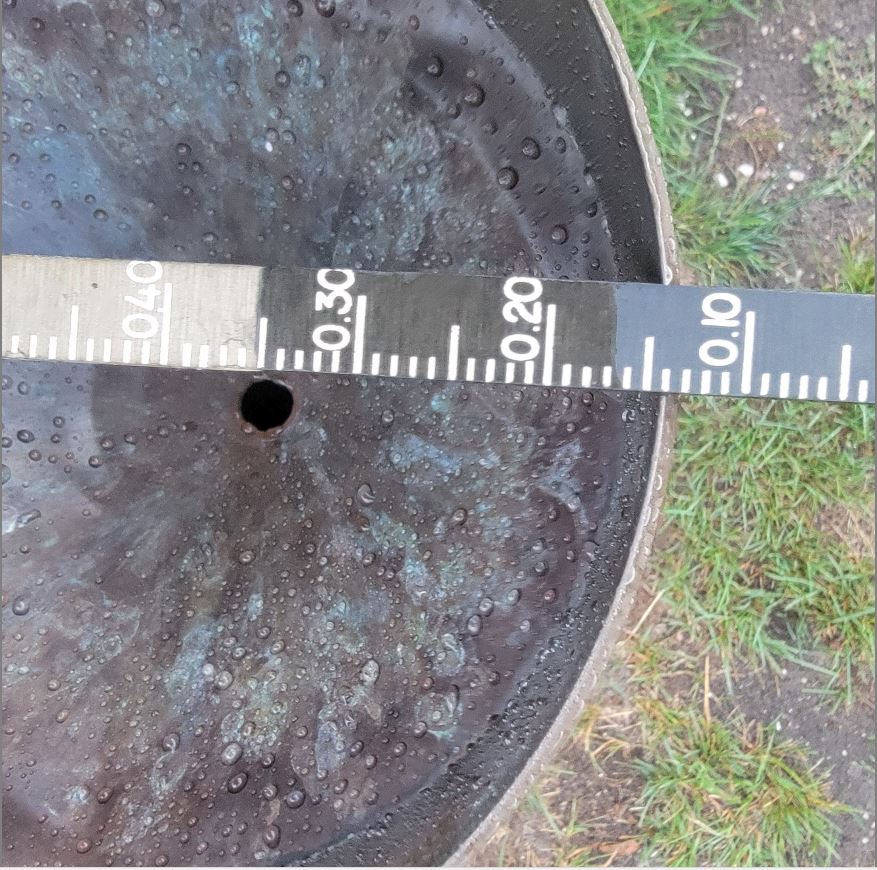
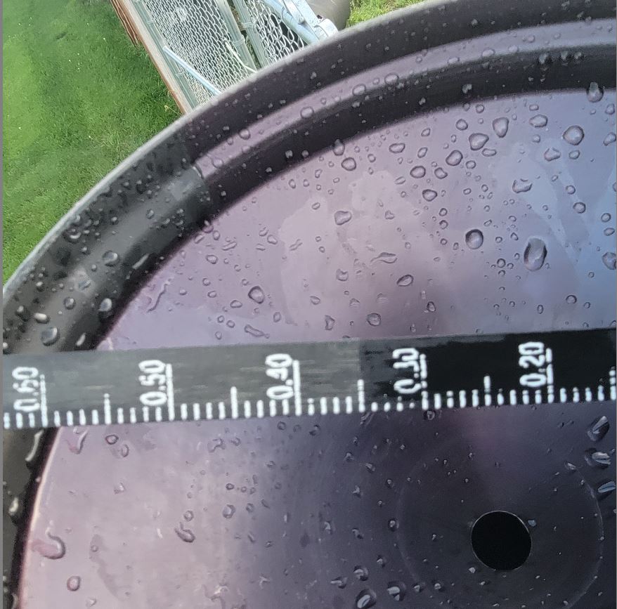
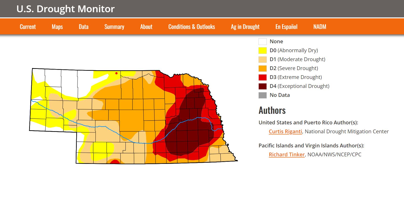
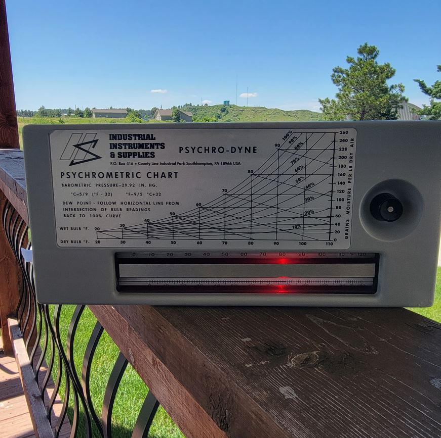
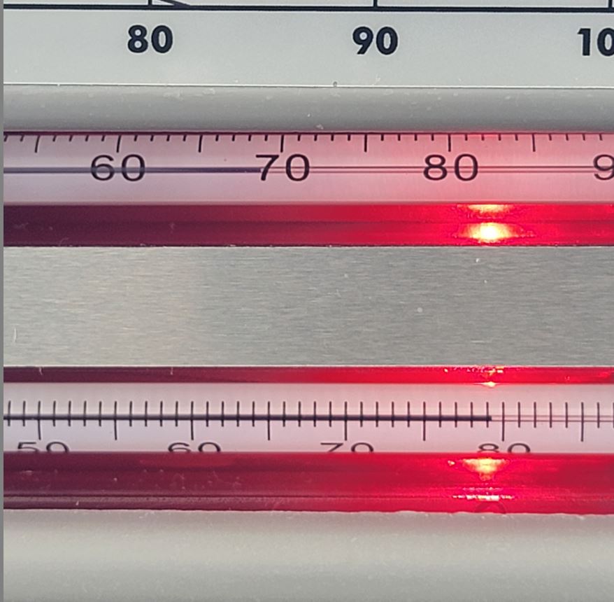
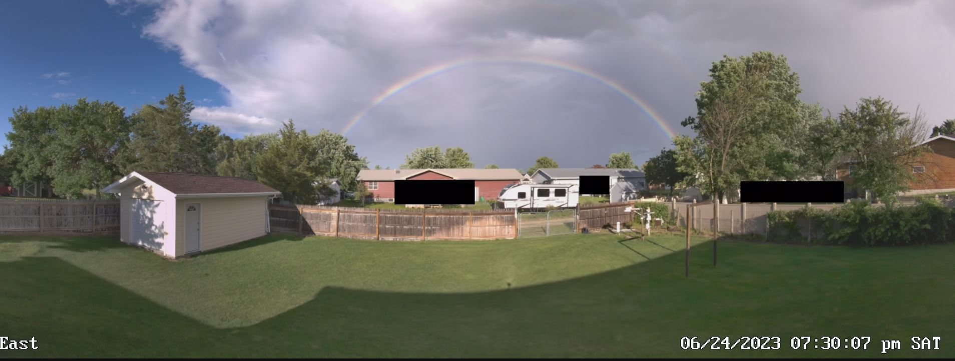
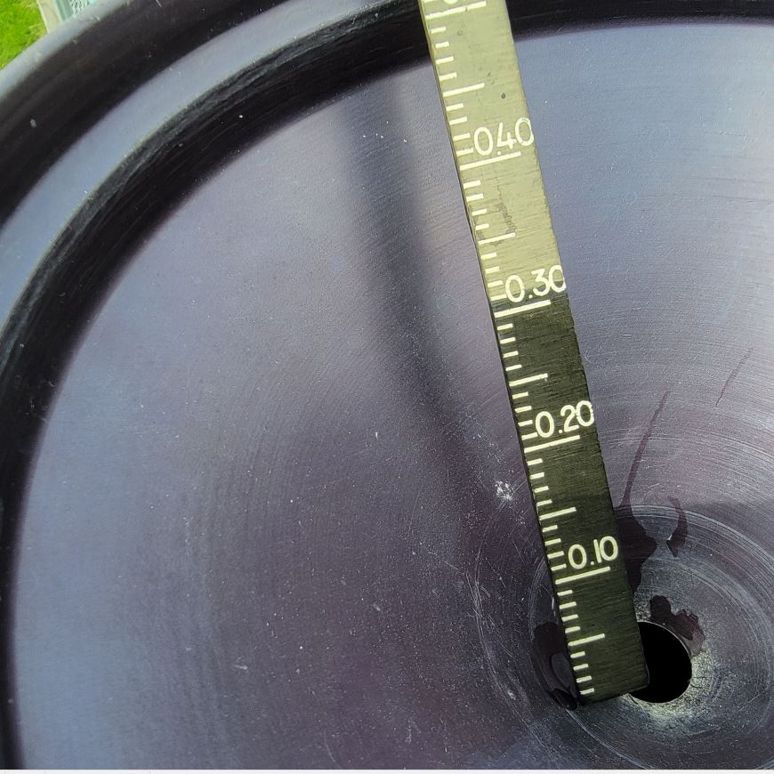
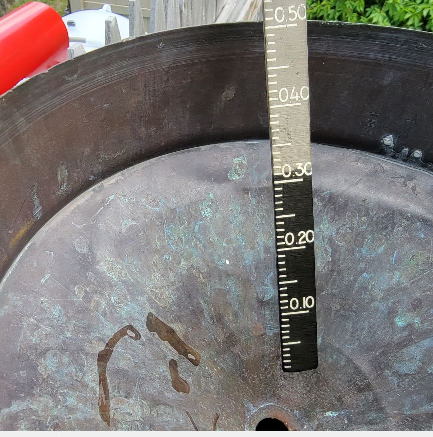
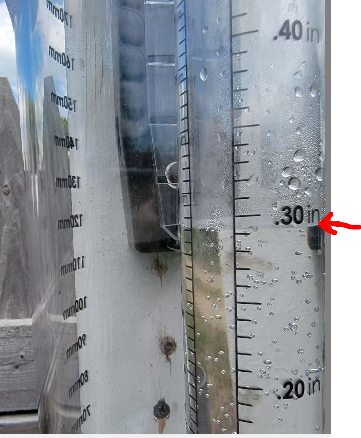
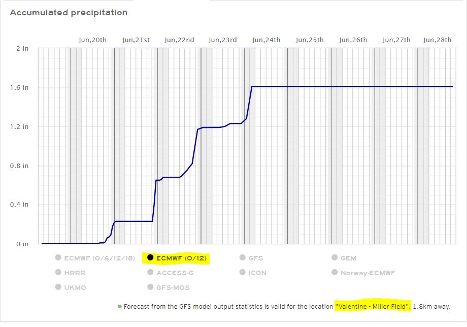
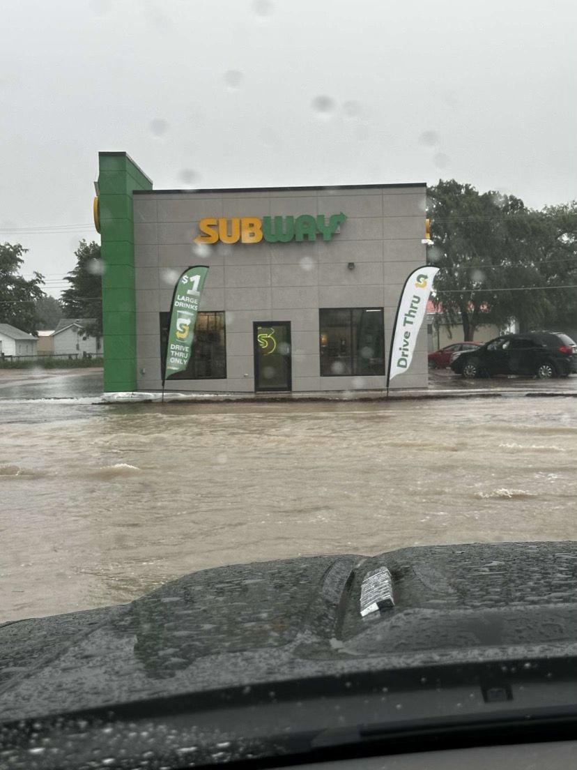
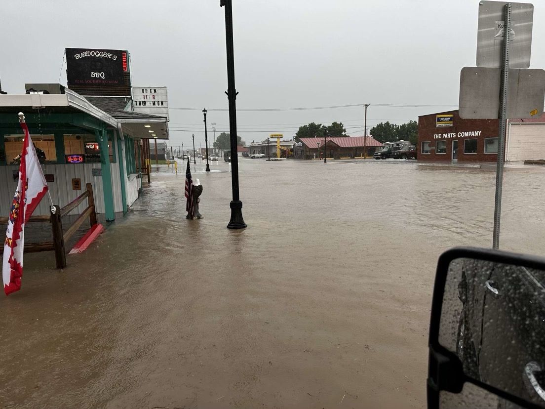
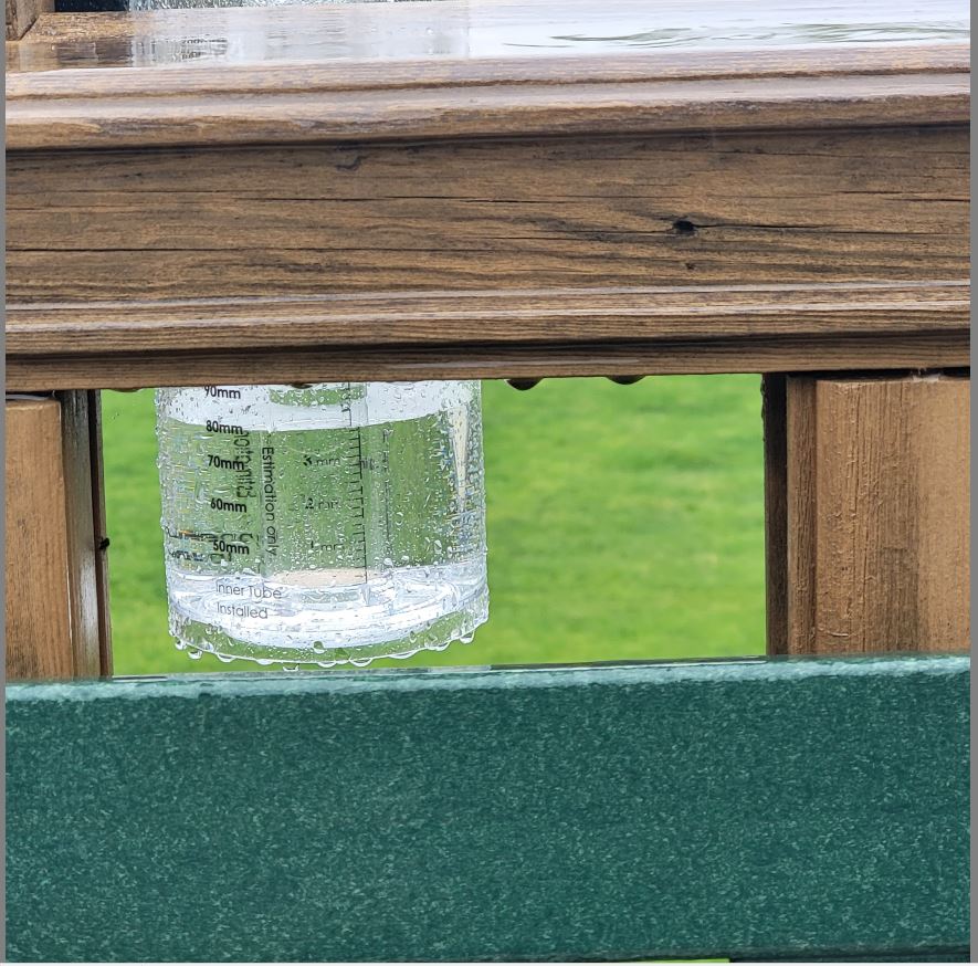
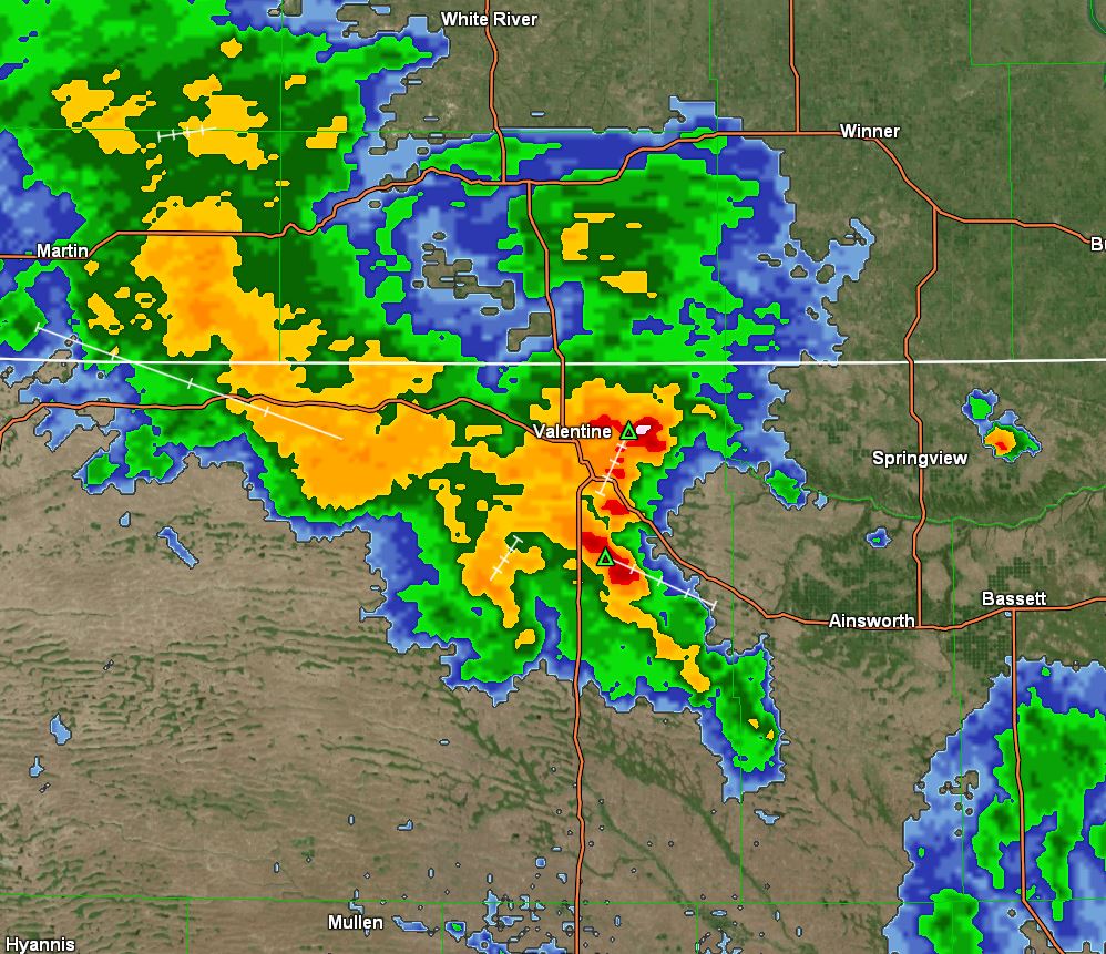
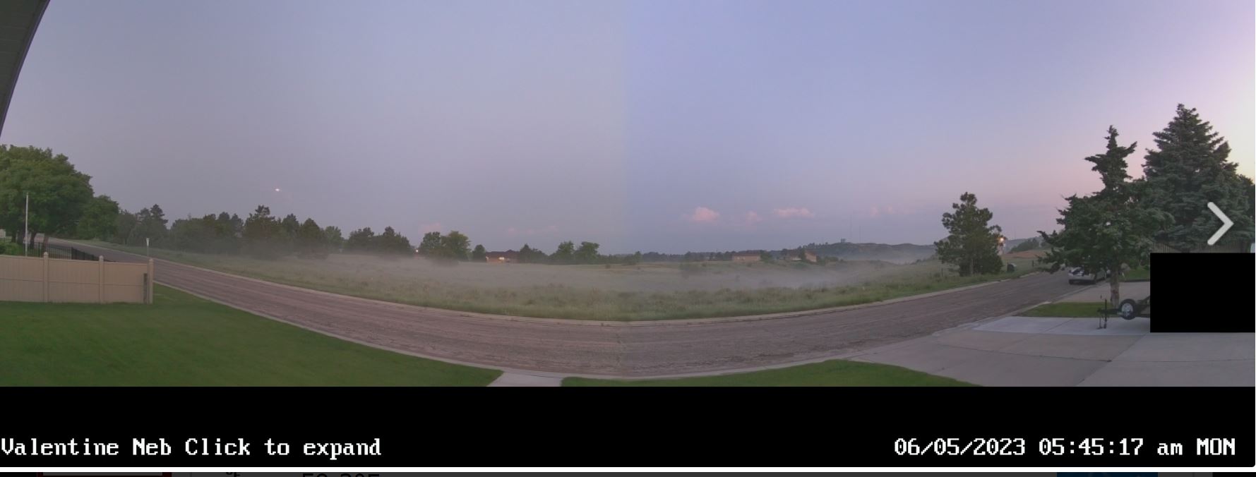
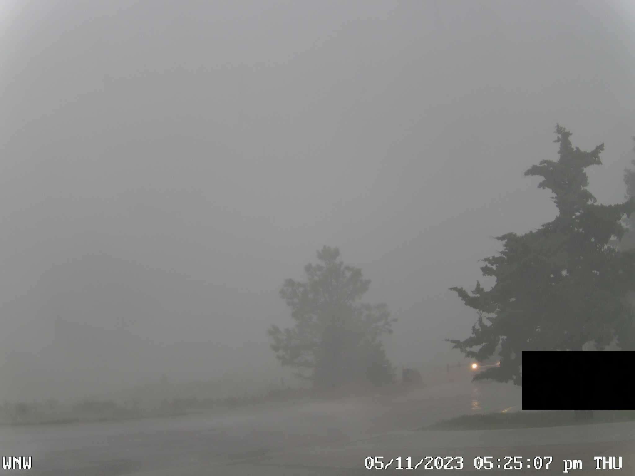
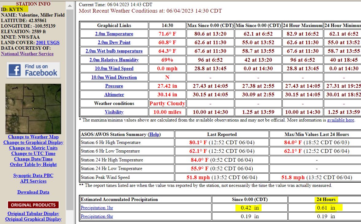
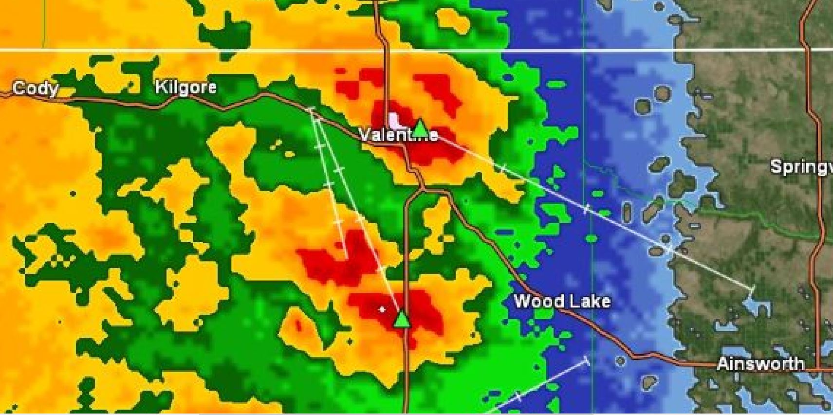
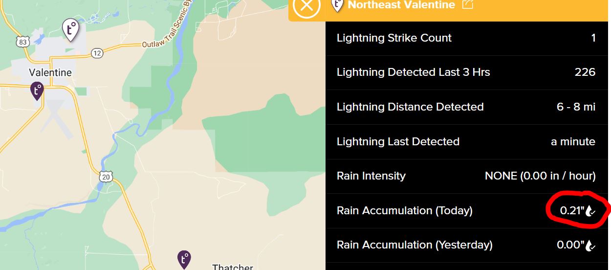
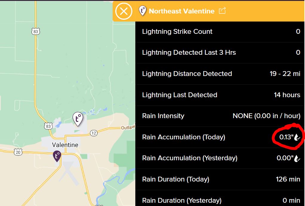
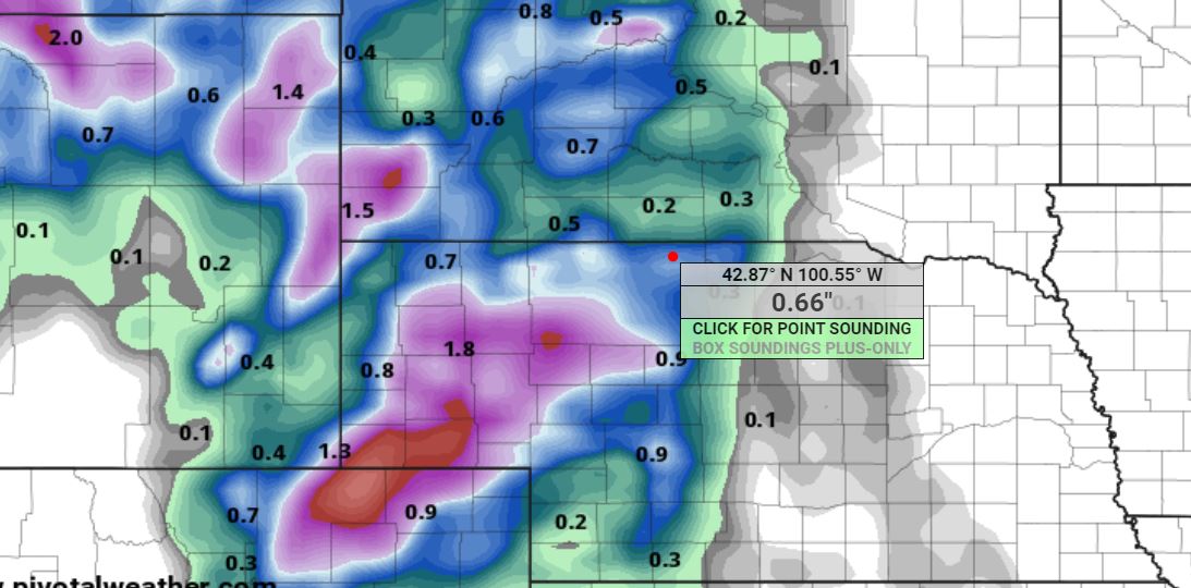
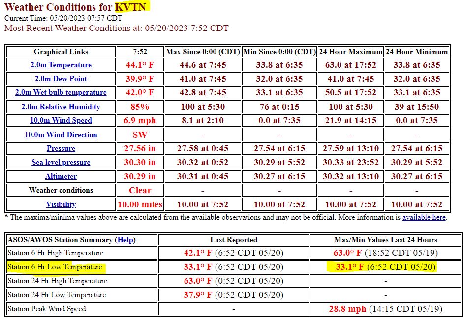
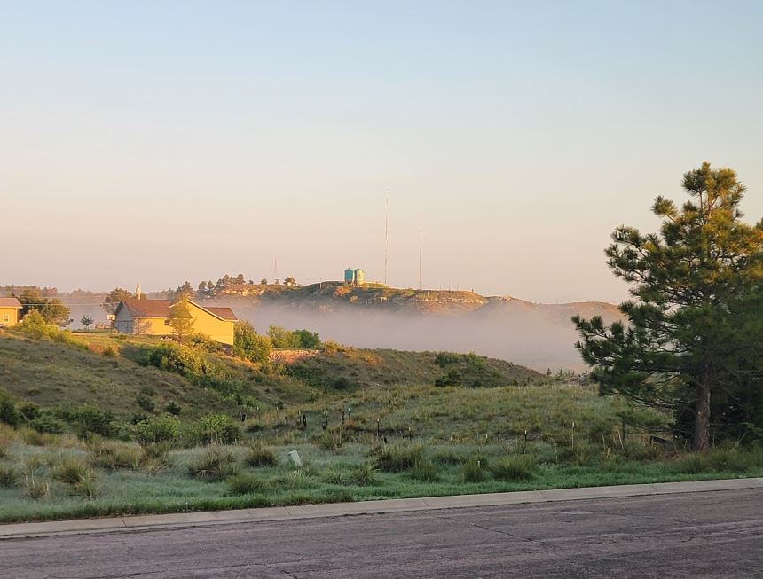
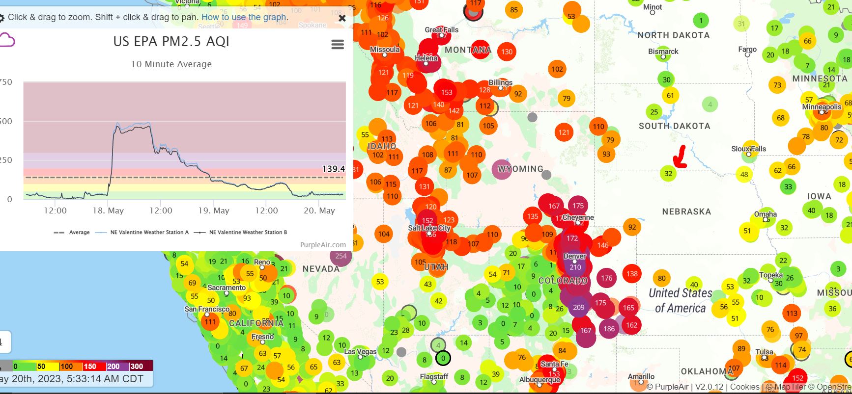
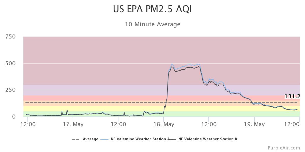
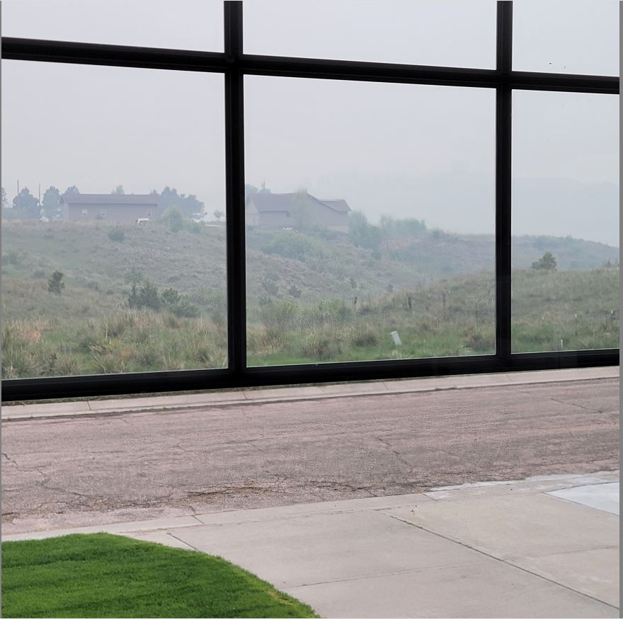
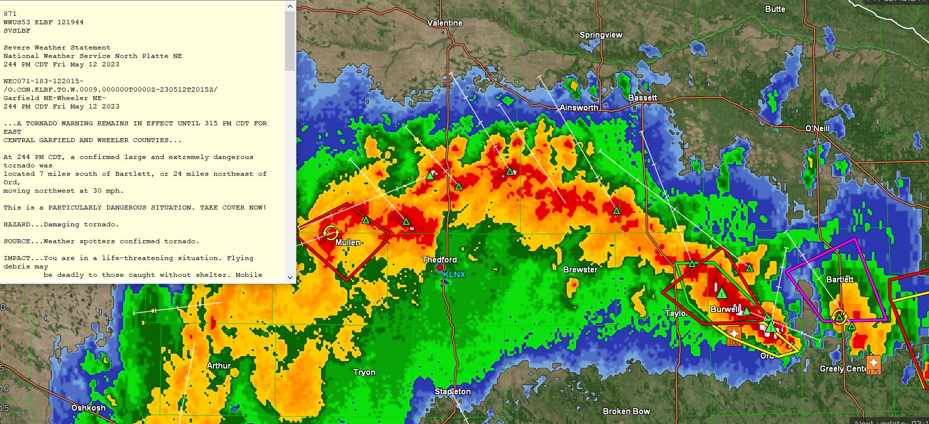
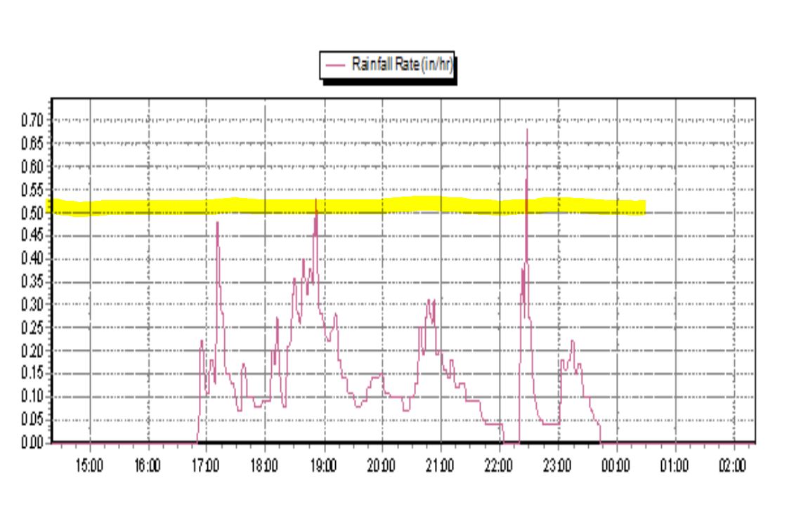
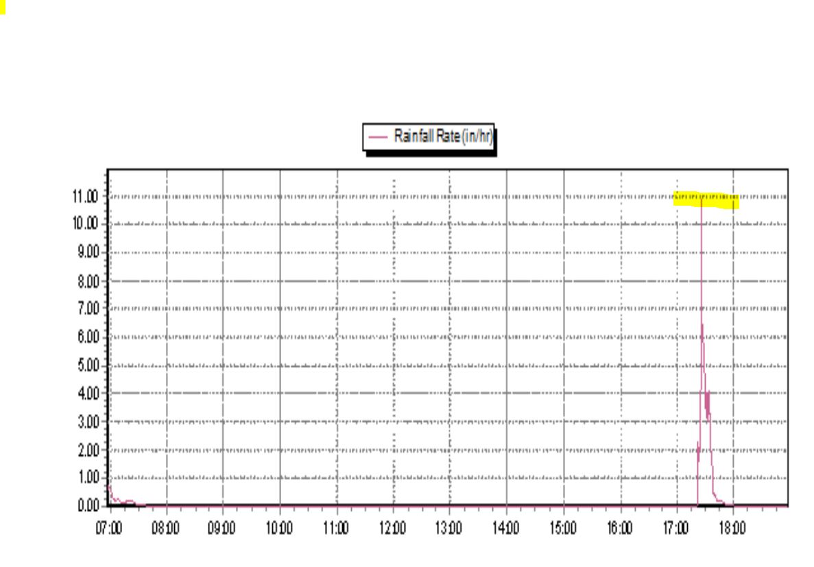
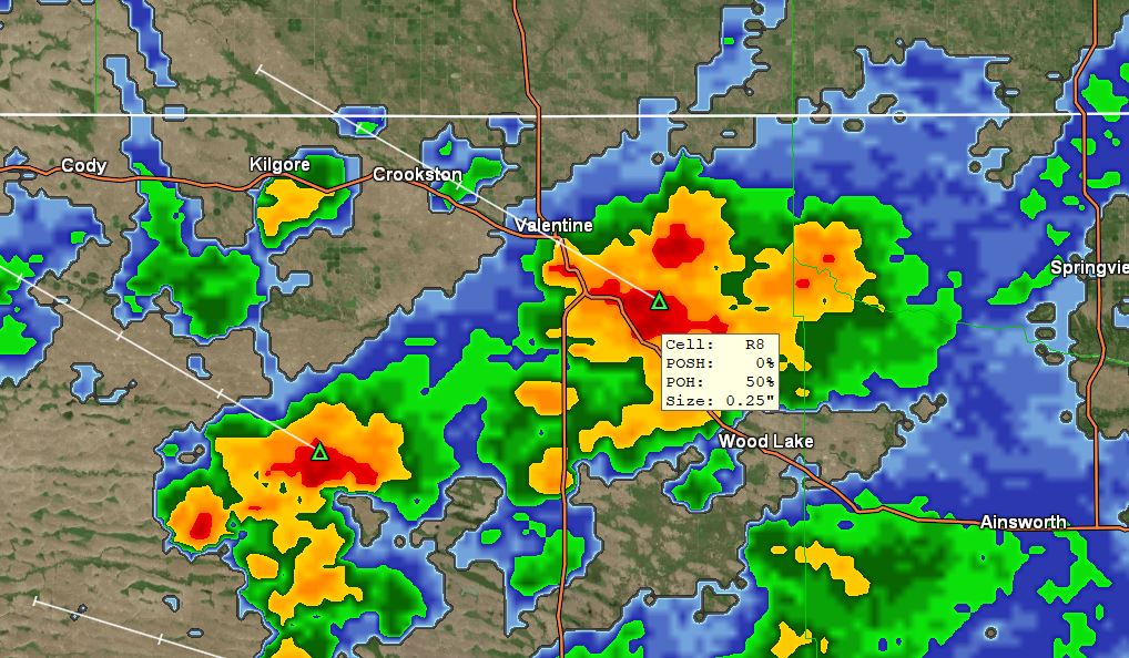
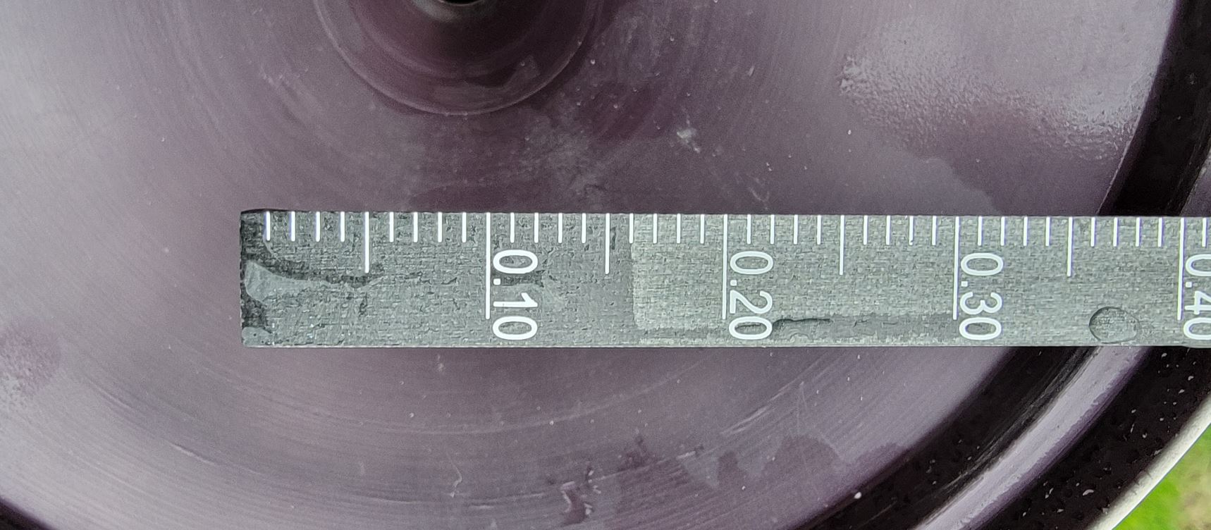
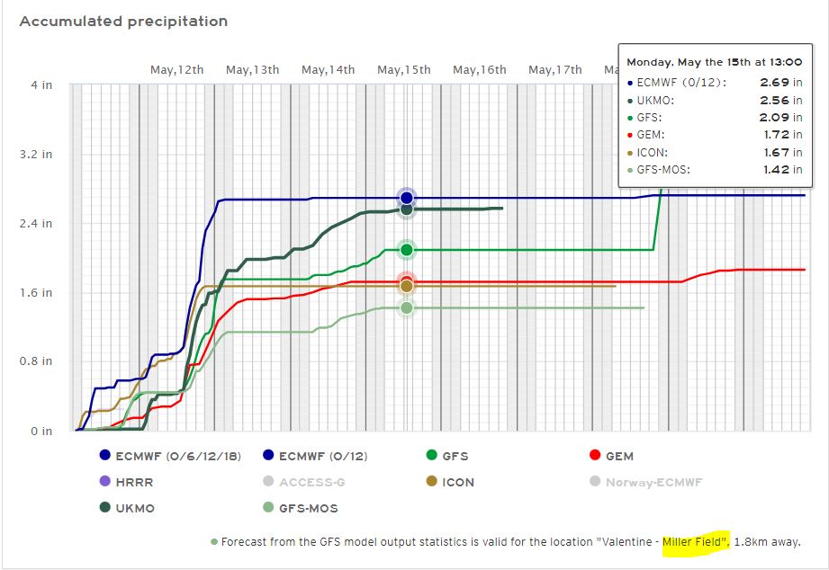
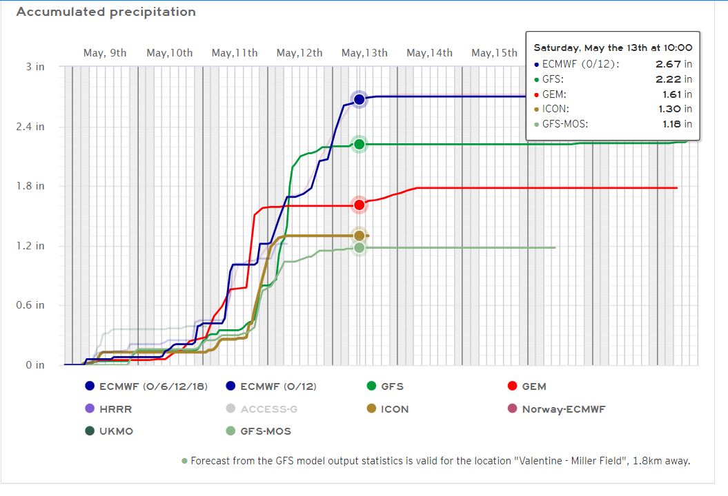
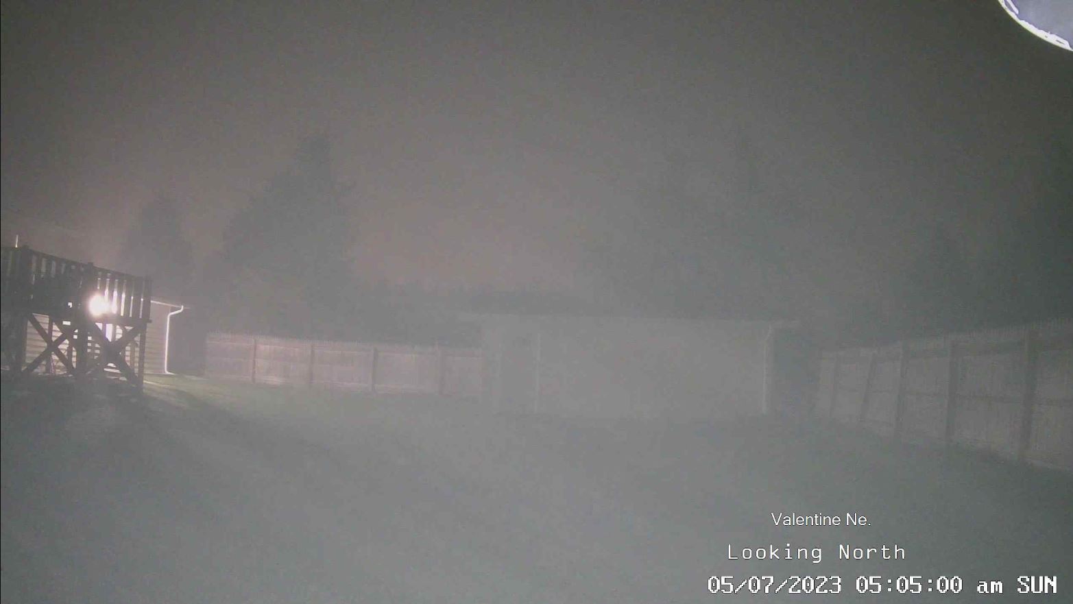
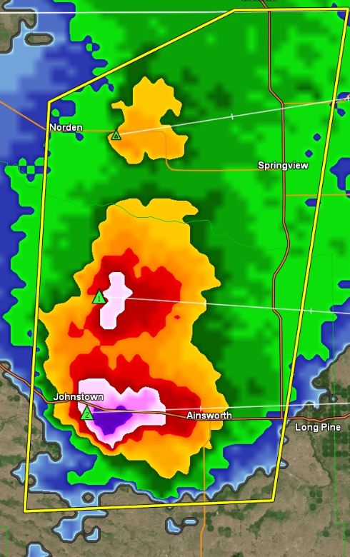
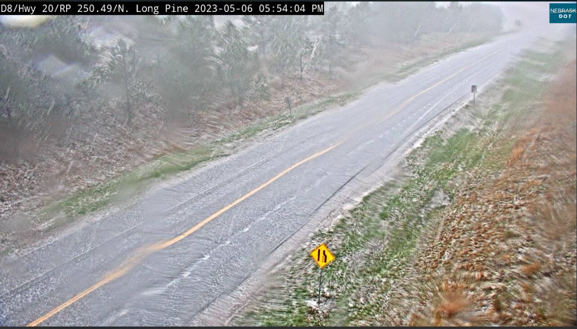
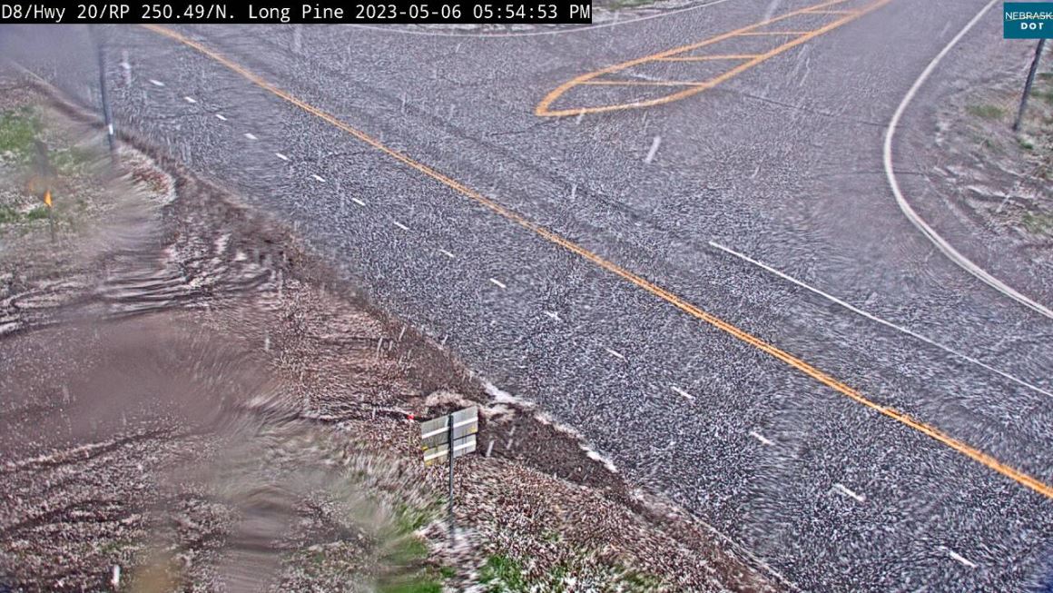
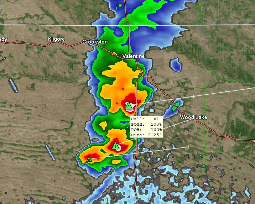
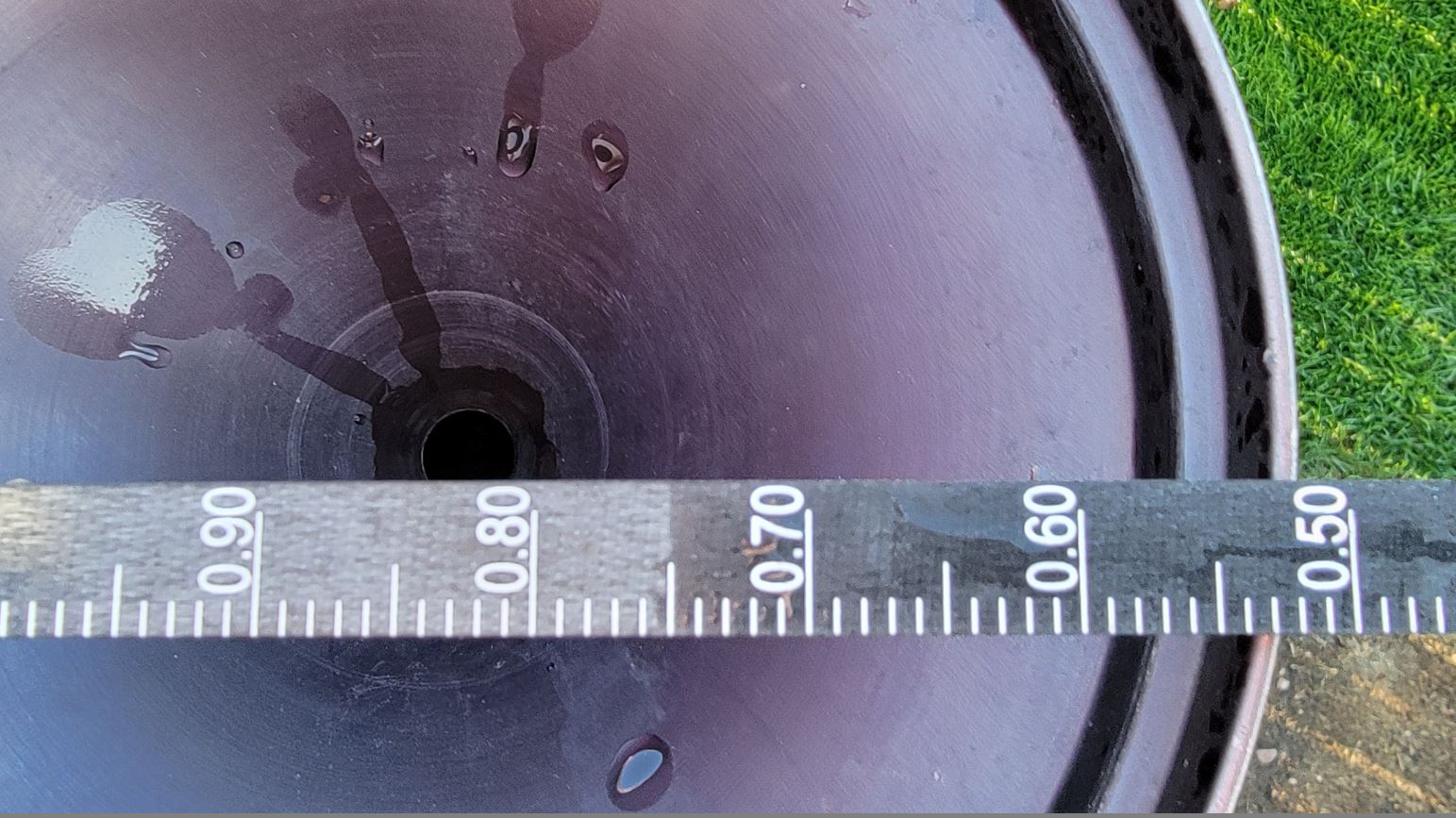
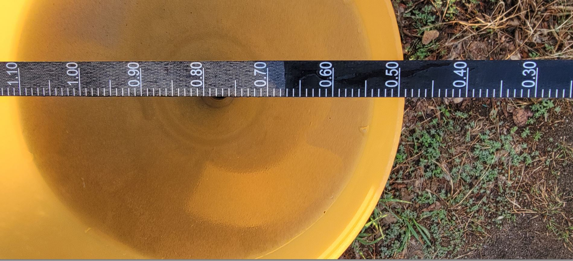
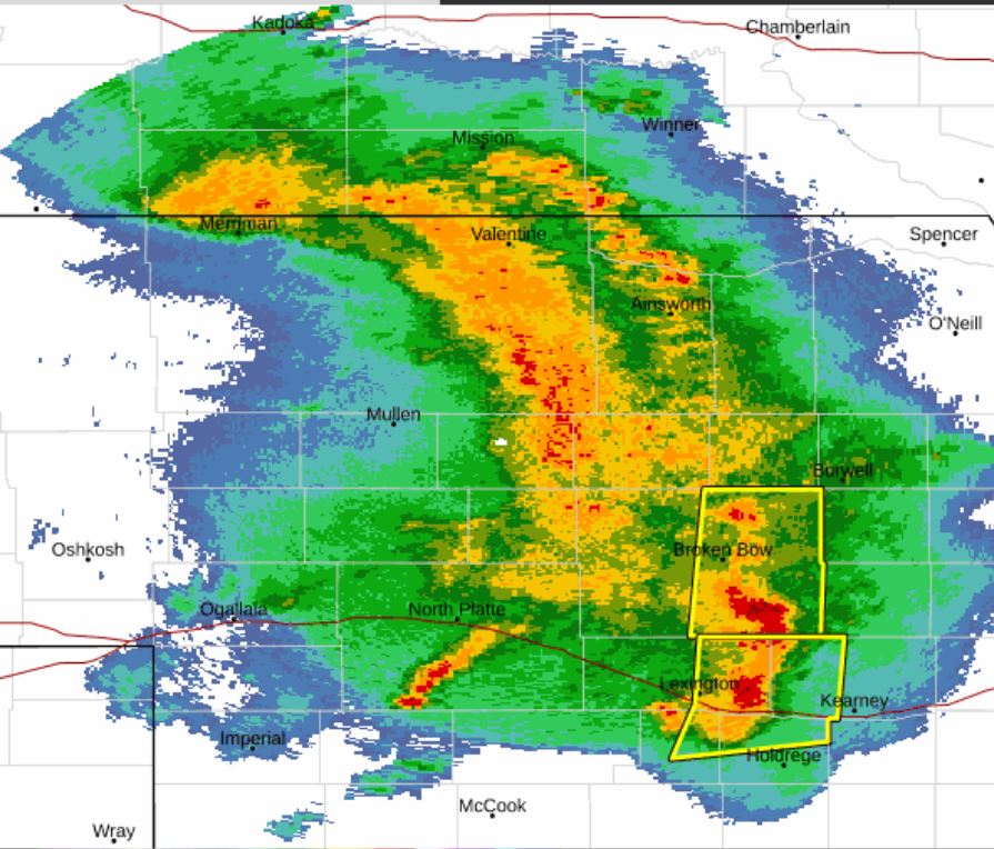
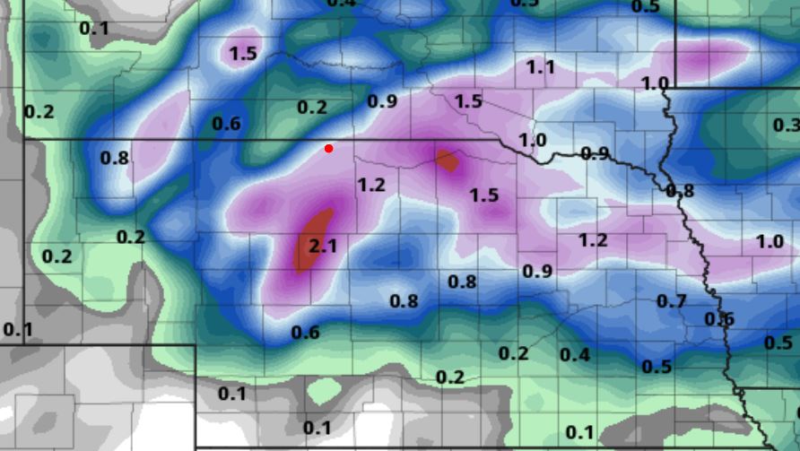
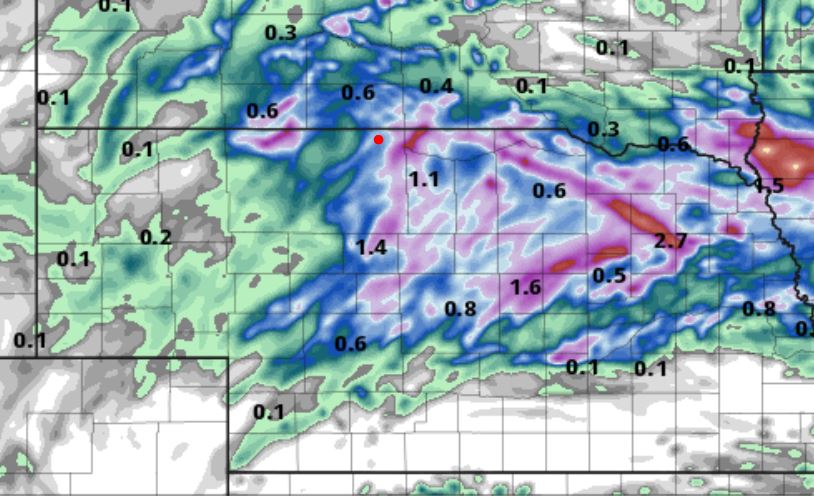
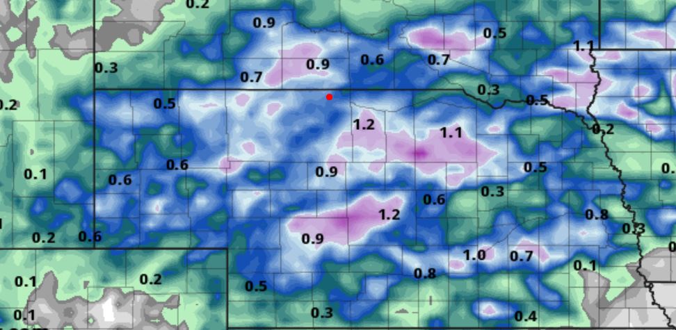
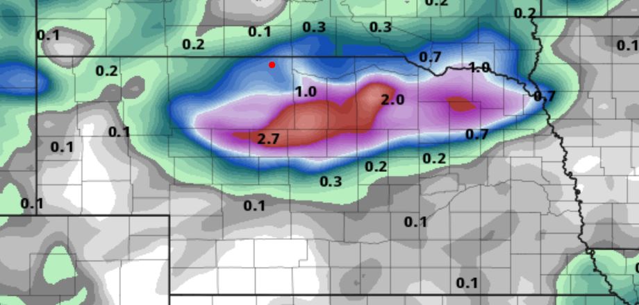
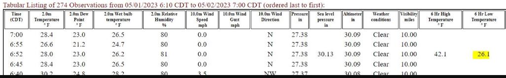
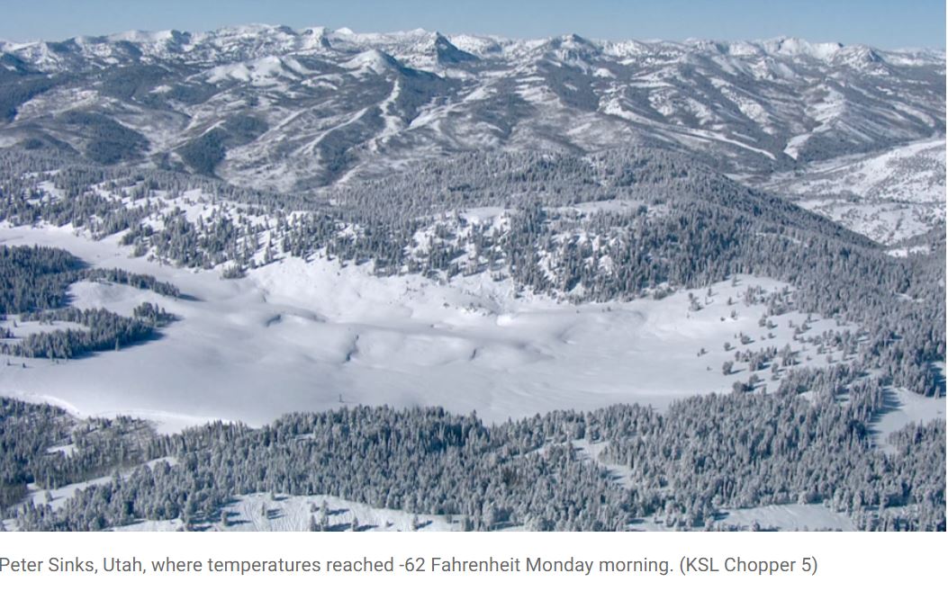
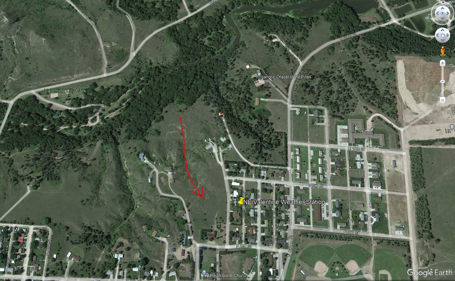
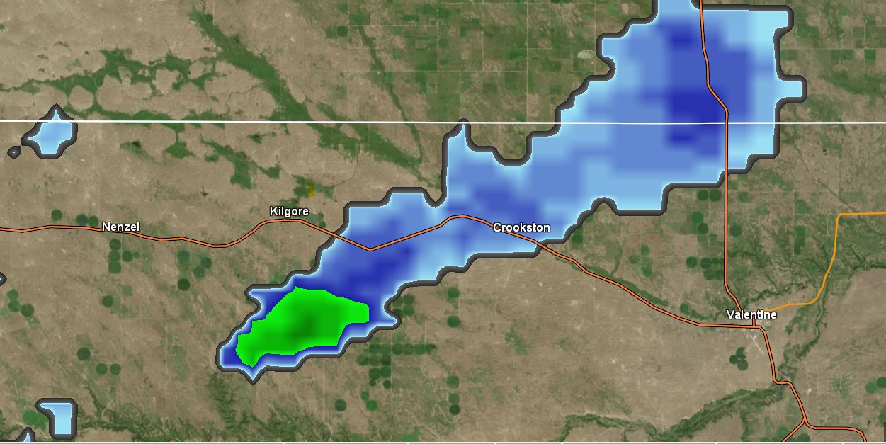
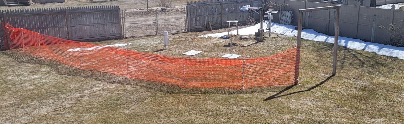
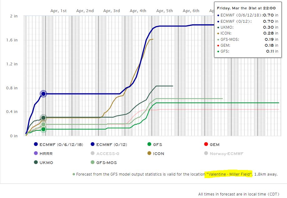
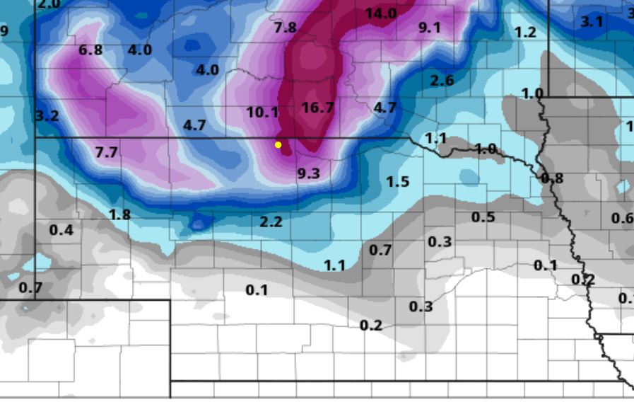
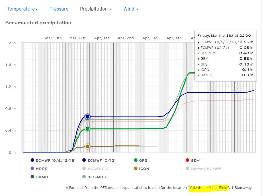
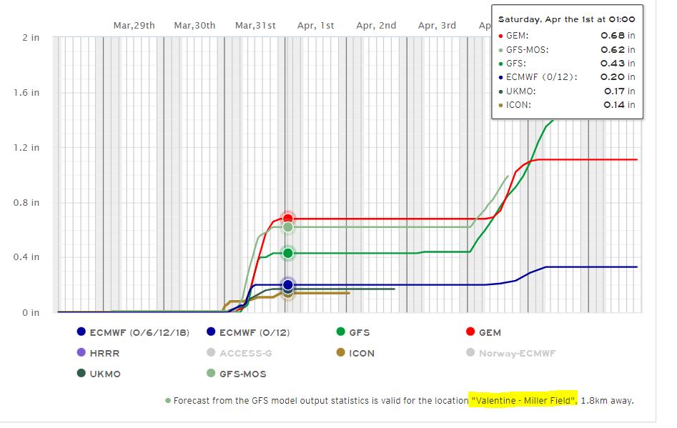
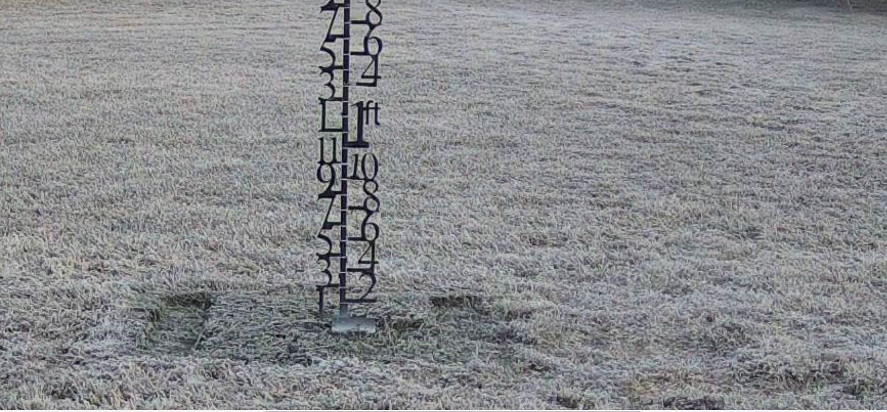
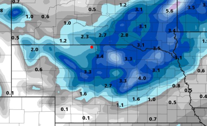
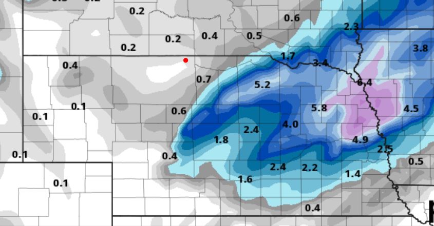
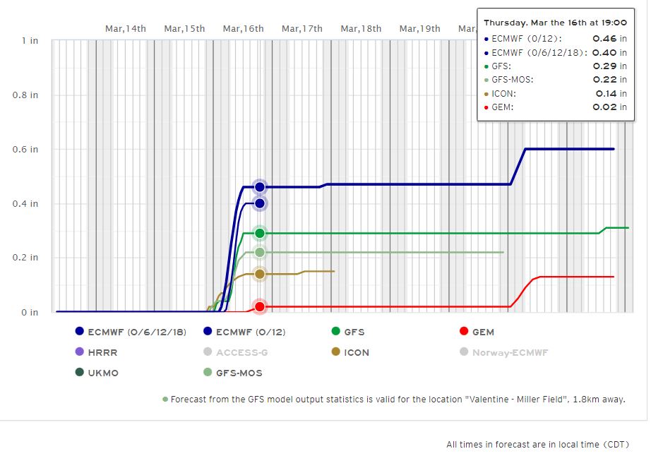
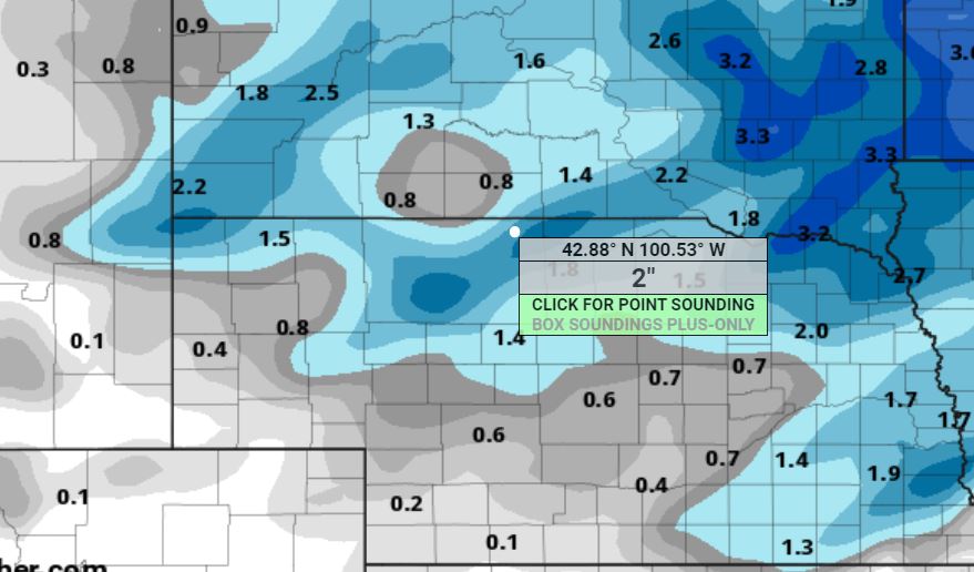
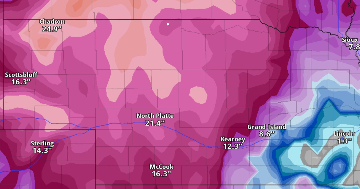
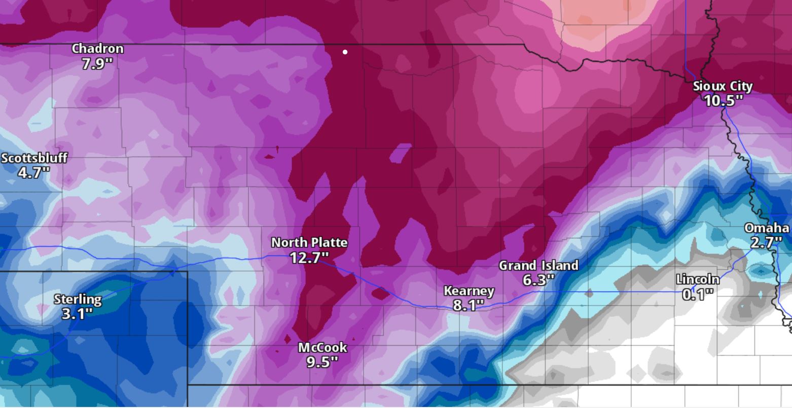
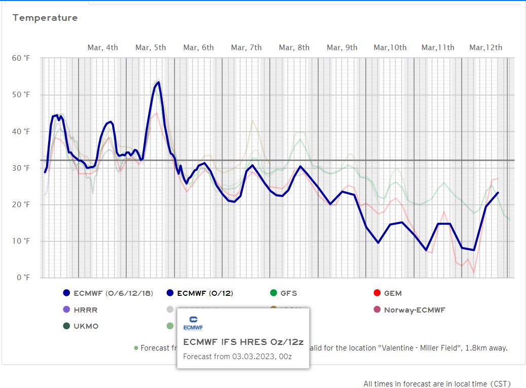
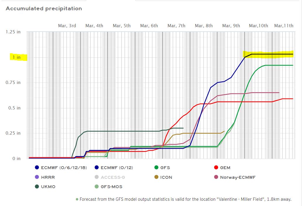
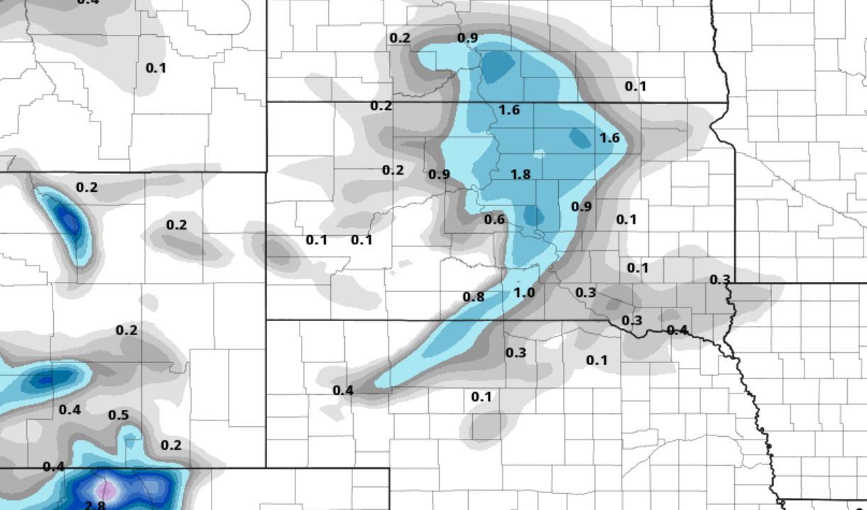
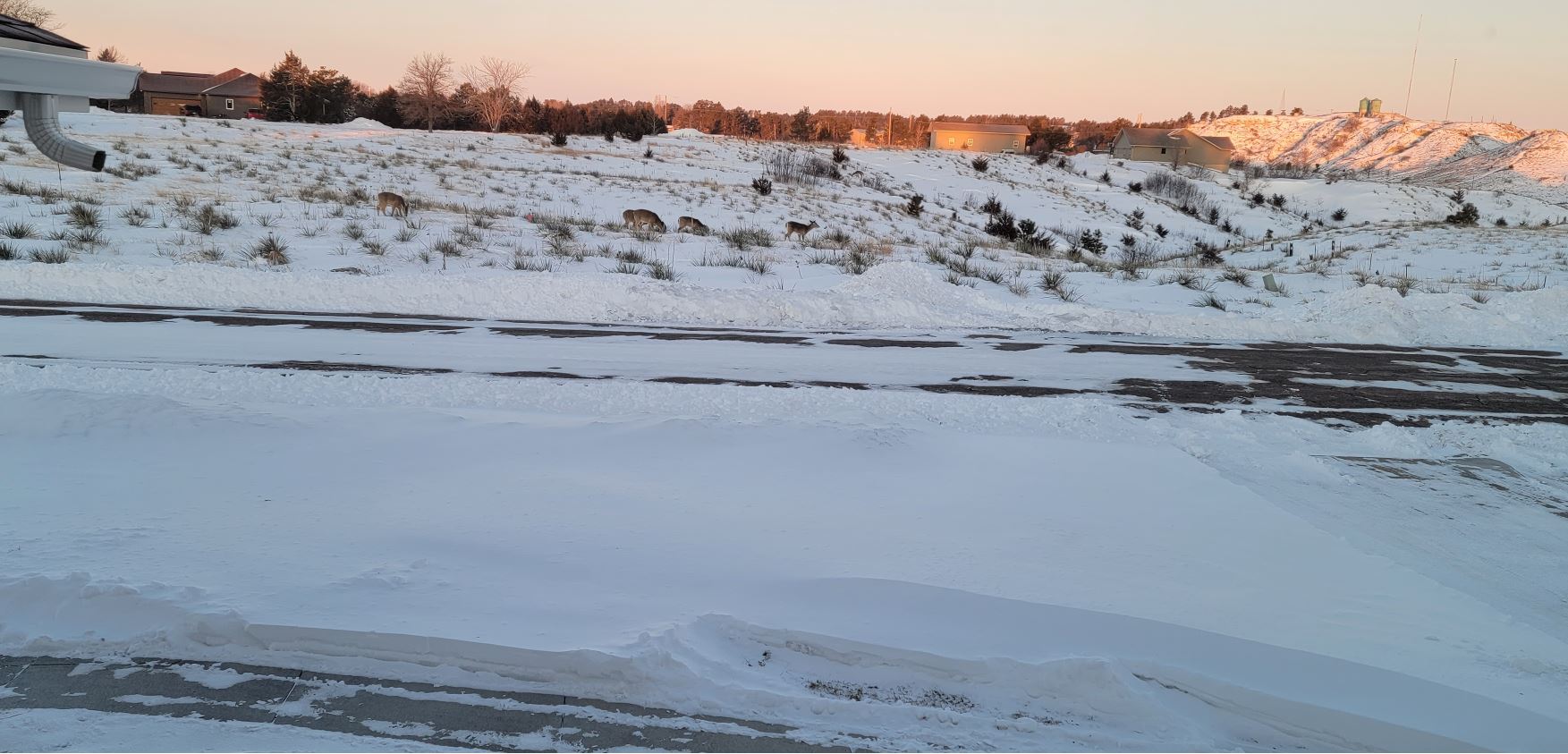
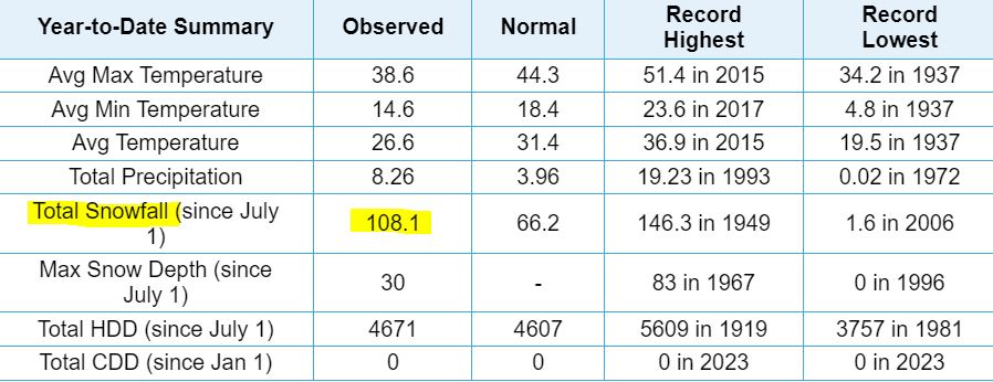
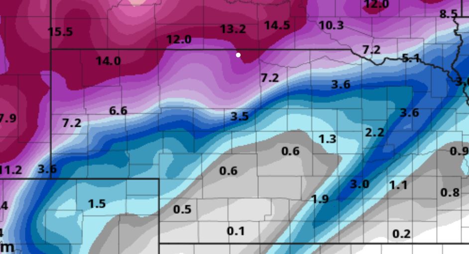
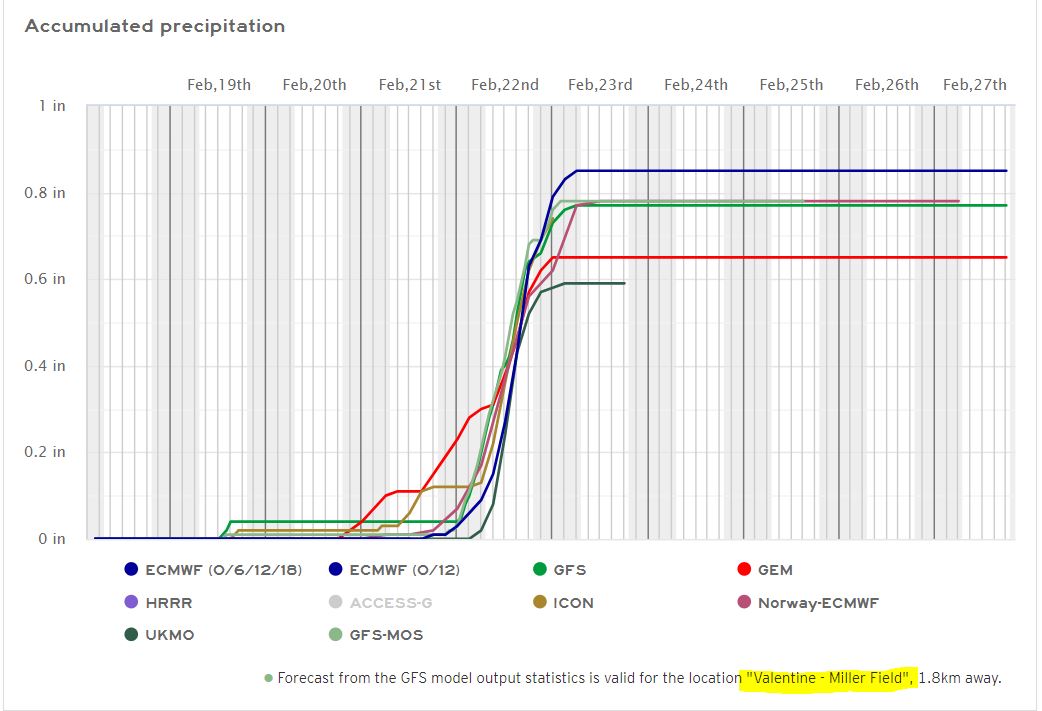
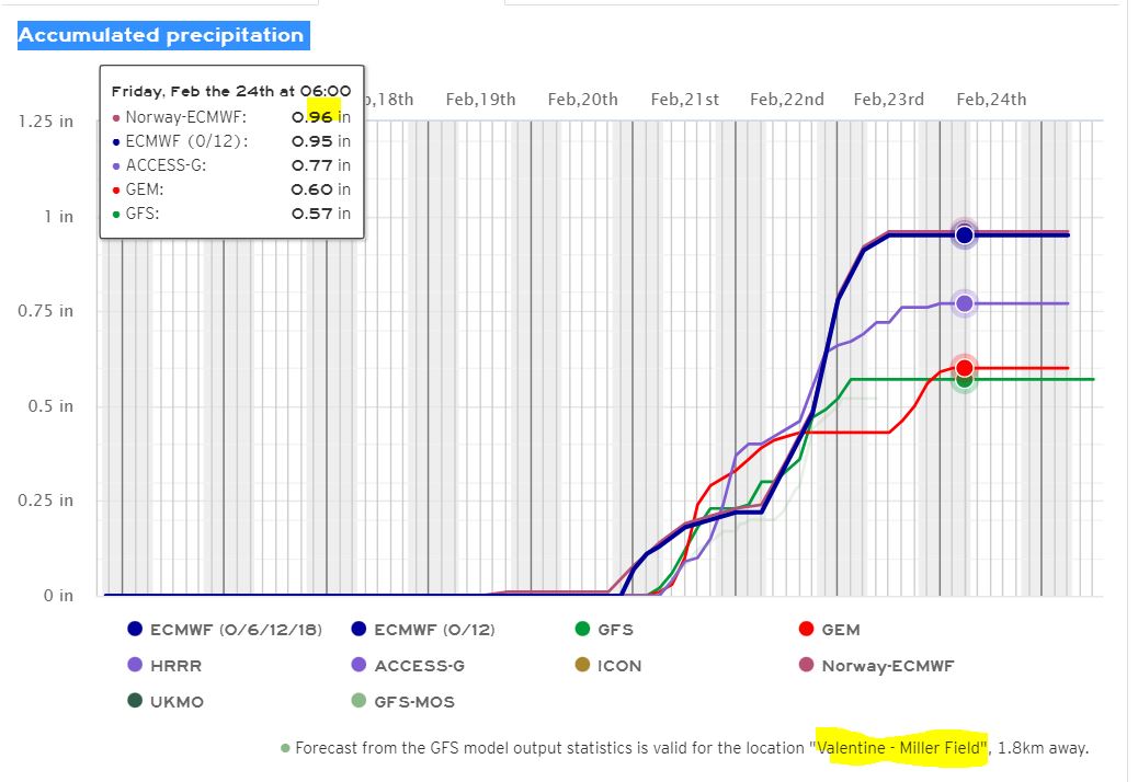
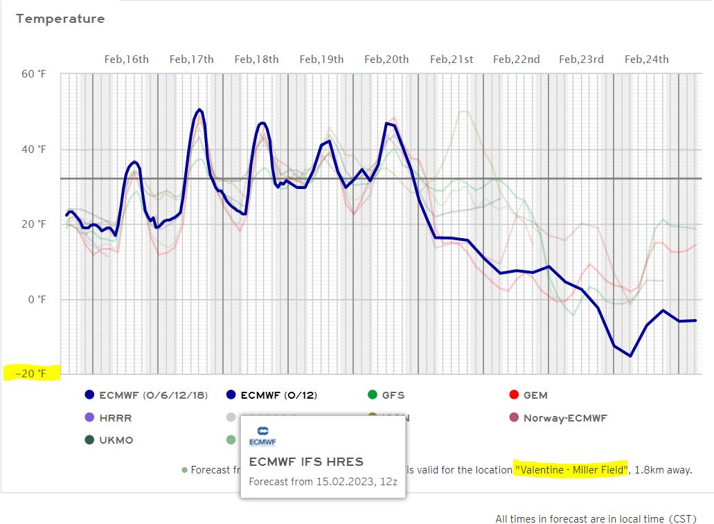
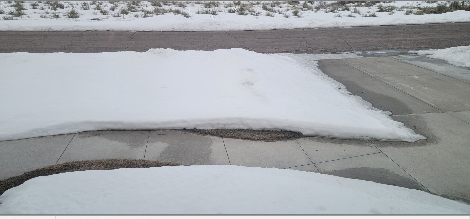
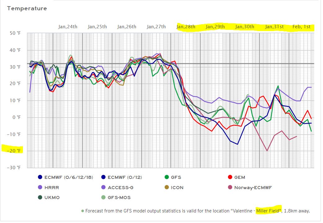
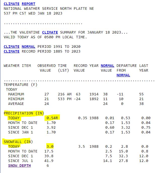
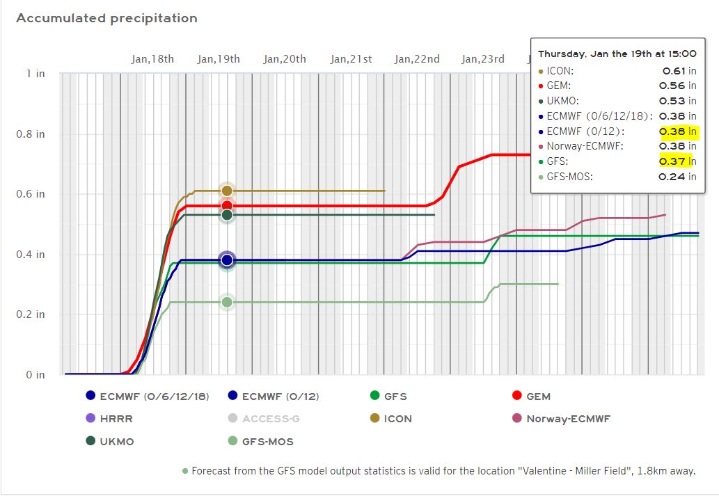
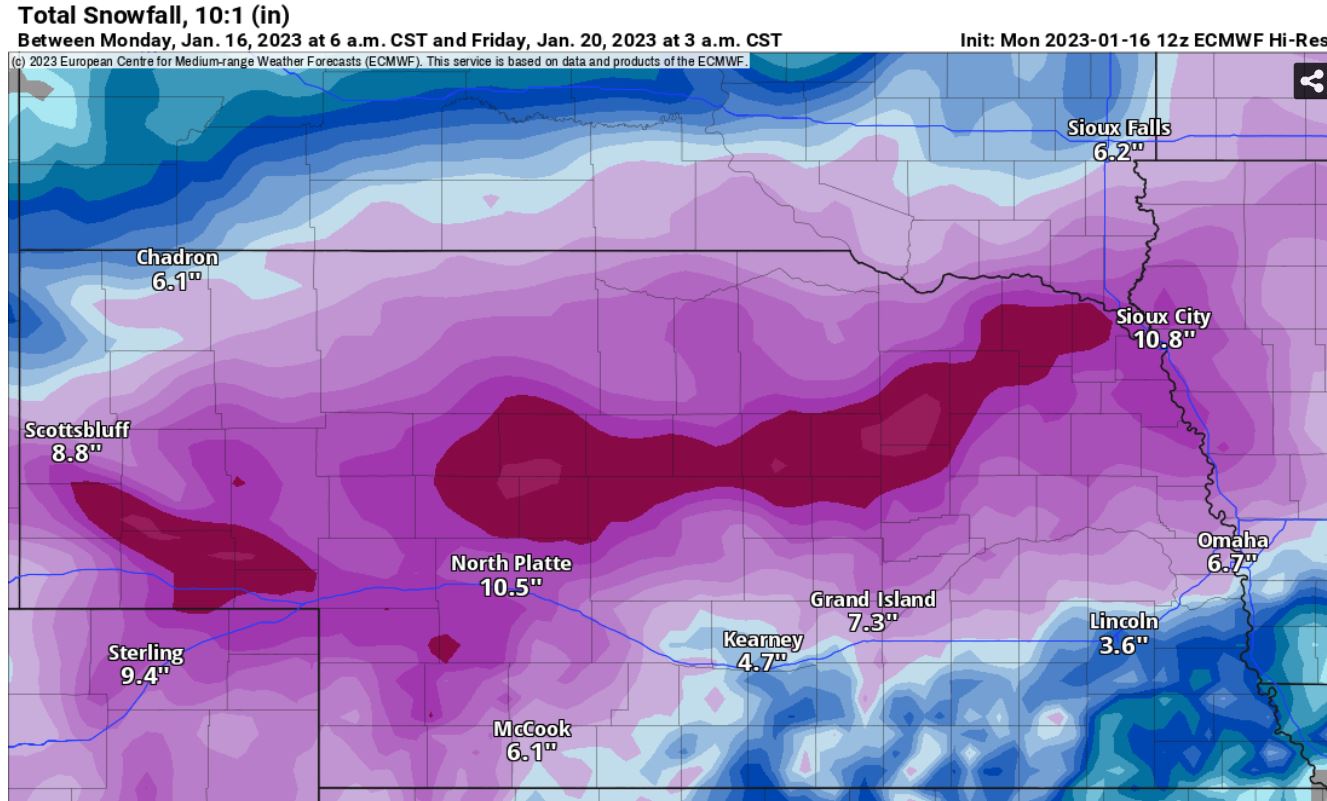
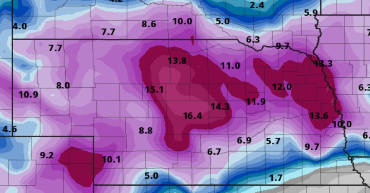
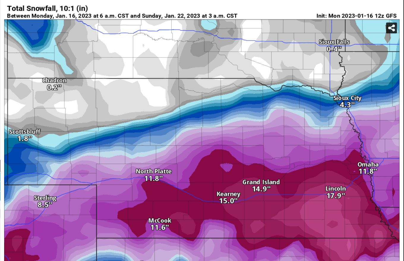
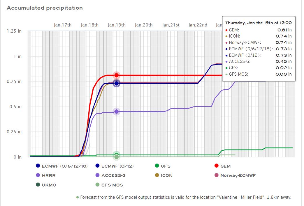
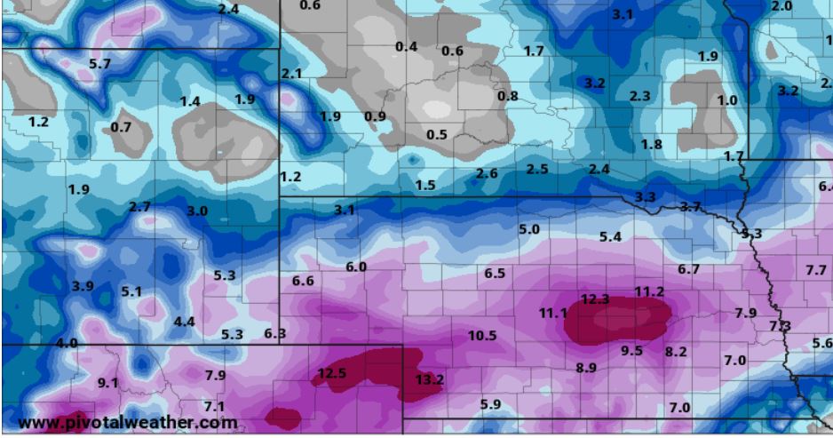
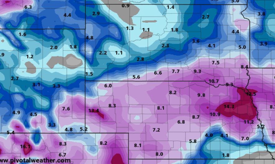
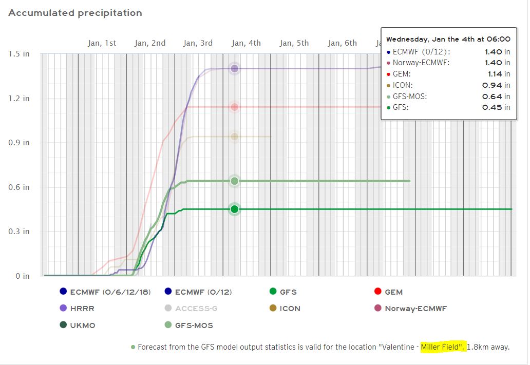
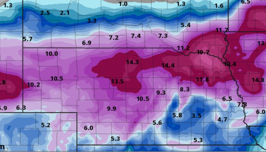
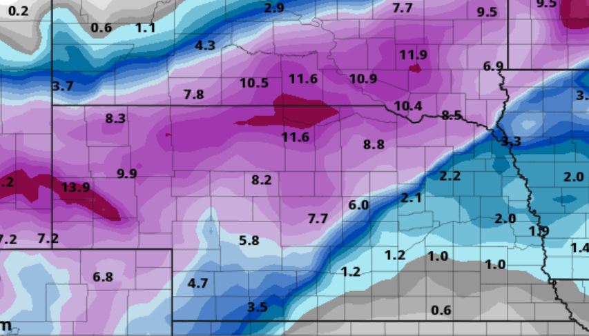
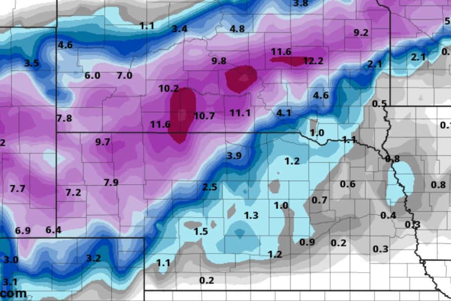
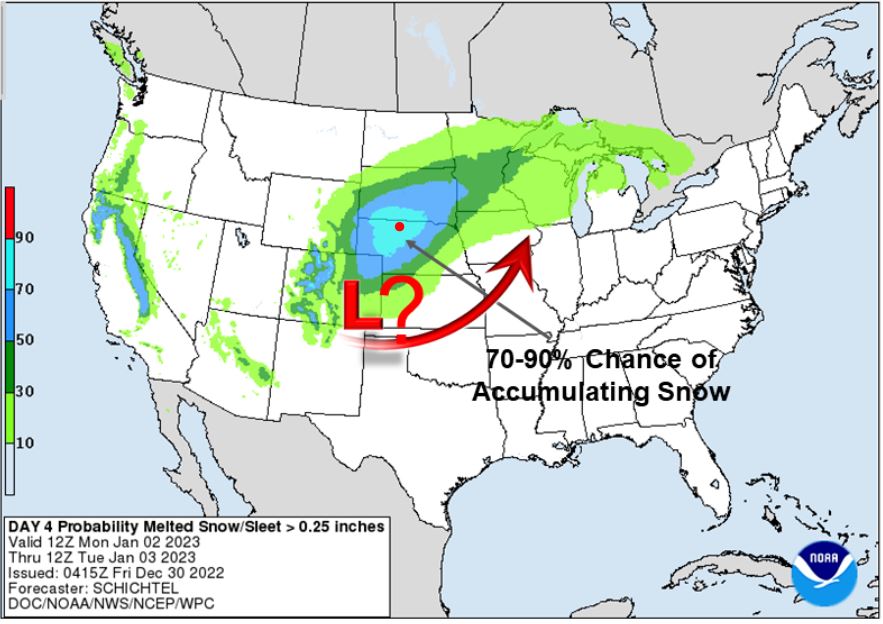
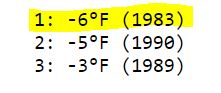
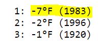
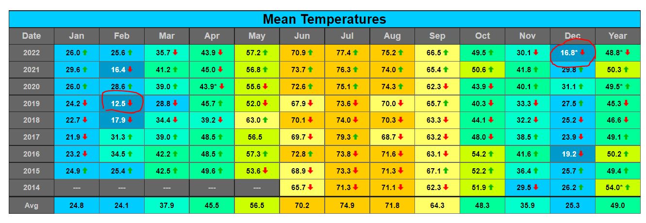
.jpg)
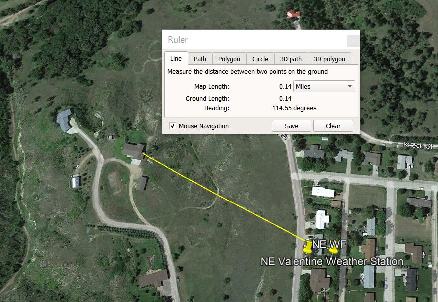
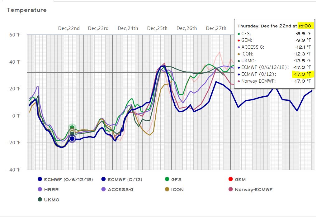
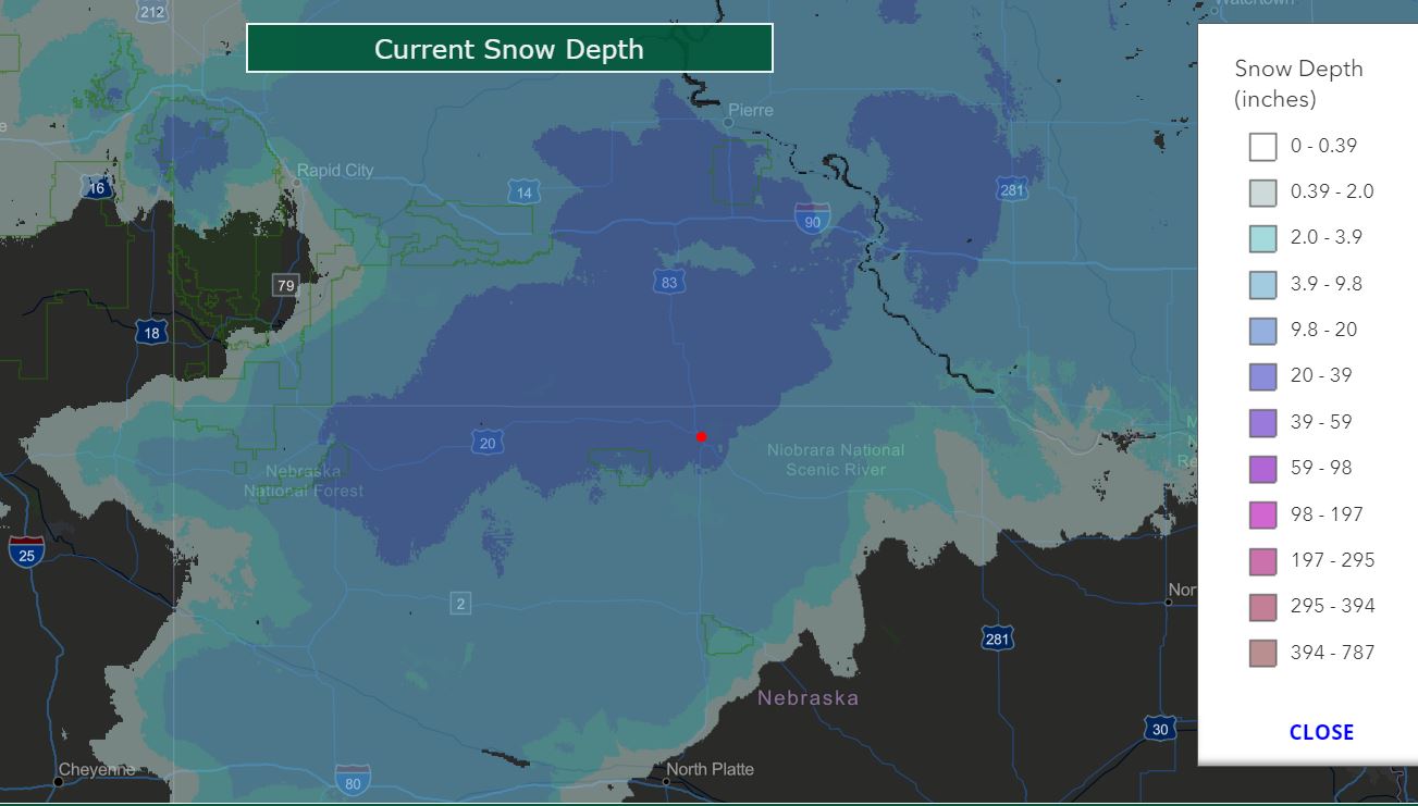
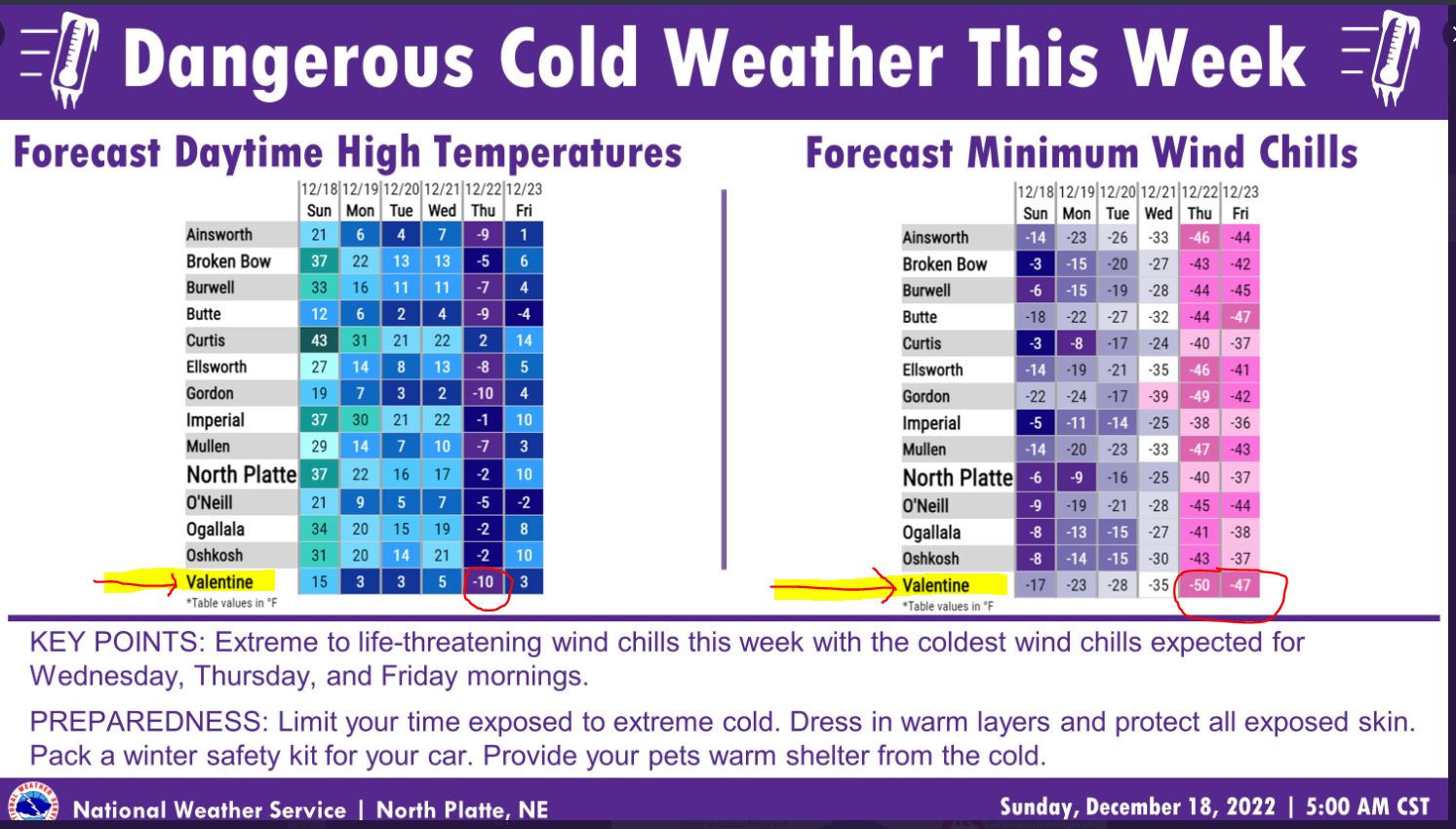
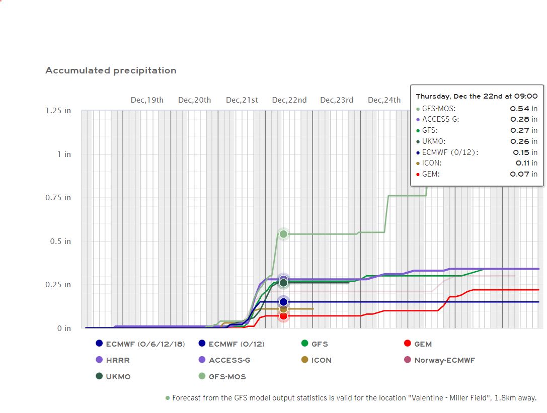
.jpg)
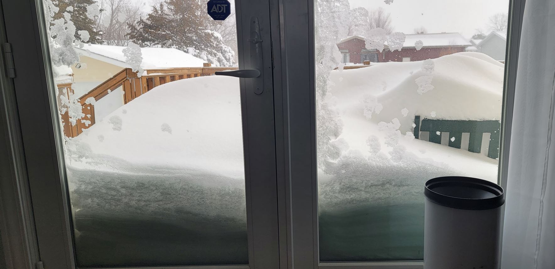
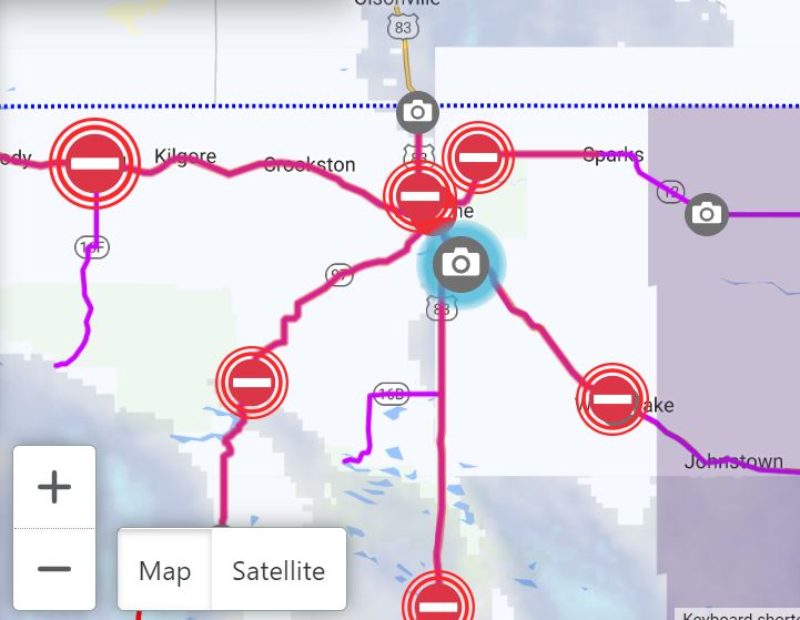
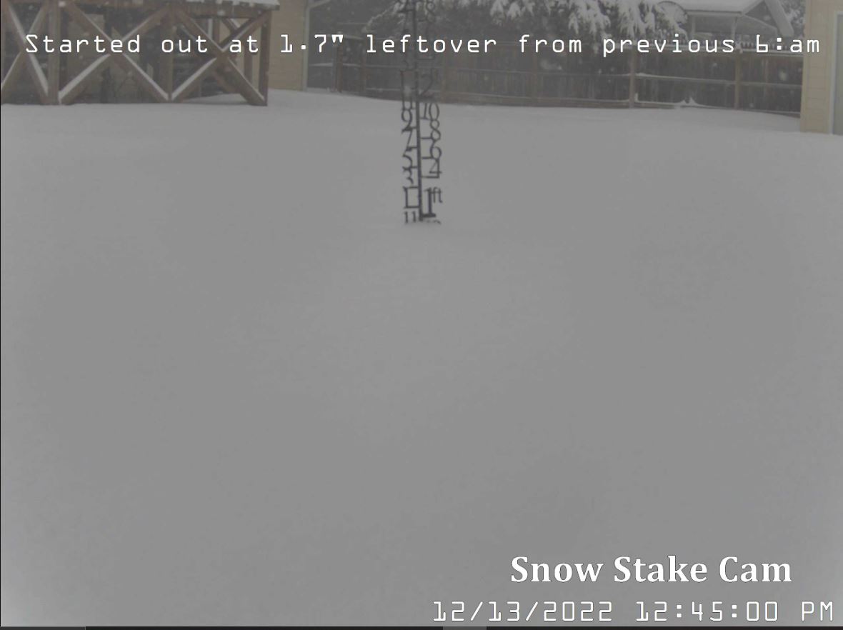
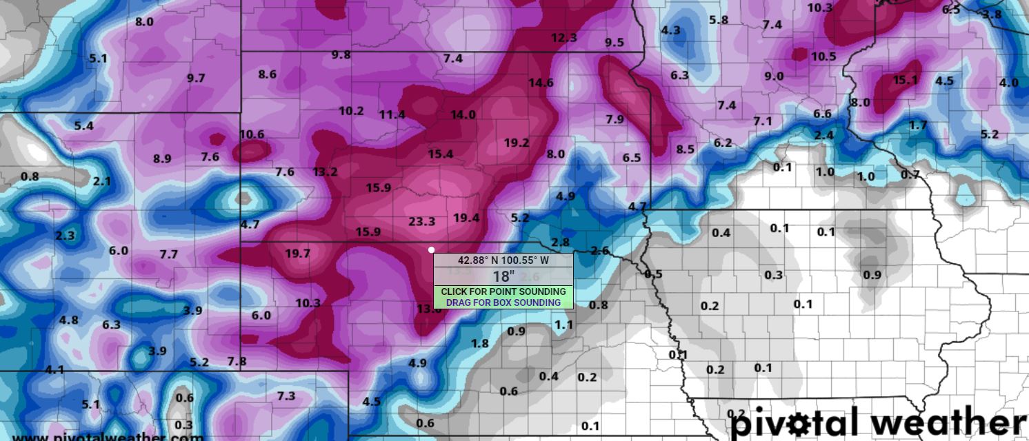
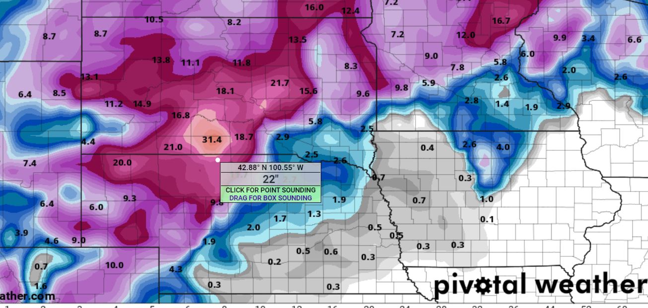
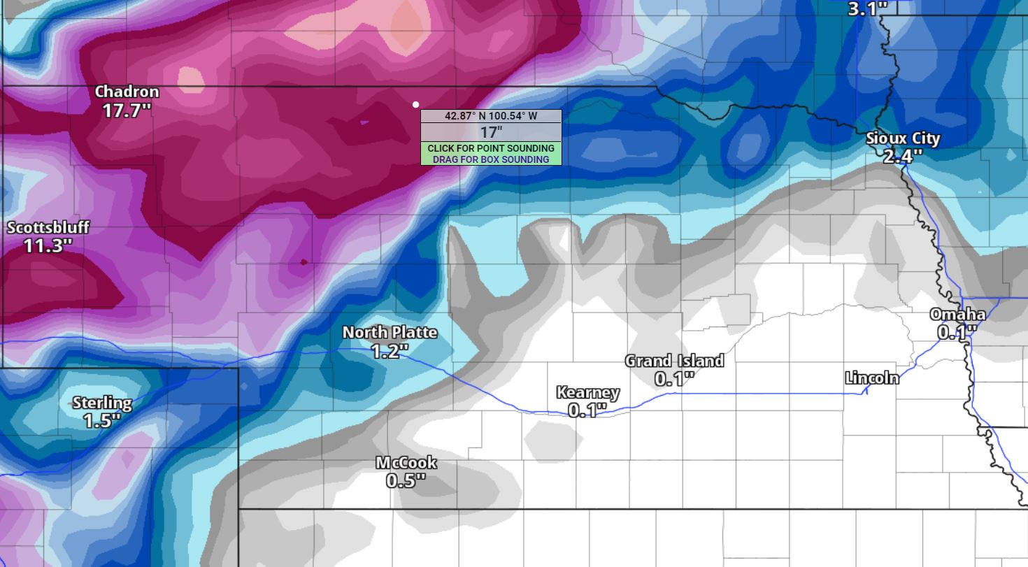
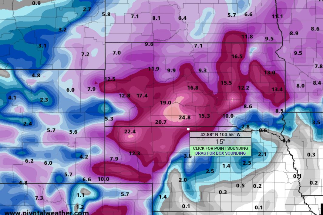
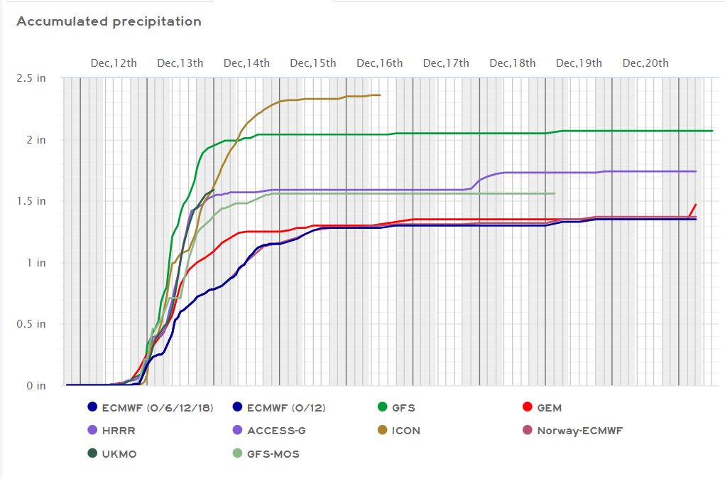
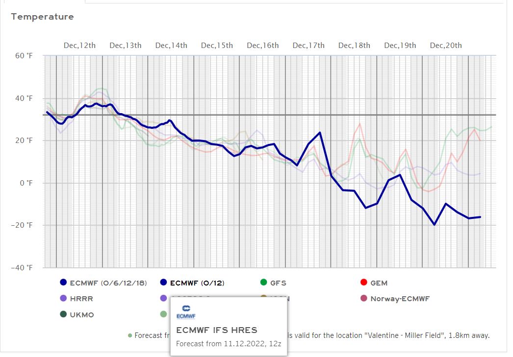
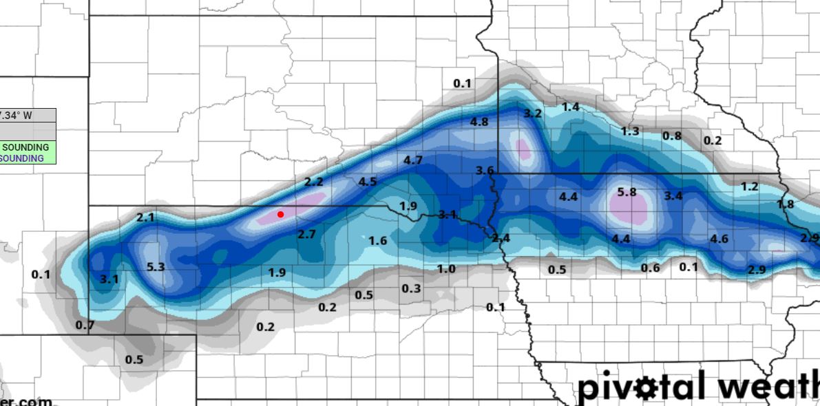
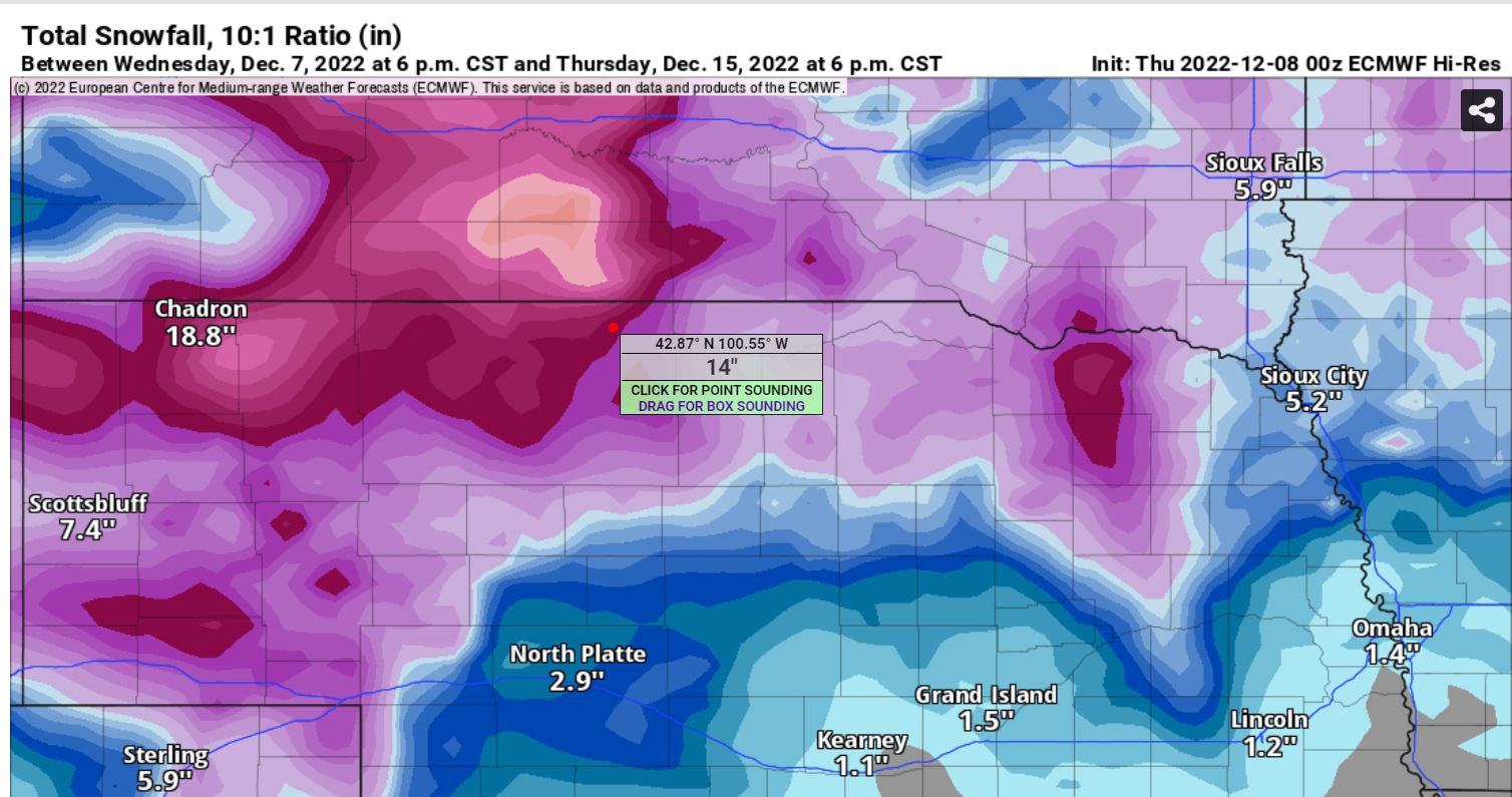
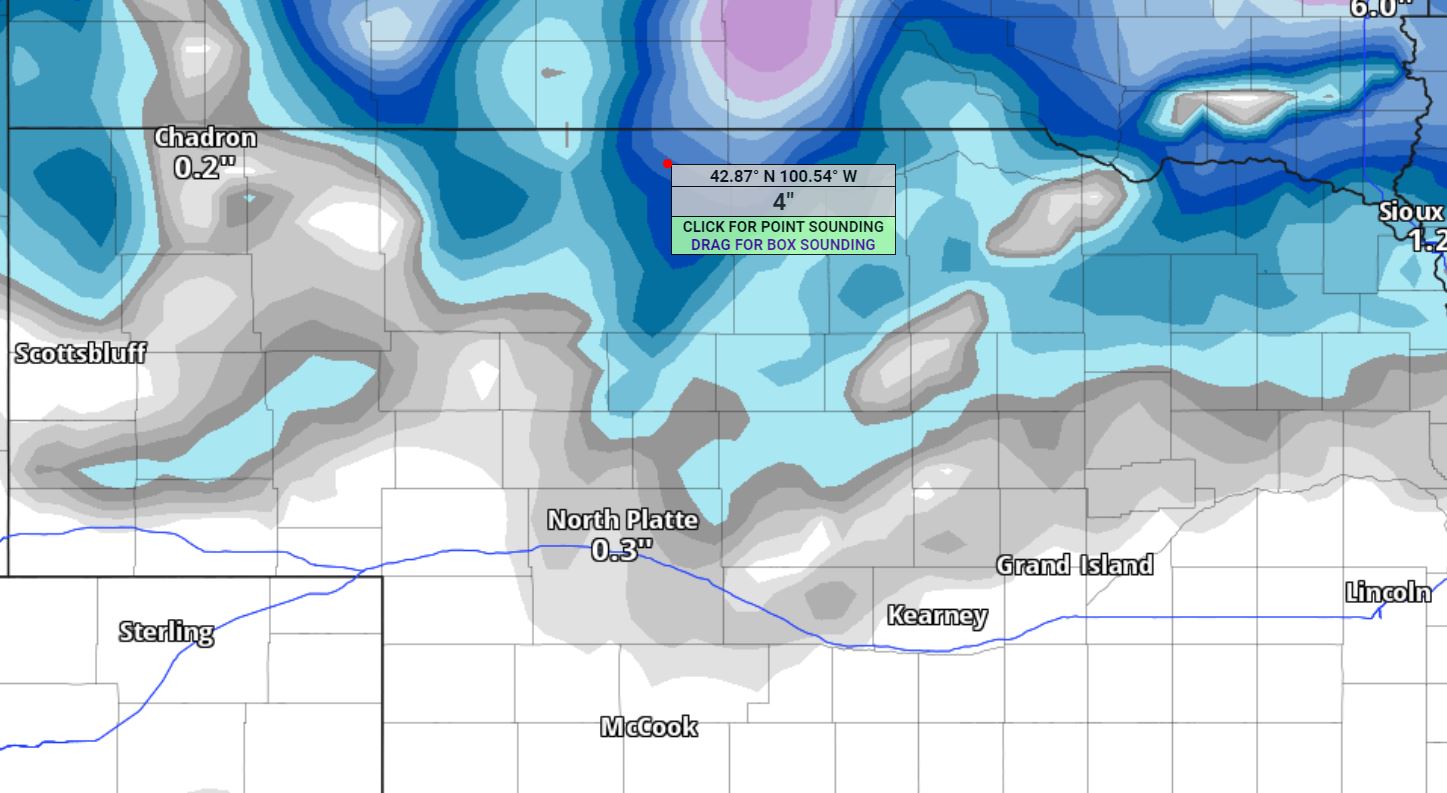
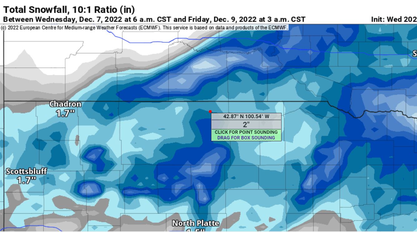
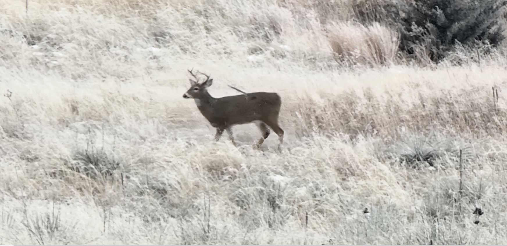
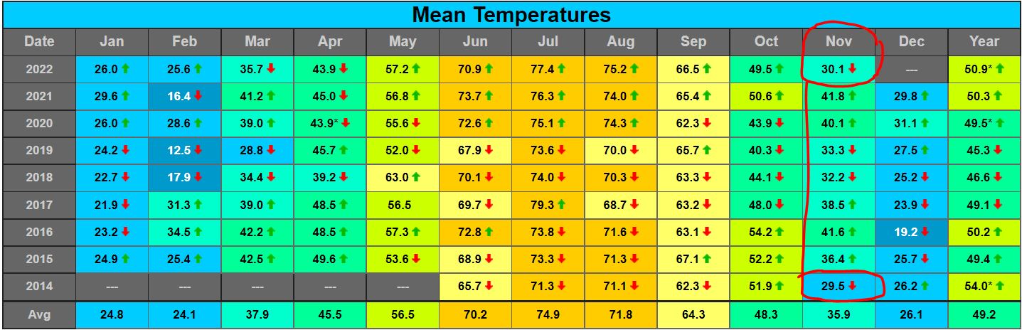
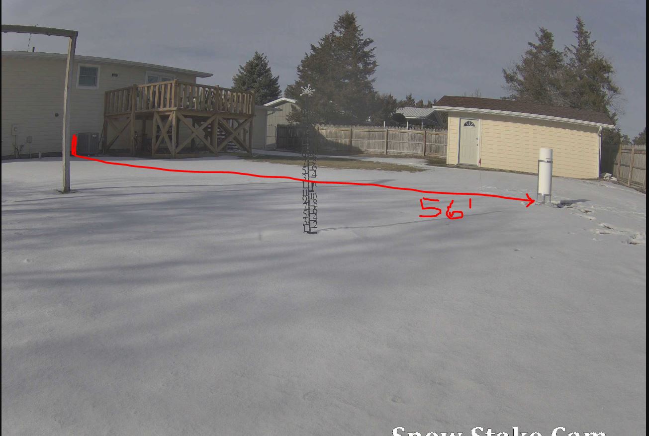
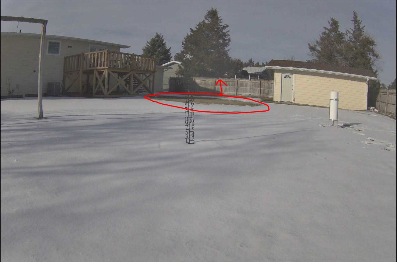
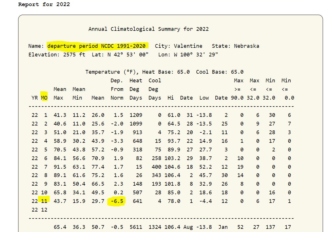
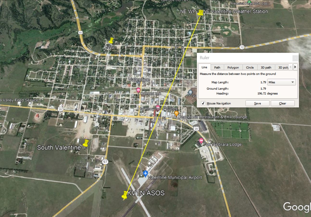
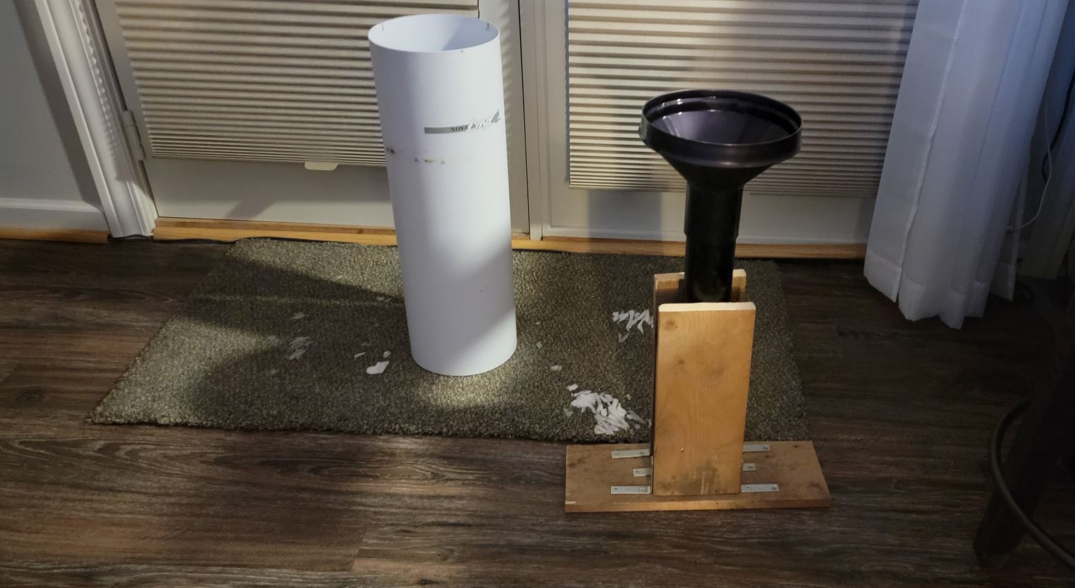
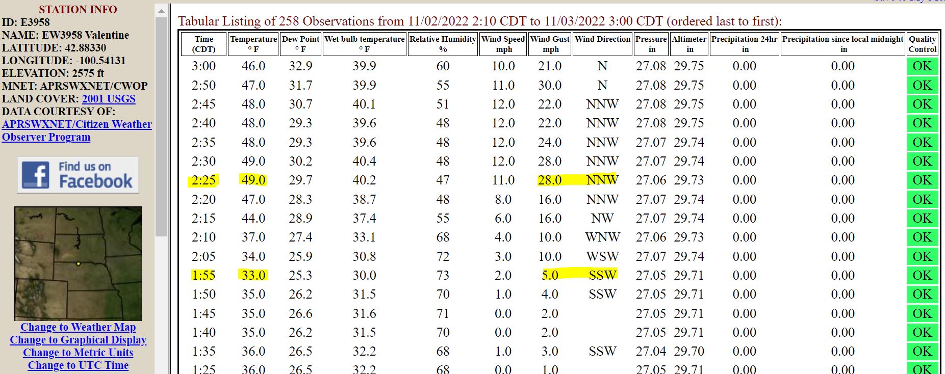
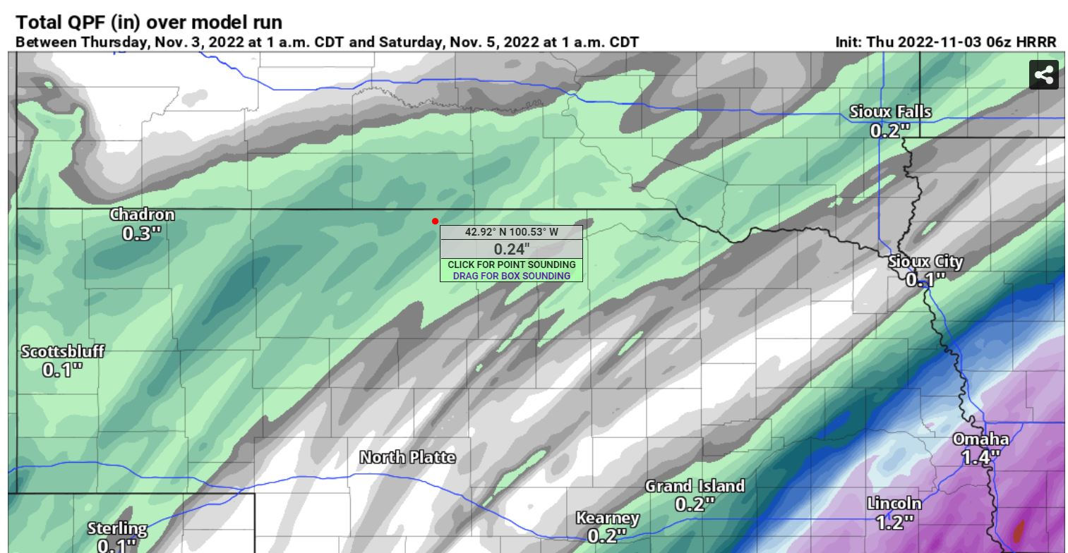
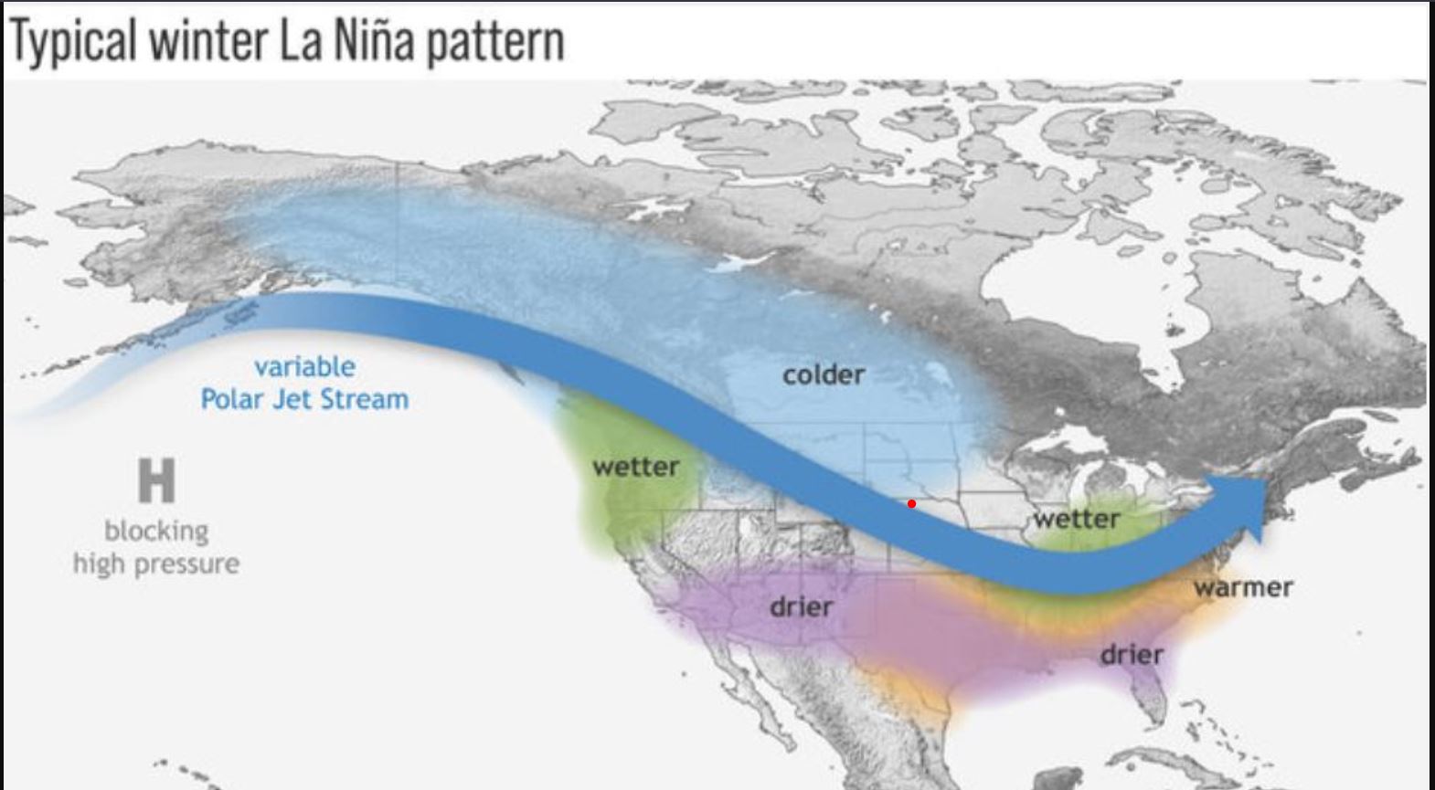
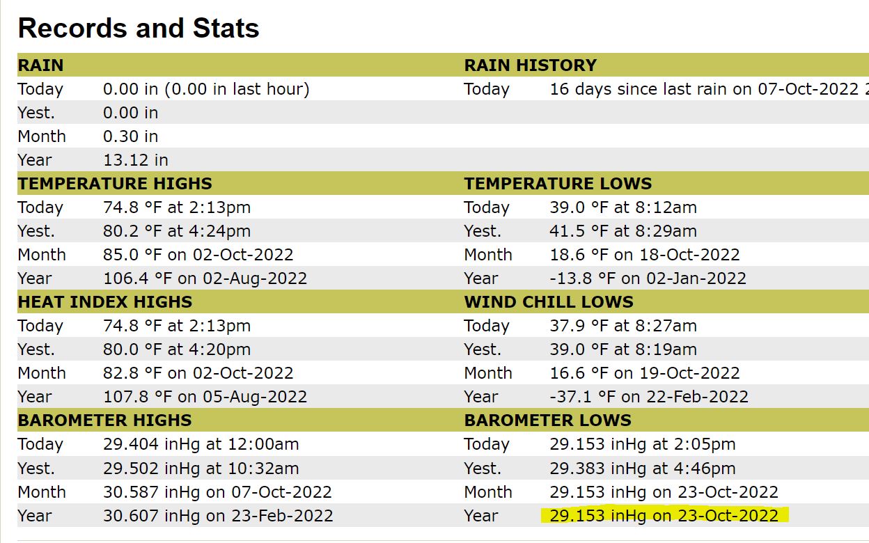
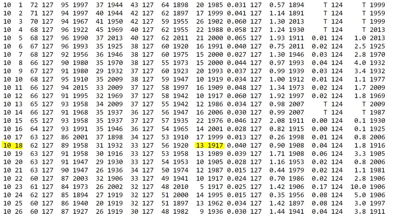
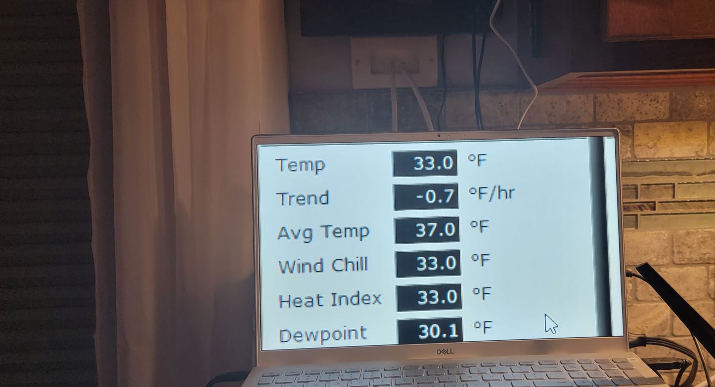
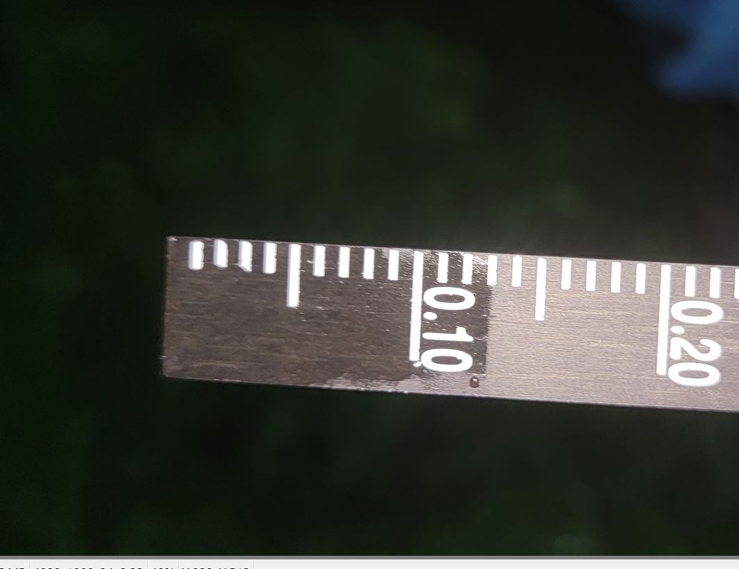
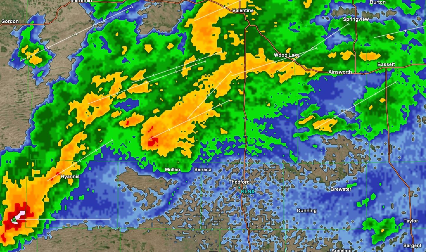
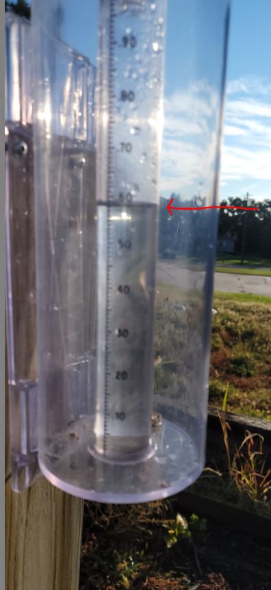
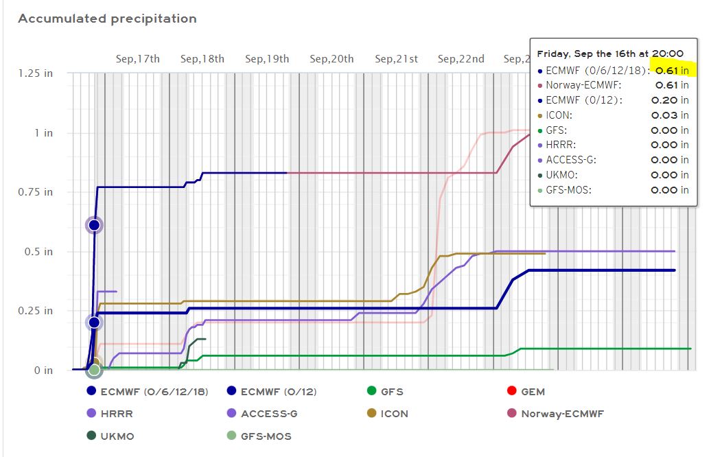
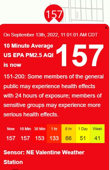
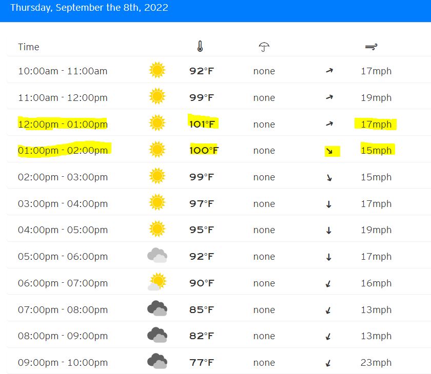
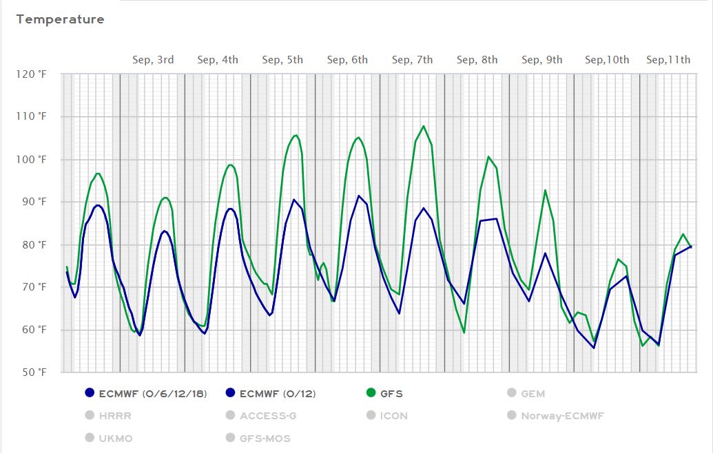
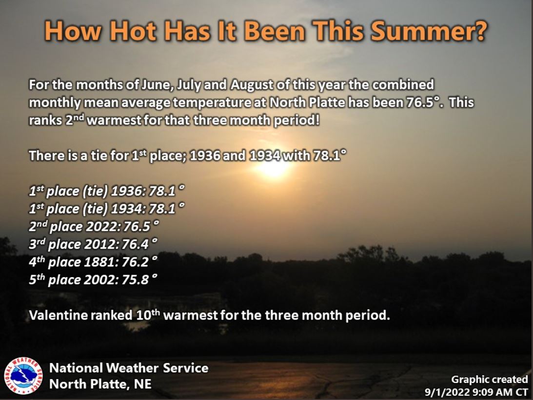
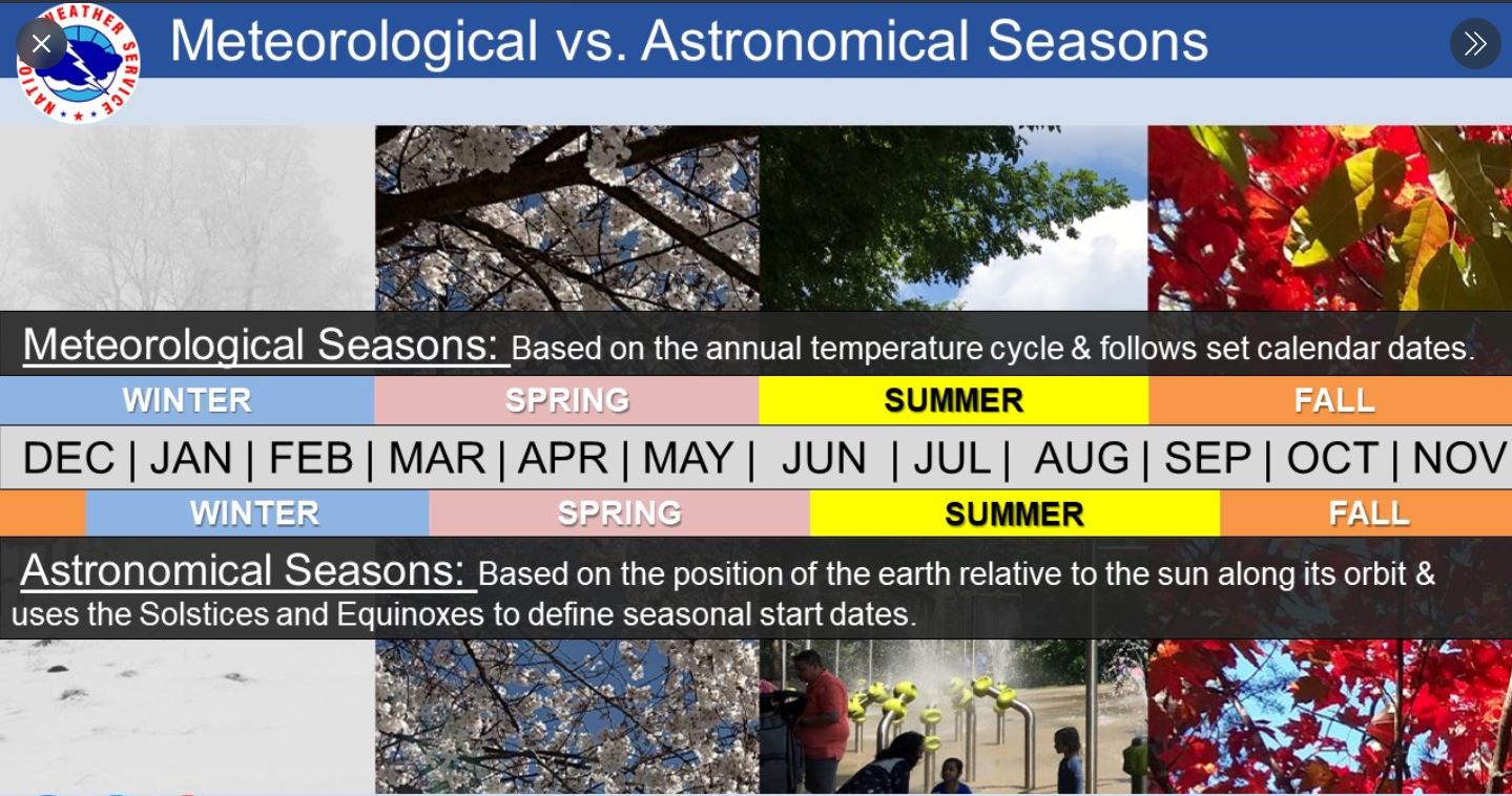
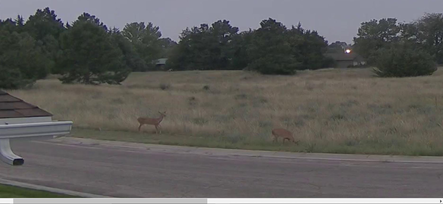
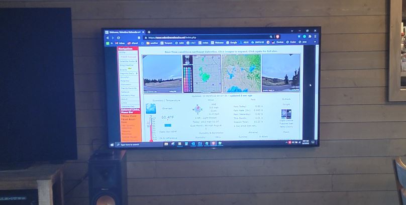
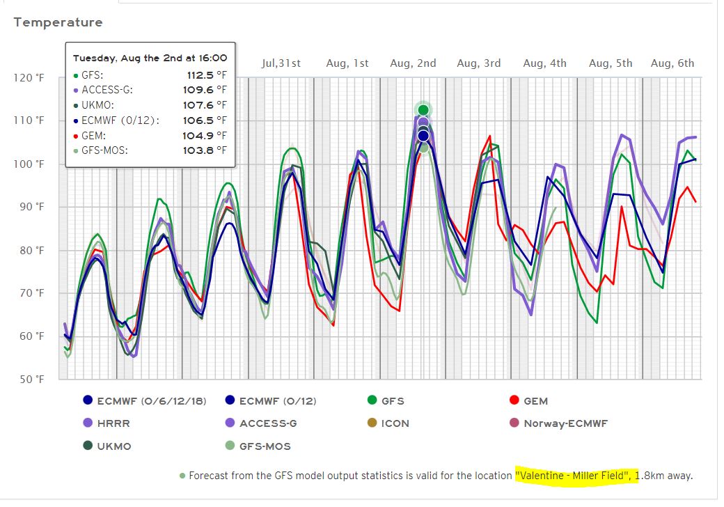
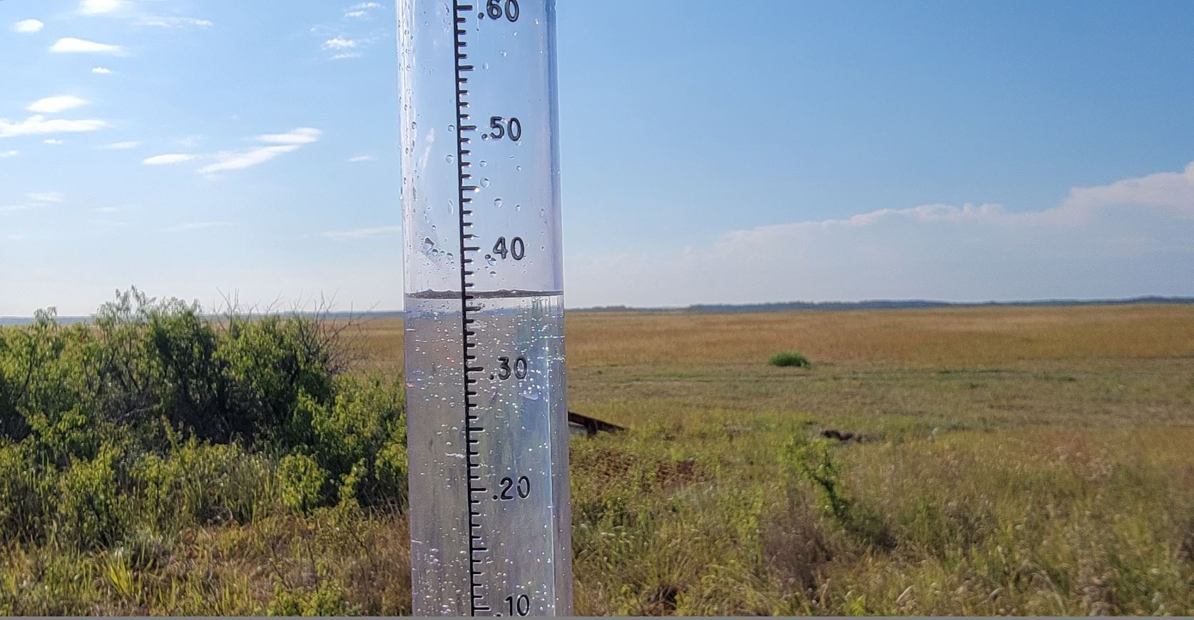
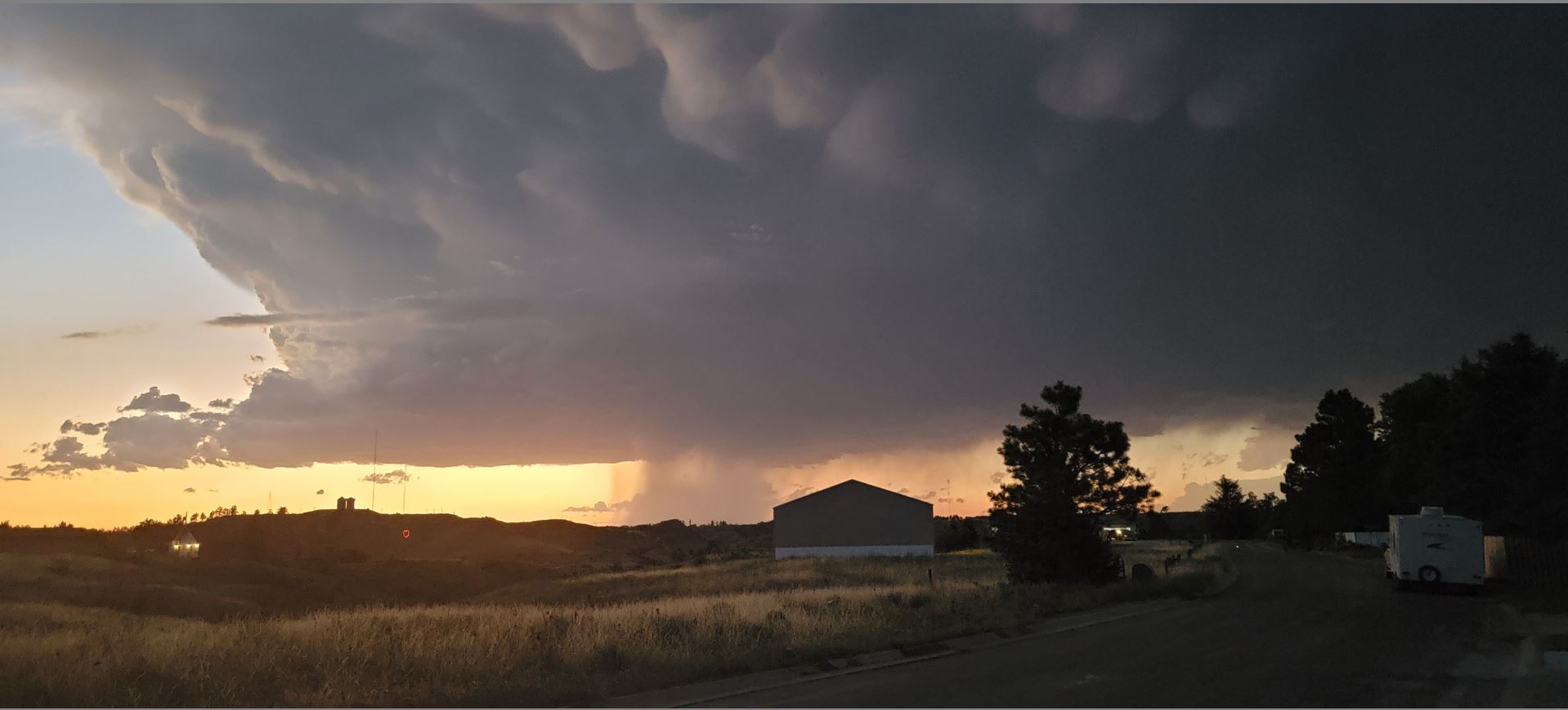
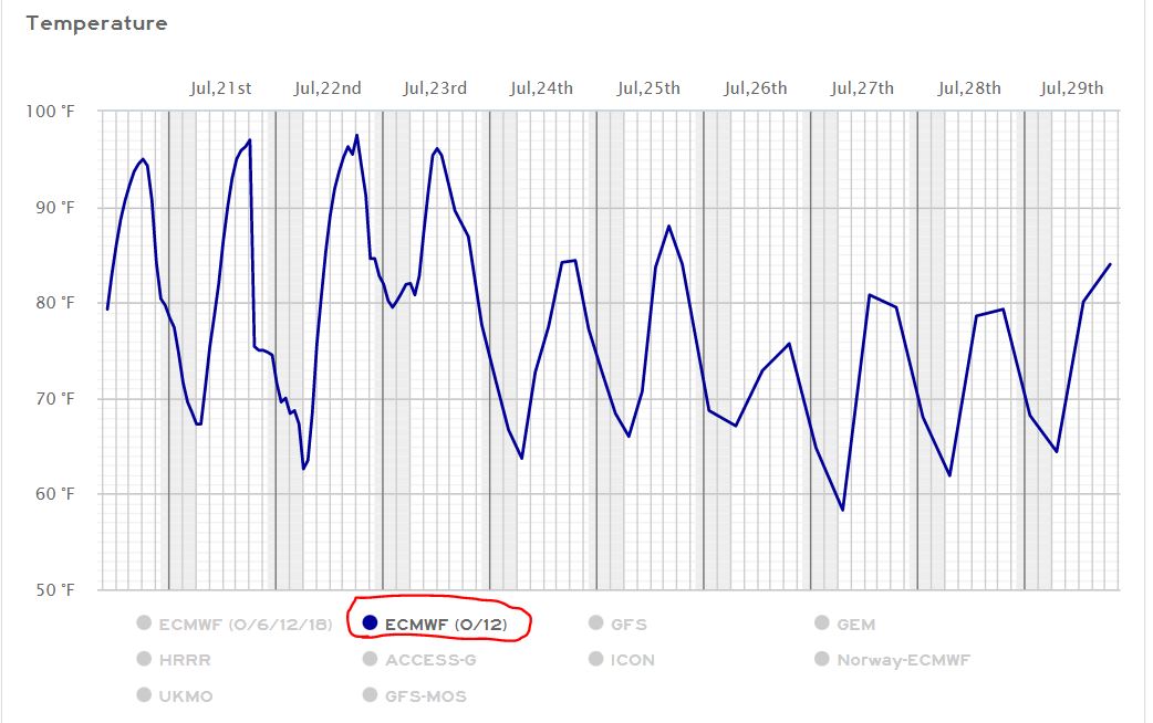
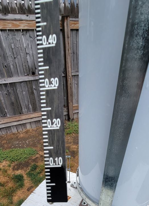
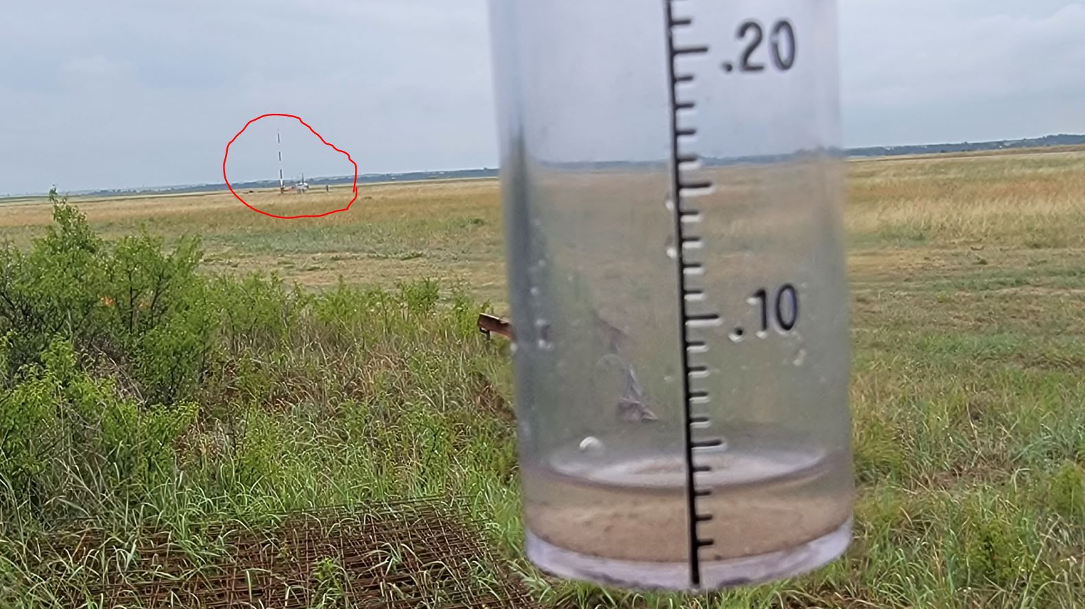
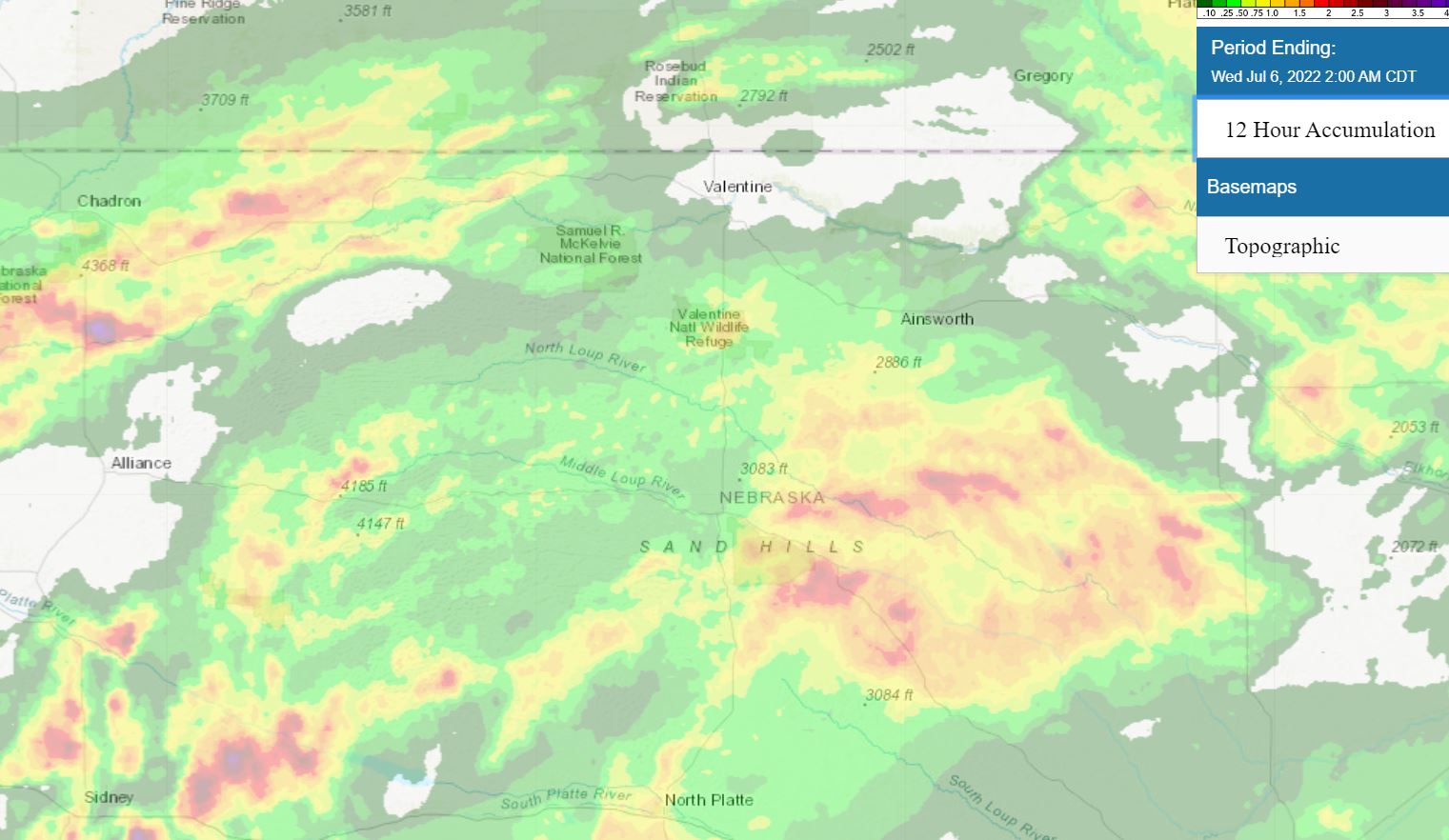
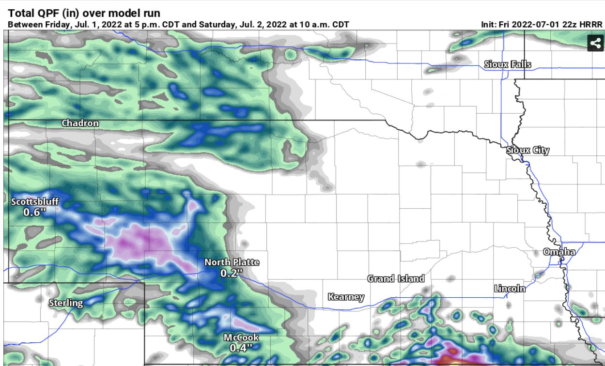
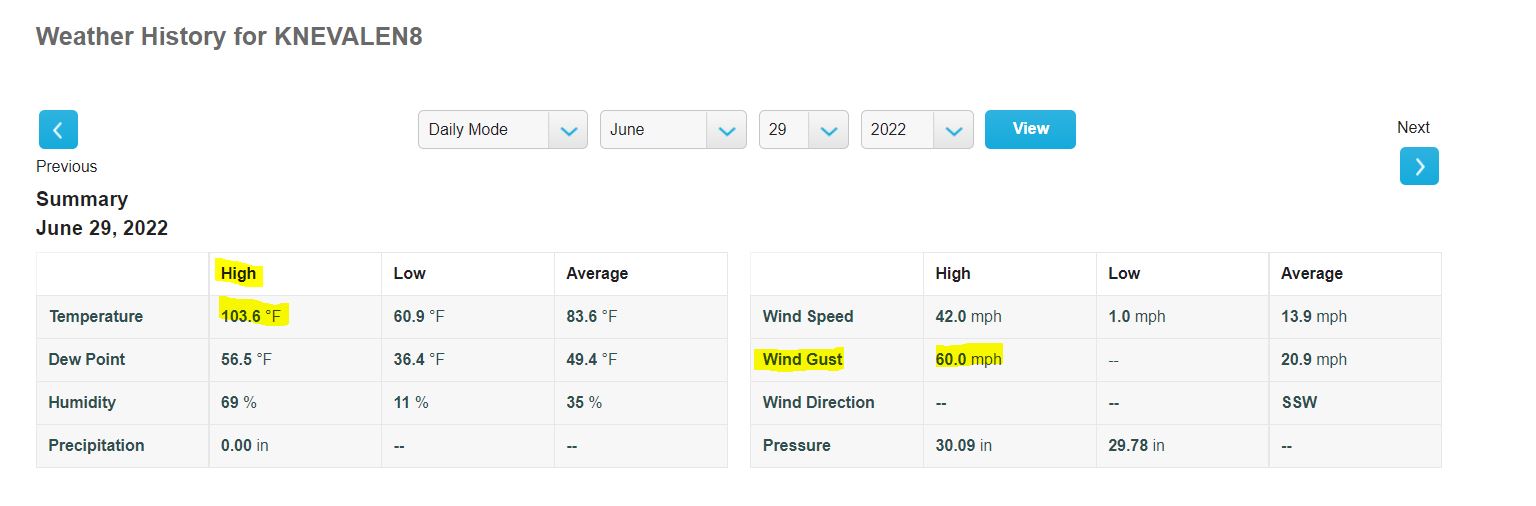
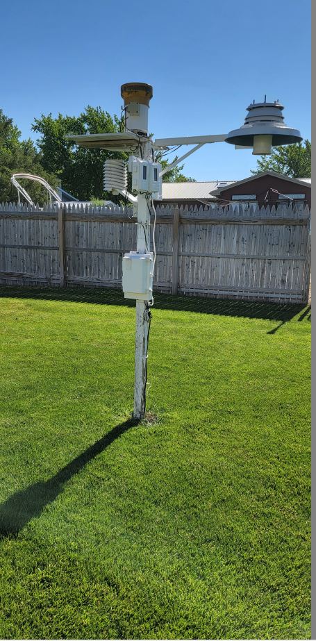
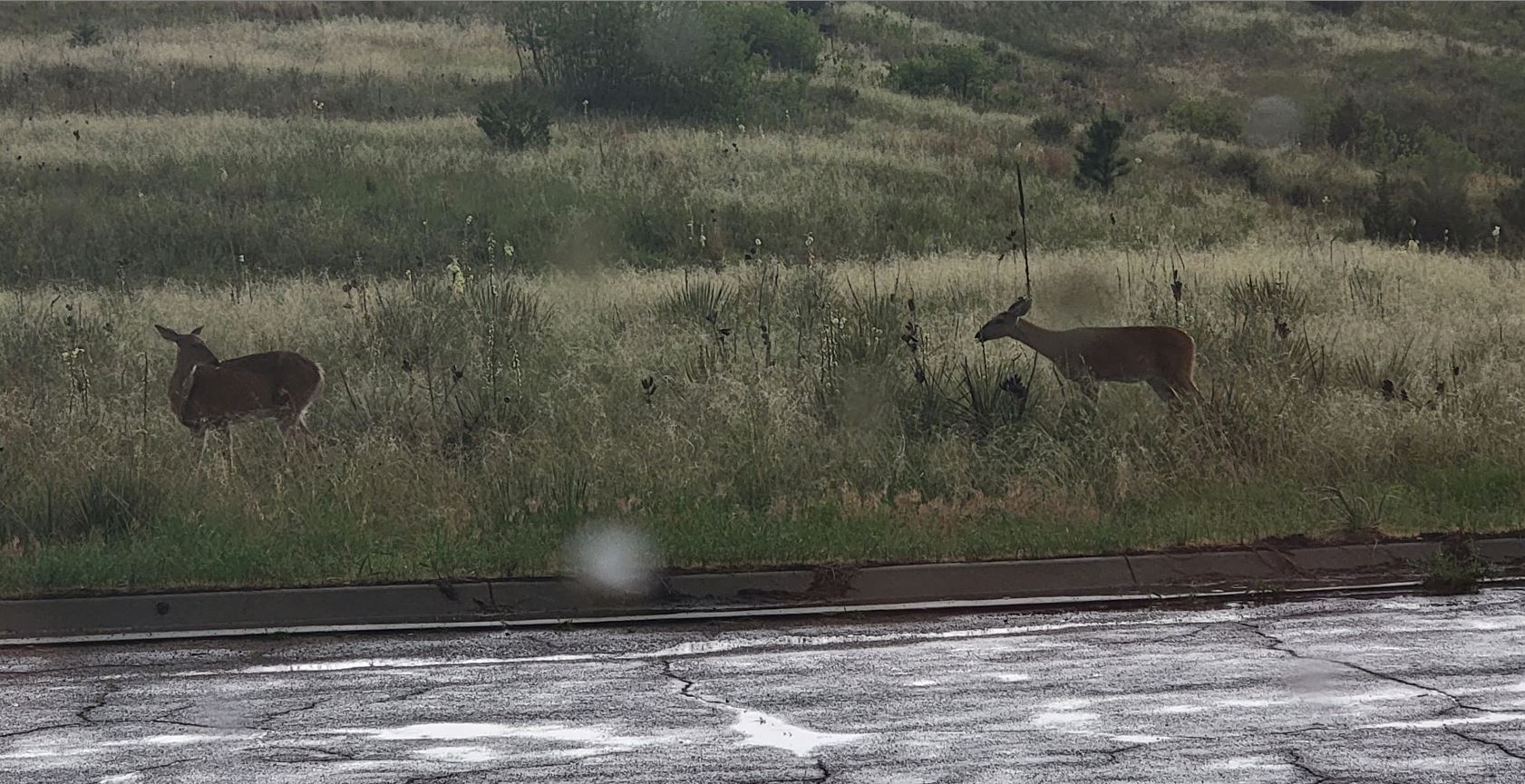
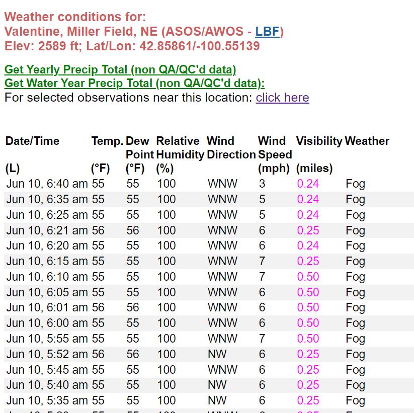
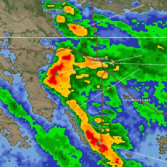
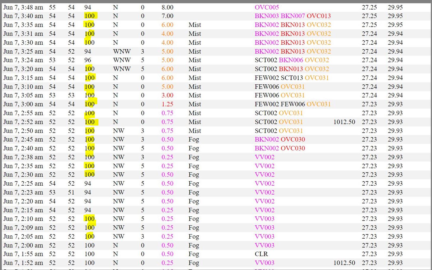
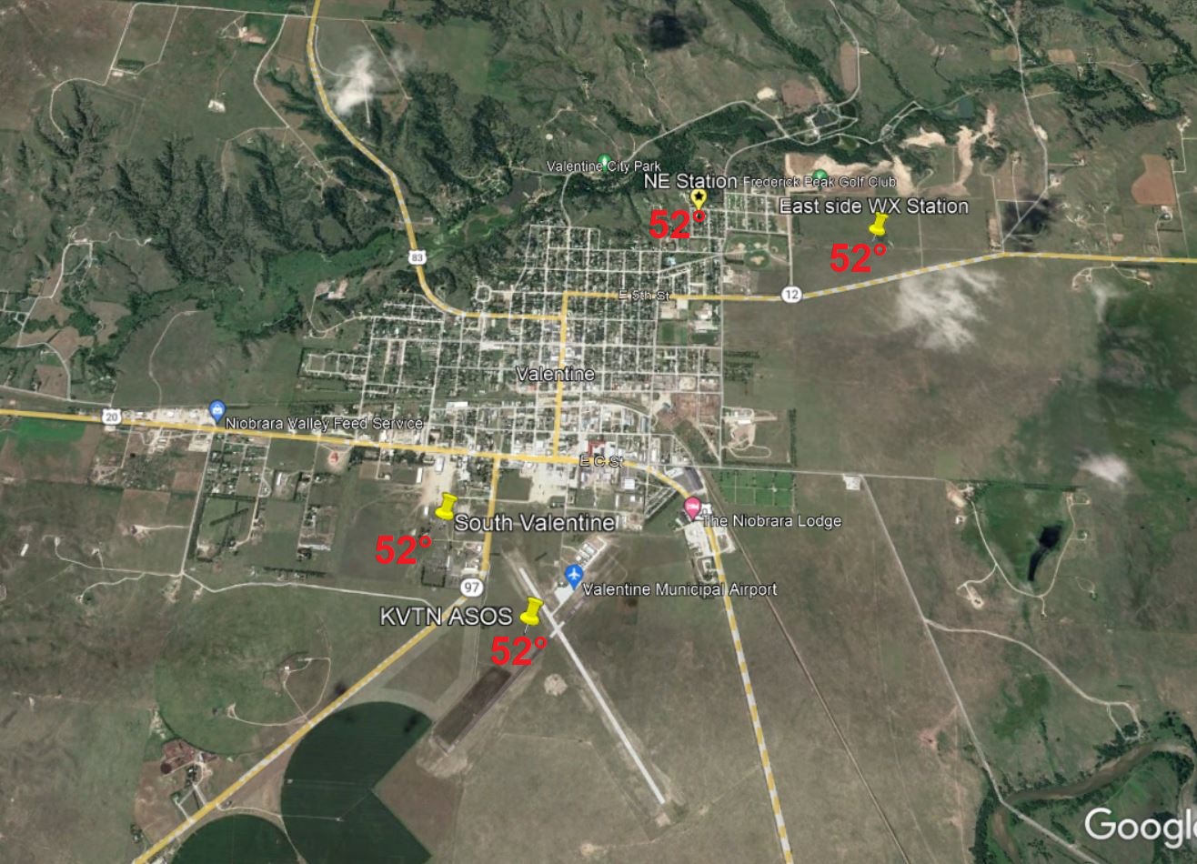
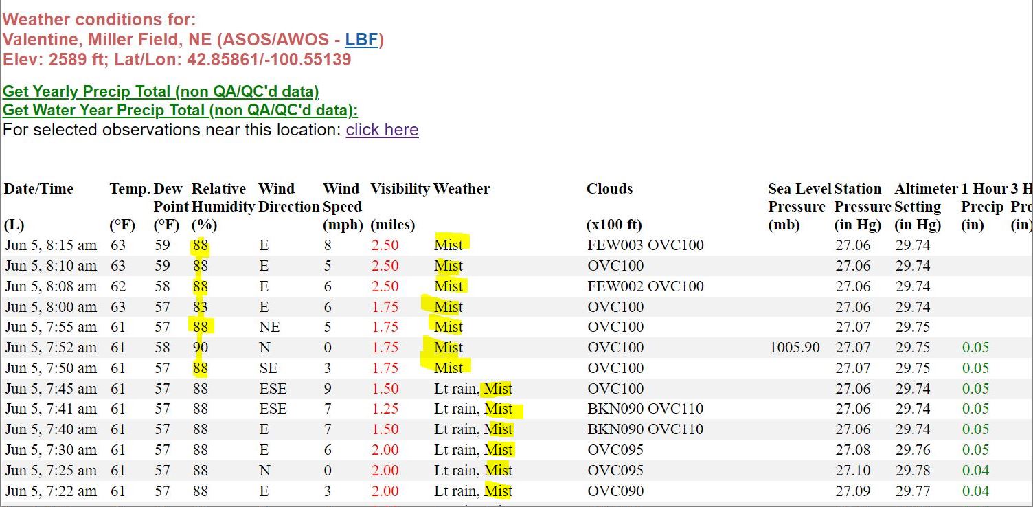
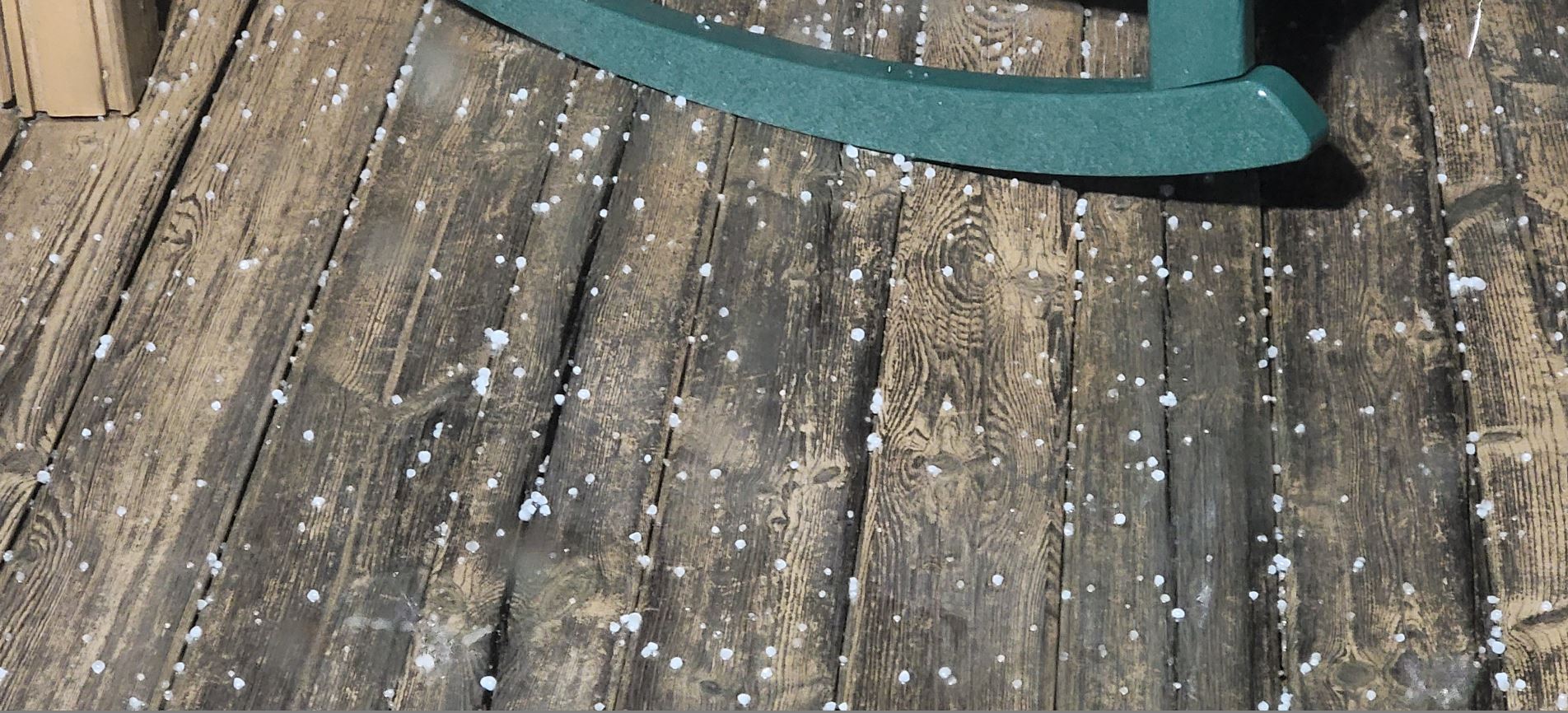
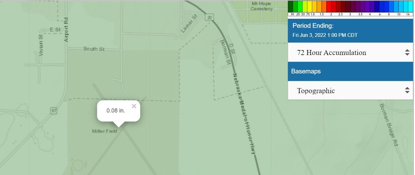
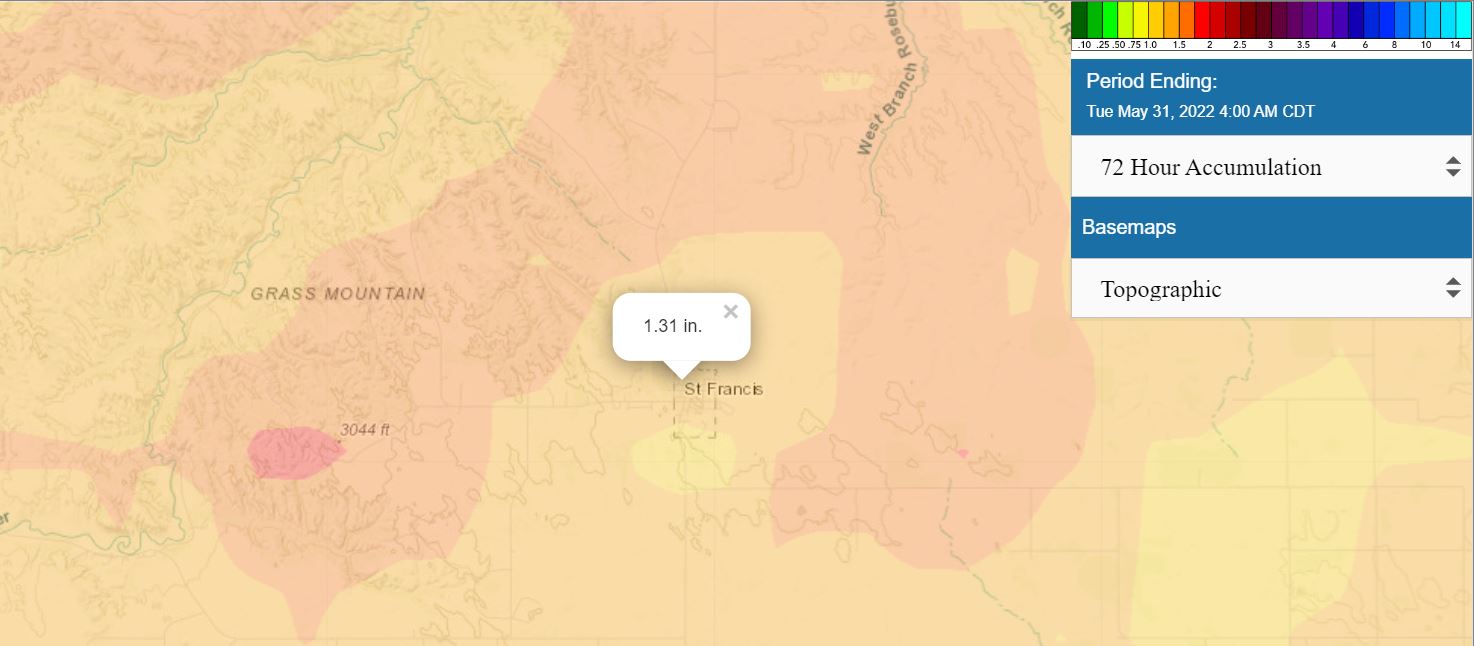
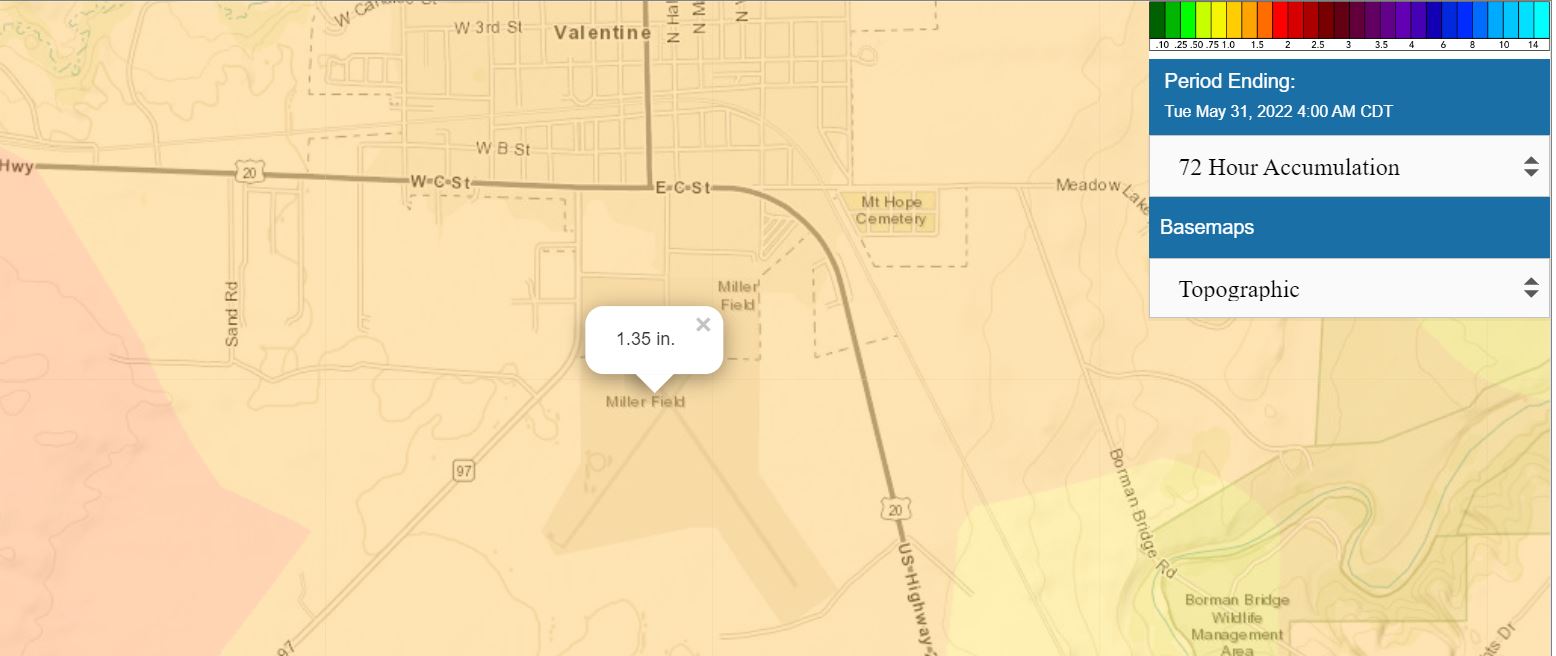
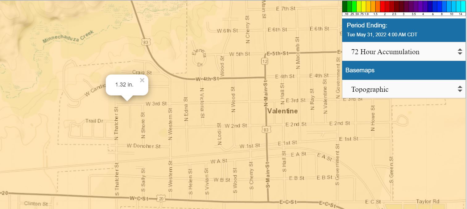
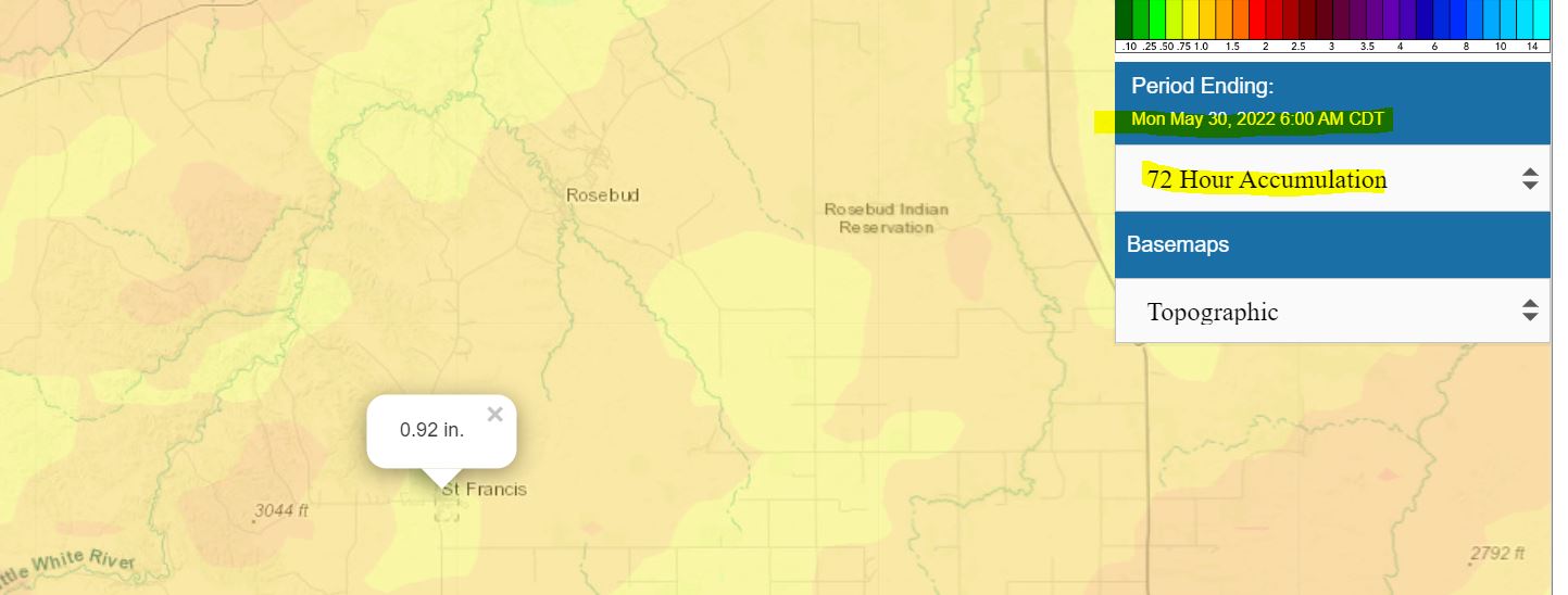
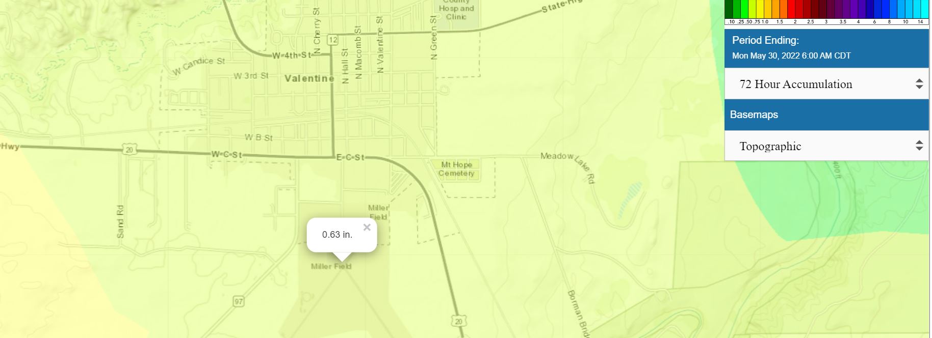
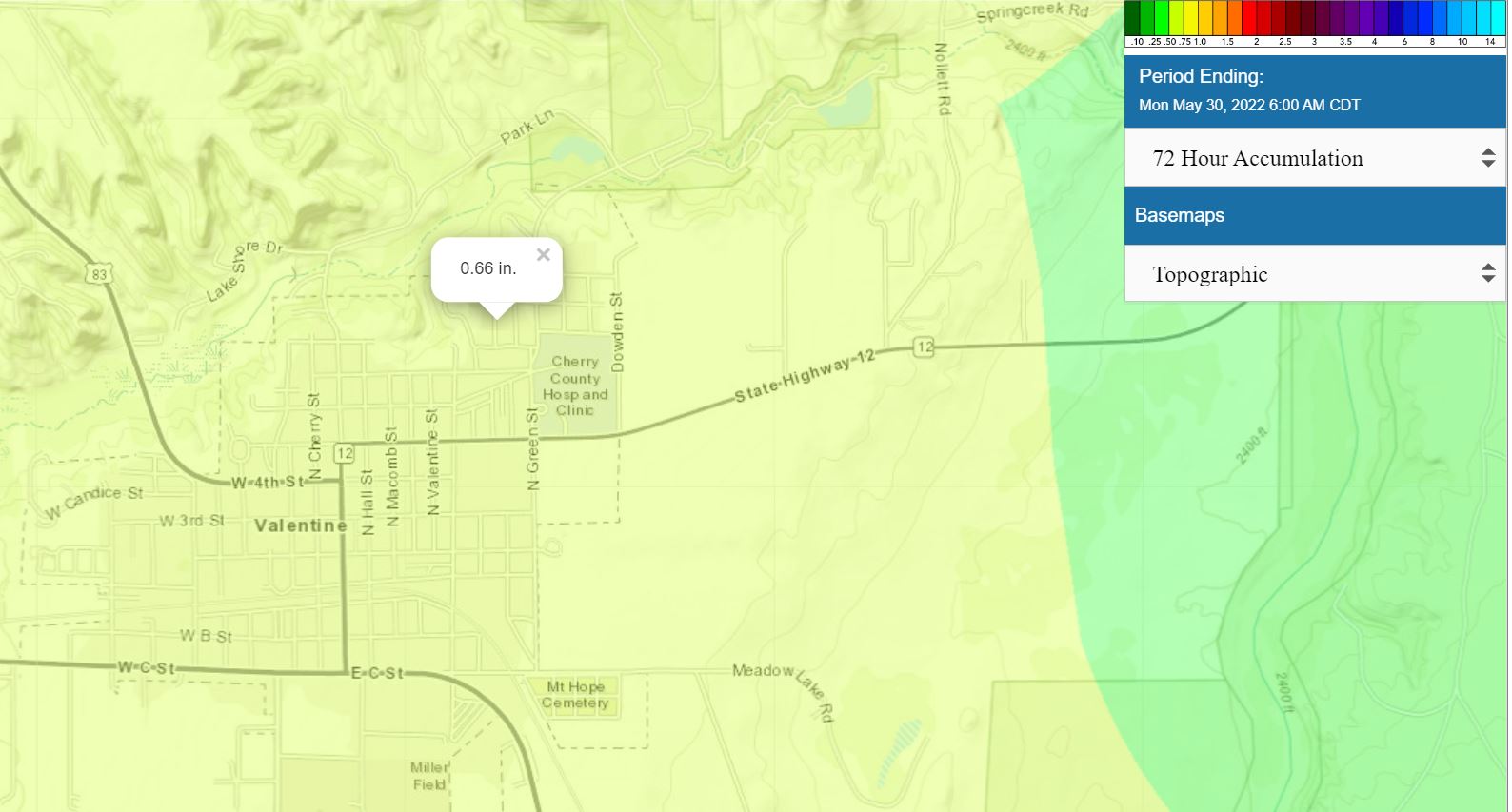
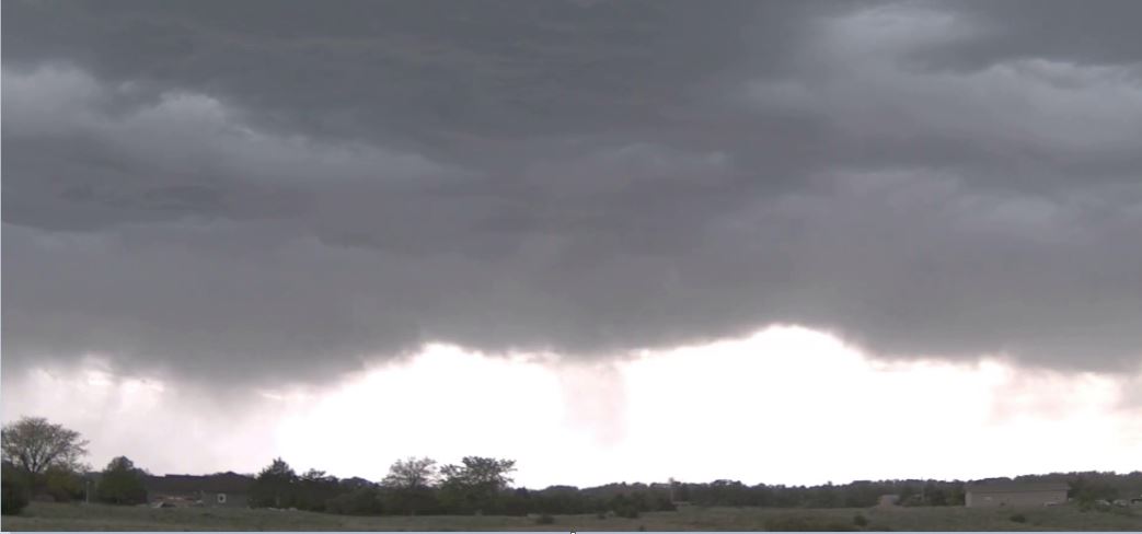
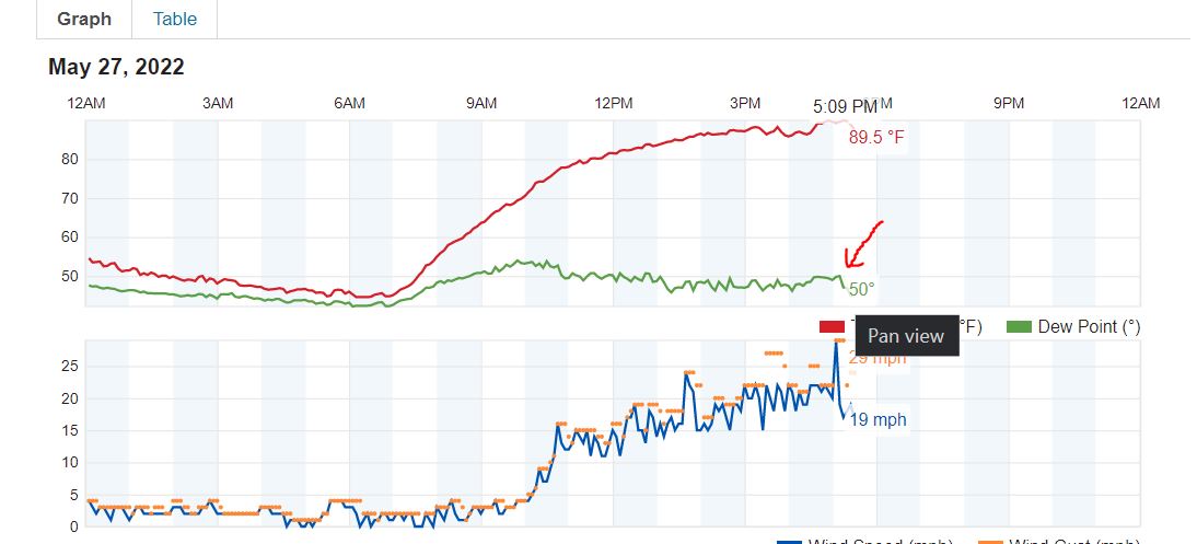
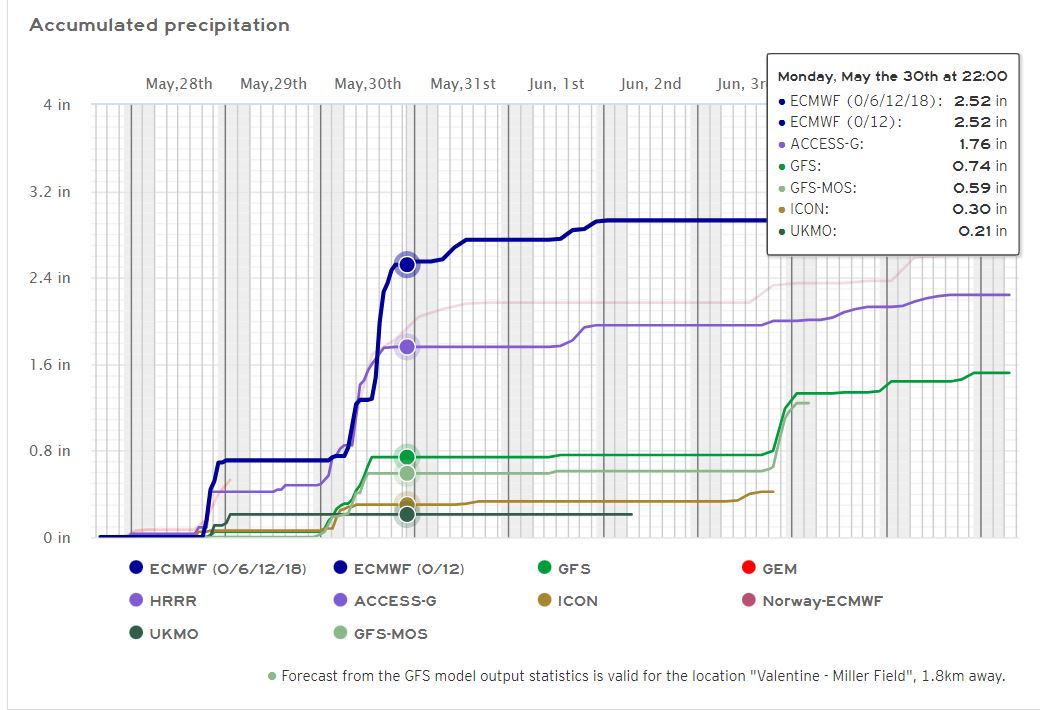
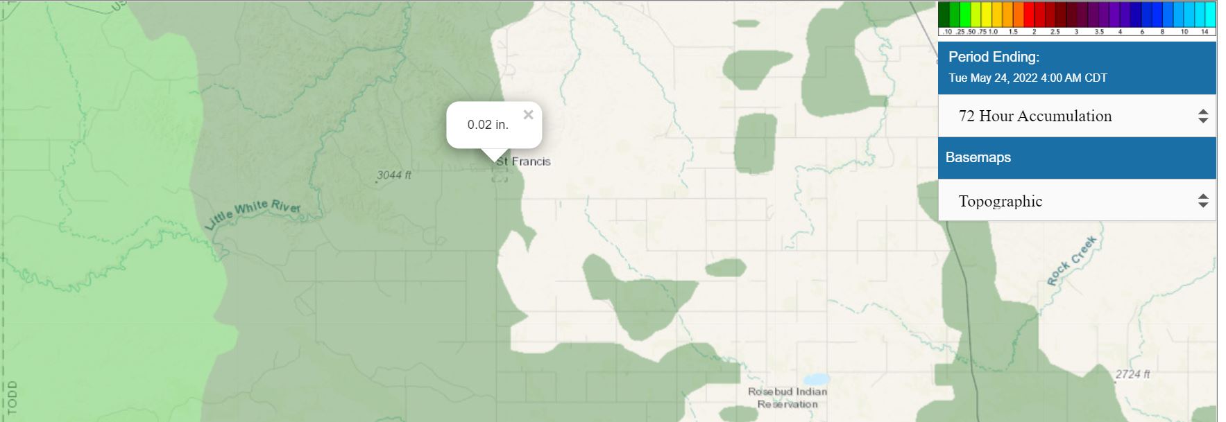
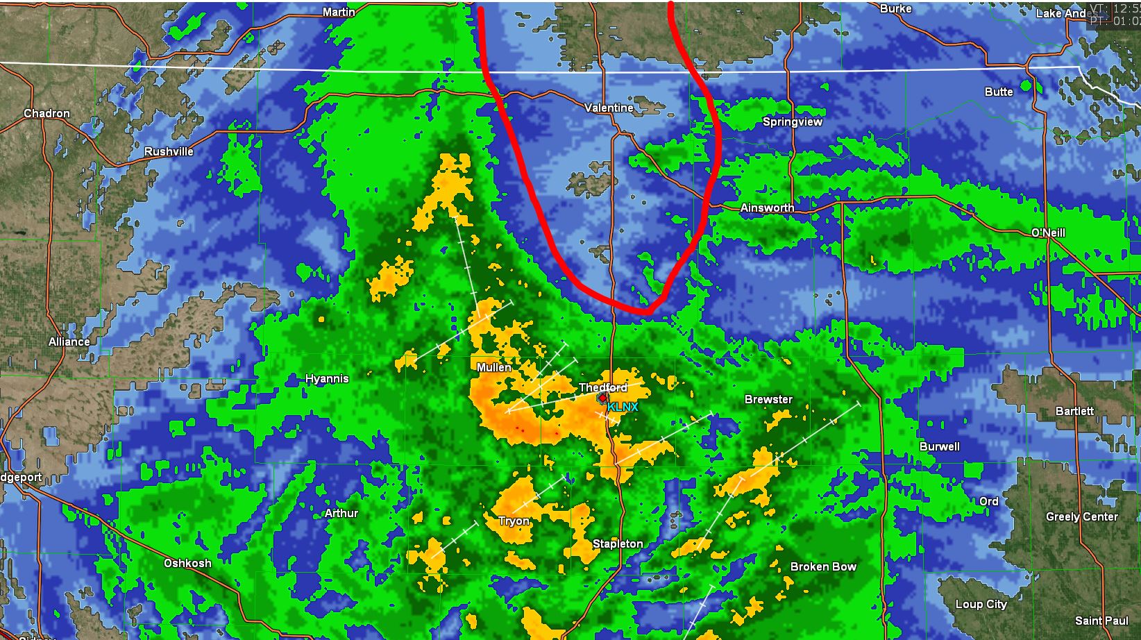
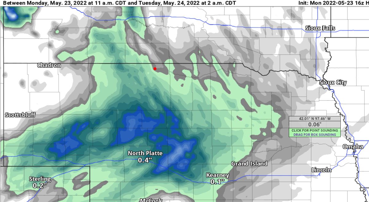
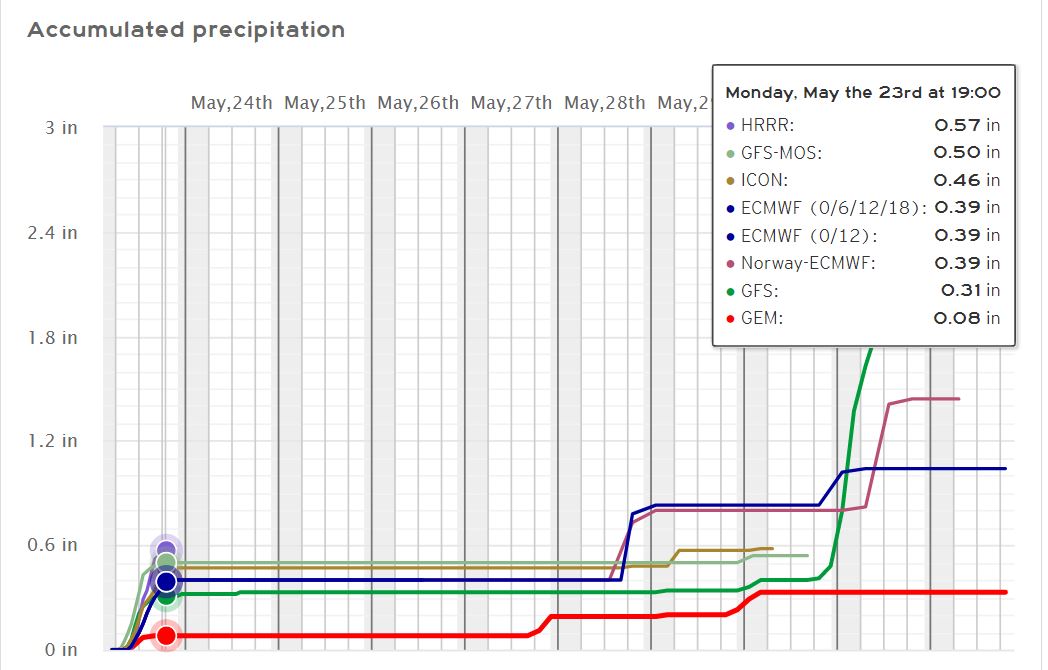
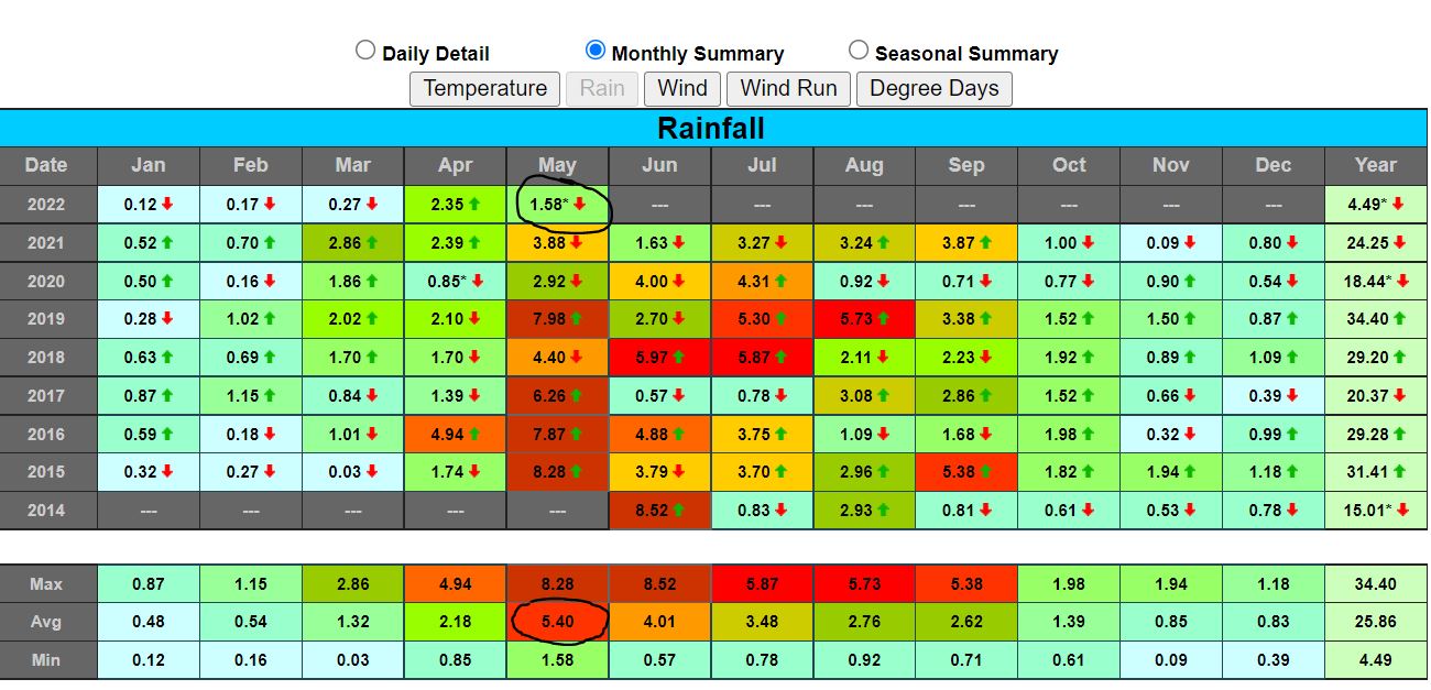
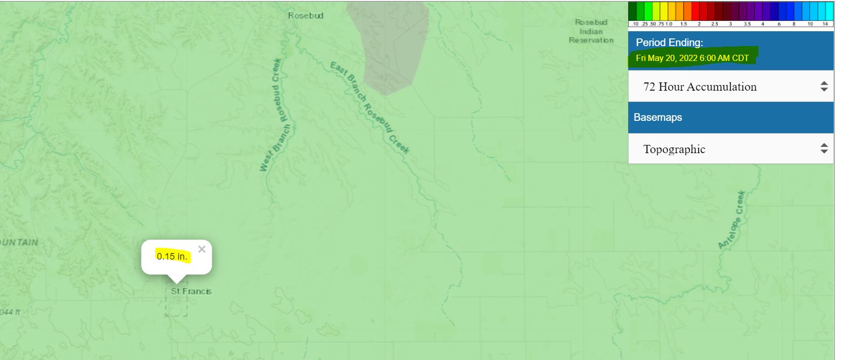
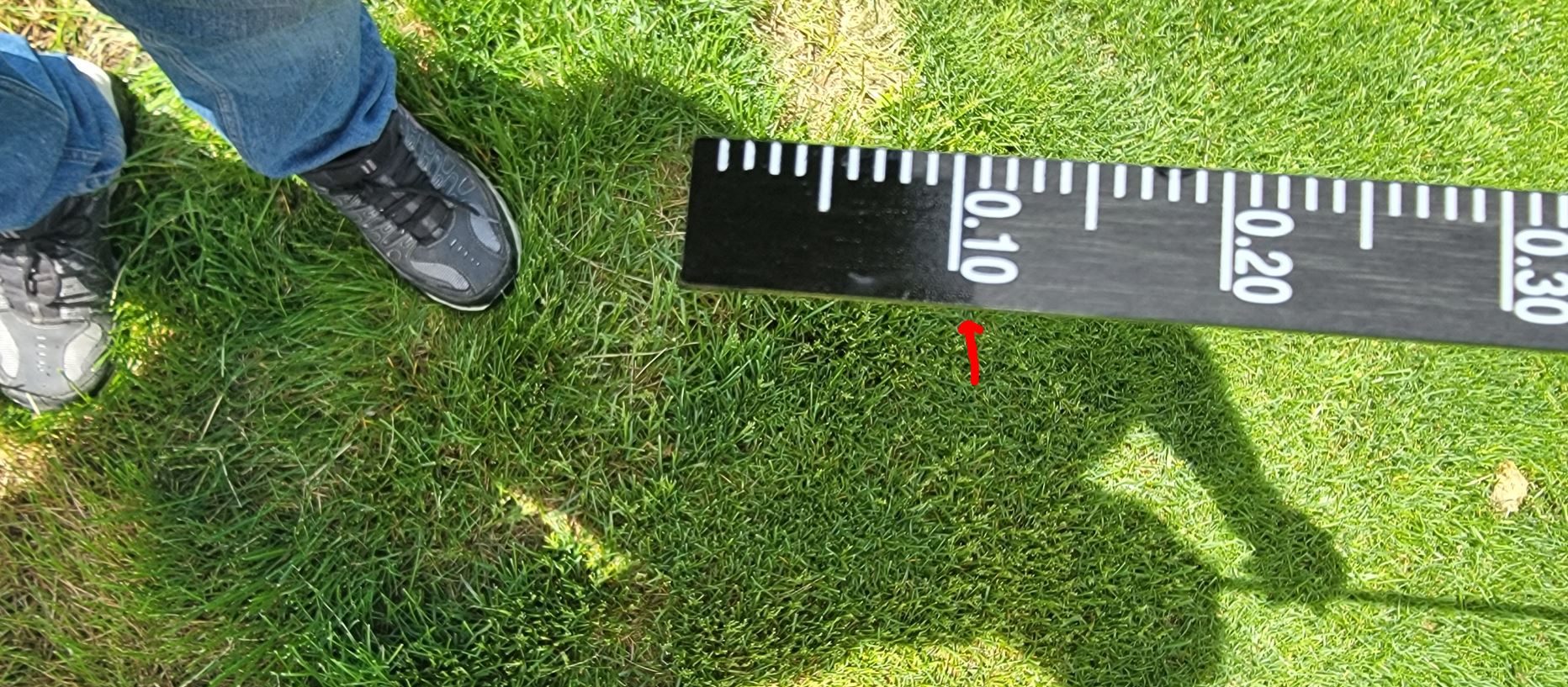
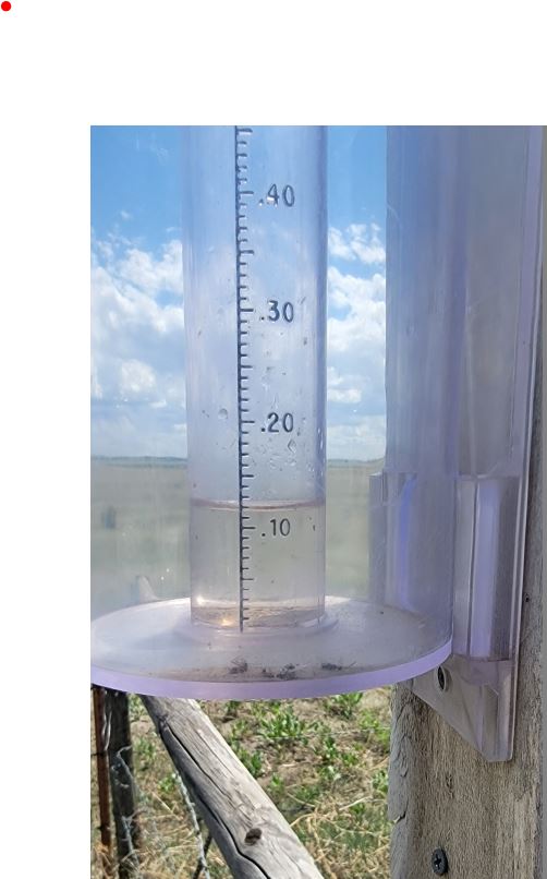
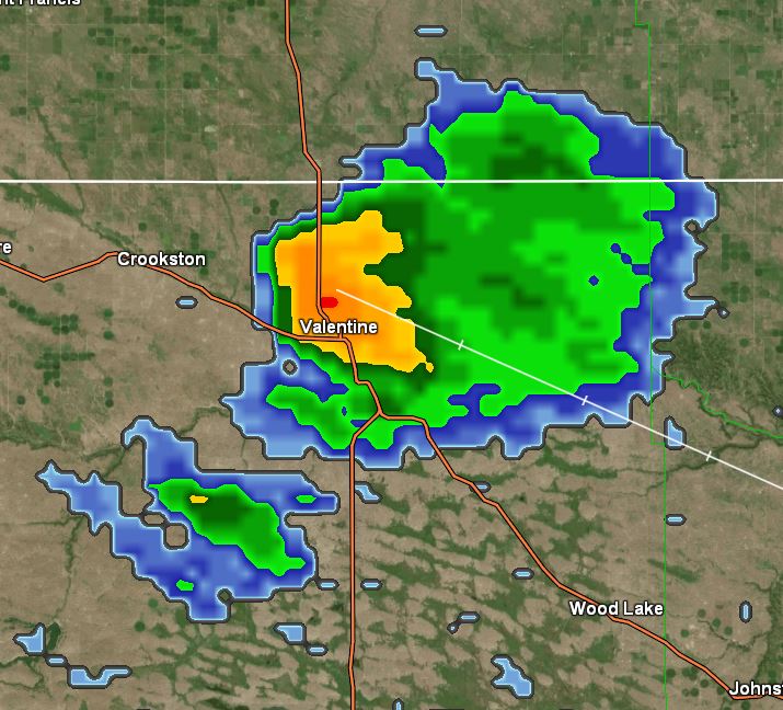
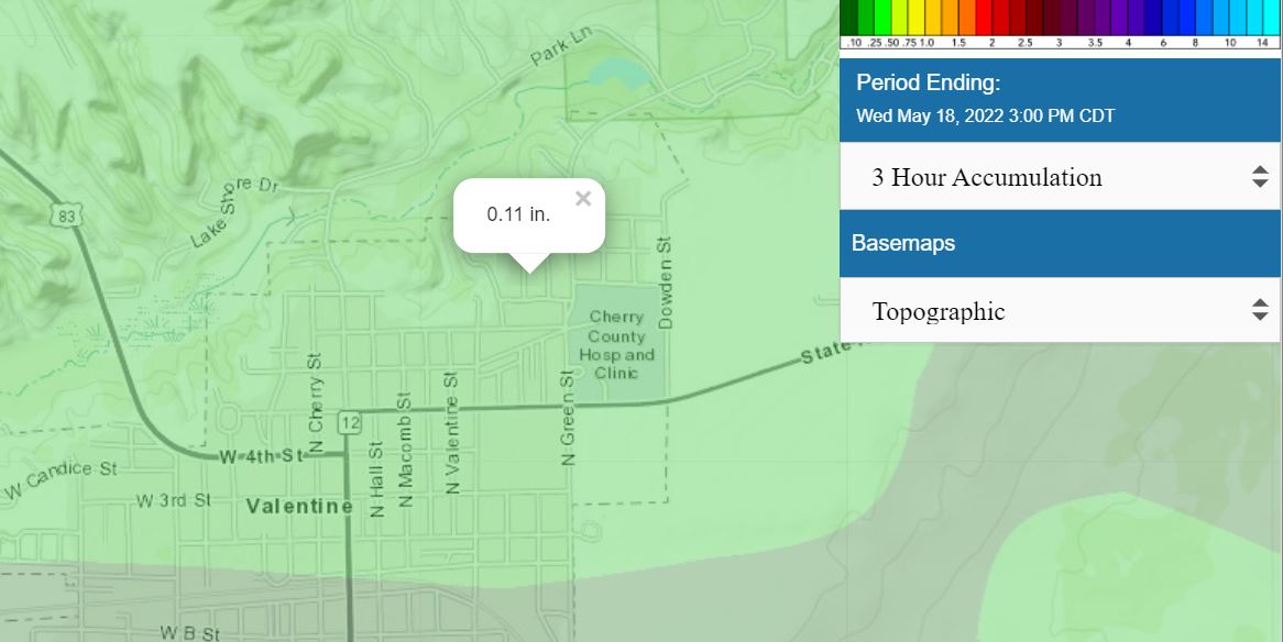
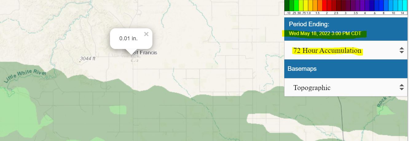
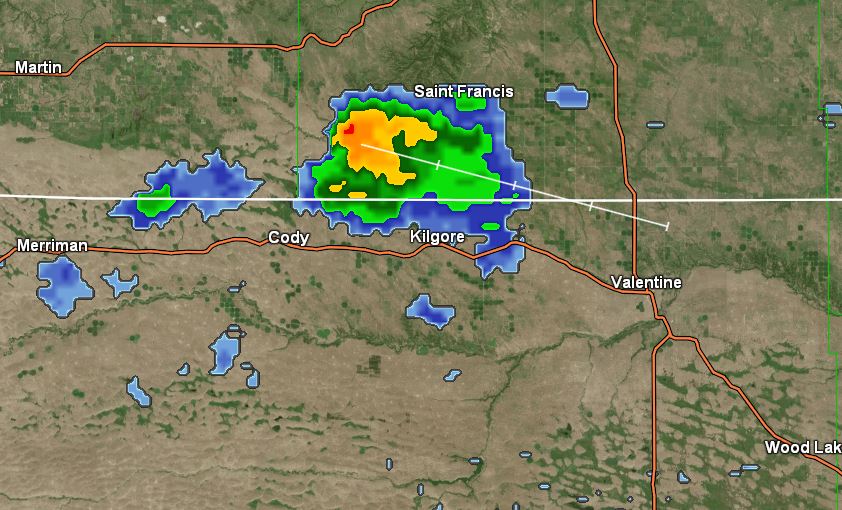
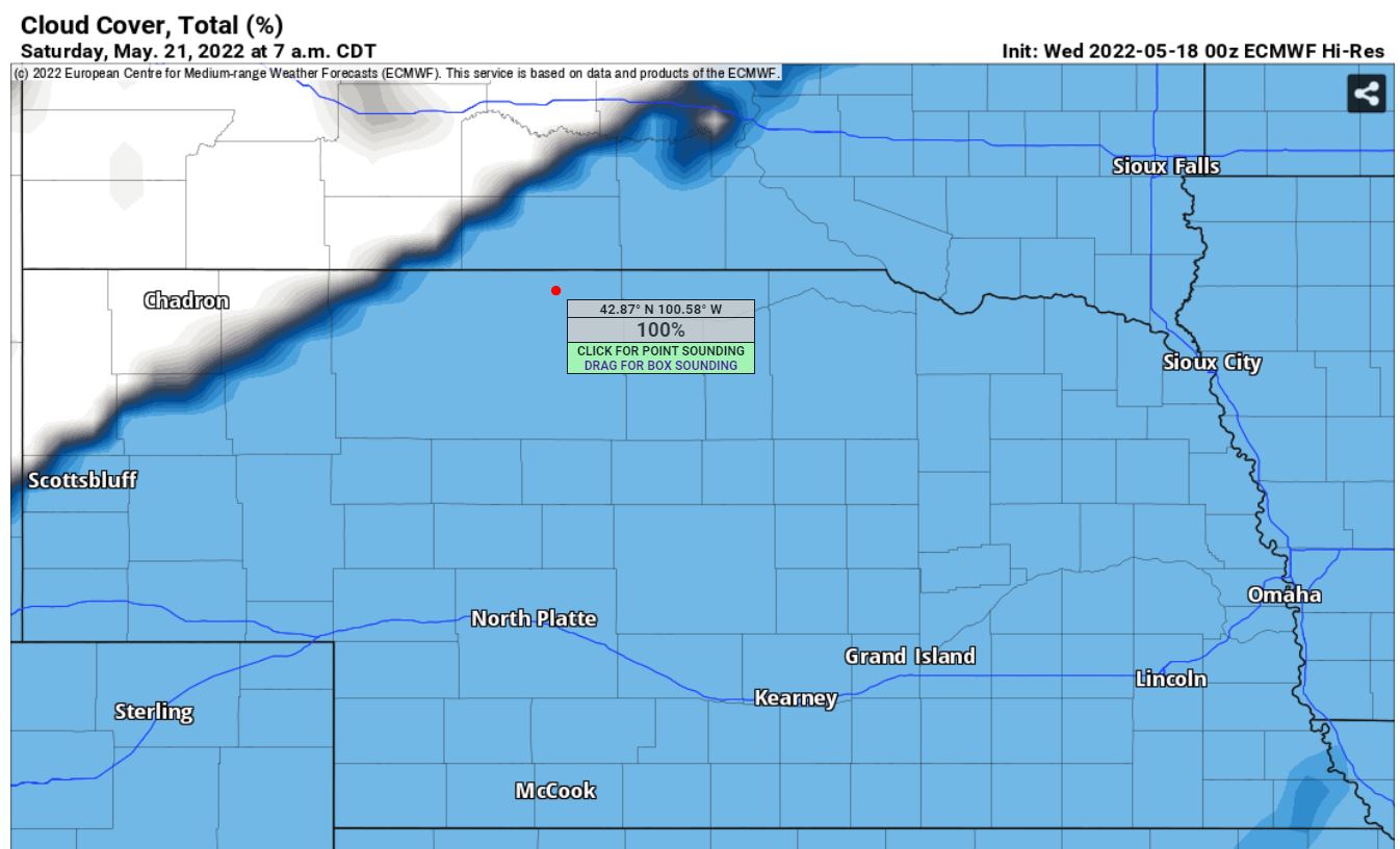
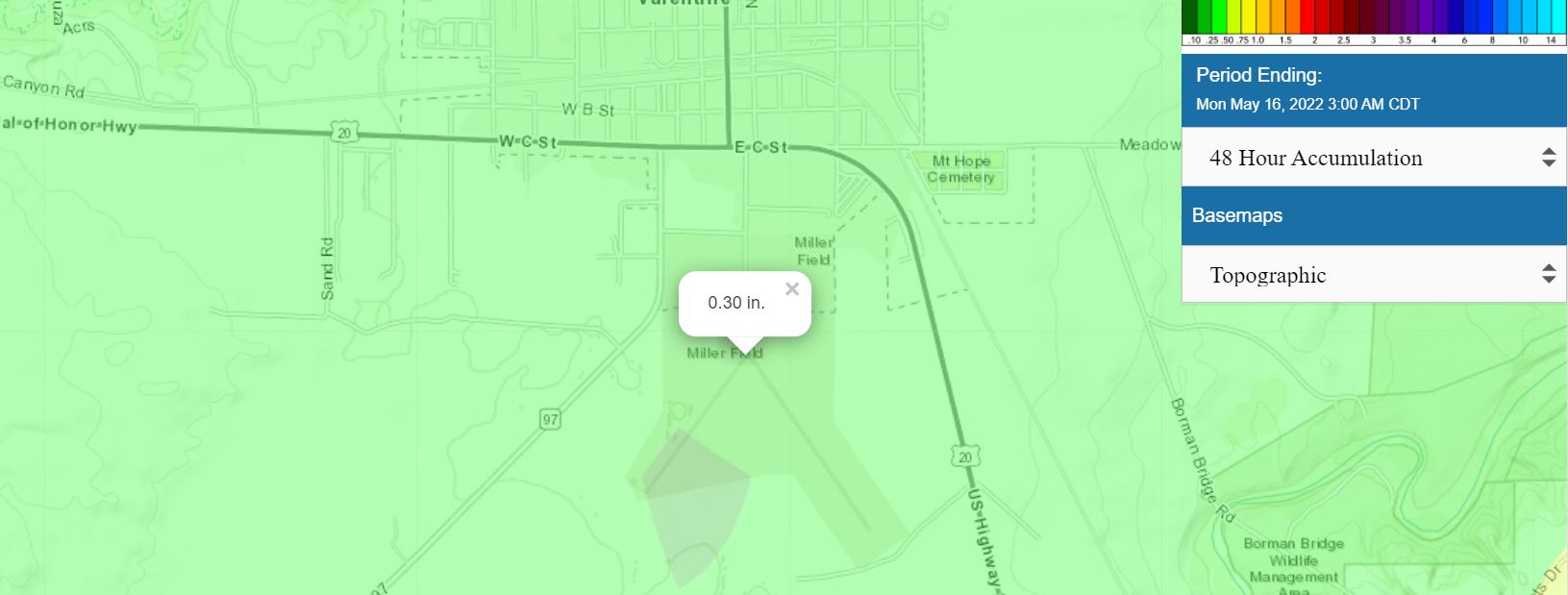
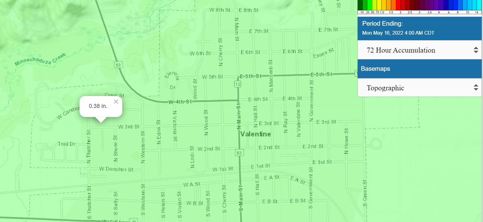
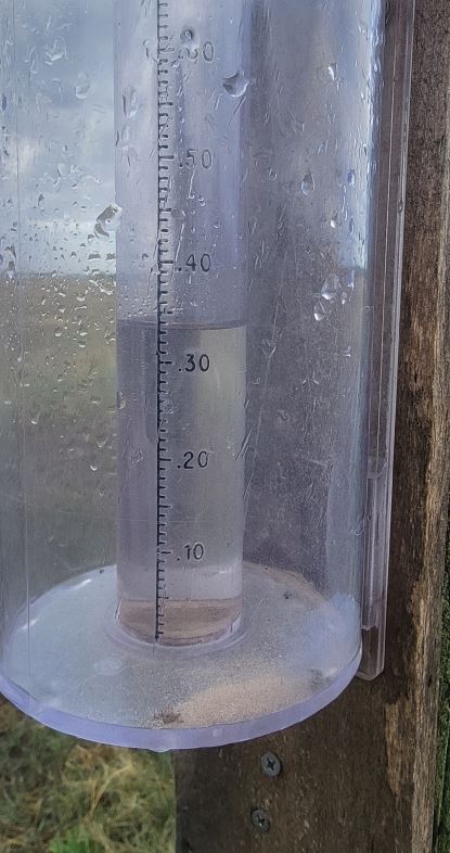
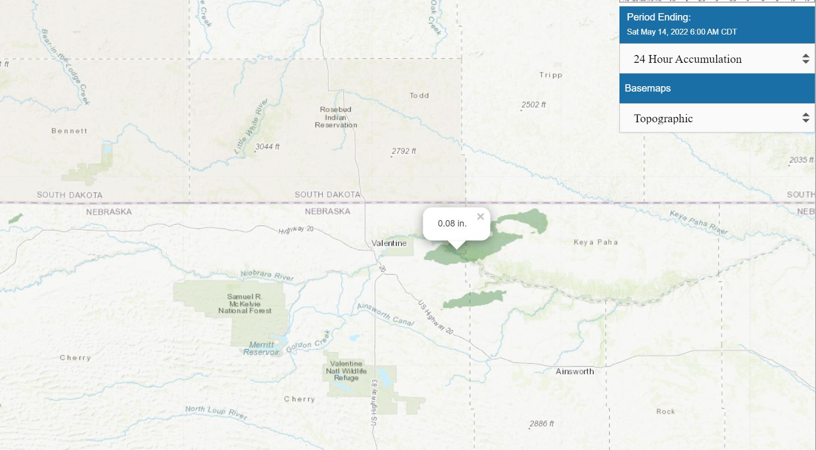
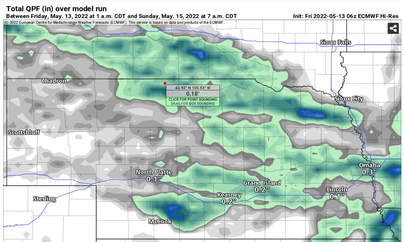
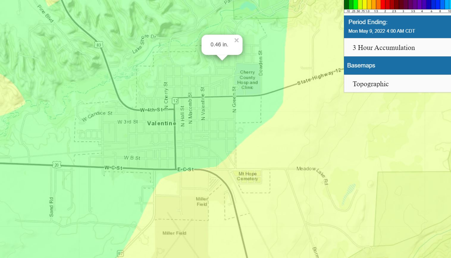
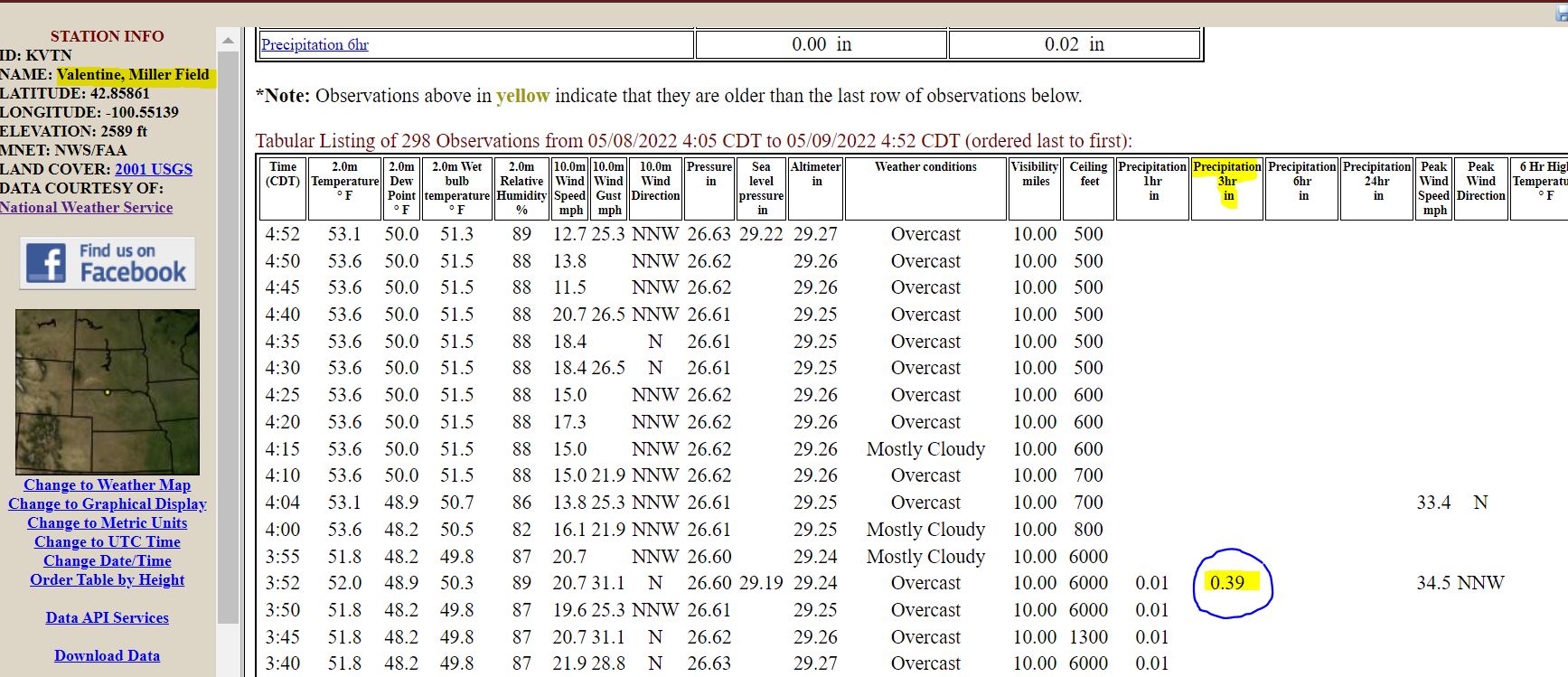
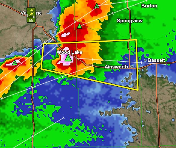
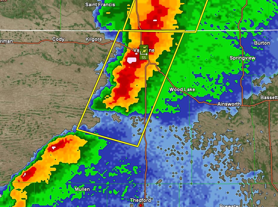
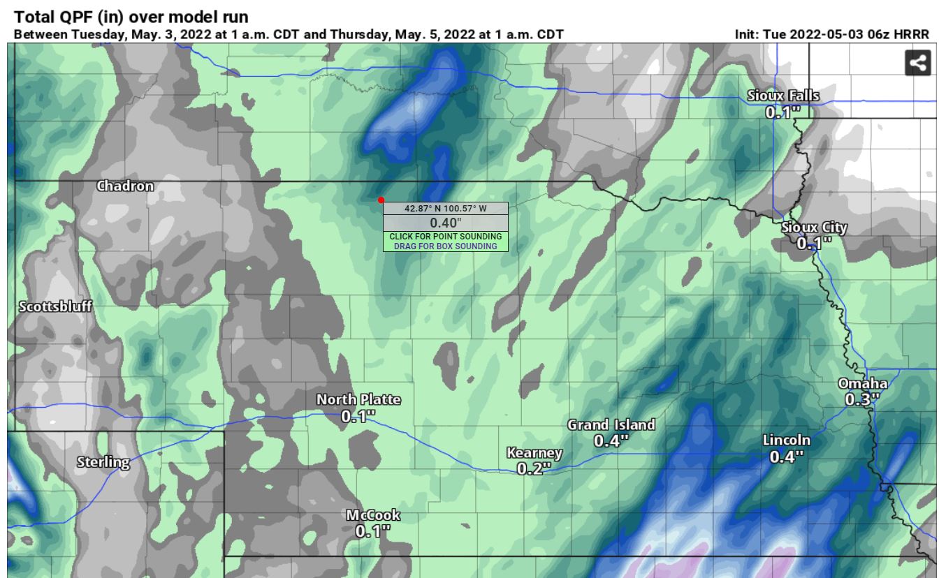
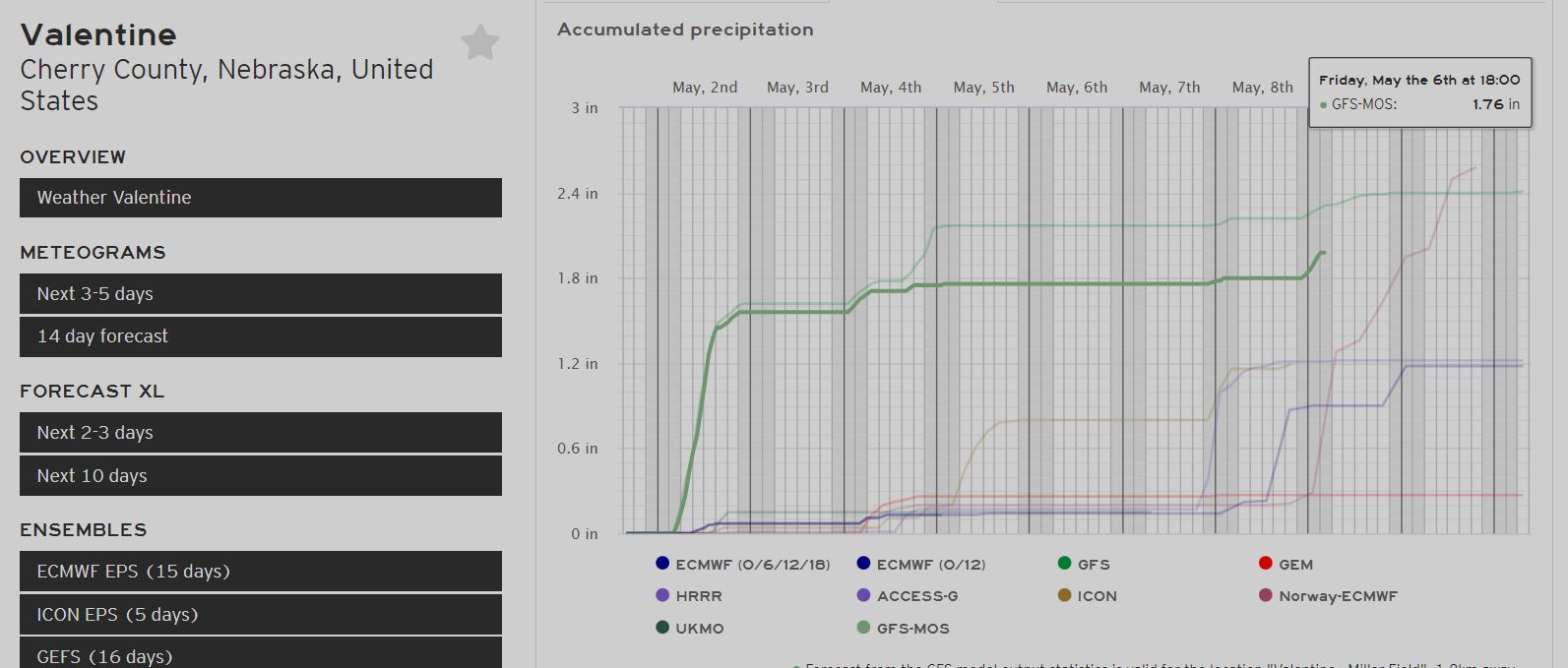
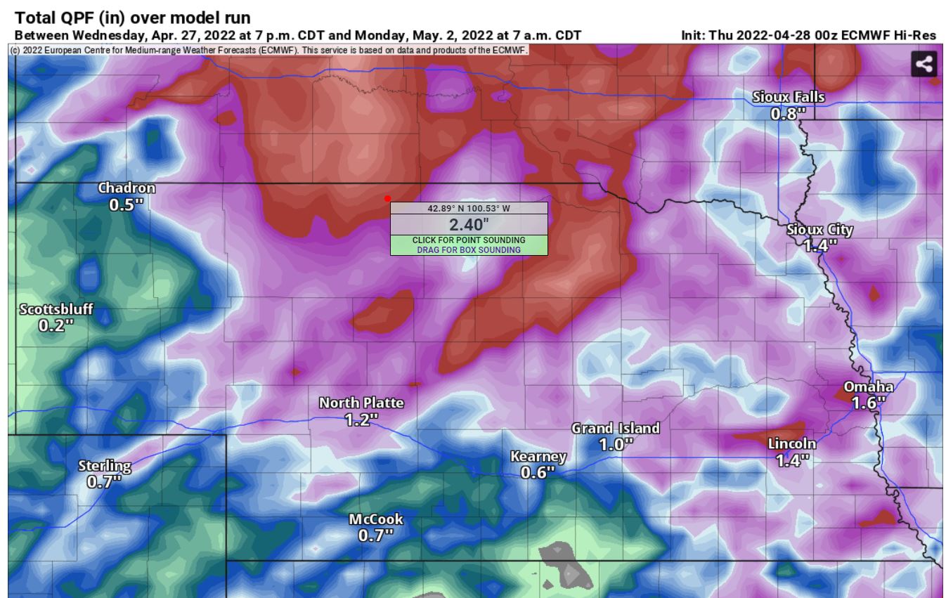
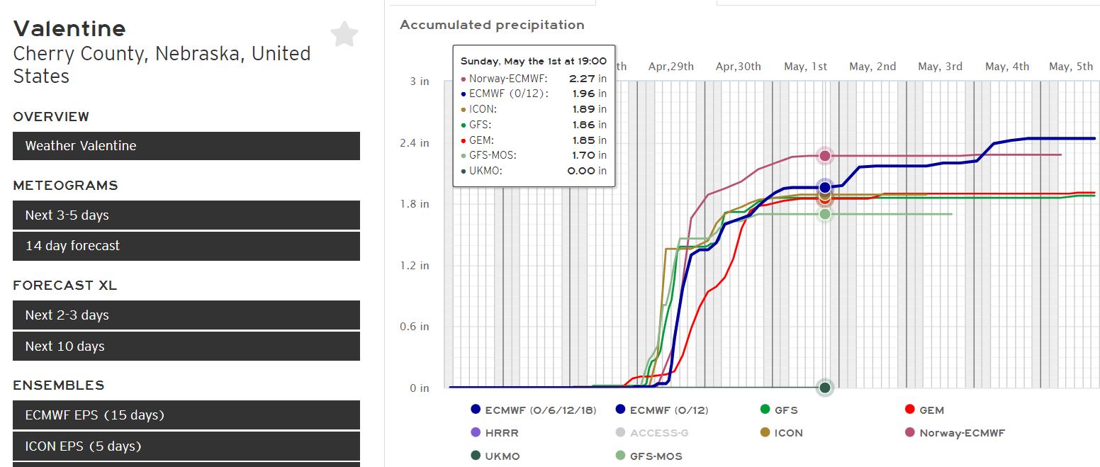
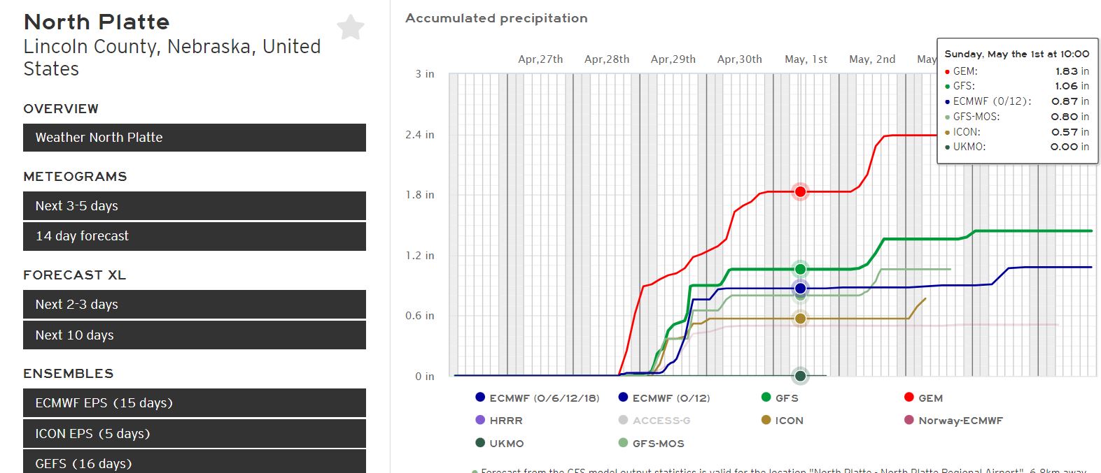
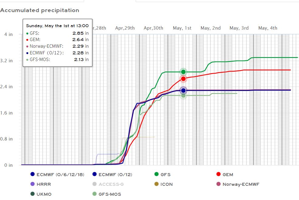
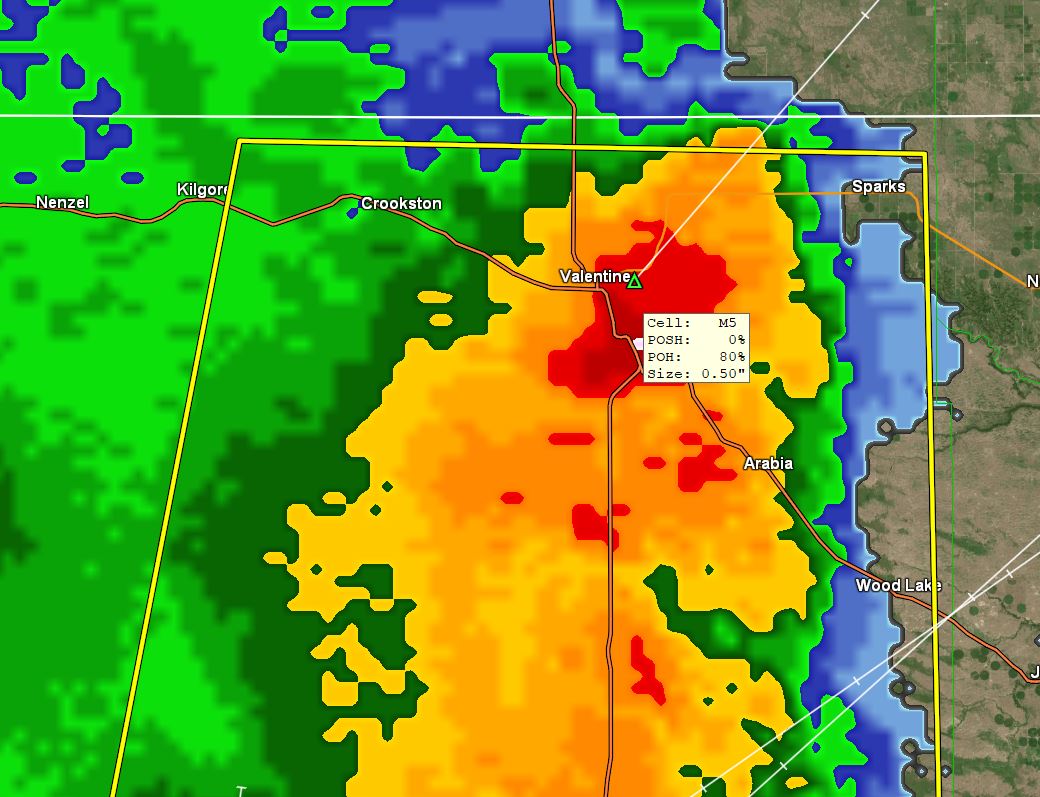
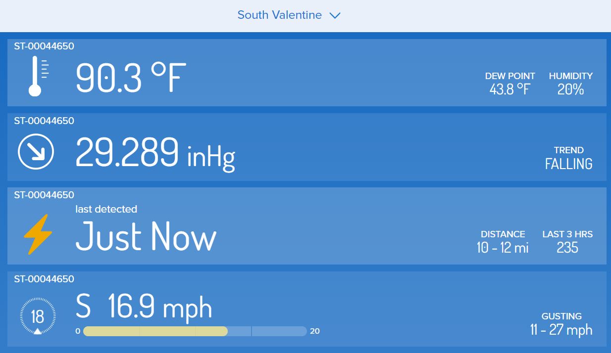
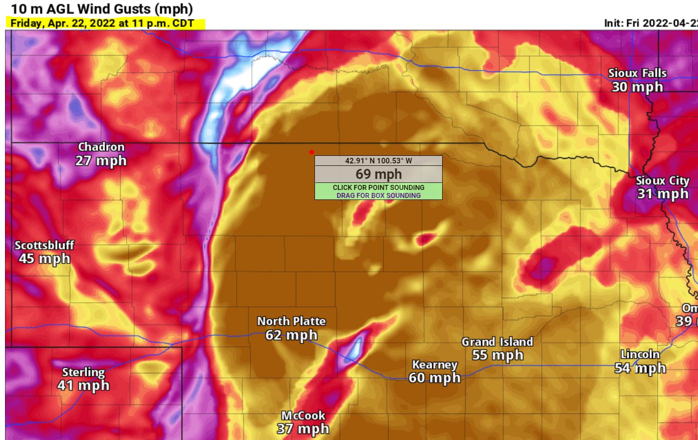
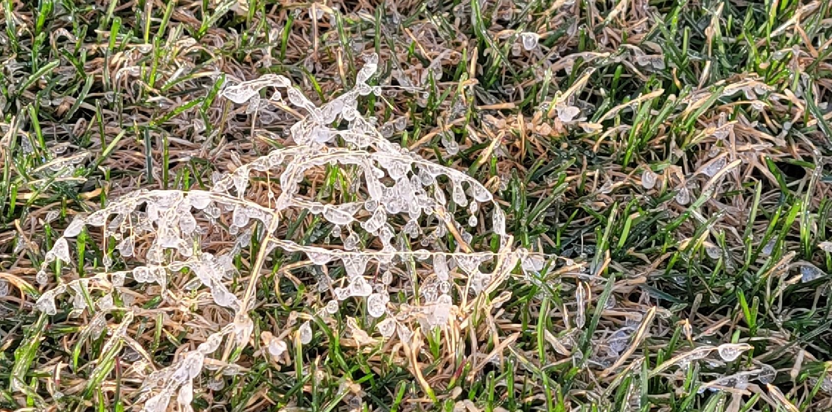
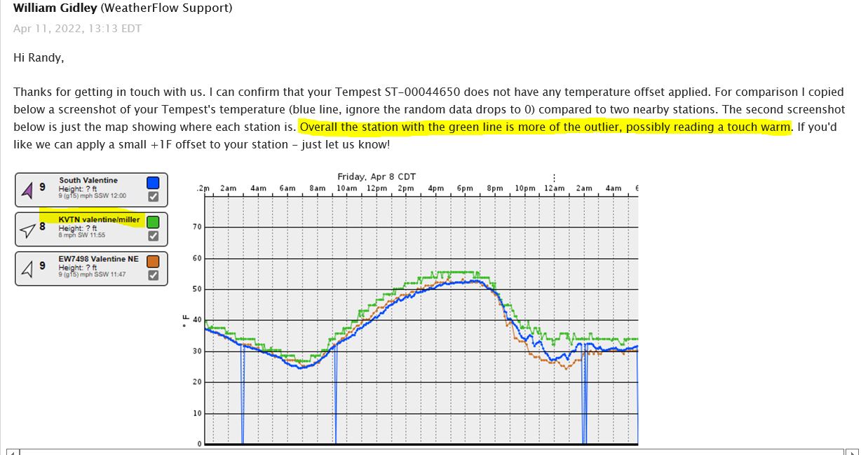
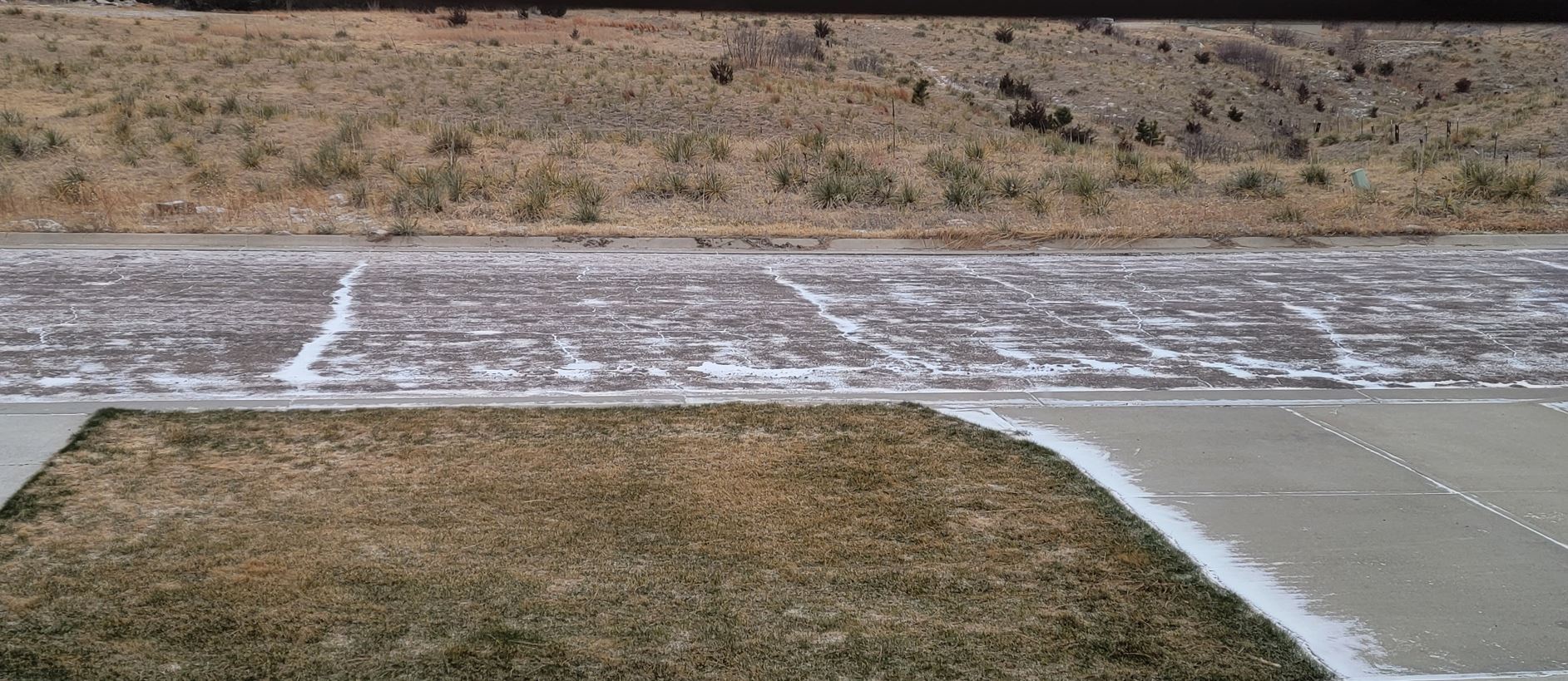
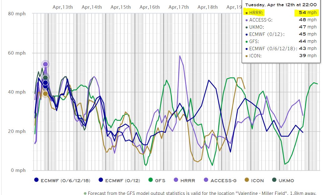
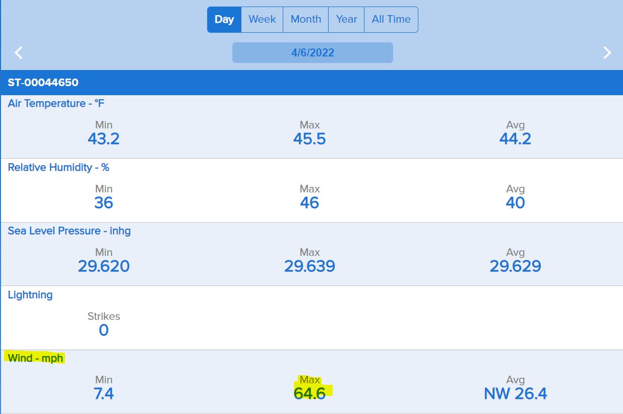
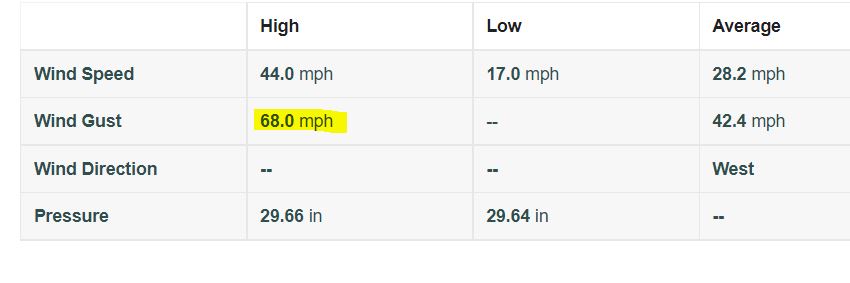
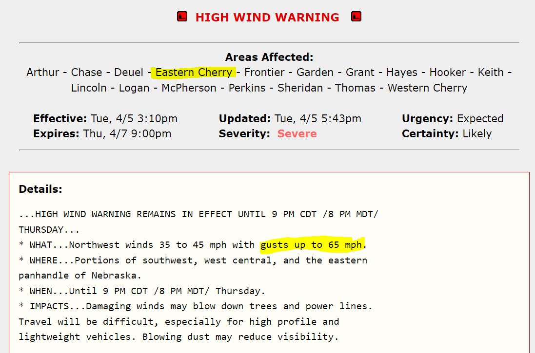
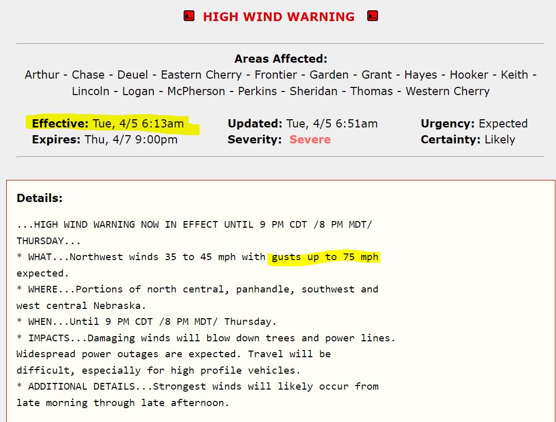
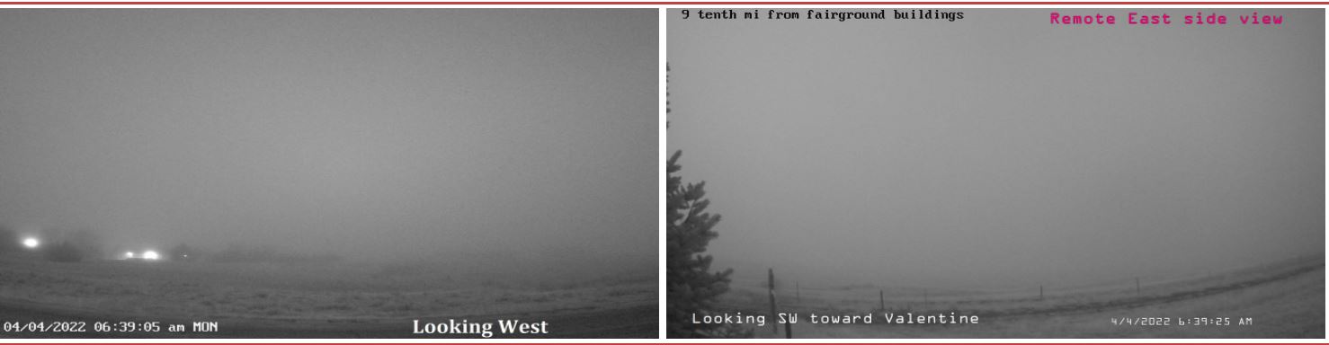
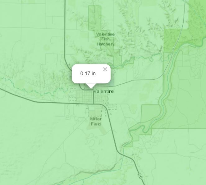
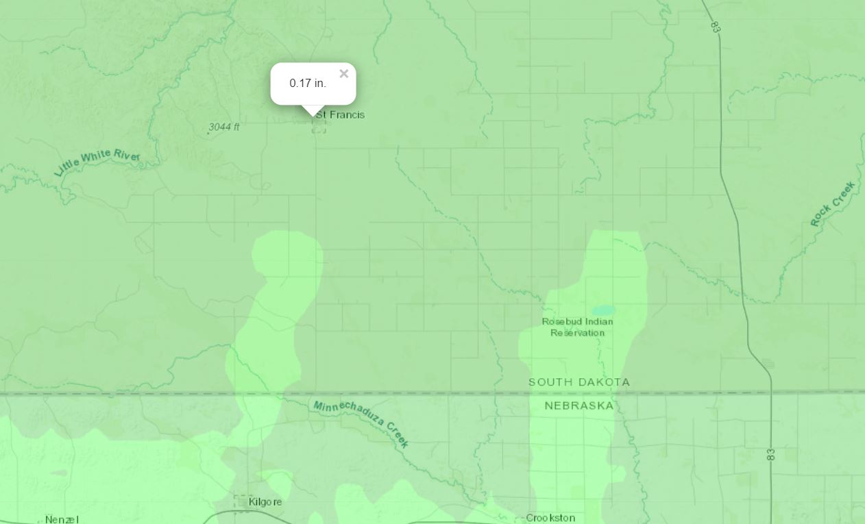
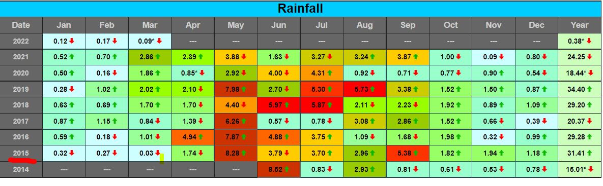
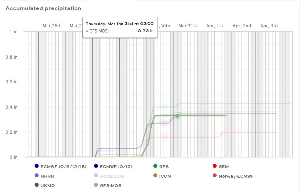
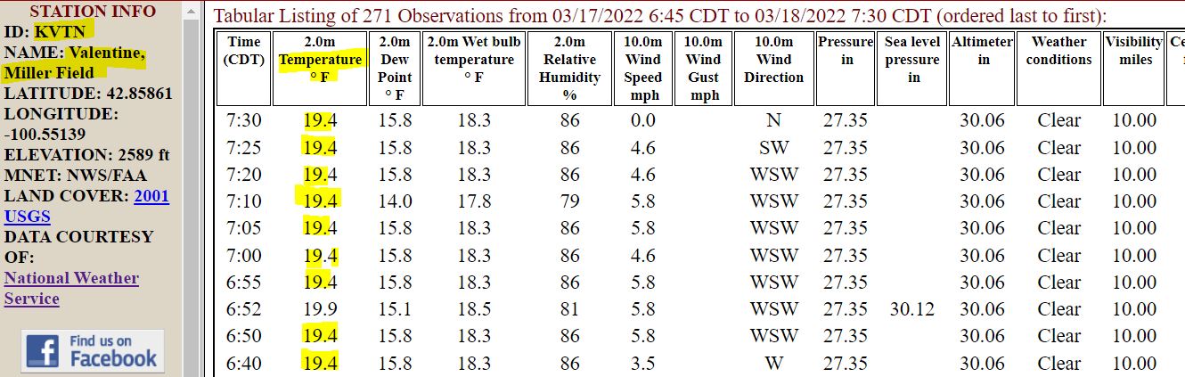
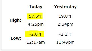
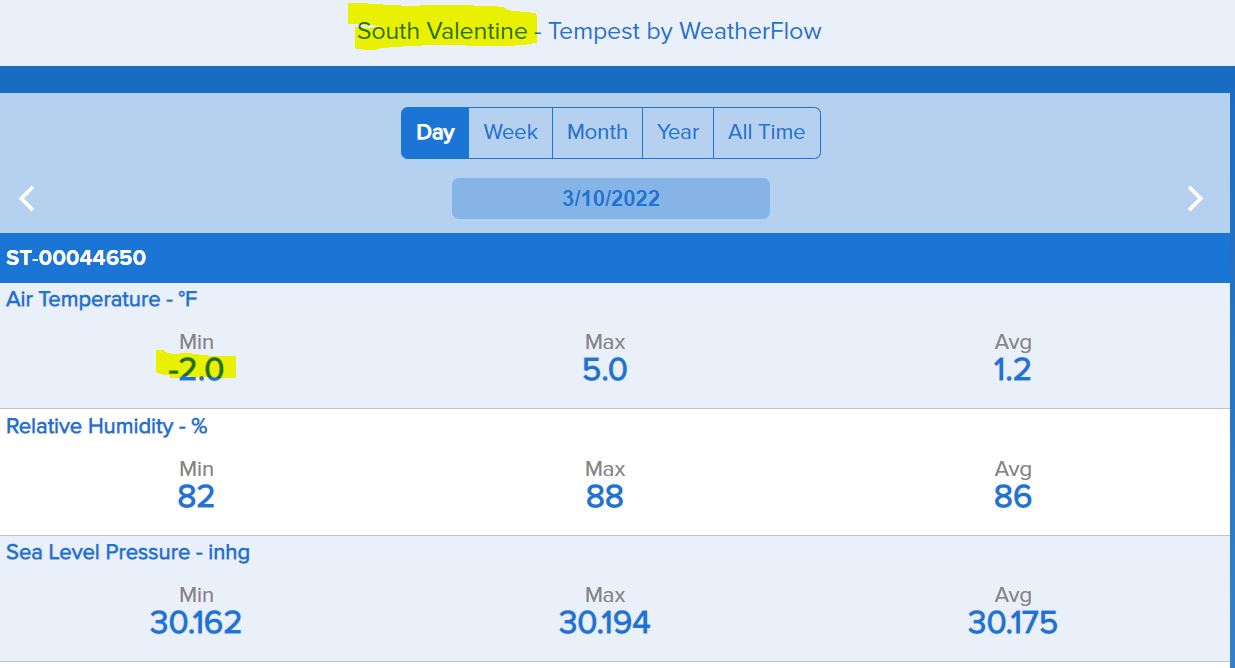
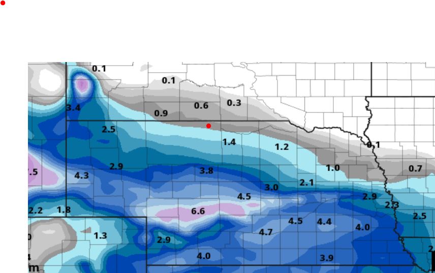
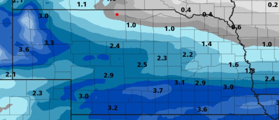
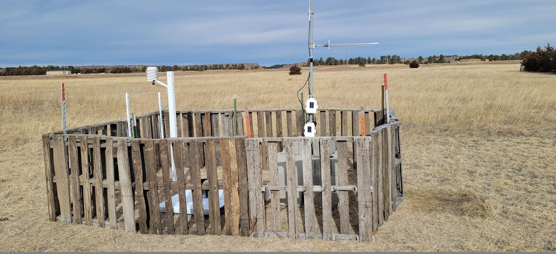
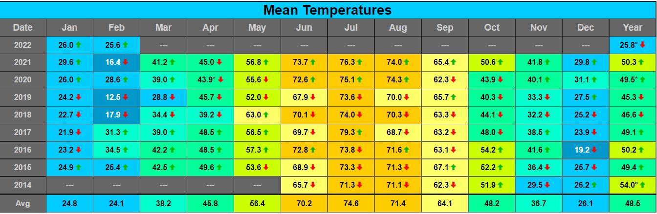
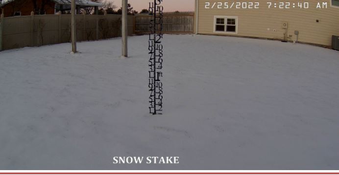
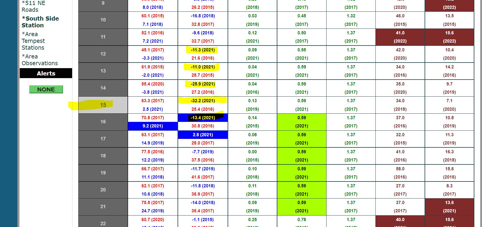
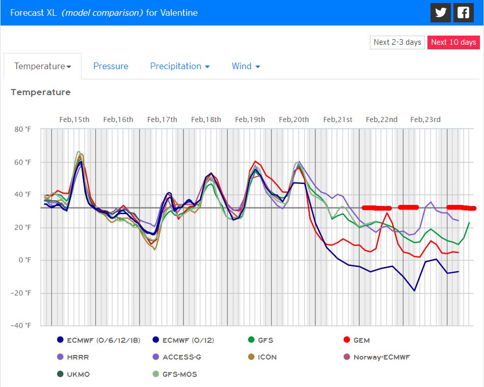
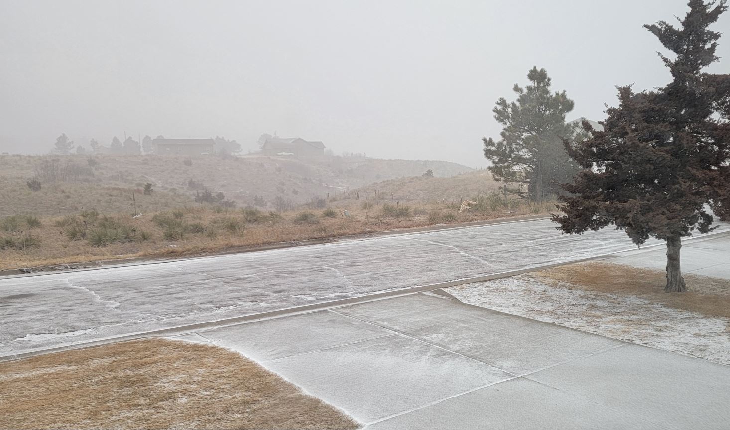
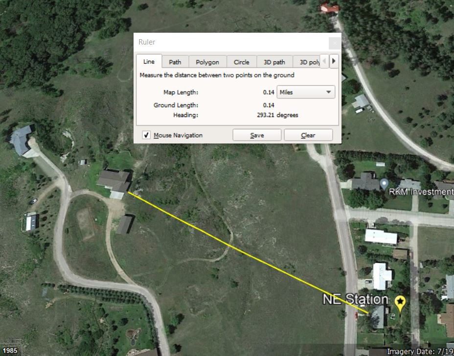
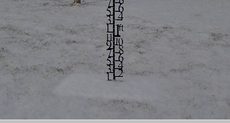
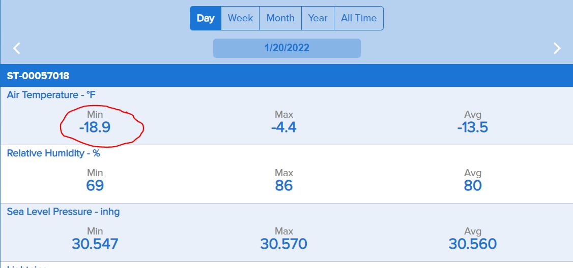
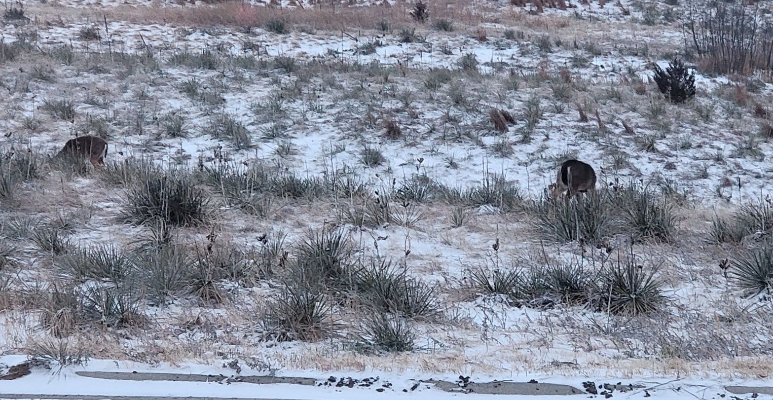
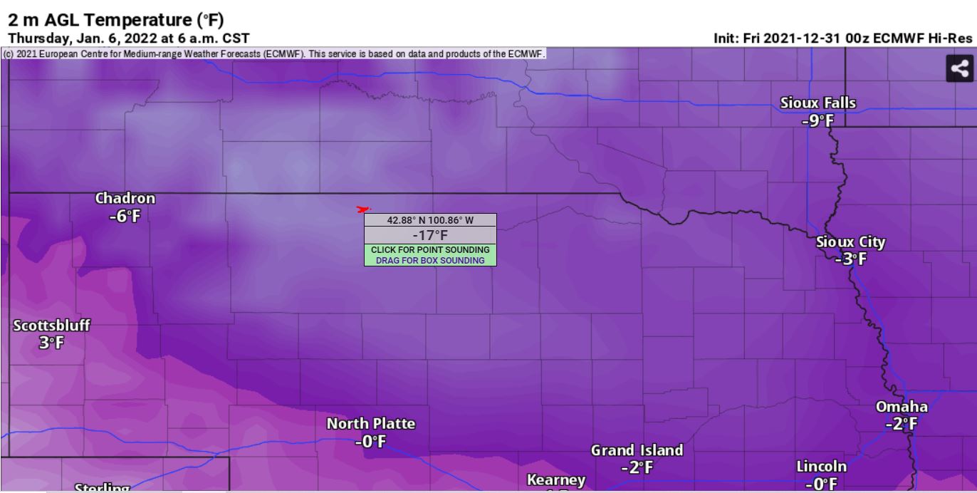
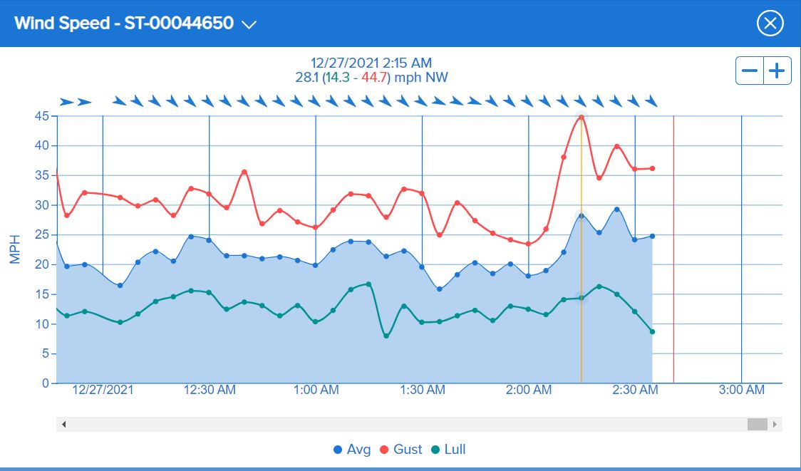
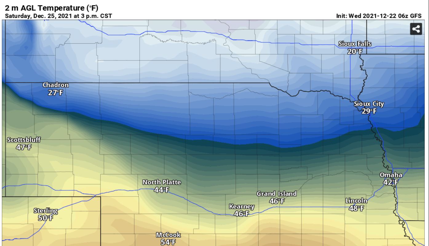
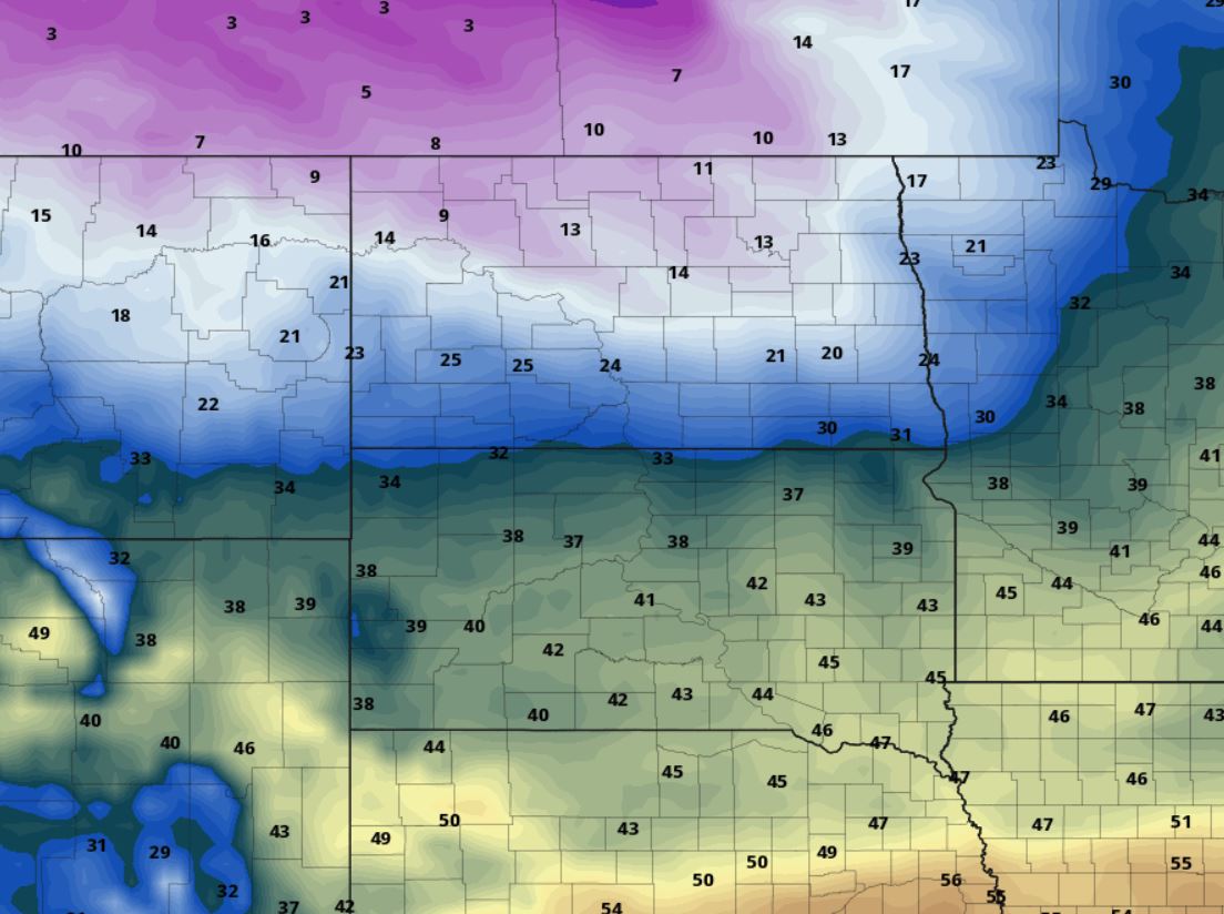
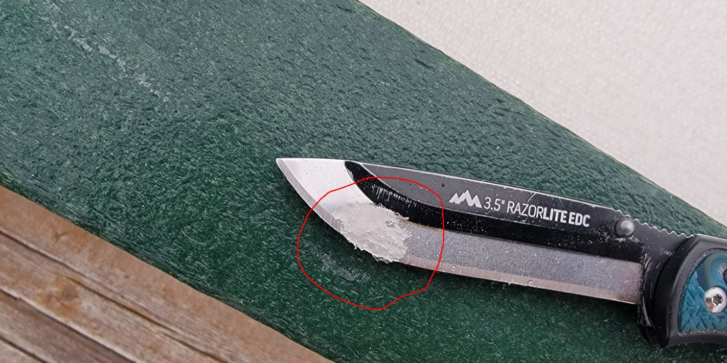
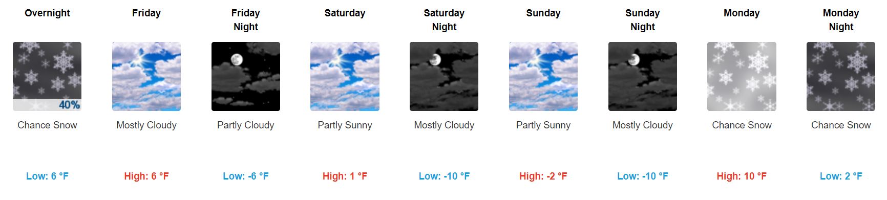
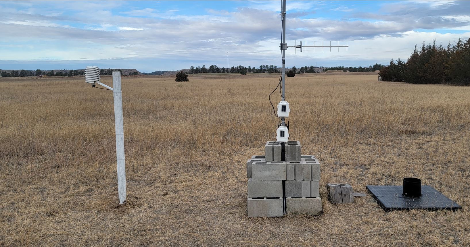
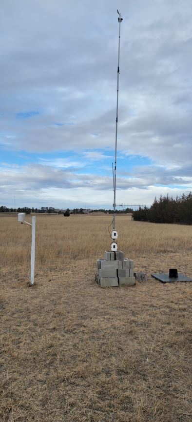
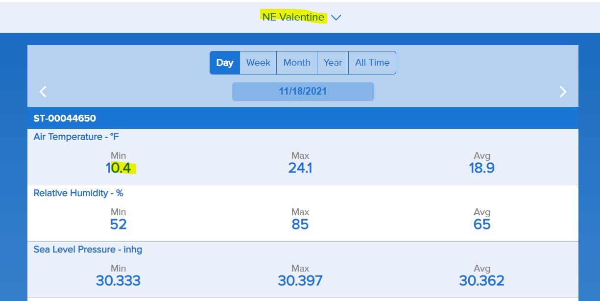
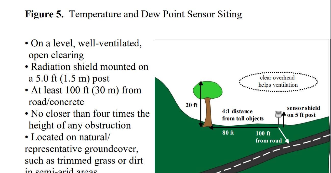
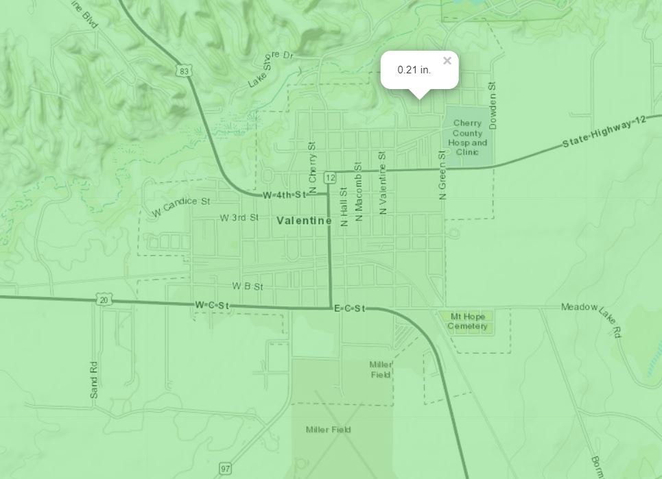
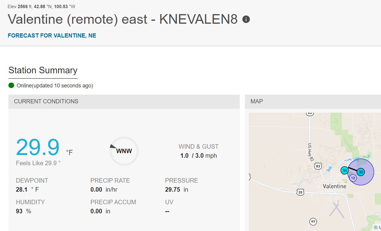
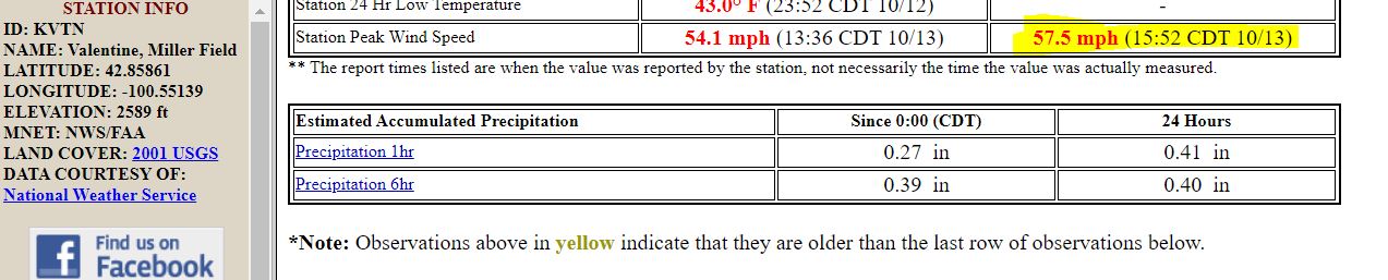
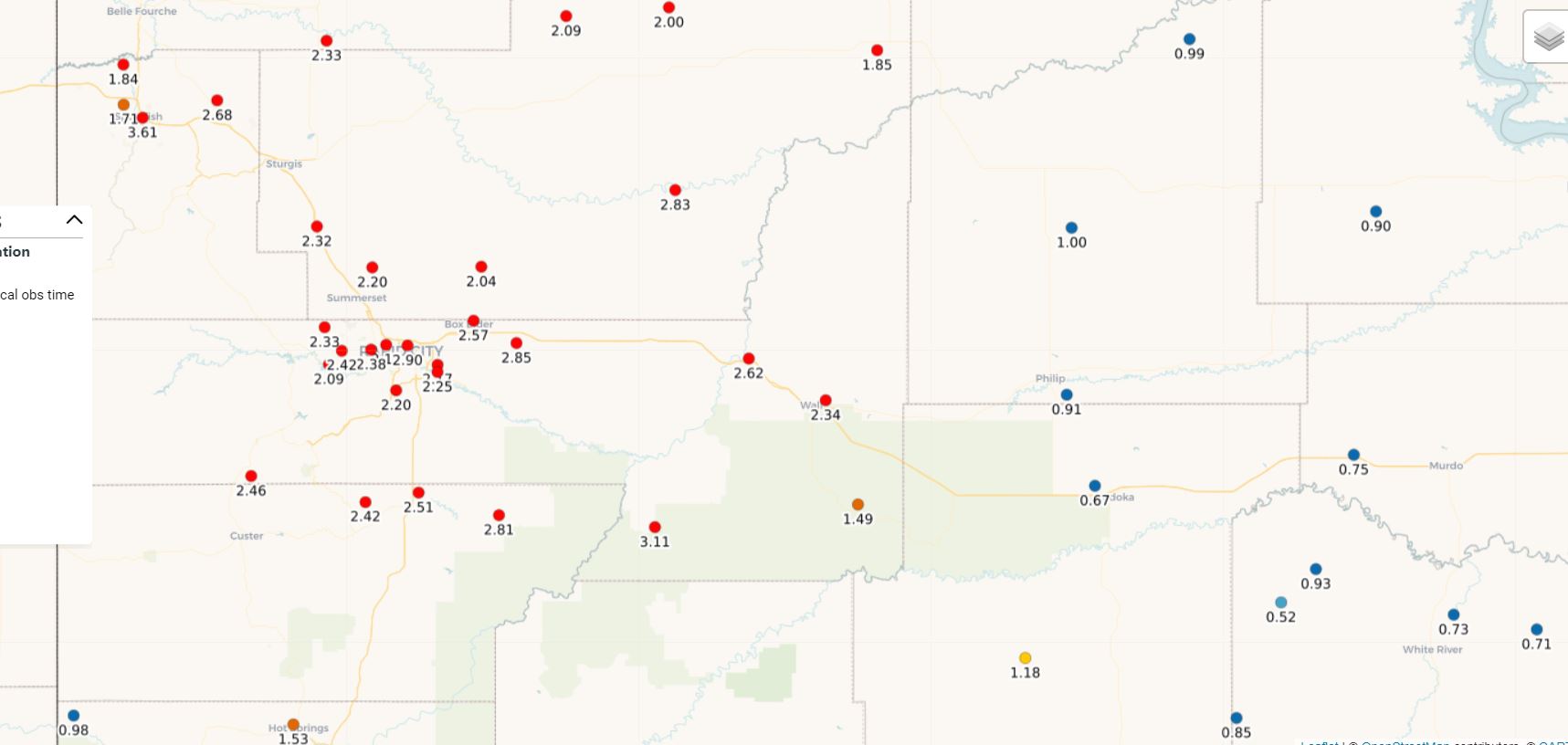
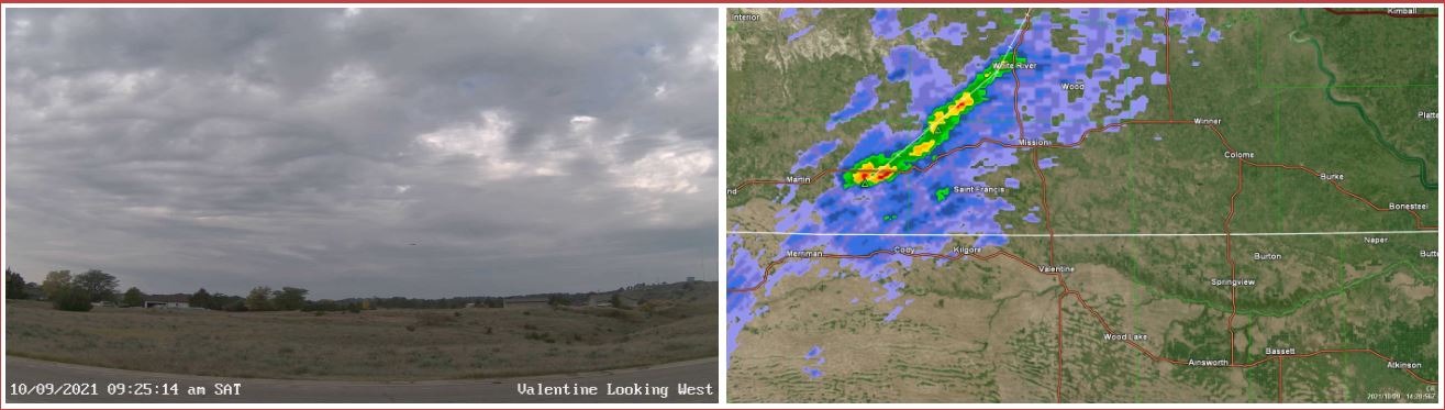
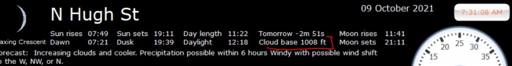
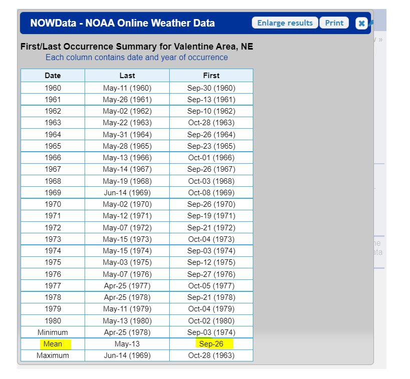
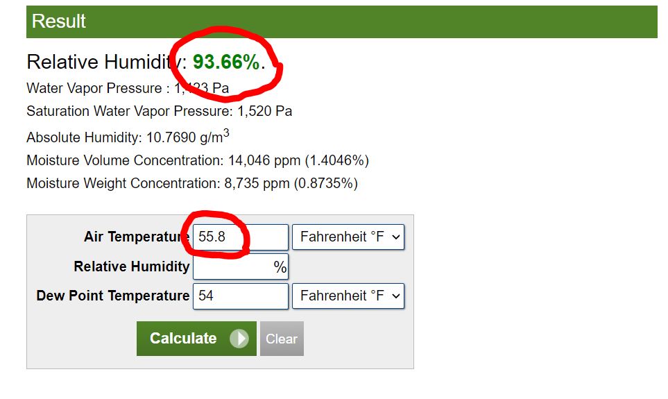
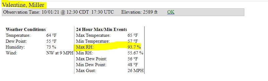
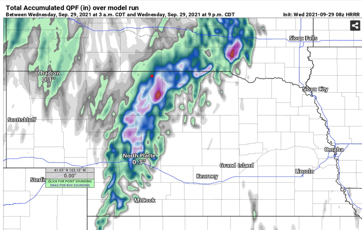
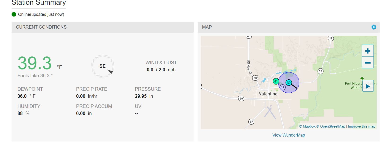
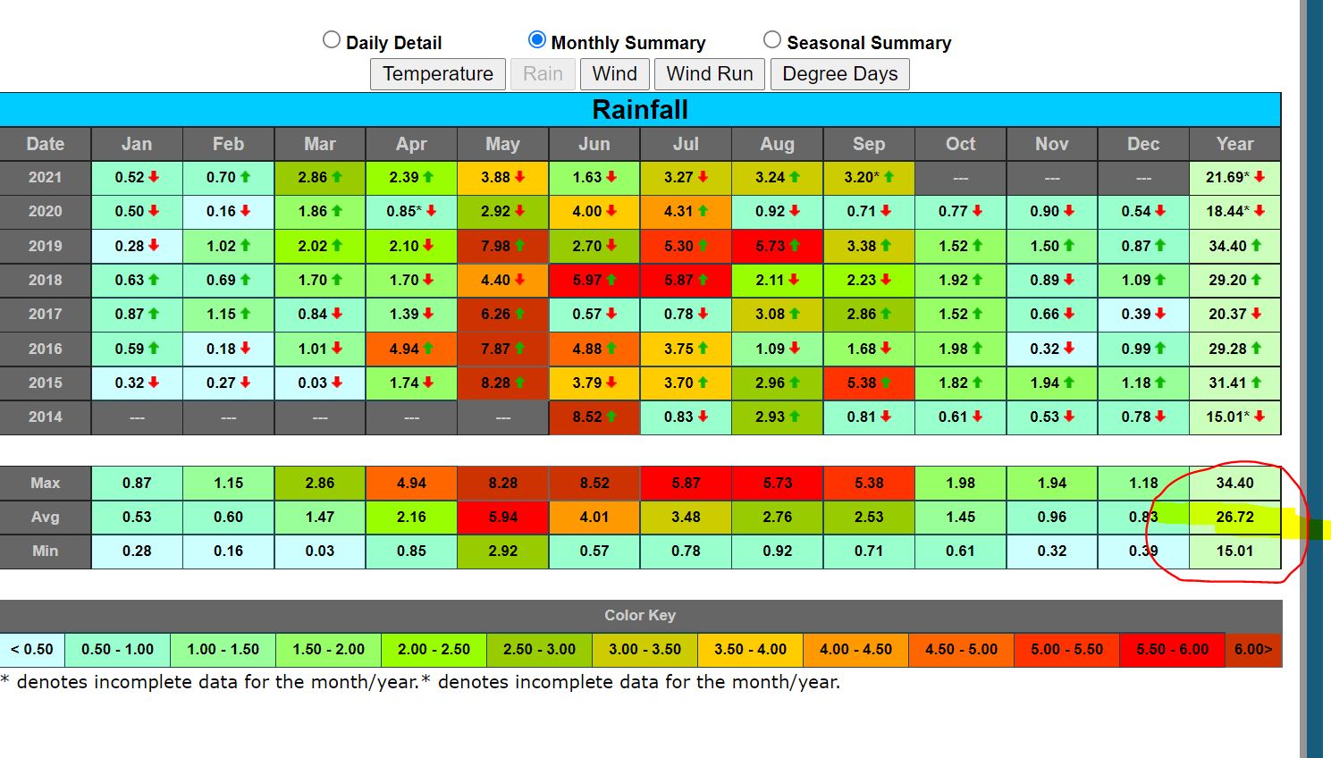
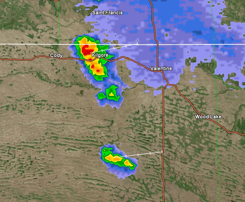
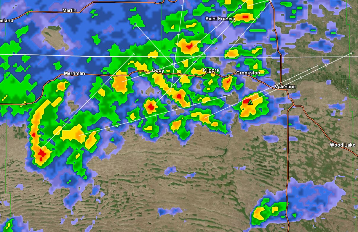
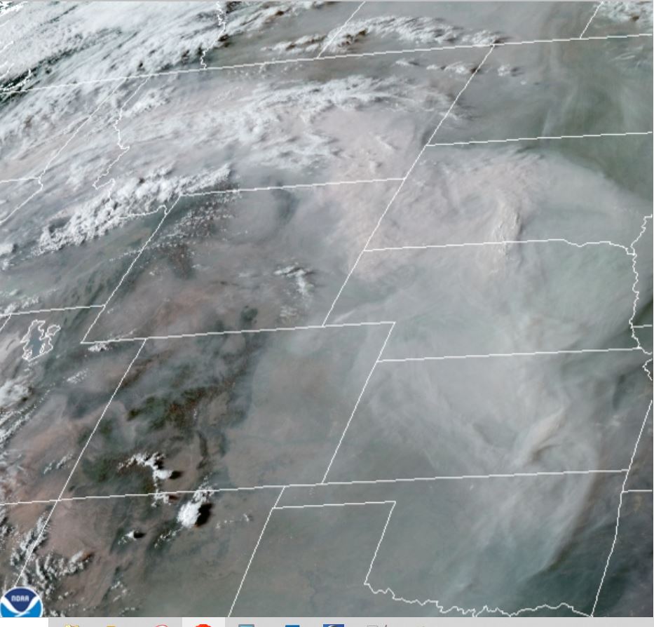
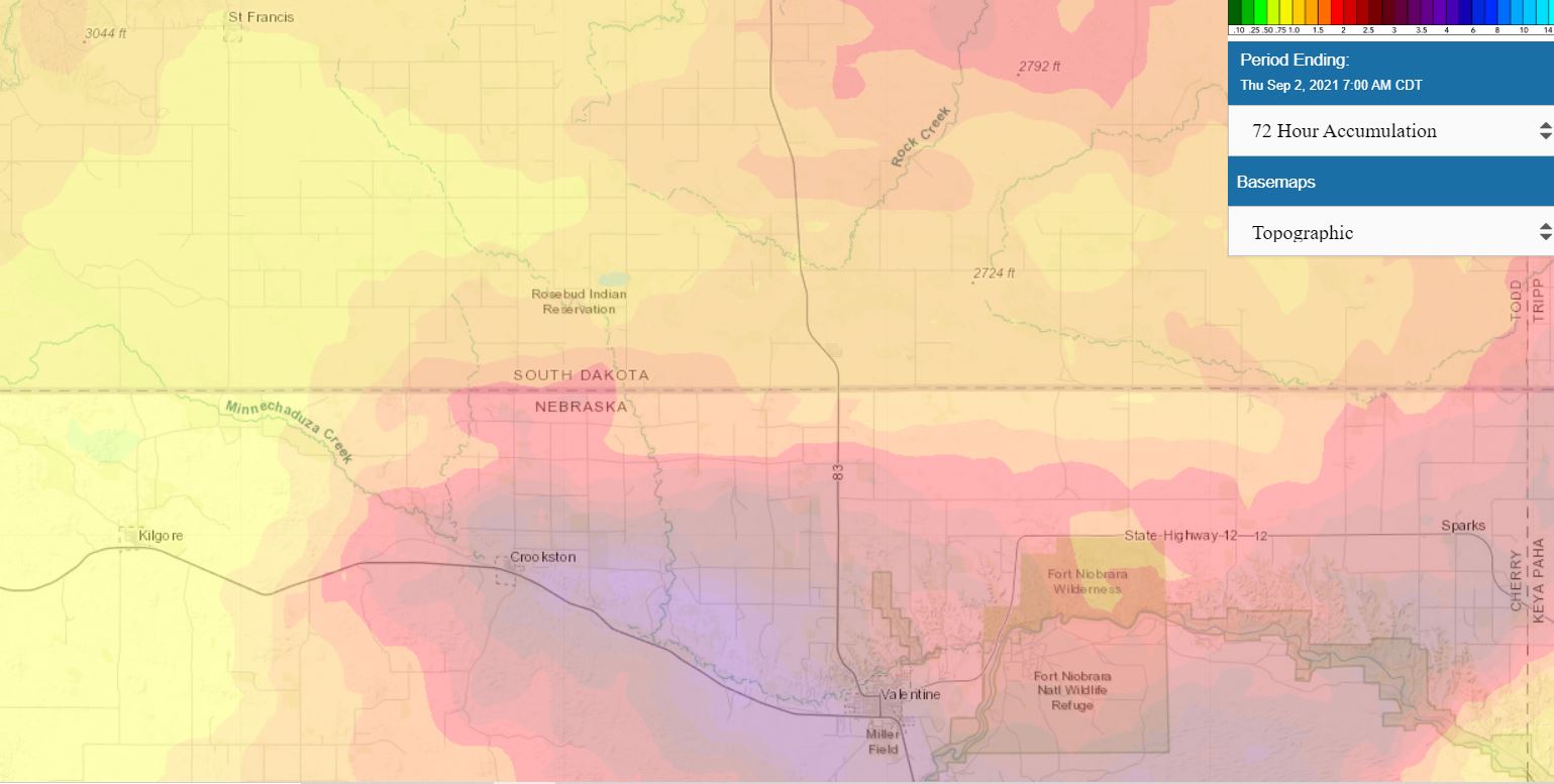
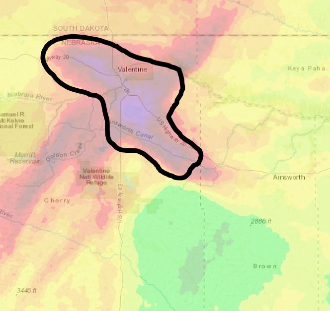
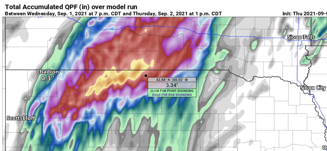
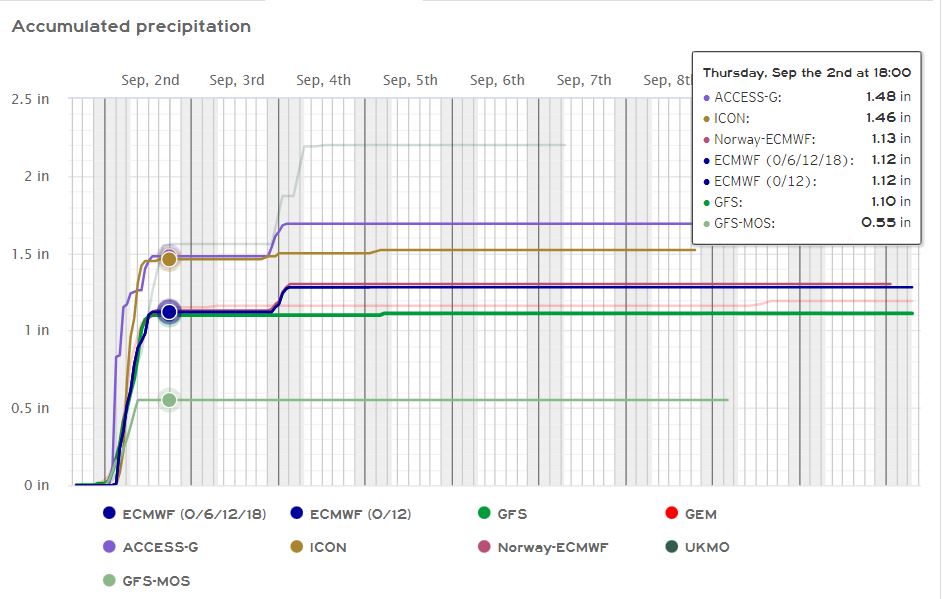
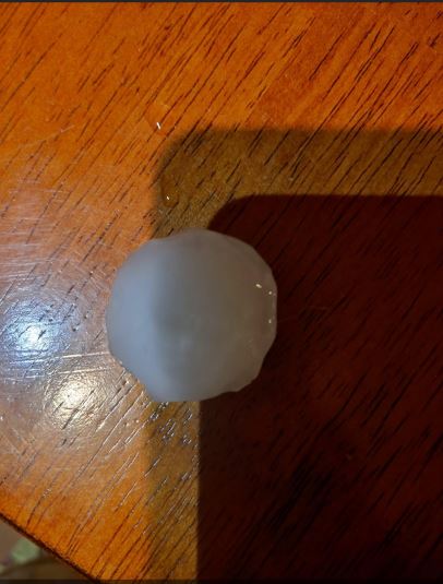
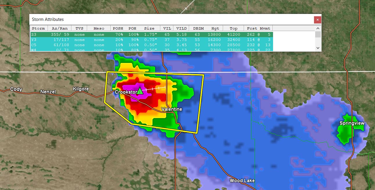
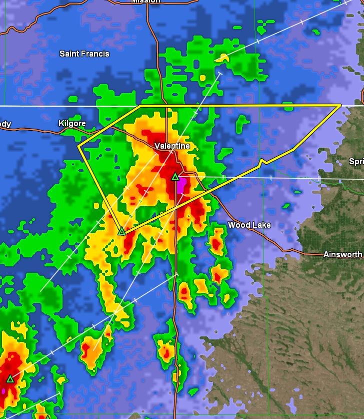
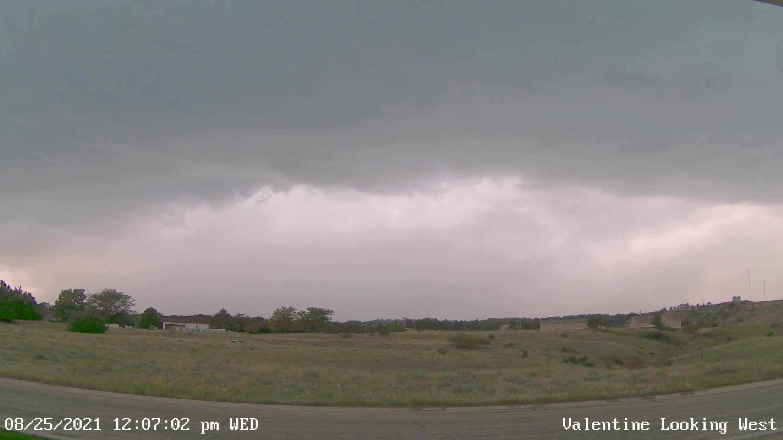
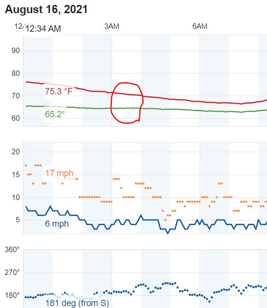
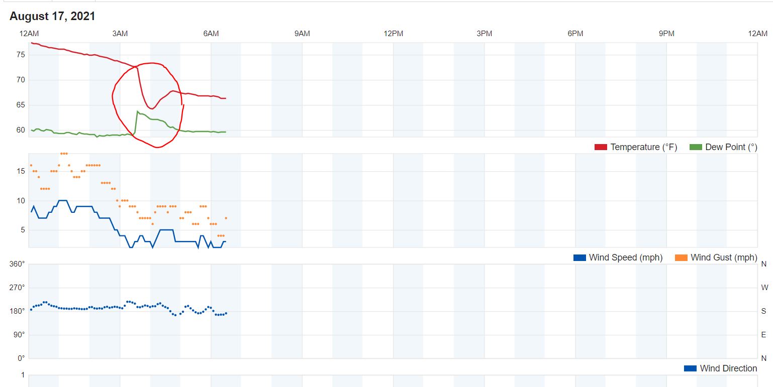
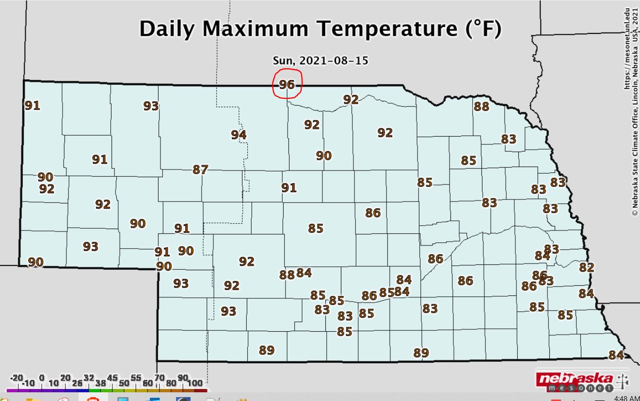
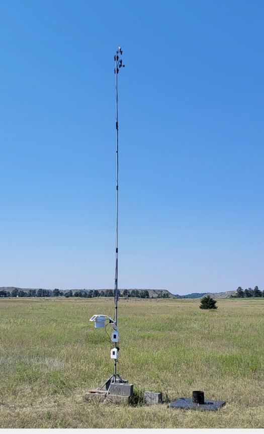
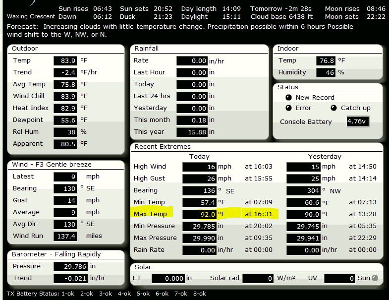
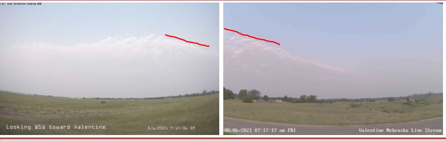
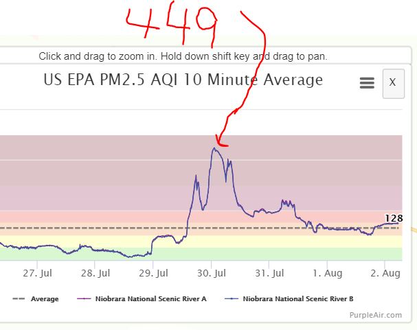
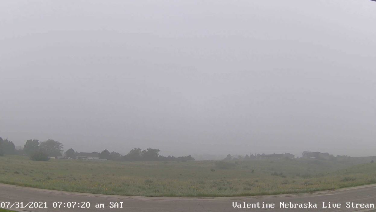
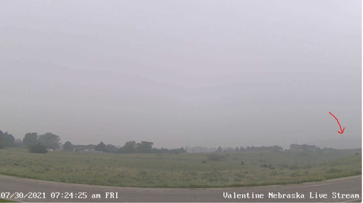
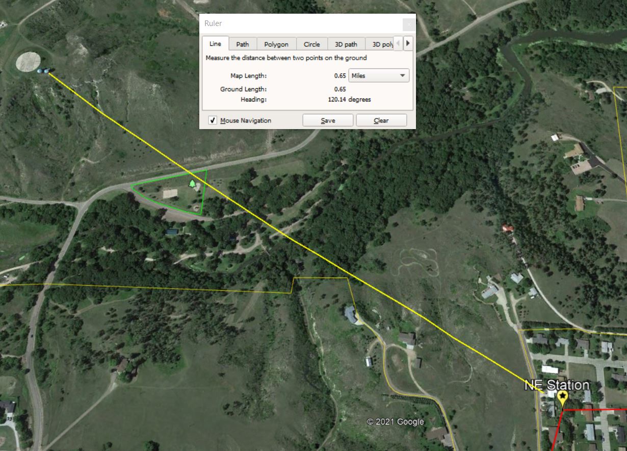
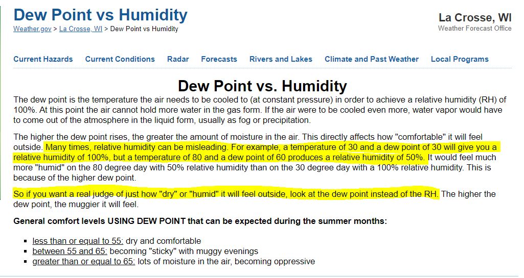
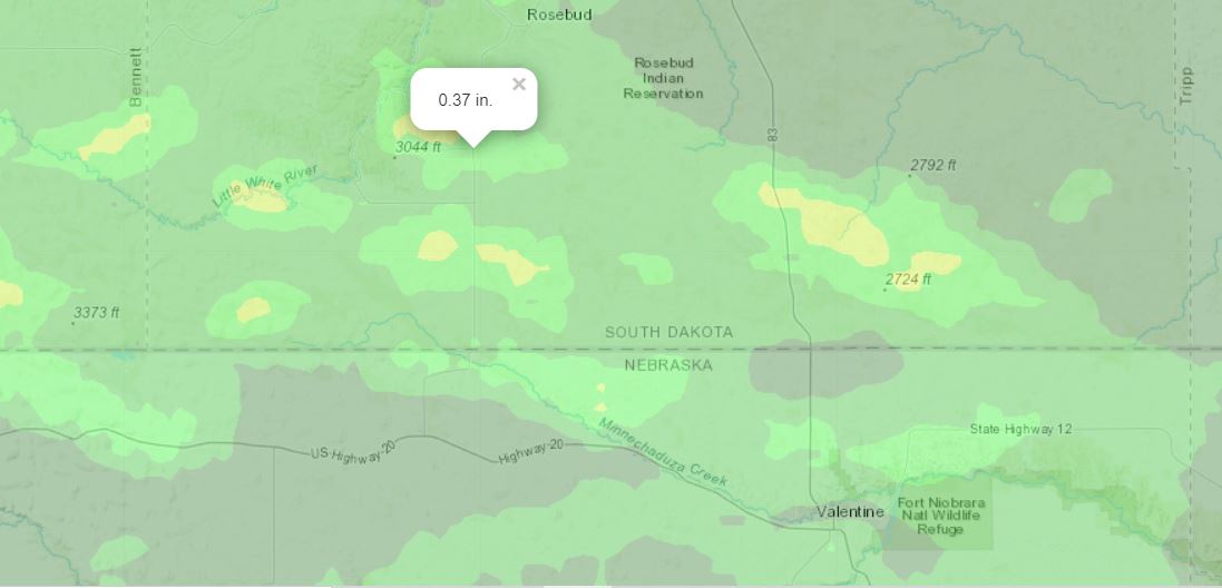
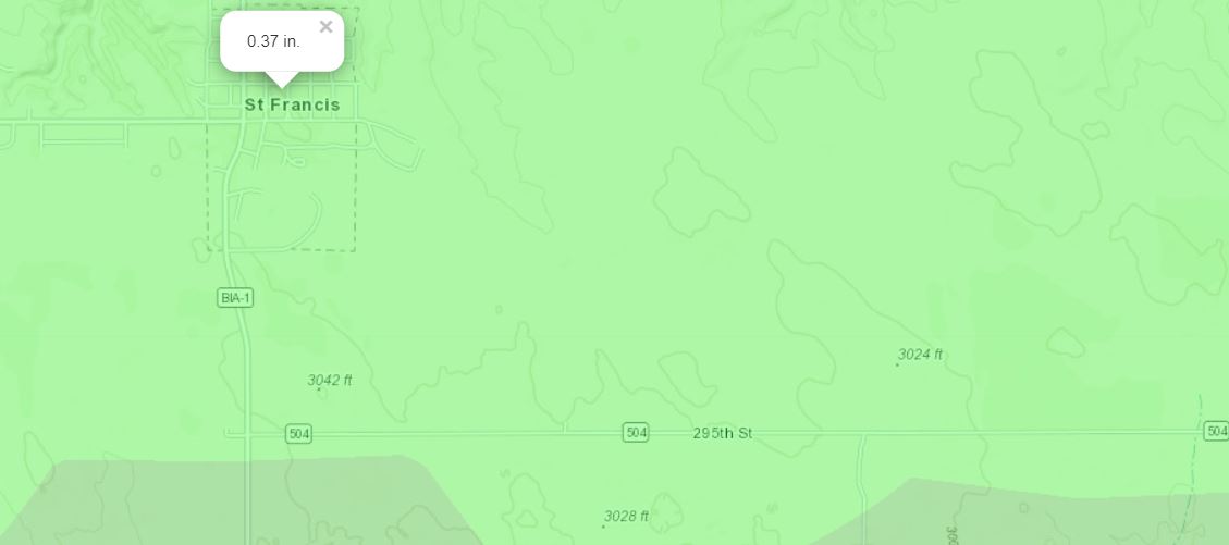
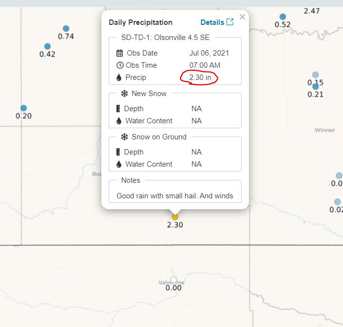
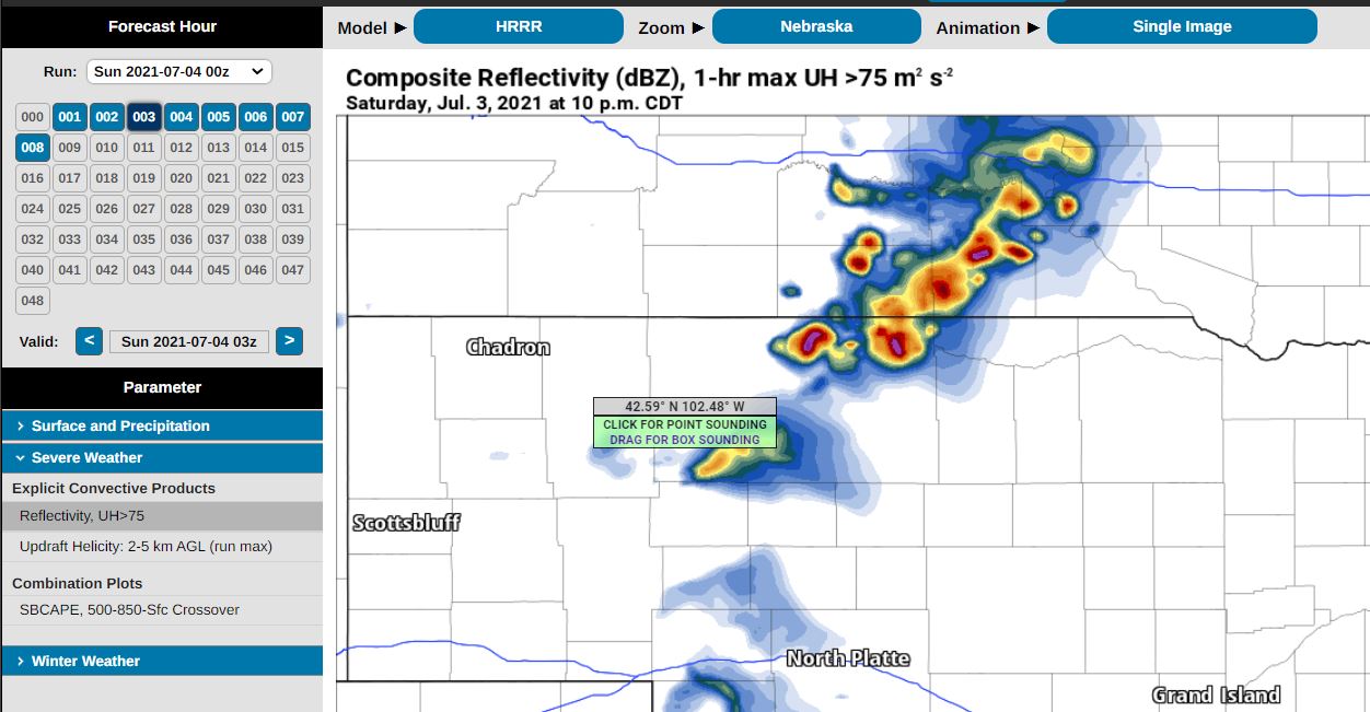
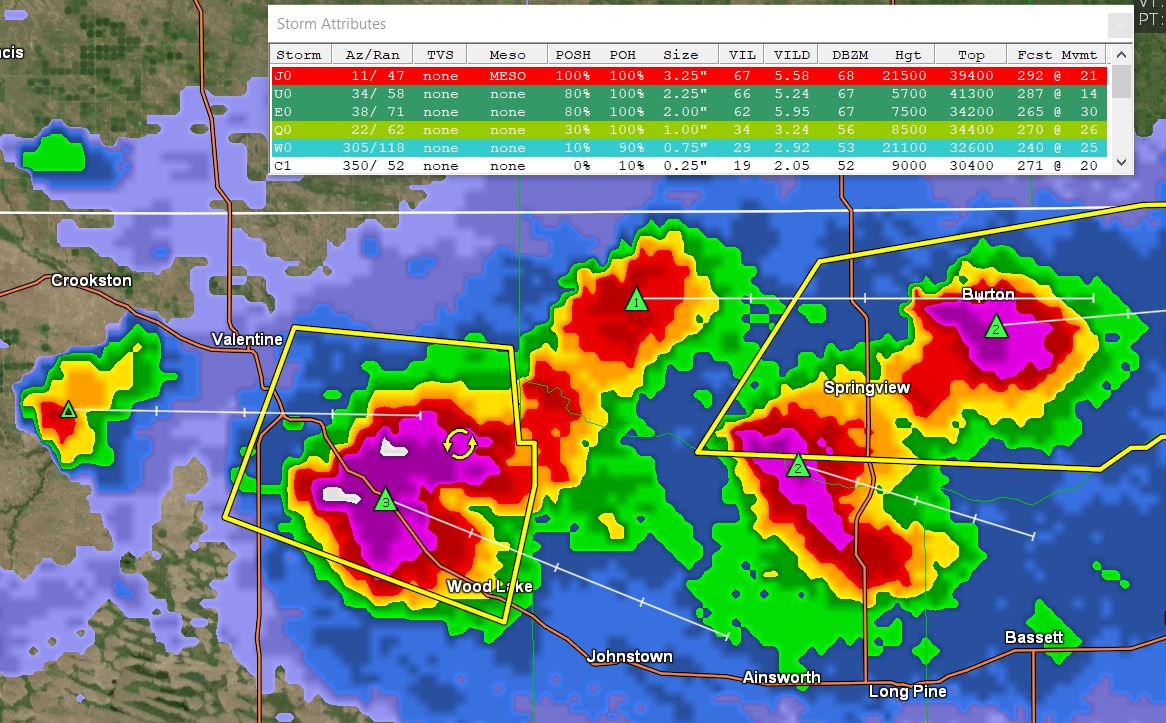
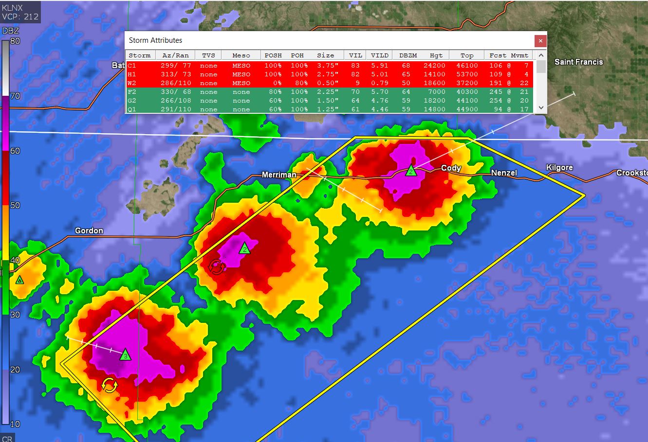
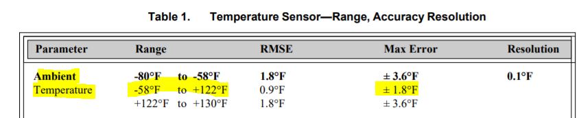
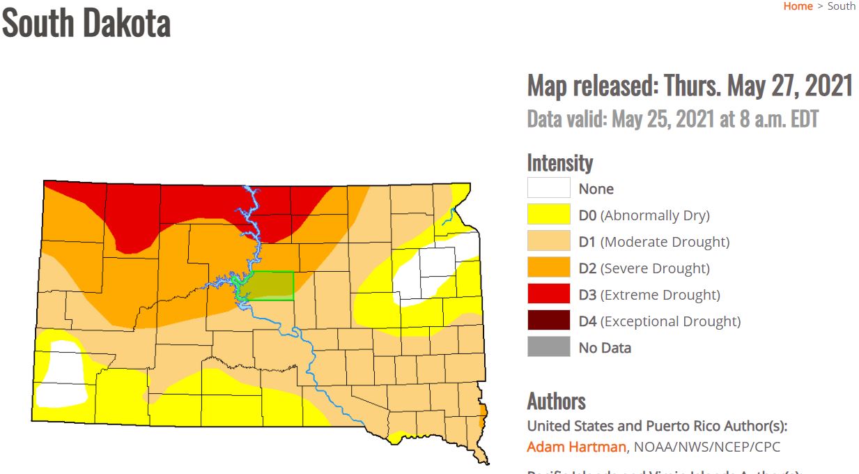
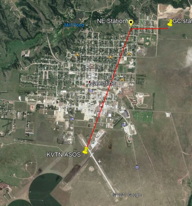
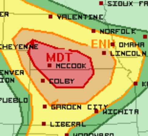
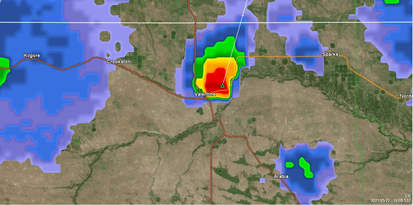
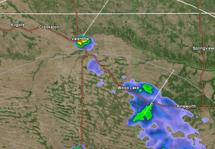
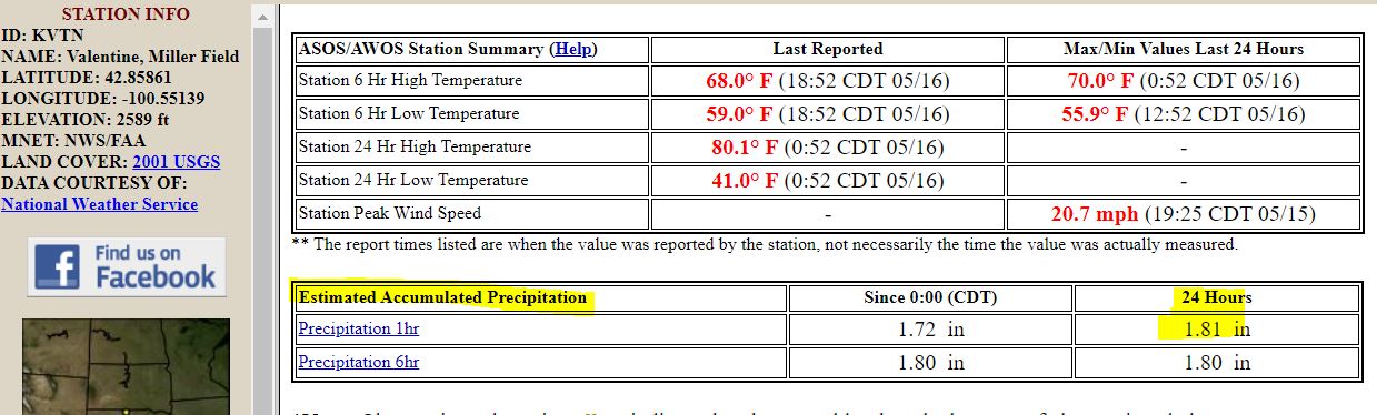
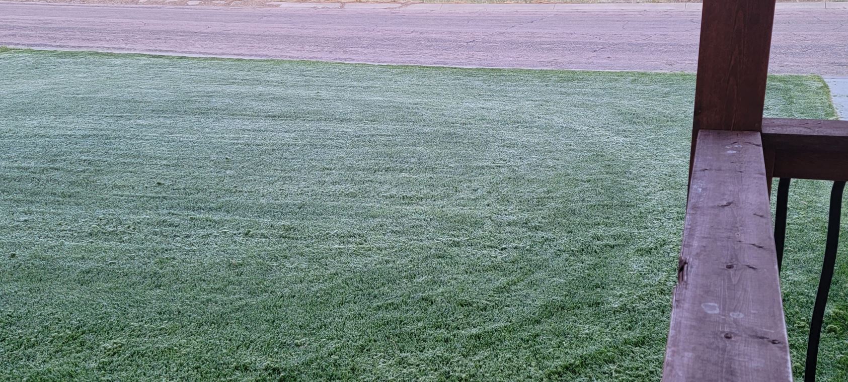
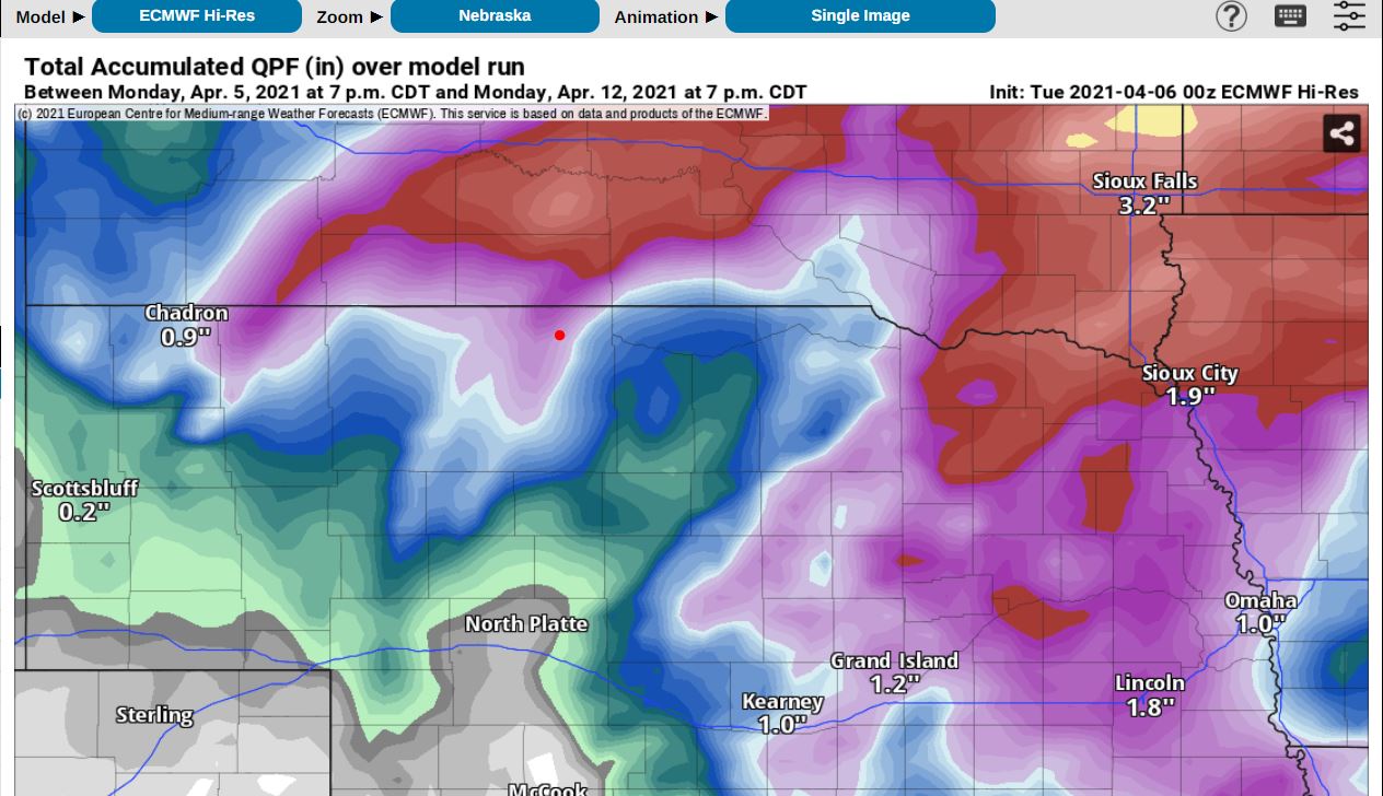
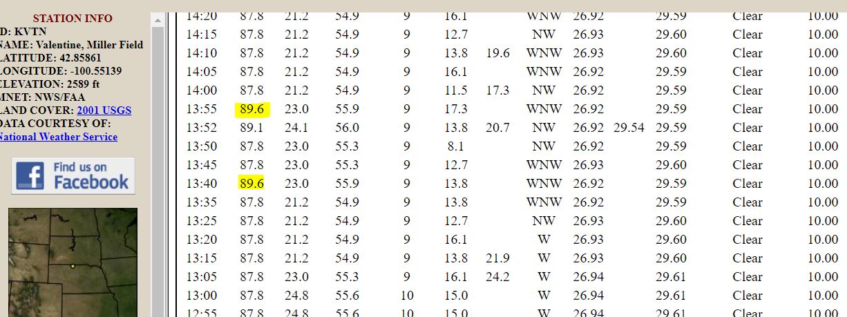
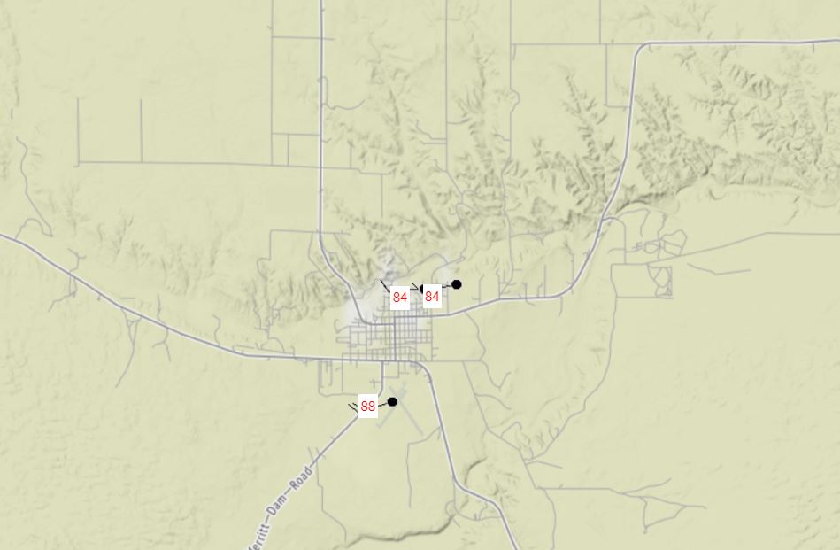
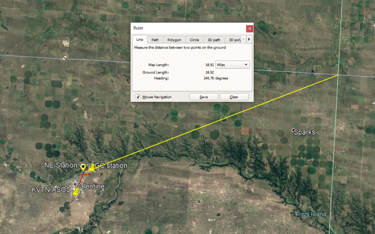
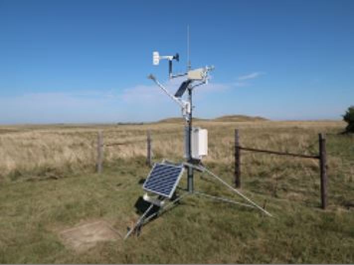
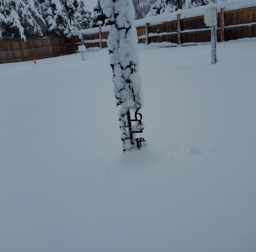
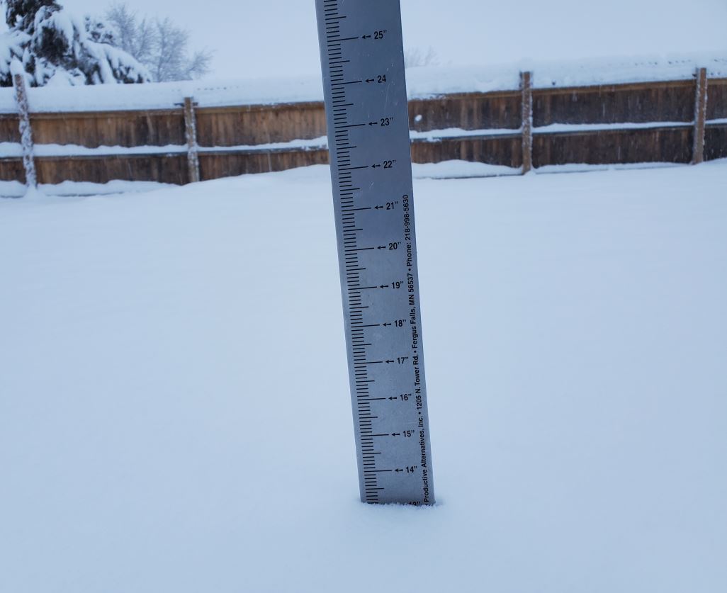
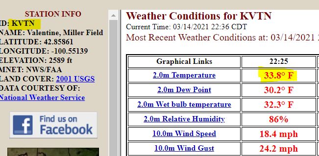
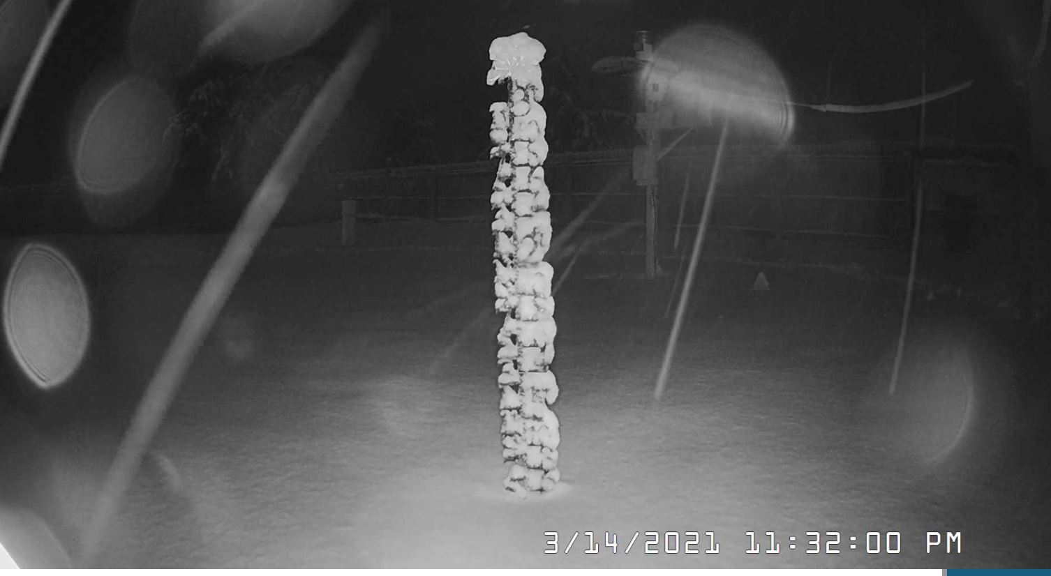
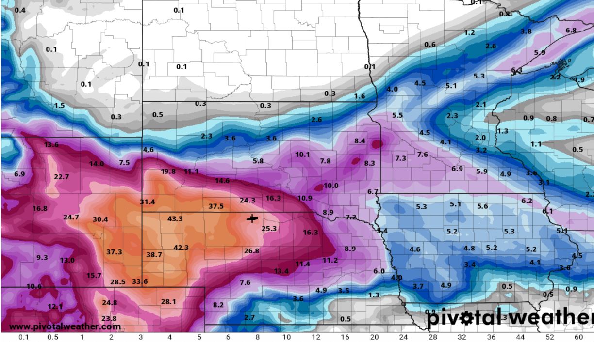
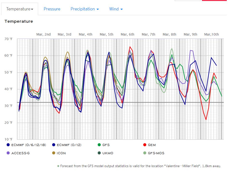
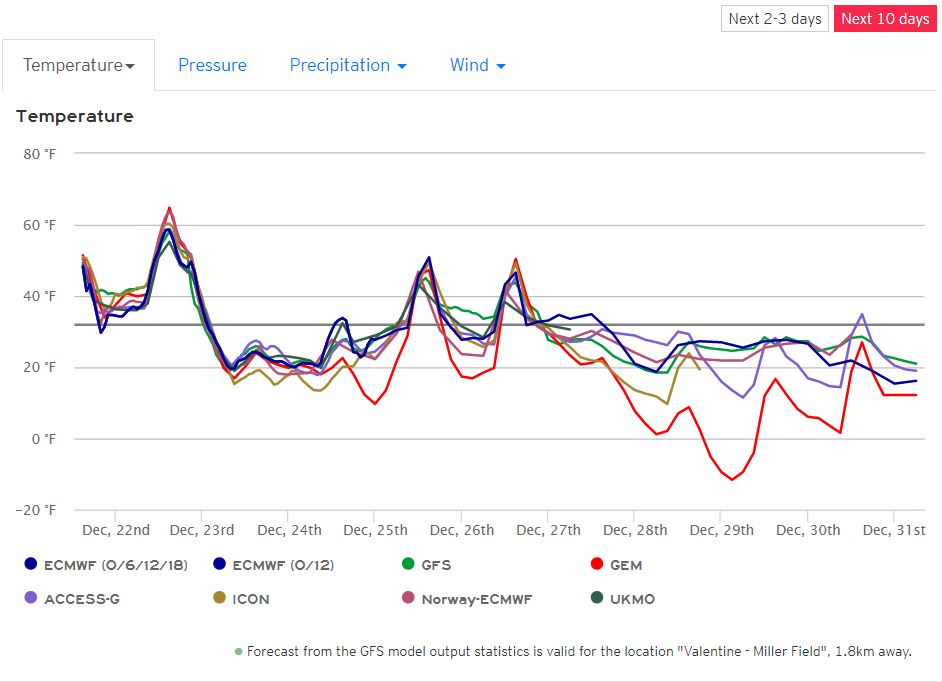
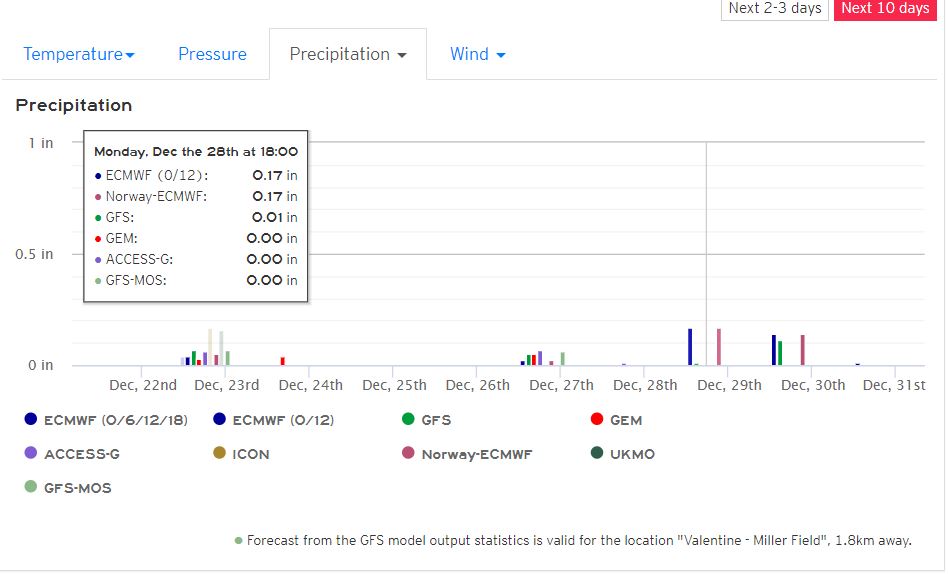
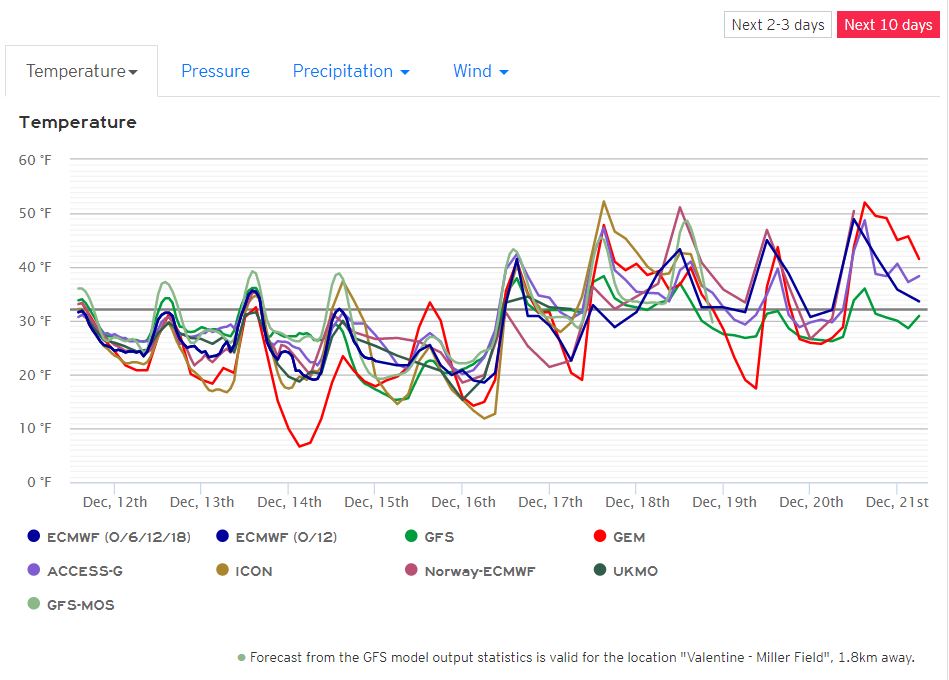
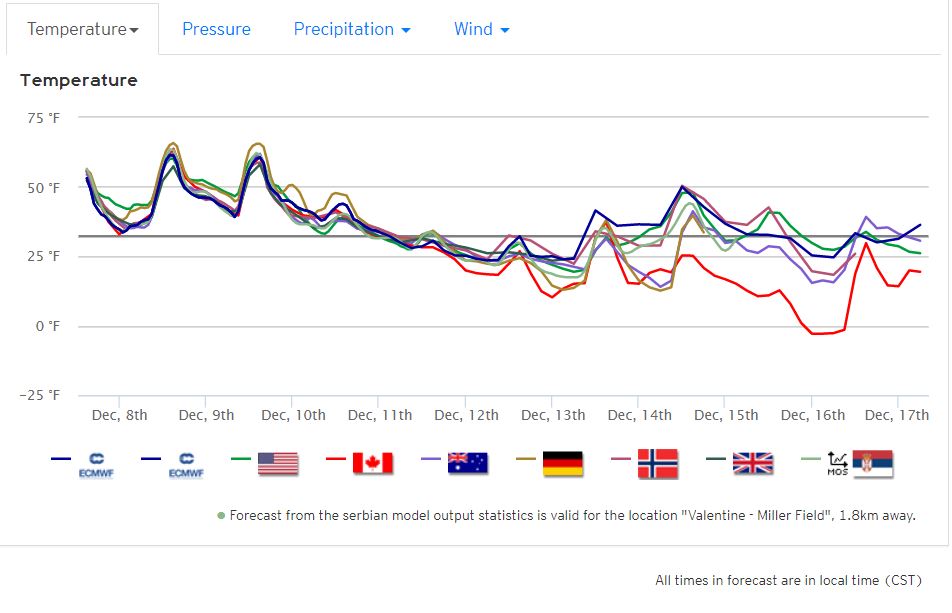
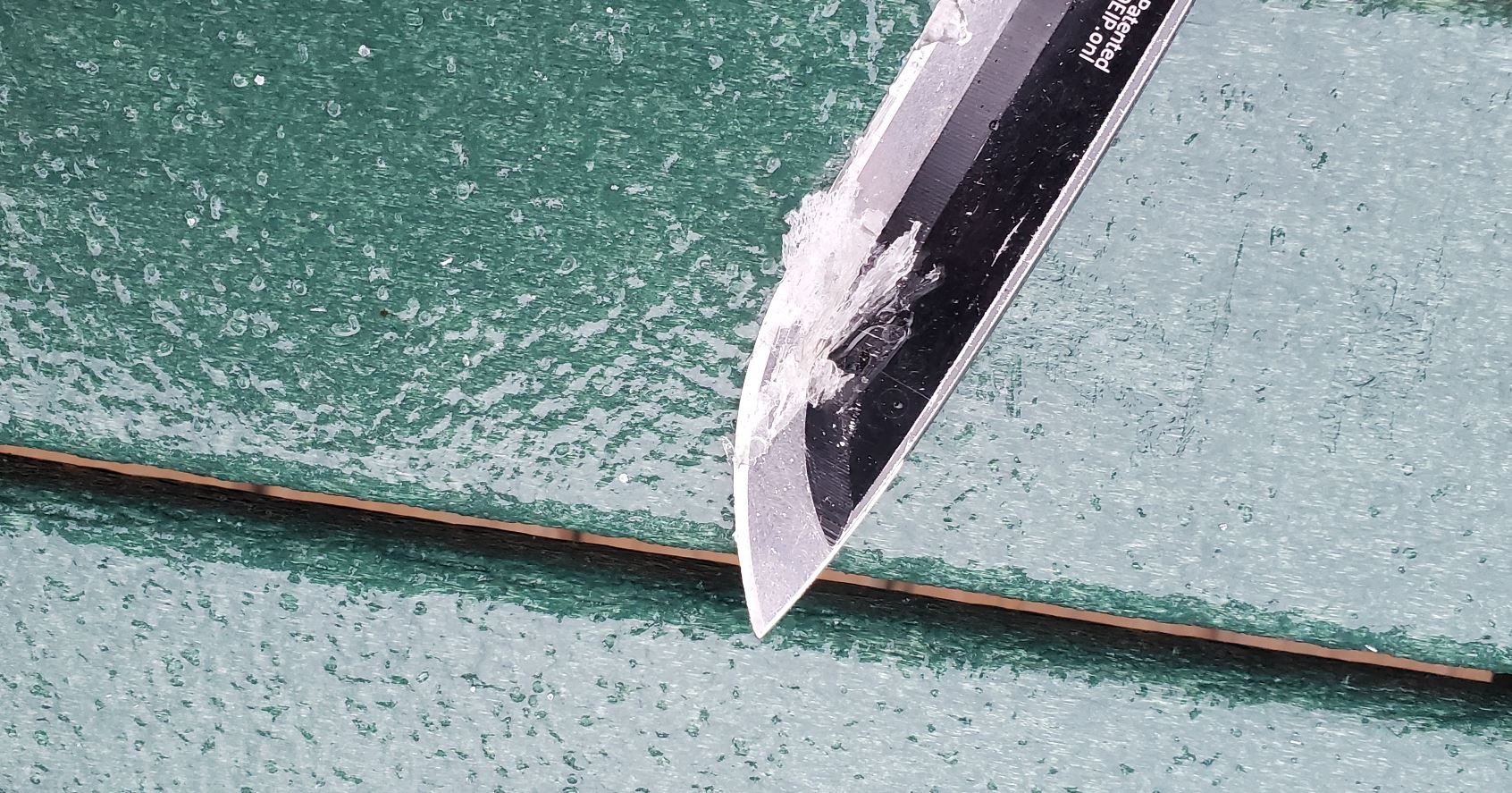
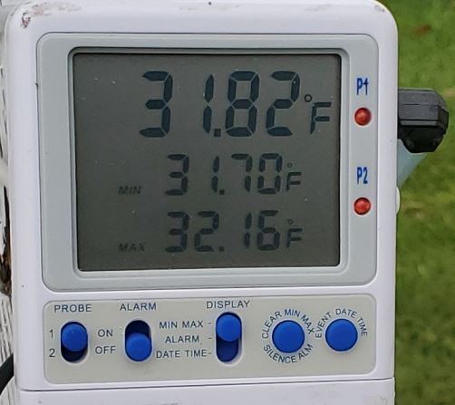
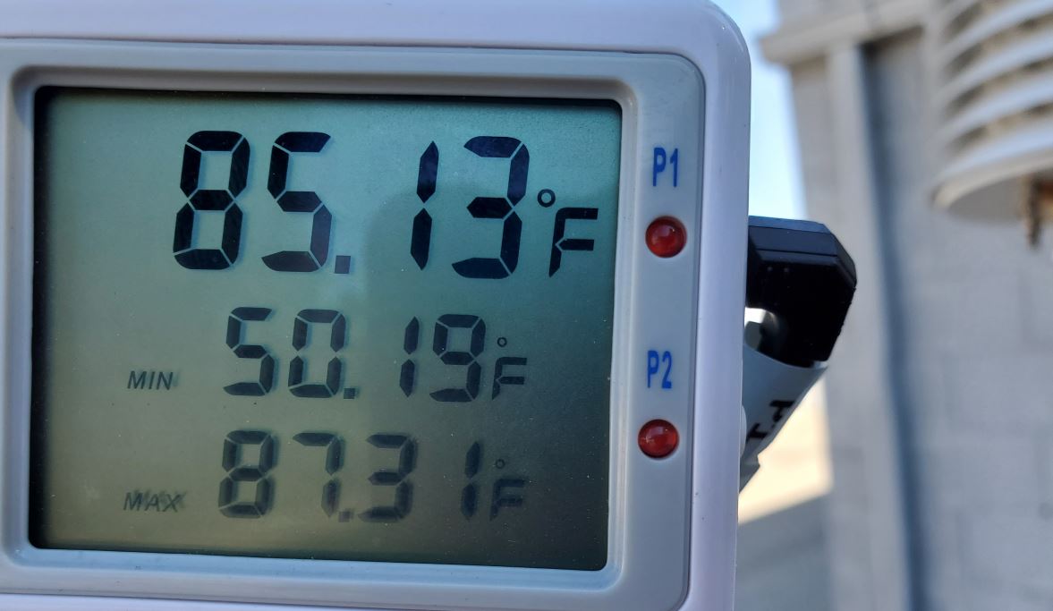
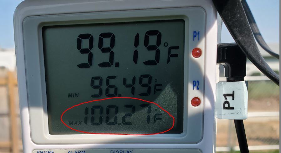
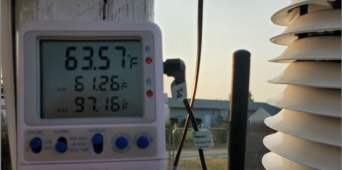
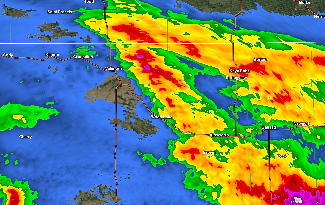
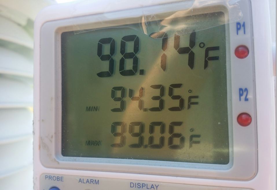
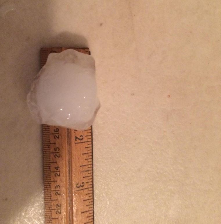
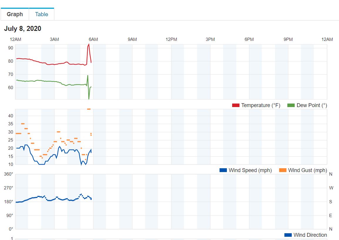
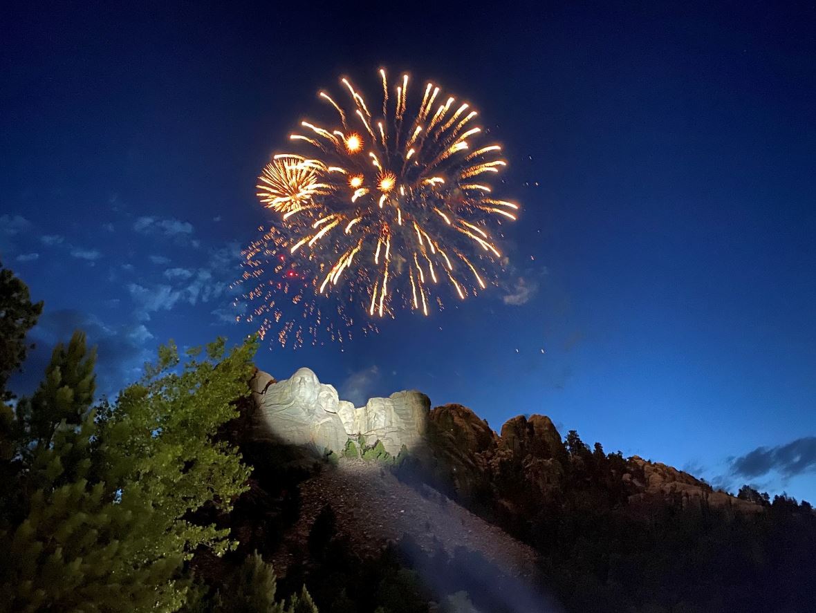
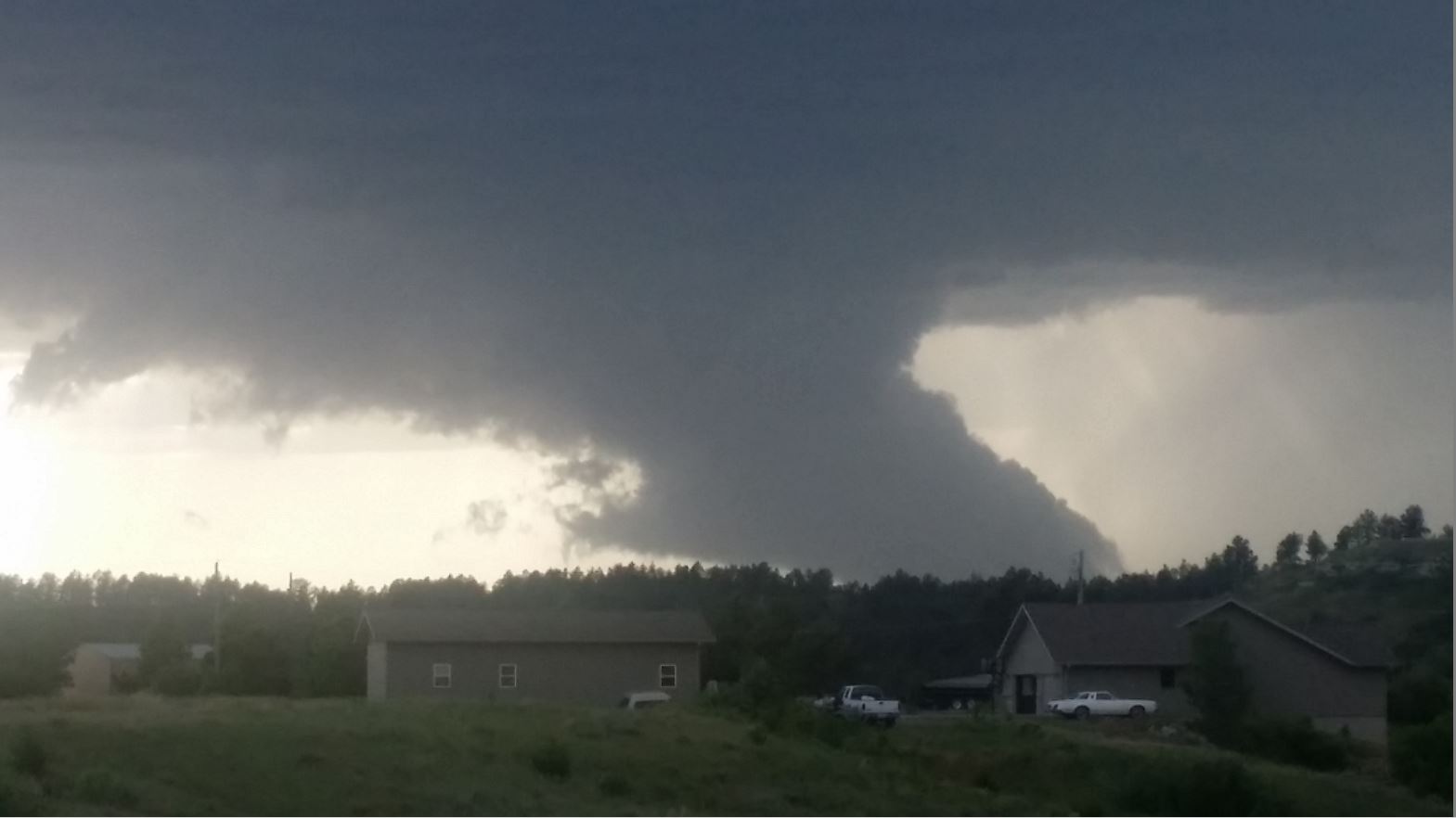
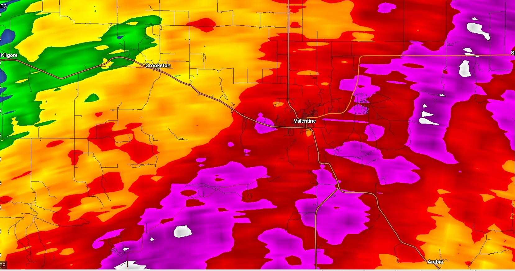
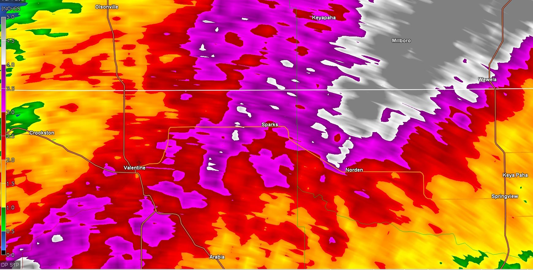
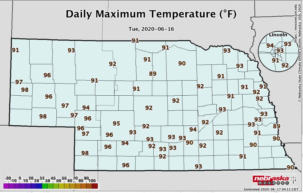
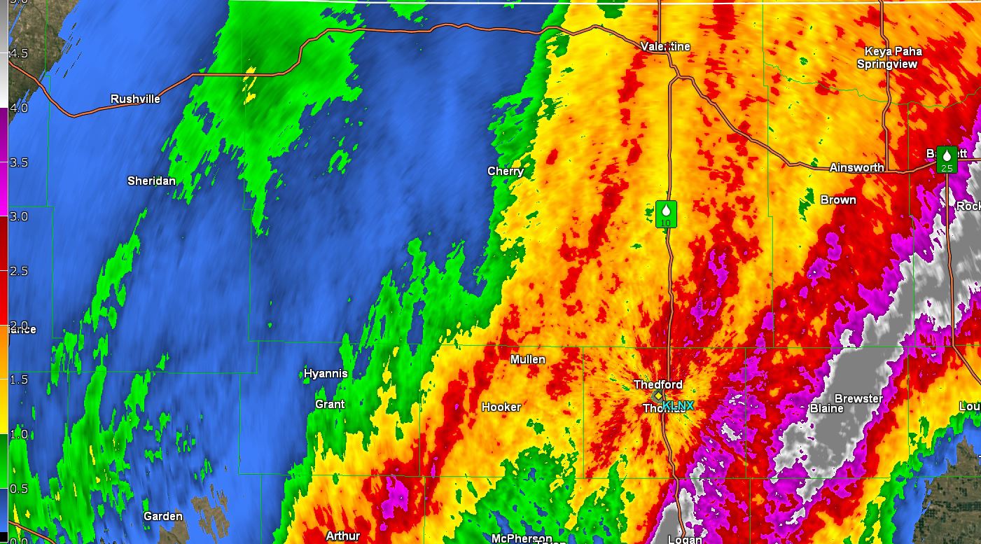
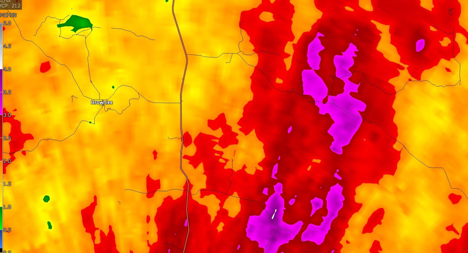
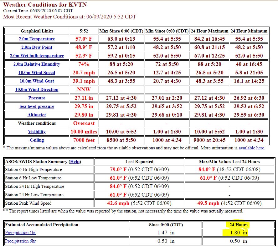
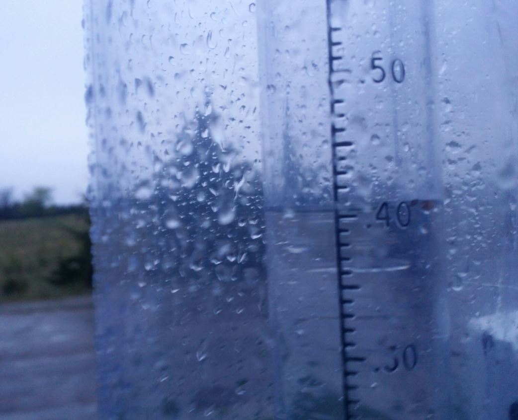
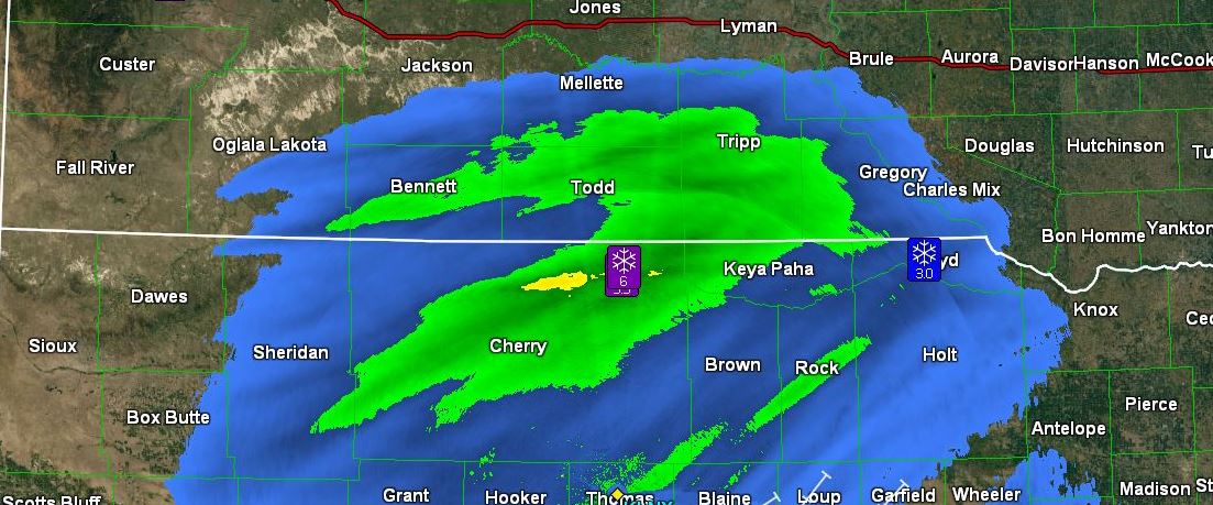
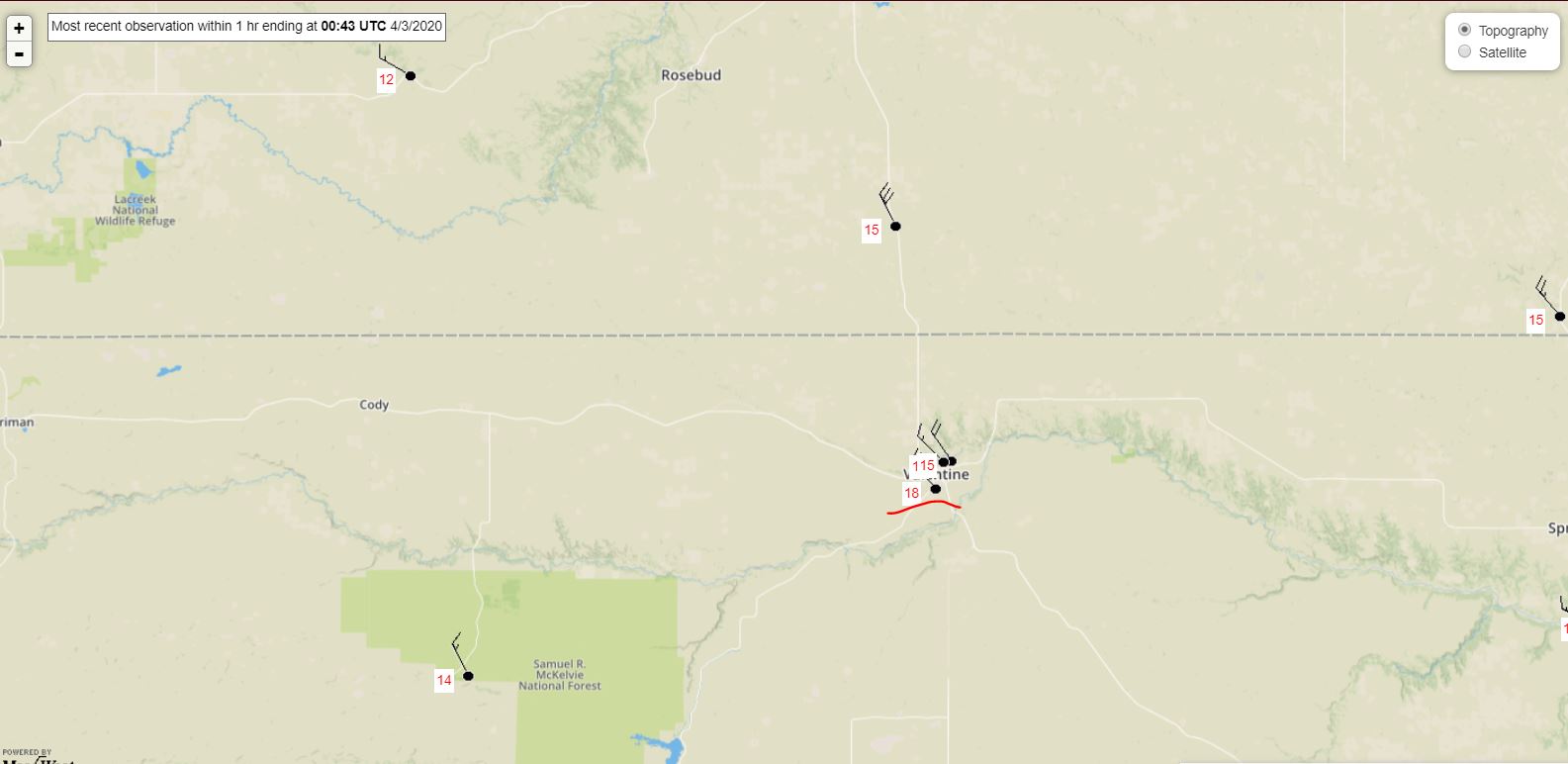
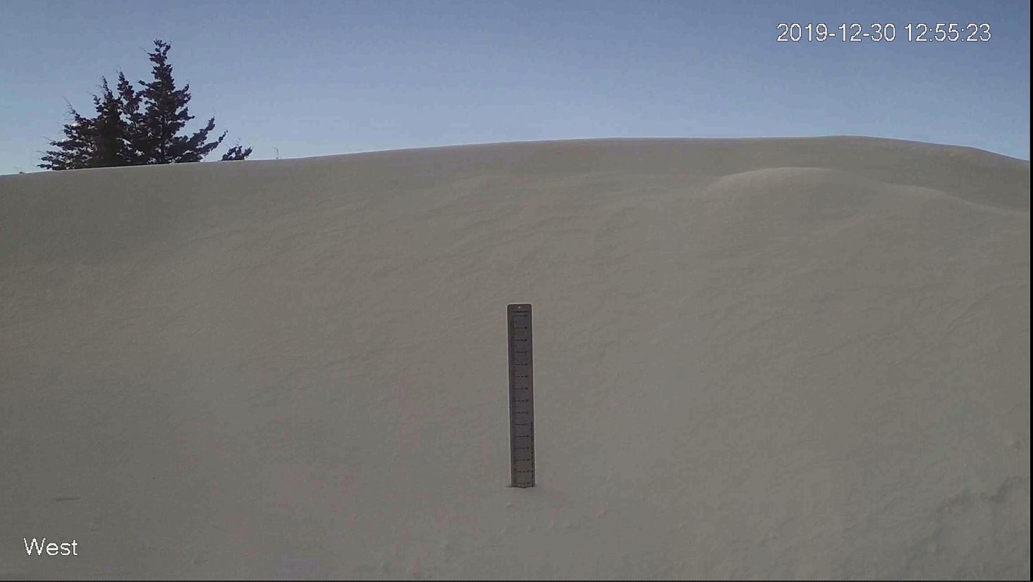
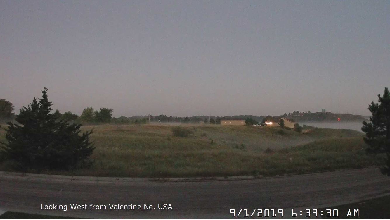
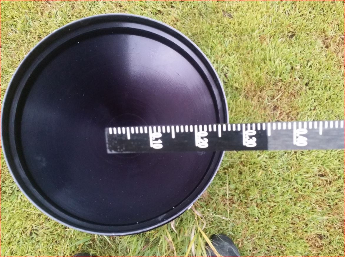
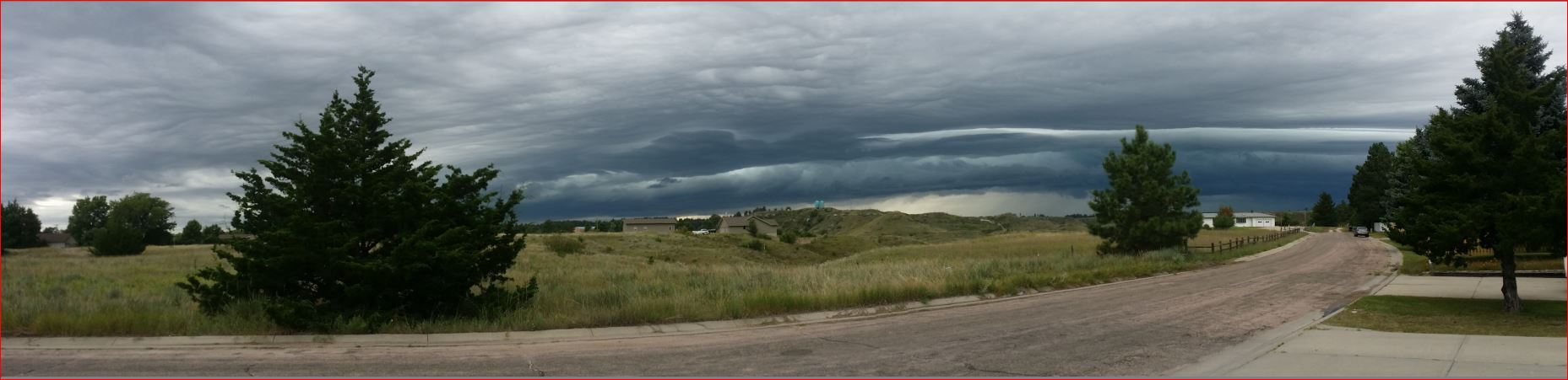
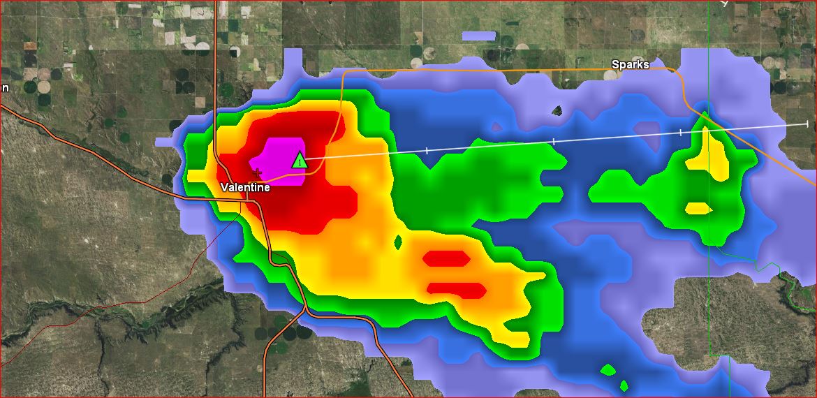
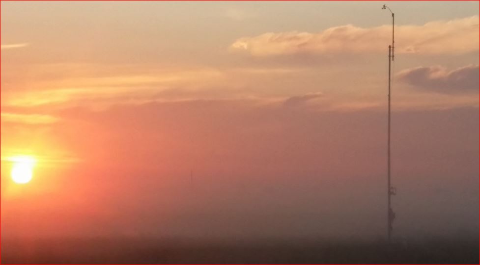
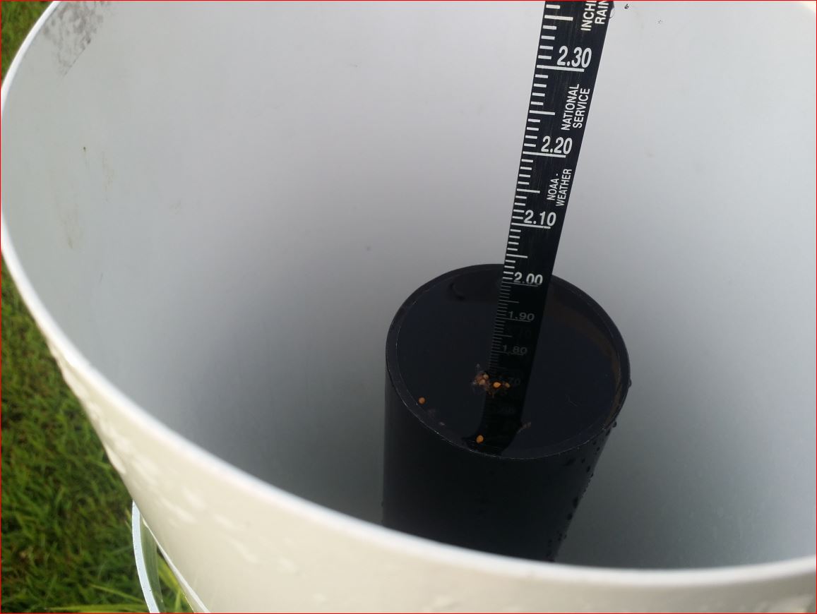
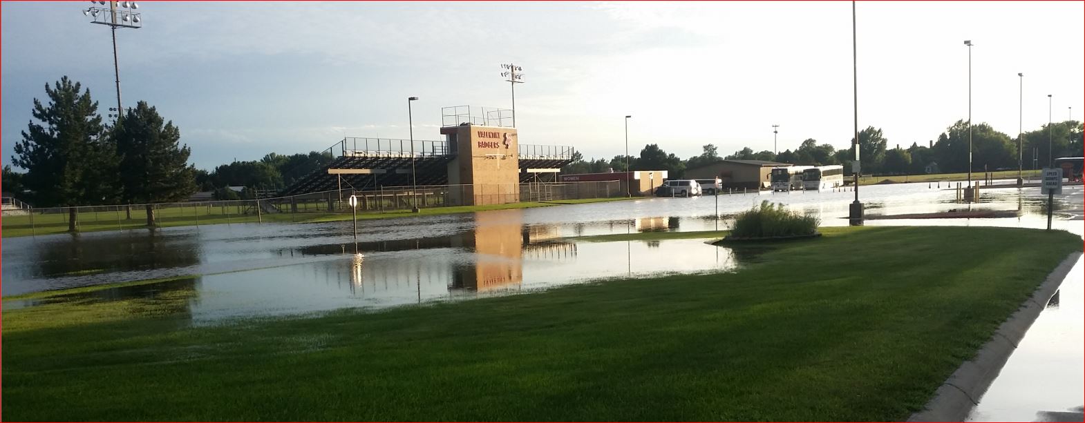
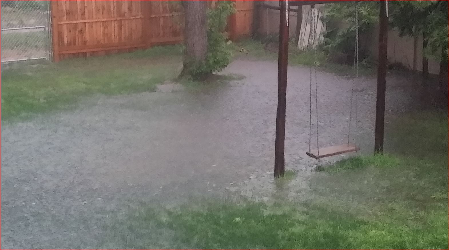
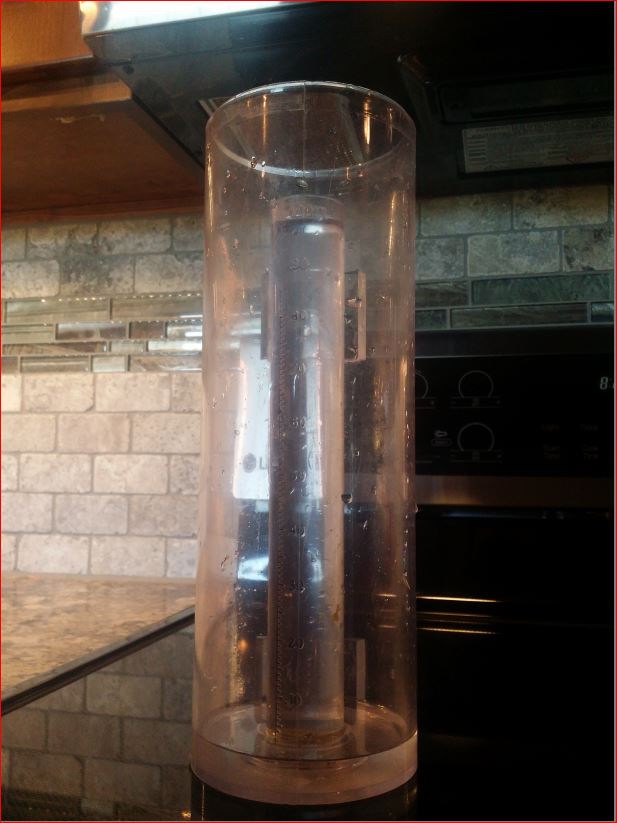
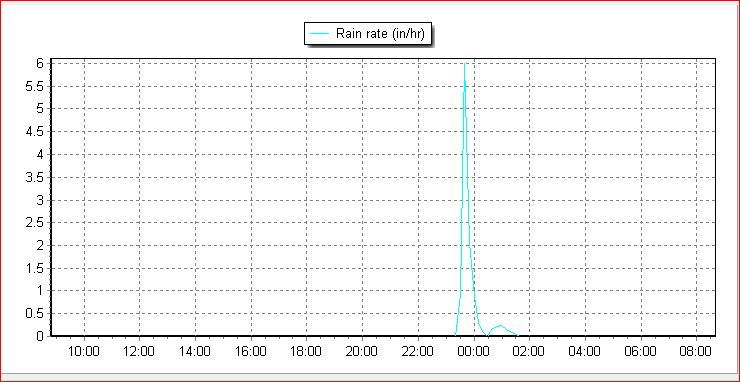
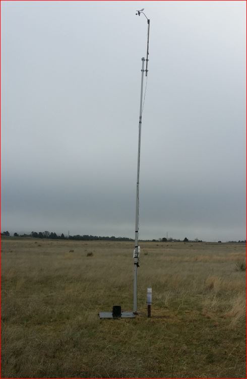
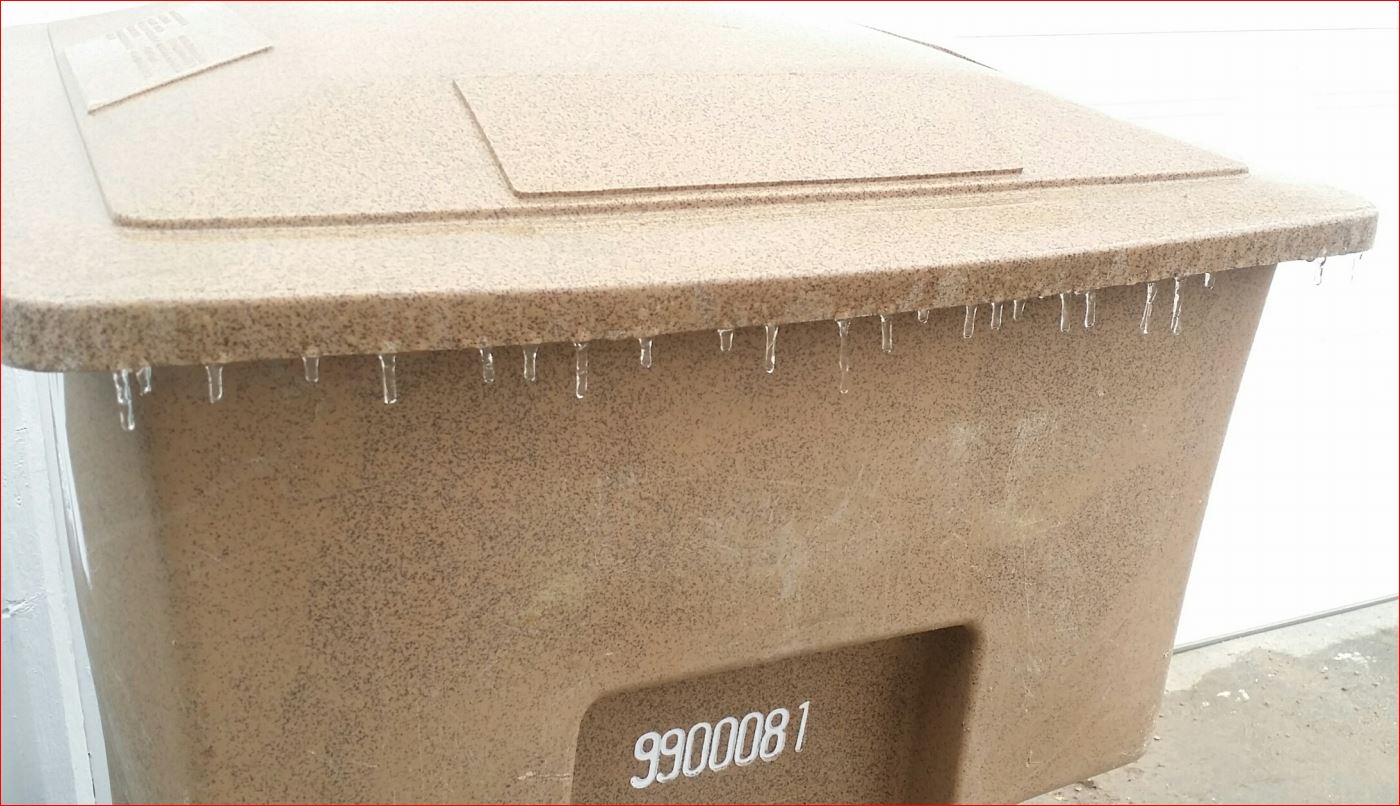
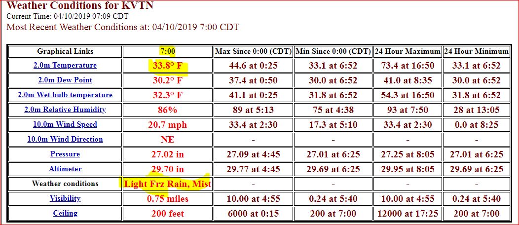
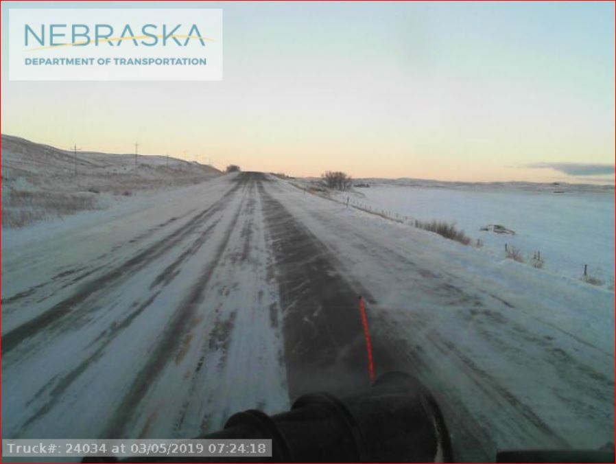
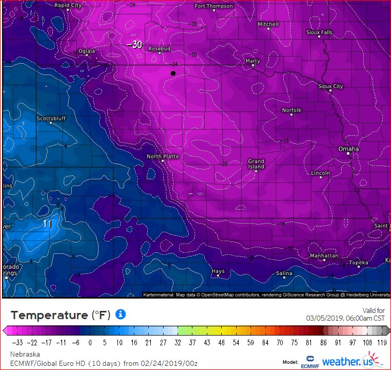
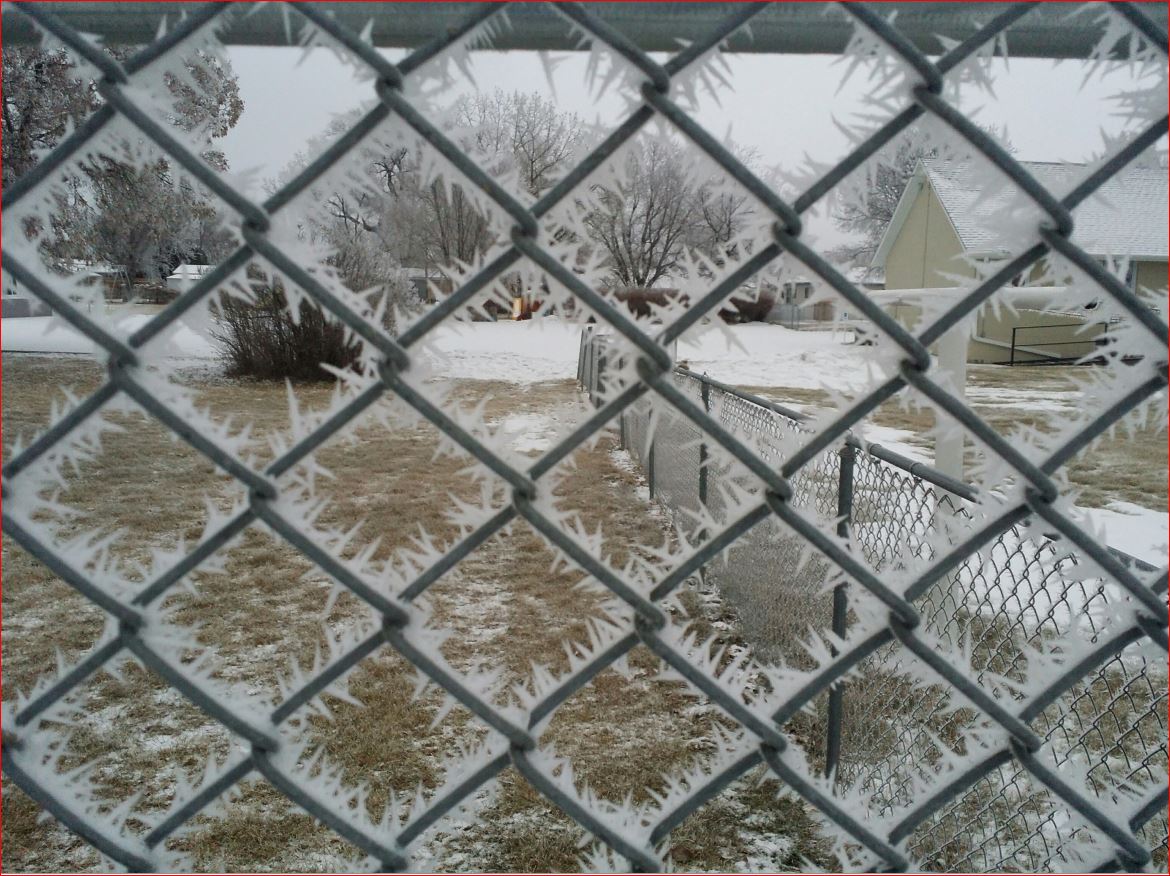
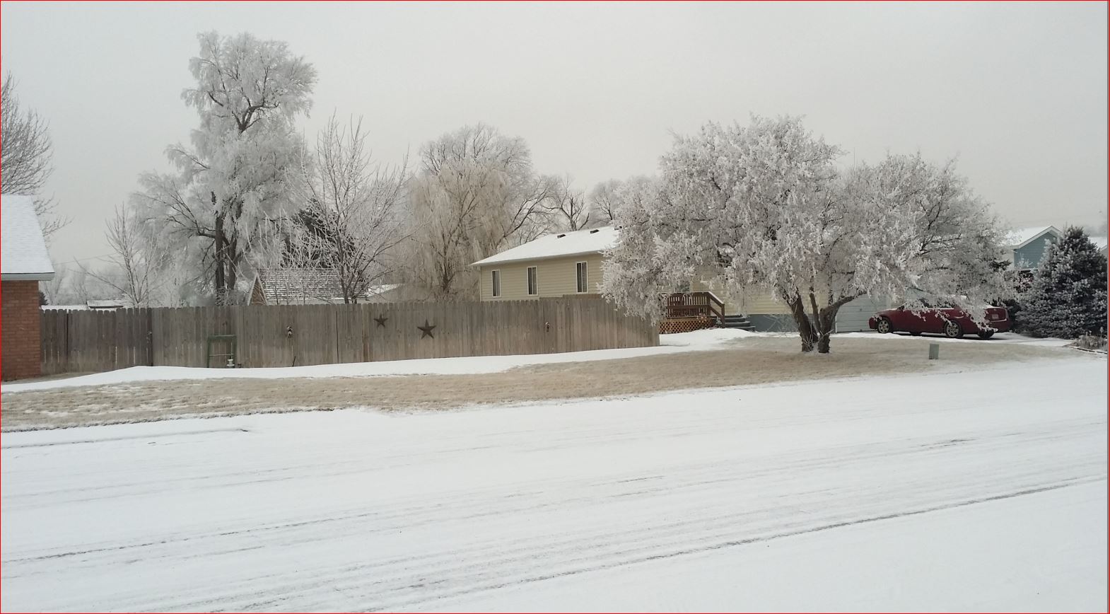
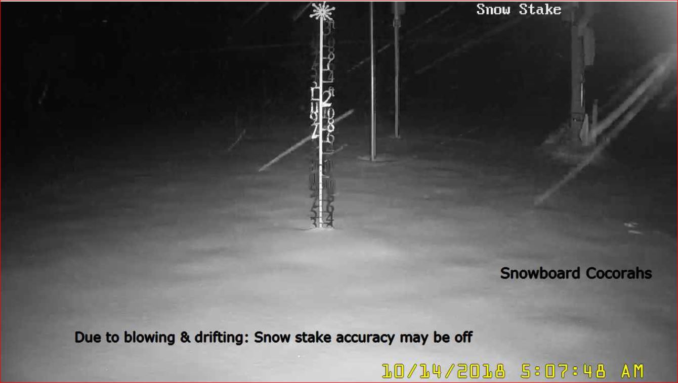
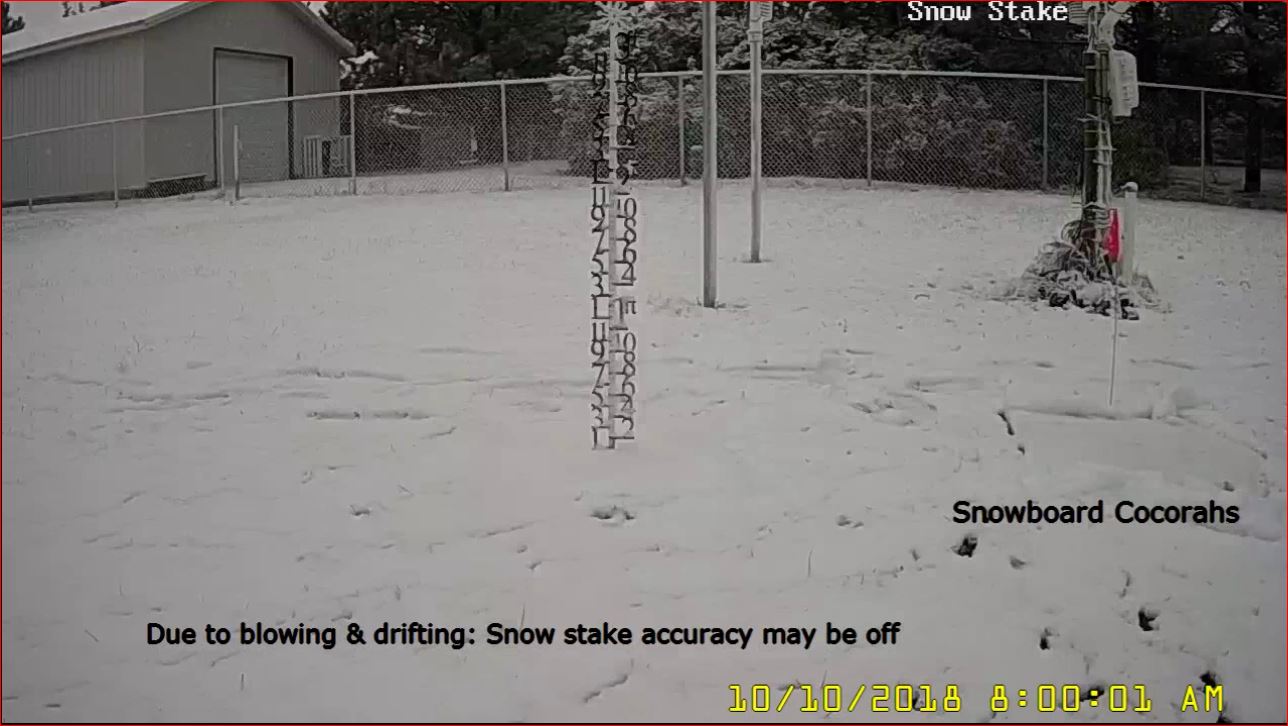
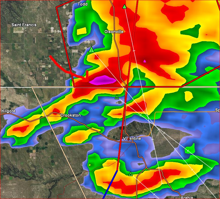
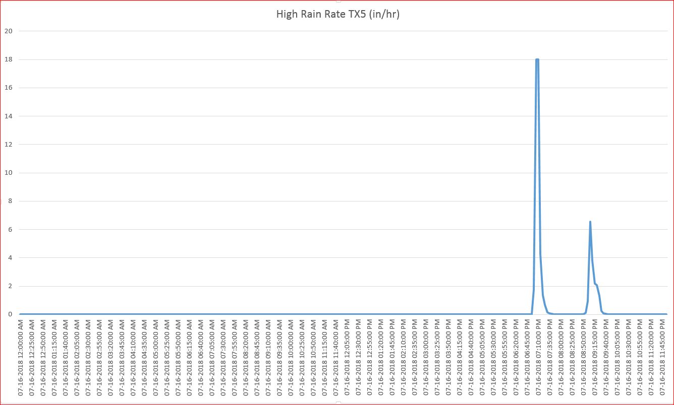
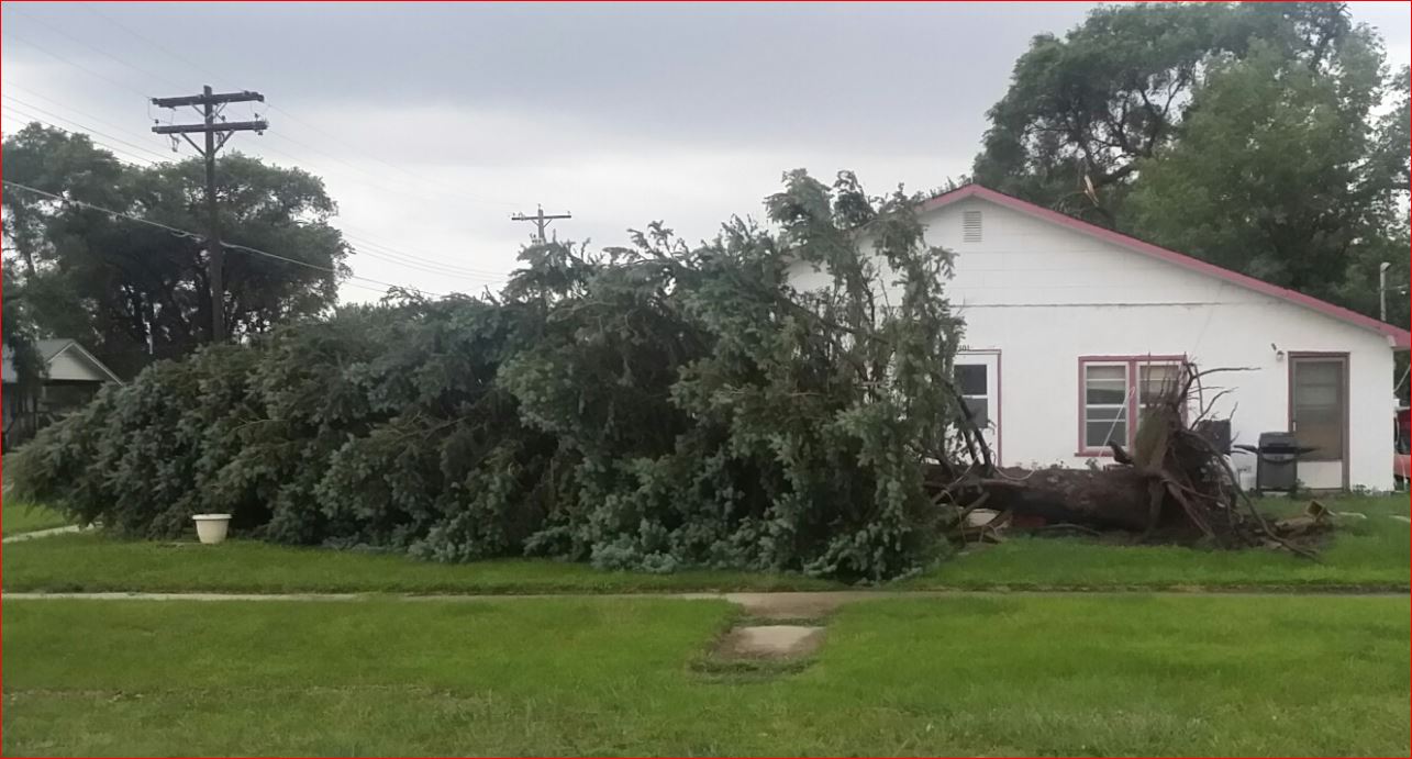
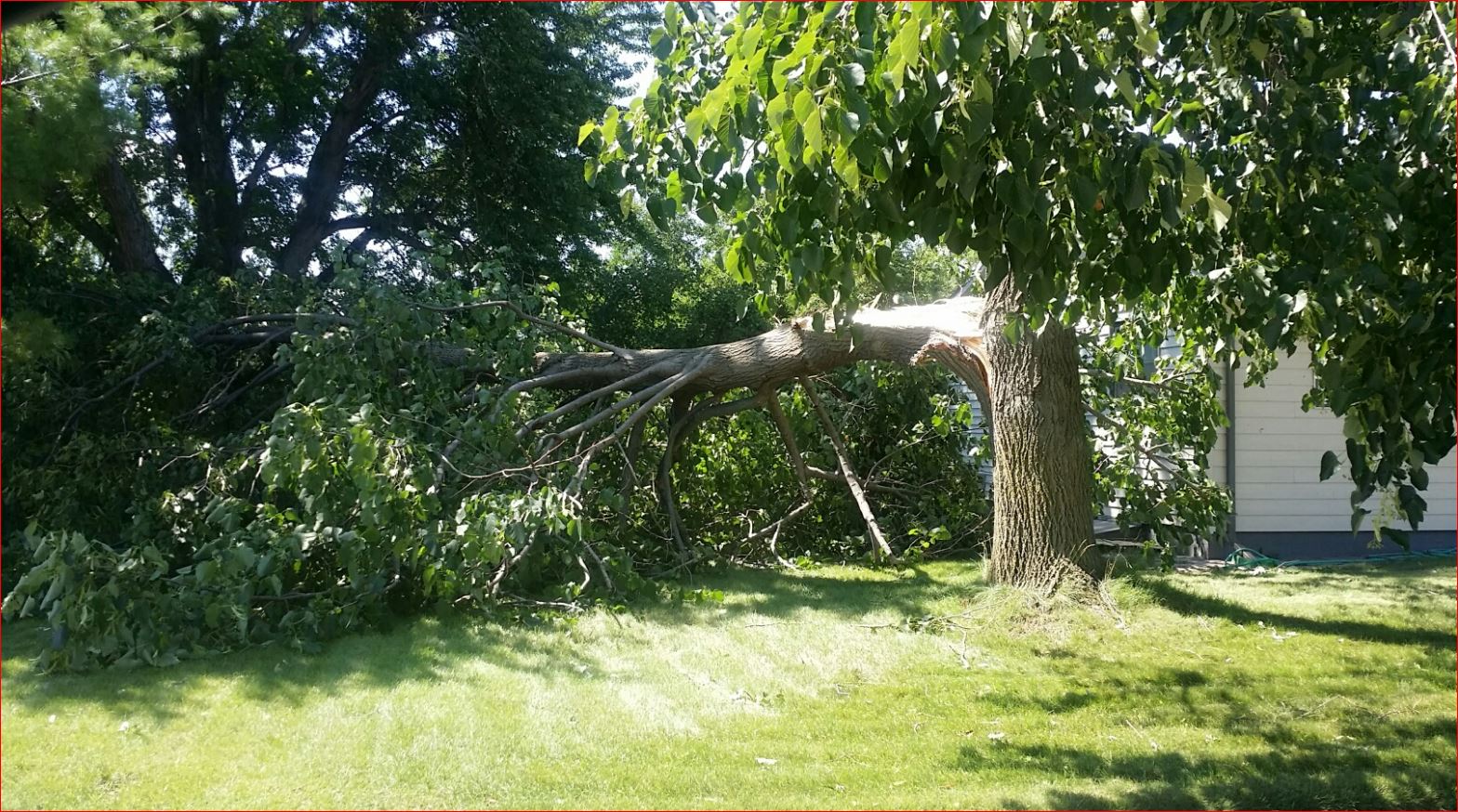
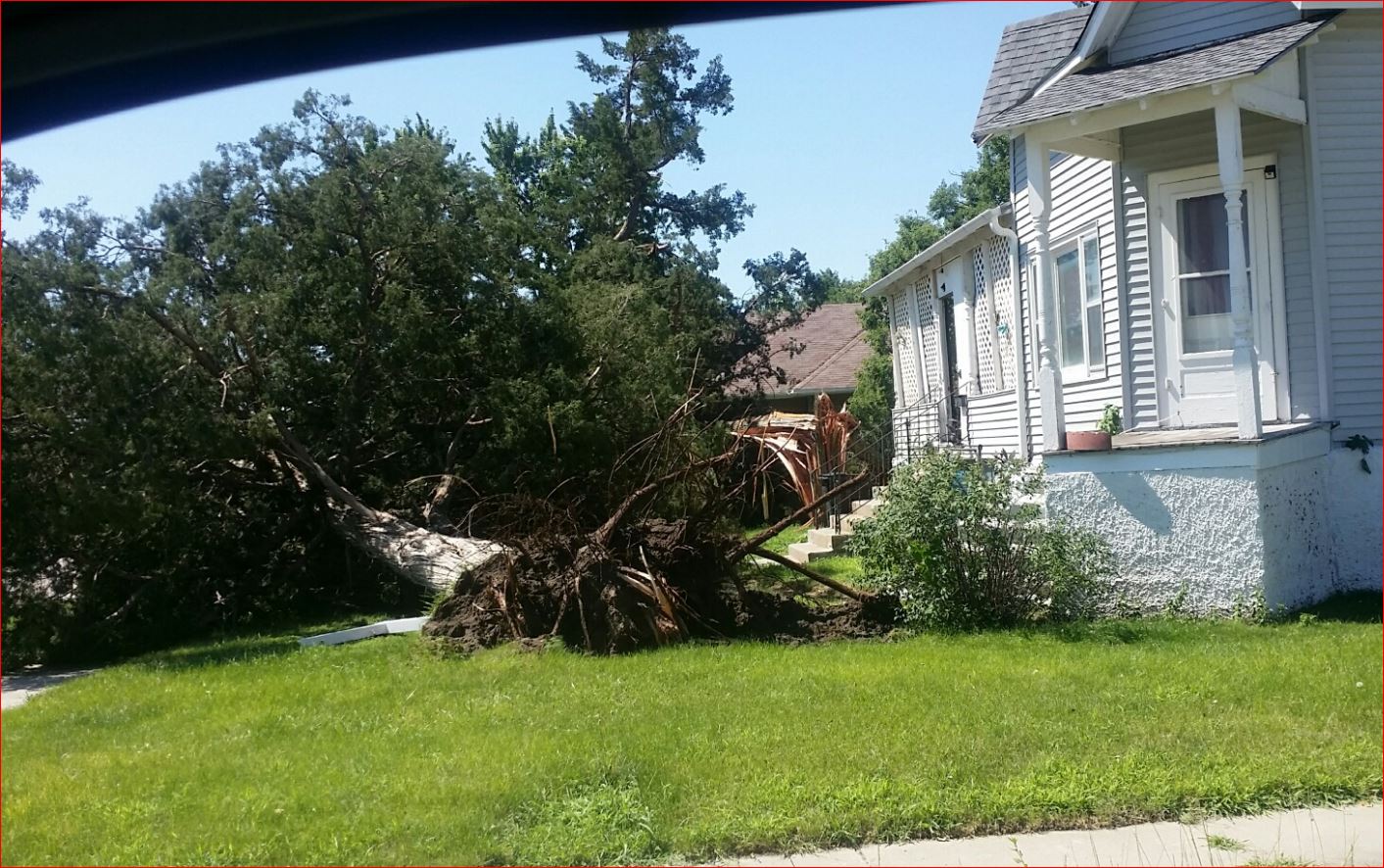
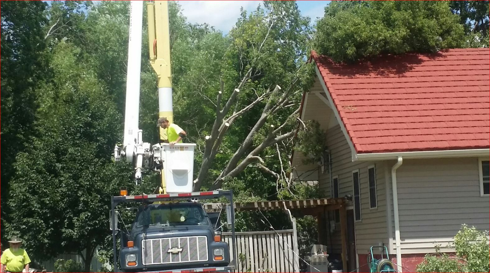
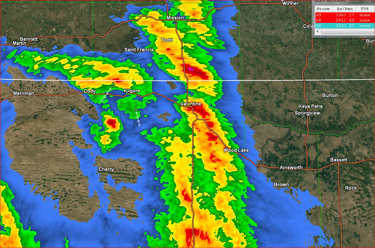
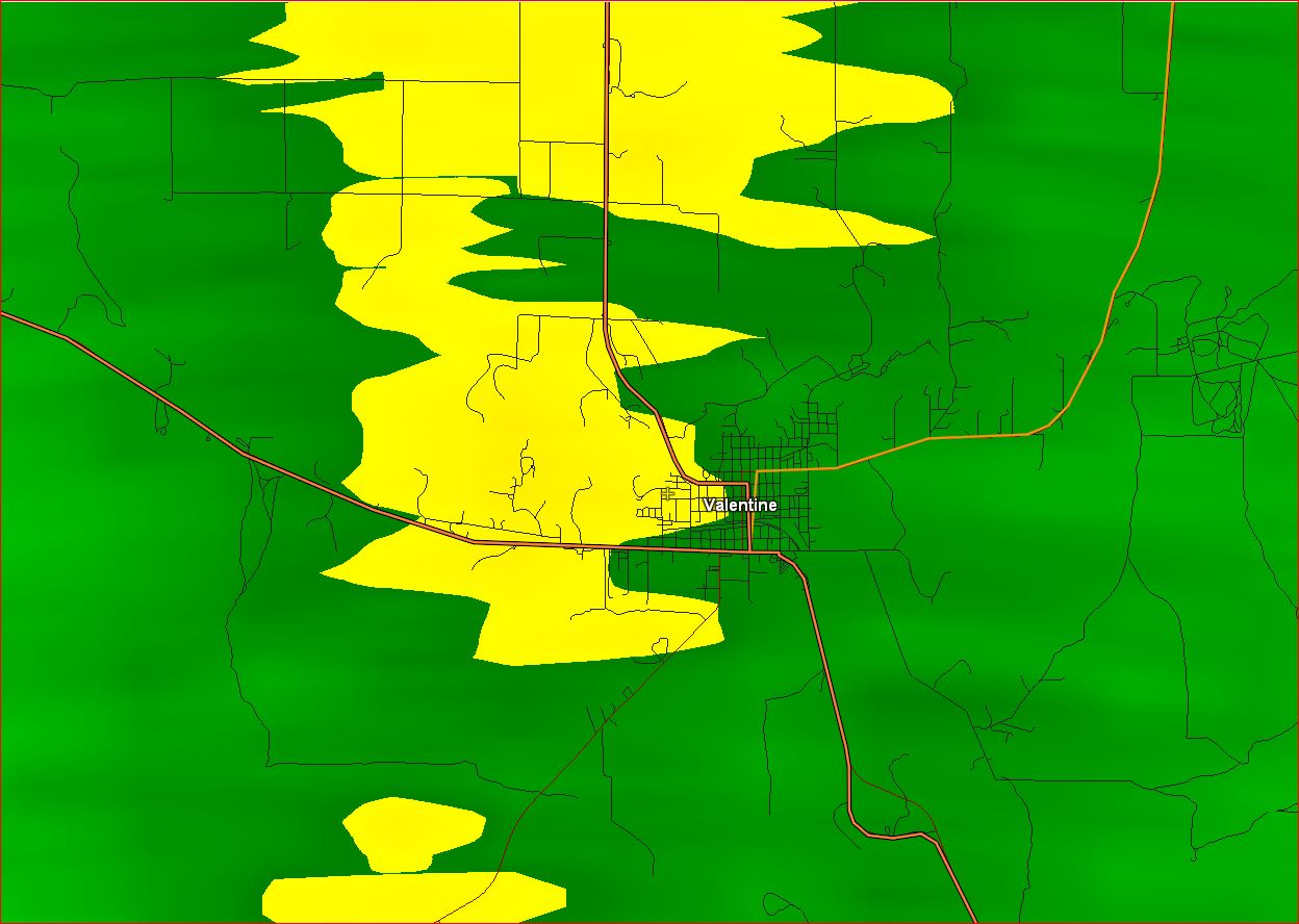
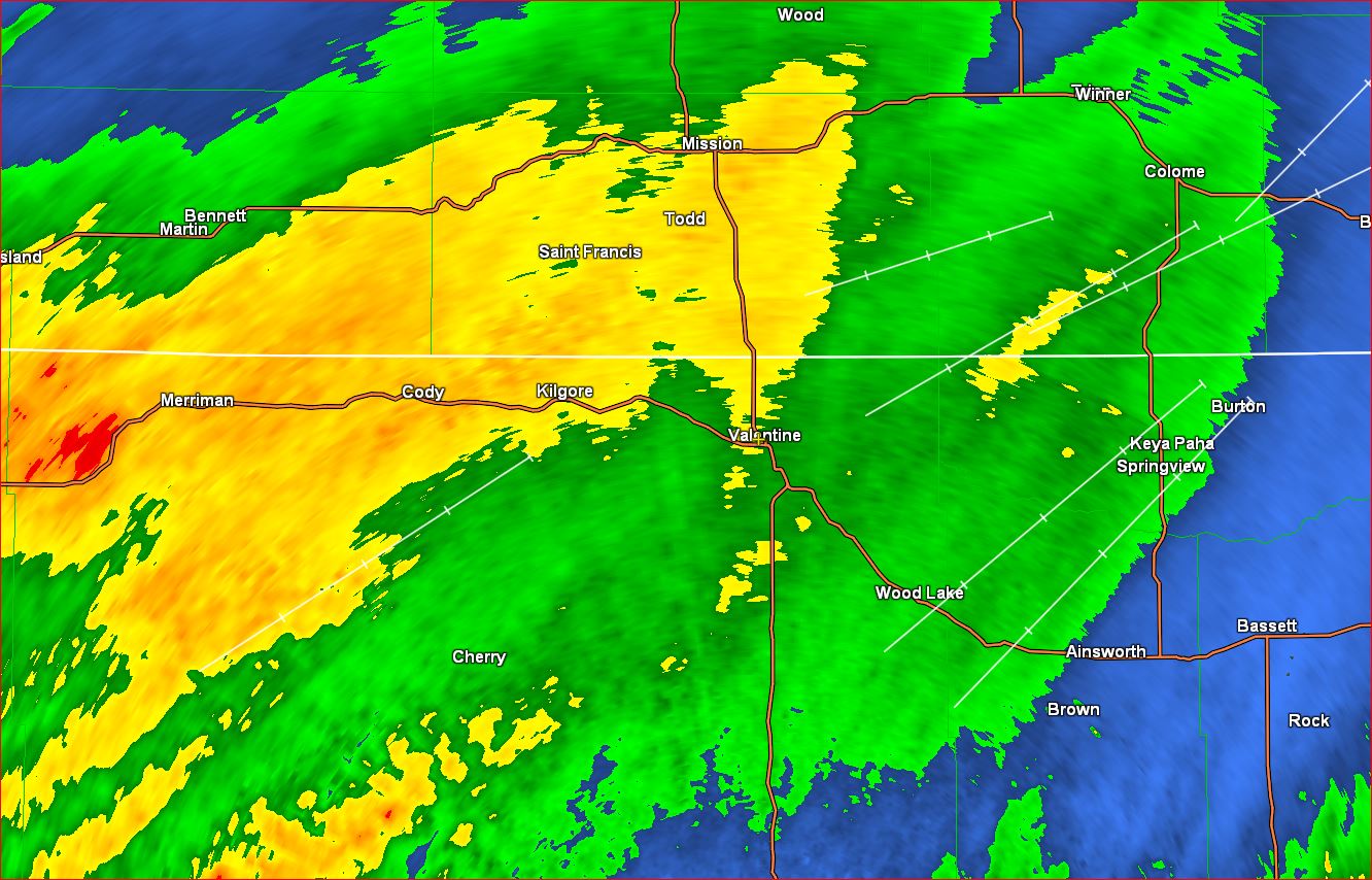
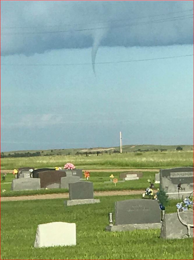
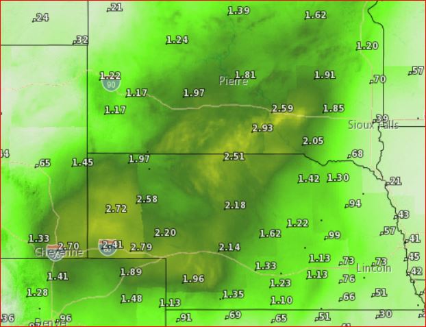
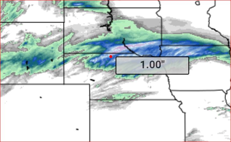
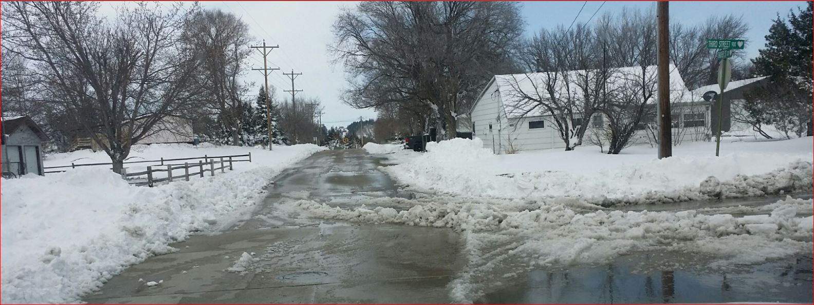
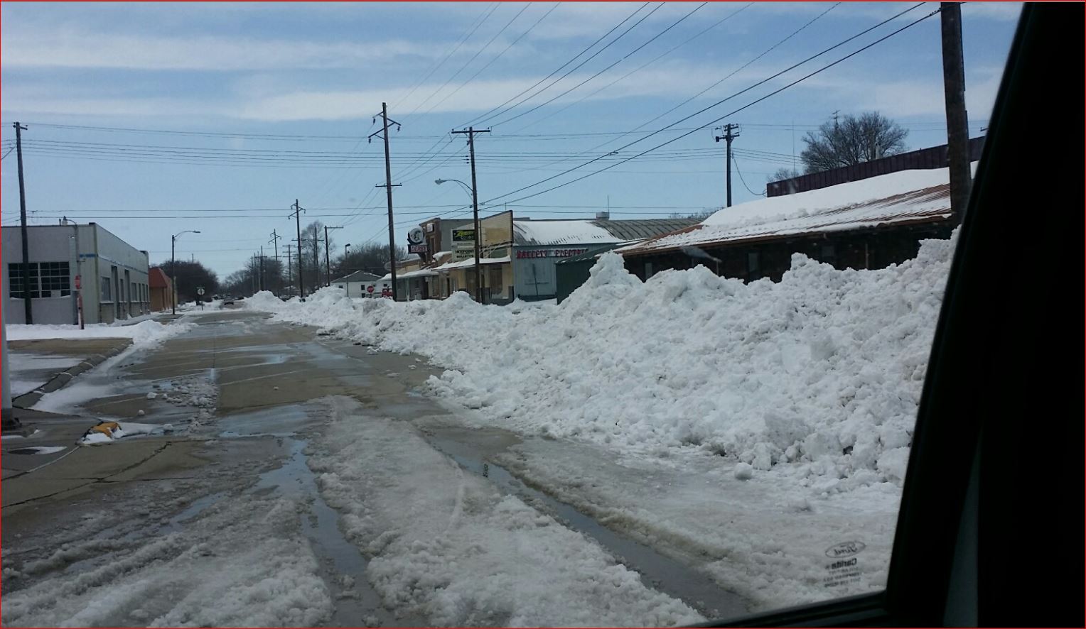
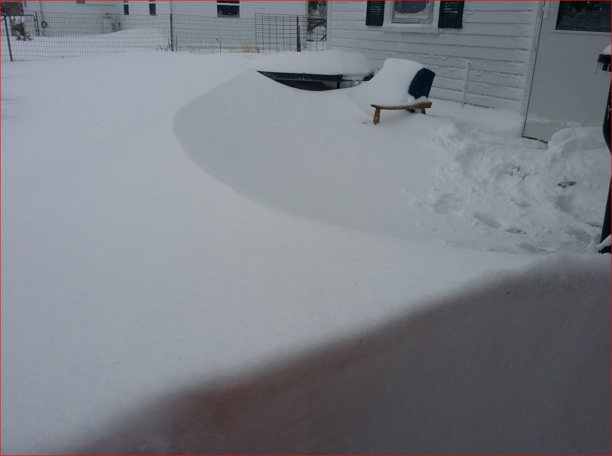